Skerray Bay

Bay in Sutherland

Scotland

Skerray Bay

Coastal cliffs at Aird Torrisdale The distant sandy beach is on Neave, an island off Skerray.
Coastal cliffs at Aird Torrisdale Credit: Alan Reid

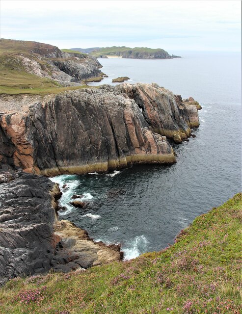
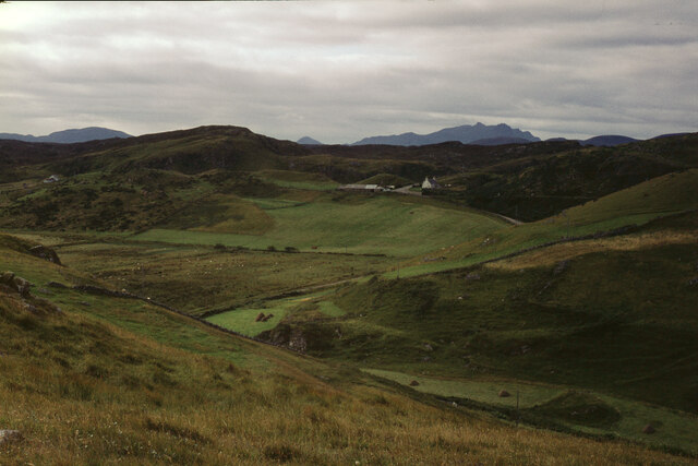
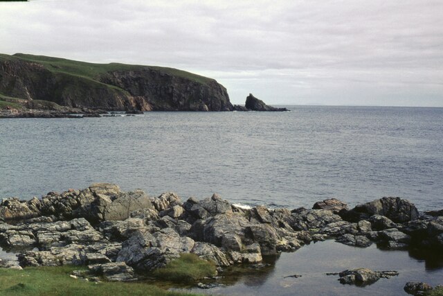
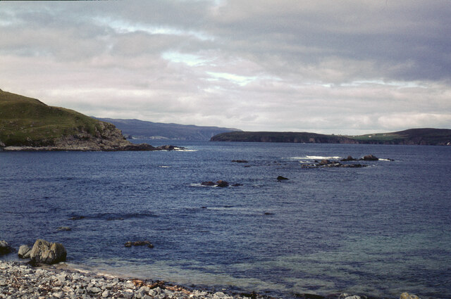
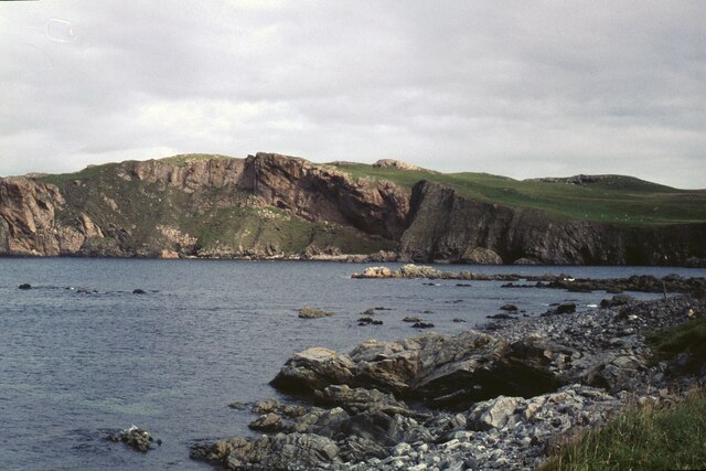
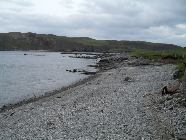
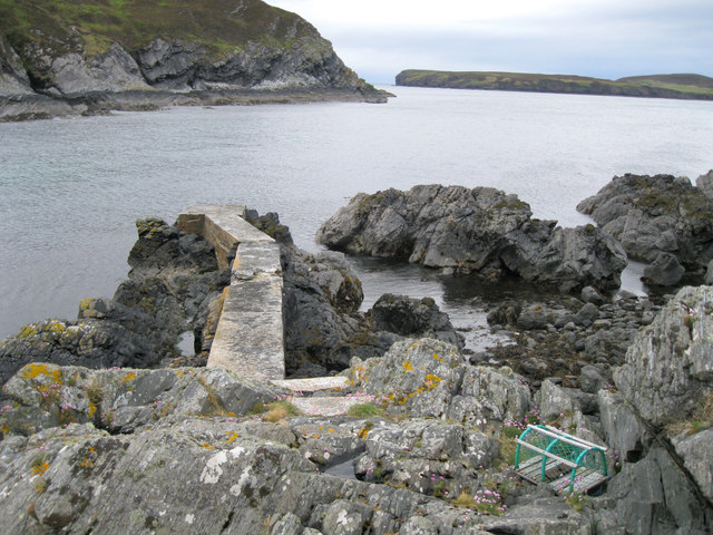
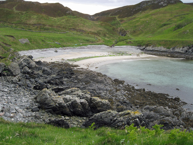
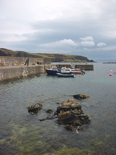
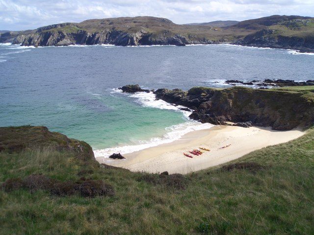
Skerray Bay, located in the county of Sutherland in the Highlands of Scotland, is a picturesque bay that offers stunning natural beauty and a tranquil environment. Situated on the north coast of Scotland, it is known for its unspoiled sandy beaches, rugged cliffs, and crystal-clear turquoise waters.

The bay is surrounded by rolling hills and dramatic landscapes, making it a popular destination for outdoor enthusiasts, nature lovers, and photographers. The area is rich in wildlife, with seabirds nesting on the cliffs and seals often spotted basking on the rocks. Dolphins and whales can also be seen playing in the bay's waters during certain times of the year.

Skerray Bay is a haven for beachgoers, with its sandy shores providing ideal conditions for sunbathing, picnicking, and sandcastle building. The bay is also a great spot for water activities such as swimming, snorkeling, and kayaking, with its calm and clear waters inviting exploration.

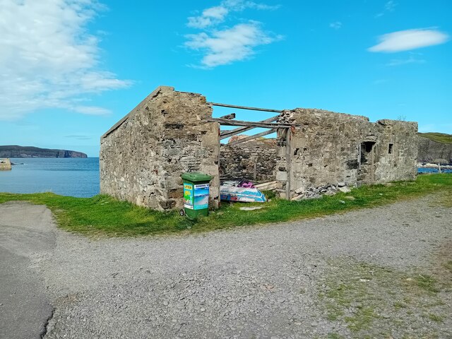
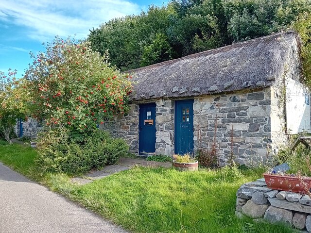
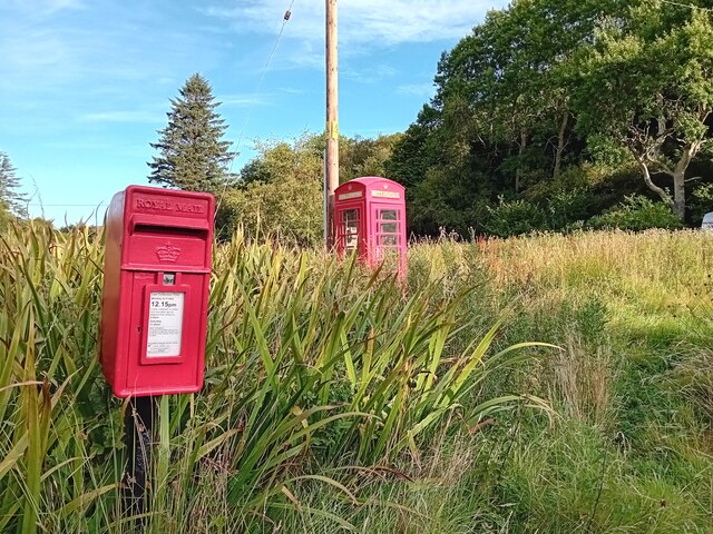
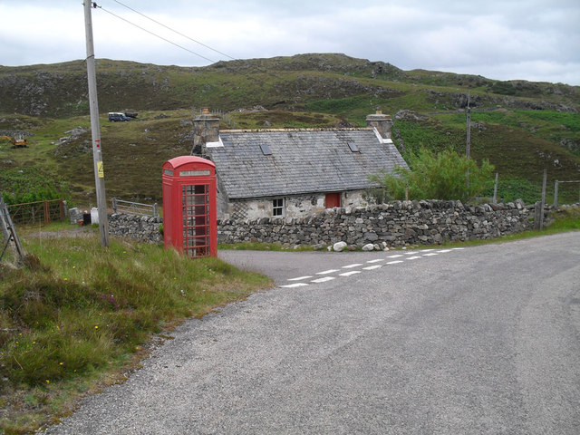
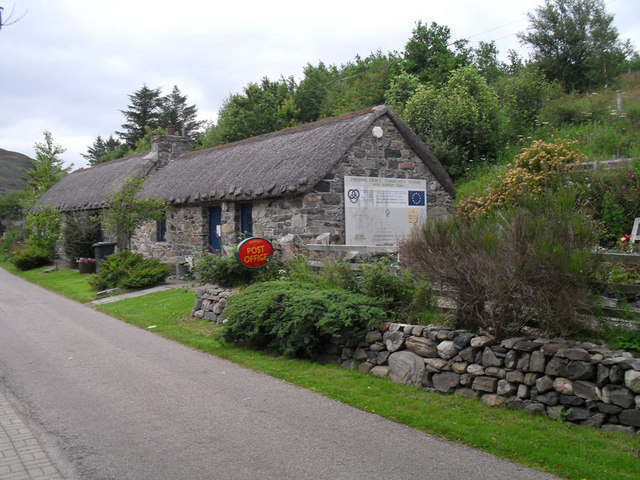
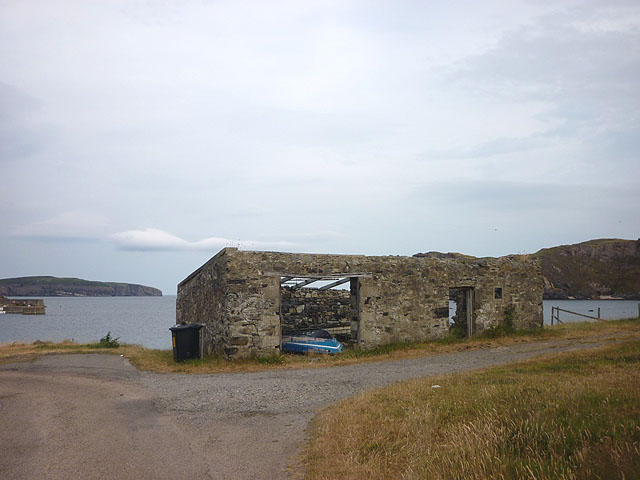
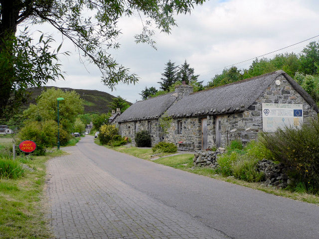
The village of Skerray, located near the bay, offers basic amenities such as a small shop and a post office. Visitors can enjoy a peaceful stroll along the bay, taking in the breathtaking views and relishing the serenity of the surroundings. The area is also a starting point for scenic walks and hikes, including the coastal path that leads to nearby caves and stunning viewpoints.

Overall, Skerray Bay is a hidden gem in the Scottish Highlands, offering a perfect blend of natural beauty, tranquility, and outdoor activities for those seeking a peaceful and scenic escape.

If you have any feedback on the listing, please let us know in the comments section below.

Skerray Bay Images

Images are sourced within 2km of 58.542498/-4.3016159 or Grid Reference NC6663. Thanks to Geograph Open Source API. All images are credited.

Coastal cliffs at Aird Torrisdale The distant sandy beach is on Neave, an island off Skerray.
Coastal cliffs at Aird Torrisdale
The distant sandy beach is on Neave, an island off Skerray.
Skerray War Memorial Unveiled and dedicated in 1922.
Skerray War Memorial
Unveiled and dedicated in 1922.
Old Store, Skerray The ruin of the old store at Skerray.
Old Store, Skerray
The ruin of the old store at Skerray.
Skerray Post Office Village Post Office in a nicely restored building.
Skerray Post Office
Village Post Office in a nicely restored building.
Postbox at Skerray KW14 32. Royal Mail list this box as 'Skerray'.
Postbox at Skerray
KW14 32. Royal Mail list this box as 'Skerray'.
The hamlet of Skerray Looking south-south-west towards Ben Loyal.
The hamlet of Skerray
Looking south-south-west towards Ben Loyal.
Stac an Fhamhair A small stack, perhaps 15m high, at the east end of Neave (or Coomb) Island, seen across Caol Beag.
Stac an Fhamhair
A small stack, perhaps 15m high, at the east end of Neave (or Coomb) Island, seen across Caol Beag.
Skerray Bay Not a bay I would be very happy to navigate into (although there is, or was, a pier on the far side, just out of shot on the left).

The southern part of Eilean nan Ron is beyond the bay, with a few deserted houses visible.
Skerray Bay
Not a bay I would be very happy to navigate into (although there is, or was, a pier on the far side, just out of shot on the left). The southern part of Eilean nan Ron is beyond the bay, with a few deserted houses visible.
Neave or Coomb Island The central part of the island seen at close range (but still across a gridline!) across Caol Beag.
Neave or Coomb Island
The central part of the island seen at close range (but still across a gridline!) across Caol Beag.
Phonebox near Skerray
Stony beach at Skerray
Skerray Post Office
Skerray Post Office
Old jetty in Lamigo Bay The relatively new creel on the rocks indicates that the jetty is still in use, although no boat was visible at this time.
Old jetty in Lamigo Bay
The relatively new creel on the rocks indicates that the jetty is still in use, although no boat was visible at this time.
Telephone Box & sign Whilst the number of iconic red phone boxes dwindles there are even fewer with the "Telephone " roadside sign.  At Skerray there is also a "Telegraph" sign on the old Post Office.
Telephone Box & sign
Whilst the number of iconic red phone boxes dwindles there are even fewer with the "Telephone " roadside sign. At Skerray there is also a "Telegraph" sign on the old Post Office.
Lamigo Bay This deserted sandy beach lies at the head of Lamigo Bay.
Lamigo Bay
This deserted sandy beach lies at the head of Lamigo Bay.
Pier at Skerray Harbour Neave (or Coombe) Island beyond across Caol Beag.
Pier at Skerray Harbour
Neave (or Coombe) Island beyond across Caol Beag.
Roofless building, Skerray Bay Eilan nan Ron (left) and Neave (Coombe) Island off shore.
Roofless building, Skerray Bay
Eilan nan Ron (left) and Neave (Coombe) Island off shore.
Memorial plaque, Skerray Pier 'In memory of Hector Mackay and John Anderson lost at sea 28th March 1973. Erected by their friends'.
Memorial plaque, Skerray Pier
'In memory of Hector Mackay and John Anderson lost at sea 28th March 1973. Erected by their friends'.
Show me another place!

Skerray Bay is located at Grid Ref: NC6663 (Lat: 58.542498, Lng: -4.3016159)

Unitary Authority: Highland

Police Authority: Highlands and Islands

What 3 Words

///outlast.resolved.grunt. Near Altnaharra, Highland

Related Wikis

Skerray Bay

Skerray Bay is an arm of the Atlantic Ocean, located on the north coast of Sutherland, Highland, Scotland. Small and rocky, it is situated to the north...

Neave Island

Neave Island (Scottish Gaelic: Eilean na Naoimh, "Isle of the Saint") or Coomb(e) Island is an island on the north coast of the Scottish mainland. Neave...

Skerray

Skerray (Scottish Gaelic: Sgeirea) is a remote small crofting hamlet and fishing port on the north coast of Sutherland, Scotland. It is located 7+3⁄4 miles...

Achtoty

Achtoty (Scottish Gaelic: Achadh Toitidh) is a remote hamlet in the Scottish Highland Council area. Achtoty is about 26 miles (42 km) west of Thurso....

Torrisdale, Sutherland

Torrisdale is a remote hamlet on the western shore of Torrisdale Bay in Sutherland, Highland, on the north coast of Scotland. It is 3 kilometres (2 mi...

Eilean nan Ròn

Eilean nan Ròn (Scottish Gaelic: island of the seals) is an island near Skerray, in the north of Sutherland, Scotland. An estimated 350 seal pups are born...

Baile Mhargaite (Sandy Dun)

Baile Mhargaite (also known as Lochan Druim An Duin, the Sandy Dun, or Invernaver Broch) is an Iron Age broch in Strathnaver, Sutherland. It is a scheduled...

Bettyhill

Bettyhill (Scottish Gaelic: Am Blàran Odhar) is a village in the parish of Farr, on the north coast of Scotland.Bettyhill lies on the A836 road 32 miles...

Nearby Amenities

Located within 500m of 58.542498,-4.3016159
Source: PGS
Lat/Long: 58.5412754/-4.2939117
Source: PGS
Lat/Long: 58.5413028/-4.2941933
Source: PGS
Lat/Long: 58.5413974/-4.2943419
Source: PGS
Lat/Long: 58.5413493/-4.294049
Source: PGS
Lat/Long: 58.5413918/-4.2934418
Source: PGS
Lat/Long: 58.5416539/-4.2952539
Source: PGS
Lat/Long: 58.5419375/-4.2960891
Source: PGS
Lat/Long: 58.5425013/-4.2973154
Source: PGS
Lat/Long: 58.5424719/-4.2974184
Source: PGS
Lat/Long: 58.5425561/-4.2974061
Source: PGS
Lat/Long: 58.5429198/-4.2984827
Source: PGS
Lat/Long: 58.5432252/-4.2995014
Source: PGS
Lat/Long: 58.5431933/-4.299562
Source: PGS
Lat/Long: 58.543132/-4.2995513
Source: PGS
Lat/Long: 58.542926/-4.2991034
Source: PGS
Lat/Long: 58.5426026/-4.2994714
Source: PGS
Lat/Long: 58.5422493/-4.2998528
Source: PGS
Lat/Long: 58.5419019/-4.3003077
Source: PGS
Lat/Long: 58.5414464/-4.3008576
Source: PGS
Lat/Long: 58.5414231/-4.3041156
Caol Beag
Place: locality
Lat/Long: 58.5441073/-4.2982928
Skerray Bay
Natural: bay
Wikidata: Q7534696
Wikipedia: en:Skerray Bay
Lat/Long: 58.5420621/-4.3030663
Bench
Lat/Long: 58.5409183/-4.3028869
Tubeg
Place: locality
Source: os_opendata_streetview
Lat/Long: 58.5384049/-4.3042803
Drinking Water
Fee: donation
Lat/Long: 58.5410047/-4.301162
The data included in this document is from www.openstreetmap.org. The data is made available under ODbL.

Have you been to Skerray Bay?

Leave your review of Skerray Bay below (or comments, questions and feedback).