Lydgate

Settlement in Lancashire

England

Lydgate

Orchan Rocks Rocky outcrop.
Orchan Rocks Credit: Stephen Shaw

Lydgate is a small village located in the metropolitan borough of Oldham, within the county of Lancashire, England. Situated on the eastern edge of the Pennines, it lies approximately 10 miles northeast of Manchester city center. This rural village has a population of around 1,500 people.

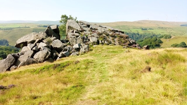
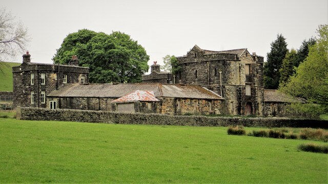
Lydgate is primarily a residential area, characterized by quaint stone-built houses and picturesque landscapes. Nestled amidst rolling hills and green fields, the village offers a tranquil escape from the bustling city life. The surrounding countryside is dotted with farms and scenic walking trails, making it an ideal spot for nature enthusiasts and outdoor activities.

The village has limited amenities, including a local pub, a primary school, and a small convenience store. However, residents have easy access to nearby towns such as Oldham and Rochdale, where they can find a wider range of services and amenities, including shopping centers, healthcare facilities, and leisure activities.

Lydgate is known for its community spirit and close-knit atmosphere. The village hosts various social events and gatherings throughout the year, fostering a sense of belonging among its residents. Additionally, its proximity to the Peak District National Park makes it a popular destination for tourists seeking a peaceful retreat and exploring the stunning natural beauty of the area.

Overall, Lydgate offers a tranquil and picturesque setting, making it an attractive place to live for those seeking a quieter lifestyle while still having access to urban amenities nearby.

If you have any feedback on the listing, please let us know in the comments section below.
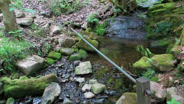
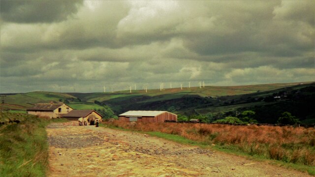
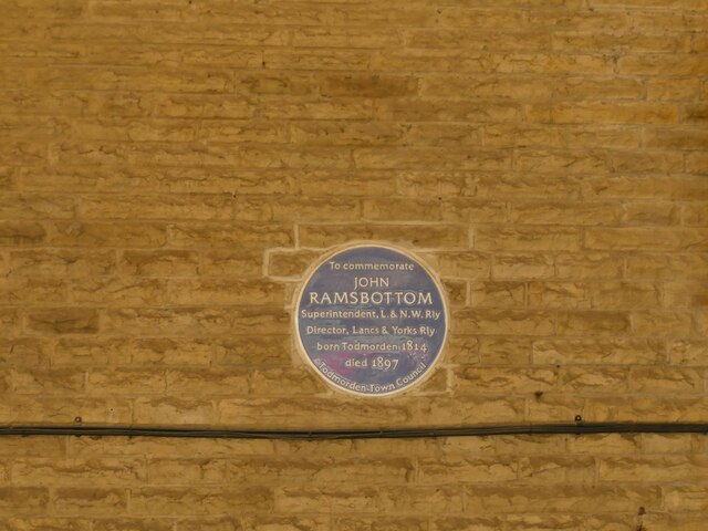
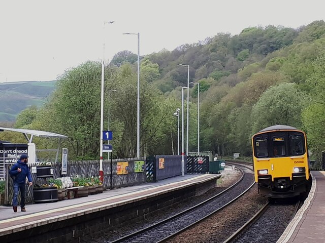
Lydgate Images

Images are sourced within 2km of 53.727187/-2.119704 or Grid Reference SD9225. Thanks to Geograph Open Source API. All images are credited.

Orchan Rocks Rocky outcrop.
Orchan Rocks
Rocky outcrop.
Burnley Road, Todmorden View from Rochdale to Leeds railway
Burnley Road, Todmorden
View from Rochdale to Leeds railway
Old Boundary Marker near Flailcroft, Todmorden Chapelry Boundary Marker beside a footpath north of Flailcroft. Todmorden parish. Inscribed H W A S C C / 1864 for Harley Wood All Saints Consolidated Chapelry. See  <span class="nowrap"><a title="https://www.thegazette.co.uk/London/issue/22908/page/5170" rel="nofollow ugc noopener" href="https://www.thegazette.co.uk/London/issue/22908/page/5170">Link</a><img style="margin-left:2px;" alt="External link" title="External link - shift click to open in new window" src="https://s1.geograph.org.uk/img/external.png" width="10" height="10"/></span>.

Milestone Society National ID: YW_TOD10pb
Old Boundary Marker near Flailcroft, Todmorden
Chapelry Boundary Marker beside a footpath north of Flailcroft. Todmorden parish. Inscribed H W A S C C / 1864 for Harley Wood All Saints Consolidated Chapelry. See LinkExternal link. Milestone Society National ID: YW_TOD10pb
OS Bench Mark OS cut bench mark from the first, 19th century, levelling, on flat rock close to the trig point. There is no sign of a pivot or rivet. The BM is shown on the 1853 6" OS map but not on subsequent editions, nor on any 25" maps. Marked as 1434.7 feet above old datum
OS Bench Mark
OS cut bench mark from the first, 19th century, levelling, on flat rock close to the trig point. There is no sign of a pivot or rivet. The BM is shown on the 1853 6" OS map but not on subsequent editions, nor on any 25" maps. Marked as 1434.7 feet above old datum
Model Farm to Dobroyd Castle The farm from Stones Road showing its apparent Scottish style with a central tower or keep.
Model Farm to Dobroyd Castle
The farm from Stones Road showing its apparent Scottish style with a central tower or keep.
Standing Stone No.2 at Stones A listed stone possibly prehistoric off Stones Lane. There are reportedly another 3 in the area but only No.1. is also listed. Midgelden Brook is in the valley beyond
Standing Stone No.2 at Stones
A listed stone possibly prehistoric off Stones Lane. There are reportedly another 3 in the area but only No.1. is also listed. Midgelden Brook is in the valley beyond
Centre Hill Monument A possible prehistoric stone mounted on a mill stone at Stones
Centre Hill Monument
A possible prehistoric stone mounted on a mill stone at Stones
Stile on Path above Stones Wood A stile using the decorative iron pillars common around Stones & Dobroyd Castle
Stile on Path above Stones Wood
A stile using the decorative iron pillars common around Stones & Dobroyd Castle
Gate & Iron Pillars in Mellings Clough Another set of pillars that are common around Stones & Dobroyd Castle. This set now appear to have little use being replaced by woodwork and wire fencing
Gate & Iron Pillars in Mellings Clough
Another set of pillars that are common around Stones & Dobroyd Castle. This set now appear to have little use being replaced by woodwork and wire fencing
Makeshift Crossing in Mellings Clough The stepping stones and the very low hand rail make for an exciting closing of the stream
Makeshift Crossing in Mellings Clough
The stepping stones and the very low hand rail make for an exciting closing of the stream
New Towneley in 1994 The Coal Clough Wind Farm on the skyline beyond was one of the first being commissioned in 1992
New Towneley in 1994
The Coal Clough Wind Farm on the skyline beyond was one of the first being commissioned in 1992
Lydgate Railway Viaduct in 1994 The railway arch on the far left has since had strengthening work done to counter movement which had caused it to buckle. Knotts Naze towers above
Lydgate Railway Viaduct in 1994
The railway arch on the far left has since had strengthening work done to counter movement which had caused it to buckle. Knotts Naze towers above
Plaque to John Ramsbottom on Todmorden station The plaque is on the wall of the staircase of the westbound platform. It commemorates a former Director of the Lancashire and Yorkshire Railway.
Plaque to John Ramsbottom on Todmorden station
The plaque is on the wall of the staircase of the westbound platform. It commemorates a former Director of the Lancashire and Yorkshire Railway.
Sprinter entering Todmorden station The station was opened by the Manchester and Leeds Railway in 1840 and passed through the hands of the Lancashire and Yorkshire, London Midland & Scottish Railway and eventually British Rail. It is currently operated by Northern Railway (a publicly owned company).  This train is operating a service to Blackburn, using the curve north of Todmorden station that was reopened a few years ago.
Sprinter entering Todmorden station
The station was opened by the Manchester and Leeds Railway in 1840 and passed through the hands of the Lancashire and Yorkshire, London Midland & Scottish Railway and eventually British Rail. It is currently operated by Northern Railway (a publicly owned company). This train is operating a service to Blackburn, using the curve north of Todmorden station that was reopened a few years ago.
ALDI car park, Todmorden The car park occupies the site of the former Ridgefoot cotton mill.
ALDI car park, Todmorden
The car park occupies the site of the former Ridgefoot cotton mill.
Empire Books, Stansfield Street, Todmorden The building is shown on early 20th century maps as 'Carr Mill (Slipper)'. It presumably made carpet slippers from fabric produced in one of the many local cotton mills.  A comment on a local history website says 'The footwear industry in Rossendale [not far from Todmorden] didn't really finish until the late 1980s'.
Empire Books, Stansfield Street, Todmorden
The building is shown on early 20th century maps as 'Carr Mill (Slipper)'. It presumably made carpet slippers from fabric produced in one of the many local cotton mills. A comment on a local history website says 'The footwear industry in Rossendale [not far from Todmorden] didn't really finish until the late 1980s'.
Railway footbridge at the end of Stansfield Road I presume this is a modern steel replacement for the original bridge. See <a href="https://www.geograph.org.uk/photo/2011138">SD9324 : Footbridge at the end of Stansfield Road</a> for a wider view including the stone setted approach ramp.
Railway footbridge at the end of Stansfield Road
I presume this is a modern steel replacement for the original bridge. See SD9324 : Footbridge at the end of Stansfield Road for a wider view including the stone setted approach ramp.
Railway west of Stansfield Road footbridge The two tracks lead towards Burnley; the leading crossover is used by services in the opposite direction from Blackburn to Manchester via Stansfield Hall Junction <a href="https://www.geograph.org.uk/photo/7170336">SD9324 : Site of Stansfield Hall station</a>.
Railway west of Stansfield Road footbridge
The two tracks lead towards Burnley; the leading crossover is used by services in the opposite direction from Blackburn to Manchester via Stansfield Hall Junction SD9324 : Site of Stansfield Hall station.
Show me another place!

Lydgate is located at Grid Ref: SD9225 (Lat: 53.727187, Lng: -2.119704)

Unitary Authority: Calderdale

Police Authority: West Yorkshire

What 3 Words

///unscathed.riper.chatters. Near Cornholme, West Yorkshire

Related Wikis

Todmorden High School

Todmorden High School is a comprehensive school in the town of Todmorden, Calderdale LEA, West Yorkshire, England. == Admissions == Todmorden High School...

Cornholme railway station

Cornholme railway station served the village of Cornholme in West Yorkshire, England on the Copy Pit line. The station was opened by the Lancashire and...

Mons Mill, Todmorden

Mons Mill, Todmorden, is a former cotton spinning mill in Todmorden, Calderdale, West Yorkshire, England built for the Hare Spinning Company Limited. It...

Todmorden War Memorial

Todmorden War Memorial is a war memorial located in Todmorden, West Yorkshire, England.The memorial is in the garden of remembrance in Centre Vale Park...

Nearby Amenities

Located within 500m of 53.727187,-2.119704
Lydgate
Created By: YahooApplet 1.0
Is In: Calderdale, West Yorkshire, Yorkshire, UK
Place: village
Lat/Long: 53.7265314/-2.1214919
Bus Stop
Burnley Road
Bus: yes
Local Ref: 45019895
Naptan AtcoCode: 450019895
Naptan Bearing: SE
Naptan CommonName: Burnley Road
Naptan Crossing: Orchard Road
Naptan Indicator: Stop 45019895
Naptan Notes: Advert panels fitted on 28/1/08.
Naptan PlusbusZoneRef: LEEDS
Naptan ShortCommonName: Orchard Road
Naptan Street: Burnley Road
Naptan Verified: no
Public Transport: platform
Shelter: yes
Source: naptan_import
Lat/Long: 53.724426/-2.1138872
Bus Stop
Burnley Road
Bus: yes
Local Ref: 45019896
Naptan AtcoCode: 450019896
Naptan Bearing: SE
Naptan CommonName: Burnley Road
Naptan Crossing: Church Road
Naptan Indicator: Stop 45019896
Naptan PlusbusZoneRef: LEEDS
Naptan ShortCommonName: Burnley Rd Lydgate
Naptan Street: Burnley Road
Naptan Verified: no
Public Transport: platform
Shelter: yes
Source: naptan_import
Lat/Long: 53.7258445/-2.1171165
Bus Stop
Burnley Road
Bench: no
Bin: no
Bus: yes
Lit: yes
Local Ref: 45019897
Naptan AtcoCode: 450019897
Naptan Bearing: NW
Naptan CommonName: Burnley Road
Naptan Crossing: Church Road
Naptan Indicator: Stop 45019897
Naptan Landmark: Post Office
Naptan PlusbusZoneRef: LEEDS
Naptan ShortCommonName: Church Rd Lydgate
Naptan Street: Burnley Road
Naptan Verified: no
Public Transport: platform
Shelter: no
Source: naptan_import
Tactile Paving: no
Lat/Long: 53.7257198/-2.1172633
Bus Stop
Burnley Road Mitchell Street
Bus: yes
Local Ref: 45019898
Naptan AtcoCode: 450019898
Naptan Bearing: NW
Naptan CommonName: Burnley Road Mitchell Street
Naptan Crossing: Mitchell Street
Naptan Indicator: Stop 45019898
Naptan Landmark: Industrial Estate
Naptan Notes: OSR taken place 161105
Naptan PlusbusZoneRef: LEEDS
Naptan ShortCommonName: Mitchell Street
Naptan Street: Burnley Road
Naptan Verified: no
Public Transport: platform
Source: naptan_import
Lat/Long: 53.7262034/-2.1190834
Bus Stop
Burnley Road Fielden View
Bus: yes
Local Ref: 45019899
Naptan AtcoCode: 450019899
Naptan Bearing: SE
Naptan CommonName: Burnley Road Fielden View
Naptan Crossing: Fielden View
Naptan Indicator: Stop 45019899
Naptan Landmark: Unknown
Naptan Notes: OSR taken place 161105
Naptan PlusbusZoneRef: LEEDS
Naptan ShortCommonName: Fielden View
Naptan Street: Burnley Road
Naptan Verified: no
Public Transport: platform
Source: naptan_import
Lat/Long: 53.7269946/-2.1215394
Bus Stop
Burnley Road Picker Street
Bus: yes
Local Ref: 45019900
Naptan AtcoCode: 450019900
Naptan Bearing: NW
Naptan CommonName: Burnley Road Picker Street
Naptan Crossing: Picker Street
Naptan Indicator: Stop 45019900
Naptan Landmark: The Railway PH
Naptan Notes: OSR taken place 161105
Naptan PlusbusZoneRef: LEEDS
Naptan ShortCommonName: Jumps Road
Naptan Street: Burnley Road
Naptan Verified: no
Public Transport: platform
Source: naptan_import
Lat/Long: 53.7271889/-2.1223297
Post Office
Lydgate Post Office
Addr City: Todmorden
Addr Postcode: OL14 8EX
Branch: Lydgate
Brand: Post Office
Brand Wikidata: Q1783168
Check Date: 2020-02-20
Contact Website: https://www.postoffice.co.uk/branch-finder/2514249/lydgate
Ref Pol Id: 9905
Lat/Long: 53.7260333/-2.1175449
Barrier: bollard
Bollard: fixed
Lat/Long: 53.725985/-2.1182361
Ford: stepping_stones
Lat/Long: 53.7283823/-2.1159187
Barrier: kissing_gate
Lat/Long: 53.7270316/-2.1149958
Barrier: stile
Stile: squeezer
Lat/Long: 53.7306995/-2.1189742
Barrier: stile
Material: stone
Stile: squeezer
Lat/Long: 53.7271331/-2.1122601
Barrier: stile
Material: wood
Stile: stepover
Lat/Long: 53.7238648/-2.121073
Barrier: stile
Material: wood
Stile: stepover
Lat/Long: 53.7247778/-2.1204321
Barrier: wicket_gate
Lat/Long: 53.7267813/-2.1265589
Barrier: stile
Material: wood
Stile: stepover
Lat/Long: 53.7244538/-2.1164786
Ford: yes
Lat/Long: 53.7262695/-2.1150762
Bench
Lat/Long: 53.7259979/-2.1185156
Bench
Lat/Long: 53.725968/-2.1185177
Royd House
Historic: ruins
Ruins: house
Lat/Long: 53.7235258/-2.1176555
Barrier: stile
Stile: stepover
Lat/Long: 53.7290368/-2.1134414
Noexit: yes
Lat/Long: 53.7262364/-2.1222959
Noexit: yes
Lat/Long: 53.7270572/-2.1145823
Noexit: yes
Lat/Long: 53.7271539/-2.1181358
Barrier: stile
Stile: stepover
Lat/Long: 53.7256531/-2.121908
Noexit: yes
Lat/Long: 53.7268872/-2.1238569
Bench
Backrest: yes
Lat/Long: 53.7275156/-2.1225835
Bench
Backrest: yes
Lat/Long: 53.7275061/-2.1225104
Keith's Sales Room
Addr City: Todmorden
Addr Housenumber: 388
Addr Postcode: OL14 8EX
Addr Street: Burnley Road
Shop: furniture
Lat/Long: 53.726821/-2.1209751
Barrier: stile
Stile: stepover
Lat/Long: 53.7256969/-2.1226698
The data included in this document is from www.openstreetmap.org. The data is made available under ODbL.

Have you been to Lydgate?

Leave your review of Lydgate below (or comments, questions and feedback).