Geldeston Marshes

Coastal Marsh, Saltings in Norfolk South Norfolk

England

Geldeston Marshes

Serpentine wall at the White House, Barsham The wall, in conjunction with other more conventional plain walls form an enclosed garden
Serpentine wall at the White House, Barsham Credit: Adrian S Pye

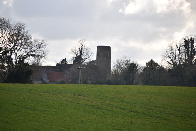
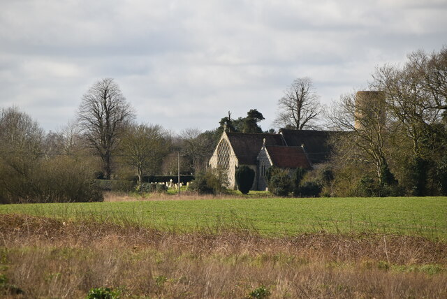
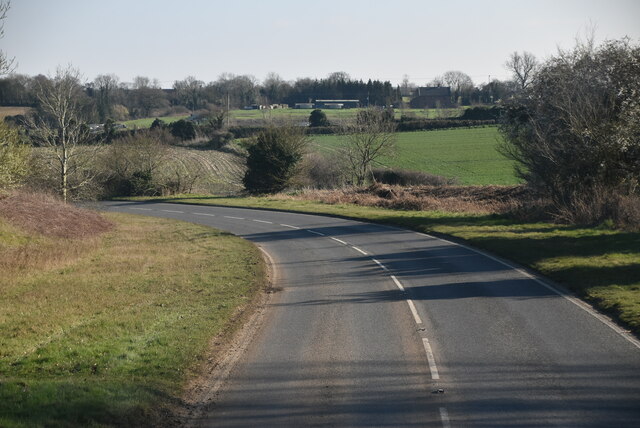
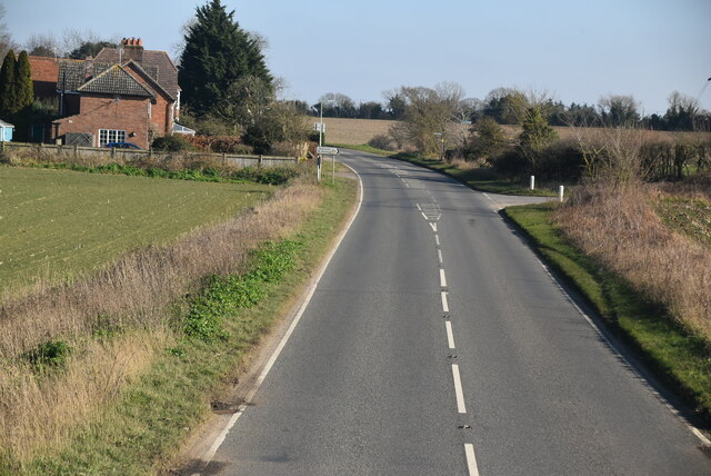
Geldeston Marshes is a prominent coastal marshland located in the county of Norfolk, England. Spanning over a vast area, this marshland is situated near the village of Geldeston, just a few miles away from the Norfolk Broads National Park.

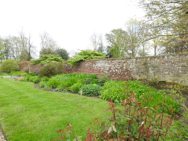
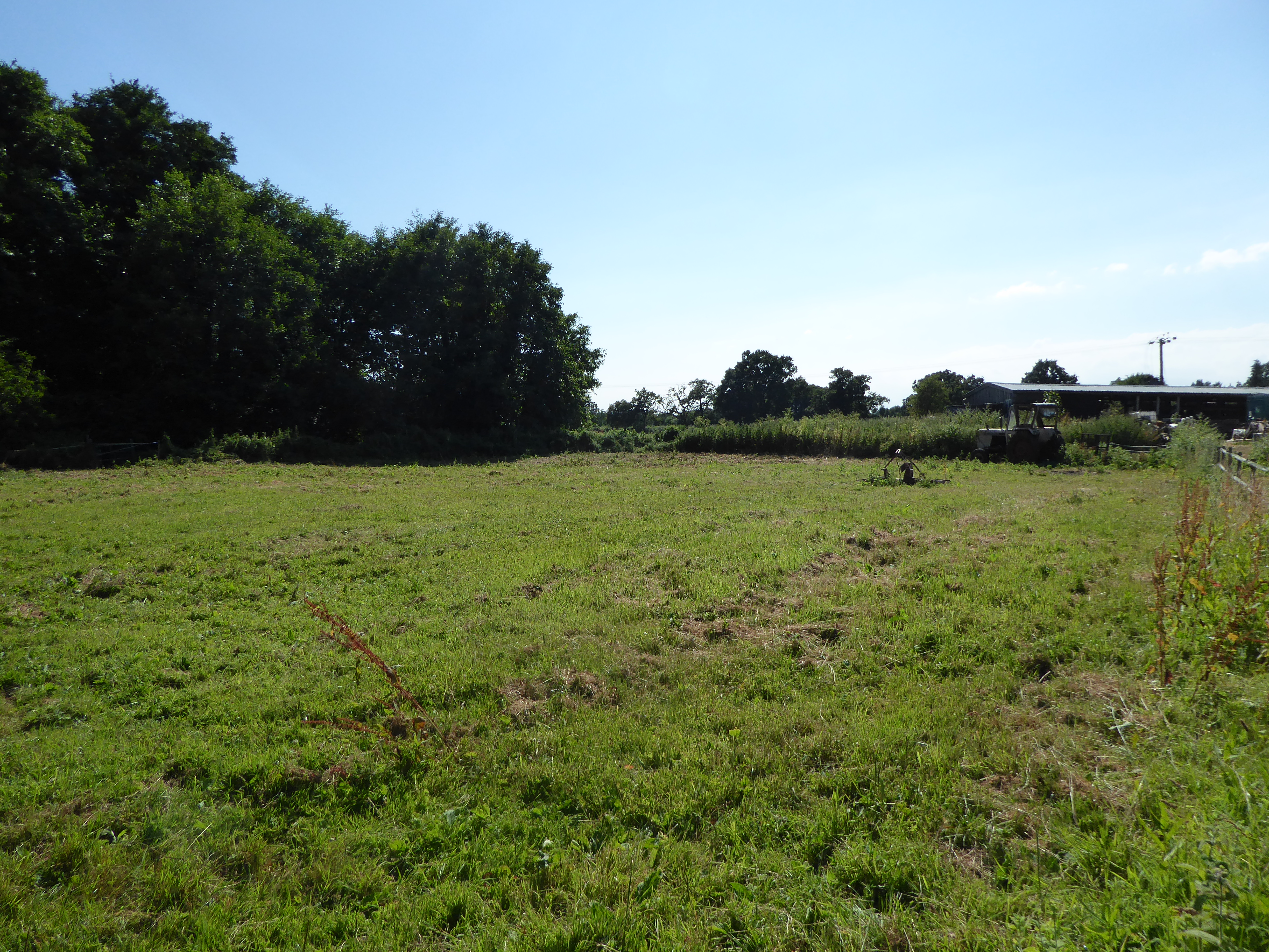
The marshes are characterized by their unique blend of saltwater and freshwater habitats, making them a haven for diverse flora and fauna. The marshes are primarily composed of saltmarshes and saltings, which are formed by tidal inundation and deposition of sediment. This dynamic environment creates an ideal breeding ground for numerous bird species, such as marsh harriers, avocets, and redshanks. The marshes also provide a habitat for various plants, including sea lavender, sea aster, and cordgrass.

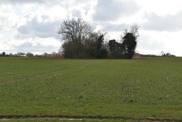
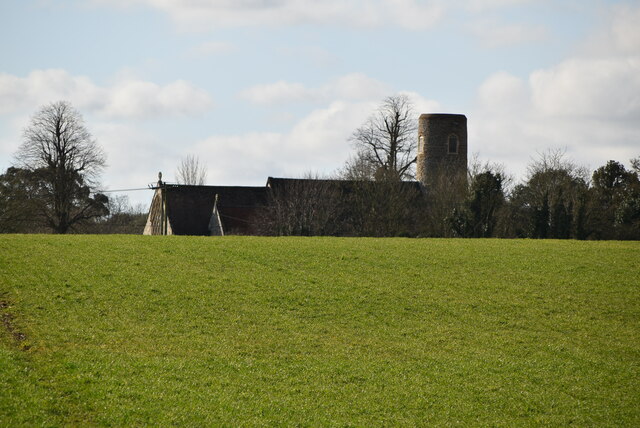
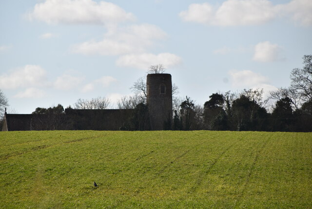
The area is renowned for its natural beauty and is a popular destination for birdwatching enthusiasts and nature lovers. Visitors can explore the marshes through a network of footpaths and trails, offering stunning views of the surrounding landscape. Additionally, several bird hides are strategically placed throughout the marshes, providing excellent vantage points for observing the diverse birdlife.

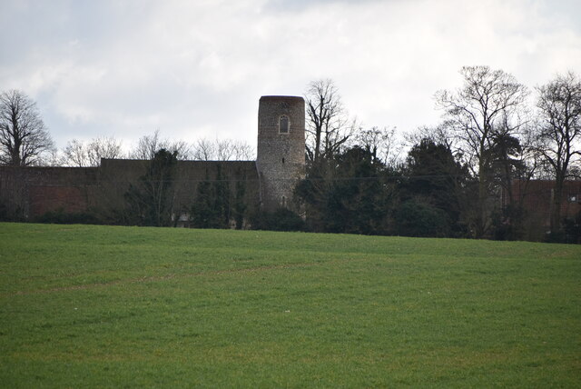
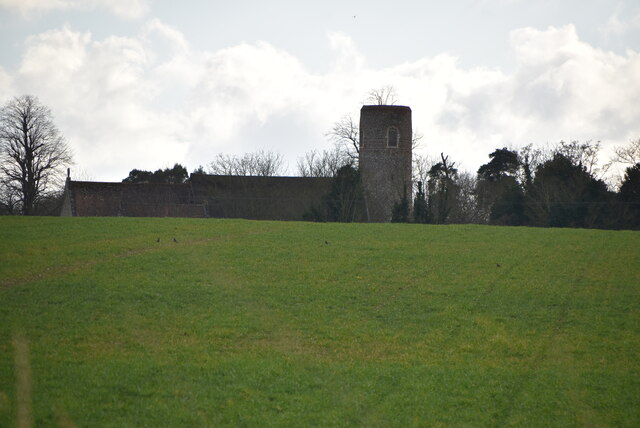
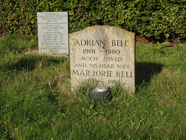
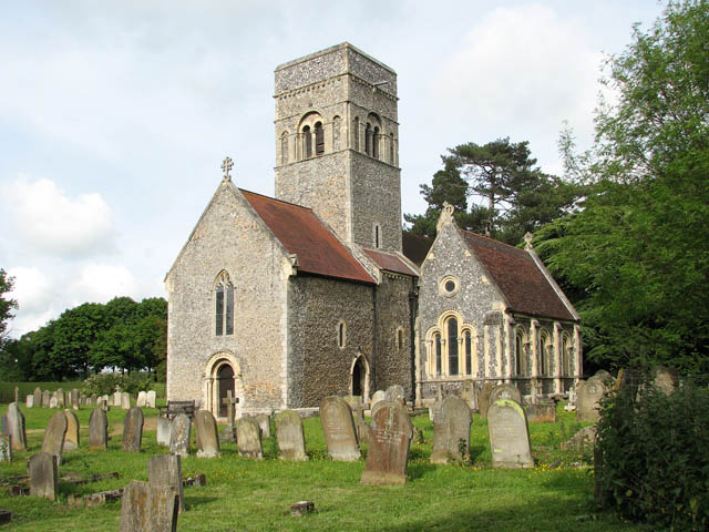
Geldeston Marshes also hold significant cultural and historical importance. The marshes have been utilized for centuries for grazing livestock and harvesting reeds for thatching roofs. Today, they continue to play a vital role in local agriculture and conservation efforts.

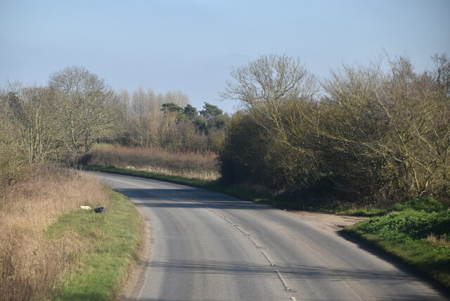
Overall, Geldeston Marshes in Norfolk offers a captivating blend of natural beauty, diverse wildlife, and historical significance, making it a must-visit destination for nature enthusiasts and those seeking tranquility amidst the coastal marshlands.

If you have any feedback on the listing, please let us know in the comments section below.

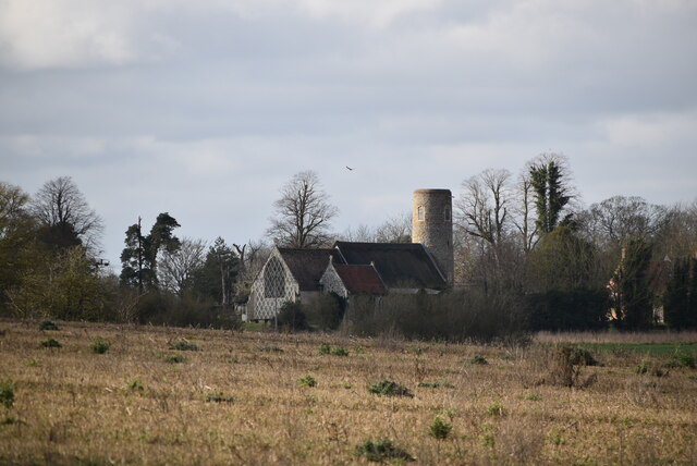
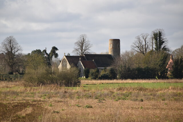
Geldeston Marshes Images

Images are sourced within 2km of 52.466072/1.5174569 or Grid Reference TM3991. Thanks to Geograph Open Source API. All images are credited.

Serpentine wall at the White House, Barsham The wall, in conjunction with other more conventional plain walls form an enclosed garden
Serpentine wall at the White House, Barsham
The wall, in conjunction with other more conventional plain walls form an enclosed garden
Wooded pond
Wooded pond
Church of Holy Trinity Grade I listed. <span class="nowrap"><a title="https://historicengland.org.uk/listing/the-list/list-entry/1032028" rel="nofollow ugc noopener" href="https://historicengland.org.uk/listing/the-list/list-entry/1032028">Link</a><img style="margin-left:2px;" alt="External link" title="External link - shift click to open in new window" src="https://s1.geograph.org.uk/img/external.png" width="10" height="10"/></span> 
<span class="nowrap"><a title="http://www.suffolkchurches.co.uk/barsham.html" rel="nofollow ugc noopener" href="http://www.suffolkchurches.co.uk/barsham.html">Link</a><img style="margin-left:2px;" alt="External link" title="External link - shift click to open in new window" src="https://s1.geograph.org.uk/img/external.png" width="10" height="10"/></span>
Church of Holy Trinity
Grade I listed. LinkExternal link LinkExternal link
Holy Trinity Church Grade I listed. <span class="nowrap"><a title="https://historicengland.org.uk/listing/the-list/list-entry/1032028" rel="nofollow ugc noopener" href="https://historicengland.org.uk/listing/the-list/list-entry/1032028">Link</a><img style="margin-left:2px;" alt="External link" title="External link - shift click to open in new window" src="https://s1.geograph.org.uk/img/external.png" width="10" height="10"/></span> 
<span class="nowrap"><a title="http://www.suffolkchurches.co.uk/barsham.html" rel="nofollow ugc noopener" href="http://www.suffolkchurches.co.uk/barsham.html">Link</a><img style="margin-left:2px;" alt="External link" title="External link - shift click to open in new window" src="https://s1.geograph.org.uk/img/external.png" width="10" height="10"/></span>
Holy Trinity Church
Grade I listed. LinkExternal link LinkExternal link
Grave of Adrian and Marjorie Bell Barsham Holy Trinity churchyard.

At the age of 19 he explored the countryside in Hundon, Suffolk, to learn about agriculture, and he farmed in various locations over the next sixty years, ending up at Crake Hall at Barsham <a title="https://www.geograph.org.uk/photo/2157926" href="https://www.geograph.org.uk/photo/2157926">Link</a> , until his death. His first book, Corduroy was an immediate best-seller and was followed by two more books on the countryside, Silver Ley in 1931 and The Cherry Tree in 1932, the three books forming a ruralist farm trilogy. He wrote the "Countryman’s Notebook" column in the Eastern Daily Press from 1950, and produced over twenty other books on the countryside, including Apple Acre (1942), Sunrise to Sunset (1944), The Budding Morrow (1946), The Flower and the Wheel (1949), Music in the Morning, (1954), A Suffolk Harvest (1956), the autobiographical My Own Master (1961) and The Green Bond (1976). Between 1930 and 1978, he set around 5,000 puzzles for The Times, and is credited with helping to establish its distinctive cryptic clue style.
Grave of Adrian and Marjorie Bell
Barsham Holy Trinity churchyard. At the age of 19 he explored the countryside in Hundon, Suffolk, to learn about agriculture, and he farmed in various locations over the next sixty years, ending up at Crake Hall at Barsham Link , until his death. His first book, Corduroy was an immediate best-seller and was followed by two more books on the countryside, Silver Ley in 1931 and The Cherry Tree in 1932, the three books forming a ruralist farm trilogy. He wrote the "Countryman’s Notebook" column in the Eastern Daily Press from 1950, and produced over twenty other books on the countryside, including Apple Acre (1942), Sunrise to Sunset (1944), The Budding Morrow (1946), The Flower and the Wheel (1949), Music in the Morning, (1954), A Suffolk Harvest (1956), the autobiographical My Own Master (1961) and The Green Bond (1976). Between 1930 and 1978, he set around 5,000 puzzles for The Times, and is credited with helping to establish its distinctive cryptic clue style.
Holy Trinity Church Grade I listed. <span class="nowrap"><a title="https://historicengland.org.uk/listing/the-list/list-entry/1032028" rel="nofollow ugc noopener" href="https://historicengland.org.uk/listing/the-list/list-entry/1032028">Link</a><img style="margin-left:2px;" alt="External link" title="External link - shift click to open in new window" src="https://s1.geograph.org.uk/img/external.png" width="10" height="10"/></span> 
<span class="nowrap"><a title="http://www.suffolkchurches.co.uk/barsham.html" rel="nofollow ugc noopener" href="http://www.suffolkchurches.co.uk/barsham.html">Link</a><img style="margin-left:2px;" alt="External link" title="External link - shift click to open in new window" src="https://s1.geograph.org.uk/img/external.png" width="10" height="10"/></span>
Holy Trinity Church
Grade I listed. LinkExternal link LinkExternal link
Holy Trinity Church <span class="nowrap"><a title="https://en.wikipedia.org/wiki/Barsham,_Suffolk" rel="nofollow ugc noopener" href="https://en.wikipedia.org/wiki/Barsham,_Suffolk">Link</a><img style="margin-left:2px;" alt="External link" title="External link - shift click to open in new window" src="https://s1.geograph.org.uk/img/external.png" width="10" height="10"/></span>
Holy Trinity Church
Entering Shipmeadow, B1062 <span class="nowrap"><a title="https://www.sabre-roads.org.uk/wiki/index.php?title=B1062" rel="nofollow ugc noopener" href="https://www.sabre-roads.org.uk/wiki/index.php?title=B1062">Link</a><img style="margin-left:2px;" alt="External link" title="External link - shift click to open in new window" src="https://s1.geograph.org.uk/img/external.png" width="10" height="10"/></span>
Entering Shipmeadow, B1062
Entering Barsham, B1062 <span class="nowrap"><a title="https://www.sabre-roads.org.uk/wiki/index.php?title=B1062" rel="nofollow ugc noopener" href="https://www.sabre-roads.org.uk/wiki/index.php?title=B1062">Link</a><img style="margin-left:2px;" alt="External link" title="External link - shift click to open in new window" src="https://s1.geograph.org.uk/img/external.png" width="10" height="10"/></span>
Entering Barsham, B1062
Show me another place!

Geldeston Marshes is located at Grid Ref: TM3991 (Lat: 52.466072, Lng: 1.5174569)

Administrative County: Norfolk

District: South Norfolk

Police Authority: Norfolk

What 3 Words

///warm.rectangular.playfully. Near Beccles, Suffolk

Related Wikis

Geldeston

Geldeston is a village and civil parish in the English county of Norfolk. The village is located 2.5 miles (4.0 km) north-west of Beccles and 14 miles...

Geldeston railway station

Geldeston (also Geldeston Halt) was a station on the Waveney Valley Line serving the village of Geldeston, Norfolk. It was operational for passenger services...

Geldeston Meadows

Geldeston Meadows is a 14-hectare (35-acre) biological Site of Special Scientific Interest near Geldeston in Norfolk. It is part of the Broadland Ramsar...
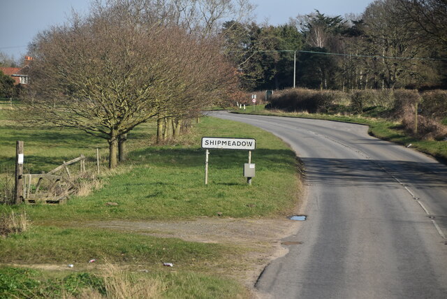
Shipmeadow

Shipmeadow is a village and civil parish located in the north of the English county of Suffolk. It is in the East Suffolk district, 2.5 miles (4.0 km)...
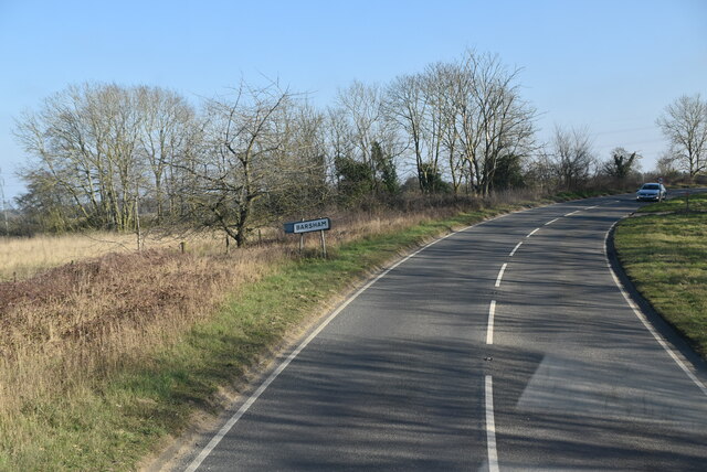
Barsham, Suffolk

Barsham is a village and civil parish in the East Suffolk district of the English county of Suffolk. It is about 2 miles (3.2 km) west of Beccles, south...

Leet Hill, Kirby Cane

Leet Hill, Kirby Cane is a 6.5-hectare (16-acre) geological Site of Special Scientific Interest in Kirby Cane in Norfolk. It is a Geological Conservation...

Haughey Air AgustaWestland AW139 crash

On 13 March 2014, an AgustaWestland AW139 helicopter of Haughey Air crashed shortly after taking off at night in fog from Gillingham, Norfolk, United Kingdom...

Gillingham, Norfolk

Gillingham ( GHIL-ing-əm) is a small village and civil parish in the English county of Norfolk. The villages is located 1.5 miles (2.4 km) north-west...

Nearby Amenities

Located within 500m of 52.466072,1.5174569
Entrance: yes
Lat/Long: 52.4636076/1.5168995
Access: yes
Barrier: lift_gate
Lift Gate Type: single
Material: metal
Lat/Long: 52.4652791/1.5165904
Disused: yes
Waterway: lock_gate
Lat/Long: 52.4631588/1.5170166
FIXME: Incomplete
Lat/Long: 52.4627842/1.518395
Entrance: main
Lat/Long: 52.4636267/1.5170524
Bench
Backrest: yes
Colour: grey
Inscription: Ben Suter / 1980-2005
Inscription 2: Benjamin Richard John Suter / Died 2nd August 2005 / Aged 24 Years
Material: wood
Lat/Long: 52.4631139/1.5157351
FIXME: Incomplete
Lat/Long: 52.4639327/1.516365
Life Ring
Emergency: life_ring
Support: fence
Lat/Long: 52.4633843/1.516818
Geldeston (or Shipmeadow) Lock
Board Type: history
Information: board
Tourism: information
Lat/Long: 52.4634059/1.516759
Information: guidepost
Tourism: information
Lat/Long: 52.4638251/1.5167537
Parking
Access: yes
Fee: no
Note: No overnight parking
Parking: surface
Smoothness: good
Supervised: no
Surface: ground
Lat/Long: 52.4654041/1.5164526
The data included in this document is from www.openstreetmap.org. The data is made available under ODbL.

Have you been to Geldeston Marshes?

Leave your review of Geldeston Marshes below (or comments, questions and feedback).