Butley Marshes

Coastal Marsh, Saltings in Suffolk East Suffolk

England

Butley Marshes

Gedgrave Road A no through road leading to Gedgrave Hall and a few other houses.
The soil is very sandy round here.
Gedgrave Road Credit: Des Blenkinsopp

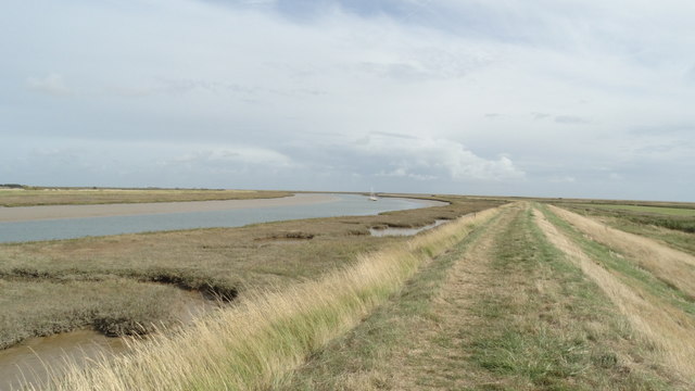
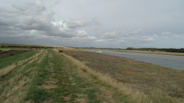
Butley Marshes is a prominent coastal marsh located in Suffolk, England. Stretching over an area of approximately 570 hectares, it is situated on the eastern side of the River Ore estuary, adjacent to the Suffolk Coast and Heaths Area of Outstanding Natural Beauty.

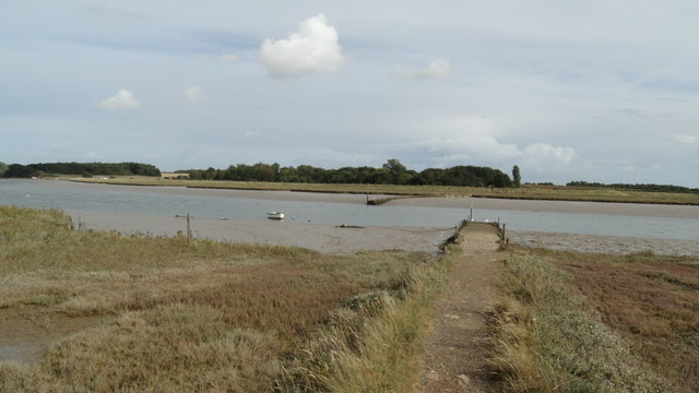
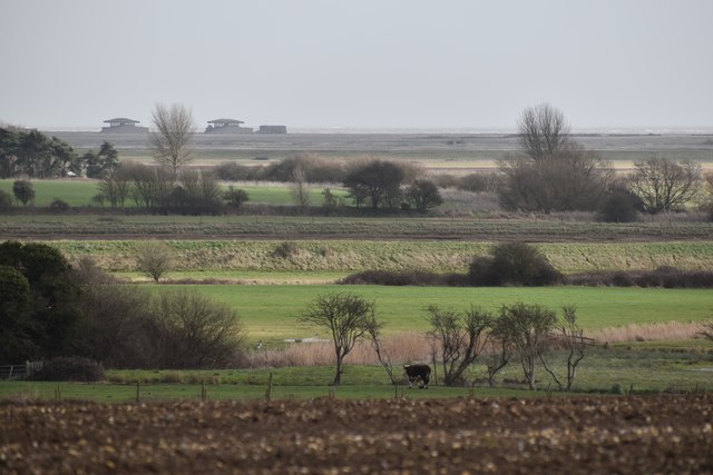
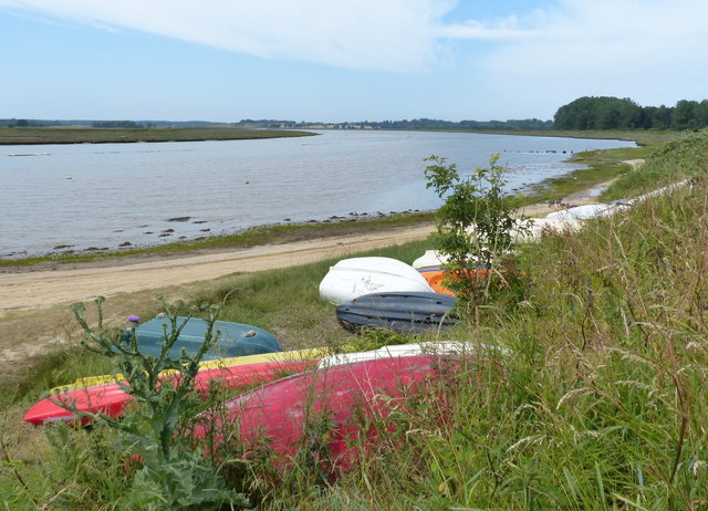
The marshes are characterized by a diverse landscape consisting of mudflats, saltmarshes, and reedbeds. These habitats are formed due to the tidal flow of the North Sea, which deposits sediment and creates a unique environment for a variety of plant and animal species. The marshes serve as an important breeding and feeding ground for numerous bird species, including wading birds, wildfowl, and rare marsh harriers.

The area is managed by the Royal Society for the Protection of Birds (RSPB) and is designated as a nature reserve. The RSPB has implemented several conservation measures to protect and enhance the biodiversity of the marshes, including the creation of freshwater scrapes to attract more bird species and the maintenance of grazing marshes to encourage the growth of specific vegetation.

Butley Marshes offer excellent opportunities for birdwatching and wildlife observation, with several well-maintained trails and viewing points. Visitors can witness the unique spectacle of thousands of wading birds congregating during high tide, as well as catch glimpses of elusive marsh harriers gliding over the reedbeds.

Moreover, the marshes play a vital role in flood protection for nearby communities by acting as a natural buffer and absorbing excess water during storm events. This ecological function, combined with its aesthetic beauty, makes Butley Marshes an important and cherished natural asset in Suffolk's coastal landscape.

If you have any feedback on the listing, please let us know in the comments section below.

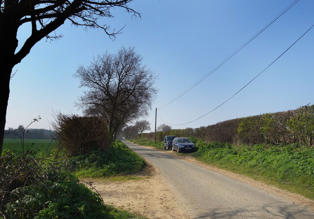
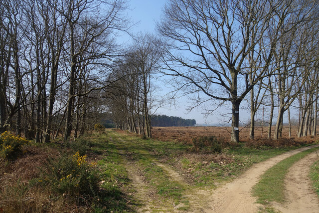
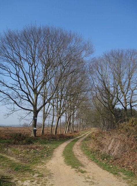
Butley Marshes Images

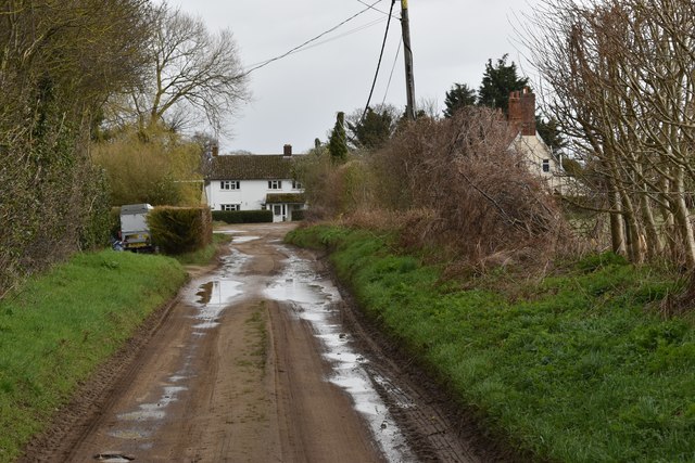
Images are sourced within 2km of 52.086623/1.4883288 or Grid Reference TM3948. Thanks to Geograph Open Source API. All images are credited.

Gedgrave Road A no through road leading to Gedgrave Hall and a few other houses.
The soil is very sandy round here.
Gedgrave Road
A no through road leading to Gedgrave Hall and a few other houses. The soil is very sandy round here.
Tracks, Gedgrave Broom A lot of this has been cut down by the look of it.
Tracks, Gedgrave Broom
A lot of this has been cut down by the look of it.
Track to The Broom A road to a premises called The Broom. On the right is Broom Covert, on the left is Gedgrave Broom.
TM4049 is kind of Broomy.
Track to The Broom
A road to a premises called The Broom. On the right is Broom Covert, on the left is Gedgrave Broom. TM4049 is kind of Broomy.
On the Suffolk Coast Path - Butley River below Boyton Dock
On the Suffolk Coast Path approaching Butley Ferry on Butley River
On the Suffolk Coast Path - western jetty at Butley Ferry on Butley River
Pasture on the floodplain of Butley River Looking west from the lane above Banters Barn Farm, with concrete structures on Orford Ness visible in the background.
Pasture on the floodplain of Butley River
Looking west from the lane above Banters Barn Farm, with concrete structures on Orford Ness visible in the background.
Gates at Banters Barn Farm Looking south-east along the lane that leads to the RSPB reserve on Boyton Marshes.
Gates at Banters Barn Farm
Looking south-east along the lane that leads to the RSPB reserve on Boyton Marshes.
New barns at Banters Barn Farm Looking east, with the confluence of the river Ore and Butley River in the background.
New barns at Banters Barn Farm
Looking east, with the confluence of the river Ore and Butley River in the background.
The Tang valley near Dock Farm
Wet fields above Dock Farm
Brick barns at Home Farm
Home Farm, Capel St. Andrew
Driveway to Butley Priory Butley Priory was built in the early 18th Century around the gateway of Butley Abbey, an 12th Century Augustinian monastery that was dissolved in 1538.
Driveway to Butley Priory
Butley Priory was built in the early 18th Century around the gateway of Butley Abbey, an 12th Century Augustinian monastery that was dissolved in 1538.
Abbey Farm and ruins of the abbey The farm sits on the site of the 12th Century Augustinian monastery. A ruined masonry arch is visible behind the farm cottages.
Abbey Farm and ruins of the abbey
The farm sits on the site of the 12th Century Augustinian monastery. A ruined masonry arch is visible behind the farm cottages.
Coulton Farm, Butley Low Corner
Boats along the Butley River The Butley River or Butley Creek is a tributary of the River Ore in Suffolk. The river is crossed by the Butley Ferry during the summer period, which carries walkers and cyclists using the Suffolk Coast Path.
Boats along the Butley River
The Butley River or Butley Creek is a tributary of the River Ore in Suffolk. The river is crossed by the Butley Ferry during the summer period, which carries walkers and cyclists using the Suffolk Coast Path.
Show me another place!

Butley Marshes is located at Grid Ref: TM3948 (Lat: 52.086623, Lng: 1.4883288)

Administrative County: Suffolk

District: East Suffolk

Police Authority: Suffolk

What 3 Words

///loopholes.relishing.agree. Near Rendlesham, Suffolk

Related Wikis

Gedgrave Hall Pit

Gedgrave Hall Pit is a 0.65-hectare (1.6-acre) geological Site of Special Scientific Interest in Gedgrave, south of Saxmundham in Suffolk. It is a Geological...

Gedgrave

Gedgrave is a civil parish in the East Suffolk district, in the English county of Suffolk in eastern England. In 2005, its population was 30. Gedgrave...

Butley Priory

Butley Priory, sometimes called Butley Abbey, was a religious house of Canons regular (Augustinians, Black canons) in Butley, Suffolk, dedicated to The...

Alde–Ore Estuary

Alde–Ore Estuary is a 2,534 hectare biological and geological Site of Special Scientific Interest which stretches along the Suffolk coast between Aldeburgh...

Nearby Amenities

Located within 500m of 52.086623,1.4883288
Burrow Hill
Place: locality
Lat/Long: 52.083495/1.4869263
Power: pole
Lat/Long: 52.085697/1.4815986
Power: pole
Lat/Long: 52.0848399/1.4824676
Power: pole
Lat/Long: 52.0854102/1.4894709
Power: pole
Lat/Long: 52.0852256/1.48839
Power: pole
Lat/Long: 52.0848102/1.4862308
Power: pole
Lat/Long: 52.0850179/1.4873117
Power: pole
Lat/Long: 52.0842729/1.484262
Power: pole
Lat/Long: 52.0846075/1.4851445
Power: pole
Lat/Long: 52.0839416/1.4833823
Power: pole
Lat/Long: 52.0839696/1.4833152
The data included in this document is from www.openstreetmap.org. The data is made available under ODbL.

Have you been to Butley Marshes?

Leave your review of Butley Marshes below (or comments, questions and feedback).