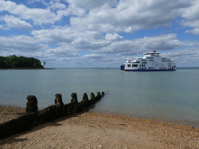
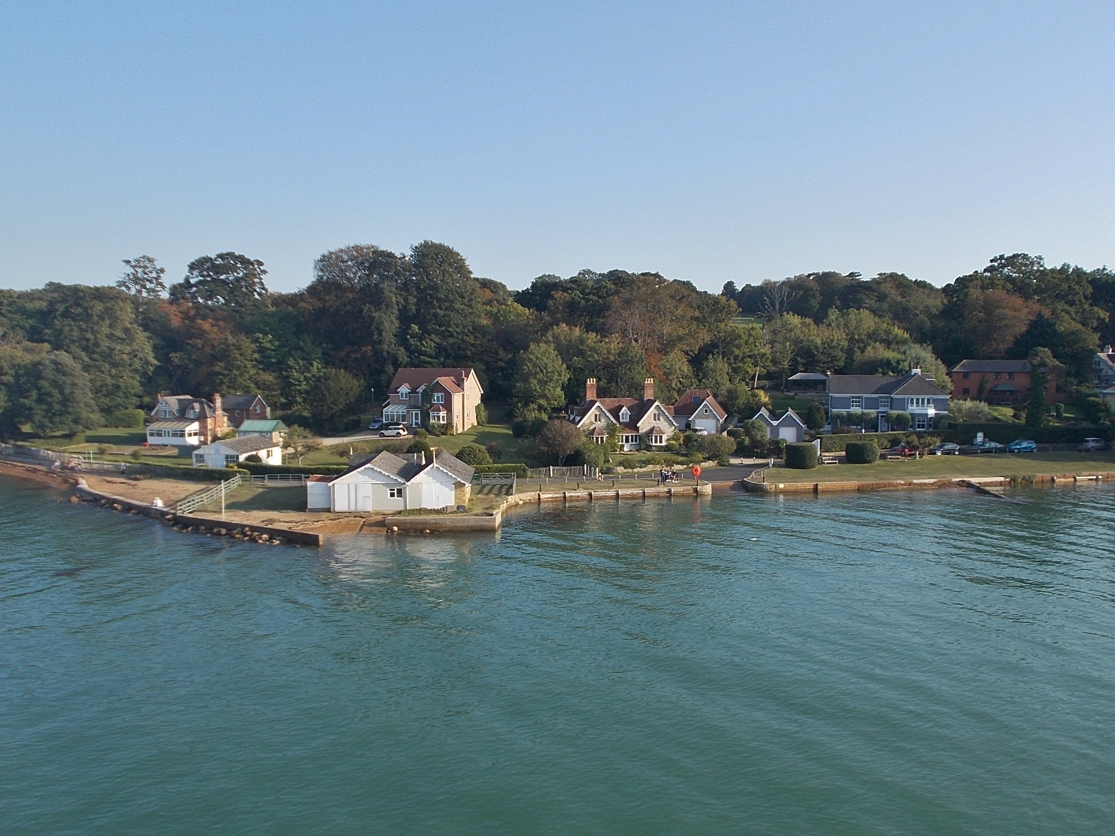
Wootton Hard

Coastal Marsh, Saltings in Hampshire

England

Wootton Hard

Roundabout on Fishbourne Lane
Roundabout on Fishbourne Lane Credit: Roger Cornfoot

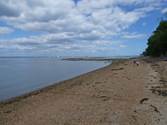
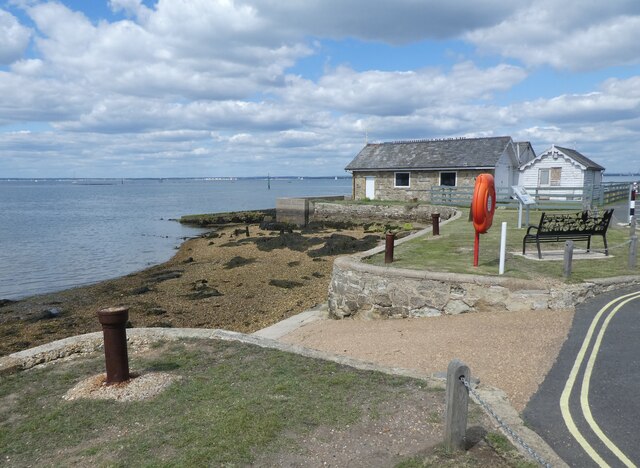
Wootton Hard is a coastal marsh and saltings located in Hampshire, England. Stretching along the coast of the Solent, it covers a vast area of approximately 300 hectares. This unique landscape is characterized by its intertidal mudflats, saltmarshes, and reedbeds, making it an important habitat for a wide range of plant and animal species.

The marshes of Wootton Hard are influenced by the rise and fall of the tides, creating a dynamic environment that supports a diverse array of wildlife. The mudflats provide food and shelter for various wading birds such as oystercatchers, curlews, and redshanks, which can be observed during low tide feeding on the rich invertebrate life found in the mud.

The saltmarshes are dominated by salt-tolerant grasses, herbs, and shrubs, which provide important nesting and foraging grounds for numerous bird species. Visitors to Wootton Hard may spot birds such as lapwings, dunlins, and avocets, particularly during the breeding season.

In addition to its avian inhabitants, Wootton Hard also supports a variety of other wildlife. The reedbeds provide cover for small mammals like voles and shrews, while the mudflats are home to a diverse range of marine invertebrates and fish, including crabs, worms, and flounder.

The Wootton Hard marshes are not only significant for their ecological value but also play an important role in flood prevention and coastal erosion control. The dense vegetation helps to stabilize the shoreline and absorb excess water during high tides and storms, reducing the risk of flooding in the surrounding areas.

Overall, Wootton Hard in Hampshire is a unique and ecologically important coastal marsh and saltings, offering a rich and diverse habitat for a wide range of wildlife species, as well as providing valuable ecosystem services for the local community.

If you have any feedback on the listing, please let us know in the comments section below.
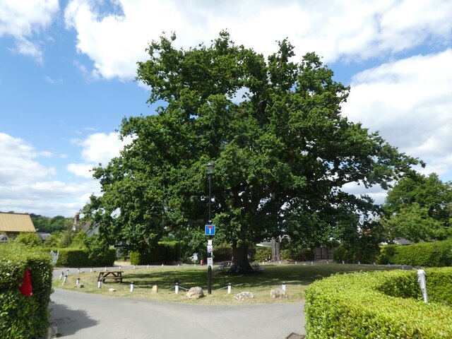
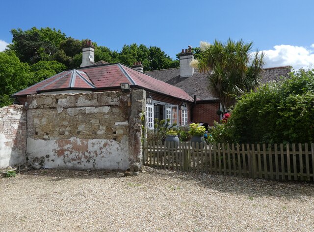
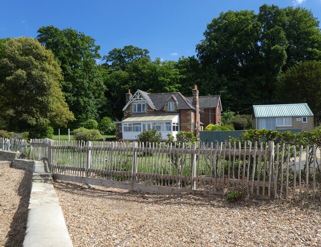
Wootton Hard Images

Images are sourced within 2km of 50.735719/-1.2152843 or Grid Reference SZ5593. Thanks to Geograph Open Source API. All images are credited.

Roundabout on Fishbourne Lane
The Fishbourne Inn
The Fishbourne Inn
Seafront cottage, Fishbourne
A Wightlink ferry arrives from Portsmouth
The foreshore at Fishbourne
Slipway at Fishbourne
Cottage on Fishbourne Lane
Wootton Creek
Wootton Creek
The Sloop Inn, Wootton Bridge
Seafront houses at Fishbourne
Quarr Abbey
Quarr Abbey
Isle of Wight coast near Quarr Abbey The Isle of Wight Coast near Quarr Abbey (just visible above the trees), viewed from the deck of the Wightlink car ferry MV Victoria of Wight on a Portsmouth - Fishbourne service as it approaches Fishbourne.
Isle of Wight coast near Quarr Abbey
The Isle of Wight Coast near Quarr Abbey (just visible above the trees), viewed from the deck of the Wightlink car ferry MV Victoria of Wight on a Portsmouth - Fishbourne service as it approaches Fishbourne.
Isle of Wight coast near Quarr Abbey Looking along the Isle of Wight coast near Quarr Abbey with the spire of All Saints' Church in Ryde visible above the skyline in the centre of the photo, viewed from the deck of the Wightlink car ferry MV Victoria of Wight on a Portsmouth - Fishbourne service as it approaches Fishbourne.
Isle of Wight coast near Quarr Abbey
Looking along the Isle of Wight coast near Quarr Abbey with the spire of All Saints' Church in Ryde visible above the skyline in the centre of the photo, viewed from the deck of the Wightlink car ferry MV Victoria of Wight on a Portsmouth - Fishbourne service as it approaches Fishbourne.
Beacon 2 Beacon 2, one of the navigation beacons marking the entrance to Fishbourne car ferry terminal, viewed from the deck of the Wightlink car ferry MV Victoria of Wight on a Portsmouth - Fishbourne service.  In the background is the Isle of Wight coast near Quarr Abbey with the spire of All Saints' Church in Ryde visible above the skyline left of centre.
Beacon 2
Beacon 2, one of the navigation beacons marking the entrance to Fishbourne car ferry terminal, viewed from the deck of the Wightlink car ferry MV Victoria of Wight on a Portsmouth - Fishbourne service. In the background is the Isle of Wight coast near Quarr Abbey with the spire of All Saints' Church in Ryde visible above the skyline left of centre.
Beacon 4 Beacon 4, one of the navigation beacons marking the entrance to Fishbourne car ferry terminal, viewed from the deck of the Wightlink car ferry MV Victoria of Wight on a Portsmouth - Fishbourne service.  Beyond are a boathouse and houses in Fishbourne Lane.
Beacon 4
Beacon 4, one of the navigation beacons marking the entrance to Fishbourne car ferry terminal, viewed from the deck of the Wightlink car ferry MV Victoria of Wight on a Portsmouth - Fishbourne service. Beyond are a boathouse and houses in Fishbourne Lane.
Towards Portsmouth Looking back from the deck of the Wightlink car ferry MV Victoria of Wight on a Portsmouth - Fishbourne service as it approaches the terminal at Fishbourne.  Prominent in the distance is the Spinnaker Tower in Portsmouth.  Either side of the entrance channel are a pair of row of navigation beacons, with odd numbers ones on the left, in green, and even numbered ones on the right, in red.
Towards Portsmouth
Looking back from the deck of the Wightlink car ferry MV Victoria of Wight on a Portsmouth - Fishbourne service as it approaches the terminal at Fishbourne. Prominent in the distance is the Spinnaker Tower in Portsmouth. Either side of the entrance channel are a pair of row of navigation beacons, with odd numbers ones on the left, in green, and even numbered ones on the right, in red.
Fishbourne A boathouse and houses in Fishbourne Lane, seen from the deck of the Wightlink car ferry MV Victoria of Wight on a Portsmouth - Fishbourne service as it approaches the terminal at Fishbourne.
Fishbourne
A boathouse and houses in Fishbourne Lane, seen from the deck of the Wightlink car ferry MV Victoria of Wight on a Portsmouth - Fishbourne service as it approaches the terminal at Fishbourne.
Show me another place!

Wootton Hard is located at Grid Ref: SZ5593 (Lat: 50.735719, Lng: -1.2152843)

Unitary Authority: Isle of Wight

Police Authority: Hampshire

What 3 Words

///september.dabble.opinion. Near Wootton, Isle of Wight

Related Wikis

Fishbourne, Isle of Wight

Fishbourne is a village between Wootton and Ryde, on the Isle of Wight. The name "Fishbourne" might mean "stream of fish" or "fish spring." It is positioned...
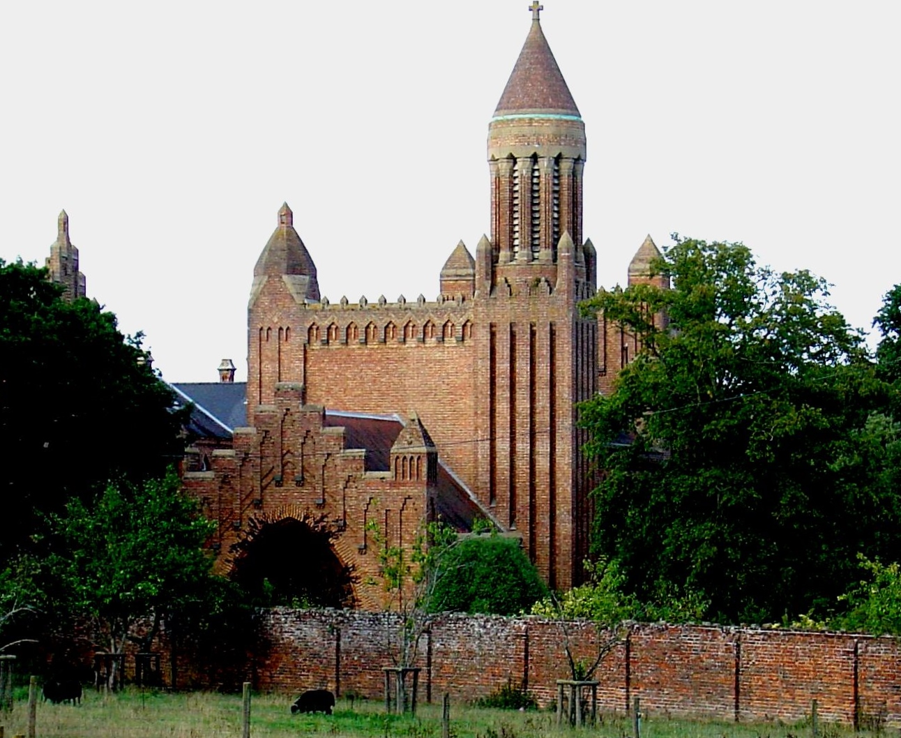
Quarr Abbey House

The Quarr Abbey House was one of several houses constructed along the north coast of the Isle of Wight in southern England. Built in the 19th century from...

Isle of Wight Festival 1969

The 1969 Isle of Wight Festival was held on 29–31 August 1969 at Wootton Creek, on the Isle of Wight. The festival attracted an audience of approximately...

Quarr Abbey

Quarr Abbey (French: Abbaye Notre-Dame de Quarr) is a monastery between the villages of Binstead and Fishbourne on the Isle of Wight in southern England...

Nearby Amenities

Located within 500m of 50.735719,-1.2152843
Ferry Terminal
Fishbourne Car Ferry terminal
Bicycle: yes
Ferry: yes
Foot: yes
Motor Vehicle: yes
Operator: Wightlink
Public Transport: stop_position
Lat/Long: 50.7343475/-1.2134139
Source: PGS
Lat/Long: 50.7363977/-1.2145453
Source: PGS
Lat/Long: 50.7361533/-1.2150345
Source: PGS
Lat/Long: 50.7357877/-1.2155404
Source: PGS
Lat/Long: 50.7356034/-1.2165005
Source: PGS
Lat/Long: 50.7358717/-1.2166009
Source: PGS
Lat/Long: 50.7359851/-1.2170373
Source: PGS
Lat/Long: 50.7359343/-1.2174024
Source: PGS
Lat/Long: 50.7358563/-1.2176254
Source: PGS
Lat/Long: 50.7356945/-1.2179684
Source: PGS
Lat/Long: 50.7354403/-1.2186334
Source: PGS
Lat/Long: 50.7353163/-1.2188404
Source: PGS
Lat/Long: 50.7350673/-1.2192528
Source: PGS
Lat/Long: 50.7341972/-1.2197941
Source: PGS
Lat/Long: 50.7327472/-1.220058
Source: PGS
Lat/Long: 50.7334463/-1.2174238
Source: PGS
Lat/Long: 50.7335969/-1.2175585
Source: PGS
Lat/Long: 50.7346373/-1.2166693
Source: PGS
Lat/Long: 50.7342354/-1.2162293
Source: PGS
Lat/Long: 50.7339042/-1.2159604
Source: PGS
Lat/Long: 50.7339225/-1.215202
Source: PGS
Lat/Long: 50.7339281/-1.2149776
Source: PGS
Lat/Long: 50.733885/-1.2130479
Source: PGS
Lat/Long: 50.7341146/-1.2119997
Source: PGS
Lat/Long: 50.7345705/-1.2111388
Source: PGS
Lat/Long: 50.7350088/-1.2108796
Post Box
Operator: Royal Mail
Operator Wikidata: Q638098
Ref: PO33 22
Ref GB Uprn: 10015465730
Website: https://www.royalmail.com/services-near-you/postbox/fishbourne-green-po33-4ha/0000PO3322
Lat/Long: 50.7332552/-1.2116798
Leisure: slipway
Lat/Long: 50.7346081/-1.2111019
Cafe
Creek Café
Addr City: Fishbourne
Addr Housename: Car Ferry Terminal
Addr Postcode: PO33 4EU
Addr Street: Fishbourne Lane
Cuisine: cake;coffee;tea;sandwich
Internet Access: yes
Internet Access Fee: no
Operator: Wightlink
Outdoor Seating: yes
Lat/Long: 50.7333037/-1.2141636
Access: yes
Barrier: lift_gate
Bicycle: yes
Lat/Long: 50.734056/-1.2138049
Seamark Light 1 Character: Oc
Seamark Light 1 Colour: green
Seamark Light 1 Period: 10
Seamark Light 1 Sector End: 224.3
Seamark Light 1 Sector Start: 220.8
Seamark Light 1 Sequence: 8+(2)
Seamark Light 2 Character: Oc
Seamark Light 2 Colour: white
Seamark Light 2 Period: 10
Seamark Light 2 Sector End: 225.8
Seamark Light 2 Sector Start: 224.3
Seamark Light 2 Sequence: 8+(2)
Seamark Light 3 Character: Oc
Seamark Light 3 Colour: red
Seamark Light 3 Period: 10
Seamark Light 3 Sector End: 230.8
Seamark Light 3 Sector Start: 225.8
Seamark Light 3 Sequence: 8+(2)
Seamark Light Reference: A 0665.8
Seamark Type: light_major
Lat/Long: 50.7339567/-1.2142615
Bench
Backrest: yes
Mapillary: 251380703440391
Survey Date: 2018-04-05
Lat/Long: 50.7341937/-1.211471
Bench
Backrest: yes
Mapillary: 2788829398114434
Survey Date: 2018-04-05
Lat/Long: 50.7343058/-1.2113123
Bench
Lat/Long: 50.7343959/-1.2111987
Bench
Lat/Long: 50.7344818/-1.2111131
Stop
Lat/Long: 50.7333132/-1.2135046
Stop
Note: implicit
Lat/Long: 50.7334074/-1.213974
Give Way
Lat/Long: 50.7334612/-1.2140814
Stop
Note: implicit
Lat/Long: 50.7334327/-1.2138938
Stop
Note: marked
Lat/Long: 50.7334448/-1.2138562
Stop
Lat/Long: 50.7331791/-1.2138823
Stop
Lat/Long: 50.7331671/-1.2139141
Stop
Note: implicit
Lat/Long: 50.7334204/-1.2139352
Stop
Note: implicit
Lat/Long: 50.7333967/-1.2140088
Leisure: slipway
Lat/Long: 50.7358568/-1.2163946
Pub
The Fishbourne Inn
Addr City: Fishbourne
Addr Country: GB
Addr Housenumber: 111
Addr Postcode: PO33 4EU
Addr Street: Fishbourne Lane
Fhrs Id: 541033
Outdoor Seating: yes
Source Addr: FHRS Open Data
Lat/Long: 50.7328306/-1.212048
Leisure: picnic_table
Lat/Long: 50.732907/-1.2118321
Leisure: picnic_table
Lat/Long: 50.7329631/-1.2118844
Leisure: picnic_table
Lat/Long: 50.7329698/-1.2117704
Fishbourne
Place: village
Wikidata: Q2075943
Wikipedia: en:Fishbourne, Isle of Wight
Lat/Long: 50.7319767/-1.2145819
Defibrillator
Emergency: defibrillator
Indoor: no
Lat/Long: 50.7332076/-1.2140442
Power: substation
Ref GB Uprn: 10024893377
Lat/Long: 50.731484/-1.2140432
Leisure: slipway
Lat/Long: 50.733896/-1.2146974
Leisure: slipway
Lat/Long: 50.7328095/-1.2176263
Addr Housename: Bodwen Court
Addr Street: Woodside Road
Lat/Long: 50.737674/-1.2158105
Hiking: yes
Information: guidepost
Tourism: information
Lat/Long: 50.7324717/-1.211531
Hiking: yes
Information: guidepost
Tourism: information
Lat/Long: 50.736899/-1.2163362
Stop
Access: destination
Barrier: lift_gate
Lat/Long: 50.7322242/-1.2131811
Stop
Access: destination
Barrier: lift_gate
Lat/Long: 50.7322641/-1.213002
Turning Loop
Lat/Long: 50.7315108/-1.2133107
Charging Station
Capacity: 2
Mapillary: 532950341409059
Operator: bp pulse
Lat/Long: 50.7321941/-1.2133787
Bench
Backrest: yes
Lat/Long: 50.732279/-1.2126387
Cafe
The Hut
Building: kiosk
Lat/Long: 50.7326417/-1.2119299
Stop
Access: destination
Barrier: lift_gate
Lat/Long: 50.732211/-1.2132388
Give Way
Lat/Long: 50.7321978/-1.2133119
Access: destination
Barrier: swing_gate
Lat/Long: 50.7336149/-1.2140511
Fixme: check for turn restriction
Lat/Long: 50.7336613/-1.2142425
Note: marking
Lat/Long: 50.7324409/-1.2136482
Note: marking
Lat/Long: 50.7329712/-1.2140506
Stop
Note: implicit
Lat/Long: 50.733184/-1.2139994
Give Way
Lat/Long: 50.732339/-1.2128086
Give Way
Lat/Long: 50.7321179/-1.2127973
Traffic Calming: bump
Lat/Long: 50.7321532/-1.2132036
Traffic Calming: bump
Lat/Long: 50.7321664/-1.2131474
Crossing
Crossing: marked
Crossing Island: no
Crossing Ref: zebra
Lat/Long: 50.7336088/-1.2138897
Crossing
Crossing: marked
Crossing Island: no
Crossing Ref: zebra
Lat/Long: 50.7335609/-1.2140431
Crossing
Crossing: marked
Crossing Island: no
Crossing Ref: zebra
Lat/Long: 50.7335254/-1.2141567
Direction: 60
Man Made: surveillance
Mapillary: 1209599789472950
Source: mapillary
Source Date: 2020-06-29
Surveillance Type: camera
Lat/Long: 50.7340921/-1.2138224
Street Lamp
Man Made: surveillance
Surveillance Type: camera
Lat/Long: 50.7335257/-1.2142058
Crossing
Crossing: marked
Crossing Island: no
Crossing Ref: zebra
Lat/Long: 50.7335767/-1.2139926
Man Made: planter
Lat/Long: 50.7321467/-1.2132346
Man Made: planter
Lat/Long: 50.7321608/-1.2131762
Man Made: planter
Lat/Long: 50.7321759/-1.2131135
Crossing
Crossing: marked
Crossing Island: no
Crossing Ref: zebra
Tactile Paving: no
Lat/Long: 50.7323672/-1.2134569
Crossing
Lat/Long: 50.7330962/-1.2140087
Assembly Point
Assembly Point Fire: yes
Emergency: assembly_point
Lat/Long: 50.732301/-1.2126295
Barrier: bollard
Lat/Long: 50.7332216/-1.2134087
Barrier: bollard
Lat/Long: 50.7331234/-1.2133337
Barrier: bollard
Lat/Long: 50.7330283/-1.2132611
Barrier: bollard
Lat/Long: 50.7329318/-1.2131874
Barrier: bollard
Lat/Long: 50.7328345/-1.2131132
Barrier: bollard
Lat/Long: 50.7327402/-1.2130411
Barrier: bollard
Lat/Long: 50.732647/-1.21297
Barrier: bollard
Lat/Long: 50.7325428/-1.2128904
Barrier: bollard
Lat/Long: 50.7324481/-1.2128181
Barrier: bollard
Lat/Long: 50.7321963/-1.2129861
Barrier: bollard
Lat/Long: 50.7321733/-1.2129906
Barrier: bollard
Lat/Long: 50.7321504/-1.2129951
Barrier: bollard
Lat/Long: 50.732129/-1.2129854
Barrier: bollard
Lat/Long: 50.7321094/-1.212968
Barrier: bollard
Lat/Long: 50.7321/-1.2129366
Barrier: bollard
Lat/Long: 50.7321064/-1.2129044
Barrier: bollard
Lat/Long: 50.7321195/-1.2128776
Barrier: bollard
Lat/Long: 50.7321402/-1.2128743
Barrier: bollard
Lat/Long: 50.7321624/-1.2128709
Barrier: bollard
Lat/Long: 50.7321856/-1.2128672
Barrier: bollard
Lat/Long: 50.7322073/-1.2128638
Barrier: bollard
Lat/Long: 50.732228/-1.2128606
Barrier: bollard
Lat/Long: 50.7322482/-1.2128649
Barrier: bollard
Lat/Long: 50.7322632/-1.2128806
Barrier: bollard
Lat/Long: 50.7320884/-1.2130721
Barrier: bollard
Lat/Long: 50.7321088/-1.2130682
Barrier: bollard
Lat/Long: 50.7321311/-1.2130639
Barrier: bollard
Lat/Long: 50.7321528/-1.2130598
Barrier: bollard
Lat/Long: 50.7321759/-1.2130554
Barrier: bollard
Lat/Long: 50.7321986/-1.2130511
Barrier: bollard
Lat/Long: 50.7322211/-1.2130468
Barrier: bollard
Lat/Long: 50.7322442/-1.2130424
Barrier: bollard
Lat/Long: 50.7321091/-1.2130837
Barrier: bollard
Lat/Long: 50.7321287/-1.2130947
Barrier: bollard
Lat/Long: 50.7321526/-1.2131082
Street Lamp
Lat/Long: 50.732504/-1.2129946
Street Lamp
Lat/Long: 50.7326488/-1.2131047
Street Lamp
Man Made: surveillance
Surveillance Type: camera
Lat/Long: 50.7329418/-1.2133274
Street Lamp
Lat/Long: 50.732794/-1.213215
Street Lamp
Lat/Long: 50.7330885/-1.2134389
Street Lamp
Lat/Long: 50.7332292/-1.2135459
Barrier: bollard
Lat/Long: 50.7321171/-1.2132908
Seamark Buoy Lateral Category: starboard
Seamark Buoy Lateral Colour: green
Seamark Buoy Lateral Shape: conical
Seamark Buoy Lateral System: iala-a
Seamark Type: buoy_lateral
Lat/Long: 50.7321075/-1.2185571
Seamark Beacon Special Purpose Colour: black
Seamark Beacon Special Purpose Shape: pile
Seamark Type: beacon_special_purpose
Lat/Long: 50.7334147/-1.2181011
Seamark Beacon Lateral Category: port
Seamark Beacon Lateral Colour: red
Seamark Beacon Lateral Shape: pile
Seamark Beacon Lateral System: iala-a
Seamark Type: beacon_lateral
Lat/Long: 50.7344622/-1.2180555
Seamark Buoy Lateral Category: starboard
Seamark Buoy Lateral Colour: green
Seamark Buoy Lateral Shape: spherical
Seamark Buoy Lateral System: iala-a
Seamark Type: buoy_lateral
Lat/Long: 50.7354875/-1.2170067
Seamark Buoy Special Purpose Colour: yellow
Seamark Buoy Special Purpose Shape: spar
Seamark Type: buoy_special_purpose
Lat/Long: 50.7366419/-1.2129164
Seamark Buoy Lateral Category: starboard
Seamark Buoy Lateral Colour: green
Seamark Buoy Lateral Shape: conical
Seamark Buoy Lateral System: iala-a
Seamark Type: buoy_lateral
Lat/Long: 50.7353195/-1.2132302
Seamark Buoy Lateral Category: port
Seamark Buoy Lateral Colour: red
Seamark Buoy Lateral Shape: can
Seamark Buoy Lateral System: iala-a
Seamark Type: buoy_lateral
Lat/Long: 50.7349639/-1.2135131
Seamark Fog Signal Category: bell
Seamark Light Category: vertical
Seamark Light Character: F
Seamark Light Colour: red
Seamark Light Multiple: 2
Lat/Long: 50.7348/-1.2124255
Seamark Beacon Lateral Category: starboard
Seamark Beacon Lateral Colour: green
Seamark Beacon Lateral System: iala-a
Seamark Light Character: Q
Seamark Light Colour: green
Seamark Type: beacon_lateral
Lat/Long: 50.7358016/-1.2121922
Seamark Beacon Lateral Category: starboard
Seamark Beacon Lateral Colour: green
Seamark Beacon Lateral System: iala-a
Seamark Light Character: Fl
Seamark Light Colour: green
Seamark Light Period: 2.5
Seamark Topmark Colour: green
Seamark Topmark Shape: cone, point up
Seamark Type: beacon_lateral
Lat/Long: 50.7369237/-1.210497
Seamark Beacon Lateral Category: port
Seamark Beacon Lateral Colour: red
Seamark Beacon Lateral Shape: pile
Seamark Beacon Lateral System: iala-a
Seamark Light Character: Fl
Seamark Light Colour: red
Seamark Light Period: 2.5
Seamark Name: 4
Seamark Topmark Colour: red
Seamark Topmark Shape: cylinder
Seamark Type: beacon_lateral
Lat/Long: 50.7364314/-1.2096494
Seamark Pile Category: stake
Seamark Type: pile
Lat/Long: 50.7342729/-1.2178168
Seamark Pile Category: stake
Seamark Type: pile
Lat/Long: 50.734194/-1.2178382
Seamark Pile Category: stake
Seamark Type: pile
Lat/Long: 50.734025/-1.2178999
Seamark Pile Category: stake
Seamark Type: pile
Lat/Long: 50.7339656/-1.2181239
Seamark Pile Category: stake
Seamark Type: pile
Lat/Long: 50.7361606/-1.2141153
Seamark Pile Category: stake
Seamark Type: pile
Lat/Long: 50.7360622/-1.2140456
Seamark Pile Category: stake
Seamark Type: pile
Lat/Long: 50.7359883/-1.2139852
Seamark Pile Category: stake
Seamark Type: pile
Lat/Long: 50.7361521/-1.214578
Seamark Pile Category: stake
Seamark Type: pile
Lat/Long: 50.7360732/-1.2145284
Seamark Pile Category: stake
Seamark Type: pile
Lat/Long: 50.7360129/-1.2145177
Seamark Pile Category: stake
Seamark Type: pile
Lat/Long: 50.7359544/-1.2144707
Seamark Pile Category: stake
Seamark Type: pile
Lat/Long: 50.7358695/-1.2144345
Seamark Pile Category: stake
Seamark Type: pile
Lat/Long: 50.7358186/-1.2143514
Seamark Pile Category: stake
Seamark Type: pile
Lat/Long: 50.7358245/-1.2142266
Seamark Pile Category: stake
Seamark Type: pile
Lat/Long: 50.7358593/-1.2141113
Seamark Pile Category: stake
Seamark Type: pile
Lat/Long: 50.7359017/-1.2139866
Seamark Pile Category: stake
Seamark Type: pile
Lat/Long: 50.7361182/-1.2139772
Seamark Pile Category: stake
Seamark Type: pile
Lat/Long: 50.7360494/-1.2139316
Seamark Pile Category: stake
Seamark Type: pile
Lat/Long: 50.7359841/-1.2138538
Seamark Pile Category: stake
Seamark Type: pile
Lat/Long: 50.7359162/-1.2138028
Seamark Pile Category: stake
Seamark Type: pile
Lat/Long: 50.7359645/-1.213717
Seamark Pile Category: stake
Seamark Type: pile
Lat/Long: 50.7360044/-1.2136352
Seamark Pile Category: stake
Seamark Type: pile
Lat/Long: 50.7360027/-1.2135319
Seamark Type: wreck
Seamark Wreck Category: hull_showing
Lat/Long: 50.7341261/-1.2170684
Seamark Rock Water Level: covers
Seamark Type: rock
Lat/Long: 50.7386687/-1.2160116
Seamark Rock Water Level: covers
Seamark Type: rock
Lat/Long: 50.7386924/-1.2162906
Seamark Rock Water Level: covers
Seamark Type: rock
Lat/Long: 50.7386483/-1.2158024
Seamark Rock Water Level: covers
Seamark Type: rock
Lat/Long: 50.7382935/-1.213831
Seamark Rock Water Level: covers
Seamark Type: rock
Lat/Long: 50.7362667/-1.2138283
Seamark Rock Water Level: covers
Seamark Type: rock
Lat/Long: 50.7362311/-1.2139168
Seamark Rock Water Level: covers
Seamark Type: rock
Lat/Long: 50.7361852/-1.2139383
Seamark Rock Water Level: covers
Seamark Type: rock
Lat/Long: 50.7363041/-1.2141314
Seamark Rock Water Level: covers
Seamark Type: rock
Lat/Long: 50.7364959/-1.2141153
Seamark Rock Water Level: covers
Seamark Type: rock
Lat/Long: 50.7365332/-1.2132356
Seamark Rock Water Level: covers
Seamark Type: rock
Lat/Long: 50.7364976/-1.2132436
Seamark Rock Water Level: covers
Seamark Type: rock
Lat/Long: 50.7365027/-1.2131766
Seamark Rock Water Level: covers
Seamark Type: rock
Lat/Long: 50.7364738/-1.2130585
Seamark Rock Water Level: covers
Seamark Type: rock
Lat/Long: 50.7364806/-1.2128896
Seamark Rock Water Level: covers
Seamark Type: rock
Lat/Long: 50.7367166/-1.2126964
Seamark Rock Water Level: covers
Seamark Type: rock
Lat/Long: 50.7368269/-1.2127501
Bus Stop
Ferry Terminal
Bench: no
Bin: no
Bus: yes
Contact Website: https://www.islandbuses.info/stops/230000055
Lit: yes
Naptan AtcoCode: 230000055
Naptan NaptanCode: iowmdaw
Public Transport: platform
Shelter: no
Survey Date: 2018-11-29
Tactile Paving: no
Lat/Long: 50.7331978/-1.2132859
The data included in this document is from www.openstreetmap.org. The data is made available under ODbL.

Have you been to Wootton Hard?

Leave your review of Wootton Hard below (or comments, questions and feedback).