Wootton Creek

Sea, Estuary, Creek in Hampshire

England

Wootton Creek

Archway at Quarr Abbey These outbuildings next to the abbey are made out of local stone and are quite different in appearance to the red brick abbey itself.
Archway at Quarr Abbey Credit: Des Blenkinsopp

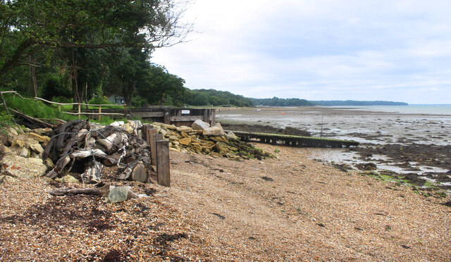
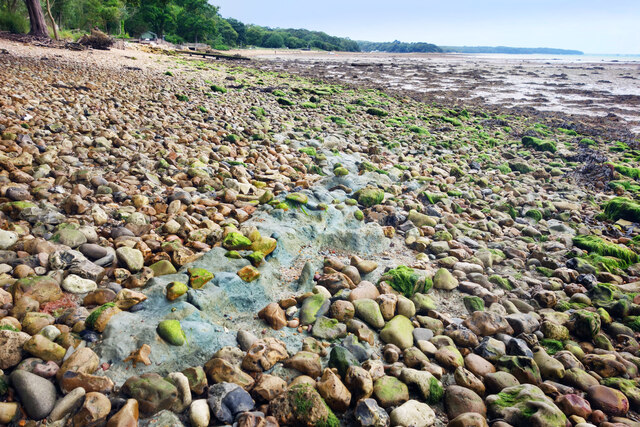
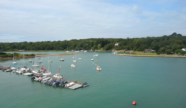
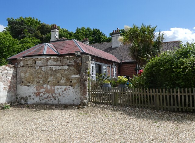
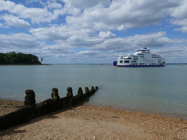
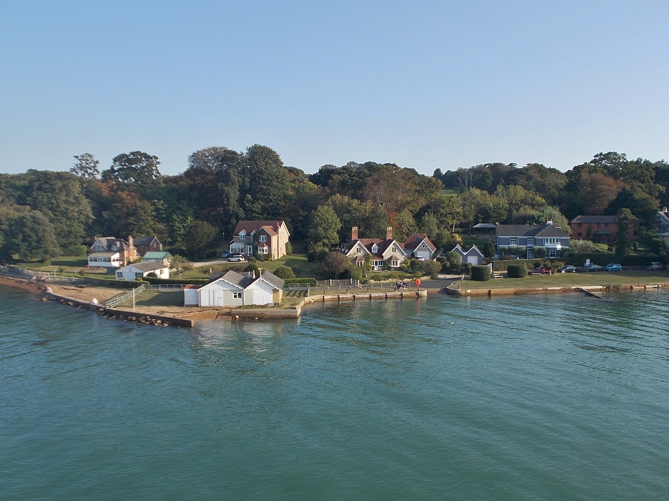
Wootton Creek is a picturesque waterway located on the northern coast of the Isle of Wight, in Hampshire, England. It is a tidal estuary that meanders its way through the countryside, connecting the Solent, a strait separating the island from the mainland, with the village of Wootton.

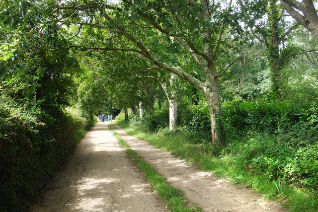
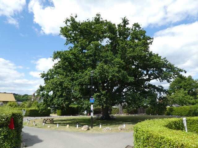
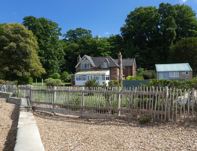
The creek spans approximately four miles in length and is surrounded by lush greenery and rolling hills, offering breathtaking views to visitors. It is renowned for its tranquil and serene atmosphere, making it a popular destination for nature lovers and those seeking a peaceful escape from the hustle and bustle of everyday life.

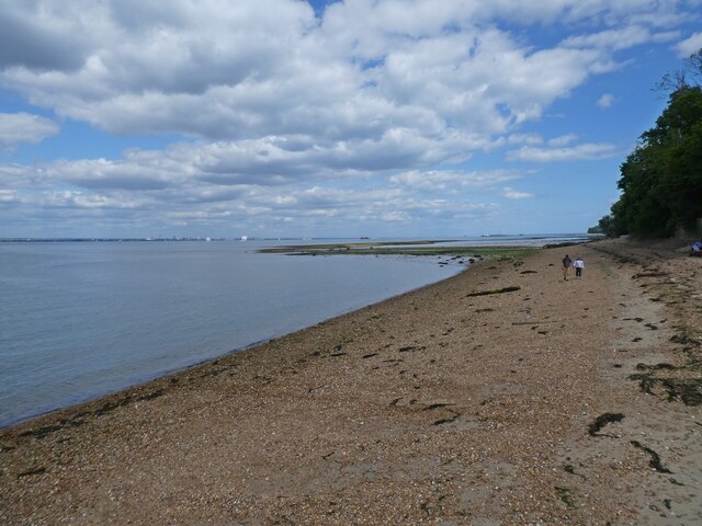
The creek is home to a diverse ecosystem, with an abundance of flora and fauna. The shallow waters provide a habitat for various species of fish, crustaceans, and birds, including herons, egrets, and oystercatchers. The surrounding marshes and mudflats are also important feeding grounds for wading birds and other wildlife.

Wootton Creek is not only a place of natural beauty but also has historical significance. The area has been inhabited since ancient times, with evidence of Roman settlements found nearby. The creek has played a crucial role in the island's maritime history, serving as a trading route and a haven for small fishing vessels.

Today, Wootton Creek remains a popular spot for boating and water sports enthusiasts. The calm waters and scenic surroundings provide an ideal setting for sailing, kayaking, and paddleboarding. Additionally, there are several marinas and boatyards along the creek, providing facilities and services for boat owners and visitors alike.

In conclusion, Wootton Creek is a hidden gem on the Isle of Wight, offering a combination of natural beauty, biodiversity, and historical significance. Whether exploring its tranquil waters or simply enjoying the stunning views, a visit to Wootton Creek is a must for anyone seeking a peaceful and idyllic coastal experience.

If you have any feedback on the listing, please let us know in the comments section below.

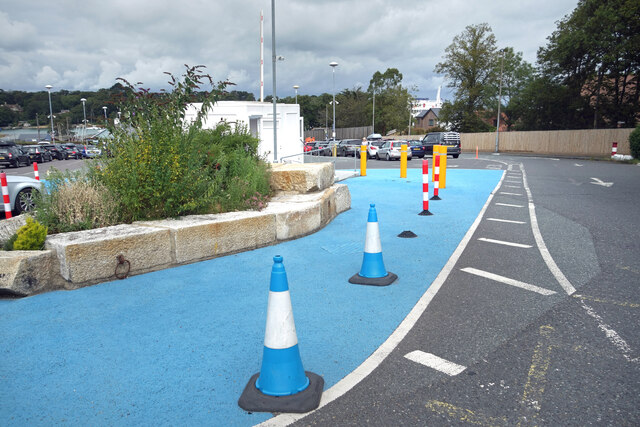
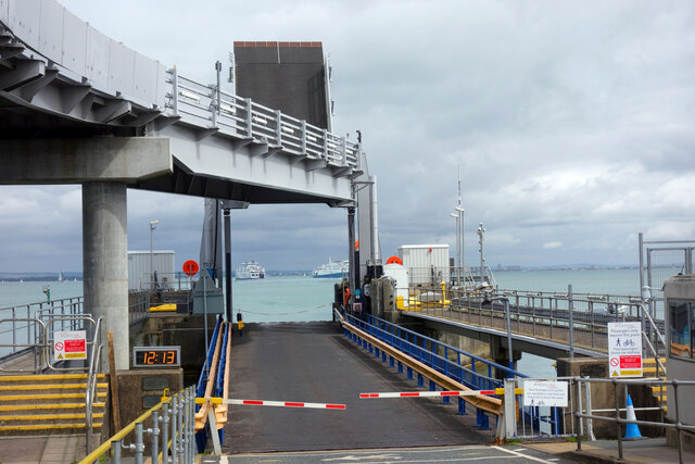
Wootton Creek Images

Images are sourced within 2km of 50.734641/-1.2168894 or Grid Reference SZ5593. Thanks to Geograph Open Source API. All images are credited.

Archway at Quarr Abbey These outbuildings next to the abbey are made out of local stone and are quite different in appearance to the red brick abbey itself.
Archway at Quarr Abbey
These outbuildings next to the abbey are made out of local stone and are quite different in appearance to the red brick abbey itself.
Quarr Road A leafy avenue between the present abbey and the ruins of its medieval predecessor. Part of the Isle of Wight Coast Path.
Quarr Road
A leafy avenue between the present abbey and the ruins of its medieval predecessor. Part of the Isle of Wight Coast Path.
Quarr Abbey Tower The abbey buildings rise above the surrounding trees.
Quarr Abbey Tower
The abbey buildings rise above the surrounding trees.
Madonna & Child, Quarr Abbey A statue in the abbey garden.
Madonna & Child, Quarr Abbey
A statue in the abbey garden.
Quarr Abbey Another picture of the impressive brick built abbey which was constructed between 1907 and 1912 to the designs of one of the monks.
Quarr Abbey
Another picture of the impressive brick built abbey which was constructed between 1907 and 1912 to the designs of one of the monks.
The Shore, Binstead The sign on the path leading down here from the road says "to the shore."
Not to the beach, an important difference. A mess of mud, seaweed, shingle and a lot of dead wood, this is a decidedly uncharismatic bit of coastline.
The Shore, Binstead
The sign on the path leading down here from the road says "to the shore." Not to the beach, an important difference. A mess of mud, seaweed, shingle and a lot of dead wood, this is a decidedly uncharismatic bit of coastline.
Stones and Clay There is just a surface scatter of stones here, stuck in an underlying layer of soft bluey-grey clay as seen centre shot.
Walking over it is a strange sensation. Not at all like the get nowhere fast trudge of shingle, more like walking on some sort of cobblestoned bog.
Stones and Clay
There is just a surface scatter of stones here, stuck in an underlying layer of soft bluey-grey clay as seen centre shot. Walking over it is a strange sensation. Not at all like the get nowhere fast trudge of shingle, more like walking on some sort of cobblestoned bog.
Houses on Wootton High Street An old Isle of Wight Railway notice board is on the wall.
Houses on Wootton High Street
An old Isle of Wight Railway notice board is on the wall.
Tesco Express, Wootton
"The Needles" at the Ferry Port By the pedestrian entrance to the IOW ferry terminal at Fishbourne.
A model of the island's famous rocks and lighthouse at the western end.
A bit of concrete, a bit of pipe, a bit of paint and a bit of imagination.
"The Needles" at the Ferry Port
By the pedestrian entrance to the IOW ferry terminal at Fishbourne. A model of the island's famous rocks and lighthouse at the western end. A bit of concrete, a bit of pipe, a bit of paint and a bit of imagination.
Cones & Colours The entrance to the ferry terminal at Fishbourne.
Cones & Colours
The entrance to the ferry terminal at Fishbourne.
12:13 at the Dock By the two vehicle loading ramps at Fishbourne ferry terminal. The arriving and departing boats are passing each other mid shot.
12:13 at the Dock
By the two vehicle loading ramps at Fishbourne ferry terminal. The arriving and departing boats are passing each other mid shot.
Moorings on Wootton Creek Like other tidal estuaries on both sides of The Solent, Wootton Creek is home to a fleet of small boats.
Moorings on Wootton Creek
Like other tidal estuaries on both sides of The Solent, Wootton Creek is home to a fleet of small boats.
Roundabout on Fishbourne Lane
The Fishbourne Inn
The Fishbourne Inn
Seafront cottage, Fishbourne
A Wightlink ferry arrives from Portsmouth
The foreshore at Fishbourne
Show me another place!

Wootton Creek is located at Grid Ref: SZ5593 (Lat: 50.734641, Lng: -1.2168894)

Unitary Authority: Isle of Wight

Police Authority: Hampshire

What 3 Words

///drape.clouding.surround. Near Wootton, Isle of Wight

Related Wikis

Fishbourne, Isle of Wight

Fishbourne is a village between Wootton and Ryde, on the Isle of Wight. The name "Fishbourne" might mean "stream of fish" or "fish spring."It is positioned...
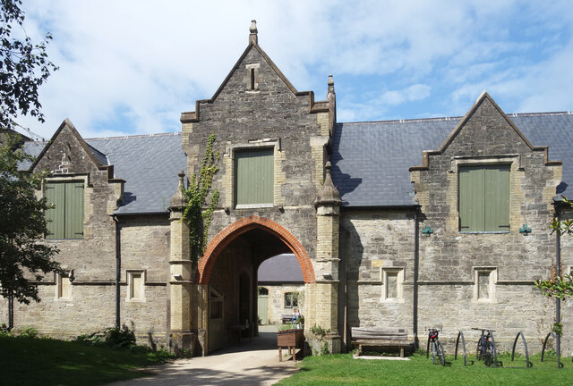
Quarr Abbey House

The Quarr Abbey House was one of several houses constructed along the north coast of the Isle of Wight in southern England. Built in the 19th century from...

Isle of Wight Festival 1969

The 1969 Isle of Wight Festival was held on 29–31 August 1969 at Wootton Creek, on the Isle of Wight. The festival attracted an audience of approximately...

Wootton Creek

Wootton Creek is a tidal estuary that flows into the Solent on the north coast of the Isle of Wight. The estuary has also been known in the past as "Fishbourne...
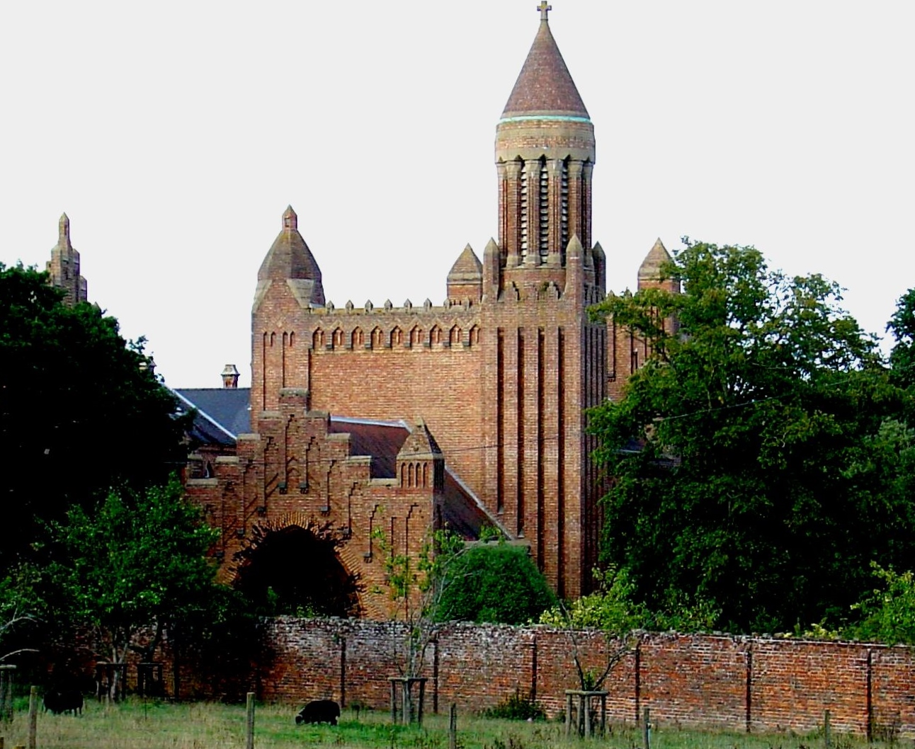
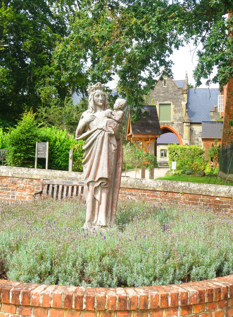
Quarr Abbey

Quarr Abbey (French: Abbaye Notre-Dame de Quarr) is a monastery between the villages of Binstead and Fishbourne on the Isle of Wight in southern England...

St Edmund's Church, Wootton

St. Edmund's Church, Wootton is a parish church in the Church of England located in Wootton, Isle of Wight. == History == The church is medieval in origin...
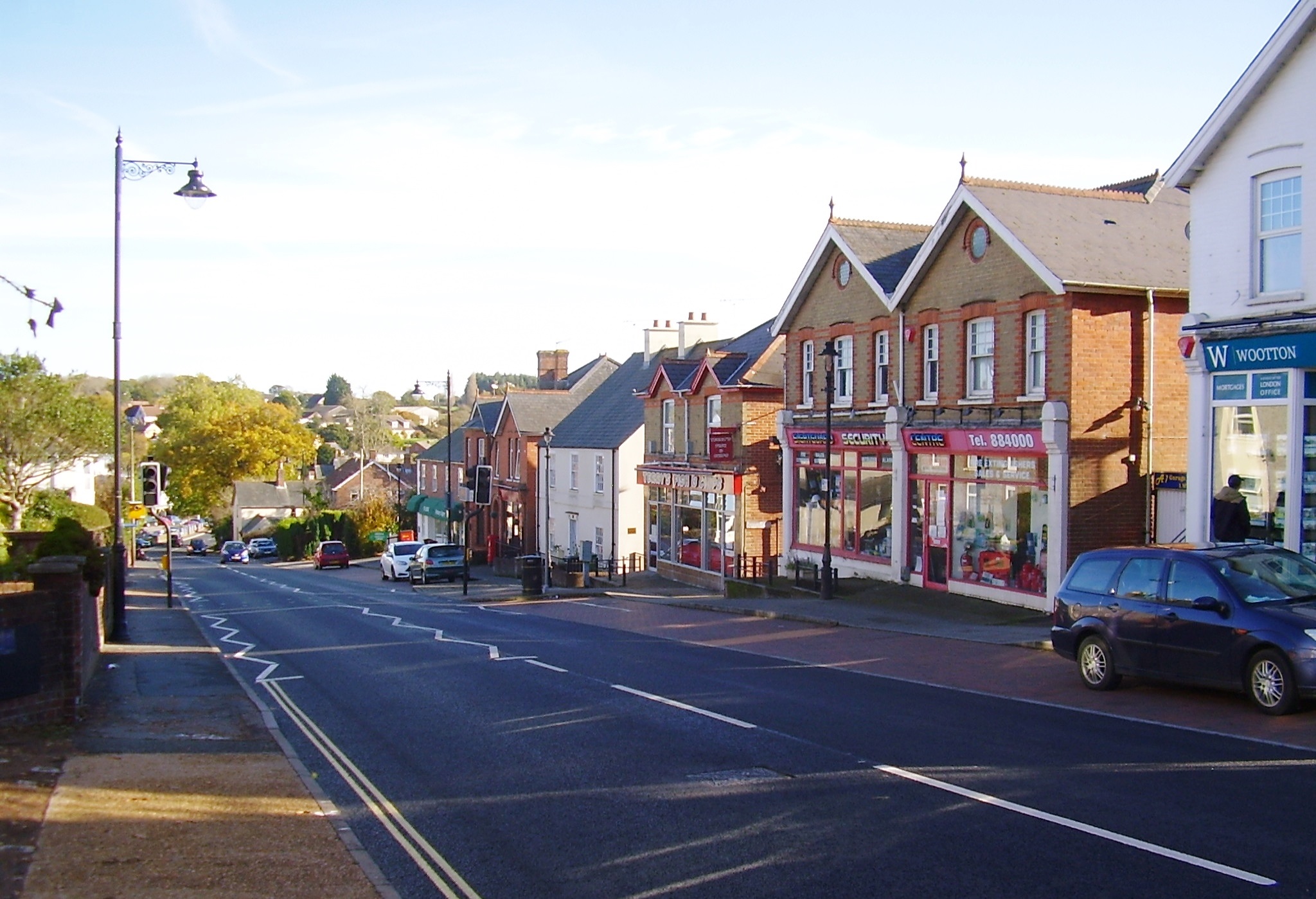
Wootton Bridge

Wootton Bridge is a large village, civil parish and electoral ward with about 3,000 residents on the Isle of Wight, first recorded around the year 1086...

St Mark's Church, Wootton

St. Mark's Church, Wootton is a church in the Church of England located in Wootton, Isle of Wight. == History == The church dates from 1909 and was designed...

Nearby Amenities

Located within 500m of 50.734641,-1.2168894
Ferry Terminal
Fishbourne Car Ferry terminal
Bicycle: yes
Ferry: yes
Foot: yes
Motor Vehicle: yes
Operator: Wightlink
Public Transport: stop_position
Lat/Long: 50.7343475/-1.2134139
Source: PGS
Lat/Long: 50.7363977/-1.2145453
Source: PGS
Lat/Long: 50.7361533/-1.2150345
Source: PGS
Lat/Long: 50.7357877/-1.2155404
Source: PGS
Lat/Long: 50.7356034/-1.2165005
Source: PGS
Lat/Long: 50.7358717/-1.2166009
Source: PGS
Lat/Long: 50.7359851/-1.2170373
Source: PGS
Lat/Long: 50.7359343/-1.2174024
Source: PGS
Lat/Long: 50.7358563/-1.2176254
Source: PGS
Lat/Long: 50.7356945/-1.2179684
Source: PGS
Lat/Long: 50.7354403/-1.2186334
Source: PGS
Lat/Long: 50.7353163/-1.2188404
Source: PGS
Lat/Long: 50.7350673/-1.2192528
Source: PGS
Lat/Long: 50.7341972/-1.2197941
Source: PGS
Lat/Long: 50.7327472/-1.220058
Source: PGS
Lat/Long: 50.7321659/-1.2201071
Source: PGS
Lat/Long: 50.7318078/-1.2206123
Source: PGS
Lat/Long: 50.731514/-1.2212229
Source: PGS
Lat/Long: 50.7304253/-1.2189437
Source: PGS
Lat/Long: 50.7309461/-1.2181303
Source: PGS
Lat/Long: 50.7334463/-1.2174238
Source: PGS
Lat/Long: 50.7335969/-1.2175585
Source: PGS
Lat/Long: 50.7346373/-1.2166693
Source: PGS
Lat/Long: 50.7342354/-1.2162293
Source: PGS
Lat/Long: 50.7339042/-1.2159604
Source: PGS
Lat/Long: 50.7339225/-1.215202
Source: PGS
Lat/Long: 50.7339281/-1.2149776
Source: PGS
Lat/Long: 50.733885/-1.2130479
Source: PGS
Lat/Long: 50.7341146/-1.2119997
Source: PGS
Lat/Long: 50.7345705/-1.2111388
Source: PGS
Lat/Long: 50.7350088/-1.2108796
Post Box
Operator: Royal Mail
Operator Wikidata: Q638098
Ref: PO33 22
Ref GB Uprn: 10015465730
Website: https://www.royalmail.com/services-near-you/postbox/fishbourne-green-po33-4ha/0000PO3322
Lat/Long: 50.7332552/-1.2116798
Leisure: slipway
Lat/Long: 50.7346081/-1.2111019
Cafe
Creek Café
Addr City: Fishbourne
Addr Housename: Car Ferry Terminal
Addr Postcode: PO33 4EU
Addr Street: Fishbourne Lane
Cuisine: cake;coffee;tea;sandwich
Internet Access: yes
Internet Access Fee: no
Operator: Wightlink
Outdoor Seating: yes
Lat/Long: 50.7333037/-1.2141636
Access: yes
Barrier: lift_gate
Bicycle: yes
Lat/Long: 50.734056/-1.2138049
Seamark Light 1 Character: Oc
Seamark Light 1 Colour: green
Seamark Light 1 Period: 10
Seamark Light 1 Sector End: 224.3
Seamark Light 1 Sector Start: 220.8
Seamark Light 1 Sequence: 8+(2)
Seamark Light 2 Character: Oc
Seamark Light 2 Colour: white
Seamark Light 2 Period: 10
Seamark Light 2 Sector End: 225.8
Seamark Light 2 Sector Start: 224.3
Seamark Light 2 Sequence: 8+(2)
Seamark Light 3 Character: Oc
Seamark Light 3 Colour: red
Seamark Light 3 Period: 10
Seamark Light 3 Sector End: 230.8
Seamark Light 3 Sector Start: 225.8
Seamark Light 3 Sequence: 8+(2)
Seamark Light Reference: A 0665.8
Seamark Type: light_major
Lat/Long: 50.7339567/-1.2142615
Telephone
Booth: KX100
Covered: booth
Ref GB Uprn: 10024901384
Lat/Long: 50.7304639/-1.2153455
Bench
Backrest: yes
Mapillary: 251380703440391
Survey Date: 2018-04-05
Lat/Long: 50.7341937/-1.211471
Bench
Backrest: yes
Mapillary: 2788829398114434
Survey Date: 2018-04-05
Lat/Long: 50.7343058/-1.2113123
Bench
Lat/Long: 50.7343959/-1.2111987
Bench
Lat/Long: 50.7344818/-1.2111131
Stop
Lat/Long: 50.7333132/-1.2135046
Stop
Note: implicit
Lat/Long: 50.7334074/-1.213974
Give Way
Lat/Long: 50.7334612/-1.2140814
Stop
Note: implicit
Lat/Long: 50.7334327/-1.2138938
Stop
Note: marked
Lat/Long: 50.7334448/-1.2138562
Stop
Lat/Long: 50.7331791/-1.2138823
Stop
Lat/Long: 50.7331671/-1.2139141
Stop
Note: implicit
Lat/Long: 50.7334204/-1.2139352
Stop
Note: implicit
Lat/Long: 50.7333967/-1.2140088
Leisure: slipway
Lat/Long: 50.7358568/-1.2163946
Pub
The Fishbourne Inn
Addr City: Fishbourne
Addr Country: GB
Addr Housenumber: 111
Addr Postcode: PO33 4EU
Addr Street: Fishbourne Lane
Fhrs Id: 541033
Outdoor Seating: yes
Source Addr: FHRS Open Data
Lat/Long: 50.7328306/-1.212048
Leisure: picnic_table
Lat/Long: 50.732907/-1.2118321
Leisure: picnic_table
Lat/Long: 50.7329631/-1.2118844
Leisure: picnic_table
Lat/Long: 50.7329698/-1.2117704
Fishbourne
Place: village
Wikidata: Q2075943
Wikipedia: en:Fishbourne, Isle of Wight
Lat/Long: 50.7319767/-1.2145819
Defibrillator
Emergency: defibrillator
Indoor: no
Lat/Long: 50.7332076/-1.2140442
Power: substation
Ref GB Uprn: 10024893377
Lat/Long: 50.731484/-1.2140432
Leisure: slipway
Lat/Long: 50.733896/-1.2146974
Leisure: slipway
Lat/Long: 50.7328095/-1.2176263
Little Canada Adventure Centre
Place: locality
Lat/Long: 50.7336881/-1.2228459
Addr Housename: Bodwen Court
Addr Street: Woodside Road
Lat/Long: 50.737674/-1.2158105
Hiking: yes
Information: guidepost
Tourism: information
Lat/Long: 50.7309174/-1.2165481
Hiking: yes
Information: guidepost
Tourism: information
Lat/Long: 50.7305354/-1.2153076
Hiking: yes
Information: guidepost
Tourism: information
Lat/Long: 50.7324717/-1.211531
Hiking: yes
Information: guidepost
Tourism: information
Lat/Long: 50.736899/-1.2163362
Stop
Access: destination
Barrier: lift_gate
Lat/Long: 50.7322242/-1.2131811
Stop
Access: destination
Barrier: lift_gate
Lat/Long: 50.7322641/-1.213002
Turning Loop
Lat/Long: 50.7315108/-1.2133107
Power: substation
Ref GB Uprn: 10024893364
Lat/Long: 50.7365801/-1.2229175
Parking
Access: customers
Fee: no
Parking: surface
Lat/Long: 50.7328121/-1.222339
Parking
Access: private
Parking: surface
Lat/Long: 50.7325543/-1.2223812
Charging Station
Capacity: 2
Mapillary: 532950341409059
Operator: bp pulse
Lat/Long: 50.7321941/-1.2133787
Power: substation
Ref GB Uprn: 10025636357
Lat/Long: 50.7368538/-1.2224044
Bench
Backrest: yes
Lat/Long: 50.732279/-1.2126387
Cafe
The Hut
Building: kiosk
Lat/Long: 50.7326417/-1.2119299
Stop
Access: destination
Barrier: lift_gate
Lat/Long: 50.732211/-1.2132388
Give Way
Lat/Long: 50.7321978/-1.2133119
Access: destination
Barrier: swing_gate
Lat/Long: 50.7336149/-1.2140511
Fixme: check for turn restriction
Lat/Long: 50.7336613/-1.2142425
Note: marking
Lat/Long: 50.7324409/-1.2136482
Note: marking
Lat/Long: 50.7329712/-1.2140506
Stop
Note: implicit
Lat/Long: 50.733184/-1.2139994
Give Way
Lat/Long: 50.732339/-1.2128086
Give Way
Lat/Long: 50.7321179/-1.2127973
Traffic Calming: bump
Lat/Long: 50.7321532/-1.2132036
Traffic Calming: bump
Lat/Long: 50.7321664/-1.2131474
Crossing
Crossing: marked
Crossing Island: no
Crossing Ref: zebra
Lat/Long: 50.7336088/-1.2138897
Crossing
Crossing: marked
Crossing Island: no
Crossing Ref: zebra
Lat/Long: 50.7335609/-1.2140431
Crossing
Crossing: marked
Crossing Island: no
Crossing Ref: zebra
Lat/Long: 50.7335254/-1.2141567
Direction: 60
Man Made: surveillance
Mapillary: 1209599789472950
Source: mapillary
Source Date: 2020-06-29
Surveillance Type: camera
Lat/Long: 50.7340921/-1.2138224
Street Lamp
Man Made: surveillance
Surveillance Type: camera
Lat/Long: 50.7335257/-1.2142058
Crossing
Crossing: marked
Crossing Island: no
Crossing Ref: zebra
Lat/Long: 50.7335767/-1.2139926
Man Made: planter
Lat/Long: 50.7321467/-1.2132346
Man Made: planter
Lat/Long: 50.7321608/-1.2131762
Man Made: planter
Lat/Long: 50.7321759/-1.2131135
Crossing
Crossing: marked
Crossing Island: no
Crossing Ref: zebra
Tactile Paving: no
Lat/Long: 50.7323672/-1.2134569
Crossing
Lat/Long: 50.7330962/-1.2140087
Assembly Point
Assembly Point Fire: yes
Emergency: assembly_point
Lat/Long: 50.732301/-1.2126295
Barrier: bollard
Lat/Long: 50.7332216/-1.2134087
Barrier: bollard
Lat/Long: 50.7331234/-1.2133337
Barrier: bollard
Lat/Long: 50.7330283/-1.2132611
Barrier: bollard
Lat/Long: 50.7329318/-1.2131874
Barrier: bollard
Lat/Long: 50.7328345/-1.2131132
Barrier: bollard
Lat/Long: 50.7327402/-1.2130411
Barrier: bollard
Lat/Long: 50.732647/-1.21297
Barrier: bollard
Lat/Long: 50.7325428/-1.2128904
Barrier: bollard
Lat/Long: 50.7324481/-1.2128181
Barrier: bollard
Lat/Long: 50.7321963/-1.2129861
Barrier: bollard
Lat/Long: 50.7321733/-1.2129906
Barrier: bollard
Lat/Long: 50.7321504/-1.2129951
Barrier: bollard
Lat/Long: 50.732129/-1.2129854
Barrier: bollard
Lat/Long: 50.7321094/-1.212968
Barrier: bollard
Lat/Long: 50.7321/-1.2129366
Barrier: bollard
Lat/Long: 50.7321064/-1.2129044
Barrier: bollard
Lat/Long: 50.7321195/-1.2128776
Barrier: bollard
Lat/Long: 50.7321402/-1.2128743
Barrier: bollard
Lat/Long: 50.7321624/-1.2128709
Barrier: bollard
Lat/Long: 50.7321856/-1.2128672
Barrier: bollard
Lat/Long: 50.7322073/-1.2128638
Barrier: bollard
Lat/Long: 50.732228/-1.2128606
Barrier: bollard
Lat/Long: 50.7322482/-1.2128649
Barrier: bollard
Lat/Long: 50.7322632/-1.2128806
Barrier: bollard
Lat/Long: 50.7320884/-1.2130721
Barrier: bollard
Lat/Long: 50.7321088/-1.2130682
Barrier: bollard
Lat/Long: 50.7321311/-1.2130639
Barrier: bollard
Lat/Long: 50.7321528/-1.2130598
Barrier: bollard
Lat/Long: 50.7321759/-1.2130554
Barrier: bollard
Lat/Long: 50.7321986/-1.2130511
Barrier: bollard
Lat/Long: 50.7322211/-1.2130468
Barrier: bollard
Lat/Long: 50.7322442/-1.2130424
Barrier: bollard
Lat/Long: 50.7321091/-1.2130837
Barrier: bollard
Lat/Long: 50.7321287/-1.2130947
Barrier: bollard
Lat/Long: 50.7321526/-1.2131082
Street Lamp
Lat/Long: 50.732504/-1.2129946
Street Lamp
Lat/Long: 50.7326488/-1.2131047
Street Lamp
Man Made: surveillance
Surveillance Type: camera
Lat/Long: 50.7329418/-1.2133274
Street Lamp
Lat/Long: 50.732794/-1.213215
Street Lamp
Lat/Long: 50.7330885/-1.2134389
Street Lamp
Lat/Long: 50.7332292/-1.2135459
Barrier: bollard
Lat/Long: 50.7321171/-1.2132908
Seamark Buoy Lateral Category: starboard
Seamark Buoy Lateral Colour: green
Seamark Buoy Lateral Shape: conical
Seamark Buoy Lateral System: iala-a
Seamark Type: buoy_lateral
Lat/Long: 50.7321075/-1.2185571
Seamark Beacon Special Purpose Colour: black
Seamark Beacon Special Purpose Shape: pile
Seamark Type: beacon_special_purpose
Lat/Long: 50.7334147/-1.2181011
Seamark Beacon Lateral Category: port
Seamark Beacon Lateral Colour: red
Seamark Beacon Lateral Shape: pile
Seamark Beacon Lateral System: iala-a
Seamark Type: beacon_lateral
Lat/Long: 50.7344622/-1.2180555
Seamark Buoy Lateral Category: starboard
Seamark Buoy Lateral Colour: green
Seamark Buoy Lateral Shape: spherical
Seamark Buoy Lateral System: iala-a
Seamark Type: buoy_lateral
Lat/Long: 50.7354875/-1.2170067
Seamark Buoy Special Purpose Colour: yellow
Seamark Buoy Special Purpose Shape: spar
Seamark Type: buoy_special_purpose
Lat/Long: 50.7366419/-1.2129164
Seamark Buoy Lateral Category: starboard
Seamark Buoy Lateral Colour: green
Seamark Buoy Lateral Shape: conical
Seamark Buoy Lateral System: iala-a
Seamark Type: buoy_lateral
Lat/Long: 50.7353195/-1.2132302
Seamark Buoy Lateral Category: port
Seamark Buoy Lateral Colour: red
Seamark Buoy Lateral Shape: can
Seamark Buoy Lateral System: iala-a
Seamark Type: buoy_lateral
Lat/Long: 50.7349639/-1.2135131
Seamark Fog Signal Category: bell
Seamark Light Category: vertical
Seamark Light Character: F
Seamark Light Colour: red
Seamark Light Multiple: 2
Lat/Long: 50.7348/-1.2124255
Seamark Beacon Lateral Category: starboard
Seamark Beacon Lateral Colour: green
Seamark Beacon Lateral System: iala-a
Seamark Light Character: Q
Seamark Light Colour: green
Seamark Type: beacon_lateral
Lat/Long: 50.7358016/-1.2121922
Seamark Pile Category: stake
Seamark Type: pile
Lat/Long: 50.7342729/-1.2178168
Seamark Pile Category: stake
Seamark Type: pile
Lat/Long: 50.734194/-1.2178382
Seamark Pile Category: stake
Seamark Type: pile
Lat/Long: 50.734025/-1.2178999
Seamark Pile Category: stake
Seamark Type: pile
Lat/Long: 50.7339656/-1.2181239
Seamark Pile Category: stake
Seamark Type: pile
Lat/Long: 50.7361606/-1.2141153
Seamark Pile Category: stake
Seamark Type: pile
Lat/Long: 50.7360622/-1.2140456
Seamark Pile Category: stake
Seamark Type: pile
Lat/Long: 50.7359883/-1.2139852
Seamark Pile Category: stake
Seamark Type: pile
Lat/Long: 50.7361521/-1.214578
Seamark Pile Category: stake
Seamark Type: pile
Lat/Long: 50.7360732/-1.2145284
Seamark Pile Category: stake
Seamark Type: pile
Lat/Long: 50.7360129/-1.2145177
Seamark Pile Category: stake
Seamark Type: pile
Lat/Long: 50.7359544/-1.2144707
Seamark Pile Category: stake
Seamark Type: pile
Lat/Long: 50.7358695/-1.2144345
Seamark Pile Category: stake
Seamark Type: pile
Lat/Long: 50.7358186/-1.2143514
Seamark Pile Category: stake
Seamark Type: pile
Lat/Long: 50.7358245/-1.2142266
Seamark Pile Category: stake
Seamark Type: pile
Lat/Long: 50.7358593/-1.2141113
Seamark Pile Category: stake
Seamark Type: pile
Lat/Long: 50.7359017/-1.2139866
Seamark Pile Category: stake
Seamark Type: pile
Lat/Long: 50.7361182/-1.2139772
Seamark Pile Category: stake
Seamark Type: pile
Lat/Long: 50.7360494/-1.2139316
Seamark Pile Category: stake
Seamark Type: pile
Lat/Long: 50.7359841/-1.2138538
Seamark Pile Category: stake
Seamark Type: pile
Lat/Long: 50.7359162/-1.2138028
Seamark Pile Category: stake
Seamark Type: pile
Lat/Long: 50.7359645/-1.213717
Seamark Pile Category: stake
Seamark Type: pile
Lat/Long: 50.7360044/-1.2136352
Seamark Pile Category: stake
Seamark Type: pile
Lat/Long: 50.7360027/-1.2135319
Seamark Type: wreck
Seamark Wreck Category: hull_showing
Lat/Long: 50.7341261/-1.2170684
Seamark Rock Water Level: covers
Seamark Type: rock
Lat/Long: 50.7386687/-1.2160116
Seamark Rock Water Level: covers
Seamark Type: rock
Lat/Long: 50.7386924/-1.2162906
Seamark Rock Water Level: covers
Seamark Type: rock
Lat/Long: 50.7386483/-1.2158024
Seamark Rock Water Level: covers
Seamark Type: rock
Lat/Long: 50.7382935/-1.213831
Seamark Rock Water Level: covers
Seamark Type: rock
Lat/Long: 50.7362667/-1.2138283
Seamark Rock Water Level: covers
Seamark Type: rock
Lat/Long: 50.7362311/-1.2139168
Seamark Rock Water Level: covers
Seamark Type: rock
Lat/Long: 50.7361852/-1.2139383
Seamark Rock Water Level: covers
Seamark Type: rock
Lat/Long: 50.7363041/-1.2141314
Seamark Rock Water Level: covers
Seamark Type: rock
Lat/Long: 50.7364959/-1.2141153
Seamark Rock Water Level: covers
Seamark Type: rock
Lat/Long: 50.7365332/-1.2132356
Seamark Rock Water Level: covers
Seamark Type: rock
Lat/Long: 50.7364976/-1.2132436
Seamark Rock Water Level: covers
Seamark Type: rock
Lat/Long: 50.7365027/-1.2131766
Seamark Rock Water Level: covers
Seamark Type: rock
Lat/Long: 50.7364738/-1.2130585
Seamark Rock Water Level: covers
Seamark Type: rock
Lat/Long: 50.7364806/-1.2128896
Seamark Rock Water Level: covers
Seamark Type: rock
Lat/Long: 50.7367166/-1.2126964
Seamark Rock Water Level: covers
Seamark Type: rock
Lat/Long: 50.7368269/-1.2127501
Bus Stop
Ferry Terminal
Bench: no
Bin: no
Bus: yes
Contact Website: https://www.islandbuses.info/stops/230000055
Lit: yes
Naptan AtcoCode: 230000055
Naptan NaptanCode: iowmdaw
Public Transport: platform
Shelter: no
Survey Date: 2018-11-29
Tactile Paving: no
Lat/Long: 50.7331978/-1.2132859
The data included in this document is from www.openstreetmap.org. The data is made available under ODbL.

Have you been to Wootton Creek?

Leave your review of Wootton Creek below (or comments, questions and feedback).