Rodley Sands

Coastal Marsh, Saltings in Gloucestershire Forest of Dean

England

Rodley Sands

Saul church I wonder if this village used to be called Paul... shame it's not on the way to a place called Damascus.
Saul church Credit: mym

Rodley Sands is a coastal marsh and saltings located in Gloucestershire, England. Situated on the banks of the River Severn, it forms part of a larger estuary system. The area is known for its unique ecosystem and diverse range of flora and fauna.

The marshland consists of a mixture of saltwater and freshwater habitats, creating a rich and fertile environment. It is characterized by its extensive mudflats, salt marshes, and sand dunes. The tidal influence from the nearby river creates a constantly changing landscape, with areas of exposed mud during low tide and submerged areas during high tide.

Rodley Sands is home to a variety of bird species, making it an important site for birdwatching. Migratory birds such as curlews, dunlins, and redshanks can be spotted here, along with resident species like herons and oystercatchers. The marshland also provides a vital feeding and breeding ground for wading birds.

The area is managed by local conservation organizations, who work to protect and preserve its unique habitats. Access to Rodley Sands is limited to designated footpaths and viewing areas, ensuring minimal disturbance to the wildlife. Visitors can enjoy walks along the coastline, observing the changing tides and the abundance of birdlife.

Overall, Rodley Sands in Gloucestershire offers a captivating natural environment, with its coastal marsh and saltings providing a haven for both wildlife and nature enthusiasts alike.

If you have any feedback on the listing, please let us know in the comments section below.
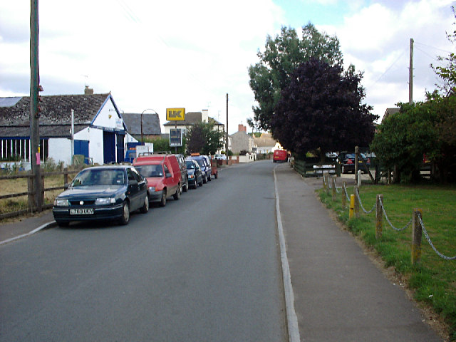
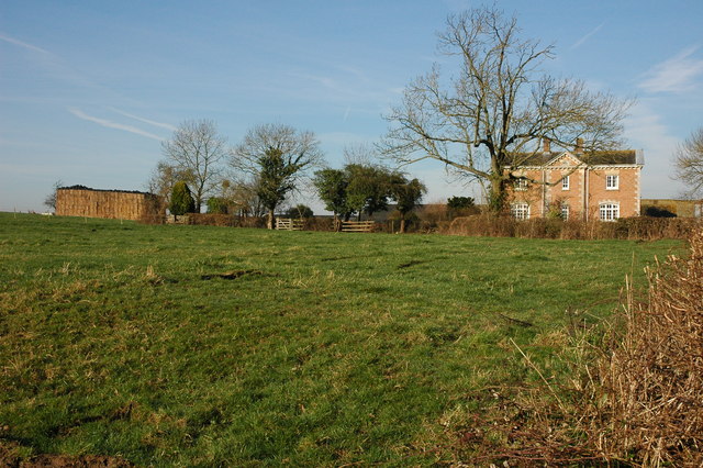
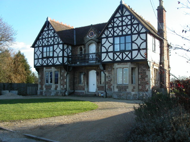
Rodley Sands Images

Images are sourced within 2km of 51.796883/-2.3789982 or Grid Reference SO7310. Thanks to Geograph Open Source API. All images are credited.

Saul church I wonder if this village used to be called Paul... shame it's not on the way to a place called Damascus.
Saul church
I wonder if this village used to be called Paul... shame it's not on the way to a place called Damascus.
High Street, Saul Looking north along High Street from just north of the junction with Church Lane. Saul has a pub and garage but no shop or post office.
High Street, Saul
Looking north along High Street from just north of the junction with Church Lane. Saul has a pub and garage but no shop or post office.
Saul Church
Saul Church
Fretherne Church Fretherne church is dedicated to St Mary.
Fretherne Church
Fretherne church is dedicated to St Mary.
Overton Farm, Fretherne Attractive red brick farmhouse in Fretherne.
Overton Farm, Fretherne
Attractive red brick farmhouse in Fretherne.
Saul Church Saul church is dedicated to St James, it was largely rebuilt in 1864-65 by Thomas Fulljames.
Saul Church
Saul church is dedicated to St James, it was largely rebuilt in 1864-65 by Thomas Fulljames.
Saul Church The tower of St James' church, Saul.
Saul Church
The tower of St James' church, Saul.
St Mary's church, Fretherne This building was constructed in the 1840's, replacing two earlier churches on the site. It is faced with Stinchcombe sandstone with Bath stone dressings.
St Mary's church, Fretherne
This building was constructed in the 1840's, replacing two earlier churches on the site. It is faced with Stinchcombe sandstone with Bath stone dressings.
St. Mary's church interior A very dark church indeed as all the ornate windows are at the extensions and porches to either side.
St. Mary's church interior
A very dark church indeed as all the ornate windows are at the extensions and porches to either side.
Tierney chapel, St. Mary's Fretherne One of the extensions added to the south side of the building. Note the ornately decorated organ pipes.
Tierney chapel, St. Mary's Fretherne
One of the extensions added to the south side of the building. Note the ornately decorated organ pipes.
St Mary's Church and war memorial at Fretherne View looks eastwards past the war memorial and St Mary's churchyard with its collection of yew trees.
St Mary's Church and war memorial at Fretherne
View looks eastwards past the war memorial and St Mary's churchyard with its collection of yew trees.
Over Hock Cliff <a href="https://www.geograph.org.uk/photo/113550">SO7209 : Hock Cliff</a> can be seen behind the wing; the house is "The Reddings". Beyond is the scattered settlement of Fretherne. The lane lies within the Arlingham bend; the Severn upstream can be seen in the background. Seen from a Stampe SV4C on a flight from Gloucestershire Airport.
Over Hock Cliff
SO7209 : Hock Cliff can be seen behind the wing; the house is "The Reddings". Beyond is the scattered settlement of Fretherne. The lane lies within the Arlingham bend; the Severn upstream can be seen in the background. Seen from a Stampe SV4C on a flight from Gloucestershire Airport.
No through road A footpath leads to the hamlet of Overton.
No through road
A footpath leads to the hamlet of Overton.
Silo and farm buildings Overton Farm.
Silo and farm buildings
Overton Farm.
Overton Farm In springtime.
Overton Farm
In springtime.
Road through Fretherne Wood A small patch of woodland, west of Fretherne.
Road through Fretherne Wood
A small patch of woodland, west of Fretherne.
Entrance to Fretherne Nurseries With old wall and stone gateposts.
Entrance to Fretherne Nurseries
With old wall and stone gateposts.
The banks of the River Severn just South of Epney Easy access to the Severn Bore which has just passed makes this a popular spot with surfers.
The banks of the River Severn just South of Epney
Easy access to the Severn Bore which has just passed makes this a popular spot with surfers.
Show me another place!

Rodley Sands is located at Grid Ref: SO7310 (Lat: 51.796883, Lng: -2.3789982)

Administrative County: Gloucestershire

District: Forest of Dean

Police Authority: Gloucestershire

What 3 Words

///page.essential.conclude. Near Frampton on Severn, Gloucestershire

Related Wikis

Priding

Priding is a hamlet in the civil parish of Arlingham, in the Stroud district, in the county of Gloucestershire, England. == References ==

Wick Court, Arlingham

Wick Court, Arlingham, Gloucestershire, England is a country house constructed between the late 14th and the mid-17th centuries. Now a base for the charity...

Rodley, Gloucestershire

Rodley is a settlement in Westbury-on-Severn parish, Forest of Dean District, Gloucestershire, England. It lies to the south east of Westbury-on-Severn...

Framilode

Framilode is a village on the banks of the River Severn in Gloucestershire, England, in the parish of Fretherne with Saul. It consists of two settlements...

River Frome, Stroud

The River Frome, once also known as the Stroudwater, is a small river in Gloucestershire, England. It is to be distinguished from another River Frome...

Westbury Shales

The Westbury Shales is a geologic formation in England. It preserves fossils of Holcoptera schlotheimi, Saurichthys acuminatus, Coleopteron sp. and Liassophlebia...

Fretherne Court

Fretherne Court was a handsome residential sporting mansion with picturesque grounds and deer park estate of some 676 acres, situated in the Severn Vale...

Saul, Gloucestershire

Saul is a village and former civil parish, now in the parish of Fretherne with Saul, in the Stroud district, in the county of Gloucestershire, England...

Related Videos

Walking the River Severn | Arlingham Horseshoe

Walking the River Severn around the Arlingham Horseshoe, we took in the peaceful views across to Newnham on Severn.

Walking Around Framilode

Framilode is a delightful and unspoilt village lying on the bank of the lower reaches of the River Severn in Gloucestershire.

Frampton on Severn Gloucestershire | A circular walk

Join us as we take a circular walk in Frampton on Severn. In the beautiful Gloucestershire countryside. Following a route around ...

Nearby Amenities

Located within 500m of 51.796883,-2.3789982
Source: PGS
Lat/Long: 51.8001232/-2.3832378
Created By: almien_coastlines
Source: PGS
Lat/Long: 51.799738/-2.382255
Source: PGS
Lat/Long: 51.7989123/-2.380199
Created By: almien_coastlines
Source: PGS
Lat/Long: 51.7985485/-2.3794739
Source: PGS
Lat/Long: 51.7982707/-2.3789091
Source: PGS
Lat/Long: 51.7980026/-2.3783077
Source: PGS
Lat/Long: 51.7977768/-2.3777723
Source: PGS
Lat/Long: 51.7974659/-2.3771511
Source: PGS
Lat/Long: 51.7969333/-2.3760303
Created By: almien_coastlines
Source: PGS
Lat/Long: 51.796442/-2.3749297
Source: PGS
Lat/Long: 51.796235/-2.3741379
Source: PGS
Lat/Long: 51.7955754/-2.3727962
Created By: almien_coastlines
Source: PGS
Lat/Long: 51.7933545/-2.3761247
Created By: almien_coastlines
Source: PGS
Lat/Long: 51.79382/-2.37779
Created By: almien_coastlines
Source: PGS
Lat/Long: 51.7941814/-2.3788573
Created By: almien_coastlines
Source: PGS
Lat/Long: 51.7944404/-2.3795693
Created By: almien_coastlines
Source: PGS
Lat/Long: 51.7948405/-2.38088
Created By: almien_coastlines
Source: PGS
Lat/Long: 51.7954073/-2.3821584
Created By: almien_coastlines
Source: PGS
Lat/Long: 51.7956815/-2.3826735
Created By: almien_coastlines
Source: PGS
Lat/Long: 51.796418/-2.384574
Created By: almien_coastlines
Source: PGS
Lat/Long: 51.796806/-2.385188
Source: PGS
Lat/Long: 51.7973711/-2.3860512
Barrier: kissing_gate
Bicycle: yes
Foot: yes
Lat/Long: 51.7964312/-2.3846893
Addr Housename: Priding House
Building: yes
Lat/Long: 51.7948777/-2.3824437
Priding Farm
Place: farm
Wikidata: Q26380788
Lat/Long: 51.7931664/-2.3777862
Barrier: kissing_gate
Bicycle: yes
Foot: yes
Lat/Long: 51.7951593/-2.3823338
The data included in this document is from www.openstreetmap.org. The data is made available under ODbL.

Have you been to Rodley Sands?

Leave your review of Rodley Sands below (or comments, questions and feedback).