Wick Court

Heritage Site in Gloucestershire Stroud

England

Wick Court

Saul church I wonder if this village used to be called Paul... shame it's not on the way to a place called Damascus.
Saul church Credit: mym

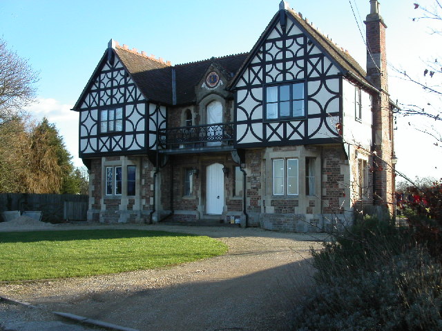
Wick Court is a historic manor house located in the county of Gloucestershire, England. Situated near the village of Arlingham, this heritage site boasts a rich history dating back to the 14th century. The manor house is a Grade II listed building, recognized for its architectural significance and historical importance.

The original structure of Wick Court was built in the 1300s, and it has undergone several renovations and additions over the centuries. The building showcases a mix of architectural styles, with elements from the medieval, Tudor, and Georgian periods. The manor house features distinctive timber framing, stone walls, and traditional thatched roofing.

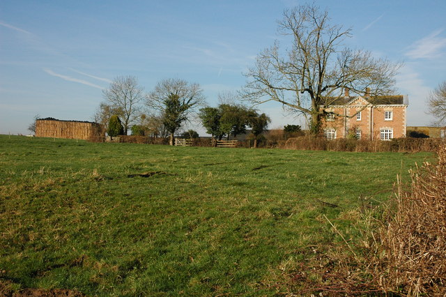
The property is set within a picturesque landscape, surrounded by lush greenery and overlooking the River Severn. It offers visitors a glimpse into the past, with its well-preserved interior and period furnishings. The rooms are adorned with antique furniture, intricate woodwork, and original artworks, providing an authentic experience of the bygone eras.

Wick Court has served various purposes throughout its history, including as a family residence, a school, and now as an educational center. Today, it operates as a residential farm school, hosting groups of children from urban areas to experience rural life and learn about sustainable farming practices. The site includes extensive gardens, orchards, and farmland, where children actively participate in farming activities and environmental education programs.

With its historical significance, architectural beauty, and educational programs, Wick Court offers a unique and enriching experience for visitors of all ages, showcasing the rich heritage and cultural importance of Gloucestershire.

If you have any feedback on the listing, please let us know in the comments section below.

Wick Court Images

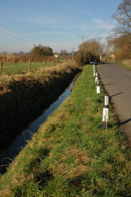
Images are sourced within 2km of 51.792/-2.383 or Grid Reference SO7310. Thanks to Geograph Open Source API. All images are credited.

Saul church I wonder if this village used to be called Paul... shame it's not on the way to a place called Damascus.
Saul church
I wonder if this village used to be called Paul... shame it's not on the way to a place called Damascus.
Fretherne (Glos) St Mary's Church
Severn Estuary shoreline including Saul Warth Area prone to flooding around Saul Warth, may become managed realignment scheme.
Severn Estuary shoreline including Saul Warth
Area prone to flooding around Saul Warth, may become managed realignment scheme.
High Street, Saul Looking north along High Street from just north of the junction with Church Lane. Saul has a pub and garage but no shop or post office.
High Street, Saul
Looking north along High Street from just north of the junction with Church Lane. Saul has a pub and garage but no shop or post office.
Hock Cliff Hock Cliff is stuffed with lower lias fossils like the devil's toenail (Gryphaea Oyster) and ammonites just waiting to be collected from the rubble at the base of the cliff. However they are grey and crumbly and so don't make great specimens. We found an Ichthysaurus vertebra this particular day. There are some hovercraft waiting to go skimming across the mudflats in the distance.
Hock Cliff
Hock Cliff is stuffed with lower lias fossils like the devil's toenail (Gryphaea Oyster) and ammonites just waiting to be collected from the rubble at the base of the cliff. However they are grey and crumbly and so don't make great specimens. We found an Ichthysaurus vertebra this particular day. There are some hovercraft waiting to go skimming across the mudflats in the distance.
Saul Church
Saul Church
Fretherne Church Fretherne church is dedicated to St Mary.
Fretherne Church
Fretherne church is dedicated to St Mary.
Roadside ditch at Fretherne
Overton Farm, Fretherne Attractive red brick farmhouse in Fretherne.
Overton Farm, Fretherne
Attractive red brick farmhouse in Fretherne.
Saul Church Saul church is dedicated to St James, it was largely rebuilt in 1864-65 by Thomas Fulljames.
Saul Church
Saul church is dedicated to St James, it was largely rebuilt in 1864-65 by Thomas Fulljames.
Saul Church The tower of St James' church, Saul.
Saul Church
The tower of St James' church, Saul.
St Mary's church, Fretherne This building was constructed in the 1840's, replacing two earlier churches on the site. It is faced with Stinchcombe sandstone with Bath stone dressings.
St Mary's church, Fretherne
This building was constructed in the 1840's, replacing two earlier churches on the site. It is faced with Stinchcombe sandstone with Bath stone dressings.
St. Mary's church interior A very dark church indeed as all the ornate windows are at the extensions and porches to either side.
St. Mary's church interior
A very dark church indeed as all the ornate windows are at the extensions and porches to either side.
Tierney chapel, St. Mary's Fretherne One of the extensions added to the south side of the building. Note the ornately decorated organ pipes.
Tierney chapel, St. Mary's Fretherne
One of the extensions added to the south side of the building. Note the ornately decorated organ pipes.
Footbridge on the Severn Way The Severn Way, at 210 miles in length, is Britain's longest river walk, appropriately following Britain's longest river.
View south-east near Fretherne.
Footbridge on the Severn Way
The Severn Way, at 210 miles in length, is Britain's longest river walk, appropriately following Britain's longest river. View south-east near Fretherne.
Long Wood and The Reddings View north-west from the Severn Way footpath near Fretherne.
Long Wood and The Reddings
View north-west from the Severn Way footpath near Fretherne.
Meadow's edge in spring Spring blossom appearing and the hedgerow leafing up. View north-east towards Fretherne.
Meadow's edge in spring
Spring blossom appearing and the hedgerow leafing up. View north-east towards Fretherne.
Bluebells and cuckooflower In the base of a hedge near <a href="https://www.geograph.org.uk/photo/759245">SO7309 : Meadow's edge in spring</a>.
Bluebells and cuckooflower
In the base of a hedge near SO7309 : Meadow's edge in spring.
Show me another place!

Wick Court is located at Grid Ref: SO7310 (Lat: 51.792, Lng: -2.383)

Administrative County: Gloucestershire

District: Stroud

Police Authority: Gloucestershire

What 3 Words

///slogans.micro.newest. Near Frampton on Severn, Gloucestershire

Related Wikis

Wick Court, Arlingham

Wick Court is a country house in the parish of Arlingham, Gloucestershire, England, 0.5 mile east of the hamlet of Overton. It was constructed between...

Priding

Priding is a hamlet in the civil parish of Arlingham, in the Stroud district, in the county of Gloucestershire, England. == References ==

Overton, Gloucestershire

Overton is a hamlet in the civil parish of Arlingham, in the Stroud district, in the county of Gloucestershire, England. The name, first recorded in 1584...

Framilode

Framilode is a village on the banks of the River Severn in Gloucestershire, England, in the parish of Fretherne with Saul. It consists of two settlements...

Nearby Amenities

Located within 500m of 51.792,-2.383
Created By: almien_coastlines
Source: PGS
Lat/Long: 51.7933545/-2.3761247
Created By: almien_coastlines
Source: PGS
Lat/Long: 51.79382/-2.37779
Created By: almien_coastlines
Source: PGS
Lat/Long: 51.7941814/-2.3788573
Created By: almien_coastlines
Source: PGS
Lat/Long: 51.7944404/-2.3795693
Created By: almien_coastlines
Source: PGS
Lat/Long: 51.7948405/-2.38088
Created By: almien_coastlines
Source: PGS
Lat/Long: 51.7954073/-2.3821584
Created By: almien_coastlines
Source: PGS
Lat/Long: 51.7956815/-2.3826735
Wick Court
Place: locality
Source: OS Opendata Streetview
Lat/Long: 51.7926768/-2.3860465
Addr Housename: Priding House
Building: yes
Lat/Long: 51.7948777/-2.3824437
Priding Farm
Place: farm
Wikidata: Q26380788
Lat/Long: 51.7931664/-2.3777862
Barrier: kissing_gate
Bicycle: yes
Foot: yes
Lat/Long: 51.7951593/-2.3823338
Barrier: kissing_gate
Lat/Long: 51.7893517/-2.387984
Barrier: stile
Lat/Long: 51.7923306/-2.3858079
The data included in this document is from www.openstreetmap.org. The data is made available under ODbL.

Have you been to Wick Court?

Leave your review of Wick Court below (or comments, questions and feedback).