North East Point

Coastal Marsh, Saltings in Lancashire Barrow-in-Furness

England

North East Point

Roa Island From Barrow lifeboat station
Roa Island Credit: Stephen Dawson

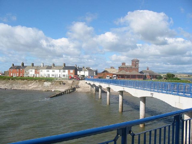
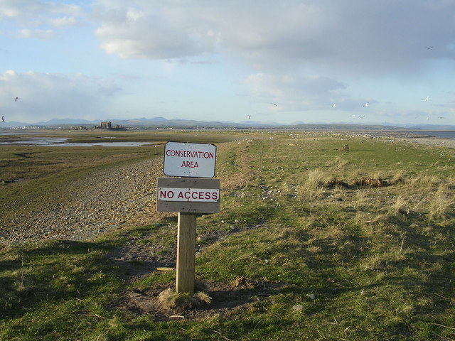
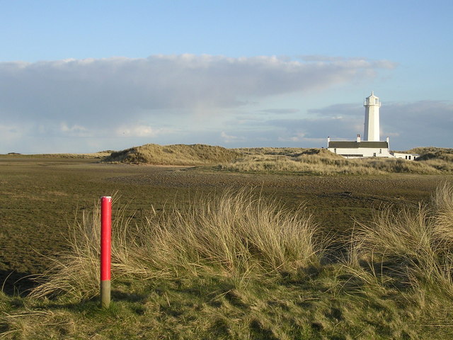
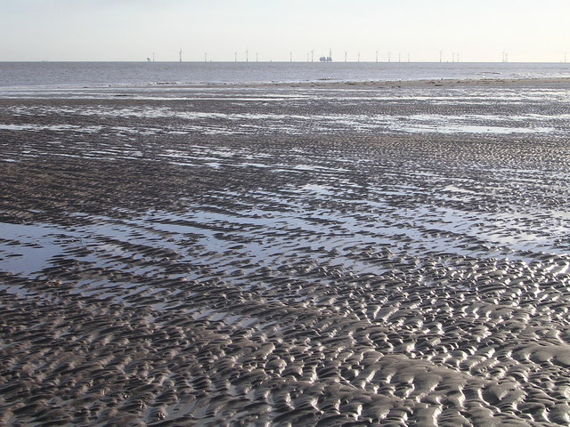
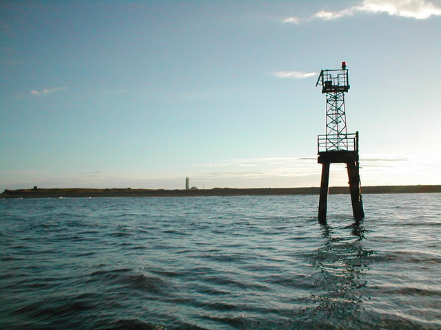
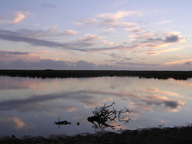
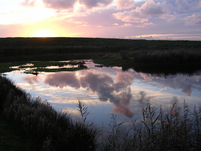
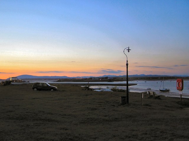
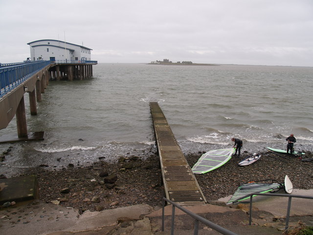
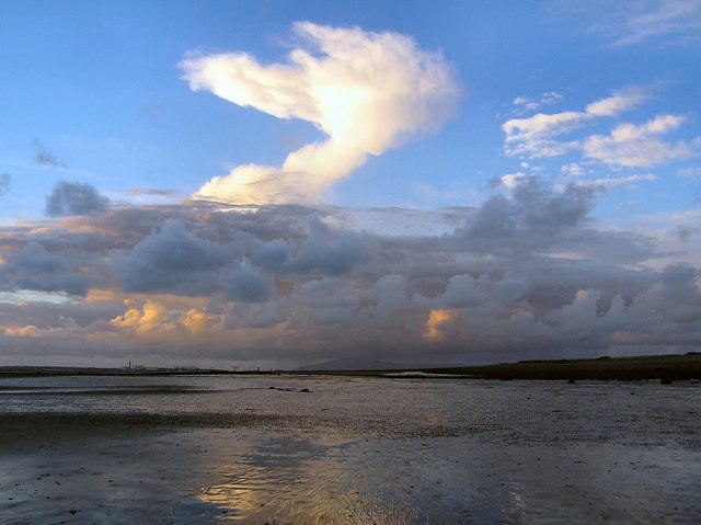
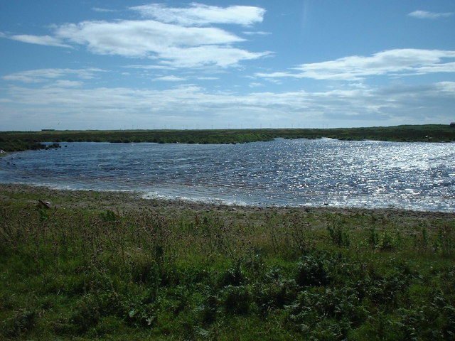
North East Point is a picturesque coastal area located in Lancashire, England. Situated on the western coast, this region is renowned for its mesmerizing marshes and saltings. The landscape is characterized by vast expanses of marshland, dotted with salt pans and lagoons, creating a unique ecosystem.

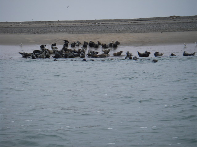
The marshes of North East Point are a haven for a diverse range of flora and fauna. The combination of saltwater and freshwater creates the ideal conditions for numerous species of wading birds, including curlews, redshanks, and oystercatchers. These birds can often be seen foraging in the shallow waters, feeding on the rich variety of invertebrates that inhabit the marshes.

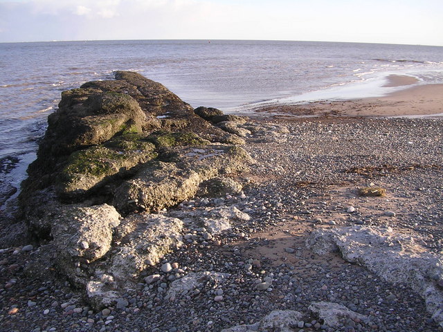
The saltings of North East Point are another distinctive feature of the area. These are low-lying areas where the tides deposit salt and other minerals, creating a salty and nutrient-rich environment. The saltings support a variety of salt-tolerant plants, such as sea lavender and glasswort, which add a vibrant touch to the landscape.

North East Point is not only a haven for wildlife but also a popular destination for visitors. The marshes and saltings provide a tranquil setting for walks and birdwatching, attracting nature enthusiasts and photographers alike. The area is also home to a visitor center, where visitors can learn more about the local ecosystem and its importance for conservation.

In summary, North East Point in Lancashire is a coastal marsh and saltings area that offers a unique and captivating natural environment. With its diverse range of wildlife and stunning landscapes, it is a must-visit destination for those seeking to immerse themselves in the beauty of nature.

If you have any feedback on the listing, please let us know in the comments section below.

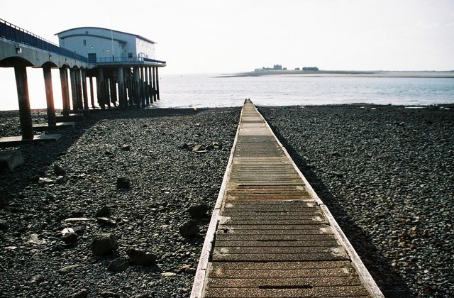
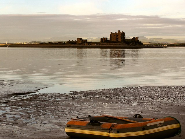
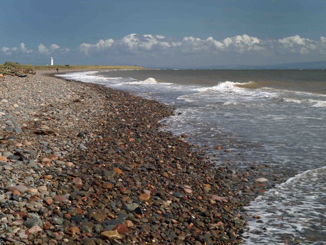
North East Point Images

Images are sourced within 2km of 54.055131/-3.1764536 or Grid Reference SD2362. Thanks to Geograph Open Source API. All images are credited.

Roa Island From Barrow lifeboat station
Roa Island
From Barrow lifeboat station
Piel Island and Castle, Barrow-in-Furness
South East Point, Walney Island A conglomerate spur of rock
South East Point, Walney Island
A conglomerate spur of rock
Shelly Bars, South Walney Nature Reserve Looking north towards Piel Castle
Shelly Bars, South Walney Nature Reserve
Looking north towards Piel Castle
South Walney Nature Reserve Looking towards Walney Lighthouse.
South Walney Nature Reserve
Looking towards Walney Lighthouse.
Mud Flats, South Walney Island Looking south towards off-shore wind farm
Mud Flats, South Walney Island
Looking south towards off-shore wind farm
Piel Castle Looking East from Fouldrey Stones. A popular summer destination for visiting and local sailors. Site of spectacular sun-sets
Piel Castle
Looking East from Fouldrey Stones. A popular summer destination for visiting and local sailors. Site of spectacular sun-sets
Sunset over Barrow in Furness
Hipsford Spit Port Hand Marker With Walney lighthouse behind. The lighthouse has quite recently been converted to automatic operation and the two cottages are for sale to private buyers.
This is a superb place to see breeding Gulls, Eider Ducks and Oyster Catchers, as well as colonies of Seals.
Hipsford Spit Port Hand Marker
With Walney lighthouse behind. The lighthouse has quite recently been converted to automatic operation and the two cottages are for sale to private buyers. This is a superb place to see breeding Gulls, Eider Ducks and Oyster Catchers, as well as colonies of Seals.
Pond at South Walney Nature Reserve
Duck Pond at South Walney Nature Reserve
Safely Ashore The head of the landing on Piel Island
Safely Ashore
The head of the landing on Piel Island
RNLI Lifeboat Station at Roa Island Also visible is Piel Island and Castle in the distance.
RNLI Lifeboat Station at Roa Island
Also visible is Piel Island and Castle in the distance.
Spirit of Ecstasy The West beach of Piel Island at low water
Spirit of Ecstasy
The West beach of Piel Island at low water
Seal colony on South Walney This colony of Grey Seals has been gradually expanding over the past few years, currently well over 70 can be seen hauled out on the sands
Seal colony on South Walney
This colony of Grey Seals has been gradually expanding over the past few years, currently well over 70 can be seen hauled out on the sands
Pond near South Walney Nature Reserve
Roa Island slipway The slipway to the ferry to Piel Island (in distance). The lifeboat station is to the left of picture.
Roa Island slipway
The slipway to the ferry to Piel Island (in distance). The lifeboat station is to the left of picture.
Bass Pool There were numerous seals swimming in the water at the time of the photograph, one can be seen centre right. There is a rich source of food for marine life hereabouts, brought in on strong tides which was making at this time. Bass Pool is no longer navigable as it dries at its NW end about half tide on the ebb. It is understood that it was the main channel through to Barrow in Furness many years ago. The main channel now passes to the east of the island which has been known for many years as Piel Harbour.
Bass Pool
There were numerous seals swimming in the water at the time of the photograph, one can be seen centre right. There is a rich source of food for marine life hereabouts, brought in on strong tides which was making at this time. Bass Pool is no longer navigable as it dries at its NW end about half tide on the ebb. It is understood that it was the main channel through to Barrow in Furness many years ago. The main channel now passes to the east of the island which has been known for many years as Piel Harbour.
Show me another place!

North East Point is located at Grid Ref: SD2362 (Lat: 54.055131, Lng: -3.1764536)

Administrative County: Cumbria

District: Barrow-in-Furness

Police Authority: Cumbria

What 3 Words

///audibly.earphones.shall. Near Barrow in Furness, Cumbria

Related Wikis

Walney Lighthouse

Walney Lighthouse is a functioning lighthouse located on Walney Island in Barrow-in-Furness, Cumbria, England. The current building dates to the early...
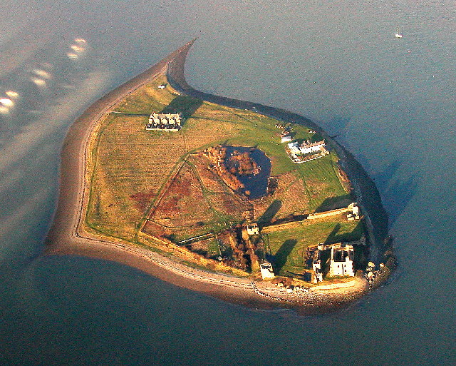
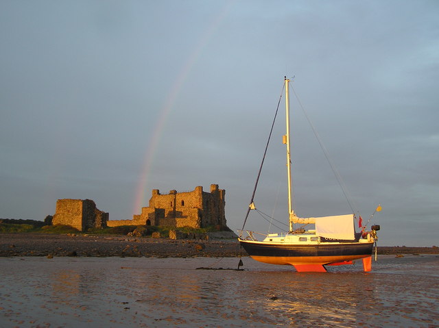
Piel Castle

Piel Castle, also known as Fouldry Castle or the Pile of Fouldray, is a castle situated on the south-eastern point of Piel Island, off the coast of the...

Piel Island

Piel Island lies in Morecambe Bay , around 1⁄2 mile (800 metres) off the southern tip of the Furness peninsula in the administrative county of Cumbria...

South Walney

South Walney is one of two nature reserves on Walney Island, England. The nature reserve has an area of 130 ha leased from Holker estates. It has been...

Sheep Island (England)

Sheep Island is an uninhabited grassy island of around 15 acres (6 ha), located just over 1⁄4 mile (400 m) from the shore of Walney Island, opposite Snab...

Foulney Island

Foulney Island is a low-lying grass and shingle area 1 mile (1.6 km) to the south-east of Roa Island, off the southern tip of the Furness Peninsula in...

Roa Island

Roa Island lies just over half a mile (1 km) south of the village of Rampside at the southernmost point of the Furness Peninsula in Westmorland and Furness...

Piel railway station

Piel railway station was the terminus of the Furness Railway's Piel Branch in Barrow-in-Furness, England that operated between 1846 and 1936. Located on...

Related Videos

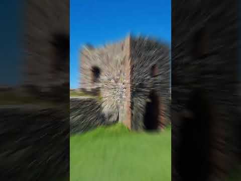
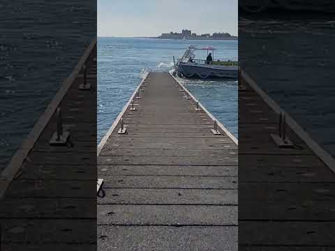
The Castle on an Island Cumbria England UK

Explore the enchanting beauty of Piel Island and its historic castle in Cumbria on my latest video! Join me as l uncover the ...
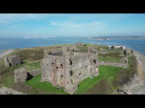
Nearby Amenities

Located within 500m of 54.055131,-3.1764536
Source: PGS
Lat/Long: 54.0531275/-3.1735675
Source: PGS
Lat/Long: 54.0533138/-3.1738527
Source: PGS
Lat/Long: 54.0534683/-3.1742121
Source: PGS
Lat/Long: 54.0536387/-3.1748163
Source: PGS
Lat/Long: 54.0537551/-3.1749708
Source: PGS
Lat/Long: 54.0538761/-3.174562
Source: PGS
Lat/Long: 54.0545199/-3.173522
Source: PGS
Lat/Long: 54.0549332/-3.1733529
Source: PGS
Lat/Long: 54.0551288/-3.1727783
Source: PGS
Lat/Long: 54.0556695/-3.1717897
Source: PGS
Lat/Long: 54.0516295/-3.1778754
Source: PGS
Lat/Long: 54.0522032/-3.1769139
Source: PGS
Lat/Long: 54.0527471/-3.1771029
Source: PGS
Lat/Long: 54.0532856/-3.1771441
Source: PGS
Lat/Long: 54.0533771/-3.1816462
Source: PGS
Lat/Long: 54.0535056/-3.1701672
Source: PGS
Lat/Long: 54.0540769/-3.1800006
Source: PGS
Lat/Long: 54.0541811/-3.1695259
Source: PGS
Lat/Long: 54.0542413/-3.1796969
Source: PGS
Lat/Long: 54.0543002/-3.1772059
Source: PGS
Lat/Long: 54.0549433/-3.1777526
Source: PGS
Lat/Long: 54.0557217/-3.1721937
Source: PGS
Lat/Long: 54.053769/-3.1697569
Source: PGS
Lat/Long: 54.0529598/-3.182569
Source: PGS
Lat/Long: 54.0531893/-3.18209
Source: PGS
Lat/Long: 54.0536387/-3.1809532
Source: PGS
Lat/Long: 54.0537992/-3.1805212
Bench
Backrest: no
Lat/Long: 54.0528056/-3.1819405
Board Type: history;wildlife
Information: board
Tourism: information
Lat/Long: 54.0528047/-3.1820961
Bench
Backrest: no
Lat/Long: 54.05281/-3.1819222
Board Type: geology
Information: board
Tourism: information
Lat/Long: 54.0531379/-3.1812556
Source: PGS
Lat/Long: 54.0545477/-3.179302
Barrier: swing_gate
Lat/Long: 54.0532852/-3.1780279
Source: PGS
Lat/Long: 54.052073/-3.1773078
Seal Cam
Camera Mount: pole
Contact Webcam: https://www.cumbriawildlifetrust.org.uk/wildlife/seal-cam
Man Made: surveillance
Operator: Cumbria Wildlife Trust
Surveillance: webcam
Surveillance Type: camera
Surveillance Zone: beach
Website: https://www.cumbriawildlifetrust.org.uk/wildlife/seal-cam
Lat/Long: 54.0528399/-3.1706511
Lighthouse Bay
Natural: bay
Lat/Long: 54.0510535/-3.1754445
North East Point
Natural: cape
Lat/Long: 54.054498/-3.1783715
Source: PGS
Lat/Long: 54.0551775/-3.1787854
Source: PGS
Lat/Long: 54.0580756/-3.17466
The data included in this document is from www.openstreetmap.org. The data is made available under ODbL.

Have you been to North East Point?

Leave your review of North East Point below (or comments, questions and feedback).