Storehouse Point

Coastal Marsh, Saltings in Glamorgan

Wales

Storehouse Point

Promenade Colonnade above Whitmore Bay
Promenade Colonnade above Whitmore Bay Credit: Alan Hughes

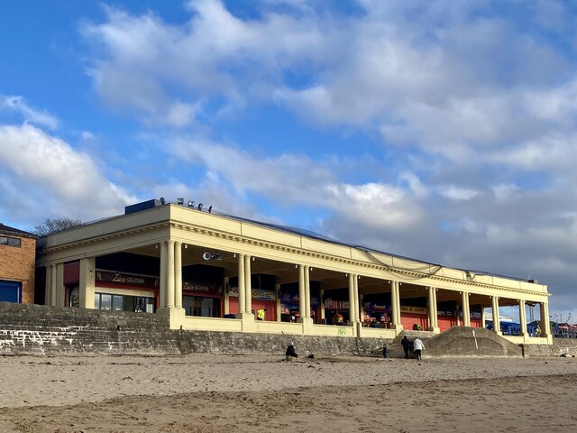
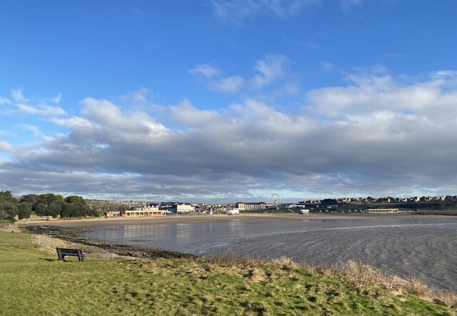
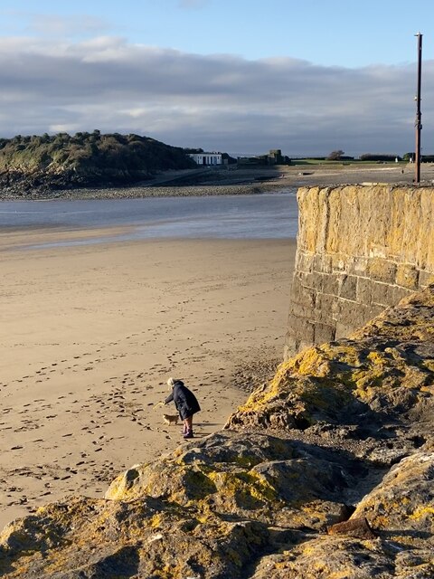
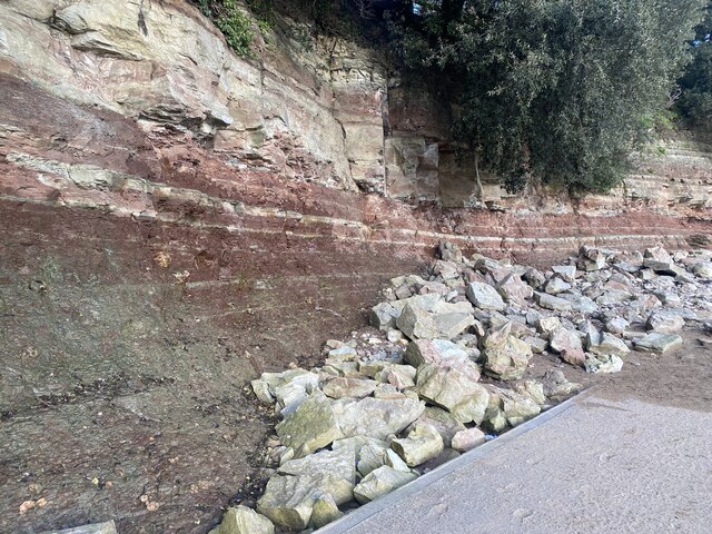
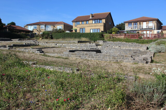
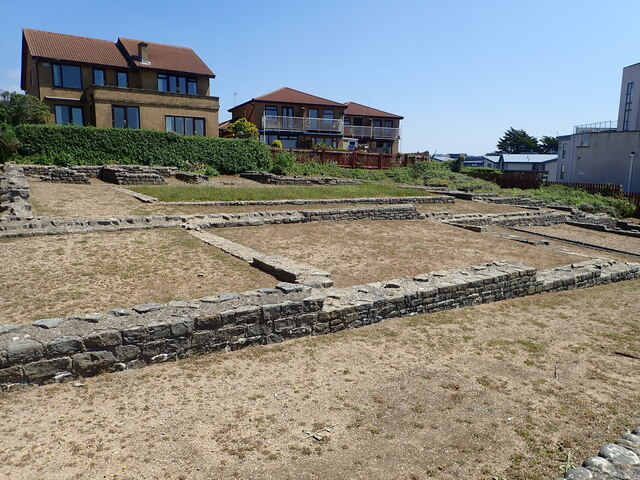
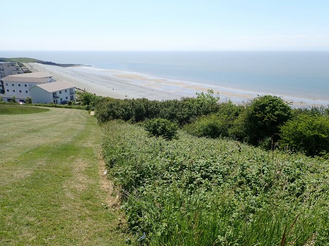
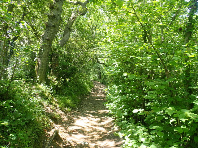
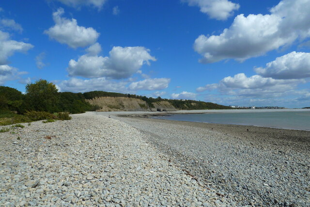
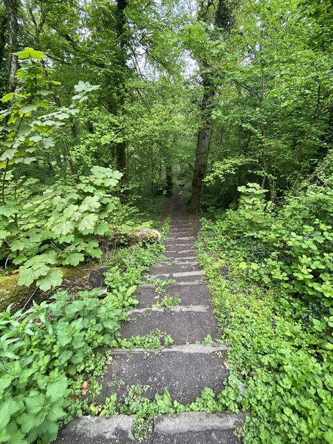
Storehouse Point is a prominent geographical feature located in Glamorgan, a county in South Wales, United Kingdom. Positioned on the coast, it is known for its unique landscape consisting of coastal marshes and saltings.

The coastal marshes in Storehouse Point are characterized by their low-lying, flat terrain and are subject to tidal inundation. They are primarily composed of salt-tolerant vegetation, such as sea lavender, cord grass, and glasswort, which thrive in the brackish water conditions. These marshes serve as a critical habitat for various bird species, including waders and waterfowl, which rely on the marshes for nesting and feeding grounds.

Adjacent to the marshes, the saltings of Storehouse Point are vast areas of salt marshes that are periodically flooded by seawater during high tides. The saltings are home to a diverse range of flora and fauna, adapted to the harsh and saline environment. Common plant species found in the saltings include samphire, sea aster, and sea purslane. These salt-tolerant plants provide essential food and shelter for invertebrates and birds.

Storehouse Point's coastal marshes and saltings offer stunning views of both land and sea, attracting nature enthusiasts and birdwatchers. The area is also of significant ecological importance, providing a vital ecosystem for various species and acting as a natural defense against coastal erosion. Efforts are being made to preserve and protect this unique coastal landscape, ensuring its continued ecological value and attractiveness to visitors.

If you have any feedback on the listing, please let us know in the comments section below.

Storehouse Point Images

Images are sourced within 2km of 51.393063/-3.2845064 or Grid Reference ST1066. Thanks to Geograph Open Source API. All images are credited.

Promenade Colonnade above Whitmore Bay
Whitmore Bay, Barry Island
Fetch! Owner and dog alongside the old harbour wall.
Fetch!
Owner and dog alongside the old harbour wall.
Pigeons ready for the race … or just having a natter?
Pigeons ready for the race
… or just having a natter?
Fallen rocks Unstable cliff face at Barry Island.
Fallen rocks
Unstable cliff face at Barry Island.
Remains of Roman building, The Knapp Bases of the limestone walls of a late Roman building around a central courtyard; of uncertain function. Situated next to the Wales Coast Path amongst modern dwellings. For a better view of the far end of the site - <a href="https://www.geograph.org.uk/photo/272229">ST0966 : Roman Villa</a>.
Remains of Roman building, The Knapp
Bases of the limestone walls of a late Roman building around a central courtyard; of uncertain function. Situated next to the Wales Coast Path amongst modern dwellings. For a better view of the far end of the site - ST0966 : Roman Villa.
Roman remains, the Knap On the bank near the Knap car park are the remains of a large Roman building, believed to have been constructed c 290 A.D. Limestone and brick was taken from the site in the Middle Ages and used to build Barry Castle.
Roman remains, the Knap
On the bank near the Knap car park are the remains of a large Roman building, believed to have been constructed c 290 A.D. Limestone and brick was taken from the site in the Middle Ages and used to build Barry Castle.
Wales Coast Path near the Knap, Barry A steep hill to the top of Bull Cliff
Wales Coast Path near the Knap, Barry
A steep hill to the top of Bull Cliff
Houses on Marine Drive Above Bull Cliff
Houses on Marine Drive
Above Bull Cliff
Wales Coast Path in Cliff Wood On the way to Porothkerry
Wales Coast Path in Cliff Wood
On the way to Porothkerry
Porthkerry Beach and Bull Cliff Porthkerry beach and Bull Cliff looking north east towards Cold Knapp.
Porthkerry Beach and Bull Cliff
Porthkerry beach and Bull Cliff looking north east towards Cold Knapp.
Walking with two poles The bridge is still in use, carrying the Vale of Glamorgan line from Barry to Bridgend.
Walking with two poles
The bridge is still in use, carrying the Vale of Glamorgan line from Barry to Bridgend.
Public footpath Path through Porthkerry Park.
Public footpath
Path through Porthkerry Park.
Horse chestnut blossom
Woodland steps Steps down into Cwm Barri and Porthkerry Park.
Woodland steps
Steps down into Cwm Barri and Porthkerry Park.
Ordnance Survey Cut Mark This OS cut mark can be found on the wall SW side of Pontypridd Road. It marks a point 54.811m above mean sea level.
Ordnance Survey Cut Mark
This OS cut mark can be found on the wall SW side of Pontypridd Road. It marks a point 54.811m above mean sea level.
Ordnance Survey Cut Mark This OS cut mark can be found on No104 Pontypridd Road. It marks a point 61.636m above mean sea level.
Ordnance Survey Cut Mark
This OS cut mark can be found on No104 Pontypridd Road. It marks a point 61.636m above mean sea level.
Railway bridge, Porthkerry Country Park Near the entrance to the park.
On the Vale of Glamorgan railway line.
Railway bridge, Porthkerry Country Park
Near the entrance to the park. On the Vale of Glamorgan railway line.
Show me another place!

Storehouse Point is located at Grid Ref: ST1066 (Lat: 51.393063, Lng: -3.2845064)

Unitary Authority: The Vale of Glamorgan

Police Authority: South Wales

What 3 Words

///boring.wire.rush. Near Barry, Vale of Glamorgan

Related Wikis

Barry railway station

Barry railway station (Welsh: Y Barri) is one of three stations serving the town of Barry, Vale of Glamorgan in South Wales. This one, Barry Town, is preceded...

Woodham Brothers

Woodham Brothers Ltd is a trading business, based mainly around activities and premises located within Barry Docks, in Barry, South Wales. It is noted...

Romilly, Vale of Glamorgan

Romilly is a western district of Barry in the Vale of Glamorgan, South Wales, United Kingdom. The area has an attractive public park which includes an...

Barry Tourist Railway

The Barry Tourist Railway (formerly the Barry Island Railway) is a railway developed to attract visitors to Barry in the Vale of Glamorgan, South Wales...

Nearby Amenities

Located within 500m of 51.393063,-3.2845064
Source: PGS
Lat/Long: 51.3934569/-3.2822058
Source: PGS
Lat/Long: 51.3931037/-3.2806824
Source: PGS
Lat/Long: 51.3928427/-3.2795774
Source: PGS
Lat/Long: 51.3925631/-3.2794191
Source: PGS
Lat/Long: 51.3921933/-3.2797383
Source: PGS
Lat/Long: 51.3915421/-3.2801138
Source: PGS
Lat/Long: 51.3910586/-3.2803095
Source: PGS
Lat/Long: 51.3907137/-3.2807575
Source: PGS
Lat/Long: 51.3905102/-3.2812721
Source: PGS
Lat/Long: 51.3903957/-3.2818169
Source: PGS
Lat/Long: 51.3903003/-3.2823427
Source: PGS
Lat/Long: 51.3901966/-3.2830105
Source: PGS
Lat/Long: 51.3901229/-3.2834343
Source: PGS
Lat/Long: 51.3900417/-3.2838458
Source: PGS
Lat/Long: 51.389912/-3.2843805
Source: PGS
Lat/Long: 51.3898583/-3.2847406
Source: PGS
Lat/Long: 51.3898508/-3.2849221
Source: PGS
Lat/Long: 51.3898269/-3.2852018
Source: PGS
Lat/Long: 51.3897514/-3.2856659
Source: PGS
Lat/Long: 51.3896957/-3.2858125
Source: PGS
Lat/Long: 51.3896626/-3.2858369
Source: PGS
Lat/Long: 51.3896879/-3.2856796
Source: PGS
Lat/Long: 51.3897389/-3.2855456
Barry
Name Cy: Y Barri
Name En: Barry
Naptan AtcoCode: 9100BARRY
Network: National Rail
Network Website: https://www.nationalrail.co.uk/stations/bry/
Network Wikidata: Q26334
Operator En: Transport for Wales
Operator Website: https://tfw.wales/places/stations/barry
Operator Wikidata: Q104878180
Public Transport: station
Railway: station
Ref Crs: BRY
Wheelchair: no
Wikidata: Q4864935
Wikipedia: en:Barry railway station
Lat/Long: 51.3972095/-3.2842532
Railway: switch
Lat/Long: 51.3939618/-3.2826571
Crossing
Crossing: marked
Crossing Island: no
Kerb: flush
Tactile Paving: yes
Lat/Long: 51.3970362/-3.2852392
Crossing
Crossing: unmarked
Crossing Island: yes
Lat/Long: 51.3950595/-3.288308
Bus Stop
Bus: yes
Naptan AtcoCode: 5720AWA11831
Naptan NaptanCode: vglgdtj
Public Transport: platform
Route Ref: 95;96;100;B3;X5;X45
Shelter: yes
Source: survey
Lat/Long: 51.3938467/-3.2865945
Post Box
Mapillary: 1980730818775433
Post Box Type: pillar
Ref: CF62 11
Source: survey
Survey Date: 2021-06-27
Lat/Long: 51.3937622/-3.2862286
Railway: switch
Lat/Long: 51.3955976/-3.2854995
Seamark Light Category: vertical
Seamark Light Character: F
Seamark Light Colour: green
Seamark Light Height: 5
Seamark Light Multiple: 2
Seamark Light Range: 5
Seamark Light Reference: A 5411
Seamark Type: light_minor
Source: US NGA Pub. 114. 2011-05-26.
Lat/Long: 51.3896621/-3.2858024
Railway: switch
Lat/Long: 51.394557/-3.2848484
Railway: buffer_stop
Lat/Long: 51.3958207/-3.2843652
Railway: buffer_stop
Lat/Long: 51.3959132/-3.2845089
Railway: buffer_stop
Lat/Long: 51.3959298/-3.2845673
Railway: buffer_stop
Lat/Long: 51.395943/-3.284608
Railway: buffer_stop
Lat/Long: 51.3959971/-3.2846381
Railway: buffer_stop
Lat/Long: 51.3960066/-3.2836002
Railway: switch
Lat/Long: 51.3973387/-3.2832029
Railway: switch
Lat/Long: 51.3960289/-3.2855814
Railway: railway_crossing
Lat/Long: 51.3962358/-3.2853496
Railway: switch
Lat/Long: 51.3964501/-3.2851083
Railway: switch
Lat/Long: 51.3964731/-3.2851617
Barrier: block
Lat/Long: 51.3929525/-3.2779597
Crossing
Crossing: traffic_signals
Lat/Long: 51.3958843/-3.2789972
Crossing
Crossing: traffic_signals
Lat/Long: 51.3938178/-3.2780911
Crossing
Crossing: traffic_signals
Lat/Long: 51.3960329/-3.2795167
Crossing
Crossing: traffic_signals
Lat/Long: 51.3959585/-3.2794166
Crossing
Crossing: traffic_signals
Lat/Long: 51.3938867/-3.2780808
Crossing
Crossing: traffic_signals
Lat/Long: 51.394131/-3.2780667
Crossing
Crossing: traffic_signals
Lat/Long: 51.3942082/-3.2780145
Crossing
Crossing: traffic_signals
Lat/Long: 51.3940908/-3.2776628
Crossing
Crossing: traffic_signals
Lat/Long: 51.3940784/-3.277542
Crossing
Crossing: traffic_signals
Lat/Long: 51.3937815/-3.2776336
Crossing
Crossing: traffic_signals
Lat/Long: 51.3937282/-3.2776784
Crossing
Crossing: traffic_signals
Lat/Long: 51.3958135/-3.2790999
Crossing
Button Operated: yes
Crossing: traffic_signals
Crossing Island: no
Tactile Paving: yes
Traffic Signals Sound: yes
Traffic Signals Vibration: yes
Lat/Long: 51.3950355/-3.2786716
Traffic Signals
Lat/Long: 51.3938187/-3.2856942
Traffic Signals
Lat/Long: 51.3939294/-3.2857821
Old Harbour
Natural: bay
Lat/Long: 51.3919571/-3.2838492
Barry Junction
Railway: junction
Lat/Long: 51.3964272/-3.2851771
Noexit: yes
Lat/Long: 51.3948911/-3.2824421
Access: no
Barrier: cycle_barrier
Foot: yes
Lat/Long: 51.3941087/-3.2783481
Crossing
Crossing: marked
Kerb: lowered
Tactile Paving: yes
Lat/Long: 51.3970013/-3.2849884
Crossing
Crossing: marked
Kerb: lowered
Tactile Paving: yes
Lat/Long: 51.3971095/-3.2850077
Post Box
Collection Times: Mo-Fr 09:00; Sa 07:00; Su off
Operator: Royal Mail
Post Box Type: pillar
Ref: CF62 10D
Royal Cypher: EIIR
Royal Cypher Wikidata: Q33102113
Lat/Long: 51.3947776/-3.2884453
Grit Bin
Lat/Long: 51.3973082/-3.2863596
Crossing
Crossing: marked
Lat/Long: 51.3954405/-3.2867351
Crossing
Crossing: marked
Lat/Long: 51.395385/-3.2863612
Bus Stop
Bus: yes
Public Transport: platform
Shelter: yes
Lat/Long: 51.3947246/-3.2877435
Entrance: yes
Lat/Long: 51.394924/-3.2885363
Bus Stop
Bench: yes
Bin: yes
Bus: yes
Naptan AtcoCode: 5720AWA11808
Naptan NaptanCode: vglgdwa
Public Transport: platform
Shelter: yes
Tactile Paving: no
Lat/Long: 51.3949812/-3.2884382
Bench
Backrest: yes
Mapillary: 681570386611117
Lat/Long: 51.3927607/-3.2792942
Bicycle Repair Station
Mapillary: 439877267930828
Operator: NHS/GIG;Bro Morgannwg
Service Bicycle Pump: yes
Service Bicycle Stand: yes
Service Bicycle Tools: yes
Valves: sclaverand;dunlop
Lat/Long: 51.3927791/-3.2791821
Direction: 215
Generator Method: photovoltaic
Generator Output Electricity: yes
Generator Solar Modules: 16
Generator Source: solar
Generator Type: solar_photovoltaic_panel
Location: roof
Power: generator
Lat/Long: 51.3932768/-3.2880416
Direction: 35
Generator Method: photovoltaic
Generator Output Electricity: yes
Generator Solar Modules: 4
Generator Source: solar
Generator Type: solar_photovoltaic_panel
Location: roof
Power: generator
Lat/Long: 51.3929279/-3.2883199
Direction: 125
Generator Method: photovoltaic
Generator Output Electricity: yes
Generator Solar Modules: 3
Generator Source: solar
Generator Type: solar_photovoltaic_panel
Location: roof
Power: generator
Lat/Long: 51.3928994/-3.2883286
Direction: 215
Generator Method: photovoltaic
Generator Output Electricity: yes
Generator Solar Modules: 4
Generator Source: solar
Generator Type: solar_photovoltaic_panel
Location: roof
Power: generator
Lat/Long: 51.3928908/-3.2883802
Direction: 215
Generator Method: photovoltaic
Generator Output Electricity: yes
Generator Solar Modules: 14
Generator Source: solar
Generator Type: solar_photovoltaic_panel
Location: roof
Power: generator
Lat/Long: 51.39174/-3.2899822
Direction: S
Generator Method: photovoltaic
Generator Output Electricity: yes
Generator Solar Modules: 16
Generator Source: solar
Generator Type: solar_photovoltaic_panel
Location: roof
Power: generator
Lat/Long: 51.3948697/-3.2880262
Direction: 215
Generator Method: photovoltaic
Generator Output Electricity: yes
Generator Solar Modules: 12
Generator Source: solar
Generator Type: solar_photovoltaic_panel
Location: roof
Power: generator
Lat/Long: 51.3954136/-3.2871725
Direction: S
Generator Method: photovoltaic
Generator Output Electricity: yes
Generator Solar Modules: 16
Generator Source: solar
Generator Type: solar_photovoltaic_panel
Location: roof
Power: generator
Lat/Long: 51.3962756/-3.2868403
The data included in this document is from www.openstreetmap.org. The data is made available under ODbL.

Have you been to Storehouse Point?

Leave your review of Storehouse Point below (or comments, questions and feedback).