Ewe Rocks

Coastal Feature, Headland, Point in Glamorgan

Wales

Ewe Rocks

Promenade Colonnade above Whitmore Bay
Promenade Colonnade above Whitmore Bay Credit: Alan Hughes

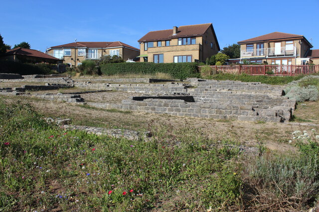
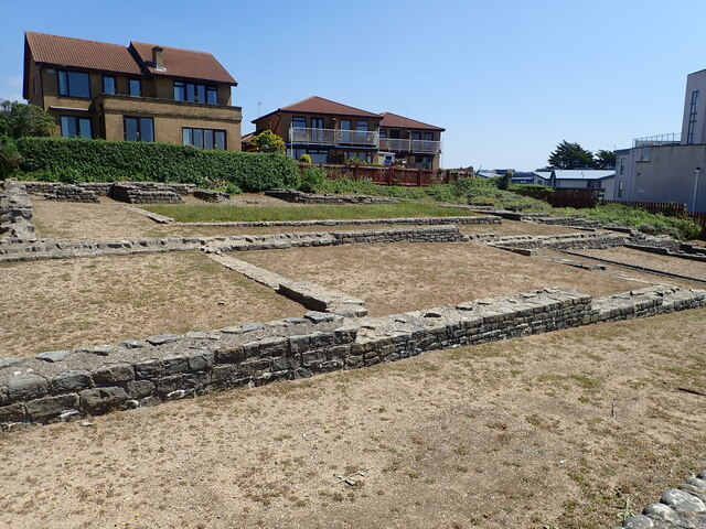
Ewe Rocks is a prominent coastal feature located in the county of Glamorgan, Wales. Situated on the southern coast of the country, it is specifically found on the picturesque headland known as Ewe Point. Ewe Rocks is recognized for its unique geological formation and its significant role in shaping the local landscape.

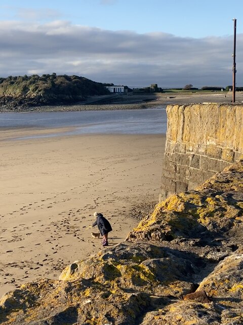
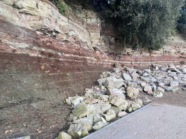
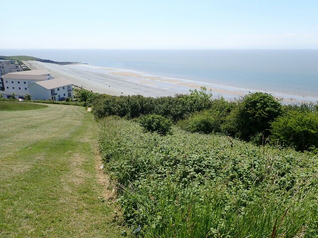
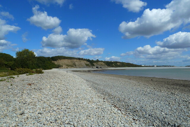
Composed of rugged cliffs and rocky outcrops, Ewe Rocks stands as a testament to the powerful forces of nature. Over the centuries, the relentless pounding of the waves has eroded the softer rock layers, leaving behind a striking formation of jagged rocks and boulders. These rocks, which vary in size and shape, create a stunning visual spectacle against the backdrop of the turquoise sea.

The area surrounding Ewe Rocks is rich in diverse marine life, making it a popular spot for nature enthusiasts and wildlife photographers. Seabirds, such as gulls and cormorants, can often be seen perched on the rocks, while seals and dolphins occasionally make appearances in the waters below.

In addition to its natural beauty, Ewe Rocks also holds historical significance. It is believed that the headland was named after the ancient Welsh word for "ewe," a testament to the area's long-standing agricultural heritage. Over the years, the rocks have become embedded in local folklore, with tales of mythical creatures and ancient battles adding to their allure.

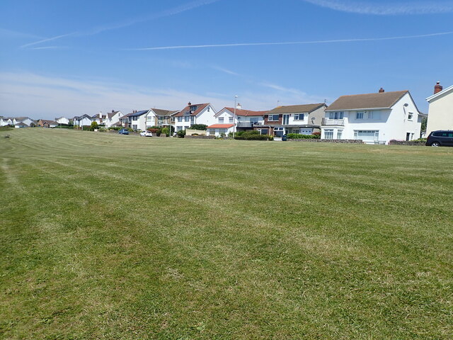
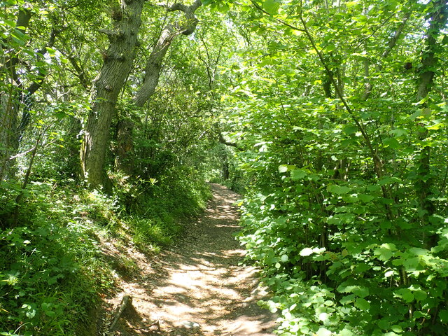
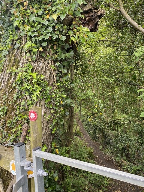
Ewe Rocks is easily accessible to visitors, with well-maintained footpaths leading to the headland. The site offers breathtaking views of the surrounding coastline, making it a favorite spot for hikers, photographers, and those seeking a peaceful retreat in nature.

If you have any feedback on the listing, please let us know in the comments section below.
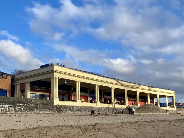
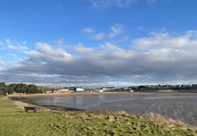
Ewe Rocks Images

Images are sourced within 2km of 51.391882/-3.2872904 or Grid Reference ST1066. Thanks to Geograph Open Source API. All images are credited.

Promenade Colonnade above Whitmore Bay
Whitmore Bay, Barry Island
Fetch! Owner and dog alongside the old harbour wall.
Fetch!
Owner and dog alongside the old harbour wall.
Pigeons ready for the race … or just having a natter?
Pigeons ready for the race
… or just having a natter?
Fallen rocks Unstable cliff face at Barry Island.
Fallen rocks
Unstable cliff face at Barry Island.
Remains of Roman building, The Knapp Bases of the limestone walls of a late Roman building around a central courtyard; of uncertain function. Situated next to the Wales Coast Path amongst modern dwellings. For a better view of the far end of the site - <a href="https://www.geograph.org.uk/photo/272229">ST0966 : Roman Villa</a>.
Remains of Roman building, The Knapp
Bases of the limestone walls of a late Roman building around a central courtyard; of uncertain function. Situated next to the Wales Coast Path amongst modern dwellings. For a better view of the far end of the site - ST0966 : Roman Villa.
Roman remains, the Knap On the bank near the Knap car park are the remains of a large Roman building, believed to have been constructed c 290 A.D. Limestone and brick was taken from the site in the Middle Ages and used to build Barry Castle.
Roman remains, the Knap
On the bank near the Knap car park are the remains of a large Roman building, believed to have been constructed c 290 A.D. Limestone and brick was taken from the site in the Middle Ages and used to build Barry Castle.
Wales Coast Path near the Knap, Barry A steep hill to the top of Bull Cliff
Wales Coast Path near the Knap, Barry
A steep hill to the top of Bull Cliff
Houses on Marine Drive Above Bull Cliff
Houses on Marine Drive
Above Bull Cliff
Wales Coast Path in Cliff Wood On the way to Porothkerry
Wales Coast Path in Cliff Wood
On the way to Porothkerry
Wales Coast Path between the Knap and Porthkerry
Pebble beach at Porthkerry Country Park
Porthkerry Beach and Bull Cliff Porthkerry beach and Bull Cliff looking north east towards Cold Knapp.
Porthkerry Beach and Bull Cliff
Porthkerry beach and Bull Cliff looking north east towards Cold Knapp.
Walking with two poles The bridge is still in use, carrying the Vale of Glamorgan line from Barry to Bridgend.
Walking with two poles
The bridge is still in use, carrying the Vale of Glamorgan line from Barry to Bridgend.
Public footpath Path through Porthkerry Park.
Public footpath
Path through Porthkerry Park.
Pond dipping in Whitelands Brook
Play area at Porthkerry Park Porthkerry viaduct beyond.
Play area at Porthkerry Park
Porthkerry viaduct beyond.
Horse chestnut blossom
Show me another place!

Ewe Rocks is located at Grid Ref: ST1066 (Lat: 51.391882, Lng: -3.2872904)

Unitary Authority: The Vale of Glamorgan

Police Authority: South Wales

What 3 Words

///fees.tapes.life. Near Barry, Vale of Glamorgan

Related Wikis

Cold Knap

Cold Knap is a district of Barry in South Wales. == Amenities == Cold Knap is a coastal pebble beach (with some sand at low tide), approximately a mile...

Barry railway station

Barry railway station (Welsh: Y Barri) is one of three stations serving the town of Barry, Vale of Glamorgan in South Wales. This one, Barry Town, is preceded...

Romilly, Vale of Glamorgan

Romilly is a western district of Barry in the Vale of Glamorgan, South Wales, United Kingdom. The area has an attractive public park which includes an...

Woodham Brothers

Woodham Brothers Ltd is a trading business, based mainly around activities and premises located within Barry Docks, in Barry, South Wales. It is noted...

Nearby Amenities

Located within 500m of 51.391882,-3.2872904
Source: PGS
Lat/Long: 51.3934569/-3.2822058
Source: PGS
Lat/Long: 51.3931037/-3.2806824
Source: PGS
Lat/Long: 51.3915421/-3.2801138
Source: PGS
Lat/Long: 51.3910586/-3.2803095
Source: PGS
Lat/Long: 51.3907137/-3.2807575
Source: PGS
Lat/Long: 51.3905102/-3.2812721
Source: PGS
Lat/Long: 51.3903957/-3.2818169
Source: PGS
Lat/Long: 51.3903003/-3.2823427
Source: PGS
Lat/Long: 51.3901966/-3.2830105
Source: PGS
Lat/Long: 51.3901229/-3.2834343
Source: PGS
Lat/Long: 51.3900417/-3.2838458
Source: PGS
Lat/Long: 51.389912/-3.2843805
Source: PGS
Lat/Long: 51.3898583/-3.2847406
Source: PGS
Lat/Long: 51.3898508/-3.2849221
Source: PGS
Lat/Long: 51.3898269/-3.2852018
Source: PGS
Lat/Long: 51.3897514/-3.2856659
Source: PGS
Lat/Long: 51.3896957/-3.2858125
Source: PGS
Lat/Long: 51.3896626/-3.2858369
Source: PGS
Lat/Long: 51.3896879/-3.2856796
Source: PGS
Lat/Long: 51.3897389/-3.2855456
Railway: switch
Lat/Long: 51.3939618/-3.2826571
Parking
Parking: surface
Lat/Long: 51.3921753/-3.2929479
Barrier: bollard
Lat/Long: 51.3895413/-3.2907034
The Knap
Place: suburb
Wikidata: Q5142291
Lat/Long: 51.3905035/-3.2915015
Crossing
Crossing: unmarked
Crossing Island: yes
Lat/Long: 51.3950595/-3.288308
Watch House Bay
Name Cy: Bae'r Tŵr Gwylio
Natural: bay
Source: OS_OpenData_StreetView
Lat/Long: 51.3882163/-3.2891681
Bus Stop
Bus: yes
Naptan AtcoCode: 5720AWA11831
Naptan NaptanCode: vglgdtj
Public Transport: platform
Route Ref: 95;96;100;B3;X5;X45
Shelter: yes
Source: survey
Lat/Long: 51.3938467/-3.2865945
Post Box
Mapillary: 1980730818775433
Post Box Type: pillar
Ref: CF62 11
Source: survey
Survey Date: 2021-06-27
Lat/Long: 51.3937622/-3.2862286
Railway: switch
Lat/Long: 51.3955976/-3.2854995
Seamark Light Category: vertical
Seamark Light Character: F
Seamark Light Colour: green
Seamark Light Height: 5
Seamark Light Multiple: 2
Seamark Light Range: 5
Seamark Light Reference: A 5411
Seamark Type: light_minor
Source: US NGA Pub. 114. 2011-05-26.
Lat/Long: 51.3896621/-3.2858024
Railway: switch
Lat/Long: 51.394557/-3.2848484
Railway: buffer_stop
Lat/Long: 51.3958207/-3.2843652
Railway: buffer_stop
Lat/Long: 51.3959132/-3.2845089
Railway: buffer_stop
Lat/Long: 51.3959298/-3.2845673
Railway: buffer_stop
Lat/Long: 51.395943/-3.284608
Railway: buffer_stop
Lat/Long: 51.3959971/-3.2846381
Railway: switch
Lat/Long: 51.3960289/-3.2855814
Traffic Signals
Lat/Long: 51.3938187/-3.2856942
Traffic Signals
Lat/Long: 51.3939294/-3.2857821
Little Island Bay
Natural: bay
Lat/Long: 51.388103/-3.2834459
Old Harbour
Natural: bay
Lat/Long: 51.3919571/-3.2838492
Noexit: yes
Lat/Long: 51.3948911/-3.2824421
Post Box
Collection Times: Mo-Fr 09:00; Sa 07:00; Su off
Operator: Royal Mail
Post Box Type: pillar
Ref: CF62 29D
Lat/Long: 51.3919247/-3.2921769
Post Box
Collection Times: Mo-Fr 09:00; Sa 07:00; Su off
Operator: Royal Mail
Post Box Type: pillar
Ref: CF62 10D
Royal Cypher: EIIR
Royal Cypher Wikidata: Q33102113
Lat/Long: 51.3947776/-3.2884453
Post Box
Collection Times: Mo-Fr 09:00; Sa 07:00; Su off
Note: type A or type B
Operator: Royal Mail
Post Box Type: pillar
Ref: CF62 17D
Royal Cypher: GR
Royal Cypher Wikidata: Q33102273
Lat/Long: 51.3958262/-3.2902267
Crossing
Crossing: marked
Lat/Long: 51.3954405/-3.2867351
Crossing
Crossing: marked
Lat/Long: 51.395385/-3.2863612
Bus Stop
Bus: yes
Public Transport: platform
Shelter: yes
Lat/Long: 51.3947246/-3.2877435
Entrance: yes
Lat/Long: 51.394924/-3.2885363
Bus Stop
Bench: yes
Bin: yes
Bus: yes
Naptan AtcoCode: 5720AWA11808
Naptan NaptanCode: vglgdwa
Public Transport: platform
Shelter: yes
Tactile Paving: no
Lat/Long: 51.3949812/-3.2884382
Direction: 215
Generator Method: photovoltaic
Generator Output Electricity: yes
Generator Solar Modules: 16
Generator Source: solar
Generator Type: solar_photovoltaic_panel
Location: roof
Power: generator
Lat/Long: 51.3932768/-3.2880416
Direction: 35
Generator Method: photovoltaic
Generator Output Electricity: yes
Generator Solar Modules: 4
Generator Source: solar
Generator Type: solar_photovoltaic_panel
Location: roof
Power: generator
Lat/Long: 51.3929279/-3.2883199
Direction: 125
Generator Method: photovoltaic
Generator Output Electricity: yes
Generator Solar Modules: 3
Generator Source: solar
Generator Type: solar_photovoltaic_panel
Location: roof
Power: generator
Lat/Long: 51.3928994/-3.2883286
Direction: 215
Generator Method: photovoltaic
Generator Output Electricity: yes
Generator Solar Modules: 4
Generator Source: solar
Generator Type: solar_photovoltaic_panel
Location: roof
Power: generator
Lat/Long: 51.3928908/-3.2883802
Direction: 215
Generator Method: photovoltaic
Generator Output Electricity: yes
Generator Solar Modules: 14
Generator Source: solar
Generator Type: solar_photovoltaic_panel
Location: roof
Power: generator
Lat/Long: 51.39174/-3.2899822
Direction: 175
Generator Method: photovoltaic
Generator Output Electricity: yes
Generator Solar Modules: 6
Generator Source: solar
Generator Type: solar_photovoltaic_panel
Location: roof
Power: generator
Lat/Long: 51.3902454/-3.2919107
Direction: 170
Generator Method: photovoltaic
Generator Output Electricity: yes
Generator Solar Modules: 11
Generator Source: solar
Generator Type: solar_photovoltaic_panel
Location: roof
Power: generator
Lat/Long: 51.3910557/-3.2918875
Direction: S
Generator Method: photovoltaic
Generator Output Electricity: yes
Generator Solar Modules: 16
Generator Source: solar
Generator Type: solar_photovoltaic_panel
Location: roof
Power: generator
Lat/Long: 51.3948697/-3.2880262
Direction: 215
Generator Method: photovoltaic
Generator Output Electricity: yes
Generator Solar Modules: 12
Generator Source: solar
Generator Type: solar_photovoltaic_panel
Location: roof
Power: generator
Lat/Long: 51.3954136/-3.2871725
Direction: S
Generator Method: photovoltaic
Generator Output Electricity: yes
Generator Solar Modules: 16
Generator Source: solar
Generator Type: solar_photovoltaic_panel
Location: roof
Power: generator
Lat/Long: 51.3962756/-3.2868403
Drinking Water
Access: yes
Bottle: yes
Covered: no
Fee: no
Operator: Vale of Glamorgan County Borough Council
Wheelchair: yes
Lat/Long: 51.3953098/-3.2916689
Bench
Backrest: yes
Lat/Long: 51.3944157/-3.2919613
Bench
Backrest: yes
Lat/Long: 51.394415/-3.2918407
Bench
Backrest: yes
Lat/Long: 51.3944662/-3.2917337
Bench
Backrest: yes
Lat/Long: 51.3946209/-3.2916208
Bench
Backrest: yes
Lat/Long: 51.3946733/-3.2915849
Bench
Backrest: yes
Lat/Long: 51.3947781/-3.2915288
Charging Station
Access: yes
Charging Station Output: 22 kW
Fee: yes
Operator: Connected Kerb
Operator Wikidata: Q113579669
Lat/Long: 51.392236/-3.2922102
Charging Station
Access: yes
Charging Station Output: 22 kW
Fee: yes
Operator: Connected Kerb
Operator Wikidata: Q113579669
Lat/Long: 51.3922432/-3.2922894
The data included in this document is from www.openstreetmap.org. The data is made available under ODbL.

Have you been to Ewe Rocks?

Leave your review of Ewe Rocks below (or comments, questions and feedback).