Garth Point

Coastal Marsh, Saltings in Caernarfonshire

Wales

Garth Point

The Walled Garden at Penrhyn Castle Penrhyn Castle is a National Trust property.
The Walled Garden at Penrhyn Castle Credit: Steve Daniels

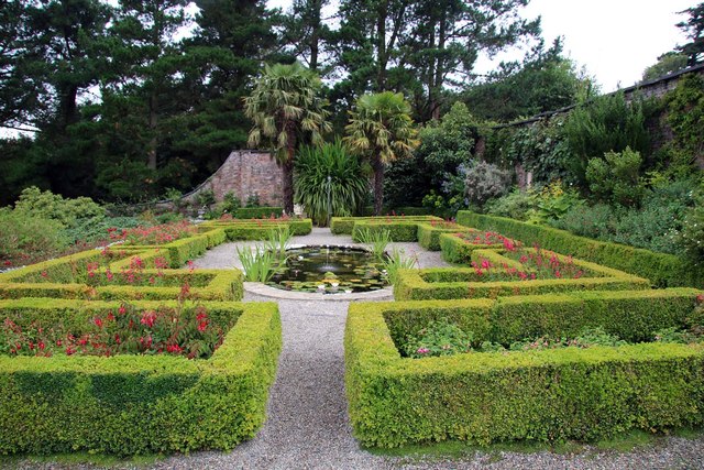
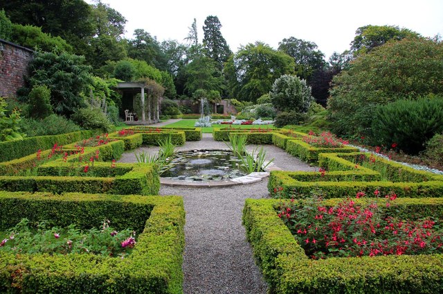
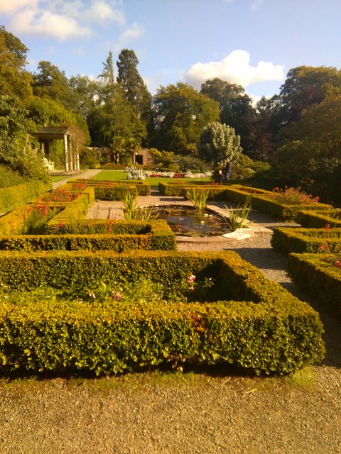
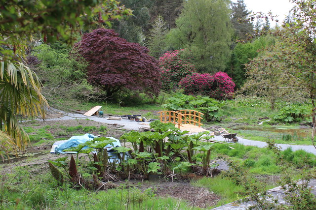
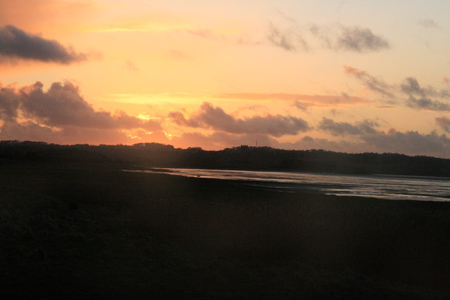
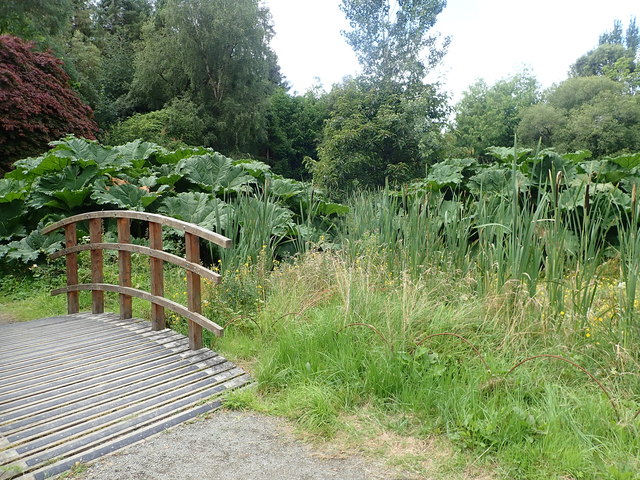
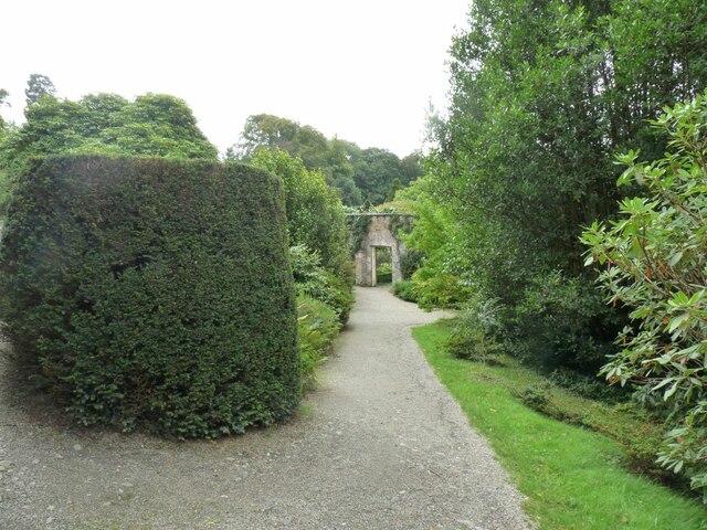
Garth Point is a coastal area located in Caernarfonshire, Wales. It is characterized by its marshes and salt marshes, creating a unique habitat for a variety of plant and animal species. The salt marshes are formed by the tidal flooding of the area, creating a brackish environment that supports a diverse range of flora and fauna.

The marshes at Garth Point are an important habitat for many bird species, including waders, ducks, and geese. The area is also home to a variety of insects, mollusks, and other invertebrates that thrive in the marshy conditions. The salt marshes provide important feeding and nesting grounds for many of these species.

In addition to its ecological importance, Garth Point is also a popular destination for outdoor enthusiasts. Visitors can enjoy walking along the coastal paths, birdwatching, and taking in the stunning views of the surrounding landscape. The area is also a designated Site of Special Scientific Interest (SSSI), highlighting its importance for conservation and protection.

Overall, Garth Point offers a unique and diverse natural environment that is both ecologically significant and aesthetically pleasing.

If you have any feedback on the listing, please let us know in the comments section below.
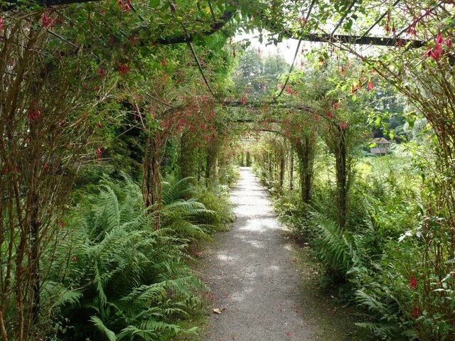
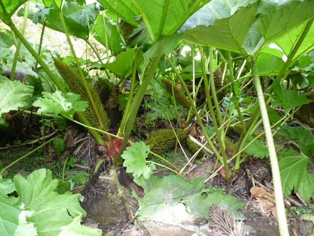
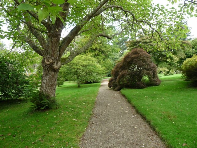
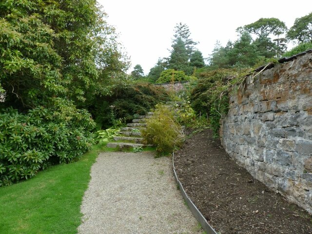
Garth Point Images

Images are sourced within 2km of 53.237081/-4.1217063 or Grid Reference SH5873. Thanks to Geograph Open Source API. All images are credited.

The Walled Garden at Penrhyn Castle Penrhyn Castle is a National Trust property.
The Walled Garden at Penrhyn Castle
Penrhyn Castle is a National Trust property.
The Walled Garden at Penrhyn Castle Penrhyn Castle is a National Trust property.
The Walled Garden at Penrhyn Castle
Penrhyn Castle is a National Trust property.
The Walled Garden at Penrhyn Castle On a glorious late summers evening.
The Walled Garden at Penrhyn Castle
On a glorious late summers evening.
Bog garden improvements - Lady Sybil's Water Garden (4) Reconstruction of an existing bridge.
Bog garden improvements - Lady Sybil's Water Garden (4)
Reconstruction of an existing bridge.
Machlud dros Stad y Penrhyn / Sunset over the Penrhyn Estate
Gardens at Penrhyn Castle Looking across part of the formal gardens at Penrhyn Castle.
Gardens at Penrhyn Castle
Looking across part of the formal gardens at Penrhyn Castle.
Box hedges at Penrhyn Castle Part of the formal gardens.
Box hedges at Penrhyn Castle
Part of the formal gardens.
Fuchsia arch Part of the formal gardens at Penrhyn Castle.
Fuchsia arch
Part of the formal gardens at Penrhyn Castle.
Fields near Penrhyn Castle Looking across a field from the grounds of Penrhyn Castle.
Fields near Penrhyn Castle
Looking across a field from the grounds of Penrhyn Castle.
Footbridge and Gunnera plants, Penrhyn Castle Bog Garden
Chapel ruins, Penrhyn Castle Medieval remains or 18th century rustic ruin?   The answer would appear to be a bit of both, as the single wall is part of the original medieval chapel, but this was dismantled in the 18thC and just the east wall re-erected here in the grounds as a piece of garden 'furniture'. A row of pet dog gravestones can be seen along the bottom of the wall, mostly dating from the 1920's.
Chapel ruins, Penrhyn Castle
Medieval remains or 18th century rustic ruin? The answer would appear to be a bit of both, as the single wall is part of the original medieval chapel, but this was dismantled in the 18thC and just the east wall re-erected here in the grounds as a piece of garden 'furniture'. A row of pet dog gravestones can be seen along the bottom of the wall, mostly dating from the 1920's.
Both ponds in the garden Looking back along the front of the Gazebo.
Both ponds in the garden
Looking back along the front of the Gazebo.
Steps down to the lower part of the garden Stone steps flanked by Urns.
Steps down to the lower part of the garden
Stone steps flanked by Urns.
The Fuchsia Arch Path beneath trained up Fuchsias.
The Fuchsia Arch
Path beneath trained up Fuchsias.
Rhubarb flowers Gunnera tinctoria is an invasive, non-native plant. This huge plant is very popular in gardens, where it's grown beside ponds and in damp, boggy ground like this.
Rhubarb flowers
Gunnera tinctoria is an invasive, non-native plant. This huge plant is very popular in gardens, where it's grown beside ponds and in damp, boggy ground like this.
Path through the centre of the garden Gravel path through the garden.
Path through the centre of the garden
Gravel path through the garden.
Steps up to the Gazebo level Stone retaining wall on the right.
Steps up to the Gazebo level
Stone retaining wall on the right.
The way out Gate into the grounds of the Castle.
The way out
Gate into the grounds of the Castle.
Show me another place!

Garth Point is located at Grid Ref: SH5873 (Lat: 53.237081, Lng: -4.1217063)

Unitary Authority: Gwynedd

Police Authority: North Wales

What 3 Words

///signed.deriving.defensive. Near Bangor, Gwynedd

Related Wikis

Garth Pier

Garth Pier (Welsh: Pier y Garth; also known as Bangor Pier) is a Grade II listed structure in Bangor, Wales. At 1,500 feet (460 m) in length, it is the...

Port Penrhyn

Port Penrhyn (Welsh: Porth Penrhyn) is a harbour located just east of Bangor in north Wales at the confluence of the River Cegin with the Menai Strait...

Afon Cegin

The Afon Cegin (River Cegin in English) is a small river draining parts of North Wales and discharging to the Menai Strait at Porth Penrhyn. Its name means...

Bangor Normal College

The Normal College, Bangor (Welsh: Y Coleg Normal) was an independent teacher training college, founded in 1858. It was created through the efforts of...

Nearby Amenities

Located within 500m of 53.237081,-4.1217063
Source: PGS
Lat/Long: 53.2333554/-4.1179558
Source: PGS
Lat/Long: 53.2337597/-4.1185257
Source: PGS
Lat/Long: 53.2341637/-4.1191613
Source: PGS
Lat/Long: 53.2347759/-4.118725
Source: PGS
Lat/Long: 53.2349587/-4.1183532
Source: PGS
Lat/Long: 53.2346955/-4.1205441
Source: PGS
Lat/Long: 53.2349281/-4.1197321
Source: PGS
Lat/Long: 53.2353843/-4.1201895
Source: PGS
Lat/Long: 53.235191/-4.1209758
Source: PGS
Lat/Long: 53.2362842/-4.1211167
Source: PGS
Lat/Long: 53.2367035/-4.1217962
Source: PGS
Lat/Long: 53.2370498/-4.1223777
Source: PGS
Lat/Long: 53.2370304/-4.1224717
Source: PGS
Lat/Long: 53.2368579/-4.1229884
Source: PGS
Lat/Long: 53.2366035/-4.1240703
Source: PGS
Lat/Long: 53.2364578/-4.124456
Source: PGS
Lat/Long: 53.2359128/-4.1261876
Source: PGS
Lat/Long: 53.2353307/-4.1277928
Source: PGS
Lat/Long: 53.2352541/-4.1280918
Traffic Signals
Traffic Signals Direction: forward
Lat/Long: 53.2339322/-4.1212
Mini Roundabout
Lat/Long: 53.2337924/-4.1207533
Pub
Ship Launch
Lat/Long: 53.2359552/-4.1220966
Bus Stop
Bench: no
Bin: no
Bus: yes
Public Transport: platform
Shelter: no
Lat/Long: 53.2334922/-4.1232218
Noexit: yes
Lat/Long: 53.2344132/-4.1231605
Barrier: yes
Lat/Long: 53.2349513/-4.1236232
Post Box
Collection Times: Mo-Fr 09:00; Sa 07:00
Operator: Royal Mail
Operator Wikidata: Q638098
Post Box Type: pillar
Ref: LL57 87
Royal Cypher: EIIR
Royal Cypher Wikidata: Q33102113
Lat/Long: 53.2346431/-4.1224706
Bus Stop
Bay: yes
Bench: no
Bin: no
Bus: yes
Naptan AtcoCode: 5400AWF80921
Naptan NaptanCode: gwngawg
Public Transport: platform
Shelter: yes
Time: y
Lat/Long: 53.2334129/-4.1230534
Bus Stop
Bus: yes
Public Transport: platform
Shelter: yes
Lat/Long: 53.2337227/-4.1204525
Bus Stop
Bus: yes
Public Transport: platform
Lat/Long: 53.2337039/-4.120743
Source: Bing
Lat/Long: 53.2329255/-4.1230351
Crossing
Crossing: unmarked
Crossing Island: yes
Crossing Markings: no
Kerb: flush
Tactile Paving: yes
Lat/Long: 53.2338078/-4.1229247
Source: Bing
Lat/Long: 53.233293/-4.1226065
Source: Bing
Lat/Long: 53.233171/-4.1223225
Source: PGS
Lat/Long: 53.2348297/-4.1205738
Source: PGS
Lat/Long: 53.2351154/-4.1200004
Source: Bing
Lat/Long: 53.2352862/-4.1226176
Source: Bing
Lat/Long: 53.2353911/-4.1226174
Source: Bing
Lat/Long: 53.2352859/-4.1223212
Source: Bing
Lat/Long: 53.235337/-4.1223211
Source: Bing
Lat/Long: 53.2353371/-4.1223705
Source: Bing
Lat/Long: 53.2353951/-4.1223704
Source: Bing
Lat/Long: 53.2353951/-4.1224152
Source: Bing
Lat/Long: 53.2353484/-4.1224153
Source: Bing
Lat/Long: 53.2353484/-4.122455
Source: Bing
Lat/Long: 53.2353914/-4.1224549
Source: Bing
Lat/Long: 53.2353914/-4.1225012
Source: Bing
Lat/Long: 53.2353446/-4.1225014
Source: Bing
Lat/Long: 53.2353446/-4.1225459
Source: Bing
Lat/Long: 53.235391/-4.1225457
Source: Bing
Lat/Long: 53.2352861/-4.122498
Source: Bing
Lat/Long: 53.2329111/-4.1230523
Source: Bing
Lat/Long: 53.2327931/-4.1227777
Source: Bing
Lat/Long: 53.2329674/-4.1231326
Source: Bing
Lat/Long: 53.2331031/-4.1228344
Source: Bing
Lat/Long: 53.2334302/-4.1220769
Source: Bing
Lat/Long: 53.2333434/-4.1221819
Source: Bing
Lat/Long: 53.2332713/-4.1220154
Source: Bing
Lat/Long: 53.2329998/-4.1225279
Source: Bing
Lat/Long: 53.2329357/-4.1223786
Source: Bing
Lat/Long: 53.2334961/-4.121935
Source: Bing
Lat/Long: 53.23363/-4.1220785
Source: Bing
Lat/Long: 53.2336813/-4.122197
Source: Bing
Lat/Long: 53.2336573/-4.1222261
Source: Bing
Lat/Long: 53.2337016/-4.1223283
Source: Bing
Lat/Long: 53.233595/-4.1224572
Source: Bing
Lat/Long: 53.23351/-4.1217268
Source: Bing
Lat/Long: 53.2334984/-4.1217
Source: Bing
Lat/Long: 53.2335641/-4.1216205
Source: Bing
Lat/Long: 53.233645/-4.1218073
Source: Bing
Lat/Long: 53.233577/-4.1218896
Source: Bing
Lat/Long: 53.2335621/-4.1218552
Source: Bing
Lat/Long: 53.2353282/-4.1227347
Source: Bing
Lat/Long: 53.2353645/-4.1228327
Source: Bing
Lat/Long: 53.2355143/-4.1226782
Source: Bing
Lat/Long: 53.235478/-4.1225801
Source: Bing
Lat/Long: 53.2347538/-4.1226975
Source: Bing
Lat/Long: 53.2348301/-4.1226483
Source: Bing
Lat/Long: 53.2346996/-4.1224631
Source: Bing
Lat/Long: 53.2348051/-4.1225402
Source: Bing
Lat/Long: 53.2340712/-4.1210268
Source: Bing
Lat/Long: 53.234066/-4.120961
Source: Bing
Lat/Long: 53.2340009/-4.1209754
Source: Bing
Lat/Long: 53.2340143/-4.1211453
Source: Bing
Lat/Long: 53.2340791/-4.121131
Source: Bing
Lat/Long: 53.234165/-4.1210062
Source: Bing
Lat/Long: 53.2340845/-4.1211994
Source: Bing
Lat/Long: 53.2341786/-4.1211787
Source: Bing
Lat/Long: 53.2341746/-4.1211289
Source: Bing
Lat/Long: 53.2342504/-4.121126
Source: Bing
Lat/Long: 53.23404/-4.1207975
Source: Bing
Lat/Long: 53.23404/-4.1207117
Source: Bing
Lat/Long: 53.2340575/-4.1206696
Source: Bing
Lat/Long: 53.2340972/-4.1206632
Source: Bing
Lat/Long: 53.2340972/-4.1206389
Source: Bing
Lat/Long: 53.2341728/-4.1206259
Source: Bing
Lat/Long: 53.2341728/-4.1205919
Source: Bing
Lat/Long: 53.2341902/-4.1205774
Source: Bing
Lat/Long: 53.2342561/-4.1205774
Source: Bing
Lat/Long: 53.2342629/-4.1206065
Source: Bing
Lat/Long: 53.2342448/-4.1208387
Source: Bing
Lat/Long: 53.234164/-4.1208431
Barrier: lift_gate
Lat/Long: 53.2342281/-4.1200756
Source: Bing
Lat/Long: 53.2343133/-4.1206
Source: Bing
Lat/Long: 53.2343152/-4.120757
Source: Bing
Lat/Long: 53.2340368/-4.1197489
Source: Bing
Lat/Long: 53.2339969/-4.1196949
Source: Bing
Lat/Long: 53.2340093/-4.1196693
Source: Bing
Lat/Long: 53.2339747/-4.1196226
Source: Bing
Lat/Long: 53.23392/-4.1197354
Source: Bing
Lat/Long: 53.233954/-4.1197812
Source: Bing
Lat/Long: 53.2339731/-4.1197512
Source: Bing
Lat/Long: 53.2340075/-4.1198093
Source: PGS
Lat/Long: 53.2352039/-4.1186887
Source: PGS
Lat/Long: 53.2351521/-4.119429
Source: PGS
Lat/Long: 53.234923/-4.1184096
Source: Bing
Lat/Long: 53.2337112/-4.1212737
Source: Bing
Lat/Long: 53.2337017/-4.1212518
Source: Bing
Lat/Long: 53.23344/-4.1209674
Source: Bing
Lat/Long: 53.2333326/-4.1206467
Source: Bing
Lat/Long: 53.2333896/-4.1202569
Source: Bing
Lat/Long: 53.2333271/-4.1203321
Source: Bing
Lat/Long: 53.2333558/-4.1203987
Source: Bing
Lat/Long: 53.2334183/-4.1203236
Source: Bing
Lat/Long: 53.2334998/-4.1204307
Source: Bing
Lat/Long: 53.2336424/-4.1207243
Source: Bing
Lat/Long: 53.2337796/-4.1212015
Source: Bing
Lat/Long: 53.2337479/-4.1212304
Source: Bing
Lat/Long: 53.2337707/-4.1211709
Source: Bing
Lat/Long: 53.233739/-4.1211998
Source: Bing
Lat/Long: 53.2337393/-4.1212364
Source: Bing
Lat/Long: 53.2337298/-4.1212145
Source: Bing
Lat/Long: 53.2340454/-4.1211384
Source: Bing
Lat/Long: 53.2340333/-4.1209682
Atm
Lat/Long: 53.2341418/-4.1209139
Garth
Is In: Bangor
Is In Country: United Kingdom
Is In County: Gwynedd
Place: suburb
Lat/Long: 53.2354765/-4.122497
Give Way
Direction: forward
Traffic Sign: GB:1003B
Lat/Long: 53.2330117/-4.122129
Crossing
Bicycle: yes
Crossing: traffic_signals
Crossing Ref: toucan
Kerb: lowered
Segregated: no
Tactile Paving: yes
Lat/Long: 53.2339258/-4.121149
Source: Bing
Lat/Long: 53.2335267/-4.1220055
Barrier: kissing_gate
Lat/Long: 53.2327378/-4.1234421
Source: Bing
Lat/Long: 53.2328977/-4.1224241
Source: Bing
Lat/Long: 53.2329571/-4.1225624
Source: Bing
Lat/Long: 53.2330652/-4.1229432
Source: Bing
Lat/Long: 53.2330856/-4.1229908
Source: Bing
Lat/Long: 53.233121/-4.1228762
Source: Bing
Lat/Long: 53.2335829/-4.1221354
Give Way
Direction: forward
Lat/Long: 53.2340599/-4.1226559
Source: PGS
Lat/Long: 53.2348346/-4.1185866
Source: Bing
Lat/Long: 53.2352852/-4.1280641
Source: Bing
Lat/Long: 53.2353148/-4.1279701
Source: Bing
Lat/Long: 53.2353854/-4.1281519
Source: Bing
Lat/Long: 53.2354149/-4.1280578
Source: PGS
Lat/Long: 53.23541/-4.1281569
Source: PGS
Lat/Long: 53.2357121/-4.1277454
Source: Bing
Lat/Long: 53.2327362/-4.1209287
Source: Bing
Lat/Long: 53.2327614/-4.1210056
Source: Bing
Lat/Long: 53.2328168/-4.1198837
Source: Bing
Lat/Long: 53.2328771/-4.1195872
Source: Bing
Lat/Long: 53.2328505/-4.1199875
Source: Bing
Lat/Long: 53.2329516/-4.1195135
Source: Bing
Lat/Long: 53.232951/-4.1196982
Source: Bing
Lat/Long: 53.233016/-4.1196384
Source: Bing
Lat/Long: 53.233067/-4.1202206
Source: Bing
Lat/Long: 53.2330954/-4.1203073
Source: Bing
Lat/Long: 53.2331039/-4.1199521
Source: Bing
Lat/Long: 53.2331241/-4.1199851
Source: Bing
Lat/Long: 53.2331543/-4.1198668
Source: Bing
Lat/Long: 53.2331866/-4.1198912
Source: Bing
Lat/Long: 53.2332283/-4.120472
Source: Bing
Lat/Long: 53.2332302/-4.1201544
Source: Bing
Lat/Long: 53.2332527/-4.1205494
Source: Bing
Lat/Long: 53.2332893/-4.1200556
Source: Bing
Lat/Long: 53.2340812/-4.1229229
Source: Bing
Lat/Long: 53.2341644/-4.1233024
Source: Bing
Lat/Long: 53.2341849/-4.122991
Source: Bing
Lat/Long: 53.2342167/-4.1231361
Source: Bing
Lat/Long: 53.2342303/-4.1231278
Source: Bing
Lat/Long: 53.2342563/-4.1232462
Source: Bing
Lat/Long: 53.2343133/-4.122781
Source: Bing
Lat/Long: 53.2343387/-4.1228969
Source: Bing
Lat/Long: 53.2348534/-4.1223638
Source: Bing
Lat/Long: 53.2348826/-4.1224902
Source: Bing
Lat/Long: 53.2354351/-4.1213535
Source: Bing
Lat/Long: 53.2355262/-4.1212936
Source: Bing
Lat/Long: 53.2355614/-4.1218903
Source: Bing
Lat/Long: 53.2355694/-4.1225661
Source: Bing
Lat/Long: 53.2355718/-4.1224533
Source: Bing
Lat/Long: 53.2356034/-4.1225681
Source: Bing
Lat/Long: 53.2356058/-4.1224553
Source: Bing
Lat/Long: 53.2356339/-4.1225075
Source: Bing
Lat/Long: 53.235634/-4.1224293
Source: Bing
Lat/Long: 53.2356492/-4.1218874
Source: Bing
Lat/Long: 53.2356634/-4.1225076
Source: Bing
Lat/Long: 53.2356635/-4.1224294
Source: Bing
Lat/Long: 53.2356652/-4.123
Source: Bing
Lat/Long: 53.23567/-4.1225161
Source: Bing
Lat/Long: 53.2356719/-4.1224337
Source: Bing
Lat/Long: 53.2356813/-4.1230701
Source: Bing
Lat/Long: 53.2356962/-4.1225178
Source: Bing
Lat/Long: 53.2356981/-4.1224354
Source: Bing
Lat/Long: 53.2357175/-4.1229665
Source: Bing
Lat/Long: 53.2357336/-4.1230366
Old Phone: +44 1248 362341
Operator: BT plc
Removed Amenity: telephone
Lat/Long: 53.2363709/-4.1219038
Disused Amenity: toilets
Layer: 1
Lat/Long: 53.240415/-4.1257772
Addr City: Bangor
Addr Housenumber: 43
Addr Postcode: LL57 2SS
Addr Street: Upper Garth Road
Source: survey
Lat/Long: 53.2348797/-4.1235993
Noexit: yes
Lat/Long: 53.2355775/-4.121287
Addr Housenumber: 29
Source: survey
Lat/Long: 53.235178/-4.1231711
Addr Housenumber: 3
Addr Postcode: LL57 2SR
Addr Street: Upper Garth Road
Source: survey
Lat/Long: 53.23606/-4.1224043
Addr Housenumber: 41
Source: survey
Lat/Long: 53.2349886/-4.123539
Addr Housenumber: 5
Addr Postcode: LL57 2SR
Addr Street: Upper Garth Road
Source: survey
Lat/Long: 53.2360223/-4.122411
Addr Housename: Glenshire
Addr Housenumber: 18
Source: survey
Lat/Long: 53.2353865/-4.1232814
Addr Housenumber: 25
Source: survey
Lat/Long: 53.2353609/-4.1227718
Addr Housenumber: 11
Source: survey
Lat/Long: 53.2358681/-4.1224137
Addr Housenumber: 12
Source: survey
Lat/Long: 53.2355825/-4.1230158
Addr Housenumber: 33
Source: survey
Lat/Long: 53.2351008/-4.1233214
Addr Housenumber: 15
Source: survey
Lat/Long: 53.2357823/-4.1224298
Addr Housenumber: 17
Addr Postcode: LL57 2SR
Source: survey
Lat/Long: 53.2357558/-4.1224419
Addr Housenumber: 19
Source: survey
Lat/Long: 53.2354845/-4.1226537
Addr Housenumber: 23
Source: survey
Lat/Long: 53.2353978/-4.1227396
Addr Housename: Woodlands
Addr Housenumber: 20
Source: survey
Lat/Long: 53.2353143/-4.1234343
Addr Housenumber: 21
Source: survey
Lat/Long: 53.2354348/-4.1227074
Addr Housenumber: 6
Addr Postcode: LL57 2SR
Addr Street: Upper Garth Road
Source: survey
Lat/Long: 53.2358425/-4.1228361
Addr Housenumber: 8
Addr Postcode: LL57 2SR
Source: survey
Lat/Long: 53.2357188/-4.1228469
Addr Housenumber: 39
Source: survey
Lat/Long: 53.2350286/-4.1234826
Addr Housenumber: 16
Source: survey
Lat/Long: 53.2354332/-4.1231929
Addr Housenumber: 10
Source: survey
Lat/Long: 53.2356675/-4.1228844
Addr Housenumber: 35
Source: survey
Lat/Long: 53.2350752/-4.123386
Addr Housenumber: 13
Source: survey
Lat/Long: 53.2358224/-4.1224204
Addr Housename: Glyncoed
Addr Housenumber: 14
Source: survey
Lat/Long: 53.2355182/-4.1230802
Addr Housenumber: 7
Source: survey
Lat/Long: 53.235983/-4.122407
Addr Housenumber: 1
Addr Postcode: LL57 2SR
Source: survey
Lat/Long: 53.2361017/-4.1224096
Addr Housenumber: 4
Addr Postcode: LL57 2SR
Addr Street: Upper Garth Road
Source: survey
Lat/Long: 53.2359018/-4.1228227
Addr Housenumber: 37
Source: survey
Lat/Long: 53.2350528/-4.1234343
Addr Housenumber: 31
Source: survey
Lat/Long: 53.2351449/-4.1232489
Addr Housenumber: 9
Source: survey
Lat/Long: 53.2359339/-4.1224084
Addr Housename: Uplands
Addr Housenumber: 22
Source: survey
Lat/Long: 53.235279/-4.123504
Addr Housenumber: 27
Source: survey
Lat/Long: 53.2352291/-4.1230133
Addr City: Bangor
Addr Housenumber: 47
Addr Postcode: LL57 2SS
Addr Street: Upper Garth Road
Source: survey
Lat/Long: 53.2348136/-4.1237105
Addr Housenumber: 71
Addr Postcode: LL57 2SS
Addr Street: Upper Garth Road
Source: survey
Lat/Long: 53.2330459/-4.1247563
Addr Housenumber: 61
Addr Postcode: LL57 2SS
Addr Street: Upper Garth Road
Source: survey
Lat/Long: 53.2334778/-4.1244211
Addr Housenumber: 67
Addr Postcode: LL57 2SS
Addr Street: Upper Garth Road
Source: survey
Lat/Long: 53.2332386/-4.1245874
Addr Housenumber: 65
Addr Postcode: LL57 2SS
Addr Street: Upper Garth Road
Source: survey
Lat/Long: 53.2332916/-4.1245364
Addr Housename: Teg Annedd
Addr Housenumber: 63
Addr Postcode: LL57 2SS
Addr Street: Upper Garth Road
Source: survey
Lat/Long: 53.2334072/-4.1244452
Addr Housenumber: 32
Source: survey
Lat/Long: 53.2347172/-4.124236
Addr City: Bangor
Addr Housenumber: 45
Addr Postcode: LL57 2SS
Addr Street: Upper Garth Road
Source: survey
Lat/Long: 53.2348553/-4.1236998
Addr Housenumber: 69
Addr Postcode: LL57 2SS
Addr Street: Upper Garth Road
Source: survey
Lat/Long: 53.2330989/-4.1247027
Source: PGS
Lat/Long: 53.2349428/-4.1181217
Source: PGS
Lat/Long: 53.2346981/-4.1183985
Source: PGS
Lat/Long: 53.234874/-4.1180983
Garth Point
Place: locality
Lat/Long: 53.2369828/-4.123139
Addr Housenumber: 64
Addr Postcode: LL57 2SS
Addr Street: Upper Garth Road
Source: survey
Lat/Long: 53.2334809/-4.1260493
Bench
Backrest: yes
Material: metal
Lat/Long: 53.2346847/-4.1277332
Bench
Backrest: yes
Material: metal
Lat/Long: 53.2346036/-4.1278857
Tourism: viewpoint
Lat/Long: 53.2346464/-4.1277955
Power: substation
Lat/Long: 53.234232/-4.123464
Restaurant
Voltaire
Addr City: Bangor
Addr Housenumber: 25
Addr Postcode: LL57 2SE
Addr Street: Ffordd Garth
Addr Street En: Garth Road
Check Date: 2024-03-01
Diet Vegan: only
Diet Vegetarian: yes
Fhrs Id: 878095
Fhrs Local Authority Id: 24805
Level: 0
Lat/Long: 53.2347697/-4.1224825
Defibrillator
Emergency: defibrillator
Lat/Long: 53.2334507/-4.1217984
Barrier: bollard
Bicycle: yes
Foot: yes
Lat/Long: 53.2338505/-4.1211808
Barrier: kerb
Kerb: lowered
Tactile Paving: yes
Lat/Long: 53.2339533/-4.1208997
Barrier: kerb
Kerb: lowered
Tactile Paving: yes
Lat/Long: 53.2338783/-4.1211694
Barrier: kerb
Kerb: lowered
Tactile Paving: yes
Lat/Long: 53.2339722/-4.121129
Traffic Signals
Traffic Signals Direction: backward
Lat/Long: 53.2339146/-4.1210993
Bench
Lat/Long: 53.2365825/-4.1225923
Waste Basket
Lat/Long: 53.2366724/-4.1223128
Bench
Lat/Long: 53.236687/-4.1224074
Bench
Lat/Long: 53.2366187/-4.1226689
Bench
Lat/Long: 53.23658/-4.1228031
Bench
Lat/Long: 53.2365976/-4.1227406
Bench
Lat/Long: 53.2365595/-4.1222815
Bench
Lat/Long: 53.2364617/-4.1222331
Bench
Lat/Long: 53.2364559/-4.1228097
Bench
Backrest: yes
Lat/Long: 53.2365549/-4.1219342
Tourism: viewpoint
Lat/Long: 53.2366529/-4.1219348
Barrier: lift_gate
Lat/Long: 53.2367718/-4.1222655
Source: PGS
Lat/Long: 53.2362842/-4.1211167
Source: PGS
Lat/Long: 53.2362744/-4.1211922
Revolution Launderette
Laundry Service: no
Payment Card: yes
Payment Cash: no
Payment Contactless: yes
Self Service: yes
Shop: laundry
Lat/Long: 53.2342288/-4.1213174
Source: PGS
Lat/Long: 53.2349342/-4.1184534
Source: PGS
Lat/Long: 53.23497/-4.1184387
Source: PGS
Lat/Long: 53.2351702/-4.1187429
Source: PGS
Lat/Long: 53.2353416/-4.1188243
Bench
Backrest: yes
Lat/Long: 53.2395138/-4.1250382
Bench
Backrest: yes
Lat/Long: 53.2405865/-4.1258243
Bench
Backrest: yes
Inscription: "Happy memories of Physics at Bangor U.C.N.W. - GDM"
Lat/Long: 53.2373495/-4.122932
Bench
Backrest: yes
Lat/Long: 53.2375234/-4.1230966
Bench
Backrest: yes
Lat/Long: 53.2405319/-4.1259995
Bench
Backrest: yes
Lat/Long: 53.2375402/-4.123116
Bench
Backrest: yes
Lat/Long: 53.2405582/-4.1259126
Bench
Backrest: yes
Lat/Long: 53.2374075/-4.1229841
Bench
Backrest: yes
Lat/Long: 53.2395737/-4.124861
Bench
Backrest: yes
Lat/Long: 53.237379/-4.1229612
Bench
Backrest: yes
Lat/Long: 53.2374654/-4.1230399
Direction: 215
Generator Method: photovoltaic
Generator Output Electricity: yes
Generator Solar Modules: 6
Generator Source: solar
Generator Type: solar_photovoltaic_panel
Location: roof
Power: generator
Lat/Long: 53.2350249/-4.1240016
Direction: 35
Generator Method: photovoltaic
Generator Output Electricity: yes
Generator Solar Modules: 4
Generator Source: solar
Generator Type: solar_photovoltaic_panel
Location: roof
Power: generator
Lat/Long: 53.2350566/-4.1239715
Direction: 125
Generator Method: photovoltaic
Generator Output Electricity: yes
Generator Solar Modules: 6
Generator Source: solar
Generator Type: solar_photovoltaic_panel
Location: roof
Power: generator
Lat/Long: 53.2350895/-4.1240291
Information: map
Tourism: information
Lat/Long: 53.2340489/-4.1204668
Benchmark: yes
Direction: 110
Man Made: survey_point
Mapillary: 496698625559090
Survey Date: 2022-06-13
Survey Point Structure: cut
Lat/Long: 53.2342914/-4.1227944
Tourism: information
Lat/Long: 53.234018/-4.1193087
Historic: memorial
Inscription: PĂ©iriannydd H. Iorys Hughes 1902-1977 Engineer
Memorial: plaque
Lat/Long: 53.2335006/-4.123354
Bench
Material: wood
Lat/Long: 53.2334274/-4.1182276
Bench
Material: wood
Lat/Long: 53.2336393/-4.1185497
Bench
Material: stone
Lat/Long: 53.2333133/-4.1181217
Addr City: Bangor
Information: qr_code
Mapillary: 733161084666541
Title En: Novelist's former home
Tourism: information
Website: https://historypoints.org/
Lat/Long: 53.2332118/-4.1234306
Waste Basket
Lat/Long: 53.2335865/-4.118359
Information: route_marker
Tourism: information
Lat/Long: 53.2342194/-4.1200655
Information: route_marker
Tourism: information
Lat/Long: 53.2341737/-4.1205141
Bench
Lat/Long: 53.2364584/-4.1218945
Binoculars
Fee: yes
Lat/Long: 53.2366802/-4.121945
Waste Basket
Waste: trash
Lat/Long: 53.2367349/-4.1220255
Waste Basket
Waste: trash
Lat/Long: 53.2369449/-4.1226762
Bench
Backrest: yes
Lat/Long: 53.2367036/-4.1219902
Noexit: yes
Lat/Long: 53.2342592/-4.1233794
Barrier: kerb
Lat/Long: 53.2340334/-4.1228063
Noexit: yes
Lat/Long: 53.2342114/-4.123657
Source: PGS
Lat/Long: 53.2366343/-4.1240782
Addr Postcode: LL57 2RT
Addr Street: Garth Road
Email: contact@ygarth.co.uk
Phone: 01248362277
Tourism: guest_house
Website: https://www.ygarth.co.uk/
Lat/Long: 53.2328423/-4.1239243
The data included in this document is from www.openstreetmap.org. The data is made available under ODbL.

Have you been to Garth Point?

Leave your review of Garth Point below (or comments, questions and feedback).