Sron a' Chorain

Coastal Marsh, Saltings in Sutherland

Scotland

Sron a' Chorain

Coldbackie beach - 1978 Coldbackie beach, Kyle of Tongue.
Coldbackie beach - 1978 Credit: Helmut Zozmann

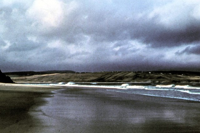
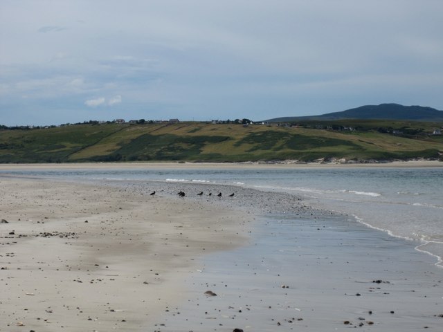
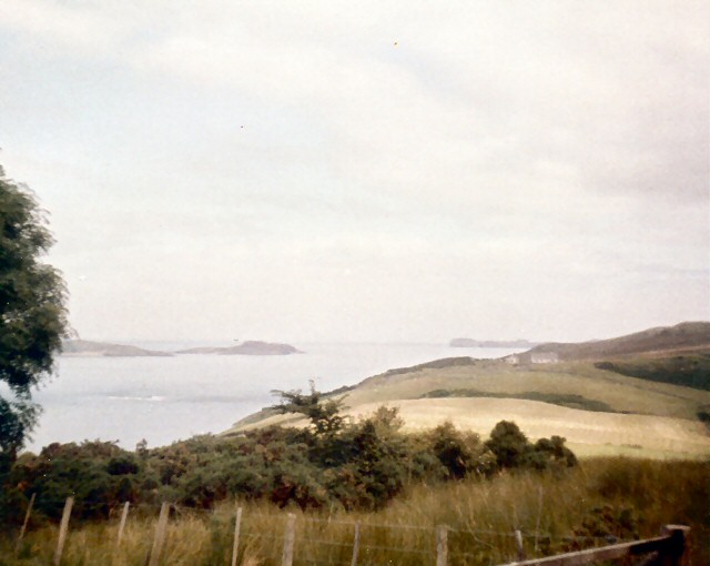
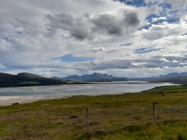
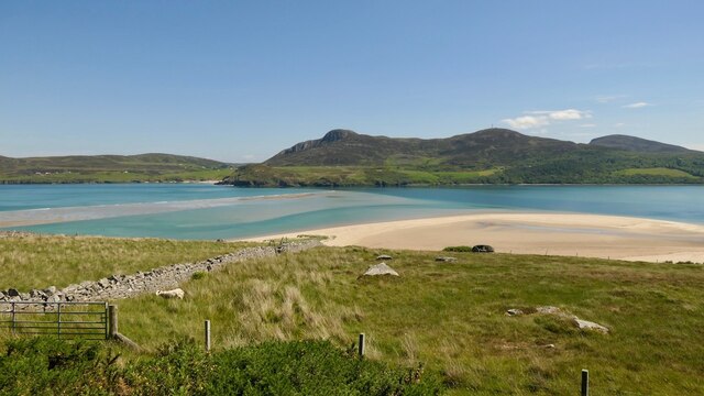
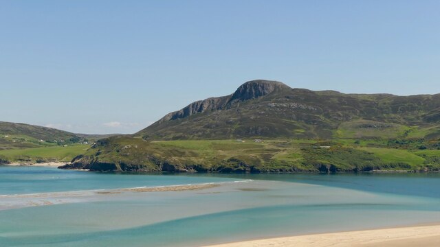
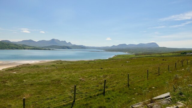
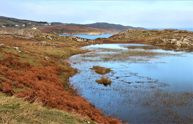
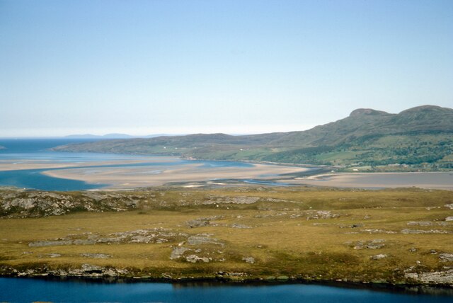
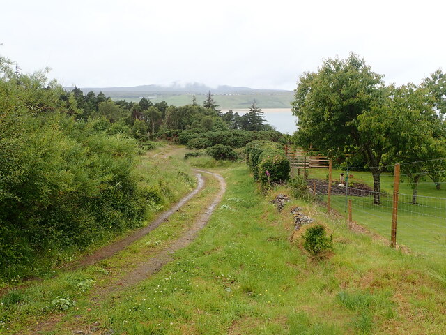
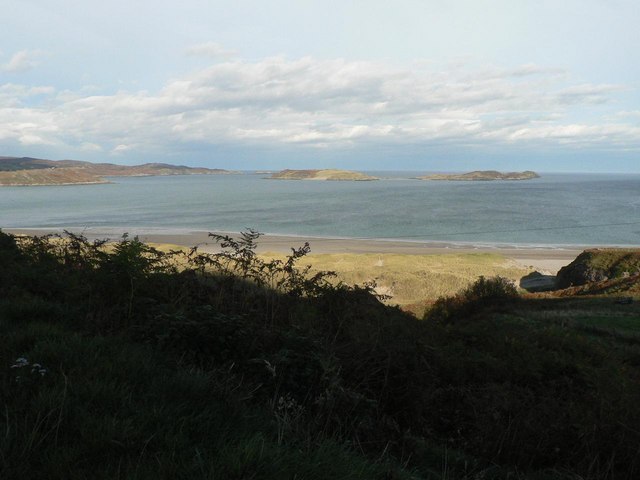
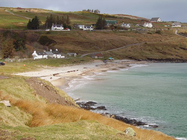
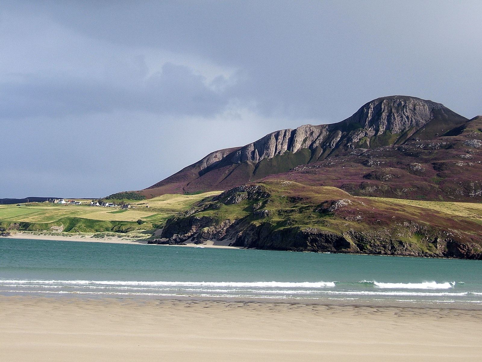
Sron a' Chorain is a coastal marsh and saltings area located in Sutherland, Scotland. This unique ecosystem is characterized by its proximity to the sea, which influences the vegetation and wildlife found in the area. The marsh is dominated by salt-tolerant plants such as sea lavender, sea rush, and sea aster, which thrive in the saline conditions of the marsh.

The saltings, or salt marshes, are important habitats for a variety of bird species, including wading birds like oystercatchers, curlews, and redshanks. These birds feed on the invertebrates and small fish that are abundant in the marshes, making it a vital feeding ground for local bird populations.

Sron a' Chorain is also home to a variety of other wildlife, including amphibians, insects, and mammals. The marsh provides important breeding grounds for amphibians such as frogs and newts, while insects like dragonflies and butterflies can be seen flitting among the plants.

Overall, Sron a' Chorain is a rich and diverse ecosystem that plays a crucial role in supporting local wildlife populations and providing a unique habitat for a variety of plant and animal species.

If you have any feedback on the listing, please let us know in the comments section below.

Sron a' Chorain Images

Images are sourced within 2km of 58.507902/-4.4277464 or Grid Reference NC5860. Thanks to Geograph Open Source API. All images are credited.

Coldbackie beach - 1978 Coldbackie beach, Kyle of Tongue.
Coldbackie beach - 1978
Coldbackie beach, Kyle of Tongue.
Coldbackie beach - Kyle of Tongue A parcel of oystercatchers spotted on the beach at the mouth of the kyle. The most westerly bay is only accessible at low tide. The township of Melness is seen across the kyle. The houses are those featured in the photograph taken in 1978 <a href="https://www.geograph.org.uk/photo/2965631">NC6060 : Coldbackie beach - 1978</a>.
Coldbackie beach - Kyle of Tongue
A parcel of oystercatchers spotted on the beach at the mouth of the kyle. The most westerly bay is only accessible at low tide. The township of Melness is seen across the kyle. The houses are those featured in the photograph taken in 1978 NC6060 : Coldbackie beach - 1978.
Rhitongue Looking across fields towards the Kyle of Tongue from the A838 South of Coldbackie.
Rhitongue
Looking across fields towards the Kyle of Tongue from the A838 South of Coldbackie.
Kyle of Tongue from Midtown A very fine view with the causeway visible and majestic Ben Loyal beyond.
Kyle of Tongue from Midtown
A very fine view with the causeway visible and majestic Ben Loyal beyond.
Kyle of Tongue seen from Midtown
The Kyle of Tongue, drying Much of the Kyle dries at low water. Watching the sands come and go is rather addictive.
The Kyle of Tongue, drying
Much of the Kyle dries at low water. Watching the sands come and go is rather addictive.
Hope and Loyal Two northern icons with the Kyle of Tongue between them.
Hope and Loyal
Two northern icons with the Kyle of Tongue between them.
Road (A836) near to Woodend Looking north-eastward.
Road (A836) near to Woodend
Looking north-eastward.
Ard Skinid lochan
Ard Skinid lochan
Kyle of Tongue before the A838 causeway was built Hills on sky line (right to left): Ben Tongue, Cnoc an Fhreiceadain, Ben Blandy, hills on Hoy in the Orkneys. In foreground is, probably, the nameless lochan at NC 550 572 on the eastern side of Cnoc Lon nan Eildean.
Kyle of Tongue before the A838 causeway was built
Hills on sky line (right to left): Ben Tongue, Cnoc an Fhreiceadain, Ben Blandy, hills on Hoy in the Orkneys. In foreground is, probably, the nameless lochan at NC 550 572 on the eastern side of Cnoc Lon nan Eildean.
The Good Eggs of Skinnet A half-dozen purchased.
The Good Eggs of Skinnet
A half-dozen purchased.
View to Ben Loyal From Midtown, Melness.
View to Ben Loyal
From Midtown, Melness.
Cottages at Woodend Pleasantly situated off the main road, A836, and overlooking the Kyle of Tongue
Cottages at Woodend
Pleasantly situated off the main road, A836, and overlooking the Kyle of Tongue
Track heading north at Woodend Though it does not go down as far as the estuary
Track heading north at Woodend
Though it does not go down as far as the estuary
At Midtown
At Midtown
View from Rhitongue A view of the Kyle of Tongue.
View from Rhitongue
A view of the Kyle of Tongue.
Kyle of Tongue
Kyle of Tongue
Cnoc an Fhreiceadain Late sun on flanks of Cnoc an Fhreiceadain from beach below Midtown - Kyle of Tongue.
Cnoc an Fhreiceadain
Late sun on flanks of Cnoc an Fhreiceadain from beach below Midtown - Kyle of Tongue.
Show me another place!

Sron a' Chorain is located at Grid Ref: NC5860 (Lat: 58.507902, Lng: -4.4277464)

Unitary Authority: Highland

Police Authority: Highlands and Islands

What 3 Words

///tidying.bagpipes.exposing. Near Altnaharra, Highland

Nearby Locations

Sron a' Chorain Midtown

Related Wikis

Achuvoldrach

Achuvoldrach (Scottish Gaelic: Achadh a’ Mholltairich) is a small remote village on the west shore of the Kyle of Tongue in Sutherland, in the Highland...

Tongue Bay

Tongue Bay (Scottish Gaelic: Tunga from Old Norse: Tunga) is located in northwest Highland, Scotland, in the western part of the former county of Sutherland...

Talmine, Sutherland

Talmine is a crofting and fishing township, overlooking Talmine Bay, an inlet on the western shore of Tongue Bay in northern Sutherland, Scottish Highlands...

Cnoc an Fhreiceadain

Cnoc an Fhreiceadain (Hill of Watching or Watch Hill) is a coastal mountain peak in northern Scotland. It is 307 metres (1,007 ft) high with commanding...

Nearby Amenities

Located within 500m of 58.507902,-4.4277464
Source: PGS
Lat/Long: 58.506869/-4.435977
Source: PGS
Lat/Long: 58.507639/-4.435763
Source: PGS
Lat/Long: 58.507778/-4.434791
Created By: almien_coastlines
Source: PGS
Lat/Long: 58.508223/-4.434552
Created By: almien_coastlines
Source: PGS
Lat/Long: 58.50874/-4.434084
Created By: almien_coastlines
Source: PGS
Lat/Long: 58.509257/-4.433616
Created By: almien_coastlines
Source: PGS
Lat/Long: 58.509772/-4.433392
Created By: almien_coastlines
Source: PGS
Lat/Long: 58.509649/-4.432897
Created By: almien_coastlines
Source: PGS
Lat/Long: 58.509654/-4.432408
Created By: almien_coastlines
Source: PGS
Lat/Long: 58.509785/-4.43217
Created By: almien_coastlines
Source: PGS
Lat/Long: 58.509916/-4.43193
Created By: almien_coastlines
Source: PGS
Lat/Long: 58.510047/-4.431691
Created By: almien_coastlines
Source: PGS
Lat/Long: 58.510177/-4.431451
Source: PGS
Lat/Long: 58.5099892/-4.430699
Source: PGS
Lat/Long: 58.5100877/-4.430075
Source: PGS
Lat/Long: 58.5103005/-4.4294355
Source: PGS
Lat/Long: 58.5104683/-4.4289357
Source: PGS
Lat/Long: 58.5105712/-4.4284505
Source: PGS
Lat/Long: 58.5105787/-4.4282417
Source: PGS
Lat/Long: 58.5105111/-4.4281452
Source: PGS
Lat/Long: 58.5104936/-4.4279895
Source: PGS
Lat/Long: 58.5103776/-4.427601
Source: PGS
Lat/Long: 58.5105076/-4.4267805
Source: PGS
Lat/Long: 58.5105375/-4.426004
Source: PGS
Lat/Long: 58.5071679/-4.4316638
Source: PGS
Lat/Long: 58.5073294/-4.4301295
The data included in this document is from www.openstreetmap.org. The data is made available under ODbL.

Have you been to Sron a' Chorain?

Leave your review of Sron a' Chorain below (or comments, questions and feedback).