Rubh' a' Charnain

Coastal Marsh, Saltings in Argyllshire

Scotland

Rubh' a' Charnain

Slopes of Beinn Eolasary A sharp reentrant which is marked as a fault on the solid geology map.
Slopes of Beinn Eolasary Credit: Richard Webb

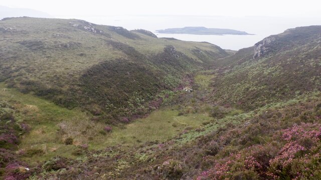
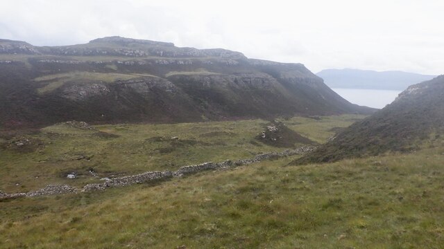
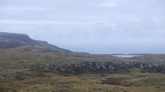
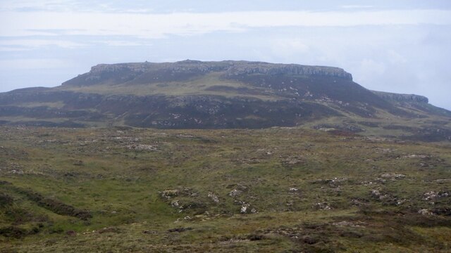
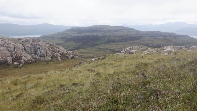
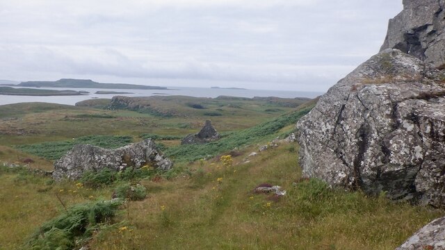
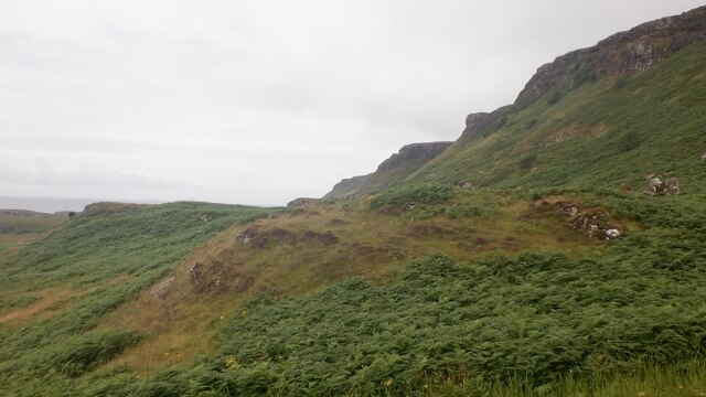
Rubh' a' Charnain is a coastal marsh located in Argyllshire, Scotland. It is situated near the village of Taynuilt and the larger town of Oban. This area is known for its picturesque beauty and offers a diverse range of habitat and wildlife.

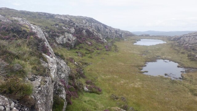
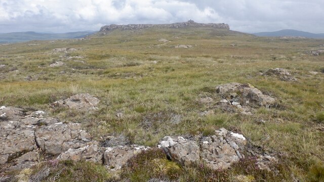
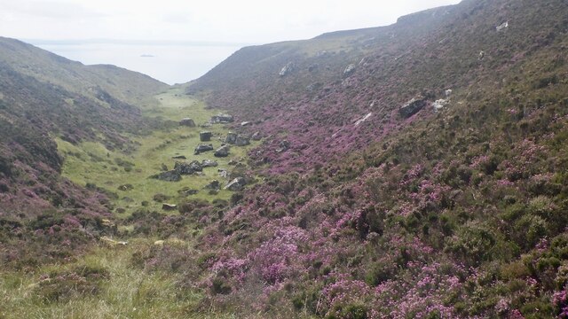
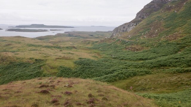
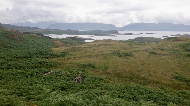
The coastal marsh is characterized by its extensive saltings, which are areas of low-lying land that are regularly inundated by the tides. These saltings provide a unique ecosystem that supports a variety of plant and animal species. The marsh is home to a wide range of bird species, including waders such as curlews, redshanks, and oystercatchers, which can be seen feeding in the mudflats during low tide.

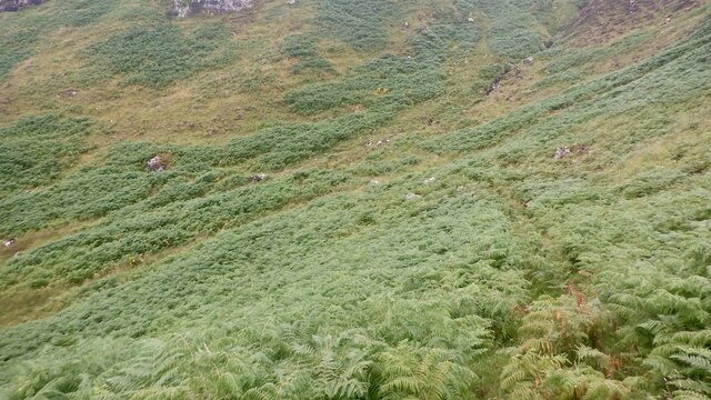
The marsh itself is covered in a lush carpet of salt-tolerant vegetation, including sea-purslane, sea aster, and sea lavender. These plants have adapted to the harsh conditions of the marsh, thriving in the salty and wet environment. They provide important habitat and food sources for the resident and migratory bird species.

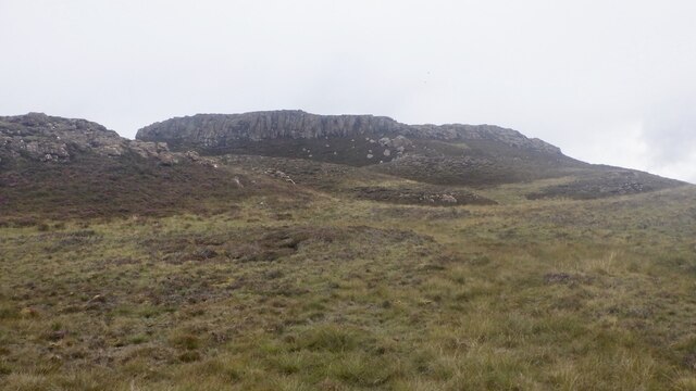
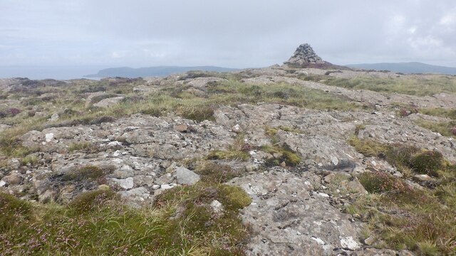
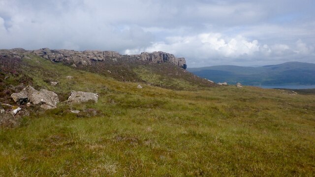
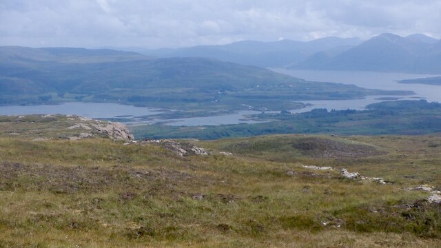
In addition to its ecological importance, Rubh' a' Charnain offers stunning views of the surrounding landscape. The marsh is bordered by rocky cliffs and offers panoramic vistas of the nearby mountains and the sea. The combination of the diverse wildlife, unique vegetation, and breathtaking scenery makes Rubh' a' Charnain a popular destination for nature enthusiasts, birdwatchers, and photographers.

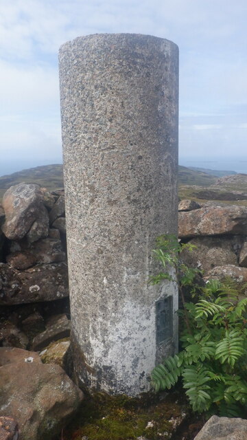
Visitors to Rubh' a' Charnain can explore the marsh via a network of footpaths and enjoy the tranquility of this remote coastal landscape. It is a place where nature thrives and offers a glimpse into the beauty and diversity of Scotland's coastal ecosystems.

If you have any feedback on the listing, please let us know in the comments section below.

Rubh' a' Charnain Images

Images are sourced within 2km of 56.468223/-6.2244241 or Grid Reference NM3938. Thanks to Geograph Open Source API. All images are credited.

Slopes of Beinn Eolasary A sharp reentrant which is marked as a fault on the solid geology map.
Slopes of Beinn Eolasary
A sharp reentrant which is marked as a fault on the solid geology map.
Top layer of the cake: Beinn Eolasary The highest lava flow in Ulva's traps makes an impressive crag. The rock is very slippery though as I found out the hard way when trying to get through at a weakness.
Top layer of the cake: Beinn Eolasary
The highest lava flow in Ulva's traps makes an impressive crag. The rock is very slippery though as I found out the hard way when trying to get through at a weakness.
Summit, Beinn Eolasary A flat basalt table on top of Ulva's highest trap lava flow.
Summit, Beinn Eolasary
A flat basalt table on top of Ulva's highest trap lava flow.
On Beinn Eolasary The crags are the upper lava flow on Ulva, the top layer in the stepped landscape of the island.
On Beinn Eolasary
The crags are the upper lava flow on Ulva, the top layer in the stepped landscape of the island.
Dry stone dyke, Ulva A wall running across the island between Beinn Eolasary and Beinn Chreagach, the two main hills.
Dry stone dyke, Ulva
A wall running across the island between Beinn Eolasary and Beinn Chreagach, the two main hills.
The lochan on Beinn an Lochain, Ulva Trap landscape seen from moorland on Beinn Chreagach
The lochan on Beinn an Lochain, Ulva
Trap landscape seen from moorland on Beinn Chreagach
Traps, Beinn Eolasary Ulva's distinctive stepped landscape, seen from Beinn Chreagach.
Traps, Beinn Eolasary
Ulva's distinctive stepped landscape, seen from Beinn Chreagach.
Beinn Chreagach, Ulva View from Beinn Eolasary showing the Ulva trap landscape formed by successive lava flows.
Beinn Chreagach, Ulva
View from Beinn Eolasary showing the Ulva trap landscape formed by successive lava flows.
One step to go - Beinn Chreagach Approaching the summit of the stepped hill - caused by successive lava flows.
One step to go - Beinn Chreagach
Approaching the summit of the stepped hill - caused by successive lava flows.
Beinn Chreagach trig pillar
Crag, Beinn Chreagach The stepped appearance of Ulva is due to a succession of lava flows.
Crag, Beinn Chreagach
The stepped appearance of Ulva is due to a succession of lava flows.
Eastern Ulva View from near the summit of Beinn Chreagach towards the narrow Sound of Ulva and wooded eastern end of the island.
Eastern Ulva
View from near the summit of Beinn Chreagach towards the narrow Sound of Ulva and wooded eastern end of the island.
Moorland on Beinn Chreagach, Ulva Seasonal pools below the summit.
Moorland on Beinn Chreagach, Ulva
Seasonal pools below the summit.
South side of Ulva Looking along the coast from near Cille Mhic Eoghainn. I escaped the coastal plain by the skyline ridge which was "interesting".  Little Colonsay is the larger island in the background.
South side of Ulva
Looking along the coast from near Cille Mhic Eoghainn. I escaped the coastal plain by the skyline ridge which was "interesting". Little Colonsay is the larger island in the background.
South side path, Ulva West of Cragaig, it is a matter of luck using the path in Summer. I was lucky, a quadbike had passed recently but the path was choked after the big nose above Cille Mhic Eoghainn.  Bracken is quite an adversary on Ulva.
South side path, Ulva
West of Cragaig, it is a matter of luck using the path in Summer. I was lucky, a quadbike had passed recently but the path was choked after the big nose above Cille Mhic Eoghainn. Bracken is quite an adversary on Ulva.
Ruin, Ulva One of many ruins along the south coast.
Ruin, Ulva
One of many ruins along the south coast.
South side path, Ulva A break from the bracken at the foot of a steep nose descending from Beinn Eolasary. This is the opposite side to <a href="https://www.geograph.org.uk/photo/5532272">NM3939 : Fractured cliff</a>
South side path, Ulva
A break from the bracken at the foot of a steep nose descending from Beinn Eolasary. This is the opposite side to NM3939 : Fractured cliff
South side of Ulva A steep basalt escarpment rises above a narrow coastal plain which was once densely populated.
South side of Ulva
A steep basalt escarpment rises above a narrow coastal plain which was once densely populated.
Show me another place!

Rubh' a' Charnain is located at Grid Ref: NM3938 (Lat: 56.468223, Lng: -6.2244241)

Unitary Authority: Argyll and Bute

Police Authority: Argyll and West Dunbartonshire

What 3 Words

///oddly.huts.headrest. Near Calgary, Argyll & Bute

Related Wikis

Ulva

Ulva (; Scottish Gaelic: Ulbha) is a small island in the Inner Hebrides of Scotland, off the west coast of Mull. It is separated from Mull by a narrow...

Little Colonsay

Little Colonsay (Scottish Gaelic: Colbhasa Beag) is an uninhabited island west of the island of the Isle of Mull in Scotland. The geology of the island...

Loch Tuath

Loch Tuath (Scottish Gaelic: Loch-a-Tuath) is a sea loch in the Inner Hebrides, Scotland that separates the Isle of Mull and the island of Ulva. Loch Tuath...

Gometra

Gometra (Scottish Gaelic: Gòmastra) is an island in the Inner Hebrides of Scotland, lying west of Mull. It lies immediately west of Ulva, to which it is...

Nearby Amenities

Located within 500m of 56.468223,-6.2244241
Created By: dmgroom_coastlines
Source: PGS
Lat/Long: 56.46421/-6.22135
Created By: dmgroom_coastlines
Source: PGS
Lat/Long: 56.46446/-6.22133
Created By: dmgroom_coastlines
Source: PGS
Lat/Long: 56.46377/-6.22485
Created By: dmgroom_coastlines
Source: PGS
Lat/Long: 56.46428/-6.22458
Created By: dmgroom_coastlines
Source: PGS
Lat/Long: 56.46439/-6.22365
Created By: dmgroom_coastlines
Source: PGS
Lat/Long: 56.46449/-6.22272
Source: PGS
Lat/Long: 56.4705741/-6.2180965
Source: PGS
Lat/Long: 56.4703071/-6.218276
Source: PGS
Lat/Long: 56.4699756/-6.2180547
Created By: dmgroom_coastlines
Source: PGS
Lat/Long: 56.4695/-6.21749
Source: PGS
Lat/Long: 56.4692804/-6.2179853
Source: PGS
Lat/Long: 56.4692763/-6.2183589
Source: PGS
Lat/Long: 56.4693867/-6.2184601
Source: PGS
Lat/Long: 56.4694811/-6.2186372
Source: PGS
Lat/Long: 56.4696052/-6.2187714
Source: PGS
Lat/Long: 56.4698/-6.2188587
Created By: dmgroom_coastlines
Source: PGS
Lat/Long: 56.47005/-6.21907
Source: PGS
Lat/Long: 56.4701456/-6.2191833
Source: PGS
Lat/Long: 56.470203/-6.2192134
Source: PGS
Lat/Long: 56.4702659/-6.2192832
Source: PGS
Lat/Long: 56.4703778/-6.2194395
Source: PGS
Lat/Long: 56.4705356/-6.2198499
Source: PGS
Lat/Long: 56.4709389/-6.2205127
Source: PGS
Lat/Long: 56.4713289/-6.2215399
Source: PGS
Lat/Long: 56.4713063/-6.222541
Source: PGS
Lat/Long: 56.4710837/-6.2232894
Source: PGS
Lat/Long: 56.4710793/-6.2235768
Source: PGS
Lat/Long: 56.4710964/-6.2237569
Source: PGS
Lat/Long: 56.4711297/-6.2240518
Source: PGS
Lat/Long: 56.4711175/-6.2243038
Source: PGS
Lat/Long: 56.4710614/-6.224617
Source: PGS
Lat/Long: 56.4709939/-6.2247941
Source: PGS
Lat/Long: 56.4709654/-6.224994
Source: PGS
Lat/Long: 56.4708983/-6.2251624
Source: PGS
Lat/Long: 56.4685853/-6.224822
Source: PGS
Lat/Long: 56.4682286/-6.2247653
Source: PGS
Lat/Long: 56.4679445/-6.225085
Source: PGS
Lat/Long: 56.467836/-6.2258141
Source: PGS
Lat/Long: 56.4675148/-6.2272487
Source: PGS
Lat/Long: 56.4678679/-6.2276368
Source: PGS
Lat/Long: 56.4676686/-6.2284978
Source: PGS
Lat/Long: 56.4676237/-6.2295681
Source: PGS
Lat/Long: 56.4677819/-6.2297699
Source: PGS
Lat/Long: 56.4681593/-6.2284275
Source: PGS
Lat/Long: 56.4682538/-6.2288835
Source: PGS
Lat/Long: 56.4683293/-6.2299486
Source: PGS
Lat/Long: 56.4687926/-6.2307285
Source: PGS
Lat/Long: 56.4686541/-6.2320856
Cille Mhic Eòghainn
Disused Amenity: place_of_worship
Historic: ruins
Lat/Long: 56.469989/-6.230638
Upper Kilviceun
Note: Gaelic name probably Cille Mhic Eòghainn Uachdarach but can't confirm
Place: locality
Lat/Long: 56.471747/-6.2294829
The data included in this document is from www.openstreetmap.org. The data is made available under ODbL.

Have you been to Rubh' a' Charnain?

Leave your review of Rubh' a' Charnain below (or comments, questions and feedback).