Eilean an Righ

Island in Argyllshire

Scotland

Eilean an Righ

South side of Ulva Looking along the coast from near Cille Mhic Eoghainn. I escaped the coastal plain by the skyline ridge which was "interesting".  Little Colonsay is the larger island in the background.
South side of Ulva Credit: Richard Webb

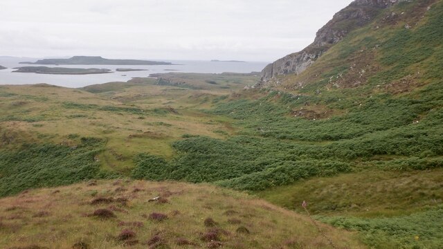
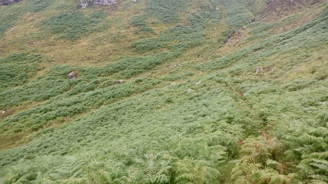
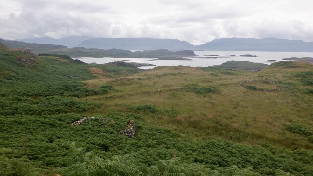
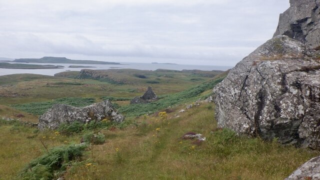
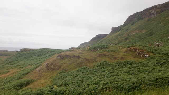
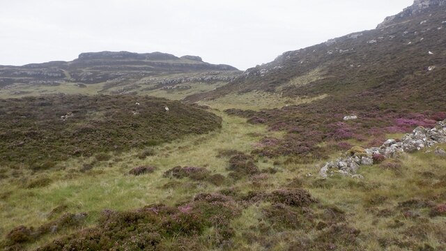
Eilean an Righ is a small island located off the coast of Argyllshire, Scotland. The name translates to "Island of the King" in Gaelic, reflecting its historical significance. The island is approximately 300 meters long and 150 meters wide, with a rugged coastline and a rocky terrain. It is surrounded by the crystal-clear waters of the Sound of Jura, offering stunning views of the surrounding landscape.

Eilean an Righ is uninhabited and is mainly used for grazing livestock. The island is home to a variety of wildlife, including seabirds, seals, and otters. Visitors can access the island by boat, although there are no facilities or amenities on the island itself.

The island has a rich history, with evidence of ancient settlements dating back to the Iron Age. It is also believed to have been a site of religious significance in early Christian times. Today, Eilean an Righ is a peaceful and secluded destination for those seeking a tranquil escape in the midst of Scotland's natural beauty.

If you have any feedback on the listing, please let us know in the comments section below.

Eilean an Righ Images

Images are sourced within 2km of 56.462503/-6.2246976 or Grid Reference NM3938. Thanks to Geograph Open Source API. All images are credited.

South side of Ulva Looking along the coast from near Cille Mhic Eoghainn. I escaped the coastal plain by the skyline ridge which was "interesting".  Little Colonsay is the larger island in the background.
South side of Ulva
Looking along the coast from near Cille Mhic Eoghainn. I escaped the coastal plain by the skyline ridge which was "interesting". Little Colonsay is the larger island in the background.
South side path, Ulva West of Cragaig, it is a matter of luck using the path in Summer. I was lucky, a quadbike had passed recently but the path was choked after the big nose above Cille Mhic Eoghainn.  Bracken is quite an adversary on Ulva.
South side path, Ulva
West of Cragaig, it is a matter of luck using the path in Summer. I was lucky, a quadbike had passed recently but the path was choked after the big nose above Cille Mhic Eoghainn. Bracken is quite an adversary on Ulva.
Ruin, Ulva One of many ruins along the south coast.
Ruin, Ulva
One of many ruins along the south coast.
South side path, Ulva A break from the bracken at the foot of a steep nose descending from Beinn Eolasary. This is the opposite side to <a href="https://www.geograph.org.uk/photo/5532272">NM3939 : Fractured cliff</a>
South side path, Ulva
A break from the bracken at the foot of a steep nose descending from Beinn Eolasary. This is the opposite side to NM3939 : Fractured cliff
South side of Ulva A steep basalt escarpment rises above a narrow coastal plain which was once densely populated.
South side of Ulva
A steep basalt escarpment rises above a narrow coastal plain which was once densely populated.
Coastal plain, Ulva View from the steep scarp running the length of Ulva's south coast towards Little Colonsay and Staffa. This was once a densely populated area and there are many ruins.
Coastal plain, Ulva
View from the steep scarp running the length of Ulva's south coast towards Little Colonsay and Staffa. This was once a densely populated area and there are many ruins.
Tràigh Bhàn and Little Colonsay White sand beaches on the south side of Ulva with Little Colonsay and Iona beyond.
Tràigh Bhàn and Little Colonsay
White sand beaches on the south side of Ulva with Little Colonsay and Iona beyond.
Cille Mhic Eoghainn Burial ground on the south side of Ulva. View from the top of a steep rocky nose used by deer and myself to escape the coastal plain.
Cille Mhic Eoghainn
Burial ground on the south side of Ulva. View from the top of a steep rocky nose used by deer and myself to escape the coastal plain.
Ruin, Ulva Looking down a steep nose of basalt towards the ruins near Cille Mhic Eoghainn
Ruin, Ulva
Looking down a steep nose of basalt towards the ruins near Cille Mhic Eoghainn
View of Beinn Eolasary, Ulva Trap landscape formed by successive lava flows.
View of Beinn Eolasary, Ulva
Trap landscape formed by successive lava flows.
Rubh' a Charnain South shore of Ulva. The prominent nose was used earlier in the day to get up Beinn Eolasary. It was steep, loose and exposed.
Rubh' a Charnain
South shore of Ulva. The prominent nose was used earlier in the day to get up Beinn Eolasary. It was steep, loose and exposed.
South side of Beinn Eolasary View from the popular anchorage near Cragaig. Escape from the coastal strip is not easy with steep ground, crags and bracken impeding progress. I went up the very distinct nose (right of centre).
South side of Beinn Eolasary
View from the popular anchorage near Cragaig. Escape from the coastal strip is not easy with steep ground, crags and bracken impeding progress. I went up the very distinct nose (right of centre).
Tràigh Bhàn White beach with a popular anchorage on the south coast of Ulva. Was remarkably clean too.

My footprints although there were a few folk off three yachts here the previous evening.
Tràigh Bhàn
White beach with a popular anchorage on the south coast of Ulva. Was remarkably clean too. My footprints although there were a few folk off three yachts here the previous evening.
South side of Ulva View westward from Tràigh Bhàn.
South side of Ulva
View westward from Tràigh Bhàn.
Rubha na Tràighe Bàine and Little Colonsay
Tràigh Bhàn With a view of Ben More
Tràigh Bhàn
With a view of Ben More
Eilean an Righ One of the islands off Ulva.
Eilean an Righ
One of the islands off Ulva.
Eilean an Righ
Eilean an Righ
Show me another place!

Eilean an Righ is located at Grid Ref: NM3938 (Lat: 56.462503, Lng: -6.2246976)

Unitary Authority: Argyll and Bute

Police Authority: Argyll and West Dunbartonshire

What 3 Words

///sculpture.introduce.satellite. Near Calgary, Argyll & Bute

Related Wikis

Ulva

Ulva (; Scottish Gaelic: Ulbha) is a small island in the Inner Hebrides of Scotland, off the west coast of Mull. It is separated from Mull by a narrow...

Little Colonsay

Little Colonsay (Scottish Gaelic: Colbhasa Beag) is an uninhabited island west of the island of the Isle of Mull in Scotland. The geology of the island...

Inch Kenneth

Inch Kenneth (Scottish Gaelic: Innis Choinnich) is a small grassy island off the west coast of the Isle of Mull, in Scotland. It is at the entrance of...

Loch Tuath

Loch Tuath (Scottish Gaelic: Loch-a-Tuath) is a sea loch in the Inner Hebrides, Scotland that separates the Isle of Mull and the island of Ulva. Loch Tuath...

Nearby Amenities

Located within 500m of 56.462503,-6.2246976
Created By: dmgroom_coastlines
Source: PGS
Lat/Long: 56.46252/-6.22055
Created By: dmgroom_coastlines
Source: PGS
Lat/Long: 56.46267/-6.22146
Created By: dmgroom_coastlines
Source: PGS
Lat/Long: 56.46344/-6.22141
Created By: dmgroom_coastlines
Source: PGS
Lat/Long: 56.46342/-6.22048
Created By: dmgroom_coastlines
Source: PGS
Lat/Long: 56.46385/-6.22061
Created By: dmgroom_coastlines
Source: PGS
Lat/Long: 56.46407/-6.2209
Created By: dmgroom_coastlines
Source: PGS
Lat/Long: 56.46421/-6.22135
Created By: dmgroom_coastlines
Source: PGS
Lat/Long: 56.46446/-6.22133
Created By: dmgroom_coastlines
Source: PGS
Lat/Long: 56.46442/-6.21948
Created By: dmgroom_coastlines
Source: PGS
Lat/Long: 56.46366/-6.21977
Created By: dmgroom_coastlines
Source: PGS
Lat/Long: 56.4634/-6.21979
Created By: dmgroom_coastlines
Source: PGS
Lat/Long: 56.46289/-6.21983
Created By: dmgroom_coastlines
Source: PGS
Lat/Long: 56.46239/-6.22009
Created By: dmgroom_coastlines
Source: PGS
Lat/Long: 56.46184/-6.2243
Created By: dmgroom_coastlines
Source: PGS
Lat/Long: 56.46197/-6.22452
Created By: dmgroom_coastlines
Source: PGS
Lat/Long: 56.46241/-6.22488
Created By: dmgroom_coastlines
Source: PGS
Lat/Long: 56.46237/-6.22519
Created By: dmgroom_coastlines
Source: PGS
Lat/Long: 56.46225/-6.22543
Created By: dmgroom_coastlines
Source: PGS
Lat/Long: 56.46213/-6.22567
Created By: dmgroom_coastlines
Source: PGS
Lat/Long: 56.46203/-6.22706
Created By: dmgroom_coastlines
Source: PGS
Lat/Long: 56.46255/-6.22726
Created By: dmgroom_coastlines
Source: PGS
Lat/Long: 56.46281/-6.22747
Created By: dmgroom_coastlines
Source: PGS
Lat/Long: 56.46278/-6.22608
Created By: dmgroom_coastlines
Source: PGS
Lat/Long: 56.46329/-6.22604
Created By: dmgroom_coastlines
Source: PGS
Lat/Long: 56.46327/-6.22512
Created By: dmgroom_coastlines
Source: PGS
Lat/Long: 56.46377/-6.22485
Created By: dmgroom_coastlines
Source: PGS
Lat/Long: 56.46428/-6.22458
Created By: dmgroom_coastlines
Source: PGS
Lat/Long: 56.46439/-6.22365
Created By: dmgroom_coastlines
Source: PGS
Lat/Long: 56.46449/-6.22272
Created By: dmgroom_coastlines
Source: PGS
Lat/Long: 56.46296/-6.22283
Created By: dmgroom_coastlines
Source: PGS
Lat/Long: 56.463/-6.22468
Created By: dmgroom_coastlines
Source: PGS
Lat/Long: 56.46258/-6.22454
Created By: dmgroom_coastlines
Source: PGS
Lat/Long: 56.46247/-6.22379
Created By: dmgroom_coastlines
Source: PGS
Lat/Long: 56.46221/-6.22358
Created By: dmgroom_coastlines
Source: PGS
Lat/Long: 56.46195/-6.2236
Created By: dmgroom_coastlines
Source: PGS
Lat/Long: 56.46183/-6.22384
Created By: dmgroom_coastlines
Source: PGS
Lat/Long: 56.46045/-6.23088
Created By: dmgroom_coastlines
Source: PGS
Lat/Long: 56.46046/-6.23134
Created By: dmgroom_coastlines
Source: PGS
Lat/Long: 56.46059/-6.23156
Created By: dmgroom_coastlines
Source: PGS
Lat/Long: 56.46111/-6.23175
Created By: dmgroom_coastlines
Source: PGS
Lat/Long: 56.46122/-6.23082
Created By: dmgroom_coastlines
Source: PGS
Lat/Long: 56.46143/-6.2305
Created By: dmgroom_coastlines
Source: PGS
Lat/Long: 56.46159/-6.23033
Created By: dmgroom_coastlines
Source: PGS
Lat/Long: 56.46158/-6.22987
Created By: dmgroom_coastlines
Source: PGS
Lat/Long: 56.46132/-6.22989
Created By: dmgroom_coastlines
Source: PGS
Lat/Long: 56.46124/-6.2302
Created By: dmgroom_coastlines
Source: PGS
Lat/Long: 56.46057/-6.23041
Created By: dmgroom_coastlines
Source: PGS
Lat/Long: 56.46003/-6.21795
Created By: dmgroom_coastlines
Source: PGS
Lat/Long: 56.46017/-6.21841
Created By: dmgroom_coastlines
Source: PGS
Lat/Long: 56.46032/-6.21932
Created By: dmgroom_coastlines
Source: PGS
Lat/Long: 56.46082/-6.21905
Created By: dmgroom_coastlines
Source: PGS
Lat/Long: 56.46108/-6.21903
Created By: dmgroom_coastlines
Source: PGS
Lat/Long: 56.46121/-6.21925
Created By: dmgroom_coastlines
Source: PGS
Lat/Long: 56.46136/-6.22017
Created By: dmgroom_coastlines
Source: PGS
Lat/Long: 56.46161/-6.21992
Created By: dmgroom_coastlines
Source: PGS
Lat/Long: 56.46186/-6.21944
Created By: dmgroom_coastlines
Source: PGS
Lat/Long: 56.46211/-6.21896
Created By: dmgroom_coastlines
Source: PGS
Lat/Long: 56.46261/-6.21869
Created By: dmgroom_coastlines
Source: PGS
Lat/Long: 56.46247/-6.21824
Created By: dmgroom_coastlines
Source: PGS
Lat/Long: 56.46232/-6.21732
Created By: dmgroom_coastlines
Source: PGS
Lat/Long: 56.46206/-6.21711
Created By: dmgroom_coastlines
Source: PGS
Lat/Long: 56.4618/-6.21667
Created By: dmgroom_coastlines
Source: PGS
Lat/Long: 56.46155/-6.21692
Created By: dmgroom_coastlines
Source: PGS
Lat/Long: 56.46129/-6.21694
Created By: dmgroom_coastlines
Source: PGS
Lat/Long: 56.46053/-6.21792
Created By: dmgroom_coastlines
Source: PGS
Lat/Long: 56.46012/-6.22188
Created By: dmgroom_coastlines
Source: PGS
Lat/Long: 56.46063/-6.22161
Created By: dmgroom_coastlines
Source: PGS
Lat/Long: 56.4606/-6.22022
Created By: dmgroom_coastlines
Source: PGS
Lat/Long: 56.46008/-6.22026
Created By: dmgroom_coastlines
Source: PGS
Lat/Long: 56.46009/-6.22072
Created By: dmgroom_coastlines
Source: PGS
Lat/Long: 56.45984/-6.22074
Created By: dmgroom_coastlines
Source: PGS
Lat/Long: 56.45972/-6.22121
Created By: dmgroom_coastlines
Source: PGS
Lat/Long: 56.45961/-6.22215
The data included in this document is from www.openstreetmap.org. The data is made available under ODbL.

Have you been to Eilean an Righ?

Leave your review of Eilean an Righ below (or comments, questions and feedback).