Hope Gap
Coastal Feature, Headland, Point in Sussex Lewes
England
Hope Gap
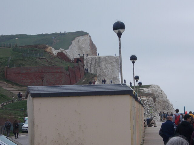
Hope Gap is a prominent coastal feature located in Sussex, England. It is classified as a headland or point due to its geographical formation and distinctive characteristics. Situated along the eastern coastline, Hope Gap offers breathtaking views of the English Channel and is a popular destination for nature lovers and hikers.
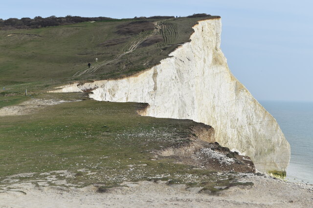
This coastal feature is formed by the erosion of the surrounding cliffs, resulting in a steep and jagged cliff face that juts out into the sea. The rugged beauty of the headland is further enhanced by its towering height, reaching up to 30 meters in some areas. The cliffs are composed of chalk, which gives them a distinctive white appearance that contrasts beautifully against the blue waters of the Channel.
Hope Gap is well-known for its dramatic coastal scenery and is often admired for its unique rock formations. The constant battering of the waves has carved out several caves and arches within the cliffs, adding to the allure of the area. Visitors can witness the power of the sea firsthand as it crashes against the rocks, creating a mesmerizing spectacle.
In addition to its natural beauty, Hope Gap also has historical significance. The headland was once home to an Iron Age fort, and remnants of this ancient settlement can still be seen today. The area is believed to have been inhabited for thousands of years, making it an intriguing location for history enthusiasts.
Overall, Hope Gap is a remarkable coastal feature that showcases the raw power of nature and offers a glimpse into the rich history of the Sussex region. Its stunning cliffs, unique rock formations, and panoramic views make it a must-visit destination for those seeking natural beauty and a sense of wonder.
If you have any feedback on the listing, please let us know in the comments section below.
Hope Gap Images
Images are sourced within 2km of 50.756171/0.13903044 or Grid Reference TV5097. Thanks to Geograph Open Source API. All images are credited.
![Cuckmere Valley walk [4] The track leads into the western section of Seaford Head Local Nature Reserve.
Starting from the car park on South Hill, the route leads south towards the sea then along the cliff tops to Hope Gap, Sleaford Head and Cuckmere Haven. The way is then inland along the bank of the Cuckmere River towards Exceat Bridge, before following the long-distance Vanguard Way back to the starting point. About 4 miles.](https://s0.geograph.org.uk/geophotos/07/22/50/7225024_9a7c0af0.jpg)
![Cuckmere Valley walk [5] Ewes and lambs in the field alongside the track.
Starting from the car park on South Hill, the route leads south towards the sea then along the cliff tops to Hope Gap, Sleaford Head and Cuckmere Haven. The way is then inland along the bank of the Cuckmere River towards Exceat Bridge, before following the long-distance Vanguard Way back to the starting point. About 4 miles.](https://s3.geograph.org.uk/geophotos/07/22/50/7225027_d71b0516.jpg)
![Cuckmere Valley walk [6] From the track this path heads toward the sea.
Starting from the car park on South Hill, the route leads south towards the sea then along the cliff tops to Hope Gap, Sleaford Head and Cuckmere Haven. The way is then inland along the bank of the Cuckmere River towards Exceat Bridge, before following the long-distance Vanguard Way back to the starting point. About 4 miles.](https://s2.geograph.org.uk/geophotos/07/22/50/7225030_4afb0304.jpg)
![Cuckmere Valley walk [7] The path continues to lead towards the sea.
Starting from the car park on South Hill, the route leads south towards the sea then along the cliff tops to Hope Gap, Sleaford Head and Cuckmere Haven. The way is then inland along the bank of the Cuckmere River towards Exceat Bridge, before following the long-distance Vanguard Way back to the starting point. About 4 miles.](https://s0.geograph.org.uk/geophotos/07/22/50/7225032_4efb3364.jpg)
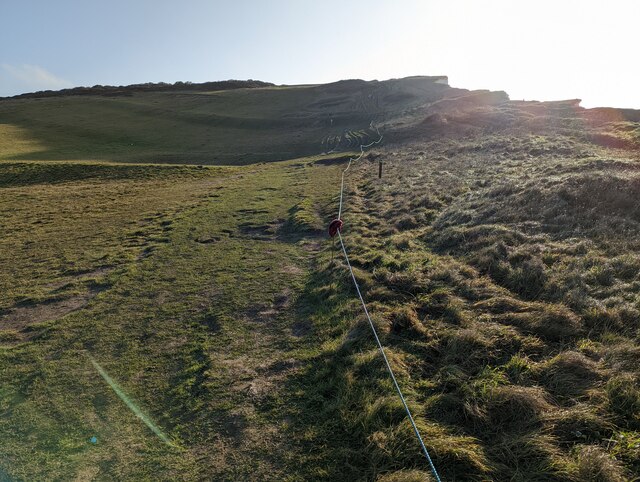
![Cuckmere Valley walk [8] At the junction of the paths there are three ways to go. This way heads east along the cliff edge towards Hope Gap.
Starting from the car park on South Hill, the route leads south towards the sea then along the cliff tops to Hope Gap, Sleaford Head and Cuckmere Haven. The way is then inland along the bank of the Cuckmere River towards Exceat Bridge, before following the long-distance Vanguard Way back to the starting point. About 4 miles.](https://s3.geograph.org.uk/geophotos/07/22/50/7225035_572d7d05.jpg)
![Cuckmere Valley walk [9] At the junction of the paths there are three ways to go. This way leads north towards South Hill Barn.
Starting from the car park on South Hill, the route leads south towards the sea then along the cliff tops to Hope Gap, Sleaford Head and Cuckmere Haven. The way is then inland along the bank of the Cuckmere River towards Exceat Bridge, before following the long-distance Vanguard Way back to the starting point. About 4 miles.](https://s2.geograph.org.uk/geophotos/07/22/50/7225042_eec5a09a.jpg)
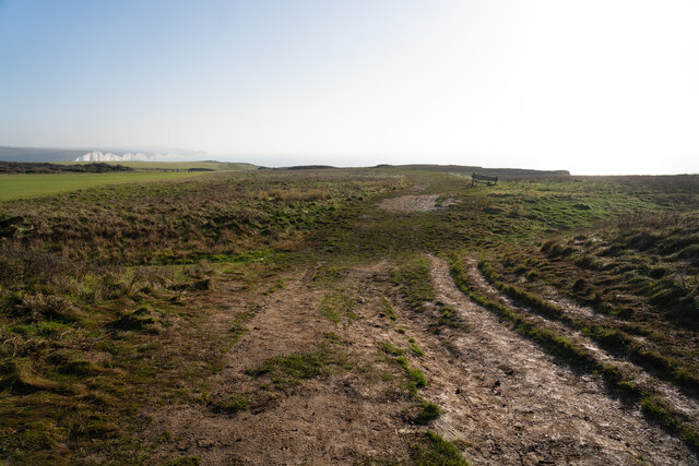
![Cuckmere Valley walk [10] At the junction of the paths there are three ways to go. This way leads west towards Seaford.
Starting from the car park on South Hill, the route leads south towards the sea then along the cliff tops to Hope Gap, Sleaford Head and Cuckmere Haven. The way is then inland along the bank of the Cuckmere River towards Exceat Bridge, before following the long-distance Vanguard Way back to the starting point. About 4 miles.](https://s2.geograph.org.uk/geophotos/07/22/50/7225046_3efc4494.jpg)
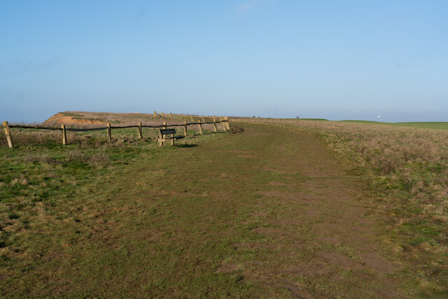
![Cuckmere Valley walk [11] An information board at the junction of the paths.
Starting from the car park on South Hill, the route leads south towards the sea then along the cliff tops to Hope Gap, Sleaford Head and Cuckmere Haven. The way is then inland along the bank of the Cuckmere River towards Exceat Bridge, before following the long-distance Vanguard Way back to the starting point. About 4 miles.](https://s0.geograph.org.uk/geophotos/07/22/50/7225048_9a1ec4c2.jpg)
Hope Gap is located at Grid Ref: TV5097 (Lat: 50.756171, Lng: 0.13903044)
Administrative County: East Sussex
District: Lewes
Police Authority: Sussex
What 3 Words
///paramedic.goat.blubber. Near Seaford, East Sussex
Nearby Locations
Related Wikis
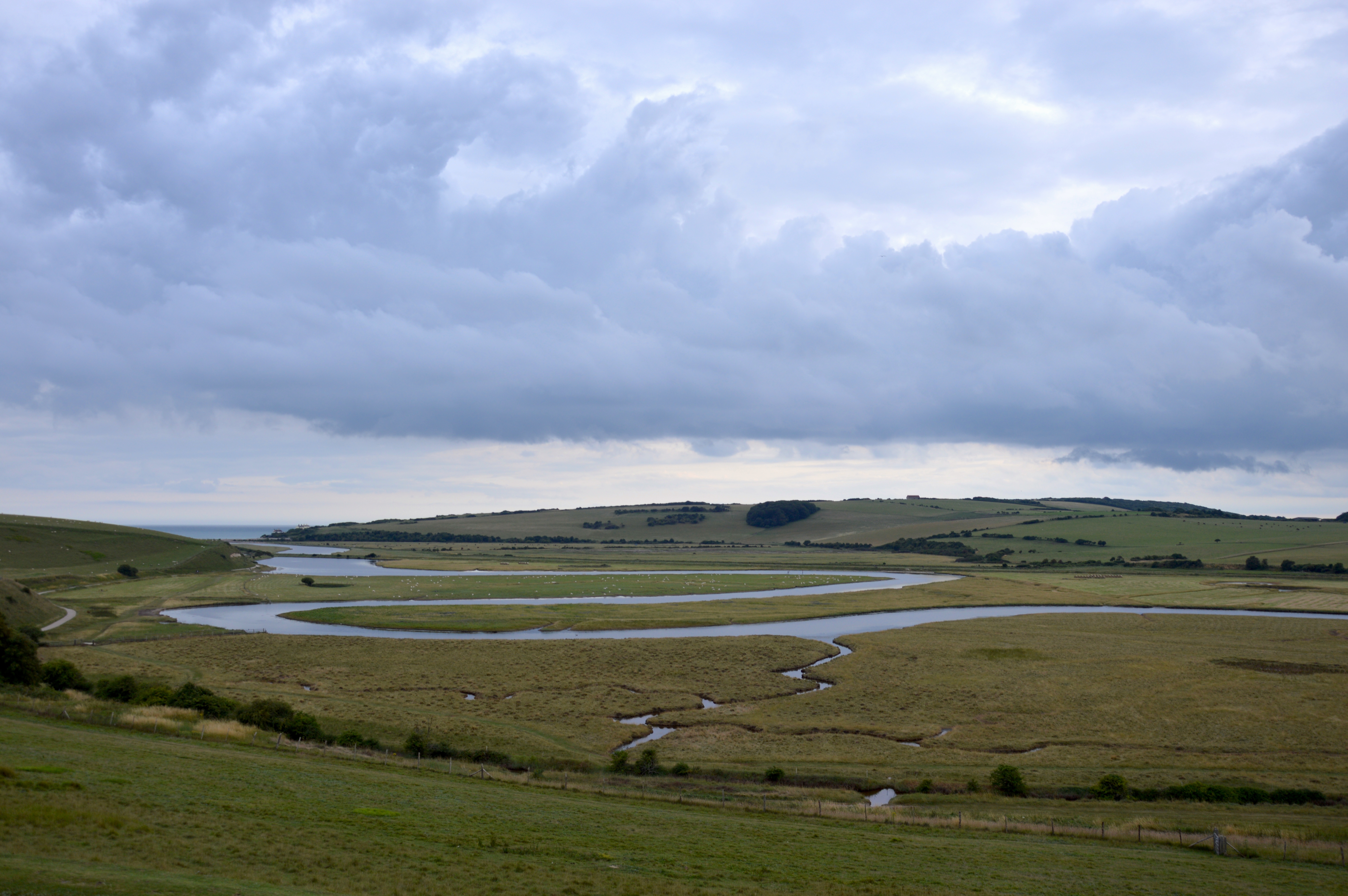
River Cuckmere
The River Cuckmere rises near Heathfield in East Sussex, England on the southern slopes of the Weald. The name of the river probably comes from an Old...

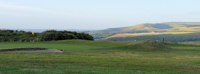
Seaford Head
Seaford Head is a 150.2-hectare (371-acre) Local Nature Reserve east of Seaford in East Sussex. It is part of Seaford to Beachy Head Site of Special Scientific...

Cuckmere Haven
Cuckmere Haven (also known as the Cuckmere estuary) is an area of flood plains in Sussex, England, where the river Cuckmere meets the English Channel between...
Seven Sisters, East Sussex
The Seven Sisters are a series of chalk sea cliffs on the English Channel coast, and are a stretch of the sea-eroded section of the South Downs range of...

Ladycross School
Ladycross was a Catholic preparatory school in Seaford, East Sussex. It was founded in 1891 in Briely Road, Bournemouth, and moved to a purpose-built school...

Seaford Head School
Seaford Head School (formerly Seaford Head Community College), in Seaford, East Sussex, England, is a co-educational secondary school with academy status...
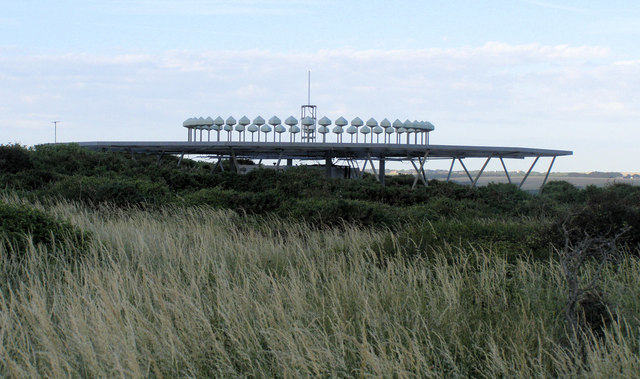
RAF Friston
Royal Air Force Friston or more simply RAF Friston is a former Royal Air Force satellite station and Emergency Landing Ground located in East Sussex, England...

Seaford Museum
The Seaford Museum and Heritage Society is a local history museum located at the Martello Tower in East Sussex, England. It was established in 1979 and...
Nearby Amenities
Located within 500m of 50.756171,0.13903044Have you been to Hope Gap?
Leave your review of Hope Gap below (or comments, questions and feedback).