Brass Point

Coastal Feature, Headland, Point in Sussex Wealden

England

Brass Point

Cliffs above Cuckmere Haven Looking down from the first of the Seven Sisters, above the mouth of the river Cuckmere
Cliffs above Cuckmere Haven Credit: Noel Jenkins

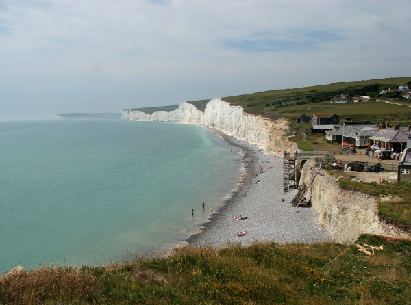
Brass Point, located in Sussex, is a prominent coastal feature that is classified as a headland or point. Situated along the southern coast of England, it is known for its stunning natural beauty and unique geological formations.

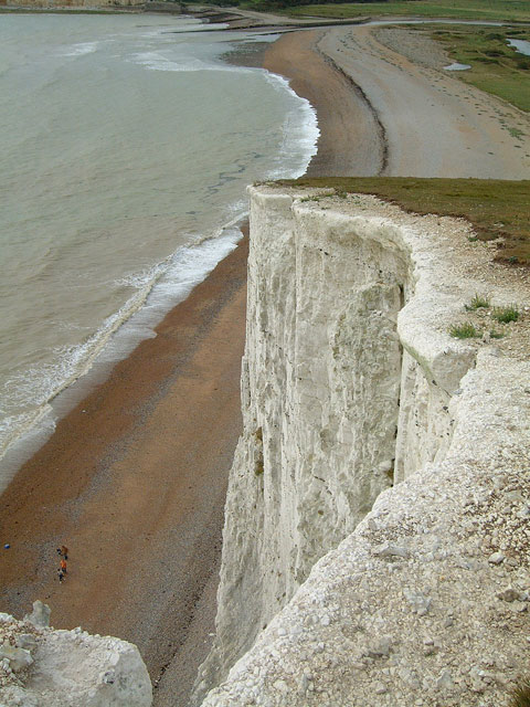
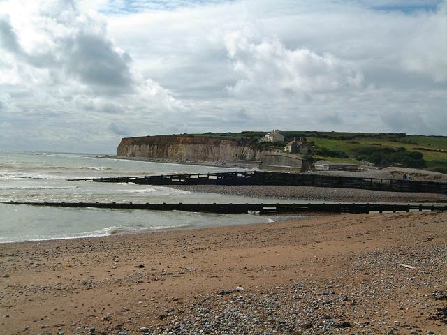
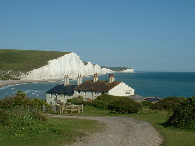
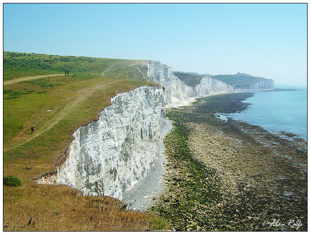
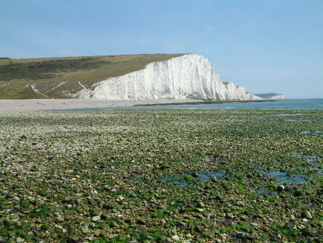
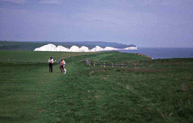
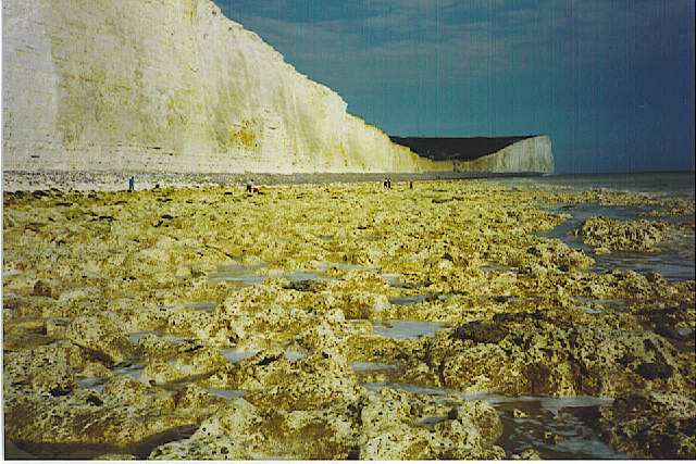
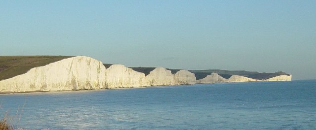
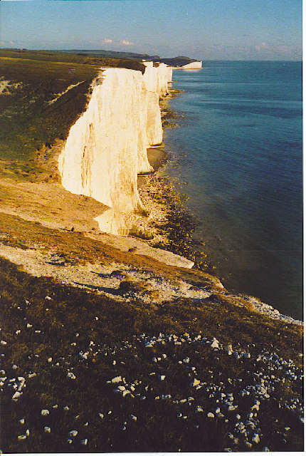
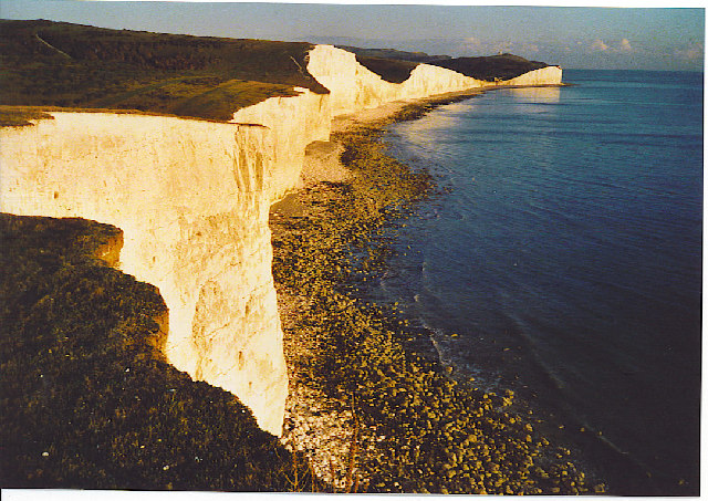
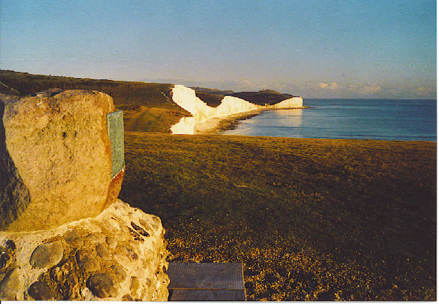
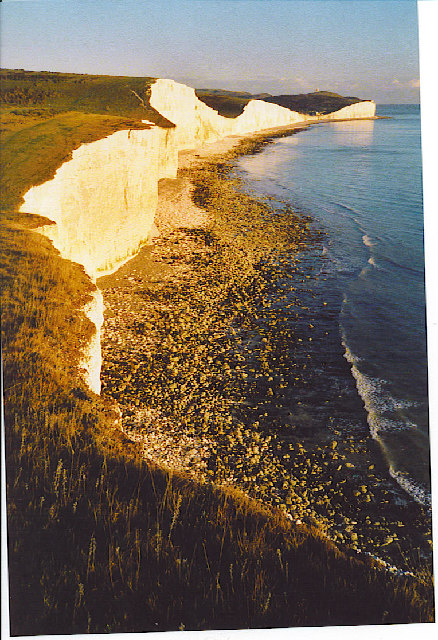
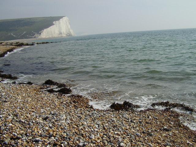
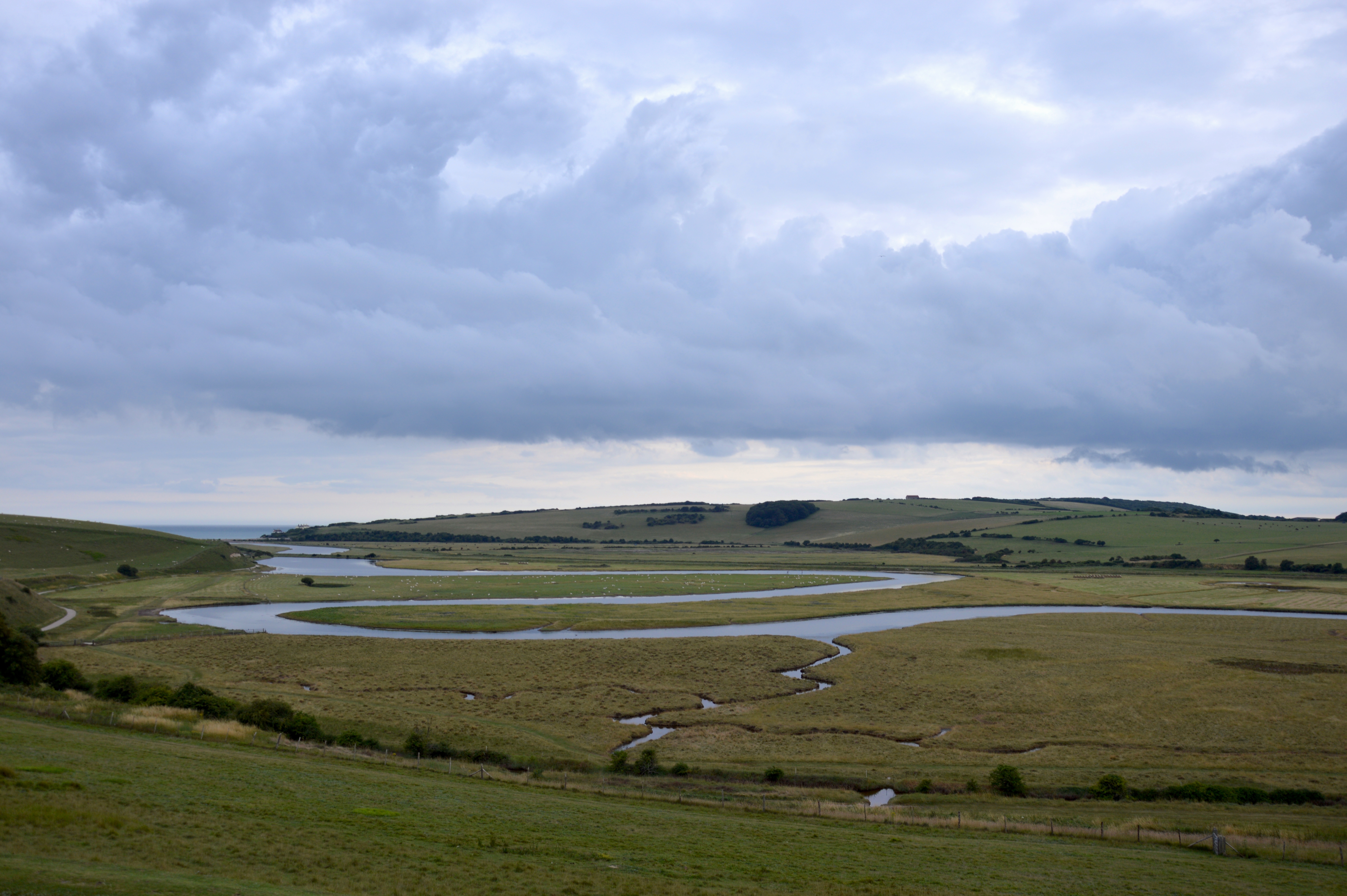
One of the defining characteristics of Brass Point is its rugged and rocky coastline. The point extends out into the English Channel, providing breathtaking panoramic views of the surrounding ocean. The cliffs that line the headland are composed of a variety of sedimentary rocks, including chalk and limestone, which have been shaped and eroded by the relentless force of the waves over thousands of years.

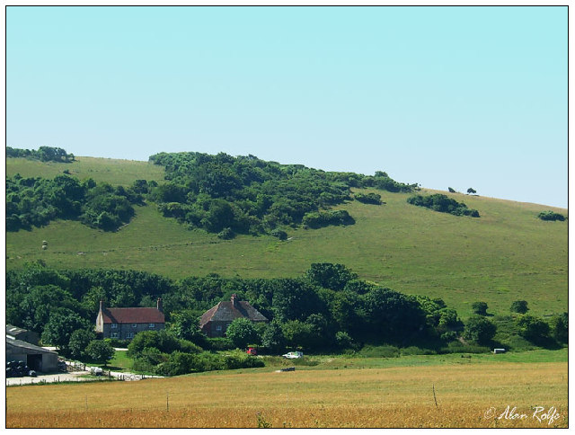
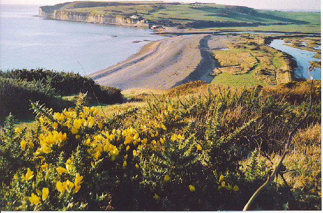
The area surrounding Brass Point is also rich in flora and fauna. The headland is home to a diverse range of plant species, including wildflowers and grasses that thrive in the coastal environment. Marine life is also abundant, with numerous species of fish, birds, and seals making the surrounding waters their home.

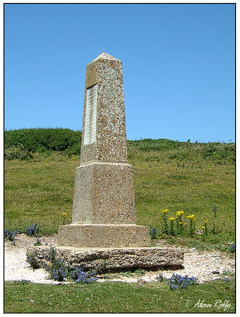
In addition to its natural beauty, Brass Point has historical significance as well. The headland has been inhabited for centuries, and remnants of ancient settlements can be found in the area. The strategic location of the point made it an ideal site for fortifications, and remnants of military structures can still be seen today.

Overall, Brass Point in Sussex is a captivating coastal feature that combines stunning natural beauty, unique geology, and a rich historical past. Its rugged cliffs, diverse flora and fauna, and historical significance make it a must-visit destination for nature enthusiasts, history buffs, and anyone seeking to immerse themselves in the beauty of the British coastline.

If you have any feedback on the listing, please let us know in the comments section below.

Brass Point Images

Images are sourced within 2km of 50.751655/0.1731476 or Grid Reference TV5396. Thanks to Geograph Open Source API. All images are credited.

Cliffs above Cuckmere Haven Looking down from the first of the Seven Sisters, above the mouth of the river Cuckmere
Cliffs above Cuckmere Haven
Looking down from the first of the Seven Sisters, above the mouth of the river Cuckmere
Cuckmere Haven The mouth of the Cuckmere
Cuckmere Haven
The mouth of the Cuckmere
Coastguard Cottages Coastguard cottages with The Seven Sisters beyond. What an idyllic location for retirement?
Coastguard Cottages
Coastguard cottages with The Seven Sisters beyond. What an idyllic location for retirement?
Michel Dean monument In the last dip on the Seven Sisters before Birling Gap. The monument is mark the gift of the land to the National Trust.
Michel Dean monument
In the last dip on the Seven Sisters before Birling Gap. The monument is mark the gift of the land to the National Trust.
On the Seven Sisters looking east The old lighthouse of Belle Tout can be seen right on the distant cliff. This was moved some 16 metres or so back from the cliff edge in 1999 and may have to be moved again within the next 50 years.
On the Seven Sisters looking east
The old lighthouse of Belle Tout can be seen right on the distant cliff. This was moved some 16 metres or so back from the cliff edge in 1999 and may have to be moved again within the next 50 years.
Farm at Foxhole Close to the Seven Sisters Country Park.
Farm at Foxhole
Close to the Seven Sisters Country Park.
Cliff End, E side of Cuckmere Haven Cuckmere Haven lies on the coast at the point where the South Downs meet the sea. Cliff End marks the western end of the famous Seven Sisters chalk cliffs.
Cliff End, E side of Cuckmere Haven
Cuckmere Haven lies on the coast at the point where the South Downs meet the sea. Cliff End marks the western end of the famous Seven Sisters chalk cliffs.
The Seven Sisters View of the Seven Sisters from the cliff path.  Could not get any closer on this occasion because of the foot and mouth restrictions.
The Seven Sisters
View of the Seven Sisters from the cliff path. Could not get any closer on this occasion because of the foot and mouth restrictions.
Birling Gap Birling Gap hotel, beach and lifeboat, facing to the west.
Birling Gap
Birling Gap hotel, beach and lifeboat, facing to the west.
The Seven Sisters - Foreshore at Low Tide Below towering chalk-white cliffs is an eroded chalk foreshore pavement at low tide. The trapped seawater is milky white too. In the distance, the dip in the cliffline is Birling Gap.
The Seven Sisters - Foreshore at Low Tide
Below towering chalk-white cliffs is an eroded chalk foreshore pavement at low tide. The trapped seawater is milky white too. In the distance, the dip in the cliffline is Birling Gap.
The Seven Sisters The nearest chalk cliff is just to the east of Cuckmere Haven in square TV5297. The Seven Sisters extend eastwards to Birling Gap in square TV5595.
The Seven Sisters
The nearest chalk cliff is just to the east of Cuckmere Haven in square TV5297. The Seven Sisters extend eastwards to Birling Gap in square TV5595.
Cuckmere Haven from Cliff End Taken from the end of the Seven Sisters, looking west over Cuckmere Haven to Seaford Head. The Haven has a distinctive shingle bar through which the meandering Cuckmere reaches the sea.
Cuckmere Haven from Cliff End
Taken from the end of the Seven Sisters, looking west over Cuckmere Haven to Seaford Head. The Haven has a distinctive shingle bar through which the meandering Cuckmere reaches the sea.
The Seven Sisters from Cliff End. Looking east towards Birling Gap. The cliff face is steadily moving inland as marine undercutting erodes the soft chalk.
The Seven Sisters from Cliff End.
Looking east towards Birling Gap. The cliff face is steadily moving inland as marine undercutting erodes the soft chalk.
Nearly High Tide at Crowlink, Seven Sisters. Chalk cliffs undergoing steady erosion.
Nearly High Tide at Crowlink, Seven Sisters.
Chalk cliffs undergoing steady erosion.
Monument at Crowlink, Seven Sisters. William Charles Campbell Monument on the South Downs Way, overlooking chalk cliffs.
Monument at Crowlink, Seven Sisters.
William Charles Campbell Monument on the South Downs Way, overlooking chalk cliffs.
Seven Sisters and Foreshore. Taken from near Crowlink, looking towards Birling Gap.
Seven Sisters and Foreshore.
Taken from near Crowlink, looking towards Birling Gap.
Cuckmere Haven East Sussex Cuckmere Haven looking east across river mouth towards Cliff End and Haven Brow one of the Seven Sisters
Cuckmere Haven East Sussex
Cuckmere Haven looking east across river mouth towards Cliff End and Haven Brow one of the Seven Sisters
Village pond, Friston Looking eastwards towards Friston church. The A259 is to the left. The sheltered side of the pond is still frozen and has some snow covering the verges.
Village pond, Friston
Looking eastwards towards Friston church. The A259 is to the left. The sheltered side of the pond is still frozen and has some snow covering the verges.
Show me another place!

Brass Point is located at Grid Ref: TV5396 (Lat: 50.751655, Lng: 0.1731476)

Administrative County: East Sussex

District: Wealden

Police Authority: Sussex

What 3 Words

///foiled.poorly.foil. Near Friston, East Sussex

Related Wikis

Seaford to Beachy Head

Seaford to Beachy Head is a 1,108.7-hectare (2,740-acre) biological and geological Site of Special Scientific Interest which stretches from Seaford to...

Seven Sisters, East Sussex

The Seven Sisters are a series of chalk sea cliffs on the English Channel coast, and are a stretch of the sea-eroded section of the South Downs range of...

RAF Friston

Royal Air Force Friston or more simply RAF Friston is a former Royal Air Force satellite station and Emergency Landing Ground located in East Sussex, England...

River Cuckmere

The River Cuckmere rises near Heathfield in East Sussex, England on the southern slopes of the Weald. The name of the river probably comes from an Old...

East Dean and Friston

East Dean and Friston is a civil parish in the Wealden District of East Sussex, England.The two villages in the parish are in a dry valley on the South...

SM UB-121

SM UB-121 was a German Type UB III submarine or U-boat in the German Imperial Navy (German: Kaiserliche Marine) during World War I. She was commissioned...

Cuckmere Haven

Cuckmere Haven (also known as the Cuckmere estuary) is an area of flood plains in Sussex, England, where the river Cuckmere meets the English Channel between...

Seven Sisters Sheep Centre

The Seven Sisters Sheep Centre was a farm near East Dean, in the Seven Sisters Country Park of the South Downs. It held a large collection of about 50...

Nearby Amenities

Located within 500m of 50.751655,0.1731476
Barrier: kissing_gate
Foot: yes
Material: wood
Lat/Long: 50.7524087/0.1728842
Seven Sisters
Direction: 130
Name Ko: 세븐시스터즈
Tourism: viewpoint
Wikidata: Q1754640
Wikipedia: en:Seven Sisters, East Sussex
Lat/Long: 50.7518331/0.1735178
Brass Point
Information: board
Operator: National Trust
Tourism: information
Lat/Long: 50.7524242/0.1730663
Flagstaff
Natural: cliff
Lat/Long: 50.7498944/0.1796365
Brass Point
Natural: cliff
Lat/Long: 50.7520992/0.1729451
Barrier: entrance
Lat/Long: 50.7523978/0.1735434
The data included in this document is from www.openstreetmap.org. The data is made available under ODbL.

Have you been to Brass Point?

Leave your review of Brass Point below (or comments, questions and feedback).