Hope Bottom
Valley in Sussex Lewes
England
Hope Bottom
Hope Bottom is a charming village nestled in the picturesque Sussex Valley in southern England. Located in the county of Sussex, it is surrounded by rolling hills and lush green countryside, making it an idyllic destination for nature lovers and those seeking a peaceful retreat.
The village is known for its quaint and traditional architecture, with charming cottages and stone houses lining its narrow streets. The local community takes great pride in preserving the village's historical character, and many of the buildings date back several centuries.
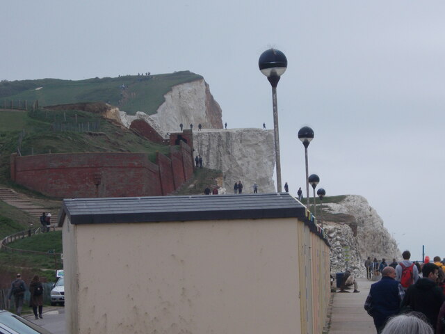
One of the highlights of Hope Bottom is its proximity to the South Downs National Park. This vast and breathtakingly beautiful park offers ample opportunities for outdoor activities such as hiking, cycling, and horseback riding. The park's diverse flora and fauna, including rare species of birds and wildflowers, attract nature enthusiasts from far and wide.
Despite its rural setting, Hope Bottom is well-connected to nearby towns and cities. The village has excellent transport links, with a nearby train station and easy access to major roads. This makes it an ideal base for exploring the wider Sussex area, including the vibrant city of Brighton and the historic town of Lewes.
In terms of amenities, Hope Bottom boasts a range of small shops, including a country store and a quaint tea room. There is also a village hall that hosts various community events throughout the year, fostering a strong sense of community spirit.
Overall, Hope Bottom offers a tranquil and picturesque setting, combined with convenient access to both natural beauty and urban attractions. It is a hidden gem in the heart of Sussex, attracting visitors with its timeless charm and serene atmosphere.
If you have any feedback on the listing, please let us know in the comments section below.
Hope Bottom Images
Images are sourced within 2km of 50.758773/0.13737669 or Grid Reference TV5097. Thanks to Geograph Open Source API. All images are credited.


![Cuckmere Valley walk [4] The track leads into the western section of Seaford Head Local Nature Reserve.
Starting from the car park on South Hill, the route leads south towards the sea then along the cliff tops to Hope Gap, Sleaford Head and Cuckmere Haven. The way is then inland along the bank of the Cuckmere River towards Exceat Bridge, before following the long-distance Vanguard Way back to the starting point. About 4 miles.](https://s0.geograph.org.uk/geophotos/07/22/50/7225024_9a7c0af0.jpg)
![Cuckmere Valley walk [5] Ewes and lambs in the field alongside the track.
Starting from the car park on South Hill, the route leads south towards the sea then along the cliff tops to Hope Gap, Sleaford Head and Cuckmere Haven. The way is then inland along the bank of the Cuckmere River towards Exceat Bridge, before following the long-distance Vanguard Way back to the starting point. About 4 miles.](https://s3.geograph.org.uk/geophotos/07/22/50/7225027_d71b0516.jpg)
![Cuckmere Valley walk [6] From the track this path heads toward the sea.
Starting from the car park on South Hill, the route leads south towards the sea then along the cliff tops to Hope Gap, Sleaford Head and Cuckmere Haven. The way is then inland along the bank of the Cuckmere River towards Exceat Bridge, before following the long-distance Vanguard Way back to the starting point. About 4 miles.](https://s2.geograph.org.uk/geophotos/07/22/50/7225030_4afb0304.jpg)
![Cuckmere Valley walk [7] The path continues to lead towards the sea.
Starting from the car park on South Hill, the route leads south towards the sea then along the cliff tops to Hope Gap, Sleaford Head and Cuckmere Haven. The way is then inland along the bank of the Cuckmere River towards Exceat Bridge, before following the long-distance Vanguard Way back to the starting point. About 4 miles.](https://s0.geograph.org.uk/geophotos/07/22/50/7225032_4efb3364.jpg)
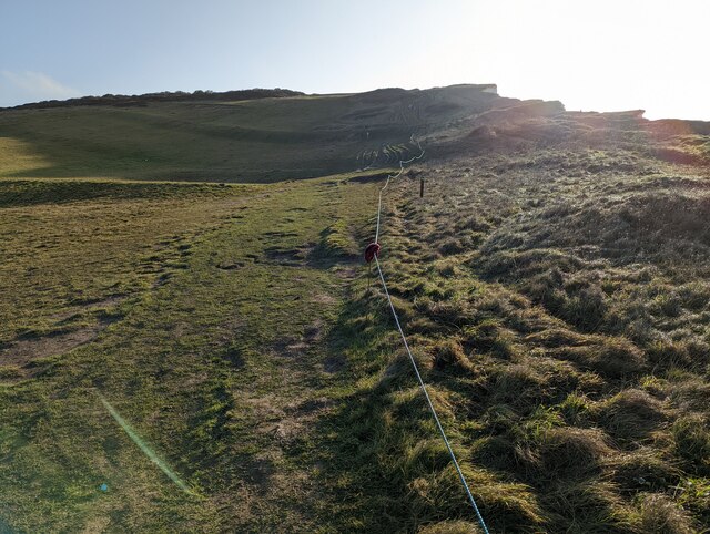
![Cuckmere Valley walk [8] At the junction of the paths there are three ways to go. This way heads east along the cliff edge towards Hope Gap.
Starting from the car park on South Hill, the route leads south towards the sea then along the cliff tops to Hope Gap, Sleaford Head and Cuckmere Haven. The way is then inland along the bank of the Cuckmere River towards Exceat Bridge, before following the long-distance Vanguard Way back to the starting point. About 4 miles.](https://s3.geograph.org.uk/geophotos/07/22/50/7225035_572d7d05.jpg)
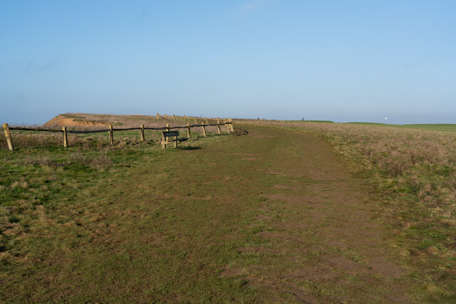
![Cuckmere Valley walk [9] At the junction of the paths there are three ways to go. This way leads north towards South Hill Barn.
Starting from the car park on South Hill, the route leads south towards the sea then along the cliff tops to Hope Gap, Sleaford Head and Cuckmere Haven. The way is then inland along the bank of the Cuckmere River towards Exceat Bridge, before following the long-distance Vanguard Way back to the starting point. About 4 miles.](https://s2.geograph.org.uk/geophotos/07/22/50/7225042_eec5a09a.jpg)
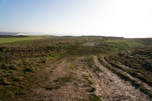
![Cuckmere Valley walk [10] At the junction of the paths there are three ways to go. This way leads west towards Seaford.
Starting from the car park on South Hill, the route leads south towards the sea then along the cliff tops to Hope Gap, Sleaford Head and Cuckmere Haven. The way is then inland along the bank of the Cuckmere River towards Exceat Bridge, before following the long-distance Vanguard Way back to the starting point. About 4 miles.](https://s2.geograph.org.uk/geophotos/07/22/50/7225046_3efc4494.jpg)
![Cuckmere Valley walk [11] An information board at the junction of the paths.
Starting from the car park on South Hill, the route leads south towards the sea then along the cliff tops to Hope Gap, Sleaford Head and Cuckmere Haven. The way is then inland along the bank of the Cuckmere River towards Exceat Bridge, before following the long-distance Vanguard Way back to the starting point. About 4 miles.](https://s0.geograph.org.uk/geophotos/07/22/50/7225048_9a1ec4c2.jpg)


Hope Bottom is located at Grid Ref: TV5097 (Lat: 50.758773, Lng: 0.13737669)
Administrative County: East Sussex
District: Lewes
Police Authority: Sussex
What 3 Words
///uniform.along.threaded. Near Seaford, East Sussex
Nearby Locations
Related Wikis

Seaford Head
Seaford Head is a 150.2-hectare (371-acre) Local Nature Reserve east of Seaford in East Sussex. It is part of Seaford to Beachy Head Site of Special Scientific...
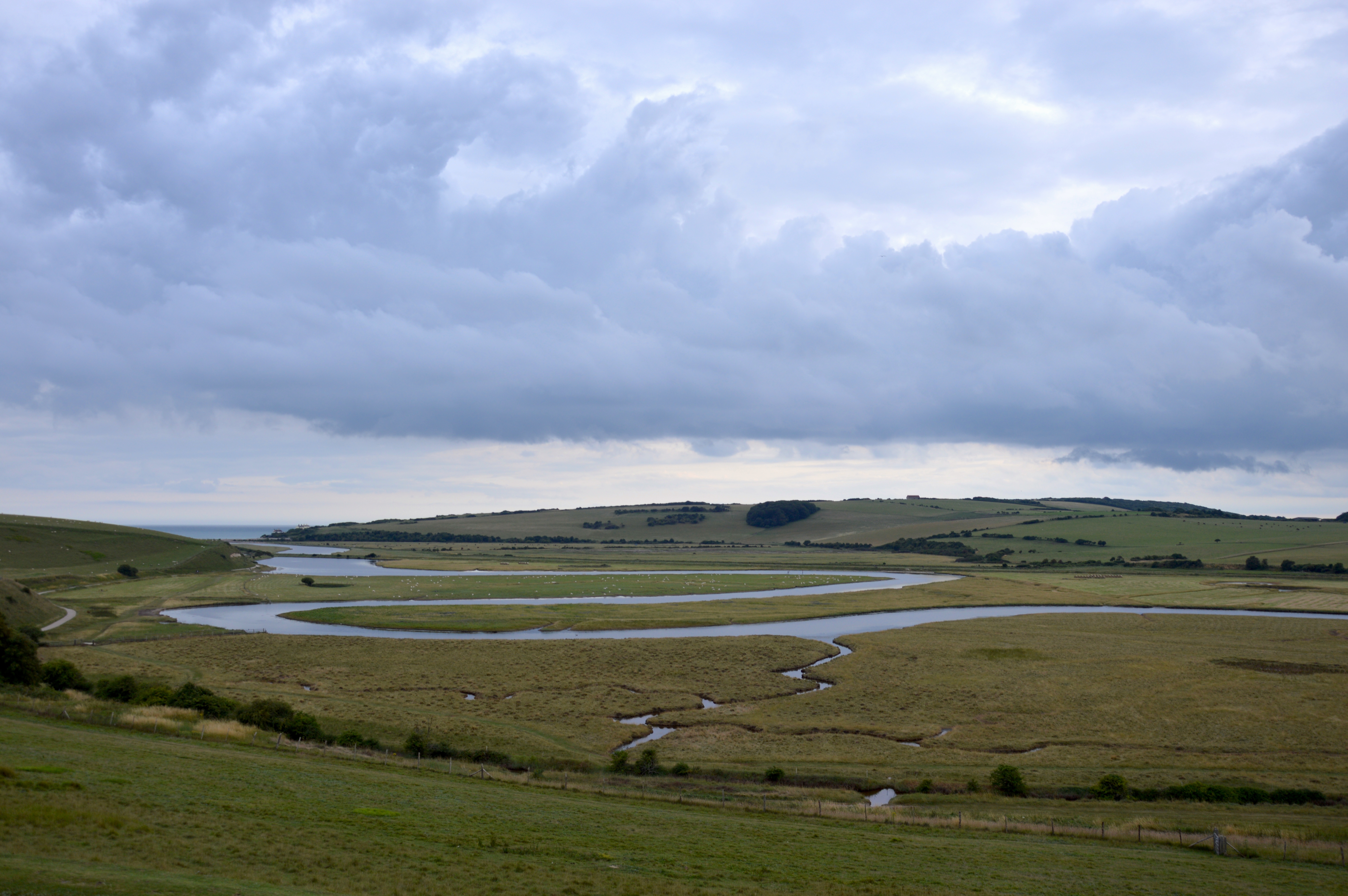
River Cuckmere
The River Cuckmere rises near Heathfield in East Sussex, England on the southern slopes of the Weald. The name of the river probably comes from an Old...

Cuckmere Haven
Cuckmere Haven (also known as the Cuckmere estuary) is an area of flood plains in Sussex, England, where the river Cuckmere meets the English Channel between...
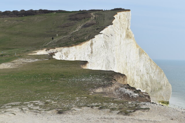
Seven Sisters, East Sussex
The Seven Sisters are a series of chalk sea cliffs on the English Channel coast, and are a stretch of the sea-eroded section of the South Downs range of...
Nearby Amenities
Located within 500m of 50.758773,0.13737669Have you been to Hope Bottom?
Leave your review of Hope Bottom below (or comments, questions and feedback).