King Rock

Coastal Feature, Headland, Point in Yorkshire

England

King Rock

Pond, Old Fall Plantation
Pond, Old Fall Plantation Credit: Mick Garratt

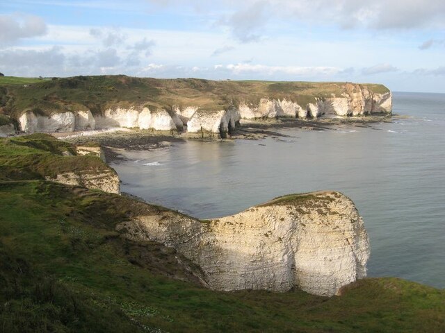
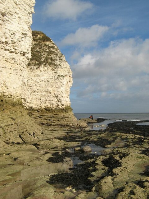
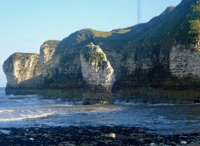
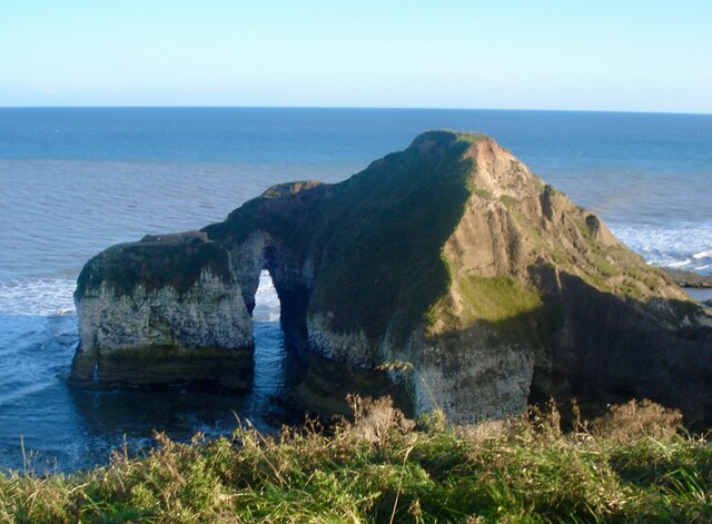
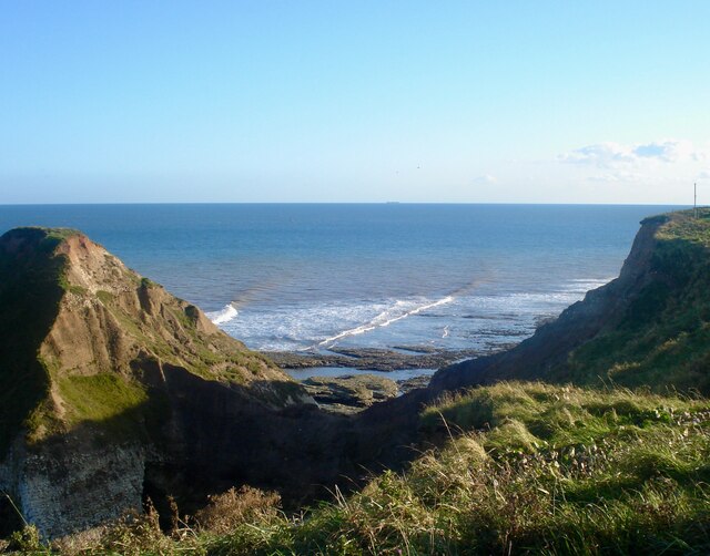
King Rock is a prominent coastal feature located in Yorkshire, England. It stands proudly as a headland, jutting out into the North Sea, and is known for its distinctive shape resembling a crown, hence the name. Situated in the northern part of the county, King Rock is a popular landmark amongst locals and tourists alike.

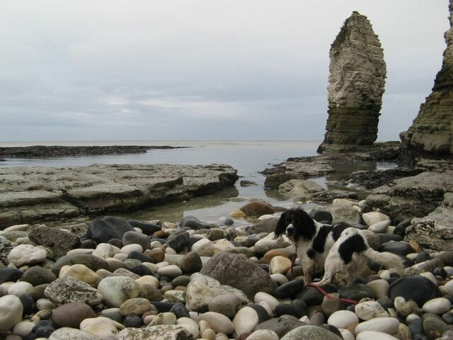
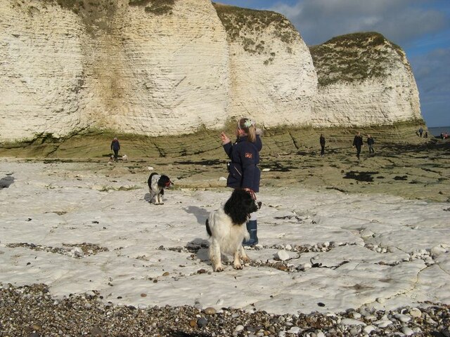
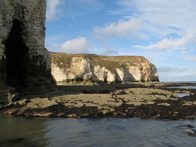
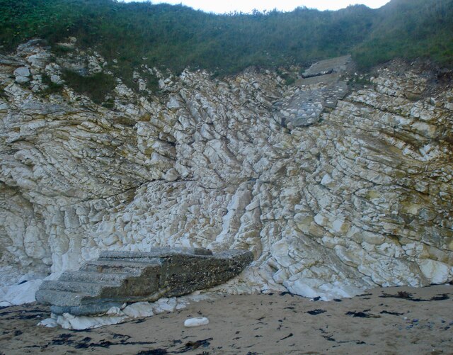
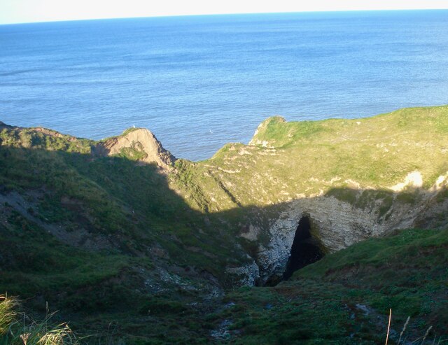
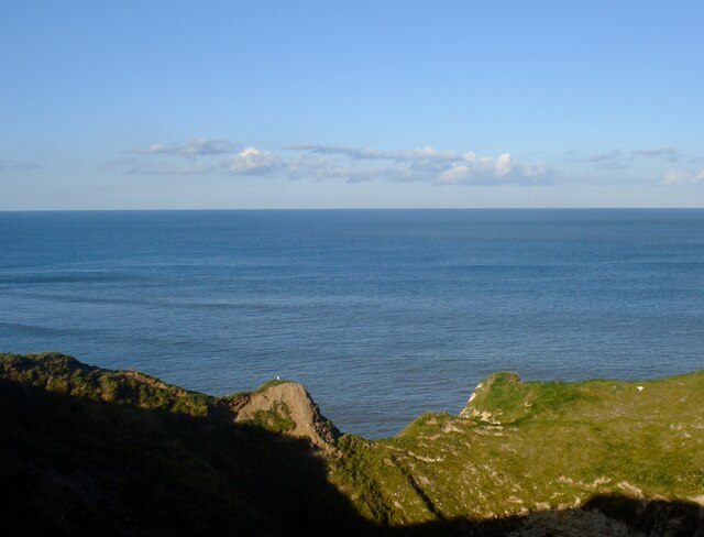
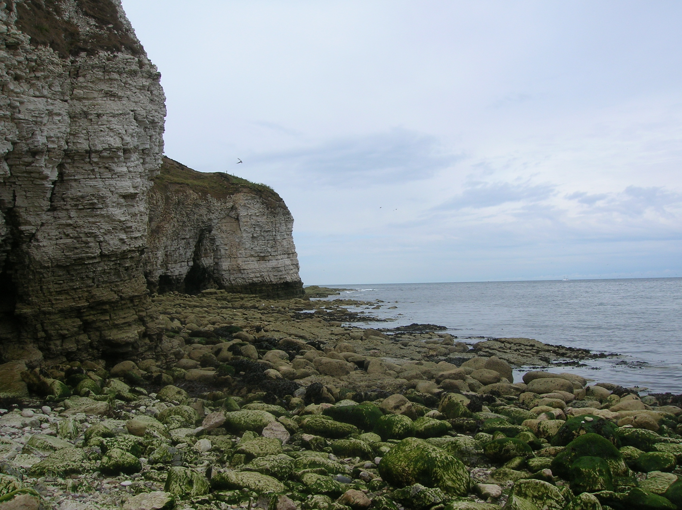
This impressive point is composed of rugged cliffs that rise majestically from the sea, offering stunning panoramic views of the surrounding coastal landscape. The cliffs are predominantly made up of sedimentary rocks, displaying layers of various colors and textures, giving the area a unique geological character.

The headland is characterized by its diverse wildlife and rich biodiversity. It serves as a vital habitat for numerous seabirds, including gulls, puffins, and cormorants, which nest and roost in the crevices and ledges along the cliffs. The surrounding waters are home to a variety of marine life, such as seals and dolphins, which can often be spotted swimming in the sea.

In addition to its natural beauty, King Rock also holds historical significance. It has witnessed the passing of centuries and has been a witness to various maritime activities and trade routes throughout history. The headland stands as a reminder of the region's maritime heritage and the important role it played in the growth and development of the local communities.

Overall, King Rock is a captivating coastal feature in Yorkshire, known for its distinctive crown-like shape, breathtaking views, and rich ecological diversity. It is a place where nature, history, and beauty converge, offering visitors an unforgettable experience.

If you have any feedback on the listing, please let us know in the comments section below.

King Rock Images

Images are sourced within 2km of 54.128342/-0.095133091 or Grid Reference TA2471. Thanks to Geograph Open Source API. All images are credited.
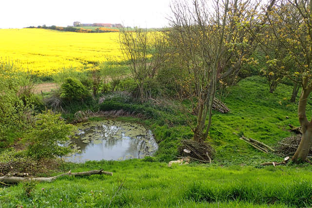
Pond, Old Fall Plantation
Fenced area inside New [or Old] Fall Plantation The map says Old Fall, the owners say New Fall. To protect wildlife, visitors are asked to keep to the inner fenced area, or a separate perimeter path.
Fenced area inside New [or Old] Fall Plantation
The map says Old Fall, the owners say New Fall. To protect wildlife, visitors are asked to keep to the inner fenced area, or a separate perimeter path.
Selwicks Bay Chalk cliffs and Selwicks Bay by Flamborough Head.
Selwicks Bay
Chalk cliffs and Selwicks Bay by Flamborough Head.
Beach boulders Parts of the shore of Selwicks Bay have a surprising population of dark-coloured, or black boulders mingled with the obvious, white chalk. They are erratics of basalt which have been carried southwards from outcrops of the Whin Sill and deposited in boulder clay which lies on top of the chalk. Subsequent erosion has seen them fall to the beach platform. On this moody day with grey skies I was amused by the way that my assistant was almost perfectly camouflaged.
Beach boulders
Parts of the shore of Selwicks Bay have a surprising population of dark-coloured, or black boulders mingled with the obvious, white chalk. They are erratics of basalt which have been carried southwards from outcrops of the Whin Sill and deposited in boulder clay which lies on top of the chalk. Subsequent erosion has seen them fall to the beach platform. On this moody day with grey skies I was amused by the way that my assistant was almost perfectly camouflaged.
Chalk platform Flat-lying chalk strata have eroded into a smooth, white platform which is unlike any which I have encountered before. At lower levels on the beach, algae have attached, as can be seen in the background and on the cliffs, but this part of the shore appears to be scoured by powerful waves carrying shingle.
Chalk platform
Flat-lying chalk strata have eroded into a smooth, white platform which is unlike any which I have encountered before. At lower levels on the beach, algae have attached, as can be seen in the background and on the cliffs, but this part of the shore appears to be scoured by powerful waves carrying shingle.
Cliffs by Molk Hole Chalk cliffs and beach platform. Young, soft rocks such as these are not my normal subject, and it was very interesting to examine these chalk outcrops. In fact, diagenetic variation means that the rock is actually harder here than in other places with this archetypal English rock. Cliffs here comprise the Flamborough Chalk Formation, which is notably free of flint. The underlying Burnham Chalk Formation, which is found on the wave-cut platform at the south of the bay, is locally rich in flints.
Cliffs by Molk Hole
Chalk cliffs and beach platform. Young, soft rocks such as these are not my normal subject, and it was very interesting to examine these chalk outcrops. In fact, diagenetic variation means that the rock is actually harder here than in other places with this archetypal English rock. Cliffs here comprise the Flamborough Chalk Formation, which is notably free of flint. The underlying Burnham Chalk Formation, which is found on the wave-cut platform at the south of the bay, is locally rich in flints.
Wave-cut platform Gently-inclined chalk strata have eroded into an extensive wave-cut platform, backed by cliffs with numerous caves.
Wave-cut platform
Gently-inclined chalk strata have eroded into an extensive wave-cut platform, backed by cliffs with numerous caves.
Expanding the Holiday Village at Flamborough
Track off Ogle Road
Track off Ogle Road
Molk Hole, Selwicks Bay Molk Hole in Selwicks Bay, from the Flamborough Head car park
Molk Hole, Selwicks Bay
Molk Hole in Selwicks Bay, from the Flamborough Head car park
Flamborough Head Lighthouse The Flamborough Head Lighthouse was built in 1806 at a cost of £8,000, and marks the Flamborough Headland
Flamborough Head Lighthouse
The Flamborough Head Lighthouse was built in 1806 at a cost of £8,000, and marks the Flamborough Headland
Weathered steps Weathered steps between Selwicks Bay and Flamborough Head car park
Weathered steps
Weathered steps between Selwicks Bay and Flamborough Head car park
Selwicks Bay A stack in front of Pigeon Hole coastline
Selwicks Bay
A stack in front of Pigeon Hole coastline
Pigeon Hole Caves Pigeon Hole Caves from Headland Walk
Pigeon Hole Caves
Pigeon Hole Caves from Headland Walk
Pigeon Hole Pigeon Hole from Headland Walk
Pigeon Hole
Pigeon Hole from Headland Walk
Green Stacks Pinnacle Green Stacks Pinnacle from Headland Walk
Green Stacks Pinnacle
Green Stacks Pinnacle from Headland Walk
High Stacks High Stacks from Headland Walk
High Stacks
High Stacks from Headland Walk
Cliffs north of Flamborough Head
Show me another place!

King Rock is located at Grid Ref: TA2471 (Lat: 54.128342, Lng: -0.095133091)

Division: East Riding

Unitary Authority: East Riding of Yorkshire

Police Authority: Humberside

What 3 Words

///downs.quickly.replaying. Near Flamborough, East Yorkshire

Related Wikis

Flamborough Head

Flamborough Head () is a promontory, 8 miles (13 km) long on the Yorkshire coast of England, between the Filey and Bridlington bays of the North Sea. It...

Flamborough

Flamborough is a village and civil parish in the East Riding of Yorkshire, England. It is situated approximately 4 miles (6 km) north-east of Bridlington...

Flamborough Lifeboat Station

Flamborough Lifeboat Station is a Royal National Lifeboat Institution (RNLI) lifeboat station located at Flamborough in the East Riding of Yorkshire, England...

Battle of Flamborough Head

The Battle of Flamborough Head was a naval battle that took place on 23 September 1779 in the North Sea off the coast of Yorkshire between a combined Franco...

Nearby Amenities

Located within 500m of 54.128342,-0.095133091
Bird hide
Tourism: viewpoint
Lat/Long: 54.1239617/-0.0951374
Direction: 225
Information: board
Tourism: information
Lat/Long: 54.1264072/-0.0940895
Breil Nook
Tourism: viewpoint
Lat/Long: 54.1279734/-0.0940211
Access: no
Barrier: stile
Foot: permissive
Material: woodcom.visualstudio.code-oss
Lat/Long: 54.1263954/-0.0940553
Access: no
Barrier: stile
Foot: permissive
Lat/Long: 54.126963/-0.0957633
Direction: 225
Information: board
Tourism: information
Lat/Long: 54.1263706/-0.0940096
The data included in this document is from www.openstreetmap.org. The data is made available under ODbL.

Have you been to King Rock?

Leave your review of King Rock below (or comments, questions and feedback).