Carlin Geo

Coastal Feature, Headland, Point in Orkney

Scotland

Carlin Geo

Sanday ferry passing the Green Holms, from the air
Sanday ferry passing the Green Holms, from the air Credit: Mike Pennington

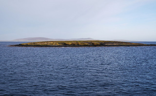
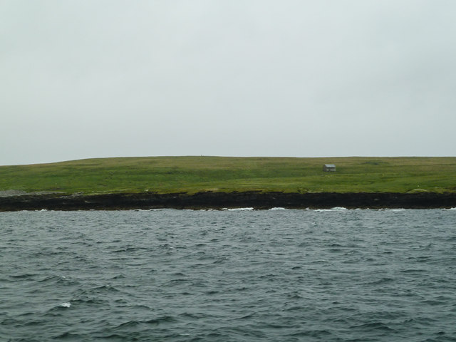
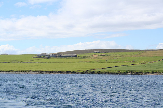
Carlin Geo is a prominent coastal feature located on the island of Orkney, Scotland. It is specifically situated on the eastern coast of the island, near the village of Birsay. Carlin Geo is classified as a headland or point, jutting out into the North Sea.

The name "Carlin Geo" is derived from the Old Norse language, with "Carlin" meaning "witch" and "Geo" meaning "inlet" or "cove." This name is believed to have originated from local folklore and legends surrounding the area.

Carlin Geo is known for its rugged and dramatic cliffs, which rise steeply from the rocky shoreline. The headland offers breathtaking views of the North Sea, with its crashing waves and rocky outcrops. The cliffs are composed of sandstone and shale, displaying layers of sedimentary rock formations that have been shaped by erosion over centuries.

The area surrounding Carlin Geo is rich in wildlife and is a popular spot for birdwatching. Visitors can often spot various seabirds, including fulmars, guillemots, and kittiwakes, nesting on the cliffs. The coastal waters are also home to seals and occasionally dolphins, adding to the natural beauty of the location.

Carlin Geo is accessible to the public and can be reached via a coastal path from Birsay. The headland is a popular destination for photographers, nature enthusiasts, and those seeking a peaceful and scenic coastal walk. It is a significant and cherished landmark in the Orkney archipelago, showcasing the stunning coastal landscapes that the region is renowned for.

If you have any feedback on the listing, please let us know in the comments section below.

Carlin Geo Images

Images are sourced within 2km of 59.132788/-2.8265141 or Grid Reference HY5227. Thanks to Geograph Open Source API. All images are credited.

Sanday ferry passing the Green Holms, from the air
Muckle Green Holm View from Whiteness Taing to the island.
Muckle Green Holm
View from Whiteness Taing to the island.
Dwelling on Muckle Green Holm This appears to be the only dwelling on the island, albeit long abandoned. It is to the west of the trig point and appears from aerial imagery to have landing pad just to the south of the house.
Dwelling on Muckle Green Holm
This appears to be the only dwelling on the island, albeit long abandoned. It is to the west of the trig point and appears from aerial imagery to have landing pad just to the south of the house.
Sound of the Green Holms Passing by Muckle Green Holm on route to Kirkwall.
Sound of the Green Holms
Passing by Muckle Green Holm on route to Kirkwall.
Sound of the Green Holms Passing Muckle Green Holm to the left and Little Green Holm to the right on the way back to Kirkwall.
Sound of the Green Holms
Passing Muckle Green Holm to the left and Little Green Holm to the right on the way back to Kirkwall.
Little Green Holm Looking roughly NW, with Rousay in the background.
Little Green Holm
Looking roughly NW, with Rousay in the background.
Trig Point, Muckle Green Holm Sitting above the cliffs and caves.
Trig Point, Muckle Green Holm
Sitting above the cliffs and caves.
Near Carlin Geo The northern end of Muckle Green Holm. Directly beyond on the horizon the round tower of the norse church on Egilsay can just be made out. The ferry we were heading north on made an almost right angled turn here out into the oncoming tidal current, which took us southwards, across the Fall of Warness, to near War Ness.
Near Carlin Geo
The northern end of Muckle Green Holm. Directly beyond on the horizon the round tower of the norse church on Egilsay can just be made out. The ferry we were heading north on made an almost right angled turn here out into the oncoming tidal current, which took us southwards, across the Fall of Warness, to near War Ness.
Sound of the Green Holms Looking NW through the gap between the two holms.
Sound of the Green Holms
Looking NW through the gap between the two holms.
Tidal energy generator, Eday Unique at this time. Works like a wind turbine, but with the ocean currents providing the energy. The circle in the middle, looking like an aero-engine is the bit that does the stuff. The contraption travels up and down the two legs just like a lift, and obviously sits on the sea floor when in use.
Tidal energy generator, Eday
Unique at this time. Works like a wind turbine, but with the ocean currents providing the energy. The circle in the middle, looking like an aero-engine is the bit that does the stuff. The contraption travels up and down the two legs just like a lift, and obviously sits on the sea floor when in use.
Show me another place!

Carlin Geo is located at Grid Ref: HY5227 (Lat: 59.132788, Lng: -2.8265141)

Unitary Authority: Orkney Islands

Police Authority: Highlands and Islands

What 3 Words

///vehicle.pinging.scooter. Near Backaland, Orkney Islands

Related Wikis

Muckle Green Holm

Muckle Green Holm is an uninhabited island in the North Isles of the Orkney archipelago in Scotland. It is roughly 28 hectares (0.11 sq mi) in extent and...
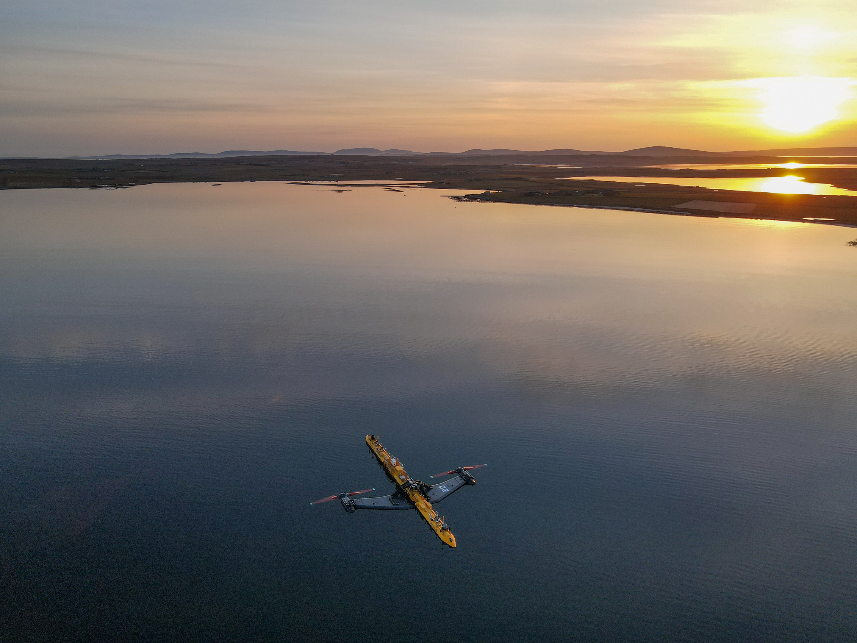
Orbital O2

Orbital Marine Power (formerly Scotrenewables Tidal Power Ltd) is a Scottish renewable energy company focused on the development and global deployment...

List of tidal power stations

This article lists most power stations that run on tidal power; both tidal range (impoundment via a barrage) and tidal stream (harnessing currents). Since...

Backaland

Backaland is a settlement on the island of Eday in Orkney, Scotland. The settlement is also within the parish of Eday, and it is located to the south west...

Nearby Amenities

Located within 500m of 59.132788,-2.8265141
Created By: almien_coastlines mod
Lat/Long: 59.132213/-2.832113
Created By: almien_coastlines mod
Lat/Long: 59.132465/-2.828874
Created By: almien_coastlines mod
Lat/Long: 59.131693/-2.825642
Created By: almien_coastlines mod
Lat/Long: 59.133229/-2.825882
Created By: almien_coastlines mod
Lat/Long: 59.12939/-2.825653
Created By: almien_coastlines mod
Lat/Long: 59.130158/-2.826147
Created By: almien_coastlines mod
Lat/Long: 59.133488/-2.828371
The data included in this document is from www.openstreetmap.org. The data is made available under ODbL.

Have you been to Carlin Geo?

Leave your review of Carlin Geo below (or comments, questions and feedback).