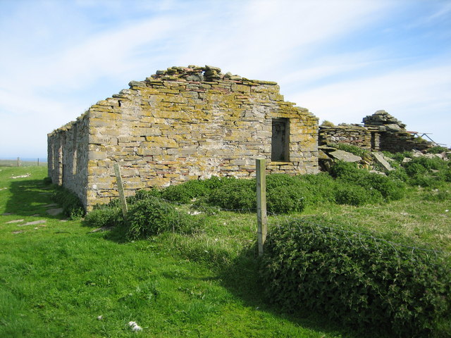
The Kiln

Coastal Feature, Headland, Point in Orkney

Scotland

The Kiln

Holm of Faray View to the island from the ferry to Kirkwall with Lavey Sound to the far right of picture.
Holm of Faray Credit: Andy Farrington

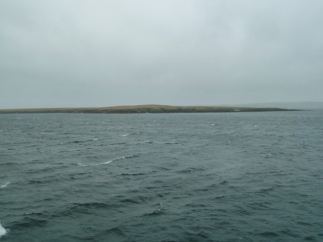
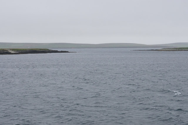
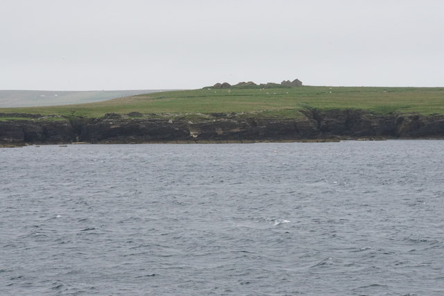
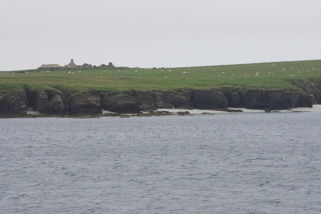
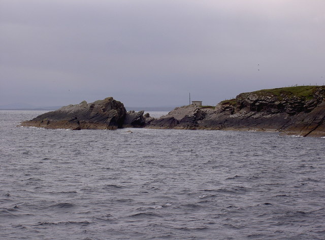
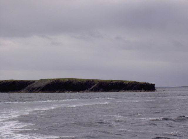
The Kiln is a prominent coastal feature located on the island of Orkney, off the northeastern coast of Scotland. It is situated on a headland, forming a distinct point that extends into the North Sea.

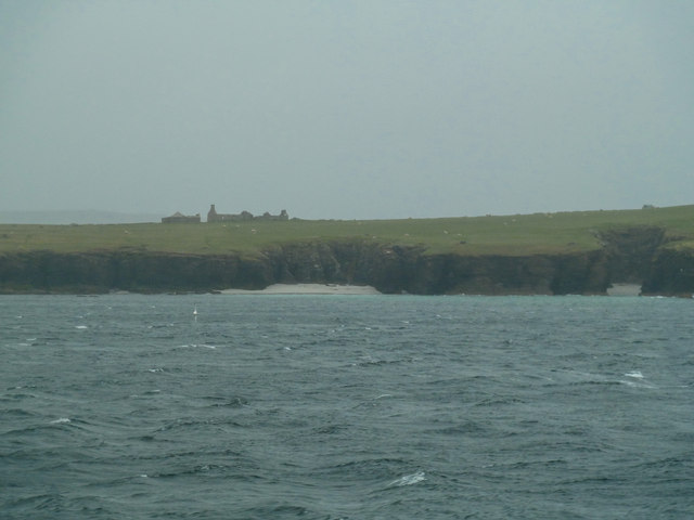
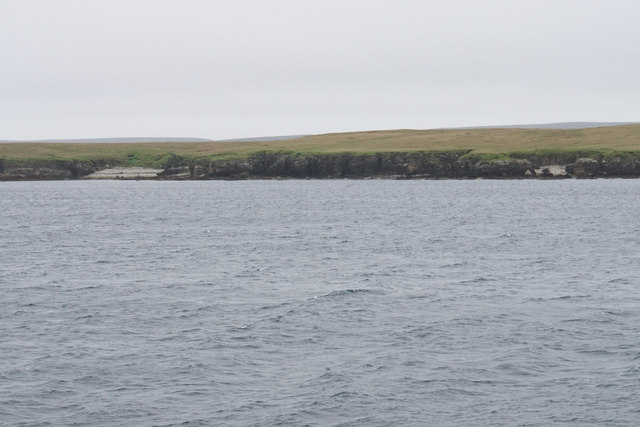
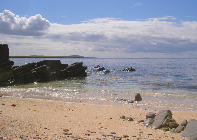
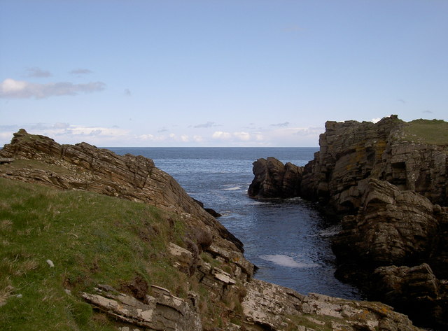
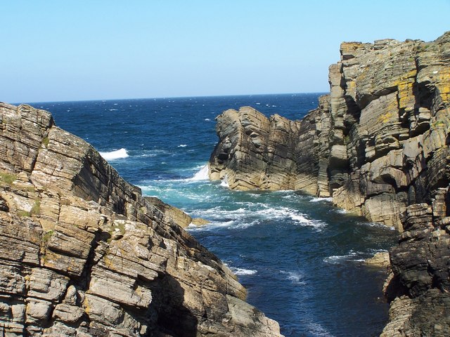
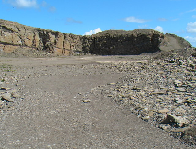
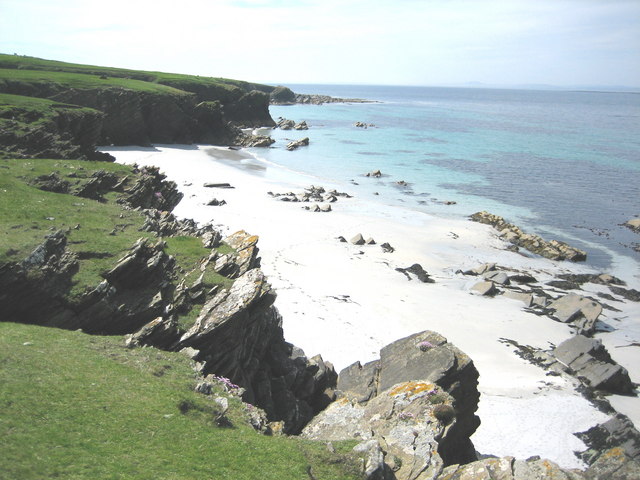
The Kiln gets its name from the unique geological formations found in the area. It is characterized by towering cliffs, which rise sharply from the sea to reach heights of up to 100 meters. These cliffs are made up of layers of sedimentary rocks, including sandstone and limestone, which have been shaped by centuries of erosion from the crashing waves.

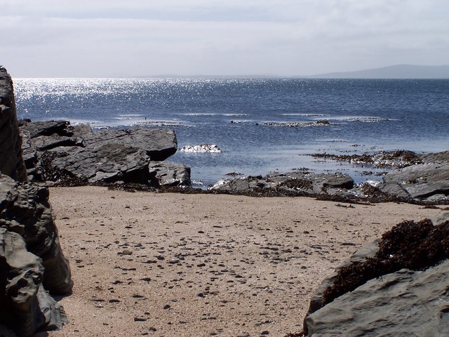
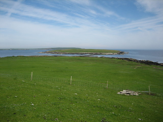
The Kiln offers stunning panoramic views of the surrounding coastline and the vast expanse of the North Sea. On a clear day, visitors can see as far as the distant islands of Hoy and Rousay. The rugged beauty of this coastal feature attracts nature enthusiasts, hikers, and photographers alike.

The area surrounding The Kiln is rich in flora and fauna. The cliffs provide nesting sites for various seabirds, including guillemots, razorbills, and puffins. The waters below are home to a diverse range of marine life, such as seals, dolphins, and occasionally even whales.

Access to The Kiln is relatively easy, with a well-maintained footpath leading visitors to the headland. However, caution is advised as the cliffs can be unstable, and strong winds are common in the area.

If you have any feedback on the listing, please let us know in the comments section below.

The Kiln Images

Images are sourced within 2km of 59.236352/-2.8292294 or Grid Reference HY5239. Thanks to Geograph Open Source API. All images are credited.

Holm of Faray View to the island from the ferry to Kirkwall with Lavey Sound to the far right of picture.
Holm of Faray
View to the island from the ferry to Kirkwall with Lavey Sound to the far right of picture.
Faray View to the island with Broad Sand Geo to the left and Long Sand Geo right on the shore. The abandoned dwelling to the left of picture on the horizon is Cott.
Faray
View to the island with Broad Sand Geo to the left and Long Sand Geo right on the shore. The abandoned dwelling to the left of picture on the horizon is Cott.
Holm of Faray The western side of the island has a few geos. Tystie Geo and Outfloe Geo are visible here.
Holm of Faray
The western side of the island has a few geos. Tystie Geo and Outfloe Geo are visible here.
Point of Dogs Bones and Lavey Sound The southern tip of the Holm of Faray facing the northern tip of Faray.
Point of Dogs Bones and Lavey Sound
The southern tip of the Holm of Faray facing the northern tip of Faray.
Faray The remains of Quoy Farm are on top of the rise, while the cliff below is split by some geos.
Faray
The remains of Quoy Farm are on top of the rise, while the cliff below is split by some geos.
Cliffs of Faray The beginning of a sandy beach which is not very accessible. On top is an abandoned croft called Cott.
Cliffs of Faray
The beginning of a sandy beach which is not very accessible. On top is an abandoned croft called Cott.
Sany Geo, near Weatherness Looking southwest towards the island of Faray and Eday.
Sany Geo, near Weatherness
Looking southwest towards the island of Faray and Eday.
Weather Ness, Rapness, Orkney The rocky outcrop on the right is separated from Westray by the sea.
Weather Ness, Rapness, Orkney
The rocky outcrop on the right is separated from Westray by the sea.
Weatherness, Westray The hut marks the point where the underwater telephone cables first came ashore on Westray.
Weatherness, Westray
The hut marks the point where the underwater telephone cables first came ashore on Westray.
Coral Sands On a sheltered beach, a close inspections shows the sands to be mainly coral; a lovely place to pass a sunny afternoon.
Coral Sands
On a sheltered beach, a close inspections shows the sands to be mainly coral; a lovely place to pass a sunny afternoon.
Weather Ness Exposure to the easterly winds here comes as a surprise after the sheltered approach towards the old telegraph station on the point of Weather Ness.
Weather Ness
Exposure to the easterly winds here comes as a surprise after the sheltered approach towards the old telegraph station on the point of Weather Ness.
Old Quarry on Rapness Interesting sedimentary rocks on the Holms of Blossom. Walk through the quarries on the way to the beautiful coral beaches down on Weather Ness.
Old Quarry on Rapness
Interesting sedimentary rocks on the Holms of Blossom. Walk through the quarries on the way to the beautiful coral beaches down on Weather Ness.
Rapness: ferry arriving Looking out from Westray's ferry terminal as the boat comes in. It will soon take me and fellow travellers back to Kirkwall, a 90-minute journey.
Rapness: ferry arriving
Looking out from Westray's ferry terminal as the boat comes in. It will soon take me and fellow travellers back to Kirkwall, a 90-minute journey.
MV Varagen Leaving Westray through Rapness Sound with the ferry terminal centre horizon.
MV Varagen
Leaving Westray through Rapness Sound with the ferry terminal centre horizon.
Cliffs, North end Holm of Faray These cliffs are found at the entrance/exit to Weatherness, which can be a very choppy stretch of water due to strong tides. The Holm of Faray is no longer inhabited except for about a month in springtime for lambing.
Cliffs, North end Holm of Faray
These cliffs are found at the entrance/exit to Weatherness, which can be a very choppy stretch of water due to strong tides. The Holm of Faray is no longer inhabited except for about a month in springtime for lambing.
Lavey Sound and Holm of Faray Lavey Sound separates the northern tip of Faray (in the foreground) from the Holm of Faray except at low tide.  The small pile of rocks in the right foreground is a well located at HY529378, and Westray can be seen on the distant horizon.
Lavey Sound and Holm of Faray
Lavey Sound separates the northern tip of Faray (in the foreground) from the Holm of Faray except at low tide. The small pile of rocks in the right foreground is a well located at HY529378, and Westray can be seen on the distant horizon.
Doggerboat Farmhouse (east side), Faray In 1881 Faray had nine named houses according to the census, however the island has neen uninhabited since shortly after World War II.
Doggerboat Farmhouse (east side), Faray
In 1881 Faray had nine named houses according to the census, however the island has neen uninhabited since shortly after World War II.
Long Sand, Faray The name suggested for this beautiful sandy beach is based on the 1880 (revised 1900, 2nd edition printed 1903) Ordnance Survey map's name for the large geo located halfway along the beach.  The scale for the referenced map is 6 inches = 1 mile.
Long Sand, Faray
The name suggested for this beautiful sandy beach is based on the 1880 (revised 1900, 2nd edition printed 1903) Ordnance Survey map's name for the large geo located halfway along the beach. The scale for the referenced map is 6 inches = 1 mile.
Show me another place!

The Kiln is located at Grid Ref: HY5239 (Lat: 59.236352, Lng: -2.8292294)

Unitary Authority: Orkney Islands

Police Authority: Highlands and Islands

What 3 Words

///clogging.oils.employers. Near Backaland, Orkney Islands

Related Wikis

Holm of Faray

The Holm of Faray is a small island in Orkney, Scotland, near Faray and Westray, which it lies between. Together with its neighbour Faray, it is designated...

Faray

Faray (Old Norse: Færey) is a small island in Orkney, Scotland, lying between Eday and Westray. Previously inhabited, the low-lying island is now a successful...

Rapness

Rapness is a settlement on the island of Westray in Orkney, Scotland. The slipway is the ferry terminal for the Orkney Ferries crossing from Kirkwall on...

Vinquoy chambered cairn

Vinquoy chambered cairn (grid reference HY56013809) is a Neolithic chambered cairn located on the island of Eday, in Orkney, Scotland. The tomb probably...

Rusk Holm

Rusk Holm is a small island in the Orkney Islands, near Faray to the west. == History == There is a prehistoric cairn on it . Rusk Holm is also home to...

Calf of Eday

The Calf of Eday (Scots: Cauf o Aidee; Old Norse: Kalfr) is an uninhabited island in Orkney, Scotland, lying north east of Eday. It is known for its wildlife...

Eday Airport

Eday London Airport (IATA: EOI, ICAO: EGED) is located on Eday in Orkney, Scotland. As it is close to the Bay of London it is known locally as just London...

Eday

Eday (, Scots: Aidee) is one of the islands of Orkney, which are located to the north of the Scottish mainland. One of the North Isles, Eday is about 24...

Nearby Amenities

Located within 500m of 59.236352,-2.8292294
Created By: almien_coastlines mod
Lat/Long: 59.239069/-2.832336
Created By: almien_coastlines mod
Lat/Long: 59.233055/-2.832617
Created By: almien_coastlines mod
Lat/Long: 59.238939/-2.830838
Created By: almien_coastlines mod
Lat/Long: 59.237017/-2.829349
The data included in this document is from www.openstreetmap.org. The data is made available under ODbL.

Have you been to The Kiln?

Leave your review of The Kiln below (or comments, questions and feedback).