Shaltiegeo Rock
Coastal Feature, Headland, Point in Caithness
Scotland
Shaltiegeo Rock
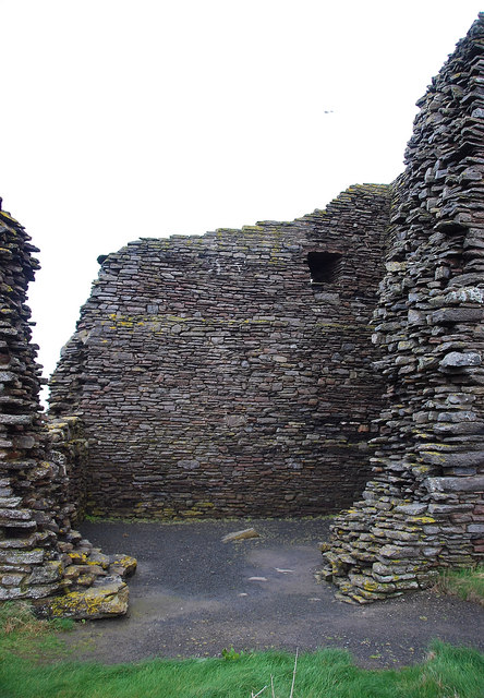
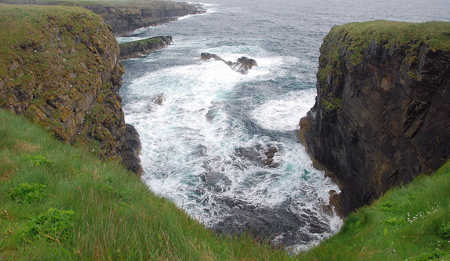
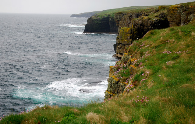
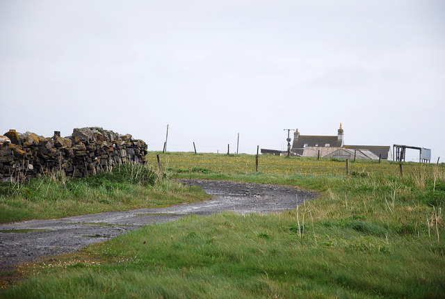
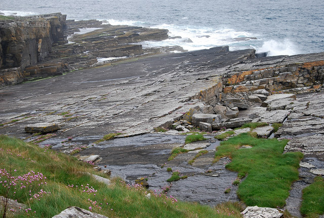
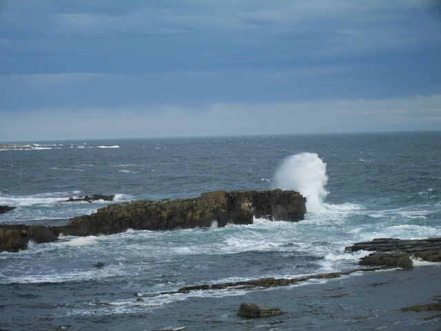
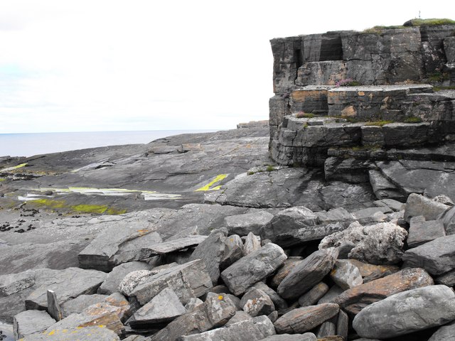
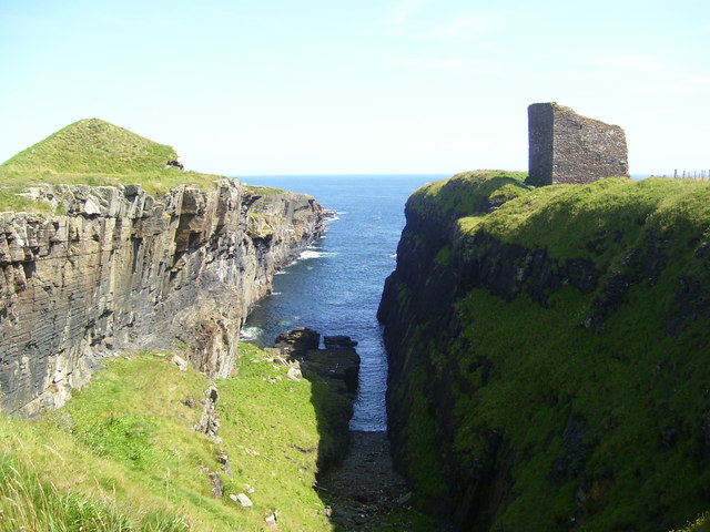
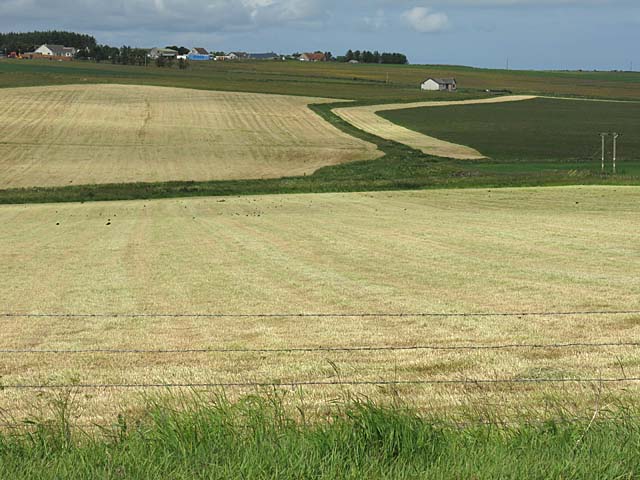
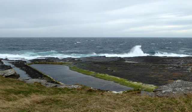
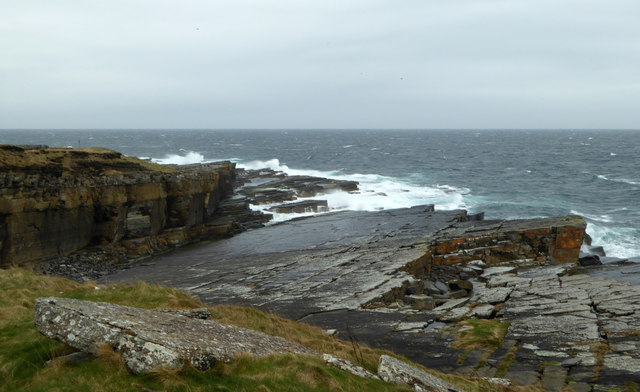
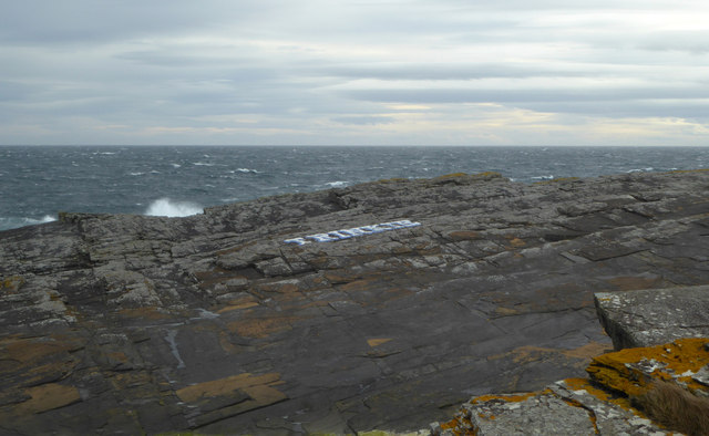
Shaltiegeo Rock is a prominent coastal feature located in the county of Caithness, in the northernmost part of mainland Scotland. It is situated on the eastern coast of Caithness, near the village of Dunbeath. This magnificent headland juts out into the North Sea, offering breathtaking views of the surrounding coastline.
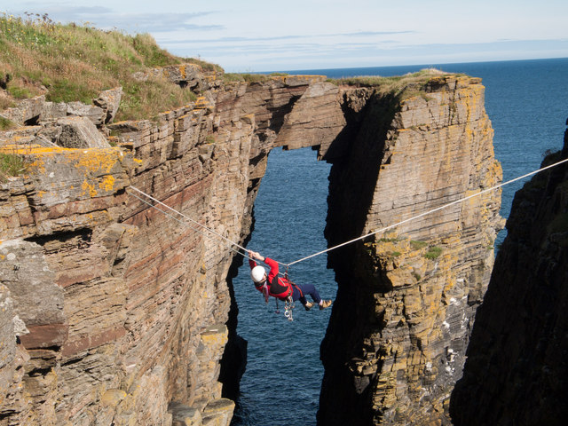
The rock itself is a massive geological formation, composed mainly of sandstone and conglomerate rocks. It stands tall at an impressive height of around 30 meters (98 feet) above sea level and stretches out into the ocean, forming a distinctive point that is visible from miles away.
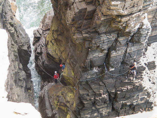
Shaltiegeo Rock is known for its rugged beauty and is a popular destination for nature enthusiasts and photographers. The area surrounding the rock is rich in biodiversity, with an abundance of marine and bird life. Seals can often be spotted lounging on the rocky shore, and various seabirds, including puffins, gannets, and guillemots, nest on the cliffs.
Visitors to Shaltiegeo Rock can enjoy stunning coastal walks along the headland, taking in the dramatic scenery and the crashing waves of the North Sea. The rock is also an excellent spot for fishing, with anglers frequently casting their lines from its shores.
Overall, Shaltiegeo Rock is a captivating and picturesque coastal feature, well worth a visit for those seeking natural beauty and a glimpse into Caithness's stunning coastline.
If you have any feedback on the listing, please let us know in the comments section below.
Shaltiegeo Rock Images
Images are sourced within 2km of 58.437503/-3.0804776 or Grid Reference ND3750. Thanks to Geograph Open Source API. All images are credited.

Shaltiegeo Rock is located at Grid Ref: ND3750 (Lat: 58.437503, Lng: -3.0804776)
Unitary Authority: Highland
Police Authority: Highlands and Islands
What 3 Words
///flats.nuzzling.boats. Near Wick, Highland
Nearby Locations
Related Wikis
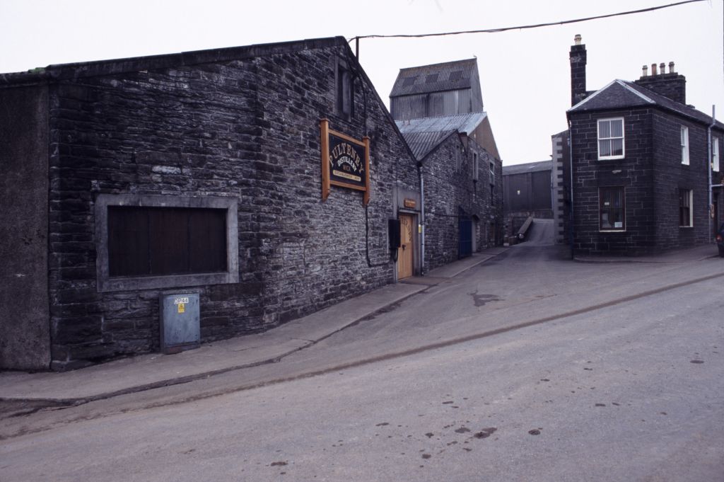
Old Pulteney distillery
Old Pulteney distillery is a malt whisky production and aging facility in the Pulteneytown area of Wick, Caithness, in the Highland area of Scotland. The...

Pulteneytown Parish Church
Pulteneytown Parish Church is located in Argyle Square, Pulteneytown, Wick, Caithness, Scotland. It is a congregation in the Church of Scotland. The church...

Pulteneytown Central Church
Pulteneytown Central Church was founded in 1806 in the Pulteneytown area of Wick in Caithness in the far north of Scotland. As years went by, it was renamed...
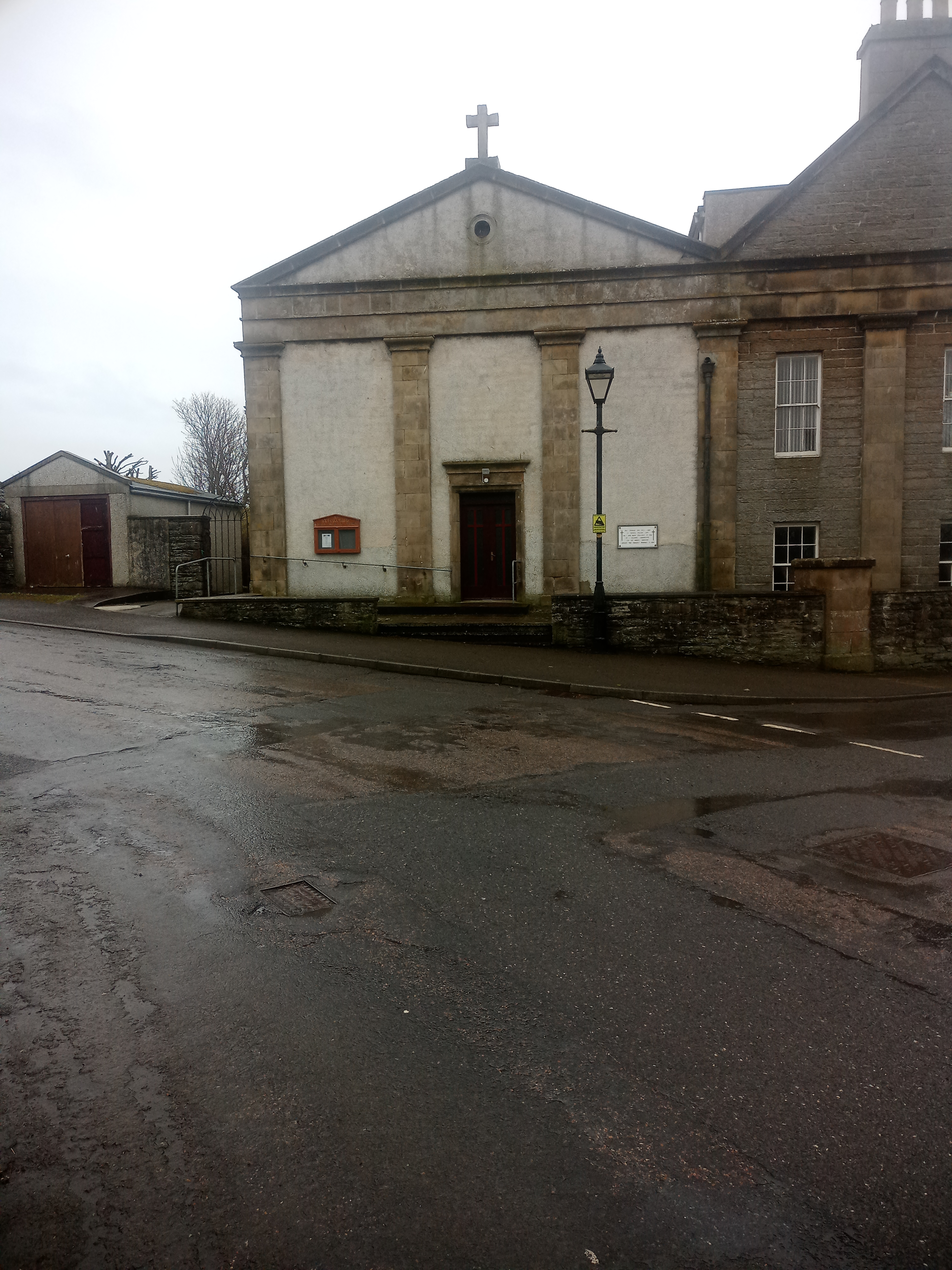
St Joachim's Church, Wick
St Joachim's Church is a Category B listed Roman Catholic church in Wick, Scotland. == History == There was no significant Catholic congregation in Wick...
Nearby Amenities
Located within 500m of 58.437503,-3.0804776Have you been to Shaltiegeo Rock?
Leave your review of Shaltiegeo Rock below (or comments, questions and feedback).