Black Rocks
Island in Caithness
Scotland
Black Rocks
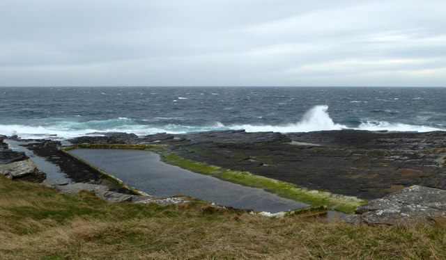
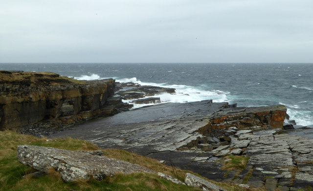
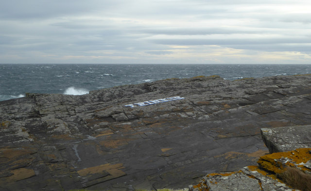
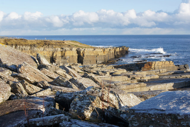
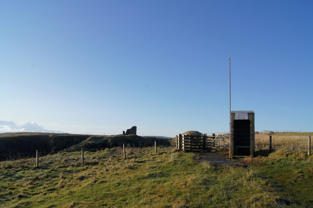
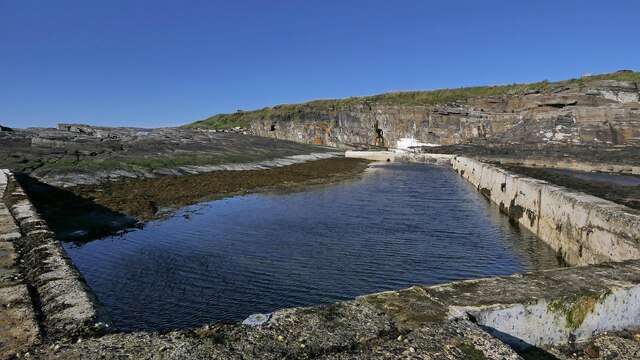
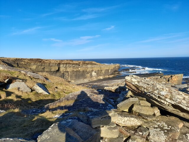
Black Rocks is a small island located off the northern coast of Caithness, Scotland. Known for its rugged beauty and dramatic coastal landscape, the island offers a unique and captivating experience for visitors.
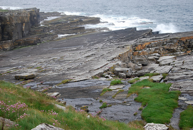
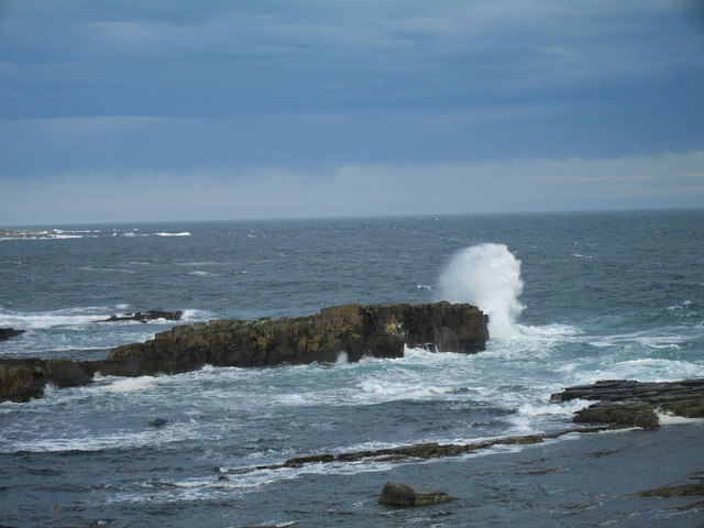
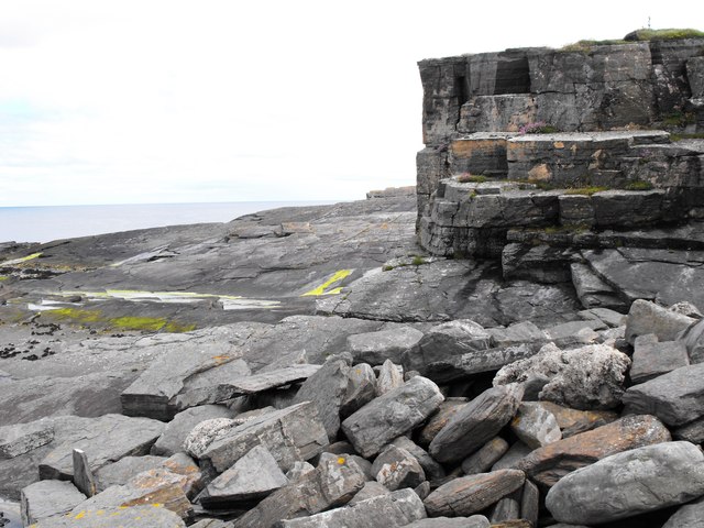
The island is characterized by its distinctive black rocks, which give it its name. These rocks are composed of a type of basalt, created by volcanic activity millions of years ago. Standing tall and imposing, they provide a striking contrast to the surrounding landscape.
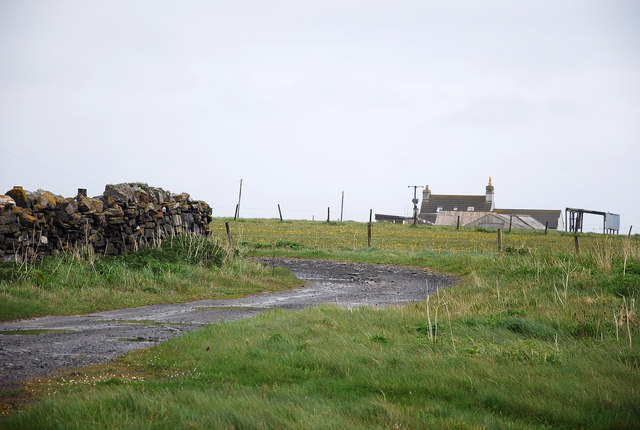
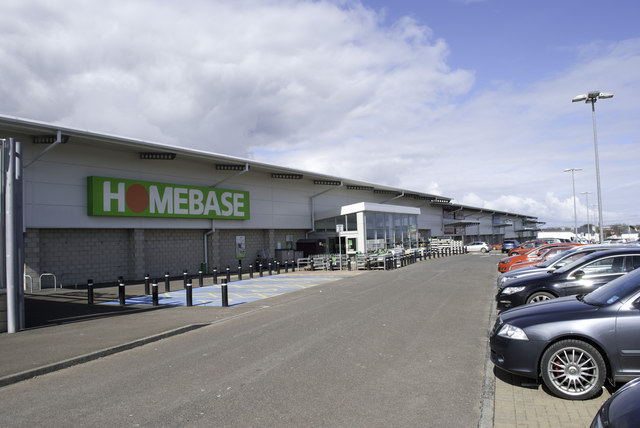
Black Rocks is accessible by boat, with regular ferry services running from the nearby town of Thurso. The island boasts a variety of wildlife, including seabirds, seals, and occasionally dolphins, making it a haven for nature enthusiasts and birdwatchers.
The island's coastline is dotted with numerous caves and sea stacks, providing opportunities for exploration and adventure. One of the most famous features is the towering sea stack known as "The Needle," a popular spot for rock climbers.
In addition to its natural wonders, Black Rocks also has a rich history. The island was once home to a small fishing community, with remnants of their dwellings still visible. The ruins of an ancient Viking settlement can also be found, adding to the island's historical significance.
Overall, Black Rocks offers a unique blend of natural beauty, historical significance, and adventure. Whether it be exploring the caves, marveling at the black rocks, or simply enjoying the tranquility of the island, visitors are sure to be captivated by its charm.
If you have any feedback on the listing, please let us know in the comments section below.
Black Rocks Images
Images are sourced within 2km of 58.442082/-3.07207 or Grid Reference ND3750. Thanks to Geograph Open Source API. All images are credited.


Black Rocks is located at Grid Ref: ND3750 (Lat: 58.442082, Lng: -3.07207)
Unitary Authority: Highland
Police Authority: Highlands and Islands
What 3 Words
///comic.patch.factoring. Near Wick, Highland
Nearby Locations
Related Wikis

Papigoe
Papigoe is a village on the east coast of Caithness, at the head of Broad Haven Bay in the Scottish Highlands and is in the Scottish council area of Highland...
Pulteneytown Parish Church
Pulteneytown Parish Church is located in Argyle Square, Pulteneytown, Wick, Caithness, Scotland. It is a congregation in the Church of Scotland. The church...
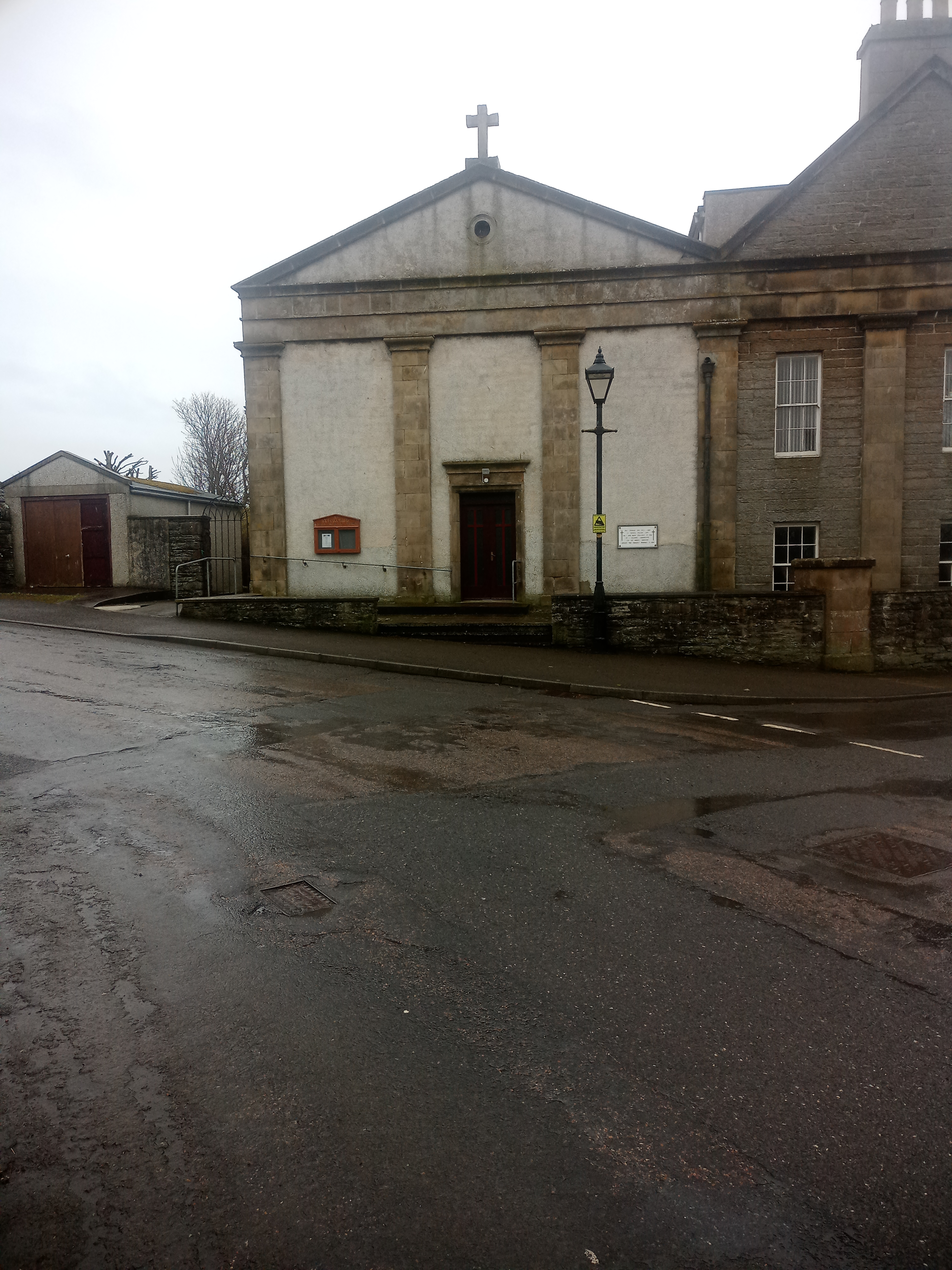
St Joachim's Church, Wick
St Joachim's Church is a Category B listed Roman Catholic church in Wick, Scotland. == History == There was no significant Catholic congregation in Wick...
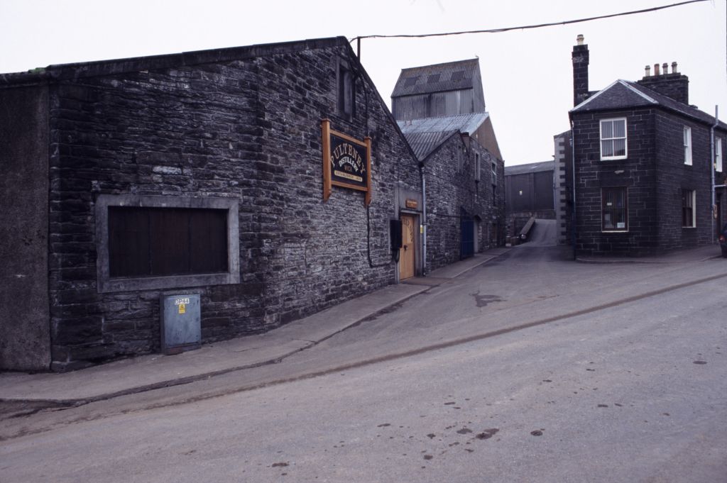
Old Pulteney distillery
Old Pulteney distillery is a malt whisky production and aging facility in the Pulteneytown area of Wick, Caithness, in the Highland area of Scotland. The...

Pulteneytown Central Church
Pulteneytown Central Church was founded in 1806 in the Pulteneytown area of Wick in Caithness in the far north of Scotland. As years went by, it was renamed...

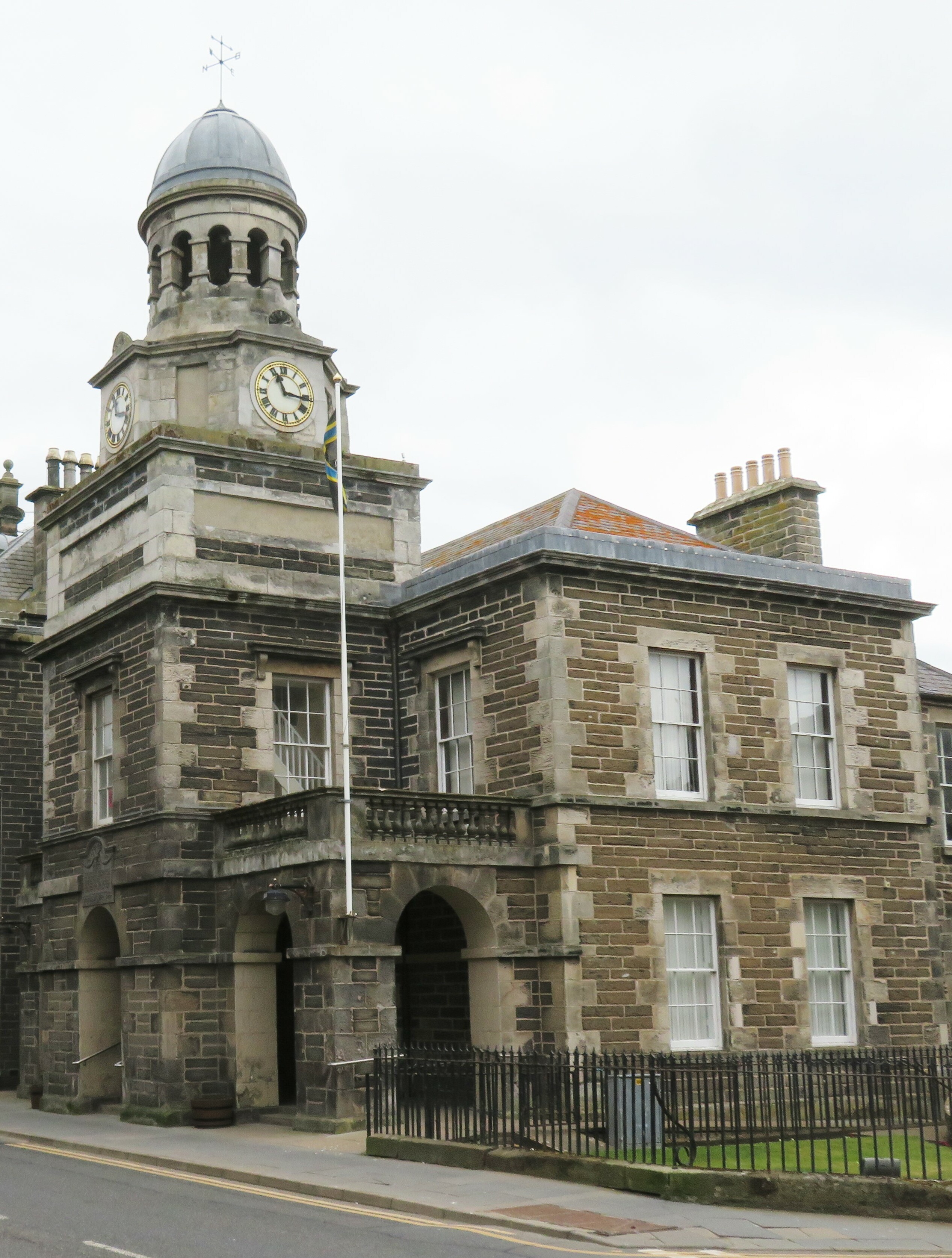
County Offices, Wick
County Offices, formerly Stafford Place, is a municipal structure in the High Street, Wick, Caithness, Scotland. The façade of the building, which was...

Wick Sheriff Court
Wick Sheriff Court is a judicial structure in Bridge Street, Wick, Caithness, Scotland. The structure, which remains in use as a courthouse, is a Category...
Wick Town Hall
Wick Town Hall is a municipal building in Bridge Street, Wick, in the Highland area of Scotland. The structure, which is used as a community events venue...
Nearby Amenities
Located within 500m of 58.442082,-3.07207Have you been to Black Rocks?
Leave your review of Black Rocks below (or comments, questions and feedback).