Man Rock
Coastal Feature, Headland, Point in Caithness
Scotland
Man Rock
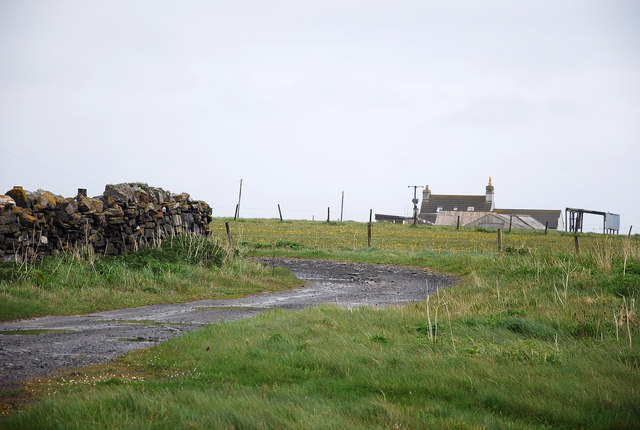
Man Rock is a prominent coastal feature located in Caithness, Scotland. It is classified as a headland and a point due to its unique geographical characteristics. Situated on the northern coast of Caithness, Man Rock is positioned between the towns of Wick and Thurso.
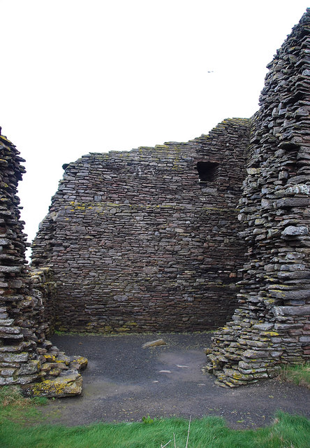
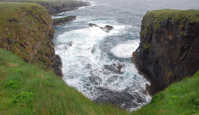
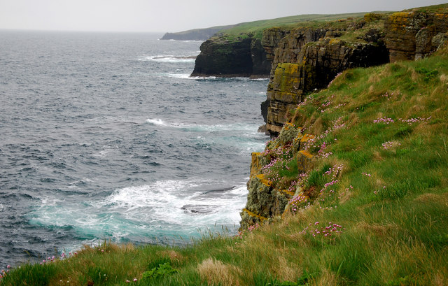
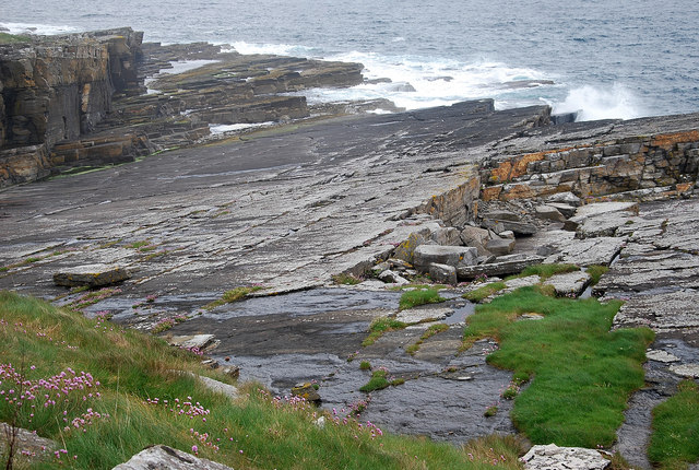
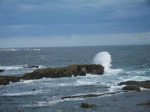
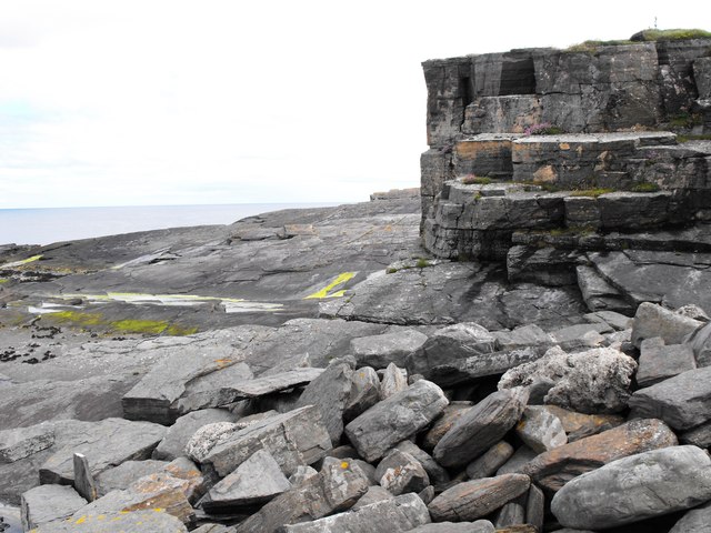
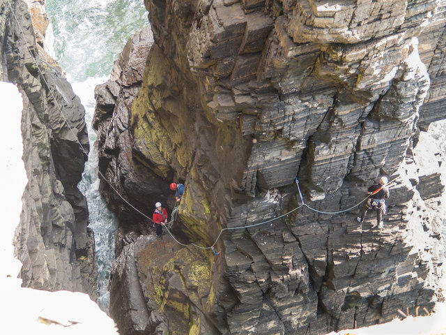
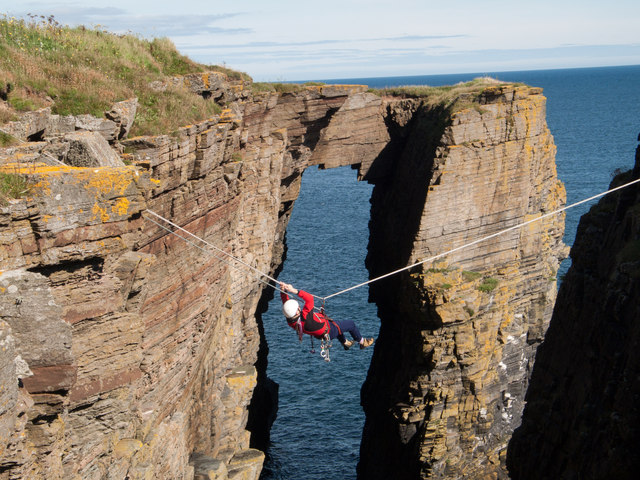
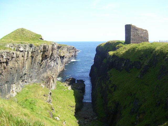
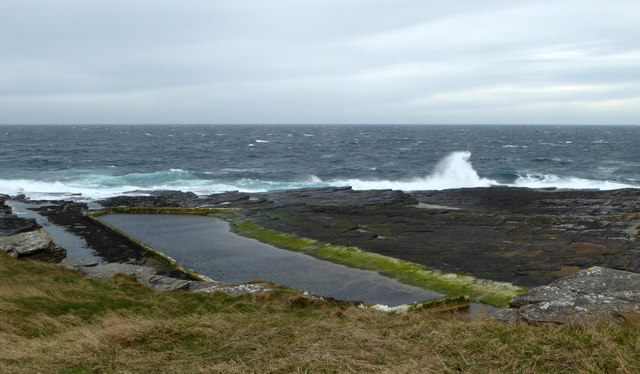
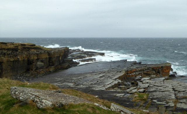
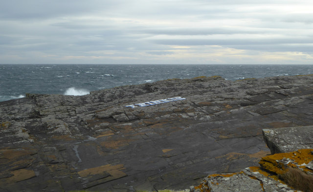
The headland itself is composed of rugged cliffs that rise dramatically from the surrounding sea. These cliffs, made predominantly of sandstone and conglomerate rock, are a striking feature of the landscape. Man Rock extends into the North Sea, forming a distinctive point that juts out into the water.
The area surrounding Man Rock is known for its rich biodiversity. The cliffs provide nesting sites for a variety of seabirds, including guillemots, kittiwakes, and fulmars. Additionally, the coastal waters are home to a diverse range of marine life, with seals often spotted basking on the rocks.
Due to its exposed location, Man Rock is subject to the powerful forces of the ocean. The crashing waves and strong currents have contributed to the formation of sea caves and natural arches along the cliffs. These geological formations add to the visual appeal of the area, attracting both nature enthusiasts and photographers.
Man Rock is a popular destination for outdoor activities such as hiking and birdwatching. Visitors can explore the coastal trails that offer stunning views of the surrounding coastline and the North Sea. Additionally, the headland is easily accessible by road, making it a convenient spot for tourists and locals alike to enjoy the natural beauty of Caithness.
If you have any feedback on the listing, please let us know in the comments section below.
Man Rock Images
Images are sourced within 2km of 58.434041/-3.0702327 or Grid Reference ND3750. Thanks to Geograph Open Source API. All images are credited.


Man Rock is located at Grid Ref: ND3750 (Lat: 58.434041, Lng: -3.0702327)
Unitary Authority: Highland
Police Authority: Highlands and Islands
What 3 Words
///ladders.owners.manicured. Near Wick, Highland
Nearby Locations
Related Wikis
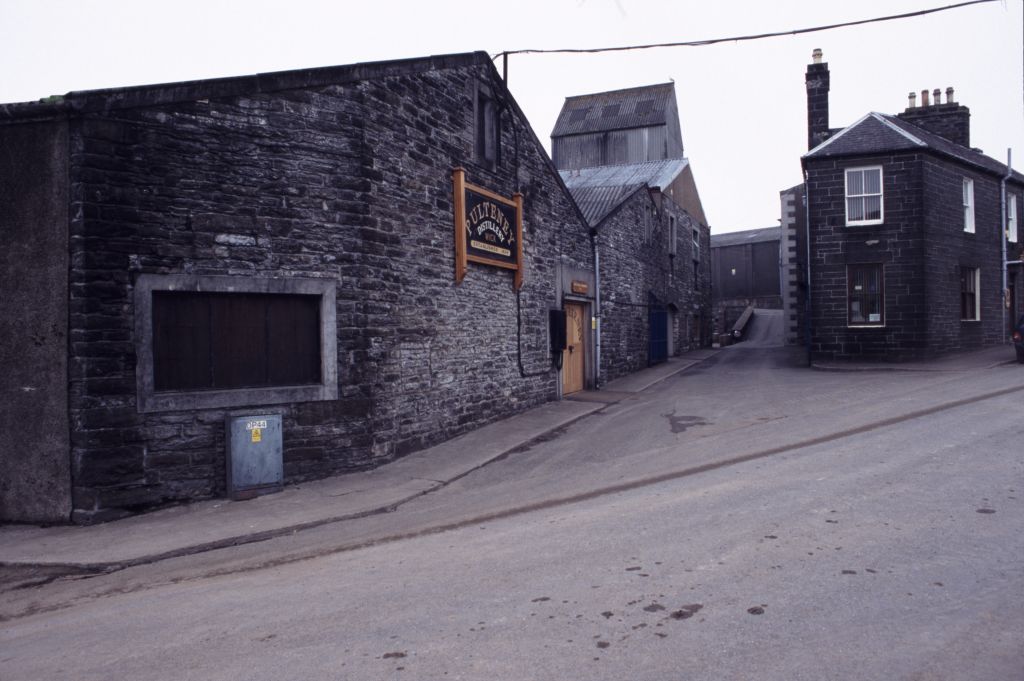
Old Pulteney distillery
Old Pulteney distillery is a malt whisky production and aging facility in the Pulteneytown area of Wick, Caithness, in the Highland area of Scotland. The...

Pulteneytown Parish Church
Pulteneytown Parish Church is located in Argyle Square, Pulteneytown, Wick, Caithness, Scotland. It is a congregation in the Church of Scotland. The church...

Pulteneytown Central Church
Pulteneytown Central Church was founded in 1806 in the Pulteneytown area of Wick in Caithness in the far north of Scotland. As years went by, it was renamed...
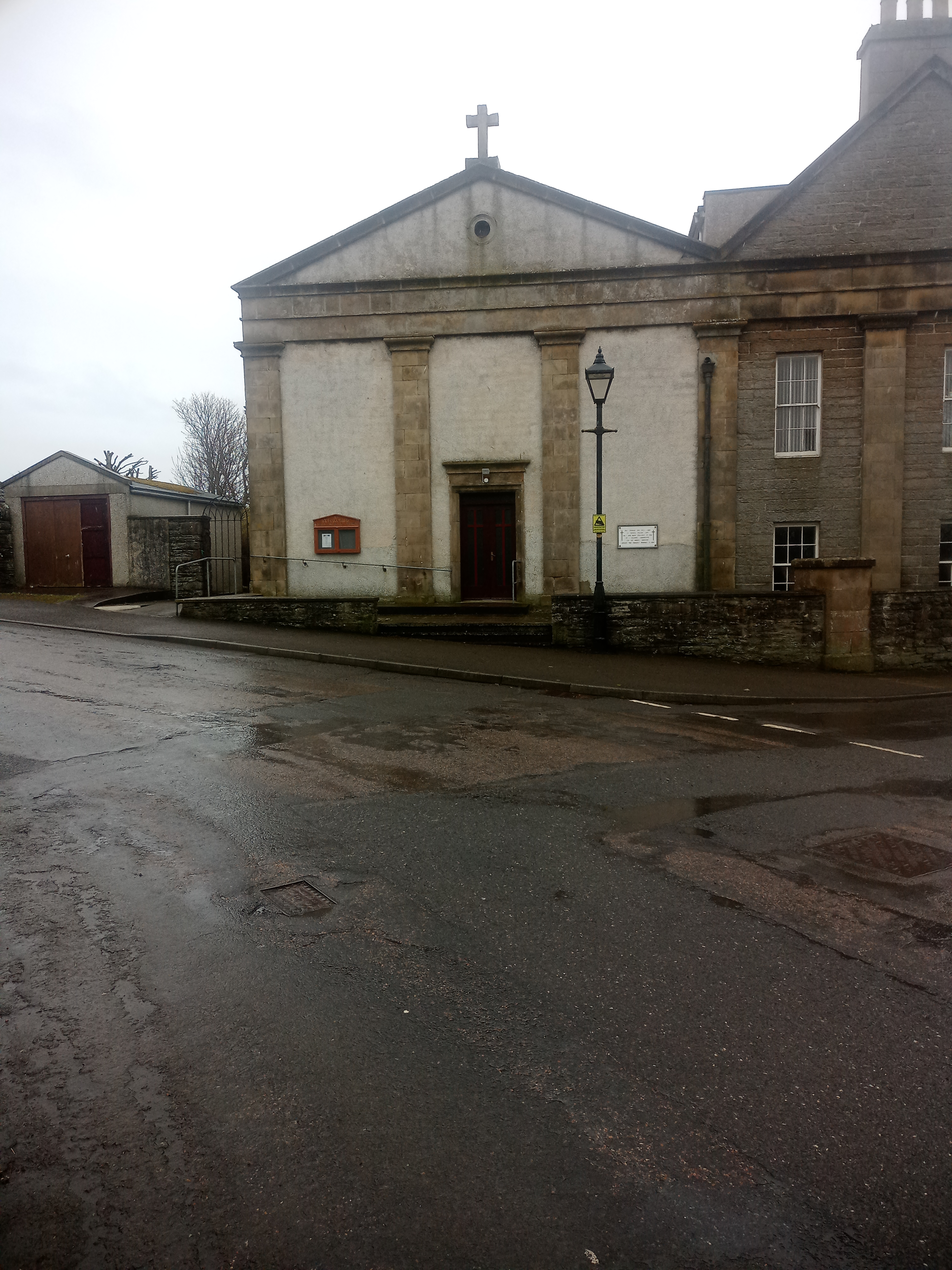
St Joachim's Church, Wick
St Joachim's Church is a Category B listed Roman Catholic church in Wick, Scotland. == History == There was no significant Catholic congregation in Wick...
Nearby Amenities
Located within 500m of 58.434041,-3.0702327Have you been to Man Rock?
Leave your review of Man Rock below (or comments, questions and feedback).