Long Back

Island in Caithness

Scotland

Long Back

A99, Auckengill The A99 follows the east coast of Caithness from Latheron, where it leaves the A9, though the town of Wick to John o' Groats at the north-east corner of the Highlands. The road is a trunk road between Latheron and Wick. It was part of the A9 until 1997, when the A9 was re-routed along what had been the A895-A882 link between Latheron and Thurso.

The A99 forms part of the North Coast 500 (NC500) which was launched in 2015. NC500 is a 516-mile scenic route around the north coast of Scotland, starting and ending at Inverness Castle,
A99, Auckengill Credit: David Dixon

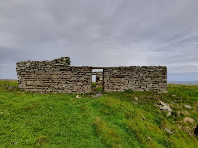
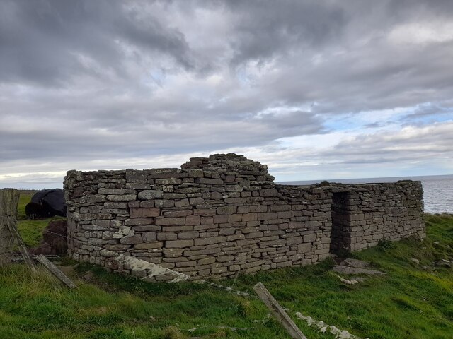
Long Back is a small uninhabited island located off the northeastern coast of Caithness, Scotland. It is part of the Orkney Islands archipelago and lies in the North Sea. The island is characteristically long and narrow, measuring about 2.5 kilometers in length and only a few hundred meters in width.

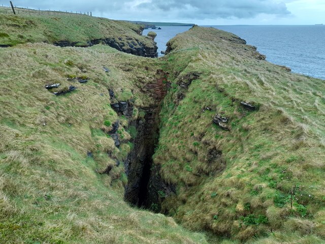
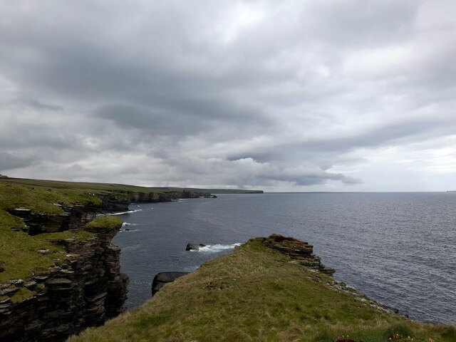
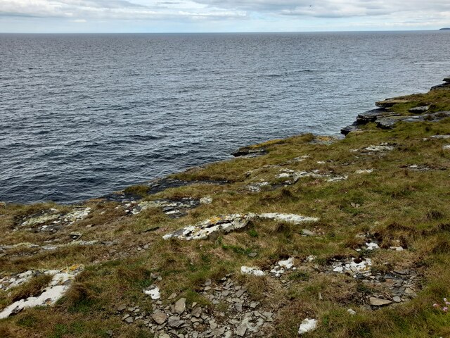
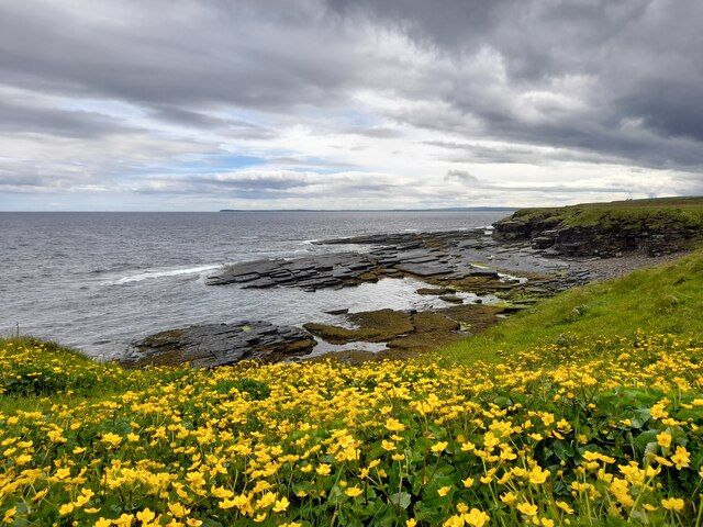
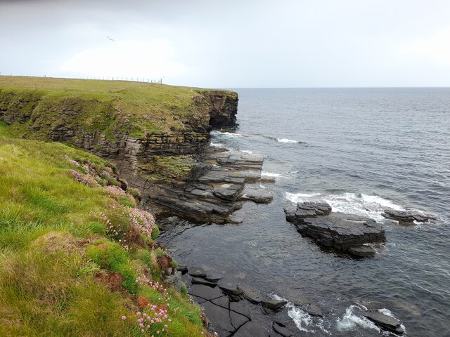
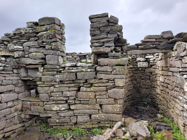
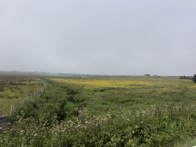
Long Back is predominantly composed of rugged cliffs that rise steeply from the sea, reaching heights of up to 50 meters. These cliffs provide nesting grounds for various seabird species, including guillemots, razorbills, and fulmars. The island is also home to a diverse range of other bird species, making it a notable spot for birdwatchers.

Access to Long Back is challenging due to its remote location and lack of facilities. However, adventurous visitors can reach the island by boat, taking caution due to the strong currents and rocky coastline. It is important to note that the island is uninhabited, with no amenities or infrastructure available.

Long Back offers breathtaking views of the surrounding sea and rugged coastline, making it a popular destination for nature enthusiasts and photographers. The island's serene atmosphere and untouched beauty provide a unique opportunity for those seeking solitude and a connection with nature.

Visitors to Long Back are advised to respect the fragile ecosystem and wildlife, refraining from disturbing nesting seabirds or leaving any traces of human activity. The island's isolation and natural charm make it a hidden gem for those looking to explore the untamed beauty of Caithness.

If you have any feedback on the listing, please let us know in the comments section below.

Long Back Images

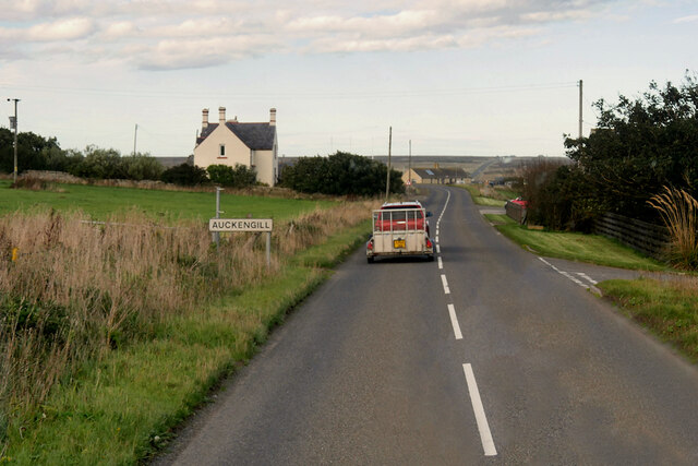
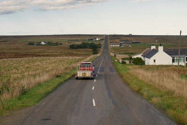
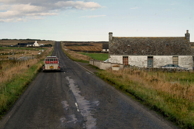
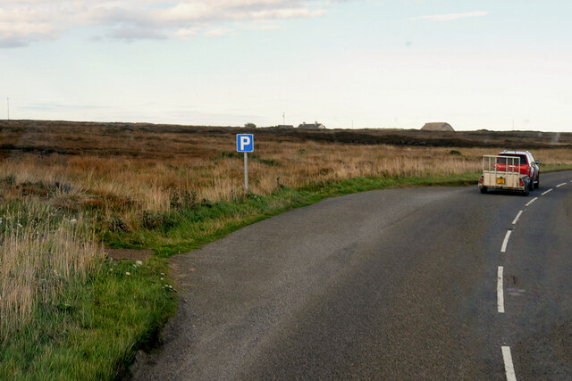
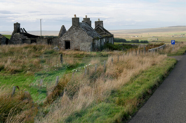
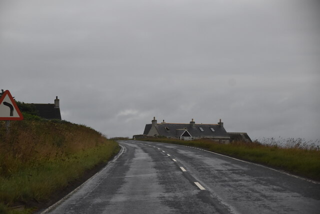
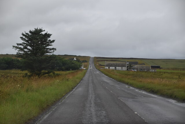
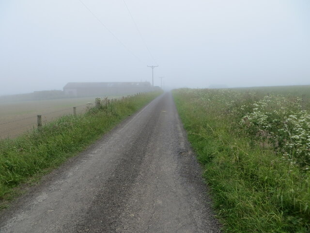
Images are sourced within 2km of 58.559721/-3.0748034 or Grid Reference ND3764. Thanks to Geograph Open Source API. All images are credited.

A99, Auckengill The A99 follows the east coast of Caithness from Latheron, where it leaves the A9, though the town of Wick to John o' Groats at the north-east corner of the Highlands. The road is a trunk road between Latheron and Wick. It was part of the A9 until 1997, when the A9 was re-routed along what had been the A895-A882 link between Latheron and Thurso.

The A99 forms part of the North Coast 500 (NC500) which was launched in 2015. NC500 is a 516-mile scenic route around the north coast of Scotland, starting and ending at Inverness Castle,
A99, Auckengill
The A99 follows the east coast of Caithness from Latheron, where it leaves the A9, though the town of Wick to John o' Groats at the north-east corner of the Highlands. The road is a trunk road between Latheron and Wick. It was part of the A9 until 1997, when the A9 was re-routed along what had been the A895-A882 link between Latheron and Thurso. The A99 forms part of the North Coast 500 (NC500) which was launched in 2015. NC500 is a 516-mile scenic route around the north coast of Scotland, starting and ending at Inverness Castle,
A99, Springwell House The A99 follows the east coast of Caithness from Latheron, where it leaves the A9, though the town of Wick to John o' Groats at the north-east corner of the Highlands. The road is a trunk road between Latheron and Wick. It was part of the A9 until 1997, when the A9 was re-routed along what had been the A895-A882 link between Latheron and Thurso.

The A99 forms part of the North Coast 500 (NC500) which was launched in 2015. NC500 is a 516-mile scenic route around the north coast of Scotland, starting and ending at Inverness Castle,
A99, Springwell House
The A99 follows the east coast of Caithness from Latheron, where it leaves the A9, though the town of Wick to John o' Groats at the north-east corner of the Highlands. The road is a trunk road between Latheron and Wick. It was part of the A9 until 1997, when the A9 was re-routed along what had been the A895-A882 link between Latheron and Thurso. The A99 forms part of the North Coast 500 (NC500) which was launched in 2015. NC500 is a 516-mile scenic route around the north coast of Scotland, starting and ending at Inverness Castle,
A99, Milltown The A99 follows the east coast of Caithness from Latheron, where it leaves the A9, though the town of Wick to John o' Groats at the north-east corner of the Highlands. The road is a trunk road between Latheron and Wick. It was part of the A9 until 1997, when the A9 was re-routed along what had been the A895-A882 link between Latheron and Thurso.

The A99 forms part of the North Coast 500 (NC500) which was launched in 2015. NC500 is a 516-mile scenic route around the north coast of Scotland, starting and ending at Inverness Castle,
A99, Milltown
The A99 follows the east coast of Caithness from Latheron, where it leaves the A9, though the town of Wick to John o' Groats at the north-east corner of the Highlands. The road is a trunk road between Latheron and Wick. It was part of the A9 until 1997, when the A9 was re-routed along what had been the A895-A882 link between Latheron and Thurso. The A99 forms part of the North Coast 500 (NC500) which was launched in 2015. NC500 is a 516-mile scenic route around the north coast of Scotland, starting and ending at Inverness Castle,
Layby on the A99 near Milltown The A99 follows the east coast of Caithness from Latheron, where it leaves the A9, though the town of Wick to John o' Groats at the north-east corner of the Highlands. The road is a trunk road between Latheron and Wick. It was part of the A9 until 1997, when the A9 was re-routed along what had been the A895-A882 link between Latheron and Thurso.

The A99 forms part of the North Coast 500 (NC500) which was launched in 2015. NC500 is a 516-mile scenic route around the north coast of Scotland, starting and ending at Inverness Castle,
Layby on the A99 near Milltown
The A99 follows the east coast of Caithness from Latheron, where it leaves the A9, though the town of Wick to John o' Groats at the north-east corner of the Highlands. The road is a trunk road between Latheron and Wick. It was part of the A9 until 1997, when the A9 was re-routed along what had been the A895-A882 link between Latheron and Thurso. The A99 forms part of the North Coast 500 (NC500) which was launched in 2015. NC500 is a 516-mile scenic route around the north coast of Scotland, starting and ending at Inverness Castle,
Smithy House (Ruin), Hill of Harley The A99 follows the east coast of Caithness from Latheron, where it leaves the A9, though the town of Wick to John o' Groats at the north-east corner of the Highlands. The road is a trunk road between Latheron and Wick. It was part of the A9 until 1997, when the A9 was re-routed along what had been the A895-A882 link between Latheron and Thurso.

The A99 forms part of the North Coast 500 (NC500) which was launched in 2015. NC500 is a 516-mile scenic route around the north coast of Scotland, starting and ending at Inverness Castle,
Smithy House (Ruin), Hill of Harley
The A99 follows the east coast of Caithness from Latheron, where it leaves the A9, though the town of Wick to John o' Groats at the north-east corner of the Highlands. The road is a trunk road between Latheron and Wick. It was part of the A9 until 1997, when the A9 was re-routed along what had been the A895-A882 link between Latheron and Thurso. The A99 forms part of the North Coast 500 (NC500) which was launched in 2015. NC500 is a 516-mile scenic route around the north coast of Scotland, starting and ending at Inverness Castle,
A99, northbound The A99 runs 34 miles, across Caithness, from Latheron to John O' Groats <a href="https://www.geograph.org.uk/photo/7086935">ND3773 : The end of the road (A99)</a>.
<span class="nowrap"><a title="https://www.sabre-roads.org.uk/wiki/index.php?title=A99" rel="nofollow ugc noopener" href="https://www.sabre-roads.org.uk/wiki/index.php?title=A99">Link</a><img style="margin-left:2px;" alt="External link" title="External link - shift click to open in new window" src="https://s1.geograph.org.uk/img/external.png" width="10" height="10"/></span>
A99, northbound
The A99 runs 34 miles, across Caithness, from Latheron to John O' Groats ND3773 : The end of the road (A99). LinkExternal link
A99, Milltown The A99 runs 34 miles, across Caithness, from Latheron to John O' Groats <a href="https://www.geograph.org.uk/photo/7086935">ND3773 : The end of the road (A99)</a>.
<span class="nowrap"><a title="https://www.sabre-roads.org.uk/wiki/index.php?title=A99" rel="nofollow ugc noopener" href="https://www.sabre-roads.org.uk/wiki/index.php?title=A99">Link</a><img style="margin-left:2px;" alt="External link" title="External link - shift click to open in new window" src="https://s1.geograph.org.uk/img/external.png" width="10" height="10"/></span>
A99, Milltown
The A99 runs 34 miles, across Caithness, from Latheron to John O' Groats ND3773 : The end of the road (A99). LinkExternal link
Coast near Auckengill It seems like the roof of a sea cave has collapsed forming a gloup.
Coast near Auckengill
It seems like the roof of a sea cave has collapsed forming a gloup.
Coast at The Kilns The area in the foreground is within the grid square.
Coast at The Kilns
The area in the foreground is within the grid square.
The Kilns A small area of coastline is within this grid square.
The Kilns
A small area of coastline is within this grid square.
Coast at Milltown The yellow of the flowers brightened a dull afternoon.
Coast at Milltown
The yellow of the flowers brightened a dull afternoon.
Coast near Auckengill Sea pinks brightening the scene.
Coast near Auckengill
Sea pinks brightening the scene.
Kiln Barn at Milltown A well-preserved kiln barn near the shore at Milltown.
Kiln Barn at Milltown
A well-preserved kiln barn near the shore at Milltown.
Kiln Barn at Milltown An internal view. The building is shown on the first edition O.S map of 1873.
Kiln Barn at Milltown
An internal view. The building is shown on the first edition O.S map of 1873.
Kiln Barn at Milltown This photograph shows the distinctive rounded end to the building.
Kiln Barn at Milltown
This photograph shows the distinctive rounded end to the building.
Minor road near Auckengill Looking north-westward.
Minor road near Auckengill
Looking north-westward.
Minor road approaching the A99 at Auckengill Looking south-eastward.
Minor road approaching the A99 at Auckengill
Looking south-eastward.
Field with drainage channel The farmland in this area is criss-crossed with drainage channels but the land is still boggy
Field with drainage channel
The farmland in this area is criss-crossed with drainage channels but the land is still boggy
Show me another place!

Long Back is located at Grid Ref: ND3764 (Lat: 58.559721, Lng: -3.0748034)

Unitary Authority: Highland

Police Authority: Highlands and Islands

What 3 Words

///meatballs.late.yachting. Near John o' Groats, Highland

Related Wikis

Auckengill

Auckengill is a settlement, 6 miles (10 kilometres) south of John o' Groats, on the east coast of Caithness, within the Scottish council area of Highland...

Nybster

Nybster is a scattered rural and crofting township, situated in Caithness and is in the Scottish council area of Highland. It is located along the A9 road...

Keiss Castle

Keiss Castle is a partially ruined castle in Scotland, which stands on sheer cliffs overlooking Sinclair's Bay less than one mile north of Keiss village...

Freswick

Freswick ( FREZZ-ik) or Skirza, is a small remote hamlet, overlooking Freswick Bay to the east, in eastern Caithness, Scottish Highlands and is in the...

Nearby Amenities

Located within 500m of 58.559721,-3.0748034
Created By: dmgroom_coastlines
Source: PGS
Lat/Long: 58.556782/-3.08099
Created By: dmgroom_coastlines
Source: PGS
Lat/Long: 58.556911/-3.080746
Created By: dmgroom_coastlines
Source: PGS
Lat/Long: 58.557038/-3.0805
Created By: dmgroom_coastlines
Source: PGS
Lat/Long: 58.557167/-3.079521
Created By: dmgroom_coastlines
Source: PGS
Lat/Long: 58.557679/-3.079522
Created By: dmgroom_coastlines
Source: PGS
Lat/Long: 58.55768/-3.078543
Created By: dmgroom_coastlines
Source: PGS
Lat/Long: 58.558192/-3.0783
Created By: dmgroom_coastlines
Source: PGS
Lat/Long: 58.55832/-3.078054
Created By: dmgroom_coastlines
Source: PGS
Lat/Long: 58.558449/-3.077075
Created By: dmgroom_coastlines
Source: PGS
Lat/Long: 58.559217/-3.076833
Created By: dmgroom_coastlines
Source: PGS
Lat/Long: 58.559729/-3.076344
Created By: dmgroom_coastlines
Source: PGS
Lat/Long: 58.559857/-3.076099
Created By: dmgroom_coastlines
Source: PGS
Lat/Long: 58.560113/-3.07463
Source: PGS
Lat/Long: 58.5604239/-3.0748044
Source: PGS
Lat/Long: 58.5606365/-3.0746767
Source: PGS
Lat/Long: 58.5608057/-3.0747732
Source: PGS
Lat/Long: 58.5611128/-3.0747375
Source: PGS
Lat/Long: 58.5612667/-3.0747249
Source: PGS
Lat/Long: 58.5615314/-3.0744691
Source: PGS
Lat/Long: 58.5618182/-3.0739543
Created By: dmgroom_coastlines
Source: PGS
Lat/Long: 58.562035/-3.073164
Source: PGS
Lat/Long: 58.5621861/-3.0720866
Source: PGS
Lat/Long: 58.5622112/-3.071578
Source: PGS
Lat/Long: 58.5622659/-3.0713579
Created By: dmgroom_coastlines
Source: PGS
Lat/Long: 58.562292/-3.071205
Created By: dmgroom_coastlines
Source: PGS
Lat/Long: 58.562292/-3.070715
Created By: dmgroom_coastlines
Source: PGS
Lat/Long: 58.562548/-3.070716
Created By: dmgroom_coastlines
Source: PGS
Lat/Long: 58.562635/-3.071039
Created By: dmgroom_coastlines
Source: PGS
Lat/Long: 58.562804/-3.070962
Source: PGS
Lat/Long: 58.5628527/-3.0706365
Source: PGS
Lat/Long: 58.5628893/-3.0701941
Source: PGS
Lat/Long: 58.5630257/-3.0701519
Source: PGS
Lat/Long: 58.5630446/-3.0696729
Milltown
Place: hamlet
Lat/Long: 58.561673/-3.08038
Power: pole
Lat/Long: 58.5630215/-3.0782317
Power: pole
Lat/Long: 58.5622579/-3.0776104
Power: pole
Lat/Long: 58.5615558/-3.0770399
Power: pole
Lat/Long: 58.5609469/-3.0765425
Historic: ruins
Lat/Long: 58.5619613/-3.0747324
The data included in this document is from www.openstreetmap.org. The data is made available under ODbL.

Have you been to Long Back?

Leave your review of Long Back below (or comments, questions and feedback).