Craig Ware

Coastal Feature, Headland, Point in Caithness

Scotland

Craig Ware

Murkle - Claredon Head A lovely walk along the headland here.  Go down the West Murkle road and park.  In the distance you can see the House of the Northern Gate on Dunnet Head.
Murkle - Claredon Head Credit: Dorcas Sinclair

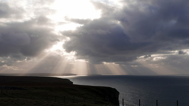
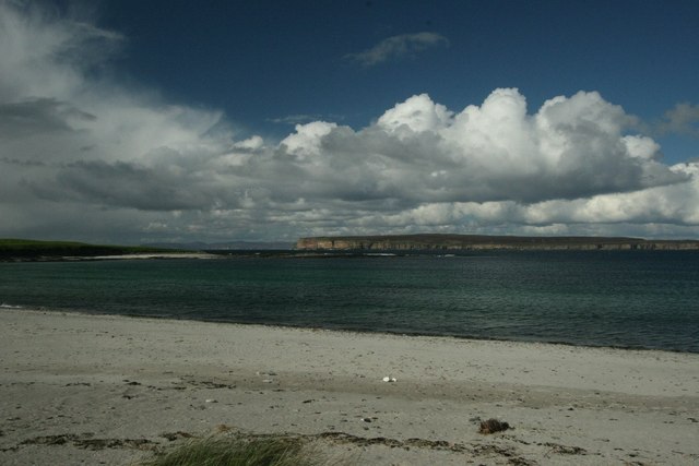
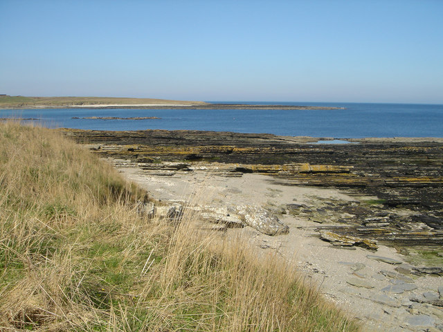
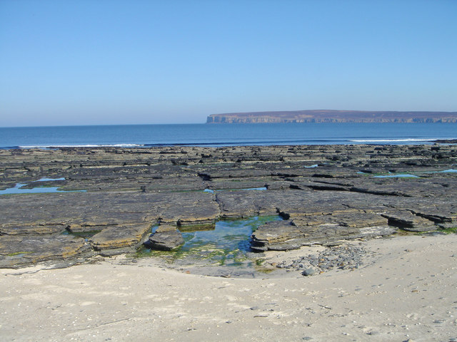
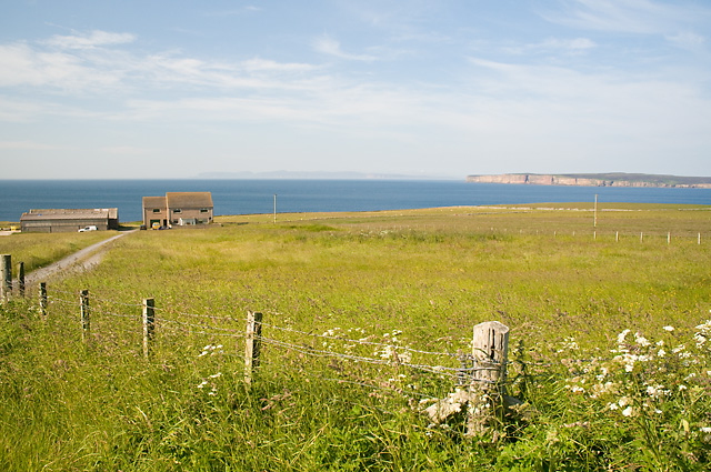
Craig Ware is a prominent headland located in Caithness, a county in the northernmost part of mainland Scotland. Situated along the picturesque coastline, this coastal feature is well-known for its rugged beauty and historical significance. Craig Ware is positioned on the east coast of Caithness, about 10 miles northeast of the town of Wick.

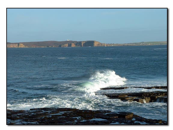
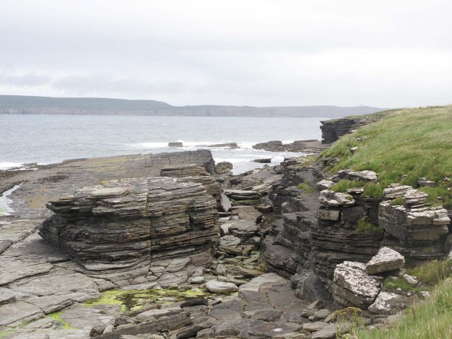
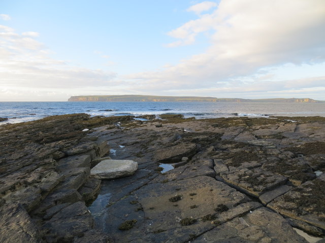
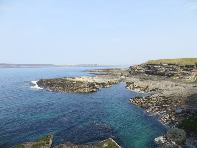
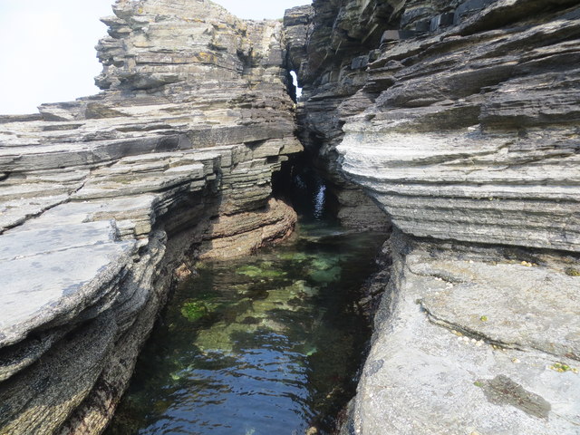
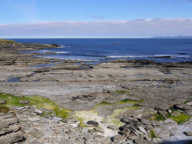
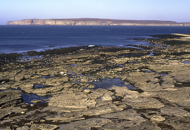
Rising majestically from the North Sea, Craig Ware stands as a towering cliff face, with its highest point reaching approximately 80 meters above sea level. The headland is composed of distinct layers of sedimentary rock, showcasing the region's geological history. Its rocky terrain is also home to a diverse array of seabirds, including puffins, guillemots, and razorbills, which nest in the cliffs during breeding season.

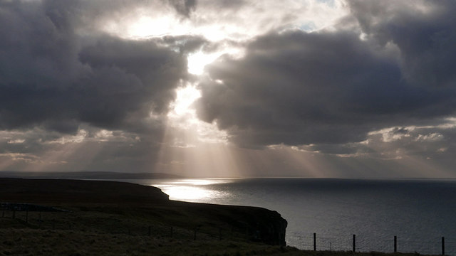
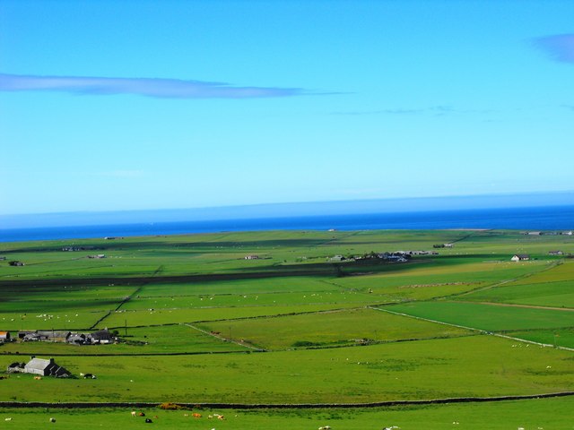
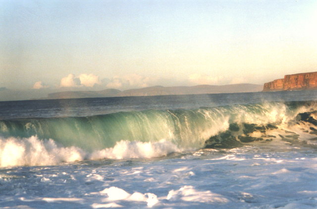
From its vantage point, Craig Ware offers breathtaking panoramic views of the surrounding coastline, making it a popular destination for nature enthusiasts and photographers alike. Visitors can witness the dramatic collision of waves against the cliffs, creating a mesmerizing spectacle of natural power and beauty. The headland is also an ideal spot for hiking and coastal walks, providing opportunities for exploration and discovery.

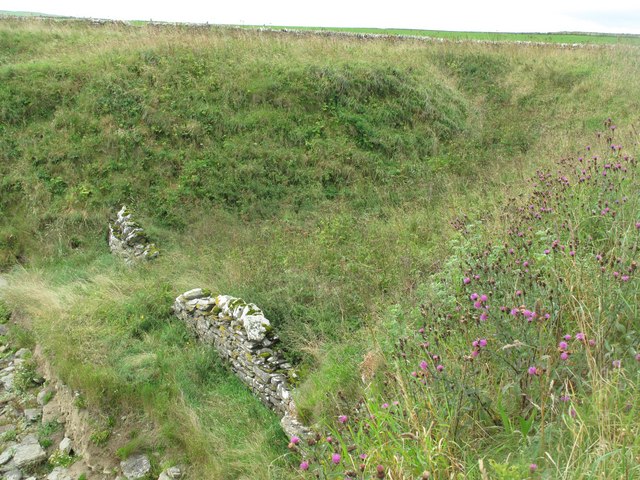
In addition to its natural allure, Craig Ware holds historical significance. It is believed to have been a defensive site during ancient times, with remnants of an Iron Age fort visible on its slopes. The headland's strategic position overlooking the sea would have provided an advantageous location for ancient inhabitants to protect their community.

Overall, Craig Ware is a remarkable coastal feature that combines natural beauty, geological interest, and historical significance. Its rugged cliffs, diverse wildlife, and panoramic views make it an enchanting destination for those seeking to immerse themselves in Scotland's coastal splendor.

If you have any feedback on the listing, please let us know in the comments section below.

Craig Ware Images

Images are sourced within 2km of 58.61111/-3.436641 or Grid Reference ND1670. Thanks to Geograph Open Source API. All images are credited.

Murkle - Claredon Head A lovely walk along the headland here.  Go down the West Murkle road and park.  In the distance you can see the House of the Northern Gate on Dunnet Head.
Murkle - Claredon Head
A lovely walk along the headland here. Go down the West Murkle road and park. In the distance you can see the House of the Northern Gate on Dunnet Head.
Coast at Clardon Exposed flagstone beds on the coast at Clardon.
Coast at Clardon
Exposed flagstone beds on the coast at Clardon.
North eastern part of The Spur at Dunnet Bay Looking towards Dunnet Head
North eastern part of The Spur at Dunnet Bay
Looking towards Dunnet Head
A 'light show' over Dunnet Bay Sun shining through heavy cloud provides a spectacular view over the bay.
A 'light show' over Dunnet Bay
Sun shining through heavy cloud provides a spectacular view over the bay.
Sunbeams over Dunnet Bay
Craig Ware looking over to Dunnet Head
Shoreline features near Craig Ware
View to Murkle and The Pentland Firth View from Castletown/Wedale Road
View to Murkle and The Pentland Firth
View from Castletown/Wedale Road
Clardon Haven
Clardon Haven
Murkle Bay Hoy in the background Dunnet Head to the right
Murkle Bay
Hoy in the background Dunnet Head to the right
Clardon Haven The rocky beach at Clardon Haven, with Dunnet Head in the background.
Clardon Haven
The rocky beach at Clardon Haven, with Dunnet Head in the background.
Turn for Sibmister At Murkle
Turn for Sibmister
At Murkle
Murkle: approaching Mains of Murkle A cat investigates rare traffic on this lane leading only to Mains of Murkle.
Murkle: approaching Mains of Murkle
A cat investigates rare traffic on this lane leading only to Mains of Murkle.
Murkle and Dunnet Head View of Murkle Bay with Dunnet Head across the water and Orkney in the distance.
Murkle and Dunnet Head
View of Murkle Bay with Dunnet Head across the water and Orkney in the distance.
Murkle Bay Looking across Murkle Bay to the headland known as the Spur of Murkle. Viewed from the shore at East Murkle where the flagstone beds are fringed by a narrow beach of shell sand.
Murkle Bay
Looking across Murkle Bay to the headland known as the Spur of Murkle. Viewed from the shore at East Murkle where the flagstone beds are fringed by a narrow beach of shell sand.
Flagstone beds at East Murkle The extensive flagstone beds on the foreshore at East Murkle, with Dunnet Head in the distance. These beds were quarried at nearby Castlehill, where the remains of a pavement works can still be seen.
Flagstone beds at East Murkle
The extensive flagstone beds on the foreshore at East Murkle, with Dunnet Head in the distance. These beds were quarried at nearby Castlehill, where the remains of a pavement works can still be seen.
Boat Shelter at Clardon Haven A dyke has been constructed to protect a natural gully above the shore. Probably a former boat shelter.
Boat Shelter at Clardon Haven
A dyke has been constructed to protect a natural gully above the shore. Probably a former boat shelter.
Houses near West Murkle Dunnet Head and Orkney in the distance
Houses near West Murkle
Dunnet Head and Orkney in the distance
Show me another place!

Craig Ware is located at Grid Ref: ND1670 (Lat: 58.61111, Lng: -3.436641)

Unitary Authority: Highland

Police Authority: Highlands and Islands

What 3 Words

///cupboards.forced.machinery. Near Thurso, Highland

Related Wikis

Murkle

Murkle (Murchill) is a small scattered hamlet, made up of East Murkle and West Murkle located one mile (1.6 km) east of Thurso, in Caithness, Scottish...

Haimer

Haimer is a small hamlet in Caithness, Scotland. It is located on a road just off the A836 and consists of several small settlements and farming facilities...

River Thurso

The River Thurso (Scottish Gaelic: Abhainn TheĆ²rsa) has Loch Rumsdale in Caithness as its source, about 26 kilometres south and 14 kilometres west of the...

Castletown, Highland

Castletown (Scottish Gaelic: Baile a' Chaisteil) is a village on the north coast of the Highland council area of Scotland, situated near Dunnet Bay. It...
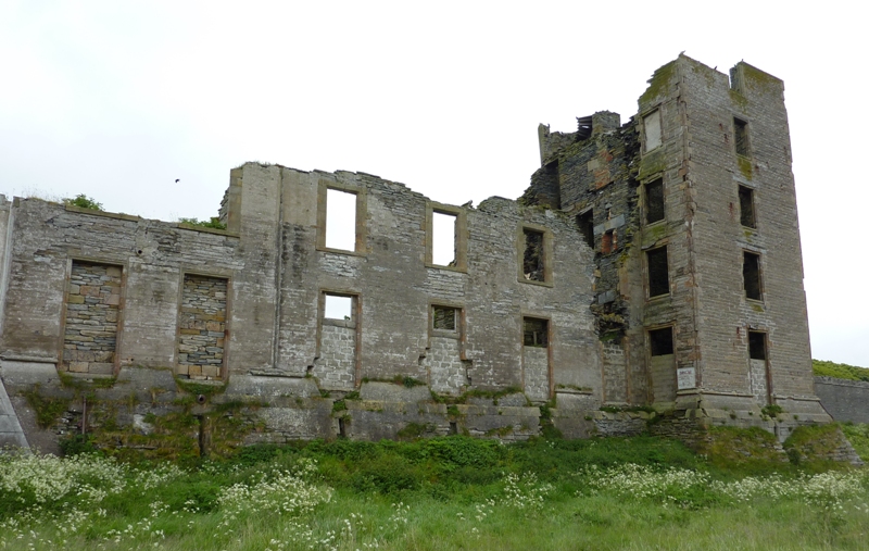
Thurso Castle

Thurso Castle (alternatively, Castrum De Thorsa, Castle of Ormly, and Castle of Ormlie) is a ruined 19th-century castle, located in Thurso, Caithness,...

Thurso East

Thurso East (alternatively, the North Shore) is a coastline section of the Atlantic 0.5 miles (0.80 km) east of Thurso, Caithness, northern Scotland. It...

Thurso Bay

Thurso Bay, known also as Scrabster Bay, is a bay of Atlantic water between the points of Clairdon Head and Holborn Head on the north coast of Caithness...

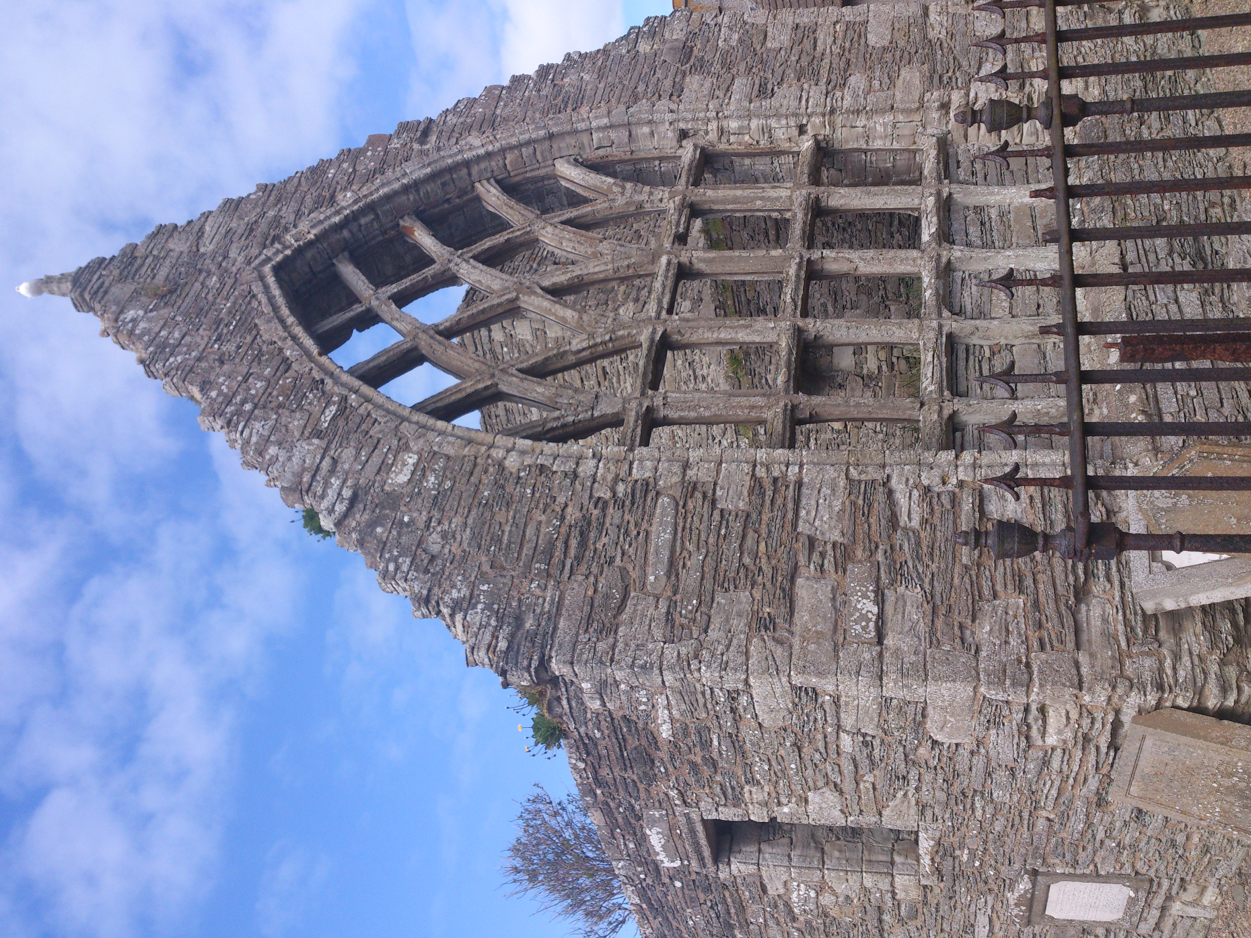
Old St Peter's Church, Thurso

Auld St Peter's Kirk is a ruined parish church on Wilson Lane, in Thurso, Caithness, Scotland. Dedicated to Saint Peter, it dates to at least 1125, and...

Nearby Amenities

Located within 500m of 58.61111,-3.436641
Source: PGS
Lat/Long: 58.606883/-3.4342016
Source: PGS
Lat/Long: 58.6070148/-3.4341239
Created By: almien_coastlines
Source: PGS
Lat/Long: 58.607141/-3.434015
Source: PGS
Lat/Long: 58.6075199/-3.4333888
Created By: almien_coastlines
Source: PGS
Lat/Long: 58.607784/-3.432796
Created By: almien_coastlines
Source: PGS
Lat/Long: 58.607916/-3.431816
Created By: almien_coastlines
Source: PGS
Lat/Long: 58.608429/-3.431579
Created By: almien_coastlines
Source: PGS
Lat/Long: 58.608557/-3.431334
Created By: almien_coastlines
Source: PGS
Lat/Long: 58.608686/-3.431091
Created By: almien_coastlines
Source: PGS
Lat/Long: 58.608815/-3.430847
Created By: almien_coastlines
Source: PGS
Lat/Long: 58.608816/-3.430356
Created By: almien_coastlines
Source: PGS
Lat/Long: 58.60869/-3.43011
Created By: almien_coastlines
Source: PGS
Lat/Long: 58.608562/-3.429862
Created By: almien_coastlines
Source: PGS
Lat/Long: 58.609462/-3.428648
Created By: almien_coastlines
Source: PGS
Lat/Long: 58.609719/-3.428651
Created By: almien_coastlines
Source: PGS
Lat/Long: 58.609973/-3.429145
Created By: almien_coastlines
Source: PGS
Lat/Long: 58.610484/-3.429396
Created By: almien_coastlines
Source: PGS
Lat/Long: 58.610482/-3.429886
Created By: almien_coastlines
Source: PGS
Lat/Long: 58.60997/-3.42988
Created By: almien_coastlines
Source: PGS
Lat/Long: 58.610096/-3.430372
Created By: almien_coastlines
Source: PGS
Lat/Long: 58.610223/-3.430864
Created By: almien_coastlines
Source: PGS
Lat/Long: 58.609711/-3.430858
Created By: almien_coastlines
Source: PGS
Lat/Long: 58.609709/-3.431348
Created By: almien_coastlines
Source: PGS
Lat/Long: 58.610221/-3.431601
Created By: almien_coastlines
Source: PGS
Lat/Long: 58.610476/-3.431604
Created By: almien_coastlines
Source: PGS
Lat/Long: 58.610733/-3.431361
Created By: almien_coastlines
Source: PGS
Lat/Long: 58.610856/-3.432834
Created By: almien_coastlines
Source: PGS
Lat/Long: 58.61111/-3.433328
Created By: almien_coastlines
Source: PGS
Lat/Long: 58.611361/-3.434802
Created By: almien_coastlines
Source: PGS
Lat/Long: 58.611356/-3.436274
Created By: almien_coastlines
Source: PGS
Lat/Long: 58.611094/-3.438233
Created By: almien_coastlines
Source: PGS
Lat/Long: 58.610833/-3.439701
Created By: almien_coastlines
Source: PGS
Lat/Long: 58.610575/-3.440189
Created By: almien_coastlines
Source: PGS
Lat/Long: 58.610311/-3.442638
Created By: almien_coastlines
Source: PGS
Lat/Long: 58.610309/-3.443128
Created By: almien_coastlines
Source: PGS
Lat/Long: 58.610302/-3.44509
Power: pole
Lat/Long: 58.6066768/-3.4375412
The data included in this document is from www.openstreetmap.org. The data is made available under ODbL.

Have you been to Craig Ware?

Leave your review of Craig Ware below (or comments, questions and feedback).