Methow Clett

Coastal Feature, Headland, Point in Caithness

Scotland

Methow Clett

Murkle - Claredon Head A lovely walk along the headland here.  Go down the West Murkle road and park.  In the distance you can see the House of the Northern Gate on Dunnet Head.
Murkle - Claredon Head Credit: Dorcas Sinclair

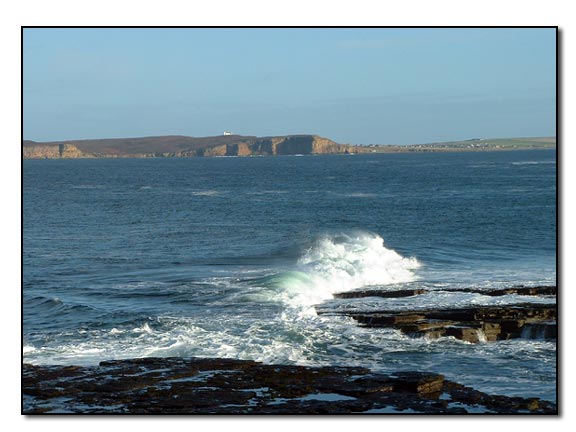
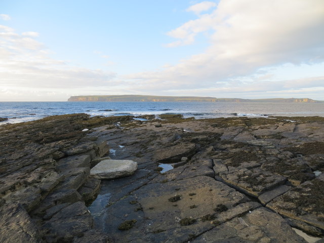
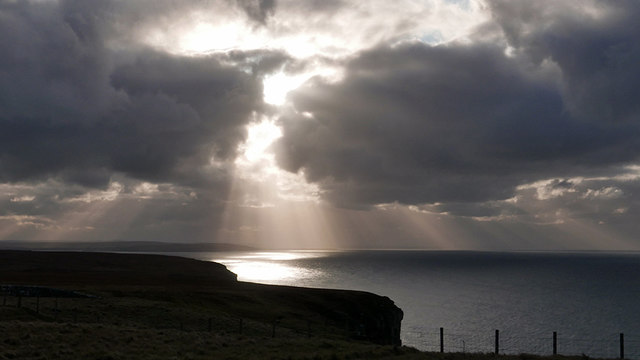
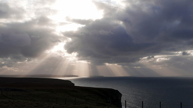
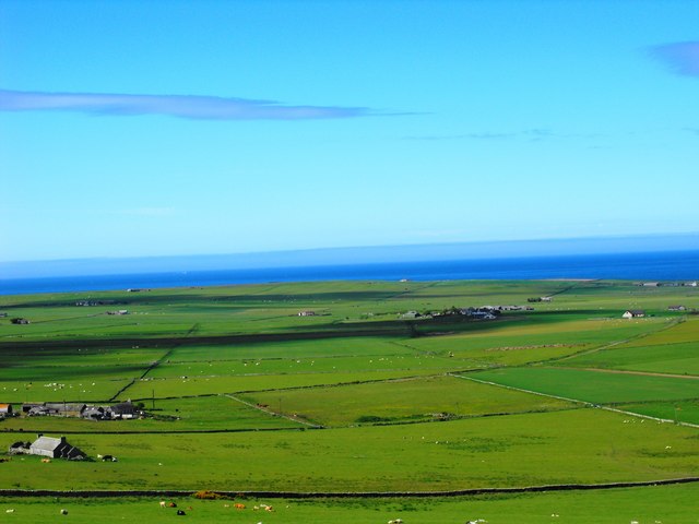
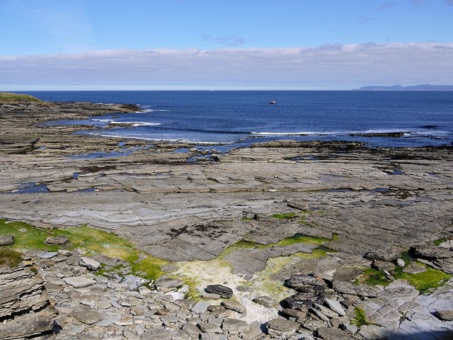
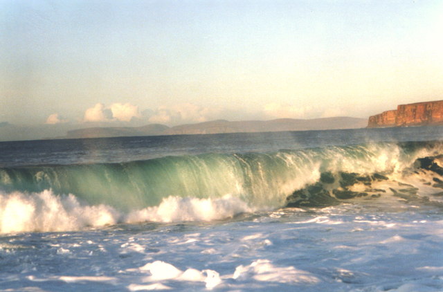
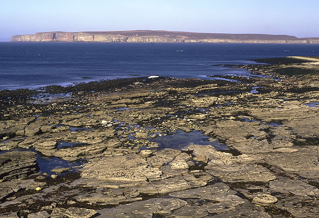
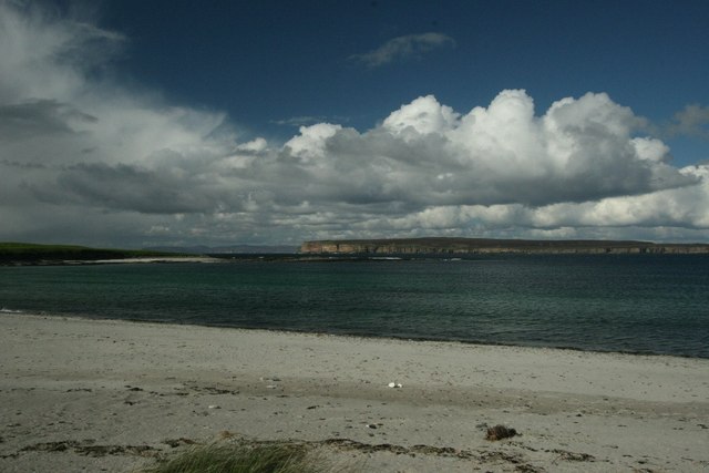
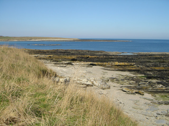
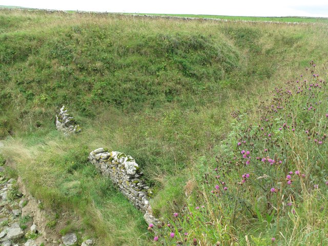
Methow Clett is a prominent coastal feature located in the county of Caithness, Scotland. This headland, also referred to as a point, is a picturesque and rugged landform that juts out into the North Sea. Situated along the northeastern coast, Methow Clett offers breathtaking views of the surrounding coastline and the open ocean.

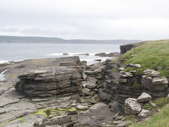
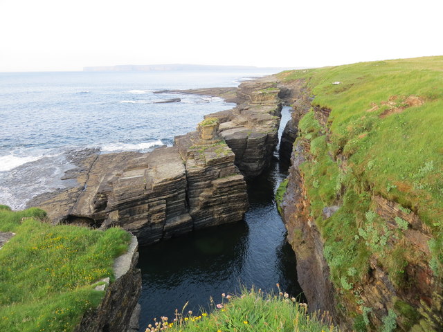
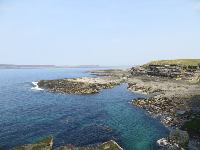
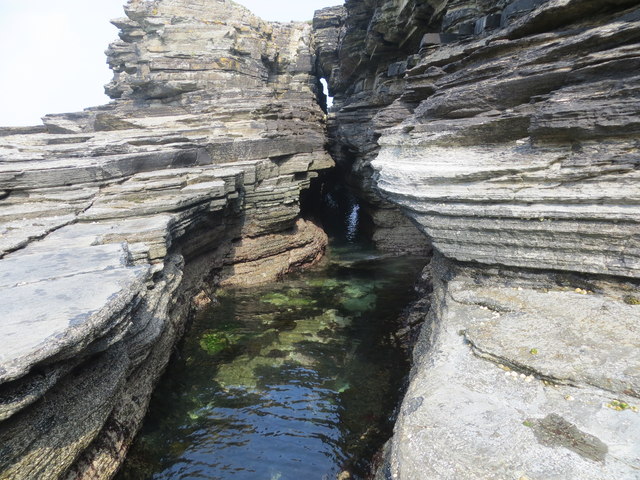
The headland is characterized by its steep cliffs, rising high above the sea, and its rocky terrain. These cliffs are composed of sedimentary rock, displaying various layers that provide insights into the region's geological history. The exposed rocks also serve as habitats for a diverse range of seabirds, including guillemots, puffins, and kittiwakes, making Methow Clett a popular spot for birdwatching enthusiasts.

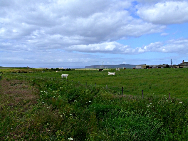
The area surrounding Methow Clett is renowned for its natural beauty and tranquility. Visitors can enjoy long walks along the coastal path, taking in the fresh sea air and absorbing the stunning coastal scenery. The headland is also home to a rich marine ecosystem, with dolphins, seals, and occasionally even whales being seen offshore.

Due to its exposed location, Methow Clett can be subject to strong winds and rough seas, adding to the dramatic nature of the landscape. However, this also means that caution must be exercised when exploring the area, especially near the cliff edges.

Overall, Methow Clett is a captivating coastal feature that showcases the rugged beauty of Caithness. With its stunning cliffs, diverse wildlife, and breathtaking views, it offers a memorable experience for nature enthusiasts and those seeking a peaceful escape by the sea.

If you have any feedback on the listing, please let us know in the comments section below.

Methow Clett Images

Images are sourced within 2km of 58.610227/-3.4457108 or Grid Reference ND1670. Thanks to Geograph Open Source API. All images are credited.

Murkle - Claredon Head A lovely walk along the headland here.  Go down the West Murkle road and park.  In the distance you can see the House of the Northern Gate on Dunnet Head.
Murkle - Claredon Head
A lovely walk along the headland here. Go down the West Murkle road and park. In the distance you can see the House of the Northern Gate on Dunnet Head.
Coast at Clardon Exposed flagstone beds on the coast at Clardon.
Coast at Clardon
Exposed flagstone beds on the coast at Clardon.
North eastern part of The Spur at Dunnet Bay Looking towards Dunnet Head
North eastern part of The Spur at Dunnet Bay
Looking towards Dunnet Head
Murphy's Craig at West Murkle
A 'light show' over Dunnet Bay Sun shining through heavy cloud provides a spectacular view over the bay.
A 'light show' over Dunnet Bay
Sun shining through heavy cloud provides a spectacular view over the bay.
Sunbeams over Dunnet Bay
Craig Ware looking over to Dunnet Head
Shoreline features near Craig Ware
View to Murkle and The Pentland Firth View from Castletown/Wedale Road
View to Murkle and The Pentland Firth
View from Castletown/Wedale Road
Clardon Haven
Clardon Haven
Murkle Bay Hoy in the background Dunnet Head to the right
Murkle Bay
Hoy in the background Dunnet Head to the right
Farmland near Thurso Farmland all around here.
Farmland near Thurso
Farmland all around here.
Clardon Haven The rocky beach at Clardon Haven, with Dunnet Head in the background.
Clardon Haven
The rocky beach at Clardon Haven, with Dunnet Head in the background.
Turn for Sibmister At Murkle
Turn for Sibmister
At Murkle
Murkle: approaching Mains of Murkle A cat investigates rare traffic on this lane leading only to Mains of Murkle.
Murkle: approaching Mains of Murkle
A cat investigates rare traffic on this lane leading only to Mains of Murkle.
Murkle and Dunnet Head View of Murkle Bay with Dunnet Head across the water and Orkney in the distance.
Murkle and Dunnet Head
View of Murkle Bay with Dunnet Head across the water and Orkney in the distance.
Murkle Bay Looking across Murkle Bay to the headland known as the Spur of Murkle. Viewed from the shore at East Murkle where the flagstone beds are fringed by a narrow beach of shell sand.
Murkle Bay
Looking across Murkle Bay to the headland known as the Spur of Murkle. Viewed from the shore at East Murkle where the flagstone beds are fringed by a narrow beach of shell sand.
Boat Shelter at Clardon Haven A dyke has been constructed to protect a natural gully above the shore. Probably a former boat shelter.
Boat Shelter at Clardon Haven
A dyke has been constructed to protect a natural gully above the shore. Probably a former boat shelter.
Show me another place!

Methow Clett is located at Grid Ref: ND1670 (Lat: 58.610227, Lng: -3.4457108)

Unitary Authority: Highland

Police Authority: Highlands and Islands

What 3 Words

///howler.gobbles.admiringly. Near Thurso, Highland

Related Wikis

Murkle

Murkle (Murchill) is a small scattered hamlet, made up of East Murkle and West Murkle located one mile (1.6 km) east of Thurso, in Caithness, Scottish...

River Thurso

The River Thurso (Scottish Gaelic: Abhainn TheĆ²rsa) has Loch Rumsdale in Caithness as its source, about 26 kilometres south and 14 kilometres west of the...

Haimer

Haimer is a small hamlet in Caithness, Scotland. It is located on a road just off the A836 and consists of several small settlements and farming facilities...
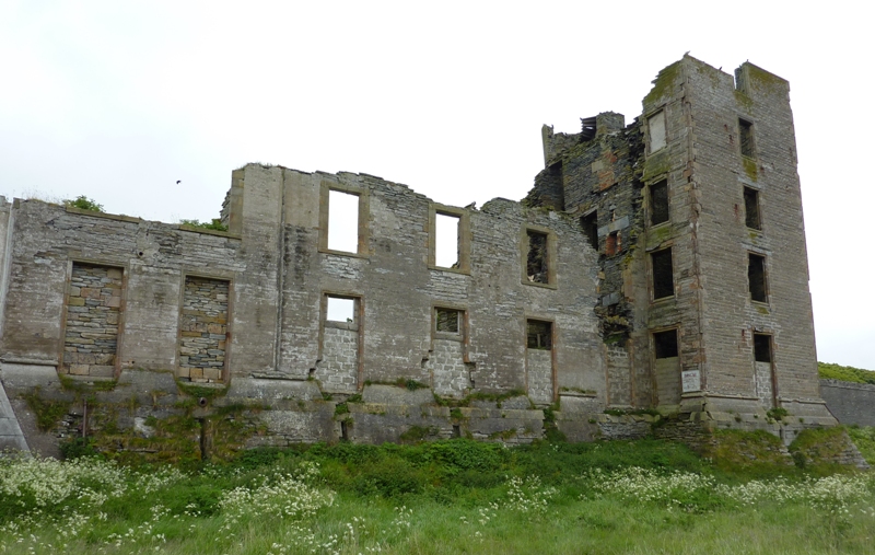
Thurso Castle

Thurso Castle (alternatively, Castrum De Thorsa, Castle of Ormly, and Castle of Ormlie) is a ruined 19th-century castle, located in Thurso, Caithness,...

Thurso East

Thurso East (alternatively, the North Shore) is a coastline section of the Atlantic 0.5 miles (0.80 km) east of Thurso, Caithness, northern Scotland. It...

Thurso Bay

Thurso Bay, known also as Scrabster Bay, is a bay of Atlantic water between the points of Clairdon Head and Holborn Head on the north coast of Caithness...

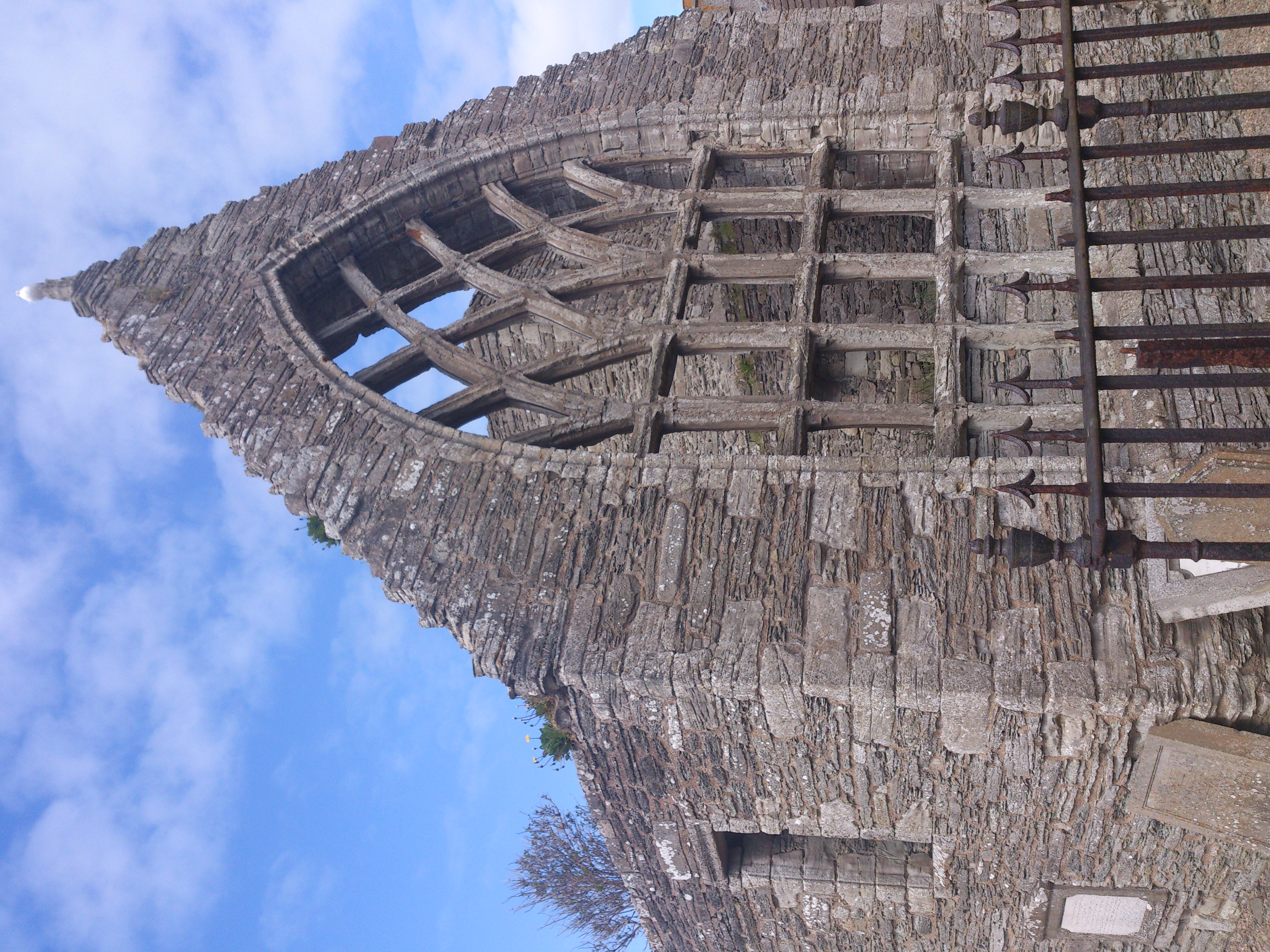
Old St Peter's Church, Thurso

Auld St Peter's Kirk is a ruined parish church on Wilson Lane, in Thurso, Caithness, Scotland. Dedicated to Saint Peter, it dates to at least 1125, and...

Castletown, Highland

Castletown (Scottish Gaelic: Baile a' Chaisteil) is a village on the north coast of the Highland council area of Scotland, situated near Dunnet Bay. It...

Nearby Amenities

Located within 500m of 58.610227,-3.4457108
Created By: almien_coastlines
Source: PGS
Lat/Long: 58.611094/-3.438233
Created By: almien_coastlines
Source: PGS
Lat/Long: 58.610833/-3.439701
Created By: almien_coastlines
Source: PGS
Lat/Long: 58.610575/-3.440189
Created By: almien_coastlines
Source: PGS
Lat/Long: 58.610311/-3.442638
Created By: almien_coastlines
Source: PGS
Lat/Long: 58.610309/-3.443128
Created By: almien_coastlines
Source: PGS
Lat/Long: 58.610302/-3.44509
Created By: almien_coastlines
Source: PGS
Lat/Long: 58.610044/-3.445578
Created By: almien_coastlines
Source: PGS
Lat/Long: 58.609787/-3.446065
Created By: almien_coastlines
Source: PGS
Lat/Long: 58.609529/-3.446552
Created By: almien_coastlines
Source: PGS
Lat/Long: 58.60927/-3.44753
Created By: almien_coastlines
Source: PGS
Lat/Long: 58.609012/-3.448017
Created By: almien_coastlines
Source: PGS
Lat/Long: 58.609004/-3.45047
Created By: almien_coastlines
Source: PGS
Lat/Long: 58.609258/-3.450963
Created By: almien_coastlines
Source: PGS
Lat/Long: 58.609512/-3.451457
Created By: almien_coastlines
Source: PGS
Lat/Long: 58.609766/-3.451951
Created By: almien_coastlines
Source: PGS
Lat/Long: 58.609893/-3.452443
Created By: almien_coastlines
Source: PGS
Lat/Long: 58.61015/-3.452202
Created By: almien_coastlines
Source: PGS
Lat/Long: 58.611174/-3.452215
Created By: almien_coastlines
Source: PGS
Lat/Long: 58.611428/-3.452709
Created By: almien_coastlines
Source: PGS
Lat/Long: 58.611683/-3.452957
Created By: almien_coastlines
Source: PGS
Lat/Long: 58.611681/-3.453448
Created By: almien_coastlines
Source: PGS
Lat/Long: 58.611169/-3.453441
Created By: almien_coastlines
Source: PGS
Lat/Long: 58.611295/-3.453933
The data included in this document is from www.openstreetmap.org. The data is made available under ODbL.

Have you been to Methow Clett?

Leave your review of Methow Clett below (or comments, questions and feedback).