Clardon Haven

Bay in Caithness

Scotland

Clardon Haven

Murkle - Claredon Head A lovely walk along the headland here.  Go down the West Murkle road and park.  In the distance you can see the House of the Northern Gate on Dunnet Head.
Murkle - Claredon Head Credit: Dorcas Sinclair

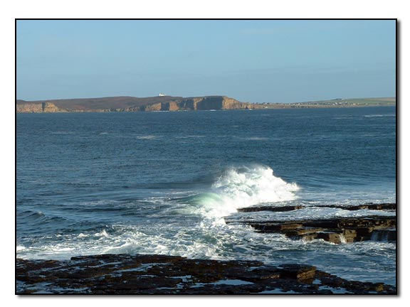
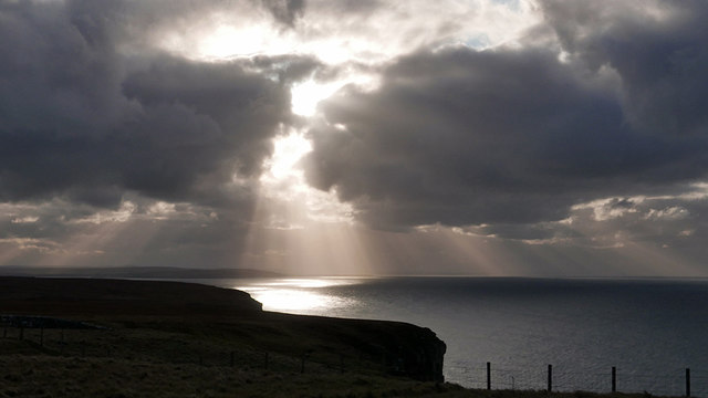
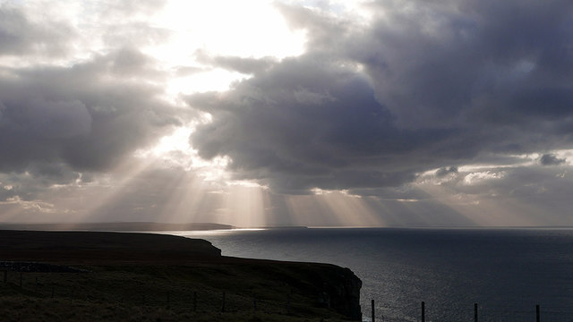
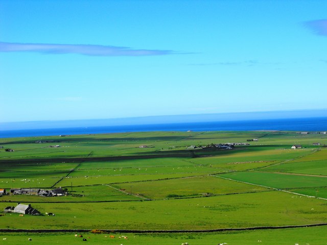
Clardon Haven, located in Caithness, is a picturesque bay situated on the northeastern coast of Scotland. Renowned for its natural beauty and tranquility, this idyllic haven offers visitors a serene retreat amidst stunning landscapes.

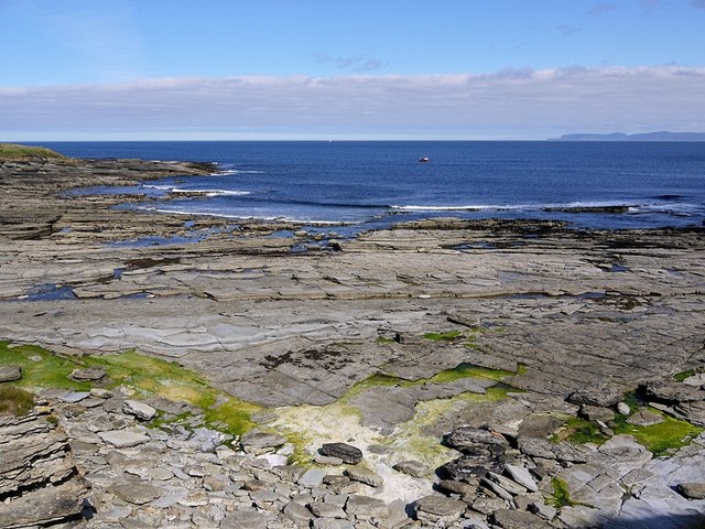
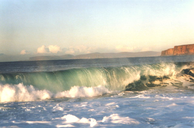
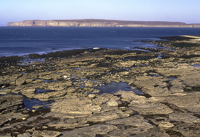
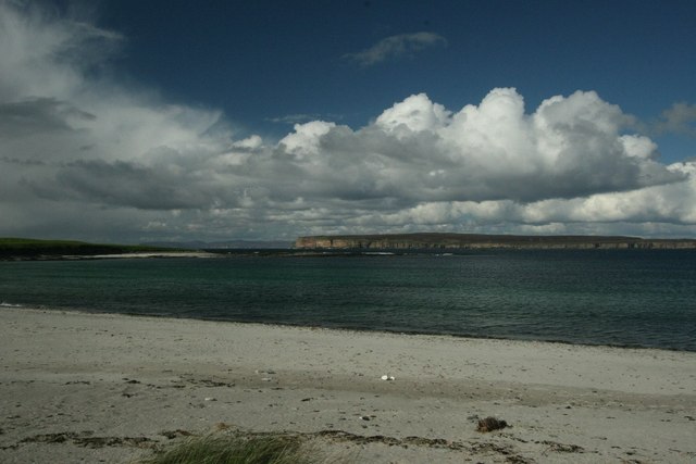
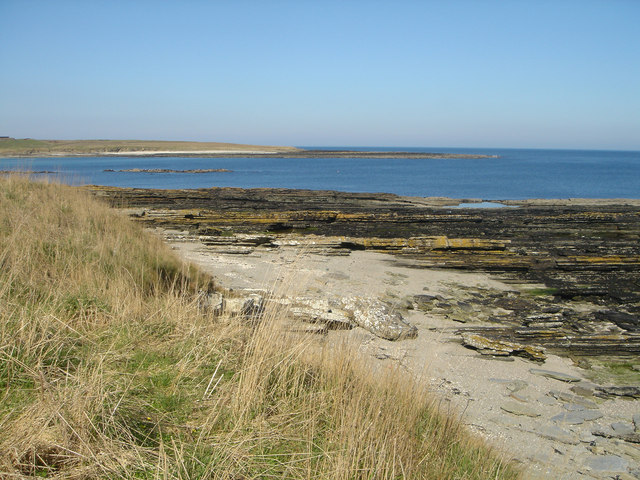
The bay itself is characterized by its pristine sandy beach, which stretches for approximately one kilometer. The soft golden sand provides a perfect spot for sunbathing, leisurely strolls, or engaging in various beach activities. The clear turquoise waters of the bay are not only visually appealing but also offer a refreshing swimming experience for locals and tourists alike.

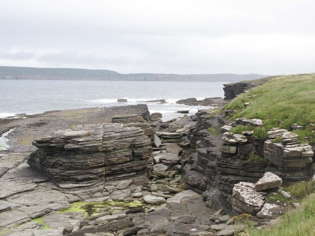
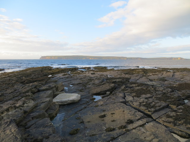
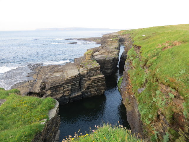
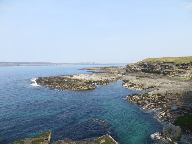
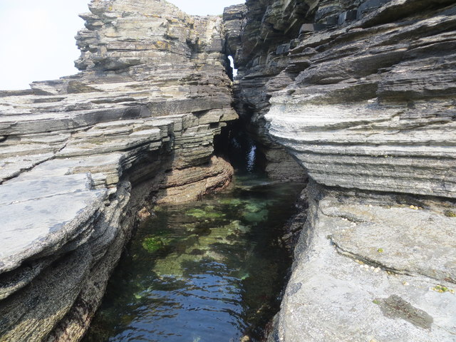
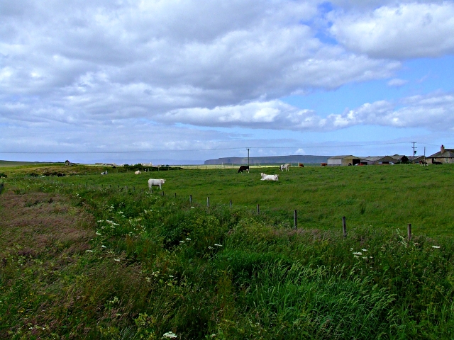
Surrounded by rugged cliffs and rolling hills, Clardon Haven offers breathtaking panoramic views of the surrounding Caithness countryside. The bay is also home to a diverse array of flora and fauna, making it an ideal destination for nature enthusiasts and birdwatchers. Seals and dolphins are often spotted frolicking in the bay, providing a unique opportunity for wildlife enthusiasts to observe these marine creatures in their natural habitat.

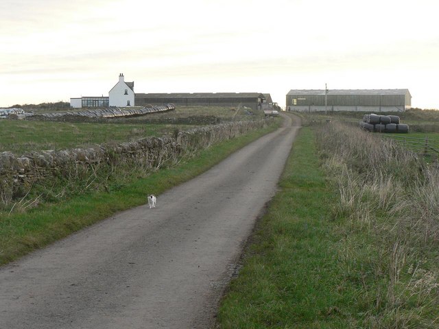
Clardon Haven boasts excellent facilities, including a well-maintained car park, public toilets, and picnic areas, ensuring visitors have a comfortable and enjoyable experience. Additionally, the bay is easily accessible, with nearby transportation links and various accommodation options in the surrounding area.

Whether it's a peaceful walk along the beach, a refreshing swim, or simply basking in the beauty of nature, Clardon Haven in Caithness offers an unforgettable coastal experience for visitors seeking relaxation and tranquility amidst Scotland's stunning coastal scenery.

If you have any feedback on the listing, please let us know in the comments section below.

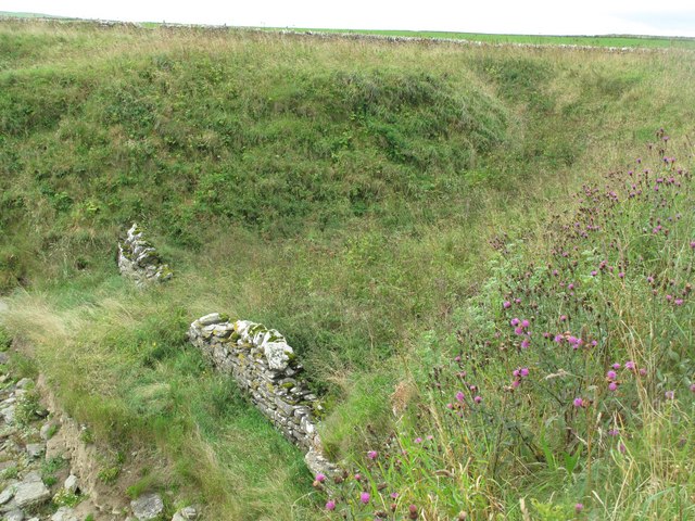
Clardon Haven Images

Images are sourced within 2km of 58.61097/-3.4459136 or Grid Reference ND1670. Thanks to Geograph Open Source API. All images are credited.

Murkle - Claredon Head A lovely walk along the headland here.  Go down the West Murkle road and park.  In the distance you can see the House of the Northern Gate on Dunnet Head.
Murkle - Claredon Head
A lovely walk along the headland here. Go down the West Murkle road and park. In the distance you can see the House of the Northern Gate on Dunnet Head.
Coast at Clardon Exposed flagstone beds on the coast at Clardon.
Coast at Clardon
Exposed flagstone beds on the coast at Clardon.
North eastern part of The Spur at Dunnet Bay Looking towards Dunnet Head
North eastern part of The Spur at Dunnet Bay
Looking towards Dunnet Head
Murphy's Craig at West Murkle
A 'light show' over Dunnet Bay Sun shining through heavy cloud provides a spectacular view over the bay.
A 'light show' over Dunnet Bay
Sun shining through heavy cloud provides a spectacular view over the bay.
Sunbeams over Dunnet Bay
Craig Ware looking over to Dunnet Head
Shoreline features near Craig Ware
View to Murkle and The Pentland Firth View from Castletown/Wedale Road
View to Murkle and The Pentland Firth
View from Castletown/Wedale Road
Clardon Haven
Clardon Haven
Murkle Bay Hoy in the background Dunnet Head to the right
Murkle Bay
Hoy in the background Dunnet Head to the right
Farmland near Thurso Farmland all around here.
Farmland near Thurso
Farmland all around here.
Clardon Haven The rocky beach at Clardon Haven, with Dunnet Head in the background.
Clardon Haven
The rocky beach at Clardon Haven, with Dunnet Head in the background.
Turn for Sibmister At Murkle
Turn for Sibmister
At Murkle
Murkle: approaching Mains of Murkle A cat investigates rare traffic on this lane leading only to Mains of Murkle.
Murkle: approaching Mains of Murkle
A cat investigates rare traffic on this lane leading only to Mains of Murkle.
Murkle and Dunnet Head View of Murkle Bay with Dunnet Head across the water and Orkney in the distance.
Murkle and Dunnet Head
View of Murkle Bay with Dunnet Head across the water and Orkney in the distance.
Murkle Bay Looking across Murkle Bay to the headland known as the Spur of Murkle. Viewed from the shore at East Murkle where the flagstone beds are fringed by a narrow beach of shell sand.
Murkle Bay
Looking across Murkle Bay to the headland known as the Spur of Murkle. Viewed from the shore at East Murkle where the flagstone beds are fringed by a narrow beach of shell sand.
Boat Shelter at Clardon Haven A dyke has been constructed to protect a natural gully above the shore. Probably a former boat shelter.
Boat Shelter at Clardon Haven
A dyke has been constructed to protect a natural gully above the shore. Probably a former boat shelter.
Show me another place!

Clardon Haven is located at Grid Ref: ND1670 (Lat: 58.61097, Lng: -3.4459136)

Unitary Authority: Highland

Police Authority: Highlands and Islands

What 3 Words

///amending.closes.silently. Near Thurso, Highland

Related Wikis

Murkle

Murkle (Murchill) is a small scattered hamlet, made up of East Murkle and West Murkle located one mile (1.6 km) east of Thurso, in Caithness, Scottish...

River Thurso

The River Thurso (Scottish Gaelic: Abhainn TheĆ²rsa) has Loch Rumsdale in Caithness as its source, about 26 kilometres south and 14 kilometres west of the...

Haimer

Haimer is a small hamlet in Caithness, Scotland. It is located on a road just off the A836 and consists of several small settlements and farming facilities...
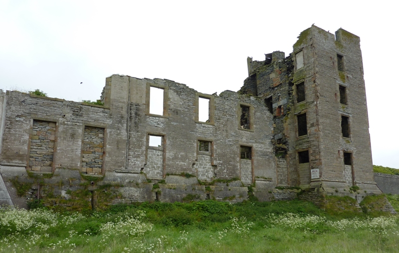
Thurso Castle

Thurso Castle (alternatively, Castrum De Thorsa, Castle of Ormly, and Castle of Ormlie) is a ruined 19th-century castle, located in Thurso, Caithness,...

Nearby Amenities

Located within 500m of 58.61097,-3.4459136
Created By: almien_coastlines
Source: PGS
Lat/Long: 58.611094/-3.438233
Created By: almien_coastlines
Source: PGS
Lat/Long: 58.610833/-3.439701
Created By: almien_coastlines
Source: PGS
Lat/Long: 58.610575/-3.440189
Created By: almien_coastlines
Source: PGS
Lat/Long: 58.610311/-3.442638
Created By: almien_coastlines
Source: PGS
Lat/Long: 58.610309/-3.443128
Created By: almien_coastlines
Source: PGS
Lat/Long: 58.610302/-3.44509
Created By: almien_coastlines
Source: PGS
Lat/Long: 58.610044/-3.445578
Created By: almien_coastlines
Source: PGS
Lat/Long: 58.609787/-3.446065
Created By: almien_coastlines
Source: PGS
Lat/Long: 58.609529/-3.446552
Created By: almien_coastlines
Source: PGS
Lat/Long: 58.60927/-3.44753
Created By: almien_coastlines
Source: PGS
Lat/Long: 58.609012/-3.448017
Created By: almien_coastlines
Source: PGS
Lat/Long: 58.609004/-3.45047
Created By: almien_coastlines
Source: PGS
Lat/Long: 58.609258/-3.450963
Created By: almien_coastlines
Source: PGS
Lat/Long: 58.609512/-3.451457
Created By: almien_coastlines
Source: PGS
Lat/Long: 58.609766/-3.451951
Created By: almien_coastlines
Source: PGS
Lat/Long: 58.609893/-3.452443
Created By: almien_coastlines
Source: PGS
Lat/Long: 58.61015/-3.452202
Created By: almien_coastlines
Source: PGS
Lat/Long: 58.611174/-3.452215
Created By: almien_coastlines
Source: PGS
Lat/Long: 58.611428/-3.452709
Created By: almien_coastlines
Source: PGS
Lat/Long: 58.611683/-3.452957
Created By: almien_coastlines
Source: PGS
Lat/Long: 58.611681/-3.453448
Created By: almien_coastlines
Source: PGS
Lat/Long: 58.611169/-3.453441
Created By: almien_coastlines
Source: PGS
Lat/Long: 58.611295/-3.453933
Created By: almien_coastlines
Source: PGS
Lat/Long: 58.611549/-3.454427
The data included in this document is from www.openstreetmap.org. The data is made available under ODbL.

Have you been to Clardon Haven?

Leave your review of Clardon Haven below (or comments, questions and feedback).