Ramshorn Rock

Coastal Feature, Headland, Point in Devon East Devon

England

Ramshorn Rock

Casting a long shadow An early morning view of part of the donkey sanctuary.
the building on the right is a hand washing point.
Casting a long shadow Credit: Anthony Vosper

Ramshorn Rock is a prominent coastal feature located in Devon, England. Situated on the southwest coast of the county, it is specifically found in the region known as the South Hams. Ramshorn Rock is a headland that juts out into the English Channel, forming a distinct point along the coastline.

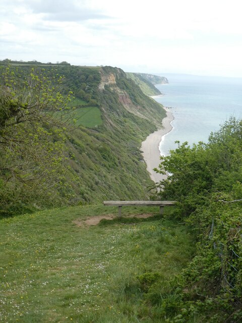
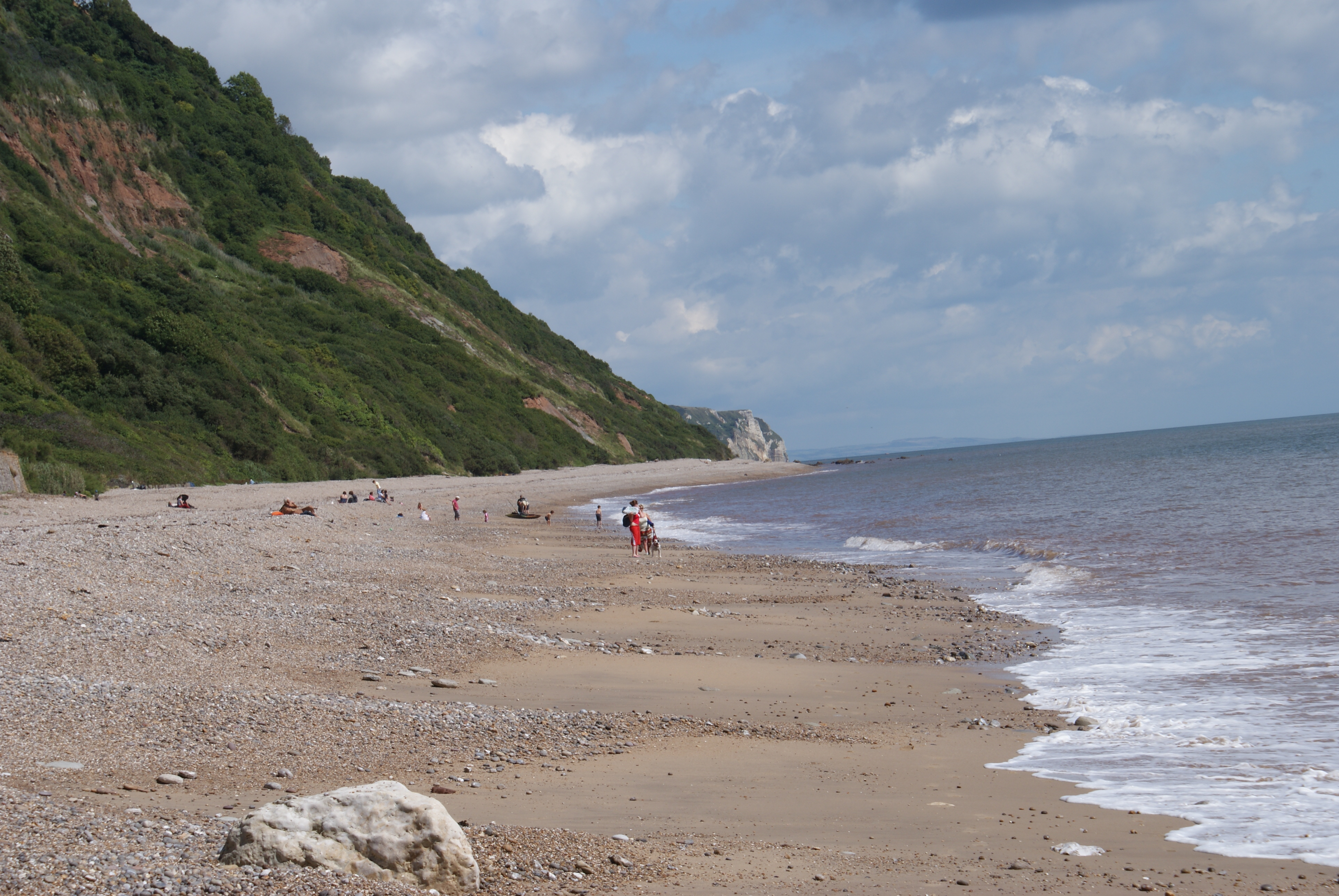
This rocky headland is characterized by its unique shape, which resembles the curve of a ram's horn, hence its name. The rock is composed of rugged cliffs and is surrounded by clear blue waters. The headland itself stands at an impressive height, offering stunning views of the surrounding area.

Ramshorn Rock is a popular destination for both locals and tourists alike due to its natural beauty and accessibility. Visitors can enjoy walking along the coastal path that runs alongside the headland, taking in the breathtaking vistas and observing the diverse marine life that inhabits the surrounding waters.

The area around Ramshorn Rock is also known for its rich biodiversity. The cliffs provide a habitat for various seabird species, including gulls and cormorants, which can often be seen perched on the rocks or soaring above the sea. The rock pools at low tide are home to an array of marine creatures, such as crabs, starfish, and small fish.

Overall, Ramshorn Rock is a striking coastal feature that showcases the natural beauty of the Devon coastline. With its distinctive shape, impressive cliffs, and abundant wildlife, it is an enchanting spot that captivates visitors and provides a memorable experience of the region's coastal landscape.

If you have any feedback on the listing, please let us know in the comments section below.

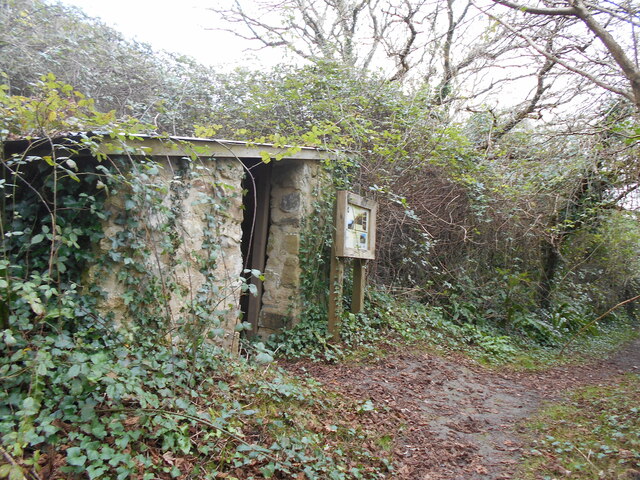
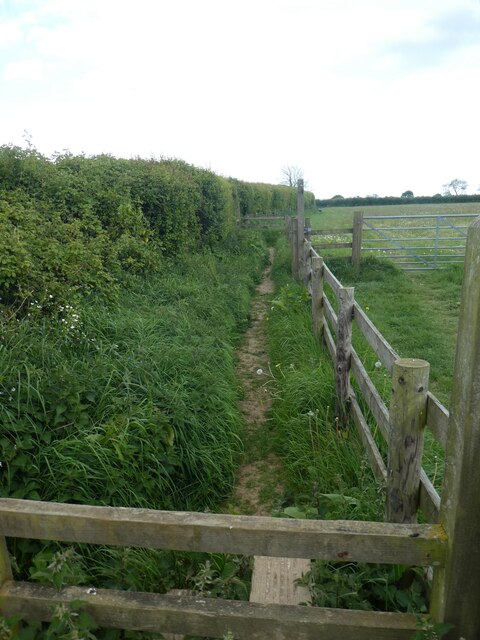
Ramshorn Rock Images

Images are sourced within 2km of 50.686025/-3.1790279 or Grid Reference SY1688. Thanks to Geograph Open Source API. All images are credited.

Casting a long shadow An early morning view of part of the donkey sanctuary.
the building on the right is a hand washing point.
Casting a long shadow
An early morning view of part of the donkey sanctuary. the building on the right is a hand washing point.
Entering the sea A small stream crosses the beach at an area known as the Glen at Weston Mouth.
The South West Coast Path climbs up from the beach on its route to Sidmouth.
Entering the sea
A small stream crosses the beach at an area known as the Glen at Weston Mouth. The South West Coast Path climbs up from the beach on its route to Sidmouth.
The Linhay A small shelter built for labourers  growing potatoes on the nearby area known locally as the Plats.
The Linhay
A small shelter built for labourers growing potatoes on the nearby area known locally as the Plats.
Dunscombe Manor farm Now the reception building of a caravan park.
Dunscombe Manor farm
Now the reception building of a caravan park.
Playground area, Donkey Sanctuary, Salcombe Regis
A field of donkeys grazing, Donkey Sanctuary, Salcombe Regis
Footpath between hedge and fence, Donkey Sanctuary,  Salcombe Regis
Footpath between hedge and fence, Donkey Sanctuary, Salcombe Regis
Stile and dog door,  Salcombe Regis
Stile and dog door, Salcombe Regis
Garden of marine souvenirs,  Salcombe Regis
Garden of marine souvenirs, Salcombe Regis
Dunscombe Lane leading from east into Salcombe Regis
Fingerpost for South West Coast Path on Higher Dunscombe Cliff The South West Coast Path has to zig-zag up the west face of the cliff, and hence the arms of the fingerpost are at an acute angle
Fingerpost for South West Coast Path on Higher Dunscombe Cliff
The South West Coast Path has to zig-zag up the west face of the cliff, and hence the arms of the fingerpost are at an acute angle
South West Coast Path on Higher Dunscombe Cliff The South West Coast Path runs inland of the fence, kept away from the unstable cliff edge
South West Coast Path on Higher Dunscombe Cliff
The South West Coast Path runs inland of the fence, kept away from the unstable cliff edge
South West Coast Path on Higher Dunscombe Cliff The South West Coast Path National Trail - 630 miles of superb coastal walking. From Minehead on the edge of the Exmoor National Park to the shores of Poole Harbour in Dorset. It is the longest of all Britain's National Trails.
Website: <span class="nowrap"><a title="http://www.southwestcoastpath.com/" rel="nofollow ugc noopener" href="http://www.southwestcoastpath.com/">Link</a><img style="margin-left:2px;" alt="External link" title="External link - shift click to open in new window" src="https://s1.geograph.org.uk/img/external.png" width="10" height="10"/></span>
South West Coast Path on Higher Dunscombe Cliff
The South West Coast Path National Trail - 630 miles of superb coastal walking. From Minehead on the edge of the Exmoor National Park to the shores of Poole Harbour in Dorset. It is the longest of all Britain's National Trails. Website: LinkExternal link
South West Coast Path by a hilltop field, Higher Dunscombe Cliff The South West Coast Path National Trail - 630 miles of superb coastal walking. From Minehead on the edge of the Exmoor National Park to the shores of Poole Harbour in Dorset. It is the longest of all Britain's National Trails.
Website: <span class="nowrap"><a title="http://www.southwestcoastpath.com/" rel="nofollow ugc noopener" href="http://www.southwestcoastpath.com/">Link</a><img style="margin-left:2px;" alt="External link" title="External link - shift click to open in new window" src="https://s1.geograph.org.uk/img/external.png" width="10" height="10"/></span>
South West Coast Path by a hilltop field, Higher Dunscombe Cliff
The South West Coast Path National Trail - 630 miles of superb coastal walking. From Minehead on the edge of the Exmoor National Park to the shores of Poole Harbour in Dorset. It is the longest of all Britain's National Trails. Website: LinkExternal link
Field boundary on Higher Dunscombe Cliff
Lower Dunscombe Cliff seen from Higher Dunscombe Cliff A well-used bench for walkers on the South West Coast Path
Lower Dunscombe Cliff seen from Higher Dunscombe Cliff
A well-used bench for walkers on the South West Coast Path
Fingerpost for South West Coast Path in valley at Lincombe Part of the way down the east slope of Higher Dunscombe Cliff, there is a footpath leading inland, supervised by a few cattle
Fingerpost for South West Coast Path in valley at Lincombe
Part of the way down the east slope of Higher Dunscombe Cliff, there is a footpath leading inland, supervised by a few cattle
Path in the valley of Lincombe
Show me another place!

Ramshorn Rock is located at Grid Ref: SY1688 (Lat: 50.686025, Lng: -3.1790279)

Administrative County: Devon

District: East Devon

Police Authority: Devon and Cornwall

What 3 Words

///tinted.doghouse.clashing. Near Sidmouth, Devon

Related Wikis

Weston Mouth

Weston Mouth is an isolated beach on the East Devon coast between Sidmouth and Seaton in England. It can be reached only by footpath, either along the...

Weston, Devon

Weston is a small hamlet near Sidmouth in East Devon, England. It is near the Donkey Sanctuary and less than a mile from the beach at Branscombe; footpaths...

The Donkey Sanctuary

The Donkey Sanctuary is a British charitable organisation devoted to the welfare of donkeys. The charity, which is based near Sidmouth in Devon, England...

Street, Devon

Street is a small village in the East Devon district of Devon, England. Its nearest town is Sidmouth, which lies approximately 4 miles (6.4 km) south-west...

Salcombe Regis

Salcombe Regis is a coastal village and former civil parish, now in the parish of Sidmouth, in the East Devon district, in the county of Devon, England...

Branscombe

Branscombe is a village in the East Devon district of the English County of Devon. The parish covers 3,440 acres (1,390 ha). Its permanent population in...

St Winifred's Church, Branscombe

St Winifred's Church is a Church of England church in Branscombe in Devon, England. The church is dedicated to Saint Winifred, a Welsh saint. It is among...

Berry Camp

Berry Camp or Berry Cliff, is an Iron Age Hill fort on a partially eroded cliff top close to Branscombe in Devon. The cliff is situated some 140 metres...

Nearby Amenities

Located within 500m of 50.686025,-3.1790279
Source: PGS
Lat/Long: 50.6846713/-3.1855019
Source: PGS
Lat/Long: 50.6848674/-3.182435
Source: PGS
Lat/Long: 50.6848579/-3.1814738
Source: PGS
Lat/Long: 50.6848494/-3.1807318
Source: PGS
Lat/Long: 50.6847626/-3.1795196
Source: PGS
Lat/Long: 50.6842828/-3.1772992
Source: PGS
Lat/Long: 50.6847158/-3.1738898
Source: PGS
Lat/Long: 50.6842216/-3.1741366
Source: PGS
Lat/Long: 50.6840782/-3.1737351
Barrier: kissing_gate
Lat/Long: 50.6865752/-3.1845049
Barrier: kissing_gate
Lat/Long: 50.6862551/-3.1819931
Weston Mouth
Place: locality
Lat/Long: 50.6848441/-3.1846939
Man Made: survey_point
Lat/Long: 50.6875366/-3.1765476
Barrier: kissing_gate
Lat/Long: 50.6857639/-3.1853877
Bench
Backrest: no
Lat/Long: 50.6866355/-3.178361
Access: no
Foot: yes
Ford: yes
Lat/Long: 50.6852328/-3.1847525
Bench
Backrest: no
Survey Date: 2023-04-07
Lat/Long: 50.686381/-3.1821168
The data included in this document is from www.openstreetmap.org. The data is made available under ODbL.

Have you been to Ramshorn Rock?

Leave your review of Ramshorn Rock below (or comments, questions and feedback).