Dunscombe Bottom

Valley in Devon East Devon

England

Dunscombe Bottom

A3052 The A3052 Road runs 27 miles from Charnmouth to Clyst St Mary. It runs parallel to the East Devon coastline, but inland.
<span class="nowrap"><a title="http://www.sabre-roads.org.uk/wiki/index.php?title=A3052" rel="nofollow ugc noopener" href="http://www.sabre-roads.org.uk/wiki/index.php?title=A3052">Link</a><img style="margin-left:2px;" alt="External link" title="External link - shift click to open in new window" src="https://s1.geograph.org.uk/img/external.png" width="10" height="10"/></span>
A3052 Credit: N Chadwick

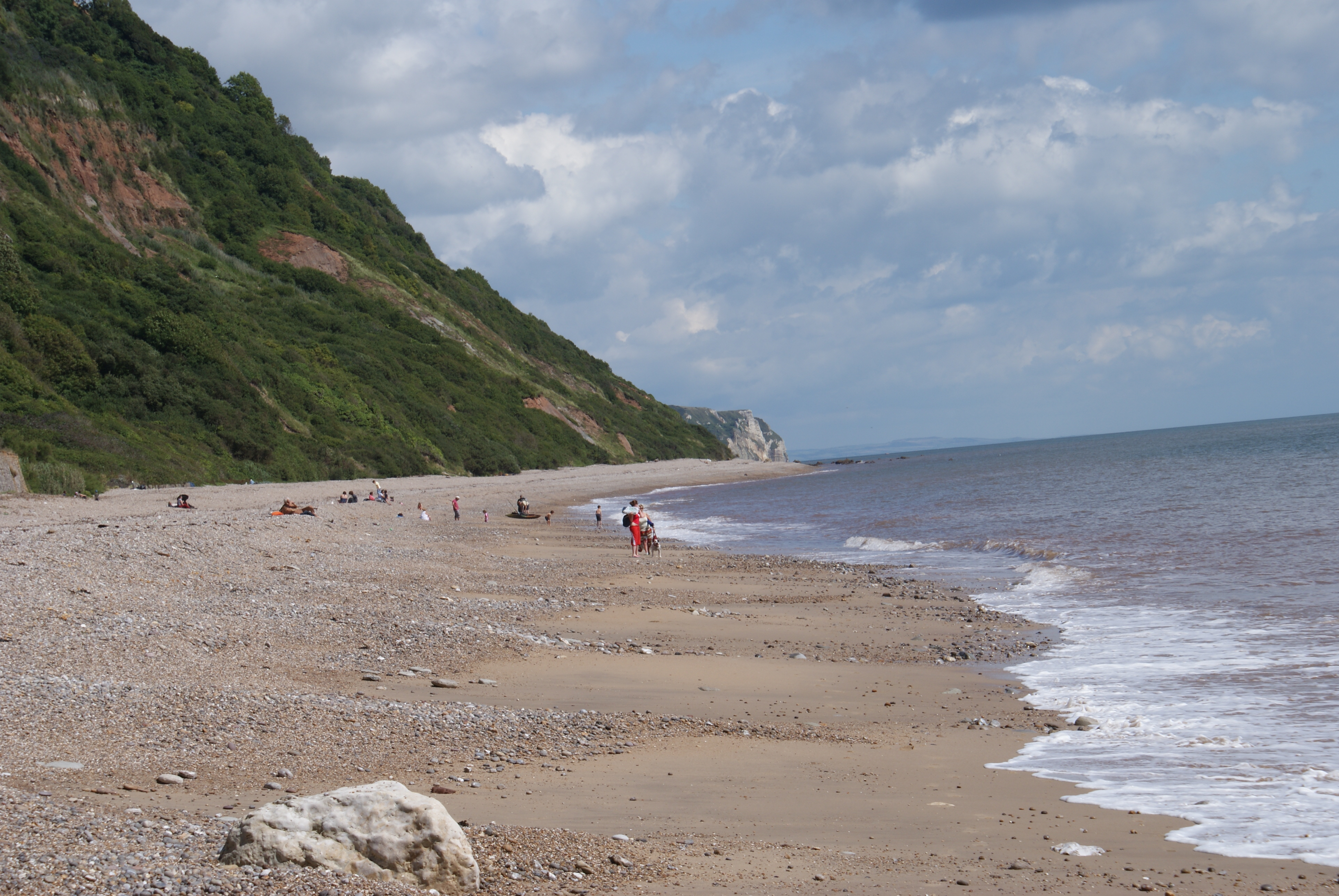
Dunscombe Bottom is a picturesque valley located in the county of Devon, England. Nestled within the East Devon Area of Outstanding Natural Beauty, it is renowned for its breathtaking scenery, diverse wildlife, and tranquil atmosphere. The valley is situated near the village of Salcombe Regis, just a few miles from the popular coastal town of Sidmouth.

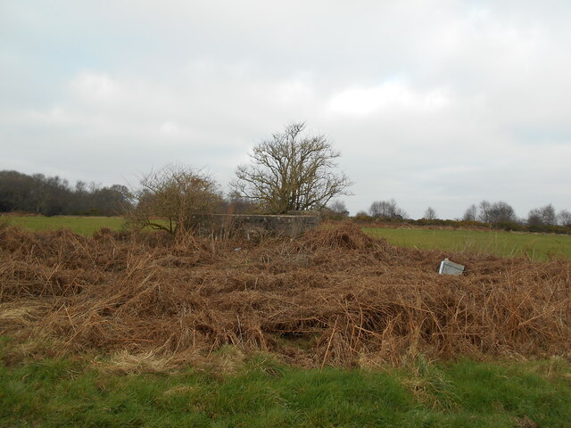
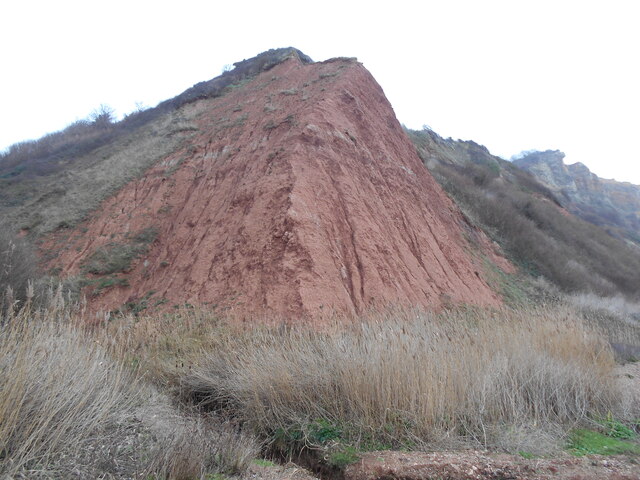
The landscape of Dunscombe Bottom is characterized by rolling hills, lush green fields, and meandering streams. The valley is predominantly covered by dense woodland, providing a haven for various species of flora and fauna. Visitors to the area can enjoy peaceful walks along the numerous footpaths that crisscross the valley, immersing themselves in the beauty of the surrounding nature.

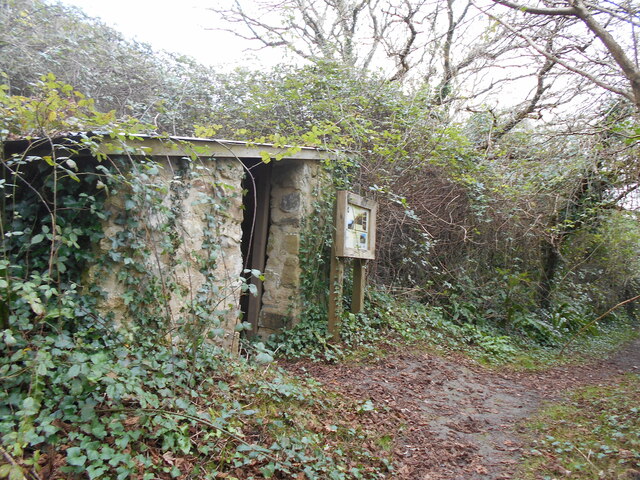
One of the notable features of Dunscombe Bottom is its rich history, evident through the presence of ancient earthworks and archaeological sites. These remnants of the past offer a glimpse into the valley's past inhabitants and their way of life. Additionally, the valley is home to a number of historic buildings, including the Grade II listed Dunscombe Manor, a charming country house dating back to the 18th century.

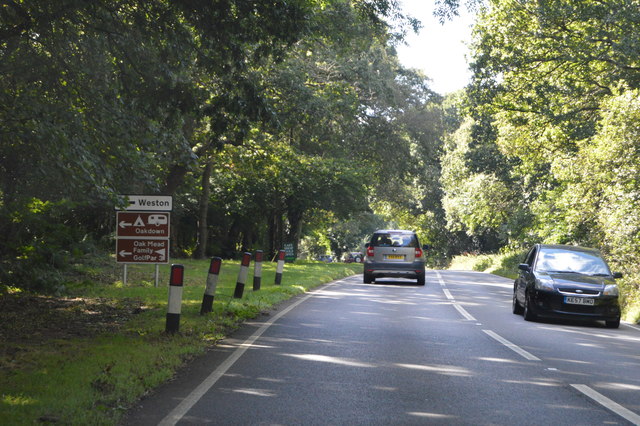
Dunscombe Bottom offers a range of recreational activities for nature enthusiasts and outdoor adventurers. The valley is a popular spot for birdwatching, with a variety of resident and migratory species to be observed. The surrounding woodlands also provide opportunities for hiking, camping, and picnicking, allowing visitors to fully immerse themselves in the natural beauty of the area.

Overall, Dunscombe Bottom is a hidden gem in the Devon countryside, offering a haven of tranquility and natural beauty for visitors to enjoy.

If you have any feedback on the listing, please let us know in the comments section below.

Dunscombe Bottom Images

Images are sourced within 2km of 50.689606/-3.1868333 or Grid Reference SY1688. Thanks to Geograph Open Source API. All images are credited.

A3052 The A3052 Road runs 27 miles from Charnmouth to Clyst St Mary. It runs parallel to the East Devon coastline, but inland.
<span class="nowrap"><a title="http://www.sabre-roads.org.uk/wiki/index.php?title=A3052" rel="nofollow ugc noopener" href="http://www.sabre-roads.org.uk/wiki/index.php?title=A3052">Link</a><img style="margin-left:2px;" alt="External link" title="External link - shift click to open in new window" src="https://s1.geograph.org.uk/img/external.png" width="10" height="10"/></span>
A3052
The A3052 Road runs 27 miles from Charnmouth to Clyst St Mary. It runs parallel to the East Devon coastline, but inland. LinkExternal link
Permissive path to the Donkey Sanctuary Described on a sign at the gate as "Oakdown's Field Trail", the path runs along this field edge towards the Donkey Sanctuary charity organisation in <a href="https://www.geograph.org.uk/gridref/SY1689">SY1689</a>
Permissive path to the Donkey Sanctuary
Described on a sign at the gate as "Oakdown's Field Trail", the path runs along this field edge towards the Donkey Sanctuary charity organisation in SY1689
Knowle House and its surrounding buildings from near Harcombe Farm Looking across the valley of the Snod Brook
Knowle House and its surrounding buildings from near Harcombe Farm
Looking across the valley of the Snod Brook
Paccombe Hill, east Devon The view down Paccombe Hill, Salcombe Regis, east Devon.
Paccombe Hill, east Devon
The view down Paccombe Hill, Salcombe Regis, east Devon.
Oakdown Caravan Site The entrance to Oakdown Caravan Site, Weston, Sidmouth.
Oakdown Caravan Site
The entrance to Oakdown Caravan Site, Weston, Sidmouth.
Coppiced hedge, Paccombe Hill A hedge that has been trimmed back rather than laid.
Coppiced hedge, Paccombe Hill
A hedge that has been trimmed back rather than laid.
Grassland, Paccombe Hill The plateau surface is grassland, this gives way to woodland on the steep slopes which descend to Paccombe.
Grassland, Paccombe Hill
The plateau surface is grassland, this gives way to woodland on the steep slopes which descend to Paccombe.
Pasture and trees by Knowle House A view from Sidmouth Bridleway 105 as it turns away from conversions at Knowle House and follows the right side of this field.
Pasture and trees by Knowle House
A view from Sidmouth Bridleway 105 as it turns away from conversions at Knowle House and follows the right side of this field.
Pasture, Knowle House From the shadow of a tree on Sidmouth Footpath 108, looking up the hill east of Knowle House.
Pasture, Knowle House
From the shadow of a tree on Sidmouth Footpath 108, looking up the hill east of Knowle House.
Gatedown Lane Leading to a number of camp sites.
Gatedown Lane
Leading to a number of camp sites.
Field by the A3052 With the head of a steep little side-valley dropping down Paccombe Hill into the Paccombe valley. Taken from an X53 bus, hence the window reflection.
Field by the A3052
With the head of a steep little side-valley dropping down Paccombe Hill into the Paccombe valley. Taken from an X53 bus, hence the window reflection.
Casting a long shadow An early morning view of part of the donkey sanctuary.
the building on the right is a hand washing point.
Casting a long shadow
An early morning view of part of the donkey sanctuary. the building on the right is a hand washing point.
Soldiers Hill water tank, Salcombe Regis A racecourse once occupied this site at the top of the hill.
Soldiers Hill water tank, Salcombe Regis
A racecourse once occupied this site at the top of the hill.
Cliff's edge Typical red sandstone cliffs at Salcombe Mouth.
note the gullies formed by water run off.
Cliff's edge
Typical red sandstone cliffs at Salcombe Mouth. note the gullies formed by water run off.
Entering the sea A small stream crosses the beach at an area known as the Glen at Weston Mouth.
The South West Coast Path climbs up from the beach on its route to Sidmouth.
Entering the sea
A small stream crosses the beach at an area known as the Glen at Weston Mouth. The South West Coast Path climbs up from the beach on its route to Sidmouth.
The Linhay A small shelter built for labourers  growing potatoes on the nearby area known locally as the Plats.
The Linhay
A small shelter built for labourers growing potatoes on the nearby area known locally as the Plats.
Dunscombe Manor farm Now the reception building of a caravan park.
Dunscombe Manor farm
Now the reception building of a caravan park.
Playground area, Donkey Sanctuary, Salcombe Regis
Show me another place!

Dunscombe Bottom is located at Grid Ref: SY1688 (Lat: 50.689606, Lng: -3.1868333)

Administrative County: Devon

District: East Devon

Police Authority: Devon and Cornwall

What 3 Words

///nods.unpacked.activism. Near Sidmouth, Devon

Related Wikis

Weston Mouth

Weston Mouth is an isolated beach on the East Devon coast between Sidmouth and Seaton in England. It can be reached only by footpath, either along the...

The Donkey Sanctuary

The Donkey Sanctuary is a British charitable organisation devoted to the welfare of donkeys. The charity, which is based near Sidmouth in Devon, England...

Weston, Devon

Weston is a small hamlet near Sidmouth in East Devon, England. It is near the Donkey Sanctuary and less than a mile from the beach at Branscombe; footpaths...

Salcombe Regis

Salcombe Regis is a coastal village and former civil parish, now in the parish of Sidmouth, in the East Devon district, in the county of Devon, England...

Nearby Amenities

Located within 500m of 50.689606,-3.1868333
Barrier: kissing_gate
Lat/Long: 50.6865752/-3.1845049
Barrier: kissing_gate
Lat/Long: 50.6864985/-3.1899057
Dunscombe
Place: hamlet
Lat/Long: 50.6916421/-3.1923894
Building: hut
Lat/Long: 50.6858611/-3.1864074
Weston Plats (NT)
Historic: archaeological_site
Lat/Long: 50.6857421/-3.1870512
Barrier: kissing_gate
Lat/Long: 50.6857639/-3.1853877
Bench
Backrest: no
Survey Date: 2023-04-07
Lat/Long: 50.686381/-3.1821168
Bench
Backrest: yes
Survey Date: 2023-04-07
Lat/Long: 50.6867189/-3.1883953
Tourism: viewpoint
Lat/Long: 50.6866725/-3.1884063
The data included in this document is from www.openstreetmap.org. The data is made available under ODbL.

Have you been to Dunscombe Bottom?

Leave your review of Dunscombe Bottom below (or comments, questions and feedback).