Westernhill Plantation

Wood, Forest in Devon East Devon

England

Westernhill Plantation

Oakdown Touring Park Oakdown Touring Park. Taken outside the Shepherd's Huts.
Oakdown Touring Park Credit: Sofia

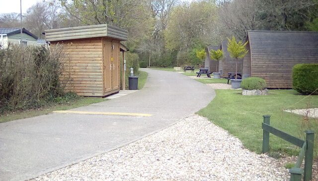
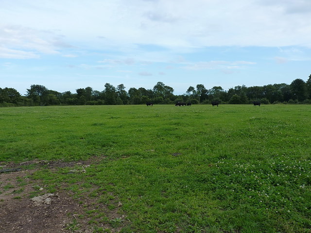
Westernhill Plantation is a picturesque woodland area located in Devon, England. Covering an expansive area of land, it is renowned for its natural beauty and rich biodiversity. The plantation is predominantly made up of dense forests, offering a serene and tranquil environment for nature enthusiasts and visitors alike.

The woodland is home to a variety of tree species, including oak, beech, and pine, which create a diverse and vibrant landscape throughout the year. The vibrant colors of the changing leaves in autumn attract many photographers and nature lovers to the area. Additionally, the forest floor is adorned with an array of wildflowers, adding to the visual appeal of the plantation.

Westernhill Plantation is also known for its abundant wildlife. It provides a habitat for a wide range of animals, including deer, foxes, rabbits, and various bird species. The plantation is a popular spot for birdwatchers, as it offers opportunities to observe species such as woodpeckers, owls, and songbirds in their natural habitat.

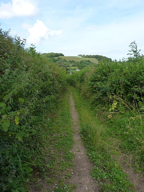
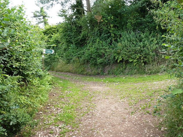
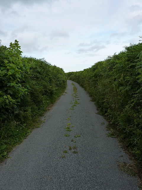
Visitors to Westernhill Plantation can explore the numerous walking trails that wind through the woodland, providing an opportunity to immerse oneself in the peaceful surroundings. These trails cater to all fitness levels, from leisurely strolls to more challenging hikes. Along the way, visitors may come across small streams and ponds, further enhancing the natural charm of the area.

Overall, Westernhill Plantation is a haven of tranquility and natural beauty, offering a unique opportunity to connect with nature and enjoy the serenity of the Devon countryside.

If you have any feedback on the listing, please let us know in the comments section below.

Westernhill Plantation Images

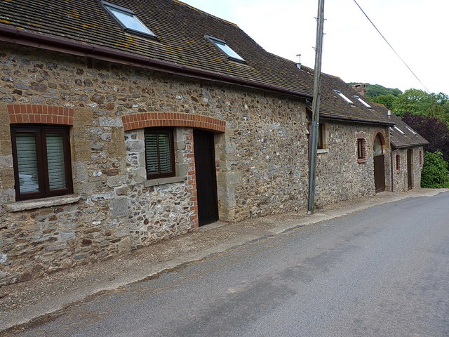
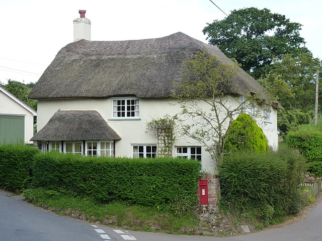
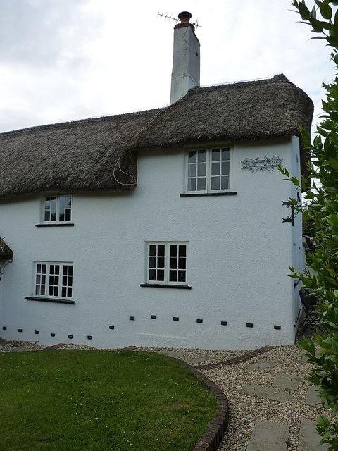
Images are sourced within 2km of 50.694216/-3.1862843 or Grid Reference SY1688. Thanks to Geograph Open Source API. All images are credited.

Oakdown Touring Park Oakdown Touring Park. Taken outside the Shepherd's Huts.
Oakdown Touring Park
Oakdown Touring Park. Taken outside the Shepherd's Huts.
A3052 The A3052 Road runs 27 miles from Charnmouth to Clyst St Mary. It runs parallel to the East Devon coastline, but inland.
<span class="nowrap"><a title="http://www.sabre-roads.org.uk/wiki/index.php?title=A3052" rel="nofollow ugc noopener" href="http://www.sabre-roads.org.uk/wiki/index.php?title=A3052">Link</a><img style="margin-left:2px;" alt="External link" title="External link - shift click to open in new window" src="https://s1.geograph.org.uk/img/external.png" width="10" height="10"/></span>
A3052
The A3052 Road runs 27 miles from Charnmouth to Clyst St Mary. It runs parallel to the East Devon coastline, but inland. LinkExternal link
Buckton Lane near Harecombe Farm A narrow, concessionary path across the lower parts of Buckton Hill.
Buckton Lane near Harecombe Farm
A narrow, concessionary path across the lower parts of Buckton Hill.
Path junction near Harecombe Farm The sign saying 'To Public footpath' is the clue here. None of the tracks in the shot are recorded as true rights of way, but they are permitted as concessionary paths to join a network of bridleways and footpaths in the area. And occasionally used by agricultural vehicles, by the look of things.
Path junction near Harecombe Farm
The sign saying 'To Public footpath' is the clue here. None of the tracks in the shot are recorded as true rights of way, but they are permitted as concessionary paths to join a network of bridleways and footpaths in the area. And occasionally used by agricultural vehicles, by the look of things.
Harecombe or Harcombe Farm cottage The spellings vary according to the scale of the map, but regardless, this is a late 17th or early 18th Century, Grade II listed building <span class="nowrap"><a title="https://www.britishlistedbuildings.co.uk/101228397-harcombe-farm-cottage-sidmouth#.WY2Sx9QrLGg" rel="nofollow ugc noopener" href="https://www.britishlistedbuildings.co.uk/101228397-harcombe-farm-cottage-sidmouth#.WY2Sx9QrLGg">Link</a><img style="margin-left:2px;" alt="External link" title="External link - shift click to open in new window" src="https://s1.geograph.org.uk/img/external.png" width="10" height="10"/></span> sporting a good example of the local chimney type.
Harecombe or Harcombe Farm cottage
The spellings vary according to the scale of the map, but regardless, this is a late 17th or early 18th Century, Grade II listed building LinkExternal link sporting a good example of the local chimney type.
Barns at Harecombe Farm A row of converted barns and outbuildings at the side of Chelson Lane.
Barns at Harecombe Farm
A row of converted barns and outbuildings at the side of Chelson Lane.
Pillar Box cottage The reason for the current name is pretty obvious, although the postbox is Victorian, so it may well have been known as something else prior to the installation of that. The cottage itself dates from the 17th Century, and was Grade II listed <span class="nowrap"><a title="https://www.britishlistedbuildings.co.uk/101097980-pillar-box-sidmouth#.WY2UtNQrLGg" rel="nofollow ugc noopener" href="https://www.britishlistedbuildings.co.uk/101097980-pillar-box-sidmouth#.WY2UtNQrLGg">Link</a><img style="margin-left:2px;" alt="External link" title="External link - shift click to open in new window" src="https://s1.geograph.org.uk/img/external.png" width="10" height="10"/></span> in 1973.
Pillar Box cottage
The reason for the current name is pretty obvious, although the postbox is Victorian, so it may well have been known as something else prior to the installation of that. The cottage itself dates from the 17th Century, and was Grade II listed LinkExternal link in 1973.
Victorian postbox at Harcombe Wallbox EX10 88, installed in a cottage wall just east of the bridge over the brook. The box looks very similar to a type made by W T Allen of London in the 1890s, but they normally cast their name at the base, which makes me think this may not actually be one of theirs.
Victorian postbox at Harcombe
Wallbox EX10 88, installed in a cottage wall just east of the bridge over the brook. The box looks very similar to a type made by W T Allen of London in the 1890s, but they normally cast their name at the base, which makes me think this may not actually be one of theirs.
Chapel Cottage, Harcombe Set slightly back from the lane up towards Harcombe, Chapel Cottage was Grade II listed <span class="nowrap"><a title="https://www.britishlistedbuildings.co.uk/101097981-chapel-cottage-sidmouth#.WY2Xg9QrLGg" rel="nofollow ugc noopener" href="https://www.britishlistedbuildings.co.uk/101097981-chapel-cottage-sidmouth#.WY2Xg9QrLGg">Link</a><img style="margin-left:2px;" alt="External link" title="External link - shift click to open in new window" src="https://s1.geograph.org.uk/img/external.png" width="10" height="10"/></span> in 1973, and dates back to the 17th Century.
Chapel Cottage, Harcombe
Set slightly back from the lane up towards Harcombe, Chapel Cottage was Grade II listed LinkExternal link in 1973, and dates back to the 17th Century.
Quickways Cottages - Westcott The western lefthand half of a pair of Grade II listed <span class="nowrap"><a title="https://www.britishlistedbuildings.co.uk/101212862-quickwayswest-cottage-sidmouth#.WY2aq9QrLGg" rel="nofollow ugc noopener" href="https://www.britishlistedbuildings.co.uk/101212862-quickwayswest-cottage-sidmouth#.WY2aq9QrLGg">Link</a><img style="margin-left:2px;" alt="External link" title="External link - shift click to open in new window" src="https://s1.geograph.org.uk/img/external.png" width="10" height="10"/></span> 18th Century listed cottages. The other half is <a href="https://www.geograph.org.uk/photo/5493353">SY1590 : Quickways Cottages - Quietways</a>
Quickways Cottages - Westcott
The western lefthand half of a pair of Grade II listed LinkExternal link 18th Century listed cottages. The other half is SY1590 : Quickways Cottages - Quietways
Quickways Cottages - Quietways The righthand and eastern half of a pair of Grade II listed <span class="nowrap"><a title="https://www.britishlistedbuildings.co.uk/101212862-quickwayswest-cottage-sidmouth#.WY2aq9QrLGg" rel="nofollow ugc noopener" href="https://www.britishlistedbuildings.co.uk/101212862-quickwayswest-cottage-sidmouth#.WY2aq9QrLGg">Link</a><img style="margin-left:2px;" alt="External link" title="External link - shift click to open in new window" src="https://s1.geograph.org.uk/img/external.png" width="10" height="10"/></span> 18th Century cottages in Harcombe. The other one of the pair is <a href="https://www.geograph.org.uk/photo/5493351">SY1590 : Quickways Cottages - Westcott</a>
Quickways Cottages - Quietways
The righthand and eastern half of a pair of Grade II listed LinkExternal link 18th Century cottages in Harcombe. The other one of the pair is SY1590 : Quickways Cottages - Westcott
Harcombe Hill cottage Another of the several well maintained Grade II listed <span class="nowrap"><a title="https://www.britishlistedbuildings.co.uk/101333804-harcombe-hill-cottage-sidmouth#.WY2imNQrLGg" rel="nofollow ugc noopener" href="https://www.britishlistedbuildings.co.uk/101333804-harcombe-hill-cottage-sidmouth#.WY2imNQrLGg">Link</a><img style="margin-left:2px;" alt="External link" title="External link - shift click to open in new window" src="https://s1.geograph.org.uk/img/external.png" width="10" height="10"/></span> 17th or 18th Century cob-and-thatch cottages that lie in this area of Harcombe and Sidbury. Harcombe Hill Cottage was once known as Pike's Cottage, presumably the name of a former resident.
Harcombe Hill cottage
Another of the several well maintained Grade II listed LinkExternal link 17th or 18th Century cob-and-thatch cottages that lie in this area of Harcombe and Sidbury. Harcombe Hill Cottage was once known as Pike's Cottage, presumably the name of a former resident.
Chelson Lane on Harcombe Hill A narrow country lane between Harcombe village and the main A3052
Chelson Lane on Harcombe Hill
A narrow country lane between Harcombe village and the main A3052
Cattle grazing on Harcombe Hill
Permissive path to the Donkey Sanctuary Described on a sign at the gate as "Oakdown's Field Trail", the path runs along this field edge towards the Donkey Sanctuary charity organisation in <a href="https://www.geograph.org.uk/gridref/SY1689">SY1689</a>
Permissive path to the Donkey Sanctuary
Described on a sign at the gate as "Oakdown's Field Trail", the path runs along this field edge towards the Donkey Sanctuary charity organisation in SY1689
Turning for Edge Farm
Chelson Lane
Chelson Lane
Boswell Lake The local farm has created a path around this lake and a notice by the bridleway invites passers-by to explore the small nature reserve
Boswell Lake
The local farm has created a path around this lake and a notice by the bridleway invites passers-by to explore the small nature reserve
Show me another place!

Westernhill Plantation is located at Grid Ref: SY1688 (Lat: 50.694216, Lng: -3.1862843)

Administrative County: Devon

District: East Devon

Police Authority: Devon and Cornwall

What 3 Words

///signal.writings.verve. Near Sidmouth, Devon

Related Wikis

The Donkey Sanctuary

The Donkey Sanctuary is a British charitable organisation devoted to the welfare of donkeys. The charity, which is based near Sidmouth in Devon, England...
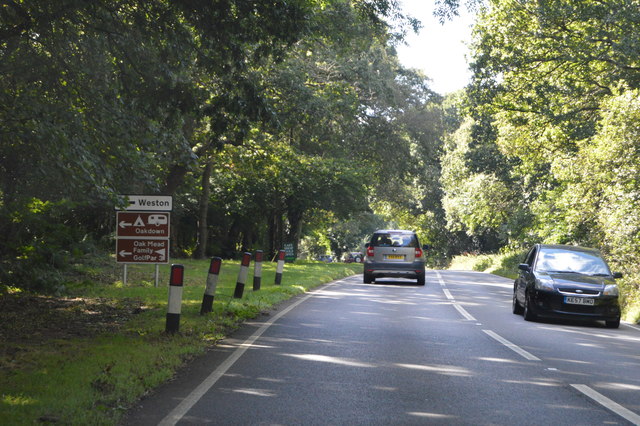
Weston, Devon

Weston is a small hamlet near Sidmouth in East Devon, England. It is near the Donkey Sanctuary and less than a mile from the beach at Branscombe; footpaths...

Weston Mouth

Weston Mouth is an isolated beach on the East Devon coast between Sidmouth and Seaton in England. It can be reached only by footpath, either along the...

Salcombe Regis

Salcombe Regis is a coastal village and former civil parish, now in the parish of Sidmouth, in the East Devon district, in the county of Devon, England...

Street, Devon

Street is a small village in the East Devon district of Devon, England. Its nearest town is Sidmouth, which lies approximately 4 miles (6.4 km) south-west...

Norman Lockyer Observatory

The Norman Lockyer Observatory, the Lockyer Technology Centre, and the Planetarium (jointly NLO), is a public access optical observatory 1 mile (1.6 km...

Sidford

Sidford is a small village in the civil parish of and on the outskirts of the town of Sidmouth in the English county of Devon. It has a population of just...

St Winifred's Church, Branscombe

St Winifred's Church is a Church of England church in Branscombe in Devon, England. The church is dedicated to Saint Winifred, a Welsh saint. It is among...

Nearby Amenities

Located within 500m of 50.694216,-3.1862843
Post Box
Brand: Royal Mail
Brand Wikidata: Q638098
Brand Wikipedia: en:Royal Mail
Collection Times: Mo-Fr 15:15, Sa 07:30
Drive Through: no
Operator: Royal Mail
Operator Wikidata: Q638098
Post Box Type: pillar
Ref: EX10 66
Royal Cypher: EIIR
Royal Cypher Wikidata: Q33102113
Lat/Long: 50.6972555/-3.1899894
Kerb: no
Lat/Long: 50.6966827/-3.1882823
Mini Roundabout
Lat/Long: 50.6961589/-3.1919609
Post Box
Collection Times: Mo-Fr 09:00; Sa 07:00
Operator: Royal Mail
Operator Wikidata: Q638098
Post Box Design: hovis
Post Box Mounting: wooden_post
Post Box Type: lamp
Ref: EX10 117D
Royal Cypher: GR
Royal Cypher Wikidata: Q33102273
Lat/Long: 50.6944154/-3.1812637
Generator Method: photovoltaic
Generator Output Electricity: yes
Generator Source: solar
Generator Type: solar_photovoltaic_panel
Location: roof
Power: generator
Lat/Long: 50.6953456/-3.1825563
Generator Method: photovoltaic
Generator Output Electricity: yes
Generator Source: solar
Generator Type: solar_photovoltaic_panel
Location: roof
Power: generator
Lat/Long: 50.6942752/-3.1801584
Telephone
Booth: K6
Covered: booth
Fee: yes
Man Made: telephone_box
Payment Coins: yes
Lat/Long: 50.6972701/-3.1900133
Noexit: yes
Lat/Long: 50.6981112/-3.1894977
Noexit: yes
Lat/Long: 50.6982022/-3.1895456
Artwork Type: sculpture
Tourism: artwork
Lat/Long: 50.6962618/-3.1886469
Donkey Sanctuary
Addr Housenumber: Slade House Farm
Addr Street: Slade Lane
Phone: +44 1395578222
Tourism: attraction
Website: http://Www.thedonkeysanctuary.org.uk
Lat/Long: 50.6966034/-3.190285
Charging Station
Lat/Long: 50.6966265/-3.1908317
Power: pole
Source: bing
Lat/Long: 50.6962351/-3.1917214
Poles: bipole
Power: pole
Source: bing
Transformer: distribution
Lat/Long: 50.6962843/-3.190729
Power: pole
Source: bing
Lat/Long: 50.6962979/-3.1901443
Power: pole
Source: bing
Lat/Long: 50.6963353/-3.1891975
Power: pole
Source: bing
Lat/Long: 50.6963727/-3.1882077
Power: pole
Source: bing
Lat/Long: 50.6964203/-3.1868291
Power: pole
Lat/Long: 50.695874/-3.1842582
Power: pole
Source: bing
Lat/Long: 50.6964797/-3.1854558
Power: pole
Source: bing
Lat/Long: 50.6965358/-3.1839189
Poles: bipole
Power: pole
Source: bing
Transformer: distribution
Lat/Long: 50.6948232/-3.1793363
Power: pole
Source: bing
Lat/Long: 50.6966386/-3.1813078
Power: pole
Source: bing
Lat/Long: 50.6965766/-3.1826958
Bench
Backrest: no
Survey Date: 2023-04-07
Lat/Long: 50.6944099/-3.1813934
Fire Hydrant
Emergency: fire_hydrant
Fire Hydrant Type: underground
Survey Date: 2023-04-07
Lat/Long: 50.6978203/-3.189328
Grit Bin
Survey Date: 2023-04-07
Lat/Long: 50.6943951/-3.1812816
The data included in this document is from www.openstreetmap.org. The data is made available under ODbL.

Have you been to Westernhill Plantation?

Leave your review of Westernhill Plantation below (or comments, questions and feedback).