Black Head

Coastal Feature, Headland, Point in Devon East Devon

England

Black Head

Commemorative Marker on South Farm Road, Near Budleigh Salterton Millennium stone beside a muddy pull-in on the north side of South Farm Road. On the boundary of Otterton and East Budleigh parishes. See also <a title="https://www.geograph.org.uk/photo/2061577" href="https://www.geograph.org.uk/photo/2061577">Link</a>.

Milestone Society National ID: DV_ELOT07cm
Commemorative Marker on South Farm Road, Near Budleigh Salterton Credit: T Jenkinson

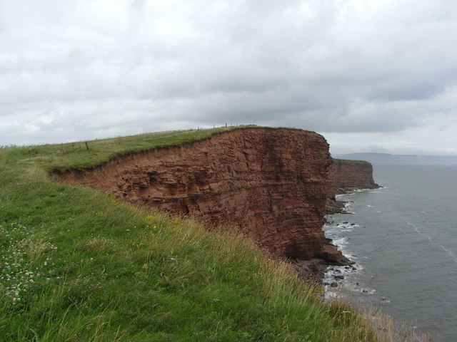
Black Head is a prominent headland located in Devon, a county in Southwest England. Situated along the stunning Jurassic Coast, it is a popular coastal feature that attracts both locals and tourists alike. With its rugged cliffs and panoramic views of the surrounding landscape, Black Head offers a unique and picturesque experience.

The headland is characterized by its distinctive black rock formations, which give it its name. These dark rocks, composed mainly of shale and limestone, are a result of millions of years of geological processes. The cliffs rise to an impressive height, offering breathtaking views of the turquoise waters of the English Channel below.

Black Head is also known for its rich biodiversity. The surrounding waters are teeming with marine life, making it a popular spot for snorkeling and diving enthusiasts. Visitors may spot a variety of marine species, including seals, dolphins, and a wide array of fish.

In addition to its natural beauty, Black Head has historical significance as well. It is believed that the headland was once a defensive site during ancient times, with evidence of Iron Age and Roman settlements in the area. Today, remnants of these ancient civilizations can still be seen, adding an element of wonder and intrigue to the landscape.

Overall, Black Head in Devon offers visitors a unique blend of natural beauty, geological wonders, and historical significance. Whether one seeks adventure, relaxation, or a glimpse into the past, Black Head is a must-visit destination along the magnificent Jurassic Coast.

If you have any feedback on the listing, please let us know in the comments section below.
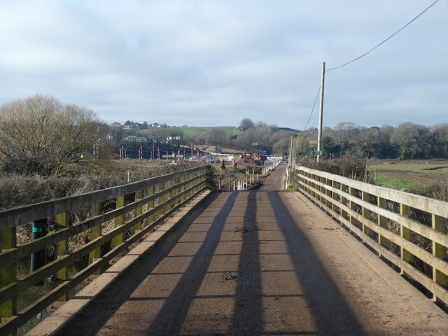
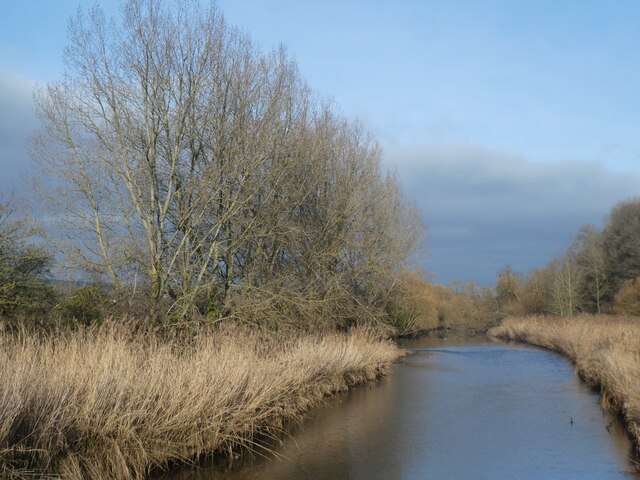
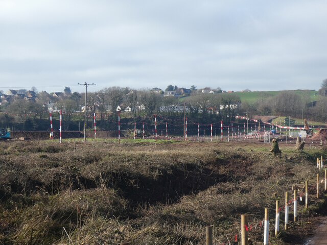
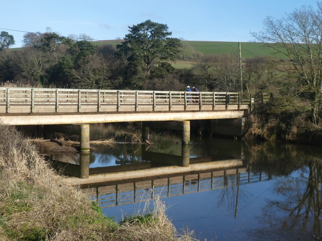
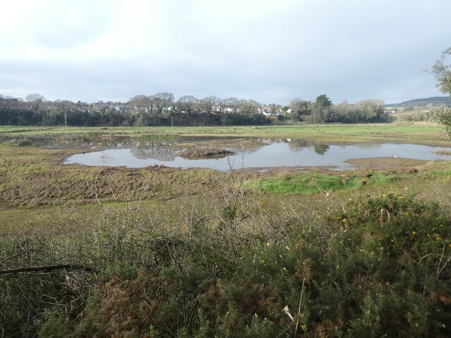
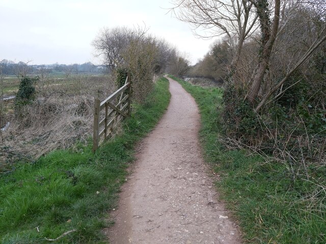
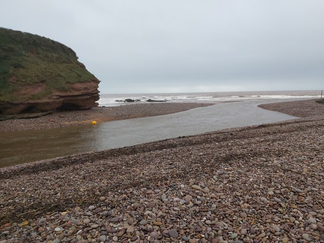
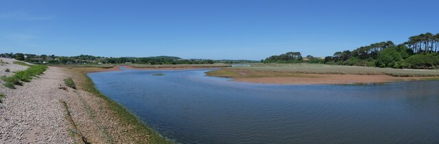
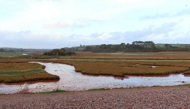
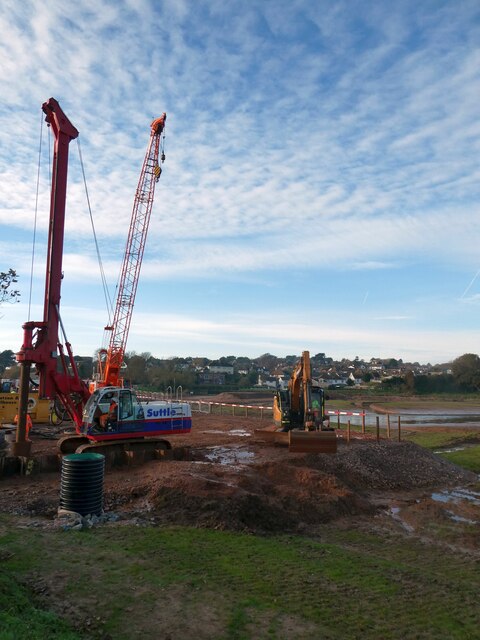
Black Head Images

Images are sourced within 2km of 50.636326/-3.2937412 or Grid Reference SY0882. Thanks to Geograph Open Source API. All images are credited.

Commemorative Marker on South Farm Road, Near Budleigh Salterton Millennium stone beside a muddy pull-in on the north side of South Farm Road. On the boundary of Otterton and East Budleigh parishes. See also <a title="https://www.geograph.org.uk/photo/2061577" href="https://www.geograph.org.uk/photo/2061577">Link</a>.

Milestone Society National ID: DV_ELOT07cm
Commemorative Marker on South Farm Road, Near Budleigh Salterton
Millennium stone beside a muddy pull-in on the north side of South Farm Road. On the boundary of Otterton and East Budleigh parishes. See also Link. Milestone Society National ID: DV_ELOT07cm
West bank of River Otter, near Clamour Bridge The River Otter rises in the Blackdown Hills and flows south to enter the English Channel just east of Budleigh Salterton. It is 20 miles long.
Wikipedia: <span class="nowrap"><a title="http://en.wikipedia.org/wiki/River_Otter" rel="nofollow ugc noopener" href="http://en.wikipedia.org/wiki/River_Otter">Link</a><img style="margin-left:2px;" alt="External link" title="External link - shift click to open in new window" src="https://s1.geograph.org.uk/img/external.png" width="10" height="10"/></span>
West bank of River Otter, near Clamour Bridge
The River Otter rises in the Blackdown Hills and flows south to enter the English Channel just east of Budleigh Salterton. It is 20 miles long. Wikipedia: LinkExternal link
River Otter. looking south from Clamour Bridge The River Otter rises in the Blackdown Hills and flows south to enter the English Channel just east of Budleigh Salterton. It is 20 miles long.
Wikipedia: <span class="nowrap"><a title="http://en.wikipedia.org/wiki/River_Otter" rel="nofollow ugc noopener" href="http://en.wikipedia.org/wiki/River_Otter">Link</a><img style="margin-left:2px;" alt="External link" title="External link - shift click to open in new window" src="https://s1.geograph.org.uk/img/external.png" width="10" height="10"/></span>
River Otter. looking south from Clamour Bridge
The River Otter rises in the Blackdown Hills and flows south to enter the English Channel just east of Budleigh Salterton. It is 20 miles long. Wikipedia: LinkExternal link
Gateposts on cycle track from Otterton to White Bridge
White Bridge over River Otter and engineering work beyond The works in the floodplain are in order to re-establish a wetland habitat and nature reserve
White Bridge over River Otter and engineering work beyond
The works in the floodplain are in order to re-establish a wetland habitat and nature reserve
Reed beds and River Otter from White Bridge The River Otter rises in the Blackdown Hills and flows south to enter the English Channel just east of Budleigh Salterton. It is 20 miles long.
Wikipedia: <span class="nowrap"><a title="http://en.wikipedia.org/wiki/River_Otter" rel="nofollow ugc noopener" href="http://en.wikipedia.org/wiki/River_Otter">Link</a><img style="margin-left:2px;" alt="External link" title="External link - shift click to open in new window" src="https://s1.geograph.org.uk/img/external.png" width="10" height="10"/></span>
Reed beds and River Otter from White Bridge
The River Otter rises in the Blackdown Hills and flows south to enter the English Channel just east of Budleigh Salterton. It is 20 miles long. Wikipedia: LinkExternal link
Re-establishing a wetland habitat, valley of River Otter The works are in order to re-establish a wetland habitat and nature reserve
Re-establishing a wetland habitat, valley of River Otter
The works are in order to re-establish a wetland habitat and nature reserve
White Bridge over River Otter The South West Coast Path crosses this bridge, as the lowest crossing of the river
White Bridge over River Otter
The South West Coast Path crosses this bridge, as the lowest crossing of the river
Wetlands in flood plain of River Otter Recent works in the floodplain have created this are in order to re-establish a wetland habitat and nature reserve
Wetlands in flood plain of River Otter
Recent works in the floodplain have created this are in order to re-establish a wetland habitat and nature reserve
Estuary of River Otter, low tide The River Otter rises in the Blackdown Hills and flows south to enter the English Channel just east of Budleigh Salterton. It is 20 miles long.
Wikipedia: <span class="nowrap"><a title="http://en.wikipedia.org/wiki/River_Otter" rel="nofollow ugc noopener" href="http://en.wikipedia.org/wiki/River_Otter">Link</a><img style="margin-left:2px;" alt="External link" title="External link - shift click to open in new window" src="https://s1.geograph.org.uk/img/external.png" width="10" height="10"/></span>
Estuary of River Otter, low tide
The River Otter rises in the Blackdown Hills and flows south to enter the English Channel just east of Budleigh Salterton. It is 20 miles long. Wikipedia: LinkExternal link
The cliff at Otterton Ledge, mouth of the river The River Otter rises in the Blackdown Hills and flows south to enter the English Channel just east of Budleigh Salterton. It is 20 miles long.
Wikipedia: <span class="nowrap"><a title="http://en.wikipedia.org/wiki/River_Otter" rel="nofollow ugc noopener" href="http://en.wikipedia.org/wiki/River_Otter">Link</a><img style="margin-left:2px;" alt="External link" title="External link - shift click to open in new window" src="https://s1.geograph.org.uk/img/external.png" width="10" height="10"/></span>
The cliff at Otterton Ledge, mouth of the river
The River Otter rises in the Blackdown Hills and flows south to enter the English Channel just east of Budleigh Salterton. It is 20 miles long. Wikipedia: LinkExternal link
Budleigh Salterton Cricket Club and wetlands beyond The Otter Estuary Reserve covers 23 ha and includes tidal mudflats and saltmarshes. It is no longer managed by Devon Wildlife Trust, it is owned and managed by Clinton Devon Estates. It is an SSSI and a good site for birds.
Budleigh Salterton Cricket Club and wetlands beyond
The Otter Estuary Reserve covers 23 ha and includes tidal mudflats and saltmarshes. It is no longer managed by Devon Wildlife Trust, it is owned and managed by Clinton Devon Estates. It is an SSSI and a good site for birds.
Footpath in the Otter Estuary A view of the public footpath, looking north, in the River Otter Estuary Nature Reserve, just west of the River Otter in East Devon.
Footpath in the Otter Estuary
A view of the public footpath, looking north, in the River Otter Estuary Nature Reserve, just west of the River Otter in East Devon.
The River Otter meets the Sea A view of the River Otter running into the sea at Otterton Ledge rocks viewable from the southern end of the Otter Estuary Nature Reserve east of Budleigh Salterton in Devon.
The River Otter meets the Sea
A view of the River Otter running into the sea at Otterton Ledge rocks viewable from the southern end of the Otter Estuary Nature Reserve east of Budleigh Salterton in Devon.
Spit and river at the south end of Otter valley
Budleigh Salterton cricket ground and work on estuary nature reserve Work in progress beyond the cricket ground to create an estuary habitat
Budleigh Salterton cricket ground and work on estuary nature reserve
Work in progress beyond the cricket ground to create an estuary habitat
Otter Estuary Nature Reserve This is the Otter Estuary Nature Reserve as seen from eastern end of the beach at Budleigh Salterton, Devon.
Otter Estuary Nature Reserve
This is the Otter Estuary Nature Reserve as seen from eastern end of the beach at Budleigh Salterton, Devon.
Construction work, Lower Otter Valley wetlands A view of the same area as in <a href="https://www.geograph.org.uk/photo/7082152">SY0782 : Budleigh Salterton Cricket Club and wetlands beyond</a>, but now dominated by the construction of new wetlands
Construction work, Lower Otter Valley wetlands
A view of the same area as in SY0782 : Budleigh Salterton Cricket Club and wetlands beyond, but now dominated by the construction of new wetlands
Show me another place!

Black Head is located at Grid Ref: SY0882 (Lat: 50.636326, Lng: -3.2937412)

Administrative County: Devon

District: East Devon

Police Authority: Devon and Cornwall

What 3 Words

///outdoor.sprouted.improve. Near Budleigh Salterton, Devon

Related Wikis

Danger Point

Danger Point is a coastal feature and cliff face in Devon, on the south coast of England. It is about 18 kilometres (11 mi) southeast of the city of Exeter...
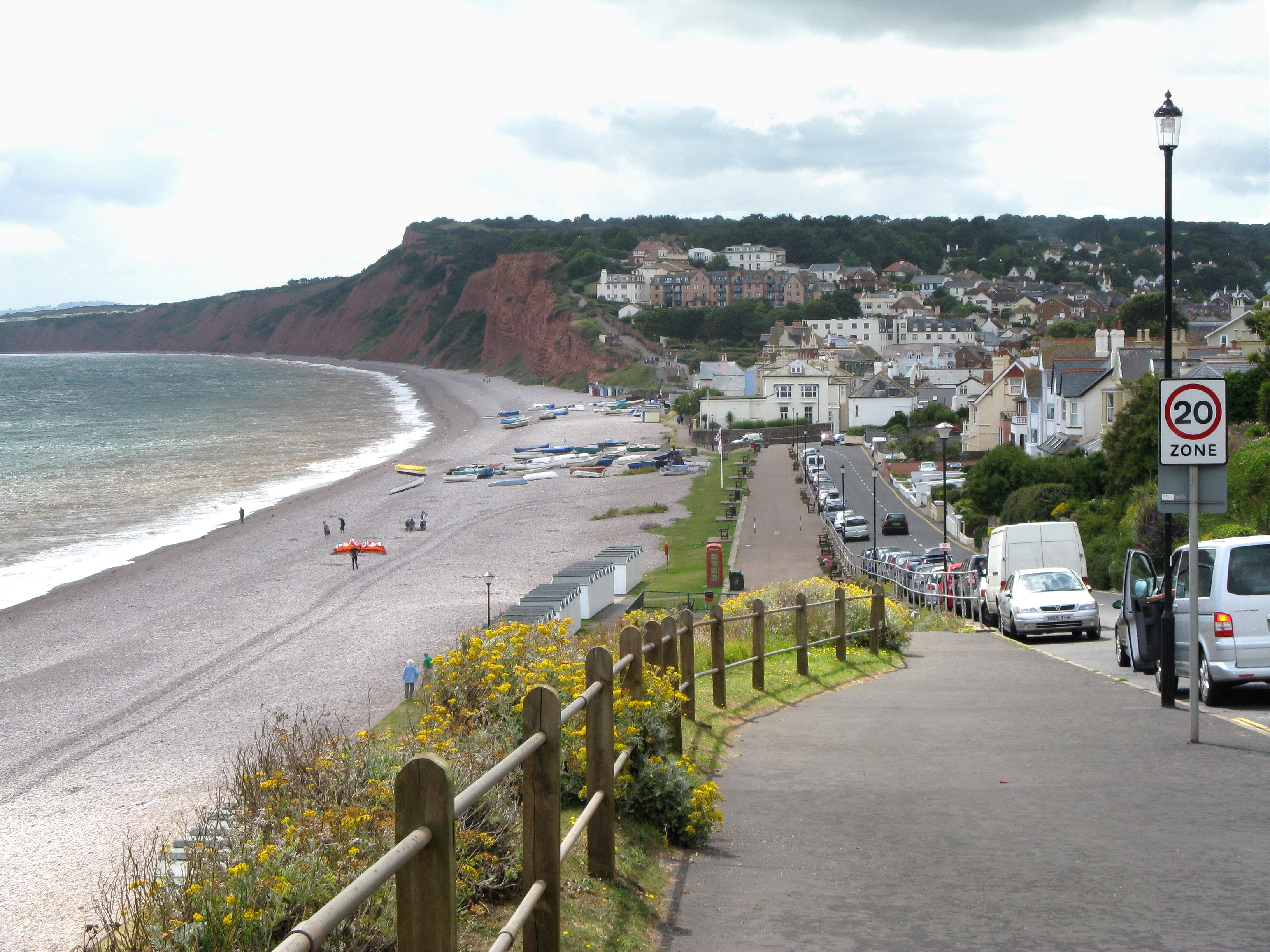
Budleigh Salterton

Budleigh Salterton is a seaside town on the coast in East Devon, England, 15 miles (24 km) south-east of Exeter. It lies within the East Devon Area of...

East Budleigh

East Budleigh is a small village in East Devon, England. The villages of Yettington, Colaton Raleigh, and Otterton lie to the west, north and east of...

Budleigh Salterton railway station

Budleigh Salterton railway station is a closed railway station that served the town of Budleigh Salterton in Devon, England. It was opened by the London...
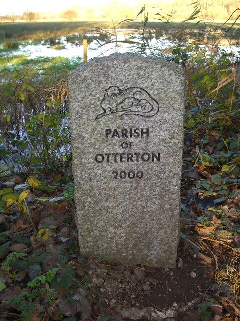
Otterton

Otterton is a village and civil parish in East Devon, England. The parish lies on the English Channel and is surrounded clockwise from the south by the...

Otterton Priory

Otterton Priory was a priory in Otterton, Devon founded before 1087 and suppressed in 1414. The tower of the parish church is the major remaining structure...

Budleigh Salterton A.F.C.

Budleigh Salterton Association Football Club is a football club based in Budleigh Salterton, Devon, England. They are currently members of the Devon League...
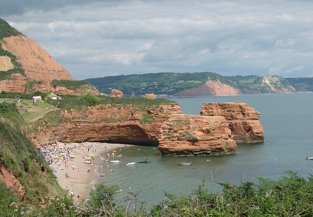
Ladram Bay

Ladram Bay is a secluded bay with a pebble beach, on the south coast of Devon, England between the coastal towns of Budleigh Salterton and Sidmouth. It...

Nearby Amenities

Located within 500m of 50.636326,-3.2937412
Source: PGS
Lat/Long: 50.6331617/-3.2984496
Source: PGS
Lat/Long: 50.6342501/-3.29714
Source: PGS
Lat/Long: 50.6347557/-3.2964365
Source: PGS
Lat/Long: 50.6349861/-3.2959184
Source: PGS
Lat/Long: 50.6353764/-3.294703
Source: PGS
Lat/Long: 50.6354153/-3.2947046
Source: PGS
Lat/Long: 50.6356948/-3.2942301
Source: PGS
Lat/Long: 50.6359197/-3.2940026
Source: PGS
Lat/Long: 50.636348/-3.2934677
Source: PGS
Lat/Long: 50.636816/-3.2933397
Source: PGS
Lat/Long: 50.6373968/-3.2929059
Source: PGS
Lat/Long: 50.6382114/-3.2925159
Source: PGS
Lat/Long: 50.639252/-3.2911303
Source: PGS
Lat/Long: 50.6396573/-3.2905962
Black Head
Natural: headland
Place: locality
Lat/Long: 50.6359728/-3.2946809
The data included in this document is from www.openstreetmap.org. The data is made available under ODbL.

Have you been to Black Head?

Leave your review of Black Head below (or comments, questions and feedback).