Coal Beach

Beach in Devon East Devon

England

Coal Beach

Commemorative Marker on South Farm Road, Near Budleigh Salterton Millennium stone beside a muddy pull-in on the north side of South Farm Road. On the boundary of Otterton and East Budleigh parishes. See also <a title="https://www.geograph.org.uk/photo/2061577" href="https://www.geograph.org.uk/photo/2061577">Link</a>.

Milestone Society National ID: DV_ELOT07cm
Commemorative Marker on South Farm Road, Near Budleigh Salterton Credit: T Jenkinson

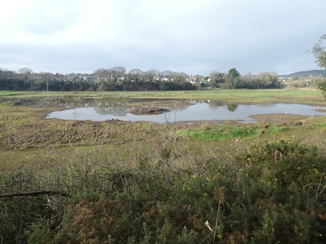
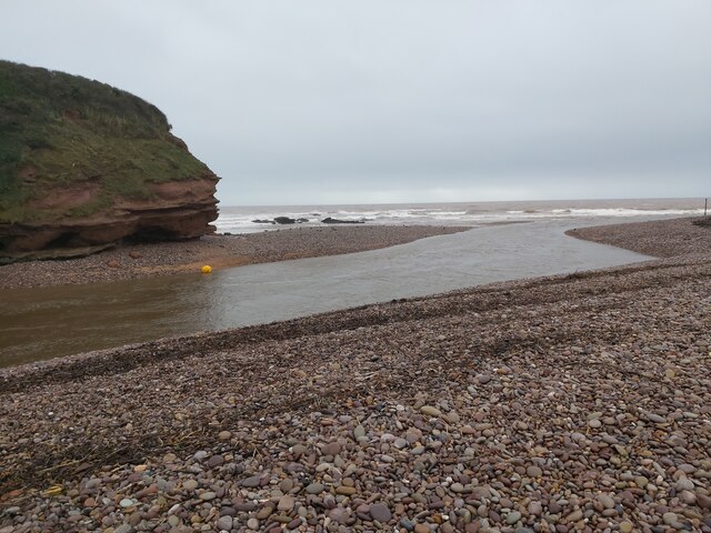
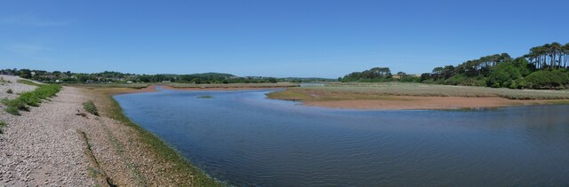
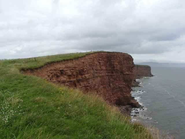
Coal Beach is a picturesque coastal area located in the county of Devon, England. Situated on the southern coast, it is renowned for its stunning natural beauty and unique geological features. The beach derives its name from the presence of coal seams that can be found along certain sections of the shoreline.

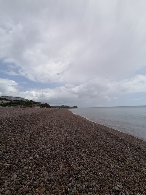
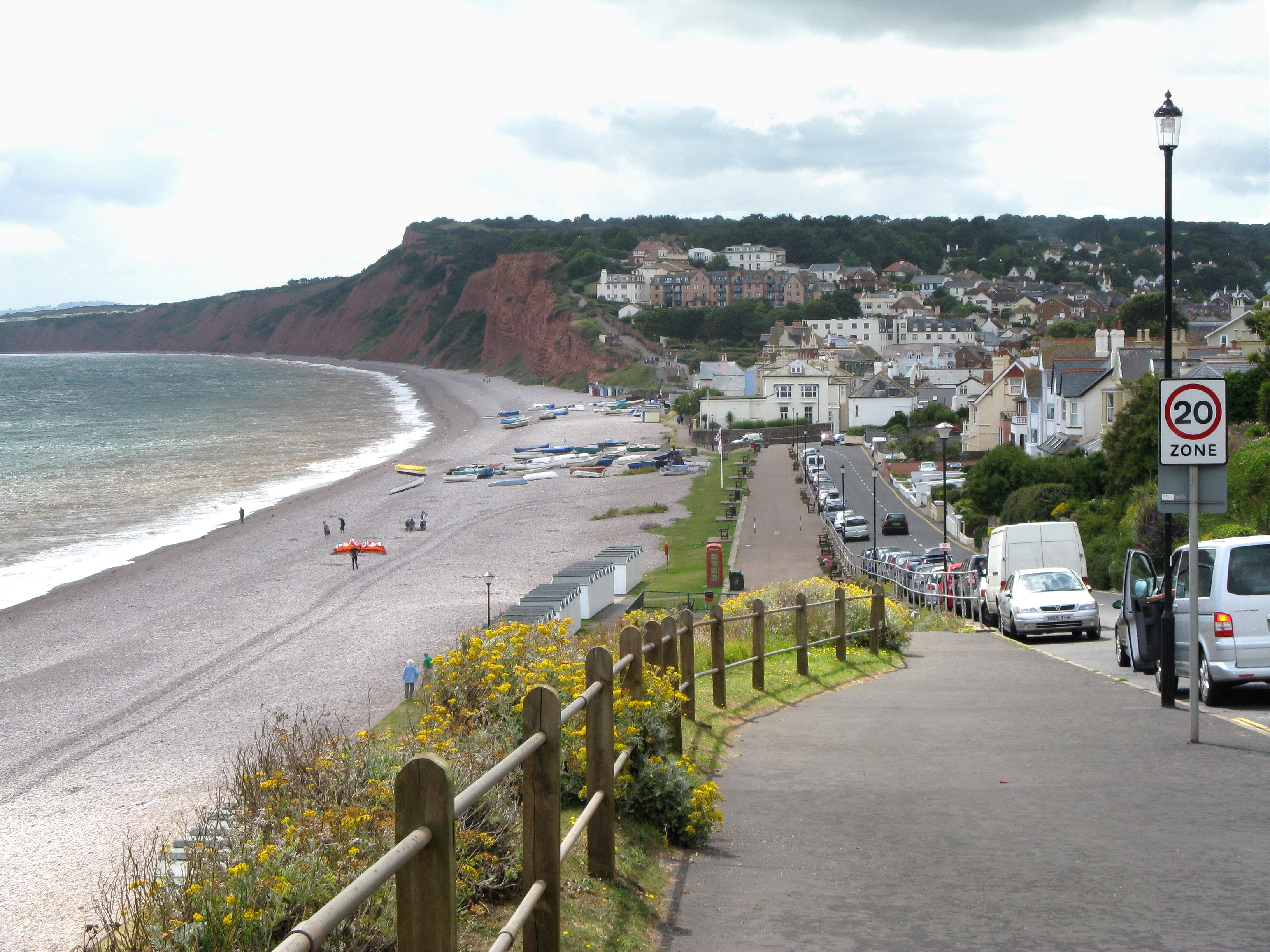
Stretching over a mile in length, Coal Beach boasts golden sands that are perfect for sunbathing, picnicking, or leisurely walks. The beach is backed by high cliffs, which add to its scenic charm and provide a sense of seclusion and tranquility. Visitors can enjoy breathtaking panoramic views of the English Channel and the surrounding rugged coastline.

Coal Beach is also a popular destination for fossil hunters and geology enthusiasts. The exposure of the coal seams in the cliffs offers a rare opportunity to discover ancient plant fossils that date back millions of years. It is advised for visitors to exercise caution and be aware of the tides when exploring the cliffs and the beach.

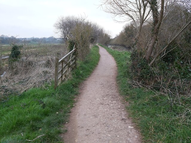
Facilities at Coal Beach are limited, with no designated car park or amenities nearby. However, this lack of development contributes to its unspoiled and secluded atmosphere, making it a favorite spot among nature lovers and those seeking a peaceful retreat. Access to the beach is via a steep path, so it is recommended to wear appropriate footwear.

Overall, Coal Beach in Devon is a hidden gem, offering visitors a chance to immerse themselves in the natural beauty of the area and explore its fascinating geological history.

If you have any feedback on the listing, please let us know in the comments section below.

Coal Beach Images

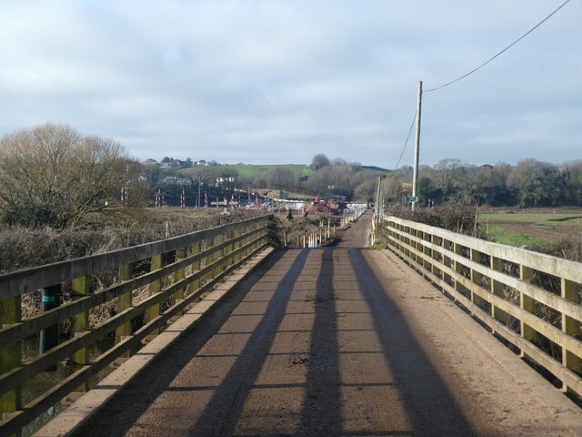
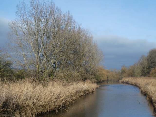
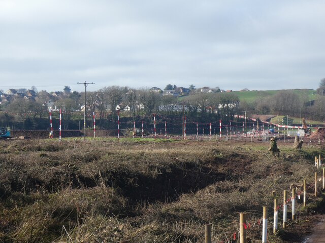
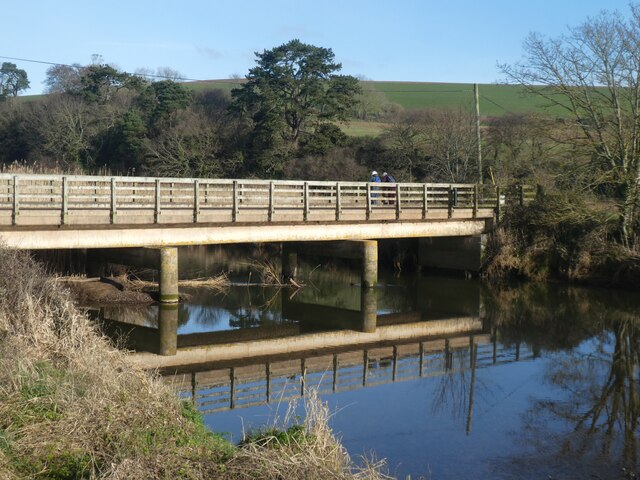
Images are sourced within 2km of 50.634937/-3.2964747 or Grid Reference SY0882. Thanks to Geograph Open Source API. All images are credited.

Commemorative Marker on South Farm Road, Near Budleigh Salterton Millennium stone beside a muddy pull-in on the north side of South Farm Road. On the boundary of Otterton and East Budleigh parishes. See also <a title="https://www.geograph.org.uk/photo/2061577" href="https://www.geograph.org.uk/photo/2061577">Link</a>.

Milestone Society National ID: DV_ELOT07cm
Commemorative Marker on South Farm Road, Near Budleigh Salterton
Millennium stone beside a muddy pull-in on the north side of South Farm Road. On the boundary of Otterton and East Budleigh parishes. See also Link. Milestone Society National ID: DV_ELOT07cm
West bank of River Otter, near Clamour Bridge The River Otter rises in the Blackdown Hills and flows south to enter the English Channel just east of Budleigh Salterton. It is 20 miles long.
Wikipedia: <span class="nowrap"><a title="http://en.wikipedia.org/wiki/River_Otter" rel="nofollow ugc noopener" href="http://en.wikipedia.org/wiki/River_Otter">Link</a><img style="margin-left:2px;" alt="External link" title="External link - shift click to open in new window" src="https://s1.geograph.org.uk/img/external.png" width="10" height="10"/></span>
West bank of River Otter, near Clamour Bridge
The River Otter rises in the Blackdown Hills and flows south to enter the English Channel just east of Budleigh Salterton. It is 20 miles long. Wikipedia: LinkExternal link
River Otter. looking south from Clamour Bridge The River Otter rises in the Blackdown Hills and flows south to enter the English Channel just east of Budleigh Salterton. It is 20 miles long.
Wikipedia: <span class="nowrap"><a title="http://en.wikipedia.org/wiki/River_Otter" rel="nofollow ugc noopener" href="http://en.wikipedia.org/wiki/River_Otter">Link</a><img style="margin-left:2px;" alt="External link" title="External link - shift click to open in new window" src="https://s1.geograph.org.uk/img/external.png" width="10" height="10"/></span>
River Otter. looking south from Clamour Bridge
The River Otter rises in the Blackdown Hills and flows south to enter the English Channel just east of Budleigh Salterton. It is 20 miles long. Wikipedia: LinkExternal link
Gateposts on cycle track from Otterton to White Bridge
White Bridge over River Otter and engineering work beyond The works in the floodplain are in order to re-establish a wetland habitat and nature reserve
White Bridge over River Otter and engineering work beyond
The works in the floodplain are in order to re-establish a wetland habitat and nature reserve
Reed beds and River Otter from White Bridge The River Otter rises in the Blackdown Hills and flows south to enter the English Channel just east of Budleigh Salterton. It is 20 miles long.
Wikipedia: <span class="nowrap"><a title="http://en.wikipedia.org/wiki/River_Otter" rel="nofollow ugc noopener" href="http://en.wikipedia.org/wiki/River_Otter">Link</a><img style="margin-left:2px;" alt="External link" title="External link - shift click to open in new window" src="https://s1.geograph.org.uk/img/external.png" width="10" height="10"/></span>
Reed beds and River Otter from White Bridge
The River Otter rises in the Blackdown Hills and flows south to enter the English Channel just east of Budleigh Salterton. It is 20 miles long. Wikipedia: LinkExternal link
Re-establishing a wetland habitat, valley of River Otter The works are in order to re-establish a wetland habitat and nature reserve
Re-establishing a wetland habitat, valley of River Otter
The works are in order to re-establish a wetland habitat and nature reserve
White Bridge over River Otter The South West Coast Path crosses this bridge, as the lowest crossing of the river
White Bridge over River Otter
The South West Coast Path crosses this bridge, as the lowest crossing of the river
Wetlands in flood plain of River Otter Recent works in the floodplain have created this are in order to re-establish a wetland habitat and nature reserve
Wetlands in flood plain of River Otter
Recent works in the floodplain have created this are in order to re-establish a wetland habitat and nature reserve
Estuary of River Otter, low tide The River Otter rises in the Blackdown Hills and flows south to enter the English Channel just east of Budleigh Salterton. It is 20 miles long.
Wikipedia: <span class="nowrap"><a title="http://en.wikipedia.org/wiki/River_Otter" rel="nofollow ugc noopener" href="http://en.wikipedia.org/wiki/River_Otter">Link</a><img style="margin-left:2px;" alt="External link" title="External link - shift click to open in new window" src="https://s1.geograph.org.uk/img/external.png" width="10" height="10"/></span>
Estuary of River Otter, low tide
The River Otter rises in the Blackdown Hills and flows south to enter the English Channel just east of Budleigh Salterton. It is 20 miles long. Wikipedia: LinkExternal link
The cliff at Otterton Ledge, mouth of the river The River Otter rises in the Blackdown Hills and flows south to enter the English Channel just east of Budleigh Salterton. It is 20 miles long.
Wikipedia: <span class="nowrap"><a title="http://en.wikipedia.org/wiki/River_Otter" rel="nofollow ugc noopener" href="http://en.wikipedia.org/wiki/River_Otter">Link</a><img style="margin-left:2px;" alt="External link" title="External link - shift click to open in new window" src="https://s1.geograph.org.uk/img/external.png" width="10" height="10"/></span>
The cliff at Otterton Ledge, mouth of the river
The River Otter rises in the Blackdown Hills and flows south to enter the English Channel just east of Budleigh Salterton. It is 20 miles long. Wikipedia: LinkExternal link
Budleigh Salterton Cricket Club and wetlands beyond The Otter Estuary Reserve covers 23 ha and includes tidal mudflats and saltmarshes. It is no longer managed by Devon Wildlife Trust, it is owned and managed by Clinton Devon Estates. It is an SSSI and a good site for birds.
Budleigh Salterton Cricket Club and wetlands beyond
The Otter Estuary Reserve covers 23 ha and includes tidal mudflats and saltmarshes. It is no longer managed by Devon Wildlife Trust, it is owned and managed by Clinton Devon Estates. It is an SSSI and a good site for birds.
Footpath in the Otter Estuary A view of the public footpath, looking north, in the River Otter Estuary Nature Reserve, just west of the River Otter in East Devon.
Footpath in the Otter Estuary
A view of the public footpath, looking north, in the River Otter Estuary Nature Reserve, just west of the River Otter in East Devon.
The River Otter meets the Sea A view of the River Otter running into the sea at Otterton Ledge rocks viewable from the southern end of the Otter Estuary Nature Reserve east of Budleigh Salterton in Devon.
The River Otter meets the Sea
A view of the River Otter running into the sea at Otterton Ledge rocks viewable from the southern end of the Otter Estuary Nature Reserve east of Budleigh Salterton in Devon.
Budleigh Salterton Seafront and Marine Parade  Budleigh seafront and marine Parade on this peaceful and charming Tuesday afternoon
Budleigh Salterton Seafront and Marine Parade
Budleigh seafront and marine Parade on this peaceful and charming Tuesday afternoon
Budleigh Salterton beach  Budleigh Salterton beach on this peaceful and charming Tuesday afternoon and the scenery is beautiful and got to be one of my favourite places I visited in Devon
Budleigh Salterton beach
Budleigh Salterton beach on this peaceful and charming Tuesday afternoon and the scenery is beautiful and got to be one of my favourite places I visited in Devon
Spit and river at the south end of Otter valley
Budleigh Salterton cricket ground and work on estuary nature reserve Work in progress beyond the cricket ground to create an estuary habitat
Budleigh Salterton cricket ground and work on estuary nature reserve
Work in progress beyond the cricket ground to create an estuary habitat
Show me another place!

Coal Beach is located at Grid Ref: SY0882 (Lat: 50.634937, Lng: -3.2964747)

Administrative County: Devon

District: East Devon

Police Authority: Devon and Cornwall

What 3 Words

///spoons.atlas.historic. Near Budleigh Salterton, Devon

Related Wikis

Danger Point

Danger Point is a coastal feature and cliff face in Devon, on the south coast of England. It is about 18 kilometres (11 mi) southeast of the city of Exeter...

Budleigh Salterton

Budleigh Salterton is a seaside town on the coast in East Devon, England, 15 miles (24 km) south-east of Exeter. It lies within the East Devon Area of...

Budleigh Salterton railway station

Budleigh Salterton railway station is a closed railway station that served the town of Budleigh Salterton in Devon, England. It was opened by the London...

East Budleigh

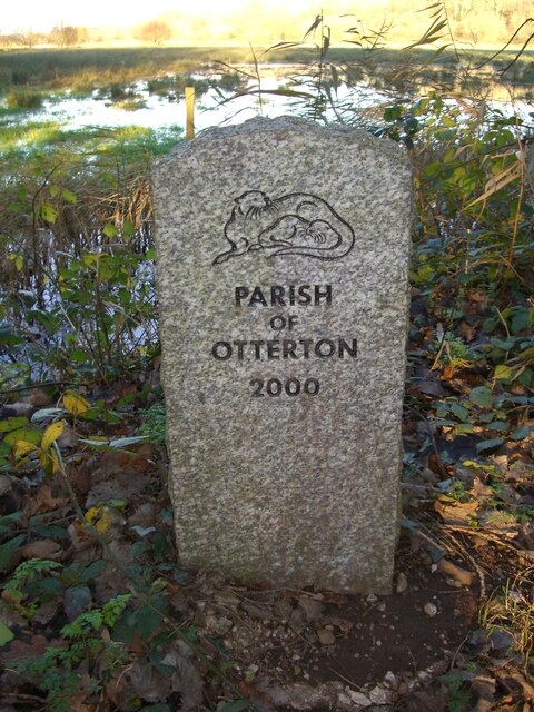
East Budleigh is a small village in East Devon, England. The villages of Yettington, Colaton Raleigh, and Otterton lie to the west, north and east of...

Nearby Amenities

Located within 500m of 50.634937,-3.2964747
Source: PGS
Lat/Long: 50.6315408/-3.300569
Source: PGS
Lat/Long: 50.631575/-3.3004707
Source: PGS
Lat/Long: 50.6324773/-3.2994984
Source: PGS
Lat/Long: 50.6325919/-3.2991717
Source: PGS
Lat/Long: 50.6329893/-3.2987411
Source: PGS
Lat/Long: 50.6331617/-3.2984496
Source: PGS
Lat/Long: 50.6342501/-3.29714
Source: PGS
Lat/Long: 50.6347557/-3.2964365
Source: PGS
Lat/Long: 50.6349861/-3.2959184
Source: PGS
Lat/Long: 50.6353764/-3.294703
Source: PGS
Lat/Long: 50.6354153/-3.2947046
Source: PGS
Lat/Long: 50.6356948/-3.2942301
Source: PGS
Lat/Long: 50.6359197/-3.2940026
Source: PGS
Lat/Long: 50.636348/-3.2934677
Source: PGS
Lat/Long: 50.636816/-3.2933397
Source: PGS
Lat/Long: 50.6373968/-3.2929059
Source: PGS
Lat/Long: 50.6382114/-3.2925159
Black Head
Natural: headland
Place: locality
Lat/Long: 50.6359728/-3.2946809
The data included in this document is from www.openstreetmap.org. The data is made available under ODbL.

Have you been to Coal Beach?

Leave your review of Coal Beach below (or comments, questions and feedback).