Danger Point

Coastal Feature, Headland, Point in Devon East Devon

England

Danger Point

White Bridge over River Otter and engineering work beyond The works in the floodplain are in order to re-establish a wetland habitat and nature reserve
White Bridge over River Otter and engineering work beyond Credit: David Smith

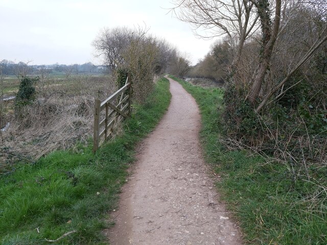
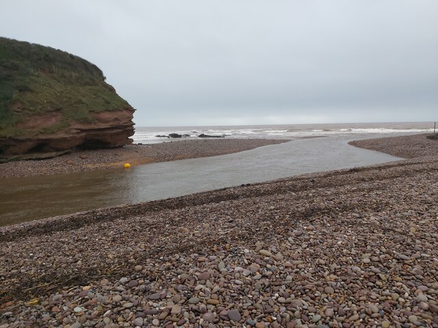
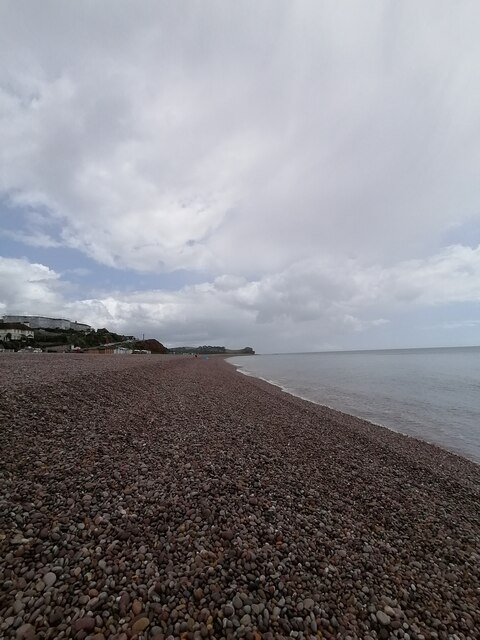
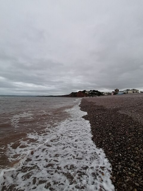
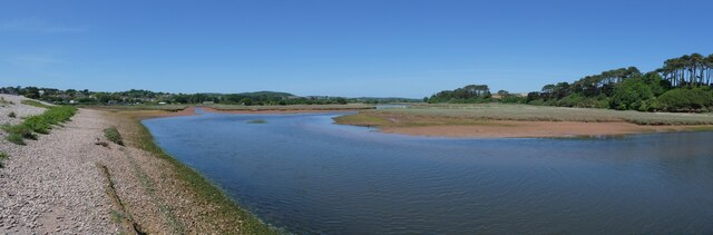
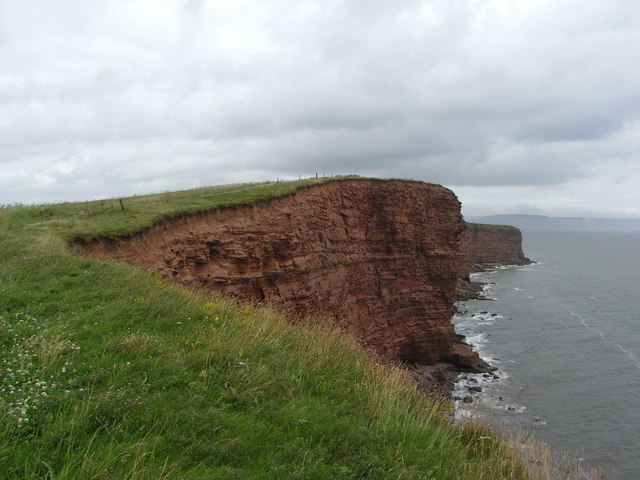
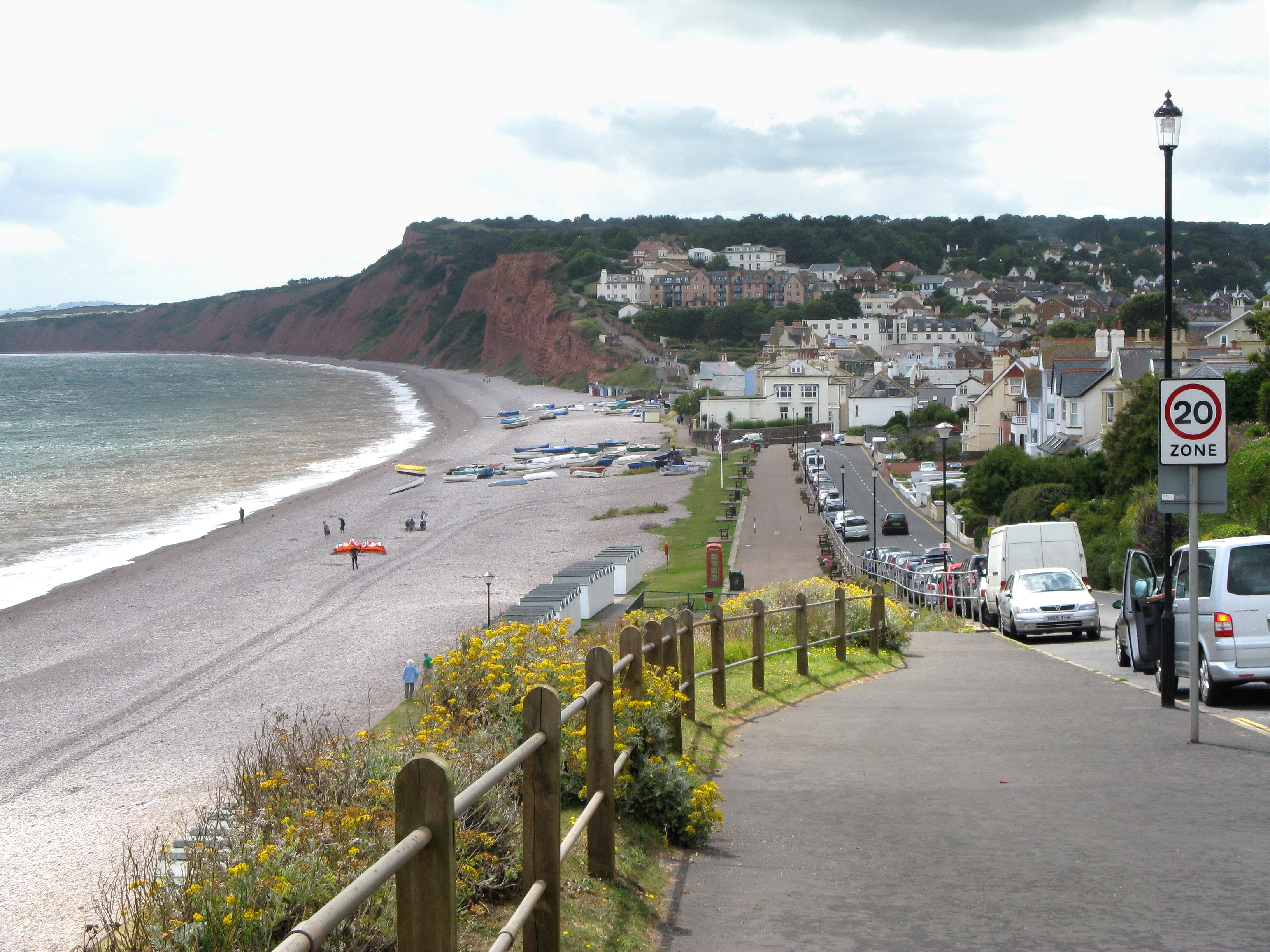
Danger Point is a prominent headland located in Devon, England, known for its stunning coastal features and historical significance. Situated along the South West Coast Path, it offers breathtaking panoramic views of the English Channel and the surrounding rugged cliffs, making it a popular destination for nature enthusiasts and history buffs alike.

The headland gets its name from the treacherous conditions that ships encountered in the past when navigating the nearby coastline. Its jagged and rocky cliffs, combined with strong currents and unpredictable weather patterns, made Danger Point a notorious hazard for seafarers. Numerous shipwrecks have occurred in the vicinity over the centuries, cementing its reputation as a dangerous location.

Aside from its natural beauty, Danger Point also boasts a rich historical heritage. Ruins of an old lookout tower, dating back to the 17th century, can still be found atop the headland. This tower served as a watch post during times of conflict, providing a vantage point to spot potential invaders or approaching ships.

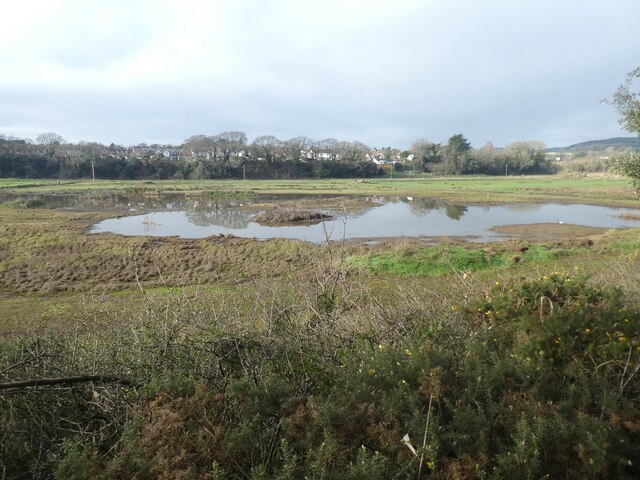
Today, Danger Point offers visitors the opportunity to explore its rugged coastal terrain, observe diverse marine life, and enjoy picturesque walks along the cliff-top paths. The area is home to a variety of seabirds, including gulls, cormorants, and puffins, making it a paradise for birdwatching enthusiasts.

Overall, Danger Point is a captivating coastal feature in Devon, offering a beautiful combination of natural beauty and historical significance. Whether it's admiring the breathtaking views, learning about its maritime past, or simply enjoying the tranquility of the surroundings, Danger Point is a must-visit destination for those seeking an authentic coastal experience.

If you have any feedback on the listing, please let us know in the comments section below.
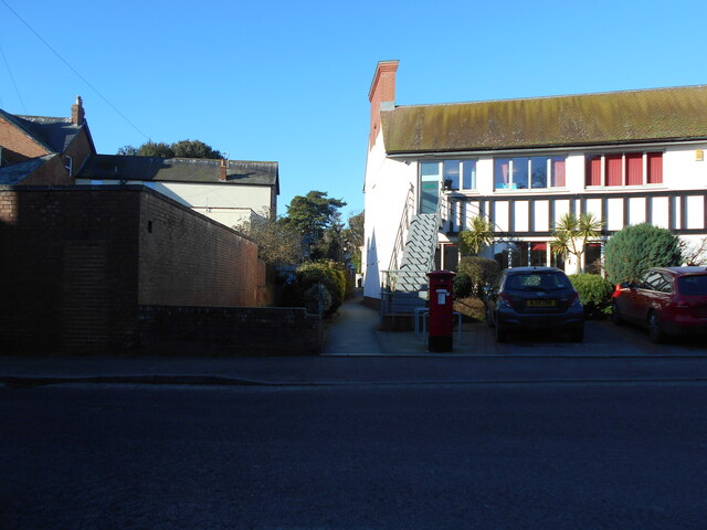
Danger Point Images

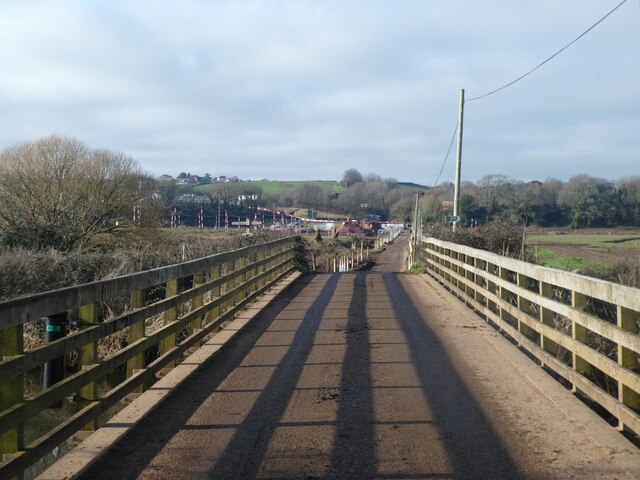
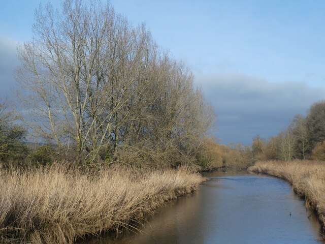
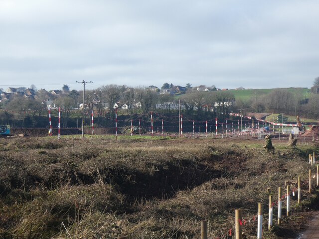
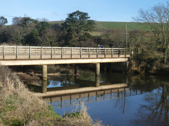
Images are sourced within 2km of 50.631613/-3.3010211 or Grid Reference SY0882. Thanks to Geograph Open Source API. All images are credited.

White Bridge over River Otter and engineering work beyond The works in the floodplain are in order to re-establish a wetland habitat and nature reserve
White Bridge over River Otter and engineering work beyond
The works in the floodplain are in order to re-establish a wetland habitat and nature reserve
Reed beds and River Otter from White Bridge The River Otter rises in the Blackdown Hills and flows south to enter the English Channel just east of Budleigh Salterton. It is 20 miles long.
Wikipedia: <span class="nowrap"><a title="http://en.wikipedia.org/wiki/River_Otter" rel="nofollow ugc noopener" href="http://en.wikipedia.org/wiki/River_Otter">Link</a><img style="margin-left:2px;" alt="External link" title="External link - shift click to open in new window" src="https://s1.geograph.org.uk/img/external.png" width="10" height="10"/></span>
Reed beds and River Otter from White Bridge
The River Otter rises in the Blackdown Hills and flows south to enter the English Channel just east of Budleigh Salterton. It is 20 miles long. Wikipedia: LinkExternal link
Re-establishing a wetland habitat, valley of River Otter The works are in order to re-establish a wetland habitat and nature reserve
Re-establishing a wetland habitat, valley of River Otter
The works are in order to re-establish a wetland habitat and nature reserve
White Bridge over River Otter The South West Coast Path crosses this bridge, as the lowest crossing of the river
White Bridge over River Otter
The South West Coast Path crosses this bridge, as the lowest crossing of the river
Wetlands in flood plain of River Otter Recent works in the floodplain have created this are in order to re-establish a wetland habitat and nature reserve
Wetlands in flood plain of River Otter
Recent works in the floodplain have created this are in order to re-establish a wetland habitat and nature reserve
Estuary of River Otter, low tide The River Otter rises in the Blackdown Hills and flows south to enter the English Channel just east of Budleigh Salterton. It is 20 miles long.
Wikipedia: <span class="nowrap"><a title="http://en.wikipedia.org/wiki/River_Otter" rel="nofollow ugc noopener" href="http://en.wikipedia.org/wiki/River_Otter">Link</a><img style="margin-left:2px;" alt="External link" title="External link - shift click to open in new window" src="https://s1.geograph.org.uk/img/external.png" width="10" height="10"/></span>
Estuary of River Otter, low tide
The River Otter rises in the Blackdown Hills and flows south to enter the English Channel just east of Budleigh Salterton. It is 20 miles long. Wikipedia: LinkExternal link
The cliff at Otterton Ledge, mouth of the river The River Otter rises in the Blackdown Hills and flows south to enter the English Channel just east of Budleigh Salterton. It is 20 miles long.
Wikipedia: <span class="nowrap"><a title="http://en.wikipedia.org/wiki/River_Otter" rel="nofollow ugc noopener" href="http://en.wikipedia.org/wiki/River_Otter">Link</a><img style="margin-left:2px;" alt="External link" title="External link - shift click to open in new window" src="https://s1.geograph.org.uk/img/external.png" width="10" height="10"/></span>
The cliff at Otterton Ledge, mouth of the river
The River Otter rises in the Blackdown Hills and flows south to enter the English Channel just east of Budleigh Salterton. It is 20 miles long. Wikipedia: LinkExternal link
Budleigh Salterton Cricket Club and wetlands beyond The Otter Estuary Reserve covers 23 ha and includes tidal mudflats and saltmarshes. It is no longer managed by Devon Wildlife Trust, it is owned and managed by Clinton Devon Estates. It is an SSSI and a good site for birds.
Budleigh Salterton Cricket Club and wetlands beyond
The Otter Estuary Reserve covers 23 ha and includes tidal mudflats and saltmarshes. It is no longer managed by Devon Wildlife Trust, it is owned and managed by Clinton Devon Estates. It is an SSSI and a good site for birds.
Pillar box at The Lawn The adjacent footpath links up to Station road. Providing a short cut to the local library.
The main Post Office was just a short walk to the left of this photograph.
Like many it has now closed.
Pillar box at The Lawn
The adjacent footpath links up to Station road. Providing a short cut to the local library. The main Post Office was just a short walk to the left of this photograph. Like many it has now closed.
Footpath in the Otter Estuary A view of the public footpath, looking north, in the River Otter Estuary Nature Reserve, just west of the River Otter in East Devon.
Footpath in the Otter Estuary
A view of the public footpath, looking north, in the River Otter Estuary Nature Reserve, just west of the River Otter in East Devon.
The River Otter meets the Sea A view of the River Otter running into the sea at Otterton Ledge rocks viewable from the southern end of the Otter Estuary Nature Reserve east of Budleigh Salterton in Devon.
The River Otter meets the Sea
A view of the River Otter running into the sea at Otterton Ledge rocks viewable from the southern end of the Otter Estuary Nature Reserve east of Budleigh Salterton in Devon.
Budleigh Salterton Seafront and Marine Parade  Budleigh seafront and marine Parade on this peaceful and charming Tuesday afternoon
Budleigh Salterton Seafront and Marine Parade
Budleigh seafront and marine Parade on this peaceful and charming Tuesday afternoon
Budleigh Salterton beach  Budleigh Salterton beach on this peaceful and charming Tuesday afternoon and the scenery is beautiful and got to be one of my favourite places I visited in Devon
Budleigh Salterton beach
Budleigh Salterton beach on this peaceful and charming Tuesday afternoon and the scenery is beautiful and got to be one of my favourite places I visited in Devon
Budleigh Salterton Town centre  Budleigh Salterton Town centre on this peaceful and charming Tuesday afternoon and a row of shops to browse
Budleigh Salterton Town centre
Budleigh Salterton Town centre on this peaceful and charming Tuesday afternoon and a row of shops to browse
Budleigh Salterton Coastal walk
Budleigh Salterton beach and rough seas Rough seas on Budleigh Salterton beach on this warm Thursday afternoon
Budleigh Salterton beach and rough seas
Rough seas on Budleigh Salterton beach on this warm Thursday afternoon
Spit and river at the south end of Otter valley
Budleigh Salterton cricket ground and work on estuary nature reserve Work in progress beyond the cricket ground to create an estuary habitat
Budleigh Salterton cricket ground and work on estuary nature reserve
Work in progress beyond the cricket ground to create an estuary habitat
Show me another place!

Danger Point is located at Grid Ref: SY0882 (Lat: 50.631613, Lng: -3.3010211)

Administrative County: Devon

District: East Devon

Police Authority: Devon and Cornwall

What 3 Words

///houseboat.scans.fidgeted. Near Budleigh Salterton, Devon

Related Wikis

Danger Point

Danger Point is a coastal feature and cliff face in Devon, on the south coast of England. It is about 18 kilometres (11 mi) southeast of the city of Exeter...

Budleigh Salterton

Budleigh Salterton is a seaside town on the coast in East Devon, England, 15 miles (24 km) south-east of Exeter. It lies within the East Devon Area of...

Budleigh Salterton railway station

Budleigh Salterton railway station is a closed railway station that served the town of Budleigh Salterton in Devon, England. It was opened by the London...

Budleigh Salterton A.F.C.

Budleigh Salterton Association Football Club is a football club based in Budleigh Salterton, Devon, England. They are currently members of the Devon League...

Nearby Amenities

Located within 500m of 50.631613,-3.3010211
Source: PGS
Lat/Long: 50.6300654/-3.3064412
Source: PGS
Lat/Long: 50.6287471/-3.3045835
Source: PGS
Lat/Long: 50.6296247/-3.3049395
Source: PGS
Lat/Long: 50.6291947/-3.3034038
Source: PGS
Lat/Long: 50.6300957/-3.3024248
Source: PGS
Lat/Long: 50.6305084/-3.3019403
Source: PGS
Lat/Long: 50.6315408/-3.300569
Source: PGS
Lat/Long: 50.631575/-3.3004707
Source: PGS
Lat/Long: 50.6324773/-3.2994984
Source: PGS
Lat/Long: 50.6325919/-3.2991717
Source: PGS
Lat/Long: 50.6329893/-3.2987411
Source: PGS
Lat/Long: 50.6331617/-3.2984496
Source: PGS
Lat/Long: 50.6342501/-3.29714
Source: PGS
Lat/Long: 50.6347557/-3.2964365
Danger Point
Place: locality
Source: NPE
Wikidata: Q1159575
Wikipedia: en:Danger Point
Lat/Long: 50.6308534/-3.299956
Source: PGS
Lat/Long: 50.629618/-3.3067433
Source: PGS
Lat/Long: 50.6297454/-3.306347
Roman Villa
Fixme: exact area unknown
Historic: archaeological_site
Lat/Long: 50.6305512/-3.3048082
Bench
Backrest: yes
Survey Date: 2023-02-19
Lat/Long: 50.6298582/-3.3071453
Life Ring
Emergency: life_ring
Survey Date: 2023-02-19
Lat/Long: 50.629834/-3.3072372
Bench
Backrest: no
Survey Date: 2023-03-18
Lat/Long: 50.6303288/-3.3055942
The data included in this document is from www.openstreetmap.org. The data is made available under ODbL.

Have you been to Danger Point?

Leave your review of Danger Point below (or comments, questions and feedback).