Berryl's Point

Coastal Feature, Headland, Point in Cornwall

England

Berryl's Point

Landscape Around Trenance Taken from a Flybe flight just after take-off from Newquay Airport bound for London Gatwick.
Landscape Around Trenance Credit: Richard Cooke

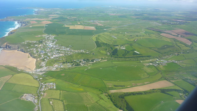
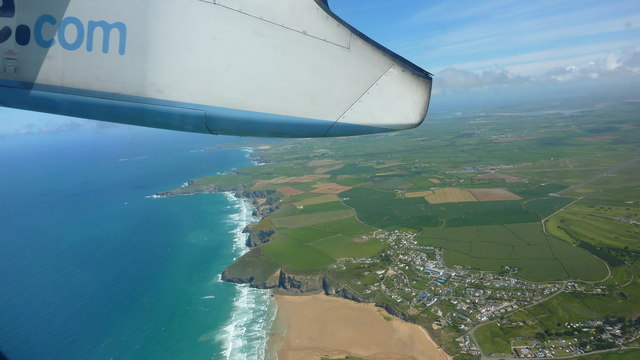
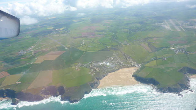
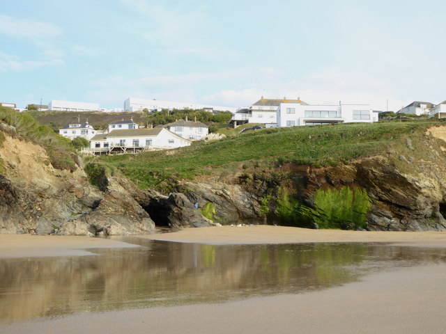
Berryl's Point is a prominent coastal feature located in Cornwall, England. Situated on the southern coast, it is a headland that juts out into the Atlantic Ocean, offering stunning views of the surrounding coastline and the vast expanse of the sea. The point is named after a local family, the Berryls, who were early settlers in the area.

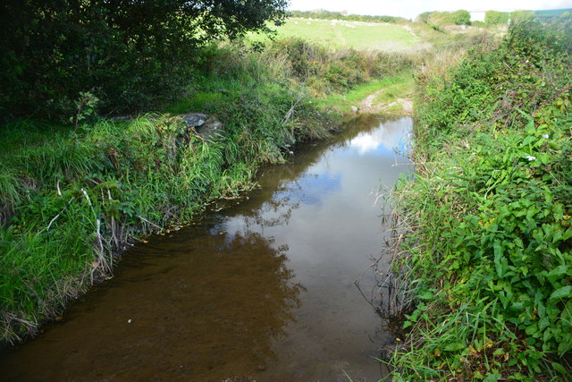
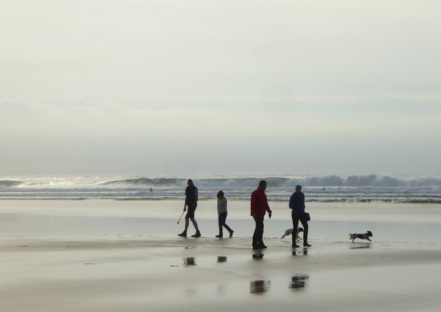
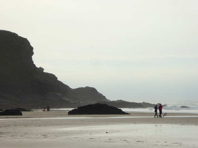
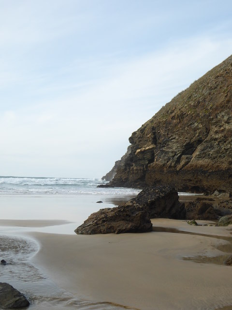
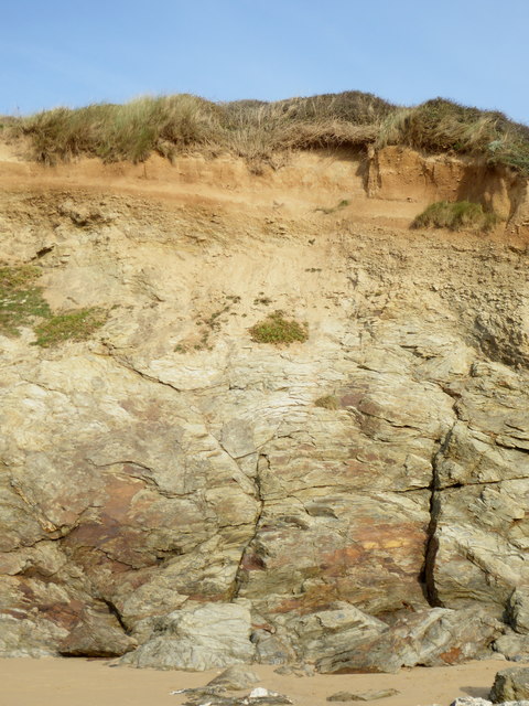
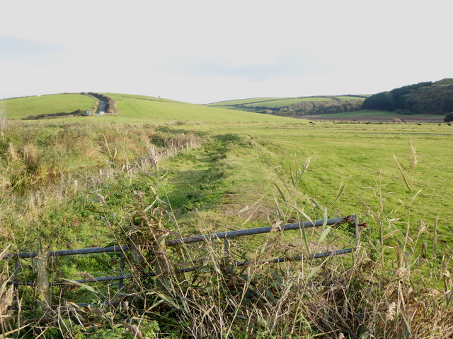
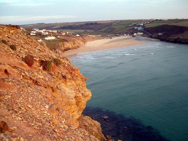
The geography of Berryl's Point is characterized by rugged cliffs, which are composed of sedimentary rocks such as sandstone and shale. These cliffs provide a dramatic backdrop to the point and contribute to its picturesque appeal. The headland is also known for its rocky shoreline and hidden coves, which are popular among beachcombers and nature enthusiasts.

The vegetation on Berryl's Point is diverse, showcasing a variety of coastal plants that are adapted to the harsh coastal environment. Hardier species such as sea thrift, sea campion, and wildflowers can be seen thriving along the cliffs and in the crevices.

Berryl's Point is a haven for wildlife, attracting various seabirds, including gulls, cormorants, and puffins. It is also a prime spot for observing marine life, with seals and dolphins occasionally spotted in the waters surrounding the point.

The point itself is accessible by a well-maintained footpath that winds along the cliff edge, providing visitors with breathtaking views of the ocean and the surrounding coastline. The path is part of a larger network of coastal trails, allowing hikers to explore the area further.

Overall, Berryl's Point is a beautiful and captivating coastal feature, offering visitors a chance to experience the rugged beauty of Cornwall's coastline and connect with nature.

If you have any feedback on the listing, please let us know in the comments section below.

Berryl's Point Images

Images are sourced within 2km of 50.463786/-5.0432019 or Grid Reference SW8467. Thanks to Geograph Open Source API. All images are credited.

Landscape Around Trenance Taken from a Flybe flight just after take-off from Newquay Airport bound for London Gatwick.
Landscape Around Trenance
Taken from a Flybe flight just after take-off from Newquay Airport bound for London Gatwick.
Atlantic Coast North of Newquay Taken from a Flybe flight just after take-off from Newquay Airport heading for London Gatwick.
Atlantic Coast North of Newquay
Taken from a Flybe flight just after take-off from Newquay Airport heading for London Gatwick.
Mawgan Porth Beach Taken from a Flybe flight, which has just taken off from Newquay Airport (visible in the background) on the way to London Gatwick.
Mawgan Porth Beach
Taken from a Flybe flight, which has just taken off from Newquay Airport (visible in the background) on the way to London Gatwick.
Ford at Gluvian Farm This is the first of two fords on the byway leading from Gluvian Farm to Tolcarne Meroch. A YouTube video of the ford can be seen at:
<span class="nowrap"><a title="https://youtu.be/vR5fE5_Vv5o" rel="nofollow ugc noopener" href="https://youtu.be/vR5fE5_Vv5o">Link</a><img style="margin-left:2px;" alt="External link" title="External link - shift click to open in new window" src="https://s1.geograph.org.uk/img/external.png" width="10" height="10"/></span>
Ford at Gluvian Farm
This is the first of two fords on the byway leading from Gluvian Farm to Tolcarne Meroch. A YouTube video of the ford can be seen at: LinkExternal link
Ford at Mawgan Porth This is the second of the two fords along this byway albeit the first is in the neighbouring grid square:
<a title="https://www.geograph.org.uk/photo/4680527" href="https://www.geograph.org.uk/photo/4680527">Link</a>
Ford at Mawgan Porth
This is the second of the two fords along this byway albeit the first is in the neighbouring grid square: Link
Dog walkers on the beach at Mawgan Porth
Berryl's Point at the south end of Mawgan Porth beach
The northern end of Mawgan Porth beach
Houses above Mawgan Porth beach
Head exposed in the cliffs at Mawgan Porth
The lifeguards' hut at Mawgan Porth Closed up for the winter.
The lifeguards' hut at Mawgan Porth
Closed up for the winter.
The River Menalhyl behind Mawgan Porth beach
Fields in the River Menalhyl valley at Mawgan Porth
SW coast path
SW coast path
Old Direction Sign - Signpost by the B3276, Mawgan Porth Cone finial - 'BMC/TBS' cast on pillar; Cornwall CC iron spear by the B3276, in parish of Mawgan in Pydar (Restormel District), Mawgan Porth, at back of footpath.

Surveyed

Milestone Society National ID: CW_SW8567.
Old Direction Sign - Signpost by the B3276, Mawgan Porth
Cone finial - 'BMC/TBS' cast on pillar; Cornwall CC iron spear by the B3276, in parish of Mawgan in Pydar (Restormel District), Mawgan Porth, at back of footpath. Surveyed Milestone Society National ID: CW_SW8567.
Mawgan Porth
Mawgan Porth
Beacon Cove Viewed from the South West Coast Path.
Beacon Cove
Viewed from the South West Coast Path.
Watergate Beach, Tregurrian
Show me another place!

Berryl's Point is located at Grid Ref: SW8467 (Lat: 50.463786, Lng: -5.0432019)

Unitary Authority: Cornwall

Police Authority: Devon and Cornwall

What 3 Words

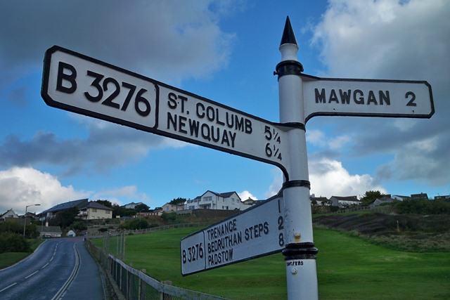
///deriving.lakeside.melon. Near Newquay, Cornwall

Related Wikis

Watergate Bay

Watergate Bay (Standard Written Form: Porth Tregoryan, meaning cove at Coryan's farmstead/village) is a long bay or beach flanked by cliffs centred two...

River Menalhyl

The River Menalhyl (Cornish: Dowr Melynheyl, meaning river of the estuary mill) is a river in Cornwall, England, that flows through the civil parishes...

St Columb Canal

St Columb Canal sometimes referred to as Edyvean's Canal, was an abortive canal scheme in Cornwall, England, designed for the carriage of sea sand for...

Mawgan Porth

Mawgan Porth (in Cornish: Porth Maugan, meaning "St. Mawgan's cove", or Porth Glyvyan, meaning "cove of the Gluvian River") is a beach and small settlement...

Trevarrian

Trevarrian pronounced (Tre-Varrion) is a hamlet south of Mawgan Porth, Cornwall, England, United Kingdom. == Cheese == St. Endellion is a brie style cheese...

Trenance

Trenance (Cornish: Trenans) is a hamlet adjoining Mawgan Porth in Cornwall, England, United Kingdom. Trenance Point is a headland nearby.There are also...

Tregurrian

Tregurrian (Cornish: Tregoryan, meaning Coryan's farm) is a hamlet 2 miles north-northeast of Newquay, on the north coast of Cornwall, England, United...

Watergate Beach

Watergate Beach is a two-mile-long stretch of sandy beach on the Atlantic coast of north Cornwall, England, United Kingdom. It is situated in Watergate...

Nearby Amenities

Located within 500m of 50.463786,-5.0432019
Source: PGS
Lat/Long: 50.4657659/-5.0384223
Source: PGS
Lat/Long: 50.4655473/-5.0406861
Source: PGS
Lat/Long: 50.4654107/-5.0410294
Source: PGS
Lat/Long: 50.4655405/-5.041126
Source: PGS
Lat/Long: 50.4653766/-5.0413835
Source: PGS
Lat/Long: 50.4651922/-5.0416624
Source: PGS
Lat/Long: 50.4648849/-5.0418877
Source: PGS
Lat/Long: 50.4647073/-5.0419307
Source: PGS
Lat/Long: 50.4645366/-5.0419199
Bench
Backrest: no
Lat/Long: 50.4642418/-5.0414033
The data included in this document is from www.openstreetmap.org. The data is made available under ODbL.

Have you been to Berryl's Point?

Leave your review of Berryl's Point below (or comments, questions and feedback).