Grange Point

Coastal Marsh, Saltings in Cornwall

England

Grange Point

Gluvian Farm Shortly after take-off from Newquay Airport on a Flybe flight to London Gatwick.
Gluvian Farm Credit: Richard Cooke

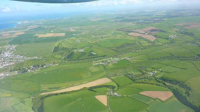
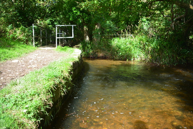
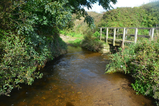
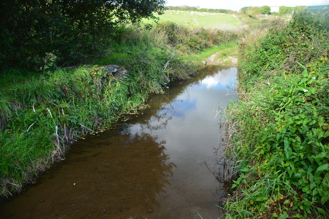
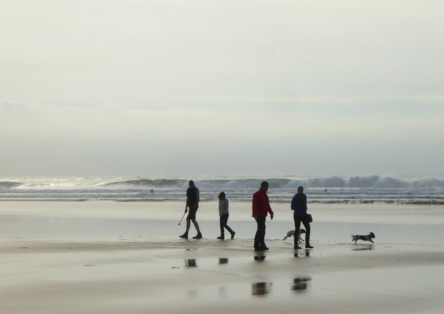
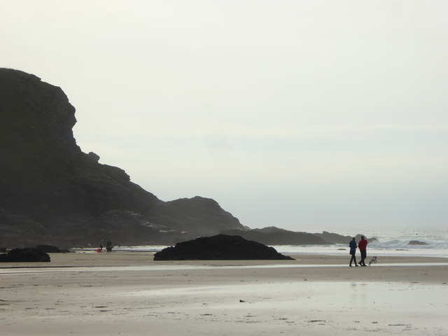
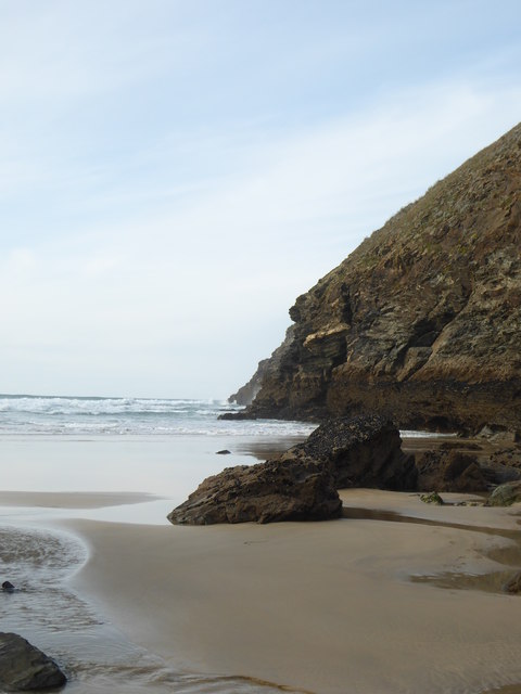
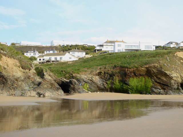
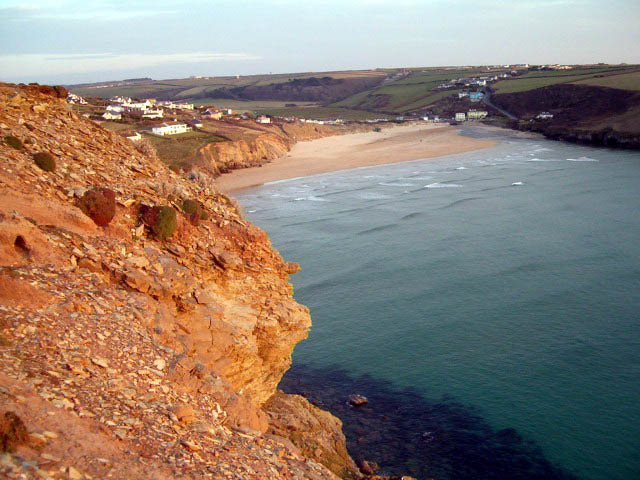
Grange Point is a stunning coastal marsh located in Cornwall, England. Situated within the larger area known as the Saltings, this picturesque landscape offers visitors a unique and diverse natural experience. The marsh is characterized by its expansive areas of salt marshes and mudflats, which are home to a wealth of flora and fauna.

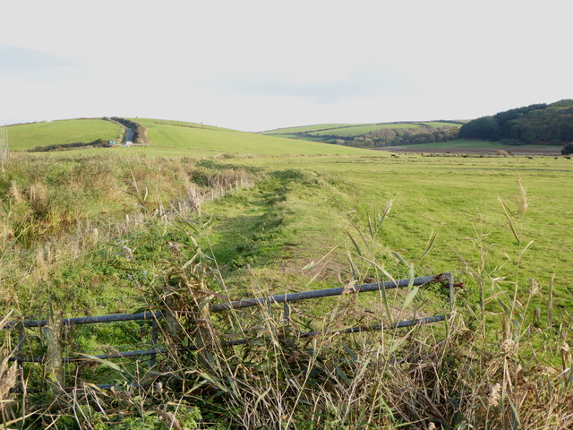
The coastal marsh at Grange Point is renowned for its exceptional beauty, with its rolling meadows and vibrant greenery. The area is an important habitat for numerous bird species, including waders and waterfowl, making it a popular destination for birdwatchers and nature enthusiasts alike.

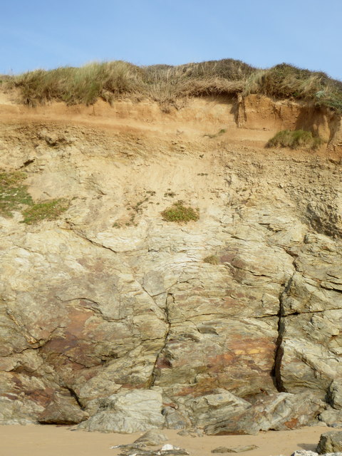
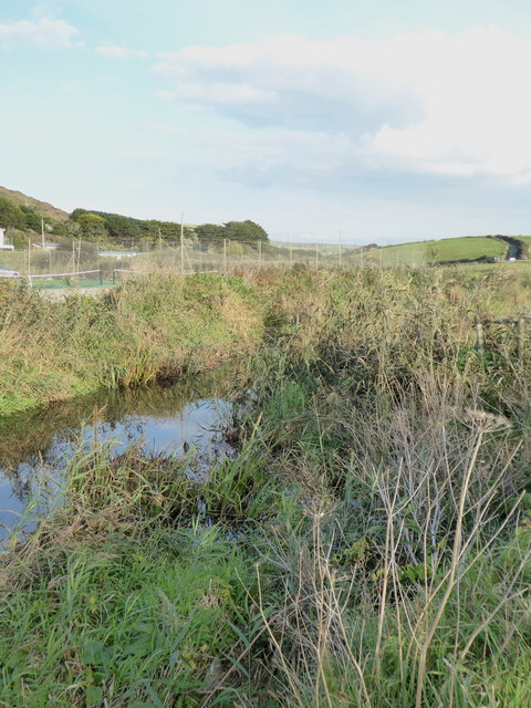
The saltings, which border the marsh, consist of a vast expanse of tidal creeks and mudflats that are exposed during low tide. These mudflats are a haven for various species of marine invertebrates, such as worms, crabs, and mollusks. The intertidal zone also supports a rich diversity of plant life, including salt-tolerant grasses and samphire.

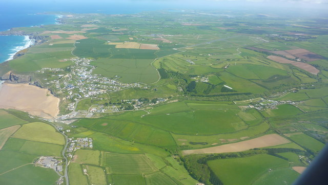
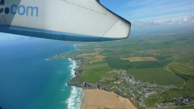
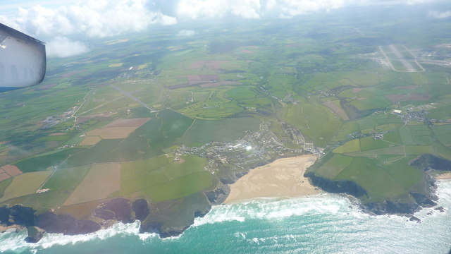
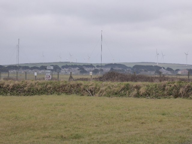
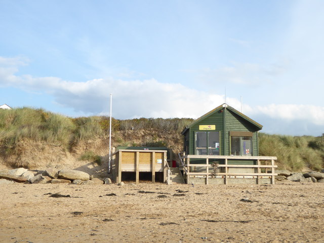
Access to Grange Point is facilitated by well-maintained footpaths and trails that wind through the marsh, providing visitors with the opportunity to explore the area's natural wonders at their own pace. The marsh and saltings offer breathtaking panoramic views of the surrounding coastline, with its rugged cliffs and crashing waves.

Grange Point is a protected area, managed by local conservation organizations, ensuring the preservation of its unique ecosystem. Visitors are encouraged to respect the delicate balance of nature and follow designated paths to minimize disturbance to the wildlife.

In summary, Grange Point in Cornwall is a remarkable coastal marsh and saltings area that boasts a rich diversity of plant and animal life. Its stunning beauty and tranquil atmosphere make it a must-visit destination for nature lovers and those seeking a peaceful retreat.

If you have any feedback on the listing, please let us know in the comments section below.

Grange Point Images

Images are sourced within 2km of 50.466726/-5.0363581 or Grid Reference SW8467. Thanks to Geograph Open Source API. All images are credited.

Gluvian Farm Shortly after take-off from Newquay Airport on a Flybe flight to London Gatwick.
Gluvian Farm
Shortly after take-off from Newquay Airport on a Flybe flight to London Gatwick.
Landscape Around Trenance Taken from a Flybe flight just after take-off from Newquay Airport bound for London Gatwick.
Landscape Around Trenance
Taken from a Flybe flight just after take-off from Newquay Airport bound for London Gatwick.
Atlantic Coast North of Newquay Taken from a Flybe flight just after take-off from Newquay Airport heading for London Gatwick.
Atlantic Coast North of Newquay
Taken from a Flybe flight just after take-off from Newquay Airport heading for London Gatwick.
Mawgan Porth Beach Taken from a Flybe flight, which has just taken off from Newquay Airport (visible in the background) on the way to London Gatwick.
Mawgan Porth Beach
Taken from a Flybe flight, which has just taken off from Newquay Airport (visible in the background) on the way to London Gatwick.
Retorrick Mill Ford This ford is found beside the holiday park on the path leading to Retorric Mill.
Retorrick Mill Ford
This ford is found beside the holiday park on the path leading to Retorric Mill.
Ford at Gluvian Farm This is the first of two fords on the byway leading from Gluvian Farm to Tolcarne Meroch. A YouTube video of the ford can be seen at:
<span class="nowrap"><a title="https://youtu.be/vR5fE5_Vv5o" rel="nofollow ugc noopener" href="https://youtu.be/vR5fE5_Vv5o">Link</a><img style="margin-left:2px;" alt="External link" title="External link - shift click to open in new window" src="https://s1.geograph.org.uk/img/external.png" width="10" height="10"/></span>
Ford at Gluvian Farm
This is the first of two fords on the byway leading from Gluvian Farm to Tolcarne Meroch. A YouTube video of the ford can be seen at: LinkExternal link
Ford at Mawgan Porth This is the second of the two fords along this byway albeit the first is in the neighbouring grid square:
<a title="https://www.geograph.org.uk/photo/4680527" href="https://www.geograph.org.uk/photo/4680527">Link</a>
Ford at Mawgan Porth
This is the second of the two fords along this byway albeit the first is in the neighbouring grid square: Link
Ford at Polgreen Manor This ford is found at Polgreen Manor.
Ford at Polgreen Manor
This ford is found at Polgreen Manor.
St Eval airfield radio transmitter station St Eval airfield radio transmitter station.  It is on the site of a former airfield which closed in the 1950s.
St Eval airfield radio transmitter station
St Eval airfield radio transmitter station. It is on the site of a former airfield which closed in the 1950s.
Dog walkers on the beach at Mawgan Porth
Berryl's Point at the south end of Mawgan Porth beach
The northern end of Mawgan Porth beach
Houses above Mawgan Porth beach
Head exposed in the cliffs at Mawgan Porth
The lifeguards' hut at Mawgan Porth Closed up for the winter.
The lifeguards' hut at Mawgan Porth
Closed up for the winter.
The River Menalhyl behind Mawgan Porth beach
Fields in the River Menalhyl valley at Mawgan Porth
SW coast path
SW coast path
Show me another place!

Grange Point is located at Grid Ref: SW8467 (Lat: 50.466726, Lng: -5.0363581)

Unitary Authority: Cornwall

Police Authority: Devon and Cornwall

What 3 Words

///signs.grasp.fractions. Near Newquay, Cornwall

Related Wikis

River Menalhyl

The River Menalhyl (Cornish: Dowr Melynheyl, meaning river of the estuary mill) is a river in Cornwall, England, that flows through the civil parishes...

St Columb Canal

St Columb Canal sometimes referred to as Edyvean's Canal, was an abortive canal scheme in Cornwall, England, designed for the carriage of sea sand for...

Mawgan Porth

Mawgan Porth (in Cornish: Porth Maugan, meaning "St. Mawgan's cove", or Porth Glyvyan, meaning "cove of the Gluvian River") is a beach and small settlement...

Trenance

Trenance (Cornish: Trenans) is a hamlet adjoining Mawgan Porth in Cornwall, England, United Kingdom. Trenance Point is a headland nearby.There are also...

Watergate Bay

Watergate Bay (Standard Written Form: Porth Tregoryan, meaning cove at Coryan's farmstead/village) is a long bay or beach flanked by cliffs centred two...

Trevarrian

Trevarrian pronounced (Tre-Varrion) is a hamlet south of Mawgan Porth, Cornwall, England, United Kingdom. == Cheese == St. Endellion is a brie style cheese...

Tregurrian

Tregurrian (Cornish: Tregoryan, meaning Coryan's farm) is a hamlet 2 miles north-northeast of Newquay, on the north coast of Cornwall, England, United...

Downhill, Cornwall

Downhill is a hamlet in the parish of St Eval, Cornwall, England. == References ==

Nearby Amenities

Located within 500m of 50.466726,-5.0363581
Source: PGS
Lat/Long: 50.470785/-5.034367
Source: PGS
Lat/Long: 50.4705052/-5.0342917
Source: PGS
Lat/Long: 50.4701159/-5.0335729
Source: PGS
Lat/Long: 50.4696653/-5.0331759
Source: PGS
Lat/Long: 50.4693784/-5.0327575
Source: PGS
Lat/Long: 50.4659707/-5.0338304
Source: PGS
Lat/Long: 50.4667151/-5.0350749
Source: PGS
Lat/Long: 50.4664147/-5.0361264
Source: PGS
Lat/Long: 50.4664488/-5.036298
Source: PGS
Lat/Long: 50.4657659/-5.0384223
Source: PGS
Lat/Long: 50.4655473/-5.0406861
Source: PGS
Lat/Long: 50.4654107/-5.0410294
Source: PGS
Lat/Long: 50.4655405/-5.041126
Source: PGS
Lat/Long: 50.4653766/-5.0413835
Source: PGS
Lat/Long: 50.4651922/-5.0416624
Source: PGS
Lat/Long: 50.4648849/-5.0418877
Source: PGS
Lat/Long: 50.4647073/-5.0419307
Source: PGS
Lat/Long: 50.4645366/-5.0419199
Bus Stop
Betty's Shop
Bus: yes
Naptan AtcoCode: 0800COC31625
Naptan Bearing: E
Naptan CommonName: Opp Petrol Station
Naptan Indicator: Opp
Naptan NaptanCode: cordagwt
Naptan Street: B3276
Naptan Verified: no
Public Transport: platform
Source: naptan_import
Lat/Long: 50.4650561/-5.0313154
Pub
Merrymoor Inn
Addr City: Newquay
Addr Place: Mawgan Porth
Addr Postcode: TR8 4BA
Addr Street: Mawgan Porth Hill
Fhrs Id: 402136
Source Addr: FHRS Open Data
Url: http://www.merrymoorinn.com/
Lat/Long: 50.4645174/-5.0319779
Restaurant
Beach Box Cafe
Addr Postcode: TR8 4BA
Lat/Long: 50.4647626/-5.0308359
Restaurant
The Blue Fish Bar
Addr Postcode: TR8 4BA
Cuisine: fish_and_chips
Lat/Long: 50.4645466/-5.03182
Cornish Fresh
Addr City: Newquay
Addr Country: GB
Addr Housename: Mawgan Porth
Addr Postcode: TR8 4BA
Addr Street: Mawgan Porth Hill
Fhrs Id: 402087
Shop: convenience
Source Addr: FHRS Open Data
Lat/Long: 50.4649355/-5.0306436
Betty's News
Shop: newsagent
Lat/Long: 50.4648104/-5.0311697
Restaurant
Catch
Addr City: Newquay
Addr Hamlet: Mawgan Porth
Addr Housename: Bridge House
Addr Postcode: TR8 4BA
Addr Street: Mawgan Porth Hill
Cuisine: fish_and_chips
Fhrs Id: 900608
Source Addr: FHRS Open Data
Lat/Long: 50.4647315/-5.0315398
Art at the Beach
Shop: art
Lat/Long: 50.4649521/-5.0305823
Married to the Sea
Shop: sports
Lat/Long: 50.4649794/-5.0304723
Disco Beads
Shop: jewelry
Lat/Long: 50.4650187/-5.0303422
Betty's Surf Shop
Addr Postcode: TR8 4BA
Shop: sports
Url: http://www.bettys-surfshop.co.uk/
Lat/Long: 50.4648258/-5.0313386
Cafe
Coasta Coffee
Addr City: Newquay
Addr Hamlet: Mawgan Porth
Addr Housename: Riviera Cafe
Addr Postcode: TR8 4BA
Addr Street: Mawgan Porth Hill
Fhrs Id: 1180629
Source Addr: FHRS Open Data
Lat/Long: 50.4644621/-5.0317356
Bus Stop
Pitch and Putt
Bus: yes
Naptan AtcoCode: 0800COC31615
Naptan Bearing: SE
Naptan CommonName: Pitch and Putt
Naptan Indicator: SE-bound
Naptan NaptanCode: cordajat
Naptan Verified: no
Public Transport: platform
Source: naptan;bing
Lat/Long: 50.4652133/-5.0301692
Bench
Backrest: no
Lat/Long: 50.4707104/-5.0335085
Bench
Backrest: no
Lat/Long: 50.4704845/-5.0332657
Bench
Backrest: yes
Lat/Long: 50.4687768/-5.0318624
Bench
Backrest: no
Lat/Long: 50.4642418/-5.0414033
Restaurant
Tredragon Pizza
Contact Facebook: https://www.facebook.com/tredragonpizza/
Currency XBT: yes
Payment Lightning: yes
Payment Lightning Contactless: no
Payment Onchain: yes
Phone: +44 1637 861937
Survey Date: 2023-04-06
Lat/Long: 50.4653495/-5.0301232
Mawgan Porth
Name Kw: Porthgluwyan
Place: village
Lat/Long: 50.4648653/-5.0319277
Natural Shower
Tourism: attraction
Lat/Long: 50.4694573/-5.0322516
Life Ring
Emergency: life_ring
Survey Date: 2023-08-19
Lat/Long: 50.4694154/-5.0324022
Waste Basket
Survey Date: 2023-08-19
Lat/Long: 50.4695563/-5.0322755
Bench
Survey Date: 2023-08-19
Lat/Long: 50.4687504/-5.0318361
Life Ring
Emergency: life_ring
Survey Date: 2023-08-19
Lat/Long: 50.4674475/-5.031435
Bench
Backrest: yes
Survey Date: 2023-08-19
Lat/Long: 50.4650687/-5.0318095
Bench
Backrest: yes
Survey Date: 2023-08-19
Lat/Long: 50.4650574/-5.0318317
Covered: no
Leisure: picnic_table
Survey Date: 2023-08-19
Lat/Long: 50.4650258/-5.0318112
Covered: no
Leisure: picnic_table
Survey Date: 2023-08-19
Lat/Long: 50.4649933/-5.0317996
Life Ring
Emergency: life_ring
Survey Date: 2023-08-19
Lat/Long: 50.4649413/-5.0317585
Post Box
Collection Times: Mo-Fr 09:00; Sa 07:00; Su off
Operator: Royal Mail
Operator Wikidata: Q638098
Post Box Mounting: brick_pillar
Post Box Type: wall
Ref: TR8 80D
Royal Cypher: GR
Royal Cypher Wikidata: Q33102273
Source: survey;aerial imagery
Survey Date: 2023-08-19
Lat/Long: 50.4646635/-5.0321598
Waste Basket
Survey Date: 2023-08-19
Lat/Long: 50.4652655/-5.0304057
Waste Basket
Survey Date: 2023-08-19
Lat/Long: 50.4653195/-5.0305539
Fire Hydrant
Emergency: fire_hydrant
Survey Date: 2023-08-19
Lat/Long: 50.4662464/-5.0299293
Post Box
Collection Times: Mo-Fr 09:00; Sa 07:00; Su off
Operator: Royal Mail
Operator Wikidata: Q638098
Post Box Design: type_n
Post Box Mounting: pier
Post Box Type: lamp
Ref: TR8 79D
Royal Cypher: EIIR
Royal Cypher Wikidata: Q33102113
Source: survey;aerial imagery
Survey Date: 2023-10-25
Lat/Long: 50.4687162/-5.0301005
Defibrillator
Access: yes
Defibrillator Location: On outside wall of Merrymoor Inn, facing the beach
Emergency: defibrillator
Indoor: no
Opening Hours: 24/7
Survey Date: 2024-02-18
Lat/Long: 50.4645939/-5.0321978
Toilets
Survey Date: 2024-02-18
Toilets Disposal: flush
Lat/Long: 50.4647791/-5.0309812
Fire Hydrant
Emergency: fire_hydrant
Fire Hydrant Type: underground
Survey Date: 2024-02-18
Lat/Long: 50.4633804/-5.0317098
The data included in this document is from www.openstreetmap.org. The data is made available under ODbL.

Have you been to Grange Point?

Leave your review of Grange Point below (or comments, questions and feedback).