An Dunan

Coastal Feature, Headland, Point in Argyllshire

Scotland

An Dunan

Rocky coastline near Malcolm's Point
Rocky coastline near Malcolm's Point Credit: Steven Brown

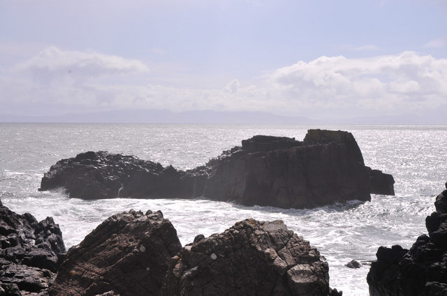
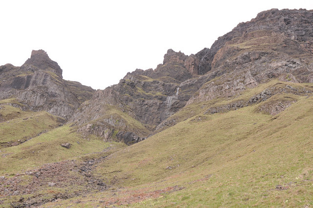
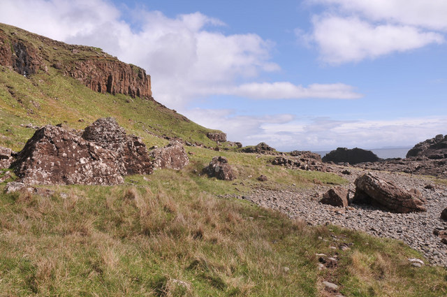
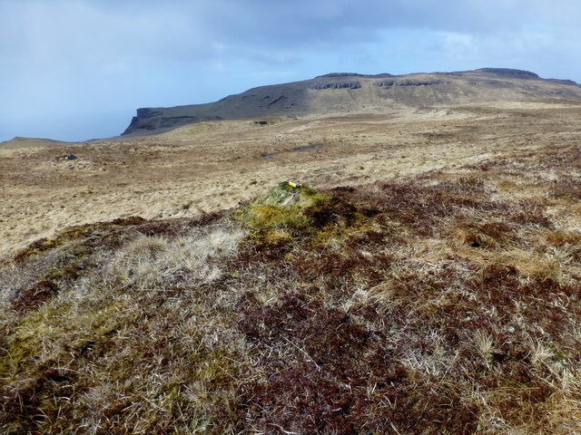
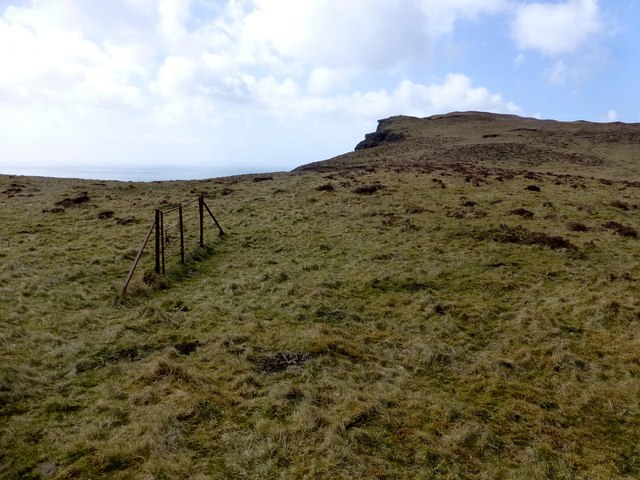
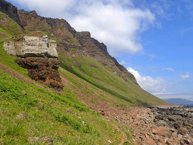
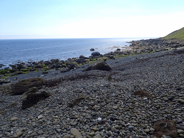
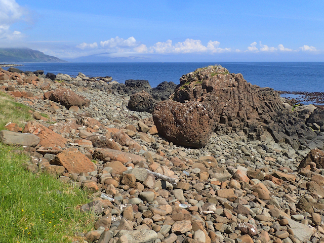
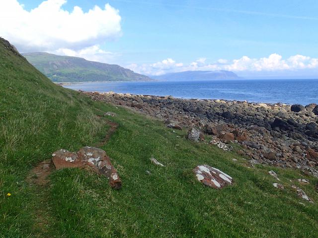
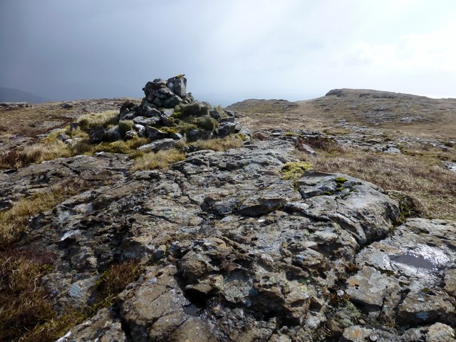
An Dunan is a prominent headland located in Argyllshire, Scotland. Situated along the stunning coastal region, this striking feature makes for a picturesque destination for nature enthusiasts and history buffs alike. The headland is formed by a rugged, rocky coastline that juts out into the North Atlantic Ocean, providing captivating views of the surrounding seascape.

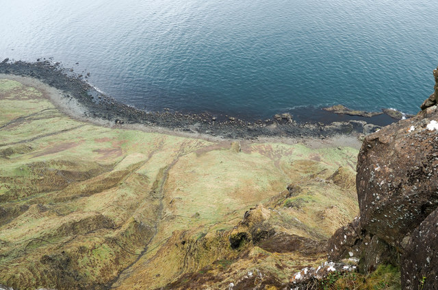
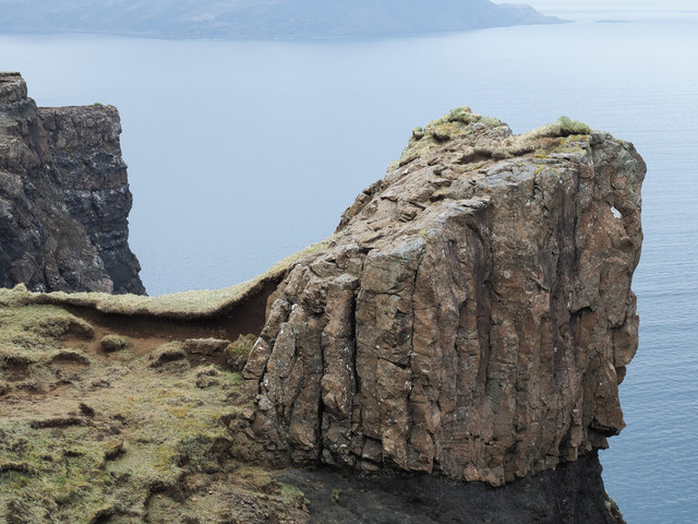
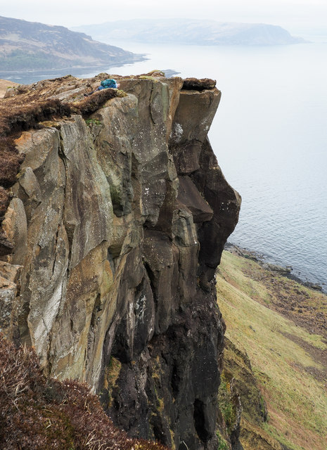
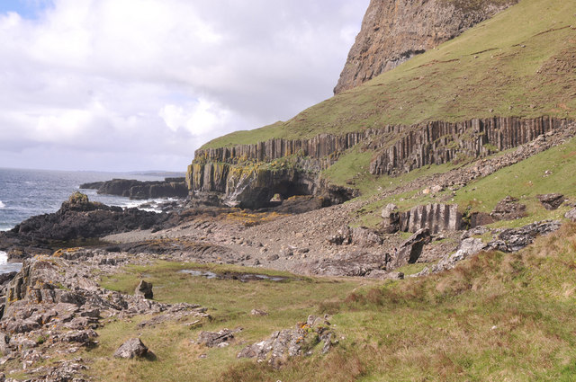
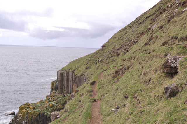
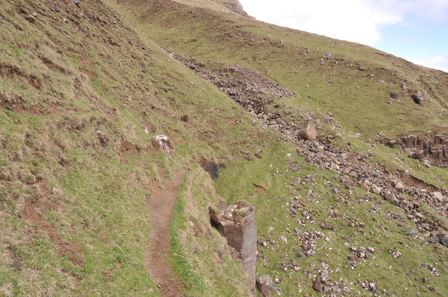
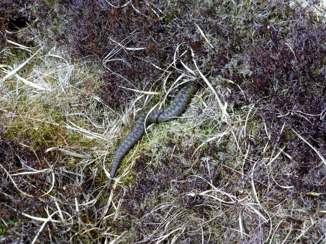
At An Dunan, visitors can observe the impressive geology of the area, with towering cliffs and rock formations adding to its allure. The headland is also home to diverse wildlife, including seabirds such as gannets and puffins, which nest in the cliffs. Marine mammals like seals and dolphins can often be spotted swimming in the waters below.

The historical significance of An Dunan adds an extra layer of intrigue to this coastal feature. The headland was once the site of an ancient fort, dating back to the Iron Age. The remains of defensive walls and structures can still be seen, providing glimpses into the lives of the inhabitants who once called this place home.

For those seeking outdoor activities, An Dunan offers opportunities for hiking and walking along its cliffside paths. The rugged terrain and breathtaking views create a memorable experience for nature lovers and photographers. Additionally, the headland is a popular spot for fishing, offering anglers a chance to cast their lines into the abundant waters.

Overall, An Dunan in Argyllshire is a captivating headland, combining natural beauty, wildlife, and historical significance into one extraordinary coastal feature.

If you have any feedback on the listing, please let us know in the comments section below.

An Dunan Images

Images are sourced within 2km of 56.296767/-6.045952 or Grid Reference NM4918. Thanks to Geograph Open Source API. All images are credited.

Rocky coastline near Malcolm's Point
Waterfall in the cliffs near Carsaig
Coastal path near Carsaig
Cnocan Buidhe Bagged on the way to Creachan Mòr with two likely high spots visited with Jim Bloomer.

Name: Cnocan Buidhe
Hill number: 102188
Height: 295m / 968ft
Area: 17E: Mull and Nearby Islands
Class: 2
Grid ref: NM 50626 19627
Summit feature: grassy knoll
Drop: 30m
Col: 265m  NM498197
Cnocan Buidhe
Bagged on the way to Creachan Mòr with two likely high spots visited with Jim Bloomer. Name: Cnocan Buidhe Hill number: 102188 Height: 295m / 968ft Area: 17E: Mull and Nearby Islands Class: 2 Grid ref: NM 50626 19627 Summit feature: grassy knoll Drop: 30m Col: 265m NM498197
A Gate But No Fence A gate but no fence to stop you tumbling over the cliff edge in poor visibility near Cnoc Carrach.
A Gate But No Fence
A gate but no fence to stop you tumbling over the cliff edge in poor visibility near Cnoc Carrach.
Path to Carsaig Following in the footsteps of David Balfour, the hero of Robert Louis Stevenson's Kidnapped, as he makes his way back to Edinburgh to confront his wicked uncle.

Stage 1, June 2016 from Erraid to Fishnish on the Isle of Mull.

See <span class="nowrap"><a title="http://www.stevensonway.org.uk" rel="nofollow ugc noopener" href="http://www.stevensonway.org.uk">Link</a><img style="margin-left:2px;" alt="External link" title="External link - shift click to open in new window" src="https://s1.geograph.org.uk/img/external.png" width="10" height="10"/></span>
Path to Carsaig
Following in the footsteps of David Balfour, the hero of Robert Louis Stevenson's Kidnapped, as he makes his way back to Edinburgh to confront his wicked uncle. Stage 1, June 2016 from Erraid to Fishnish on the Isle of Mull. See LinkExternal link
Coast below Cnocan Buidhe
Coast below Cnocan Buidhe Following in the footsteps of David Balfour, the hero of Robert Louis Stevenson's Kidnapped, as he makes his way back to Edinburgh to confront his wicked uncle.

Stage 1, June 2016 from Erraid to Fishnish on the Isle of Mull.

See <span class="nowrap"><a title="http://www.stevensonway.org.uk" rel="nofollow ugc noopener" href="http://www.stevensonway.org.uk">Link</a><img style="margin-left:2px;" alt="External link" title="External link - shift click to open in new window" src="https://s1.geograph.org.uk/img/external.png" width="10" height="10"/></span>
Coast below Cnocan Buidhe
Following in the footsteps of David Balfour, the hero of Robert Louis Stevenson's Kidnapped, as he makes his way back to Edinburgh to confront his wicked uncle. Stage 1, June 2016 from Erraid to Fishnish on the Isle of Mull. See LinkExternal link
Coast below Aoineadh nan Gamhna Following in the footsteps of David Balfour, the hero of Robert Louis Stevenson's Kidnapped, as he makes his way back to Edinburgh to confront his wicked uncle.

Stage 1, June 2016 from Erraid to Fishnish on the Isle of Mull.

See <span class="nowrap"><a title="http://www.stevensonway.org.uk" rel="nofollow ugc noopener" href="http://www.stevensonway.org.uk">Link</a><img style="margin-left:2px;" alt="External link" title="External link - shift click to open in new window" src="https://s1.geograph.org.uk/img/external.png" width="10" height="10"/></span>
Coast below Aoineadh nan Gamhna
Following in the footsteps of David Balfour, the hero of Robert Louis Stevenson's Kidnapped, as he makes his way back to Edinburgh to confront his wicked uncle. Stage 1, June 2016 from Erraid to Fishnish on the Isle of Mull. See LinkExternal link
Mull's south coast north-east of Malcolm's Point Steep grassy slopes below a vertical cliff running down to rocks at the sea shore.
Malcolm's Point and the Carsaig Arches lie to the right, out of the image - and down below of course!
A Geograph recorded for NM5018 from the only possible accessible point above the rock face by lying flat to the ground with a camera held over the cliff edge.
Mull's south coast north-east of Malcolm's Point
Steep grassy slopes below a vertical cliff running down to rocks at the sea shore. Malcolm's Point and the Carsaig Arches lie to the right, out of the image - and down below of course! A Geograph recorded for NM5018 from the only possible accessible point above the rock face by lying flat to the ground with a camera held over the cliff edge.
Rock block at cliff edge This striking feature is at the crag rim of the south side of the Ross of Mull south-east of the hill top, Creachan Mòr. An easy ascent can be made by following the narrow grass rib above the exposed soil, then by a simple scramble.
Rock block at cliff edge
This striking feature is at the crag rim of the south side of the Ross of Mull south-east of the hill top, Creachan Mòr. An easy ascent can be made by following the narrow grass rib above the exposed soil, then by a simple scramble.
Cliff edge at Aoineadh Mòr This part of the Aoineadh Mòr cliff lies close to the feature named as Dùnan na Marcachd on OS maps. It's not immediately apparent but there's a hill walker dressed in blue, lying face down overlooking the drop.
Cliff edge at Aoineadh Mòr
This part of the Aoineadh Mòr cliff lies close to the feature named as Dùnan na Marcachd on OS maps. It's not immediately apparent but there's a hill walker dressed in blue, lying face down overlooking the drop.
View to Carsaig Arches
Narrow path to the second Carsaig arch
Narrow steep path near the Carsaig Arches
By Steamer To Iona - 4th June 2012 : Malcolm's Point  Ahead Steaming back from Iona to Oban on a perfect Hebridean afternoon, the paddle steamer Waverley is heading towards the prominent cliffs of Malcolm's Point on the south coast of Mull.
By Steamer To Iona - 4th June 2012 : Malcolm's Point Ahead
Steaming back from Iona to Oban on a perfect Hebridean afternoon, the paddle steamer Waverley is heading towards the prominent cliffs of Malcolm's Point on the south coast of Mull.
Creachan Mòr Second Marilyn on a cool and windy morning with hale showers with Jim Bloomer.

Name: Creachan Mòr
Hill number: 1326
Height: 331m / 1086ft
Area: 17E: Mull and Nearby Islands
Class: Ma,3
Grid ref: NM 49621 19565
Summit feature: cairn
Drop: 165m
Col: 166m  NM518205
Creachan Mòr
Second Marilyn on a cool and windy morning with hale showers with Jim Bloomer. Name: Creachan Mòr Hill number: 1326 Height: 331m / 1086ft Area: 17E: Mull and Nearby Islands Class: Ma,3 Grid ref: NM 49621 19565 Summit feature: cairn Drop: 165m Col: 166m NM518205
Adder In Moorland I almost stood on this adder on the upper moorland slopes of Creachan Mòr.
Adder In Moorland
I almost stood on this adder on the upper moorland slopes of Creachan Mòr.
Show me another place!

An Dunan is located at Grid Ref: NM4918 (Lat: 56.296767, Lng: -6.045952)

Unitary Authority: Argyll and Bute

Police Authority: Argyll and West Dunbartonshire

What 3 Words

///method.workroom.cornering. Near Lochbuie, Argyll & Bute

Related Wikis

Carsaig Arches

Carsaig Arches are natural arch cliff formations on the Ross of Mull in the south of the Isle of Mull, on the west coast of Scotland. They are situated...

Carsaig Bay

Carsaig Bay is a cove on the Ross of Mull in the south of the Isle of Mull, off the west coast of Scotland. It is situated 5 kilometres (3 miles) eastward...

Shiaba

Shiaba (Scottish Gaelic: Siaba) is a ruined township located on the southwestern peninsula of the Isle of Mull, Scotland. It lies about 8 km to the east...

Pennyghael

Pennyghael (Scottish Gaelic: Peighinn nan Gàidheal) is a small village in the Ross of Mull, Argyll and Bute, Scotland. It is located along the A849 road...

Nearby Amenities

Located within 500m of 56.296767,-6.045952
Created By: dmgroom_coastlines
Source: PGS
Lat/Long: 56.29563/-6.03826
Created By: dmgroom_coastlines
Source: PGS
Lat/Long: 56.29551/-6.0385
Source: PGS
Lat/Long: 56.2953637/-6.0390124
Source: PGS
Lat/Long: 56.29525/-6.0392688
Source: PGS
Lat/Long: 56.2951256/-6.0396593
Source: PGS
Lat/Long: 56.2945802/-6.0403674
Source: PGS
Lat/Long: 56.2947076/-6.0404157
Source: PGS
Lat/Long: 56.2944695/-6.0407215
Source: PGS
Lat/Long: 56.2943445/-6.0411721
Source: PGS
Lat/Long: 56.294201/-6.0419639
Source: PGS
Lat/Long: 56.2939271/-6.0426666
Created By: dmgroom_coastlines
Source: PGS
Lat/Long: 56.2933/-6.04282
Created By: dmgroom_coastlines
Source: PGS
Lat/Long: 56.29305/-6.04284
Source: PGS
Lat/Long: 56.2928146/-6.0431547
Source: PGS
Lat/Long: 56.292577/-6.0445317
Source: PGS
Lat/Long: 56.2926989/-6.044996
Source: PGS
Lat/Long: 56.292466/-6.0454038
Source: PGS
Lat/Long: 56.2925162/-6.0469313
Source: PGS
Lat/Long: 56.2924684/-6.0471204
Source: PGS
Lat/Long: 56.2927739/-6.0494433
Carsaig Arches - first arch
Natural: arch
Lat/Long: 56.2930723/-6.0503828
The data included in this document is from www.openstreetmap.org. The data is made available under ODbL.

Have you been to An Dunan?

Leave your review of An Dunan below (or comments, questions and feedback).