Rubha nan Sgarbh

Coastal Feature, Headland, Point in Ross-shire

Scotland

Rubha nan Sgarbh

Chicken Head and Chicken Rock The rocks lying off Chicken Head are called Hen & Chickens and Cock Rock.  The paddle steamer HMS Lively ran aground on the rocks in 1883 and was wrecked (all aboard were rescued). The scattered wreckage of the Lively is marked by the yellow buoy at position 59°10.610’N, 06°15.467’W in depths up to 15 metres (<span class="nowrap"><a title="https://www.scottishshipwrecks.com/hms-lively/" rel="nofollow ugc noopener" href="https://www.scottishshipwrecks.com/hms-lively/">Link</a><img style="margin-left:2px;" alt="External link" title="External link - shift click to open in new window" src="https://s1.geograph.org.uk/img/external.png" width="10" height="10"/></span> Scottish Shipwrecks).
Chicken Head and Chicken Rock Credit: David Dixon

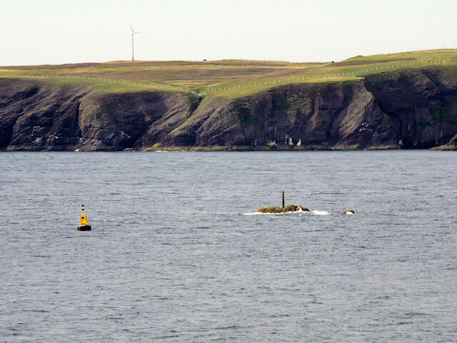
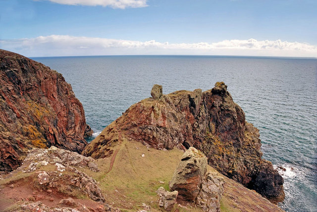
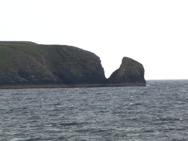
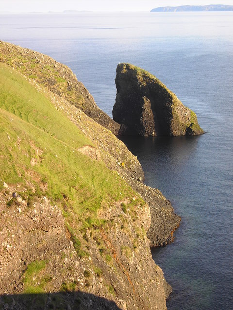
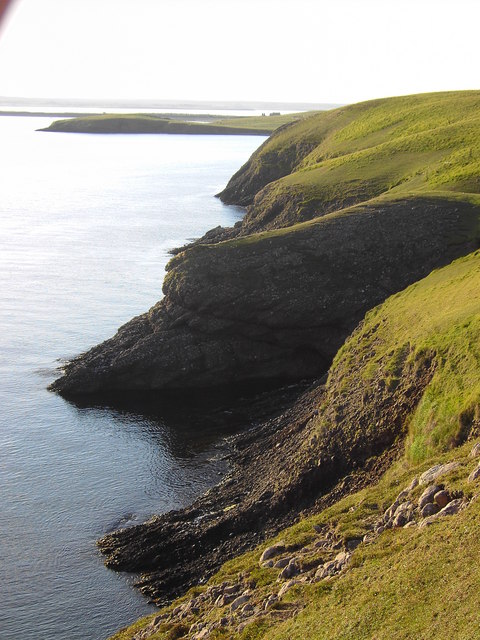
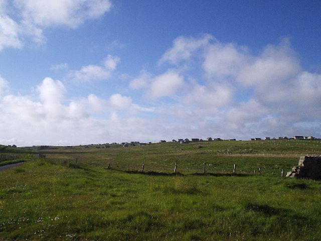
Rubha nan Sgarbh is a prominent coastal feature located in Ross-shire, Scotland. It is a headland that juts out into the North Atlantic Ocean, offering stunning views of the surrounding landscape. The name "Rubha nan Sgarbh" translates to "Point of the Cormorants" in English, which is fitting as this area is known for its diverse birdlife.

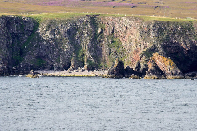
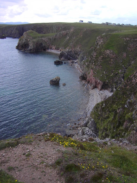
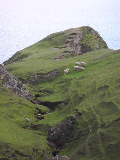
The headland is characterized by its rugged cliffs, which rise majestically from the sea. These cliffs provide nesting sites for a variety of seabirds, including cormorants, gannets, and puffins. During the breeding season, the headland comes alive with the sounds of bird calls and the sight of birds soaring through the sky.

Rubha nan Sgarbh also boasts a rich marine ecosystem. The nutrient-rich waters surrounding the headland support a diverse range of marine life, including seals, dolphins, and whales. It is not uncommon to spot these magnificent creatures swimming close to the shore, providing a unique wildlife viewing opportunity.

In addition to its natural beauty, Rubha nan Sgarbh also holds historical significance. The headland is home to the ruins of an ancient broch, a type of Iron Age fortification. These ruins offer a glimpse into the area's past and provide an interesting contrast to the surrounding natural landscape.

Overall, Rubha nan Sgarbh is a captivating coastal feature that combines breathtaking natural beauty, diverse wildlife, and historical significance. Whether you are a nature enthusiast, a birdwatcher, or a history buff, this headland is sure to leave a lasting impression.

If you have any feedback on the listing, please let us know in the comments section below.

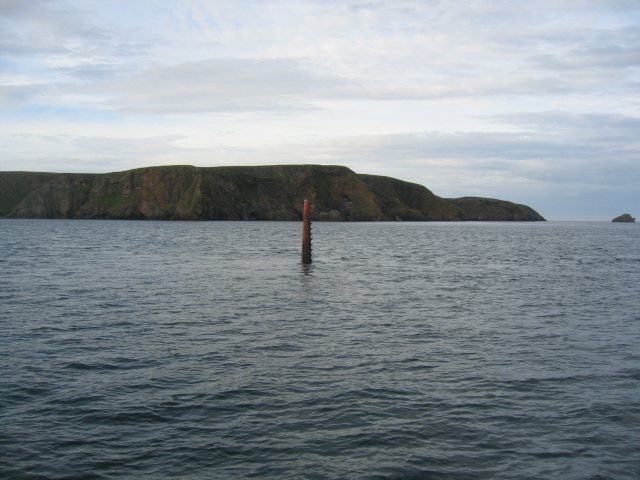
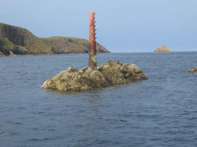
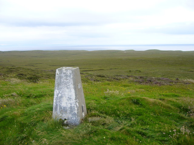
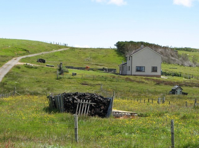
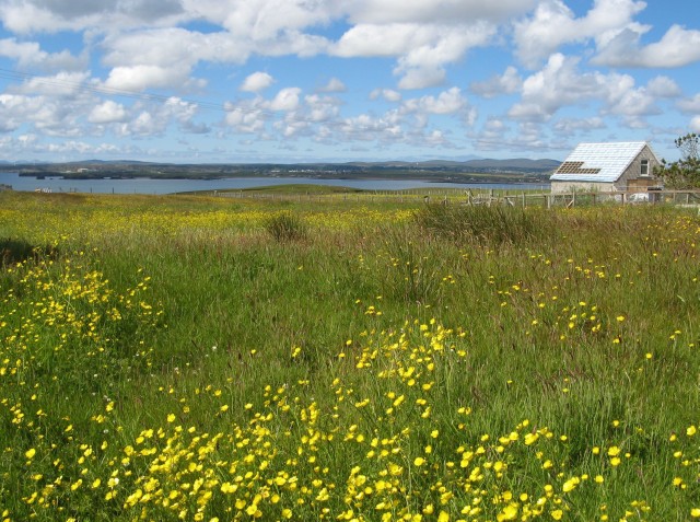
Rubha nan Sgarbh Images

Images are sourced within 2km of 58.183267/-6.2586233 or Grid Reference NB4929. Thanks to Geograph Open Source API. All images are credited.

Chicken Head and Chicken Rock The rocks lying off Chicken Head are called Hen & Chickens and Cock Rock.  The paddle steamer HMS Lively ran aground on the rocks in 1883 and was wrecked (all aboard were rescued). The scattered wreckage of the Lively is marked by the yellow buoy at position 59°10.610’N, 06°15.467’W in depths up to 15 metres (<span class="nowrap"><a title="https://www.scottishshipwrecks.com/hms-lively/" rel="nofollow ugc noopener" href="https://www.scottishshipwrecks.com/hms-lively/">Link</a><img style="margin-left:2px;" alt="External link" title="External link - shift click to open in new window" src="https://s1.geograph.org.uk/img/external.png" width="10" height="10"/></span> Scottish Shipwrecks).
Chicken Head and Chicken Rock
The rocks lying off Chicken Head are called Hen & Chickens and Cock Rock. The paddle steamer HMS Lively ran aground on the rocks in 1883 and was wrecked (all aboard were rescued). The scattered wreckage of the Lively is marked by the yellow buoy at position 59°10.610’N, 06°15.467’W in depths up to 15 metres (LinkExternal link Scottish Shipwrecks).
Isle of Lewis, cliffs on the Eye Peninsula
Eilean a' Crotaich A small islet off the Eye peninsula on Lewis.
Eilean a' Crotaich
A small islet off the Eye peninsula on Lewis.
Eilean a Crotaich A prominent islet off the Eye Peninsula. Chicken Head can be seen in the distance.
Eilean a Crotaich
A prominent islet off the Eye Peninsula. Chicken Head can be seen in the distance.
Site of Ancient Temple According to the map this area is the site of the remains of an ancient temple. Despite a lengthy search I couldn't find any sign of it but the view more than made up for the disappointment and the long hike!
Site of Ancient Temple
According to the map this area is the site of the remains of an ancient temple. Despite a lengthy search I couldn't find any sign of it but the view more than made up for the disappointment and the long hike!
The Muddy Pool Never have I been more disappointed. After walking a fair way to photograph Loch Cuilc I was confronted with this muddy pool. At first I thought I'd got the co-ordinates wrong but no....this is it!
The Muddy Pool
Never have I been more disappointed. After walking a fair way to photograph Loch Cuilc I was confronted with this muddy pool. At first I thought I'd got the co-ordinates wrong but no....this is it!
Chicken Head The red beacon marking Chicken Rock is seen centre of frame with Chicken Head prominent behind it and Eilean Croitach to extreme right.
The name of this headland is misleading in that in Old Norse it would have been "Kirk Ness" meaning the point or headland with a Church.
The Scottish Gaelic word for "chicken" is "Cearc" which is similar in pronunciation to "Kirk" (Church). The translations were mixed up so we have finished up with "Chicken Head" on the modern maps.
Chicken Head
The red beacon marking Chicken Rock is seen centre of frame with Chicken Head prominent behind it and Eilean Croitach to extreme right. The name of this headland is misleading in that in Old Norse it would have been "Kirk Ness" meaning the point or headland with a Church. The Scottish Gaelic word for "chicken" is "Cearc" which is similar in pronunciation to "Kirk" (Church). The translations were mixed up so we have finished up with "Chicken Head" on the modern maps.
The coastline in Geodh a Chuibhrig Suardail can be seen in the background
The coastline in Geodh a Chuibhrig
Suardail can be seen in the background
A burn on the common grazings
Chicken Rock Chicken Head and Eilean Crotach in distance.
Chicken Rock
Chicken Head and Eilean Crotach in distance.
Chicken Head Viewed from the causeway across to the Eye Peninsula.
Chicken Head
Viewed from the causeway across to the Eye Peninsula.
Bayble Hill trig
Bayble Hill trig
Roads of An Rubha
Roads of An Rubha
Roads of An Rubha
Roads of An Rubha
House with peat stack at Suardail This is one of several recently-built houses in the area.  The well-stocked peat stack belongs not to the house shown, but to its neighbour, just out of shot on the right.
House with peat stack at Suardail
This is one of several recently-built houses in the area. The well-stocked peat stack belongs not to the house shown, but to its neighbour, just out of shot on the right.
Buttercup invasion on the croft No longer worked, this croft is becoming overgrown.  A new house is being built on the neighbouring croft (right of photo).
Buttercup invasion on the croft
No longer worked, this croft is becoming overgrown. A new house is being built on the neighbouring croft (right of photo).
Stac Shuardal in the late evening sun
Coastline from Rubha nan Caorach Rubha Ramadal is in the background with the thin line of land being the Braigh.
Coastline from Rubha nan Caorach
Rubha Ramadal is in the background with the thin line of land being the Braigh.
Show me another place!

Rubha nan Sgarbh is located at Grid Ref: NB4929 (Lat: 58.183267, Lng: -6.2586233)

Unitary Authority: Na h-Eileanan an Iar

Police Authority: Highlands and Islands

What 3 Words

///nuggets.fallen.growl. Near Stornoway, Na h-Eileanan Siar

Related Wikis

Knock, Isle of Lewis

Knock, from the Gaelic, An Cnoc (a small hill), is a village in Point peninsula on the Isle of Lewis in the Outer Hebrides of Scotland. Point (an Rubha...

Aignish

Aignish (Scottish Gaelic: Aiginis) is located northwest of Knock and east of Stornoway on the east coast of the Isle of Lewis, in the Outer Hebrides, Scotland...

Bayble

Bayble (Scottish Gaelic: Pabail) is a village in Point (An Rubha), on the Isle of Lewis, 6 miles (10 kilometres) east of Stornoway. Bayble is also within...

Bayble Island

Bayble Island lies at the southern end of Bayble Bay (Pabail Bay). It consists of two islands (Eilean Mòr Phabaill and Eilean Beag Phabaill), but these...

Have you been to Rubha nan Sgarbh?

Leave your review of Rubha nan Sgarbh below (or comments, questions and feedback).