Malcolm's Point

Coastal Feature, Headland, Point in Argyllshire

Scotland

Malcolm's Point

Rocky coastline near Malcolm's Point
Rocky coastline near Malcolm's Point Credit: Steven Brown

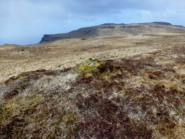
Malcolm's Point is a prominent headland located in Argyllshire, Scotland. Situated along the beautiful coastline, it juts out into the sea, offering breathtaking views of the surrounding landscape. The point is named after Malcolm, a local historical figure whose exact significance remains somewhat uncertain.

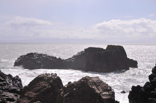
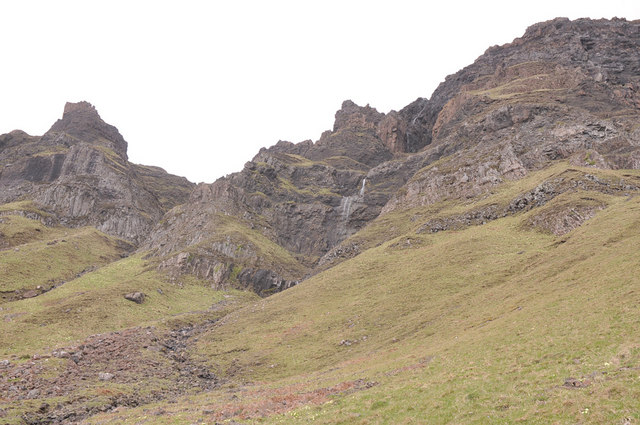
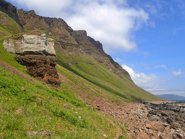
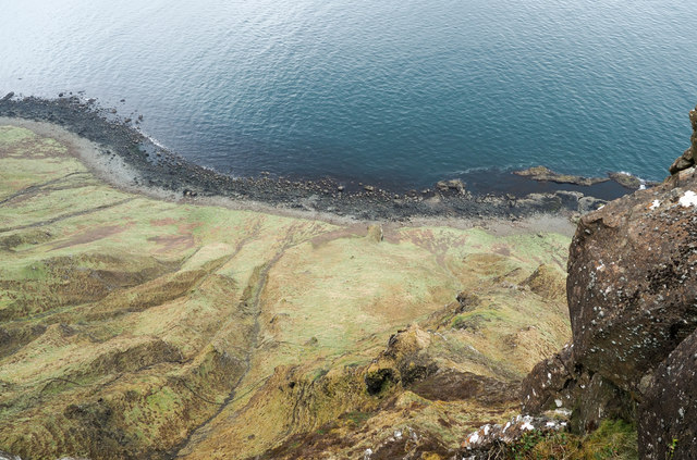
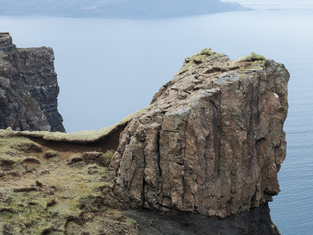
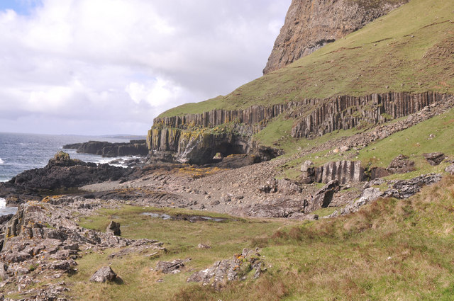
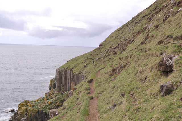
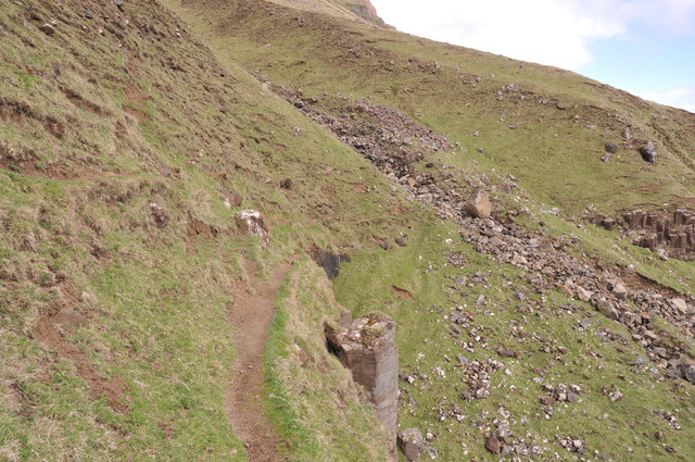
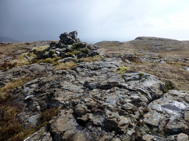
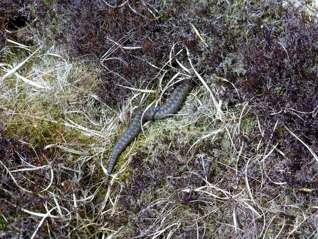
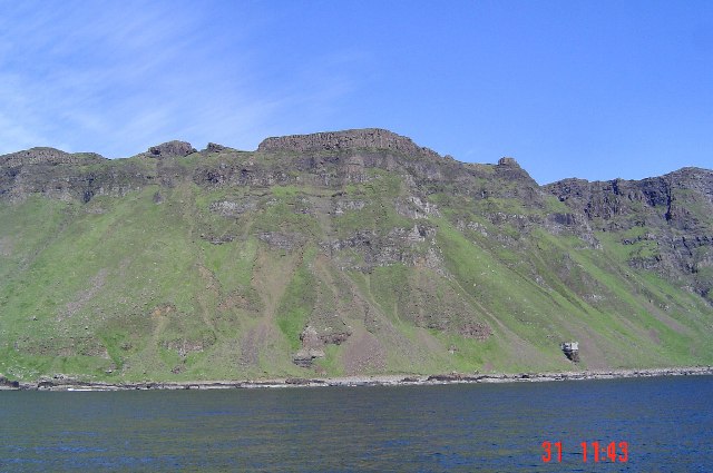
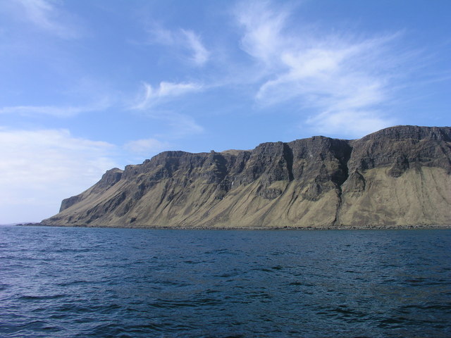
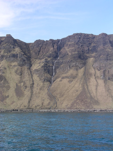
The headland is characterized by its rugged and rocky terrain, which is typical of the Argyllshire region. The cliffs that form the edges of Malcolm's Point are composed of ancient layers of sedimentary rock, displaying fascinating geological formations. These cliffs provide a habitat for a diverse range of coastal flora and fauna, making it a popular destination for nature enthusiasts and birdwatchers.

The point is also known for its picturesque lighthouse, perched atop the headland. The lighthouse was constructed in the 19th century to guide ships navigating the treacherous waters along the coast. Today, it stands as a symbol of maritime history and provides an iconic backdrop for photographs.

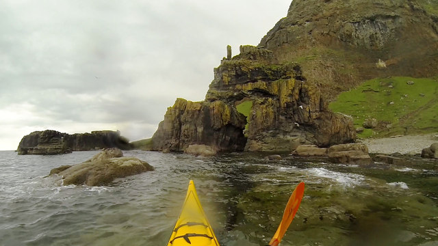
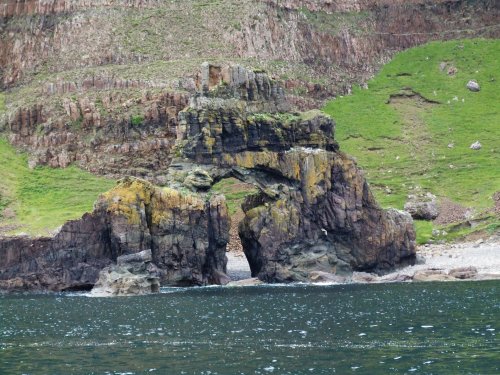
Malcolm's Point is not only a natural marvel but also holds cultural significance. Local folklore and legends are often associated with the area, adding an air of mystery and intrigue. Visitors can explore the surrounding walking trails, which offer opportunities to discover hidden coves, sandy beaches, and dramatic sea arches.

Overall, Malcolm's Point is a must-see destination for those seeking natural beauty, geological wonders, and a touch of history. Its unique combination of stunning coastline, diverse wildlife, and captivating tales make it a true gem of Argyllshire's coastal features.

If you have any feedback on the listing, please let us know in the comments section below.

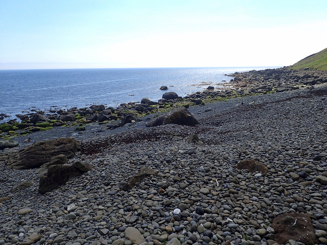
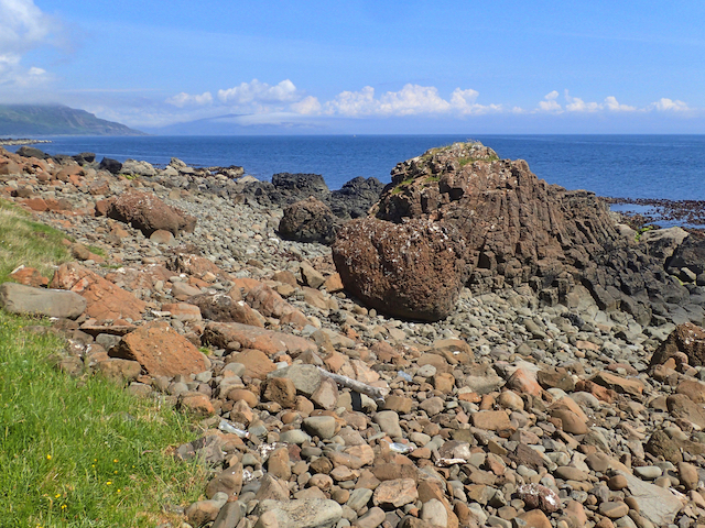
Malcolm's Point Images

Images are sourced within 2km of 56.292424/-6.0473197 or Grid Reference NM4918. Thanks to Geograph Open Source API. All images are credited.

Rocky coastline near Malcolm's Point
Waterfall in the cliffs near Carsaig
Cnocan Buidhe Bagged on the way to Creachan Mòr with two likely high spots visited with Jim Bloomer.

Name: Cnocan Buidhe
Hill number: 102188
Height: 295m / 968ft
Area: 17E: Mull and Nearby Islands
Class: 2
Grid ref: NM 50626 19627
Summit feature: grassy knoll
Drop: 30m
Col: 265m  NM498197
Cnocan Buidhe
Bagged on the way to Creachan Mòr with two likely high spots visited with Jim Bloomer. Name: Cnocan Buidhe Hill number: 102188 Height: 295m / 968ft Area: 17E: Mull and Nearby Islands Class: 2 Grid ref: NM 50626 19627 Summit feature: grassy knoll Drop: 30m Col: 265m NM498197
Path to Carsaig Following in the footsteps of David Balfour, the hero of Robert Louis Stevenson's Kidnapped, as he makes his way back to Edinburgh to confront his wicked uncle.

Stage 1, June 2016 from Erraid to Fishnish on the Isle of Mull.

See <span class="nowrap"><a title="http://www.stevensonway.org.uk" rel="nofollow ugc noopener" href="http://www.stevensonway.org.uk">Link</a><img style="margin-left:2px;" alt="External link" title="External link - shift click to open in new window" src="https://s1.geograph.org.uk/img/external.png" width="10" height="10"/></span>
Path to Carsaig
Following in the footsteps of David Balfour, the hero of Robert Louis Stevenson's Kidnapped, as he makes his way back to Edinburgh to confront his wicked uncle. Stage 1, June 2016 from Erraid to Fishnish on the Isle of Mull. See LinkExternal link
Coast below Cnocan Buidhe
Coast below Cnocan Buidhe Following in the footsteps of David Balfour, the hero of Robert Louis Stevenson's Kidnapped, as he makes his way back to Edinburgh to confront his wicked uncle.

Stage 1, June 2016 from Erraid to Fishnish on the Isle of Mull.

See <span class="nowrap"><a title="http://www.stevensonway.org.uk" rel="nofollow ugc noopener" href="http://www.stevensonway.org.uk">Link</a><img style="margin-left:2px;" alt="External link" title="External link - shift click to open in new window" src="https://s1.geograph.org.uk/img/external.png" width="10" height="10"/></span>
Coast below Cnocan Buidhe
Following in the footsteps of David Balfour, the hero of Robert Louis Stevenson's Kidnapped, as he makes his way back to Edinburgh to confront his wicked uncle. Stage 1, June 2016 from Erraid to Fishnish on the Isle of Mull. See LinkExternal link
Mull's south coast north-east of Malcolm's Point Steep grassy slopes below a vertical cliff running down to rocks at the sea shore.
Malcolm's Point and the Carsaig Arches lie to the right, out of the image - and down below of course!
A Geograph recorded for NM5018 from the only possible accessible point above the rock face by lying flat to the ground with a camera held over the cliff edge.
Mull's south coast north-east of Malcolm's Point
Steep grassy slopes below a vertical cliff running down to rocks at the sea shore. Malcolm's Point and the Carsaig Arches lie to the right, out of the image - and down below of course! A Geograph recorded for NM5018 from the only possible accessible point above the rock face by lying flat to the ground with a camera held over the cliff edge.
Rock block at cliff edge This striking feature is at the crag rim of the south side of the Ross of Mull south-east of the hill top, Creachan Mòr. An easy ascent can be made by following the narrow grass rib above the exposed soil, then by a simple scramble.
Rock block at cliff edge
This striking feature is at the crag rim of the south side of the Ross of Mull south-east of the hill top, Creachan Mòr. An easy ascent can be made by following the narrow grass rib above the exposed soil, then by a simple scramble.
View to Carsaig Arches
Narrow path to the second Carsaig arch
Narrow steep path near the Carsaig Arches
By Steamer To Iona - 4th June 2012 : Malcolm's Point  Ahead Steaming back from Iona to Oban on a perfect Hebridean afternoon, the paddle steamer Waverley is heading towards the prominent cliffs of Malcolm's Point on the south coast of Mull.
By Steamer To Iona - 4th June 2012 : Malcolm's Point Ahead
Steaming back from Iona to Oban on a perfect Hebridean afternoon, the paddle steamer Waverley is heading towards the prominent cliffs of Malcolm's Point on the south coast of Mull.
Creachan Mòr Second Marilyn on a cool and windy morning with hale showers with Jim Bloomer.

Name: Creachan Mòr
Hill number: 1326
Height: 331m / 1086ft
Area: 17E: Mull and Nearby Islands
Class: Ma,3
Grid ref: NM 49621 19565
Summit feature: cairn
Drop: 165m
Col: 166m  NM518205
Creachan Mòr
Second Marilyn on a cool and windy morning with hale showers with Jim Bloomer. Name: Creachan Mòr Hill number: 1326 Height: 331m / 1086ft Area: 17E: Mull and Nearby Islands Class: Ma,3 Grid ref: NM 49621 19565 Summit feature: cairn Drop: 165m Col: 166m NM518205
Adder In Moorland I almost stood on this adder on the upper moorland slopes of Creachan Mòr.
Adder In Moorland
I almost stood on this adder on the upper moorland slopes of Creachan Mòr.
Carsaig Arch Although the map (and lots of guidebooks) use the name "Carsaig Arches", in reality this is the one arch, whilst the other is far more of a cave with landward and seaward entrances. Both are formed in Tertiary basalt lava flows. Either can be entered on foot from the land side at low tide, whilst high tide (and a reasonable disregard for the integrity of your hull if there's any swell) is needed for entry by boat from the sea. The tide was fairly well in on our visit, so the arch was easy enough, and one could even have landed on the shingle beach inside. The cave was harder by boat, but easy from the shore side if you didn't mind ankle-deep rotting seaweed...

The arch is by far the more delicate of the two, with a narrow span and a teetering stack on the top which looks as though it might blow over in a bit of a breeze ! This whole section of coast offers splendid rock-hopping from a sea kayak and some pretty rough walking - getting tougher further west. To land and inspect the arches, it's easiest behind the small headland to the left of this photo, where a steep cobble beach allows one to gain the shore and drag boats above the high tide line. However, it would be punishing in any amount of swell, as the gradient would guarantee dumping surf and a hard landing ! Should you become stranded, feral goats would provide an excellent diet if you could find enough driftwood to cook...
Carsaig Arch
Although the map (and lots of guidebooks) use the name "Carsaig Arches", in reality this is the one arch, whilst the other is far more of a cave with landward and seaward entrances. Both are formed in Tertiary basalt lava flows. Either can be entered on foot from the land side at low tide, whilst high tide (and a reasonable disregard for the integrity of your hull if there's any swell) is needed for entry by boat from the sea. The tide was fairly well in on our visit, so the arch was easy enough, and one could even have landed on the shingle beach inside. The cave was harder by boat, but easy from the shore side if you didn't mind ankle-deep rotting seaweed... The arch is by far the more delicate of the two, with a narrow span and a teetering stack on the top which looks as though it might blow over in a bit of a breeze ! This whole section of coast offers splendid rock-hopping from a sea kayak and some pretty rough walking - getting tougher further west. To land and inspect the arches, it's easiest behind the small headland to the left of this photo, where a steep cobble beach allows one to gain the shore and drag boats above the high tide line. However, it would be punishing in any amount of swell, as the gradient would guarantee dumping surf and a hard landing ! Should you become stranded, feral goats would provide an excellent diet if you could find enough driftwood to cook...
Malcolm's Point - Mull The imposing basalt cliffs near Malcolm's Point.
Malcolm's Point - Mull
The imposing basalt cliffs near Malcolm's Point.
Coastal cliffs and Uamh Liath waterfall The photograph shows Uamh Liath waterfall in a deep cleft to the right of the picture. Photo taken 13:18
Coastal cliffs and Uamh Liath waterfall
The photograph shows Uamh Liath waterfall in a deep cleft to the right of the picture. Photo taken 13:18
Twin waterfalls cascading over coastal cliffs Taken from the HWDT research vessel Silurian
Twin waterfalls cascading over coastal cliffs
Taken from the HWDT research vessel Silurian
Show me another place!

Malcolm's Point is located at Grid Ref: NM4918 (Lat: 56.292424, Lng: -6.0473197)

Unitary Authority: Argyll and Bute

Police Authority: Argyll and West Dunbartonshire

What 3 Words

///remain.trio.redouble. Near Lochbuie, Argyll & Bute

Related Wikis

Carsaig Arches

Carsaig Arches are natural arch cliff formations on the Ross of Mull in the south of the Isle of Mull, on the west coast of Scotland. They are situated...

Carsaig Bay

Carsaig Bay is a cove on the Ross of Mull in the south of the Isle of Mull, off the west coast of Scotland. It is situated 5 kilometres (3 miles) eastward...

Shiaba

Shiaba (Scottish Gaelic: Siaba) is a ruined township located on the southwestern peninsula of the Isle of Mull, Scotland. It lies about 8 km to the east...

Pennyghael

Pennyghael (Scottish Gaelic: Peighinn nan Gàidheal) is a small village in the Ross of Mull, Argyll and Bute, Scotland. It is located along the A849 road...

Nearby Amenities

Located within 500m of 56.292424,-6.0473197
Source: PGS
Lat/Long: 56.2945802/-6.0403674
Source: PGS
Lat/Long: 56.2947076/-6.0404157
Source: PGS
Lat/Long: 56.2944695/-6.0407215
Source: PGS
Lat/Long: 56.2943445/-6.0411721
Source: PGS
Lat/Long: 56.294201/-6.0419639
Source: PGS
Lat/Long: 56.2939271/-6.0426666
Created By: dmgroom_coastlines
Source: PGS
Lat/Long: 56.2933/-6.04282
Created By: dmgroom_coastlines
Source: PGS
Lat/Long: 56.29305/-6.04284
Source: PGS
Lat/Long: 56.2928146/-6.0431547
Source: PGS
Lat/Long: 56.292577/-6.0445317
Source: PGS
Lat/Long: 56.2926989/-6.044996
Source: PGS
Lat/Long: 56.292466/-6.0454038
Source: PGS
Lat/Long: 56.2922794/-6.0465721
Source: PGS
Lat/Long: 56.2925162/-6.0469313
Source: PGS
Lat/Long: 56.2924684/-6.0471204
Source: PGS
Lat/Long: 56.292178/-6.0473317
Source: PGS
Lat/Long: 56.2927739/-6.0494433
Source: PGS
Lat/Long: 56.2926682/-6.0515673
Source: PGS
Lat/Long: 56.2927649/-6.0519729
Source: PGS
Lat/Long: 56.2927834/-6.0534309
Source: PGS
Lat/Long: 56.2922184/-6.0541303
Source: PGS
Lat/Long: 56.2919409/-6.054767
Source: PGS
Lat/Long: 56.2921514/-6.053677
Carsaig Arches - first arch
Natural: arch
Lat/Long: 56.2930723/-6.0503828
Carsaig Arches - second arch
Natural: arch
Wikidata: Q13906718
Wikipedia: en:Carsaig Arches
Lat/Long: 56.2928115/-6.0528172
Carsaig Arches
Name En: Carsaig Arches
Tourism: attraction
Lat/Long: 56.2927871/-6.0510688
The data included in this document is from www.openstreetmap.org. The data is made available under ODbL.

Have you been to Malcolm's Point?

Leave your review of Malcolm's Point below (or comments, questions and feedback).