Cairidh Ghlumaig

Coastal Feature, Headland, Point in Inverness-shire

Scotland

Cairidh Ghlumaig

Skye coastline near Osmigarry Looking towards Rubha Hunish
Skye coastline near Osmigarry Credit: David Purchase

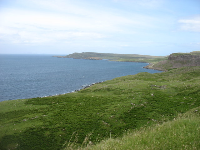
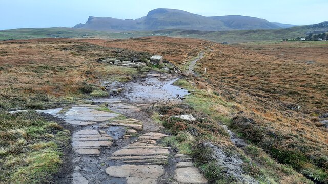
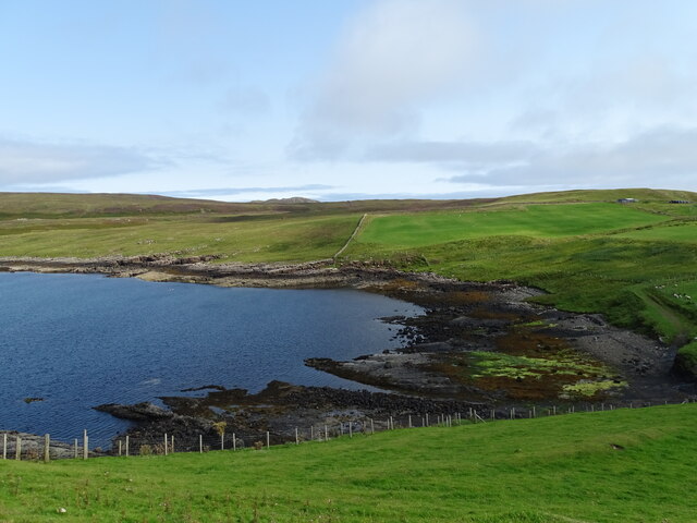
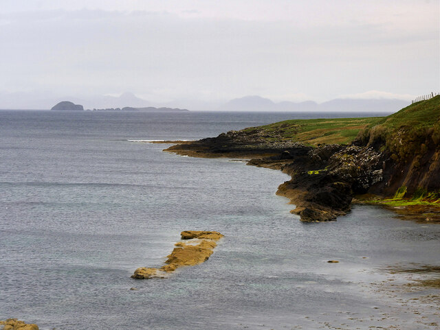
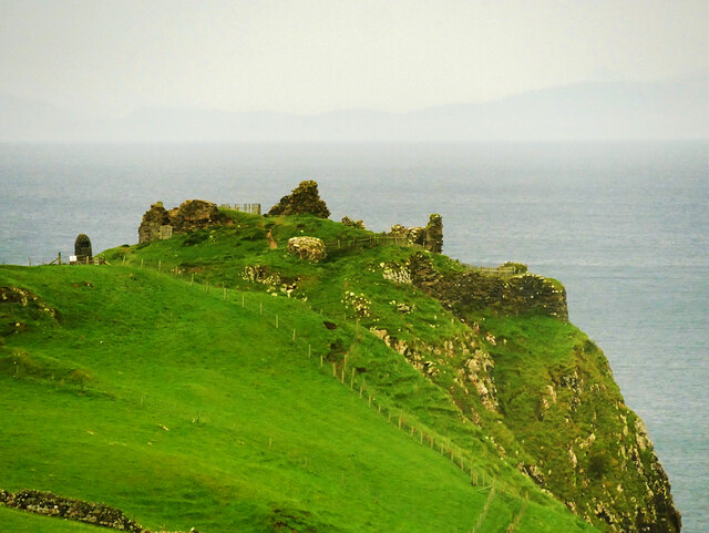
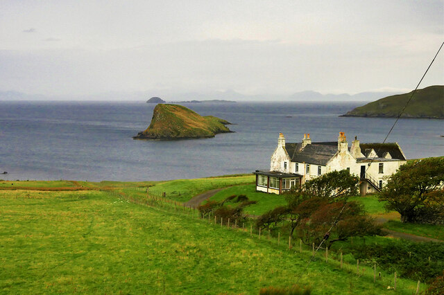
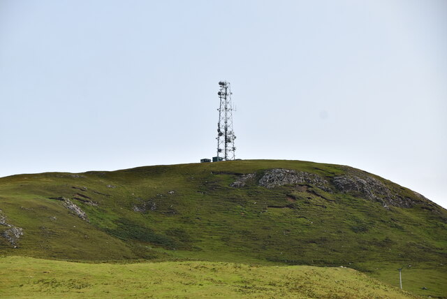
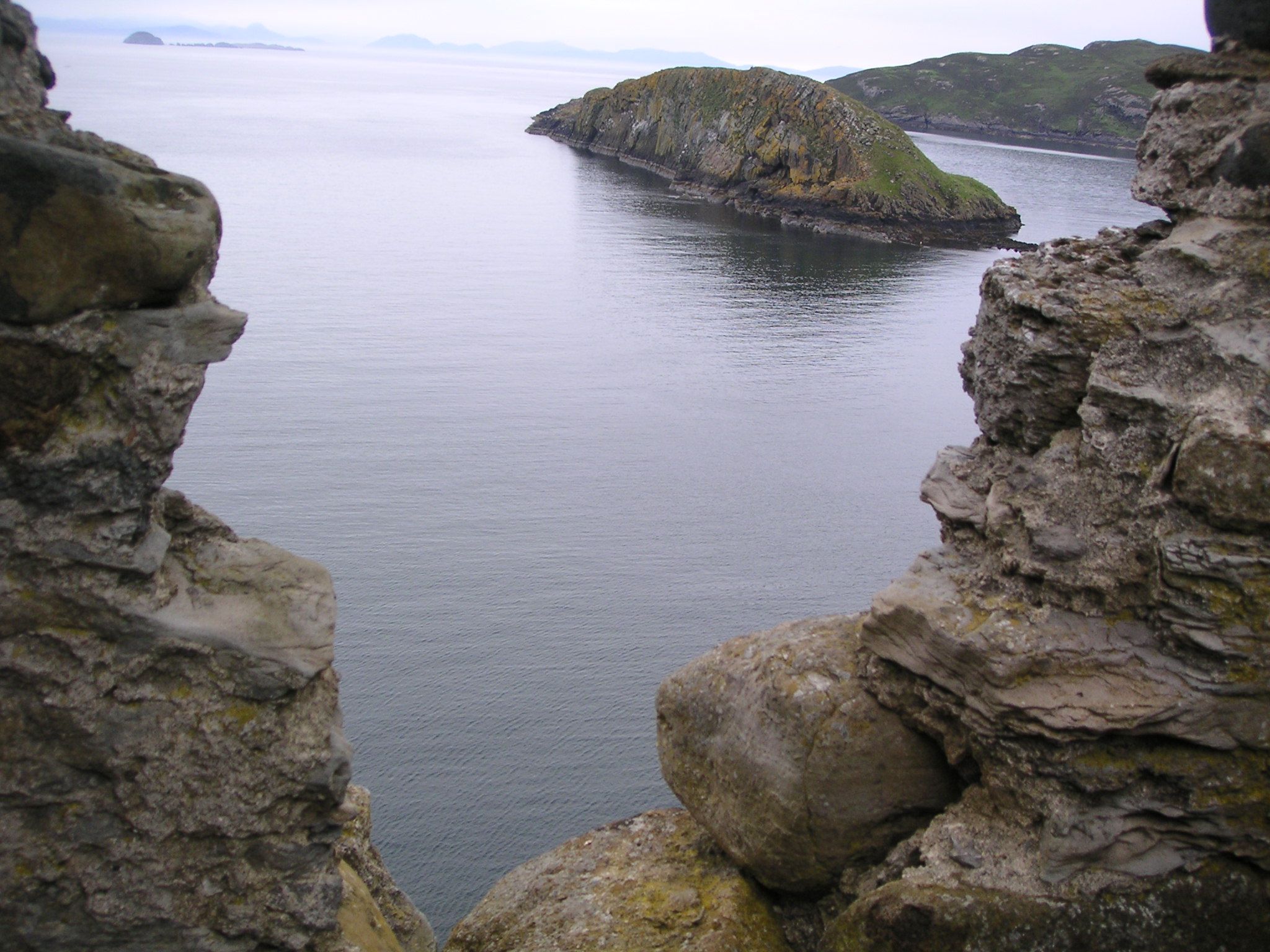
Cairidh Ghlumaig is a prominent coastal feature located in Inverness-shire, Scotland. It is specifically categorized as a headland or point due to its geographical characteristics. Situated on the western coast of Scotland, it offers stunning views of the surrounding landscape and the vast expanse of the Atlantic Ocean.

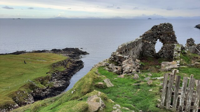
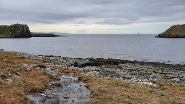
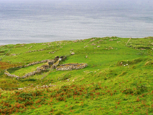
The headland is known for its rugged and rocky terrain, with cliffs rising high above the sea. These cliffs have been shaped by years of coastal erosion, creating dramatic formations and providing a habitat for various species of marine birds and other wildlife.

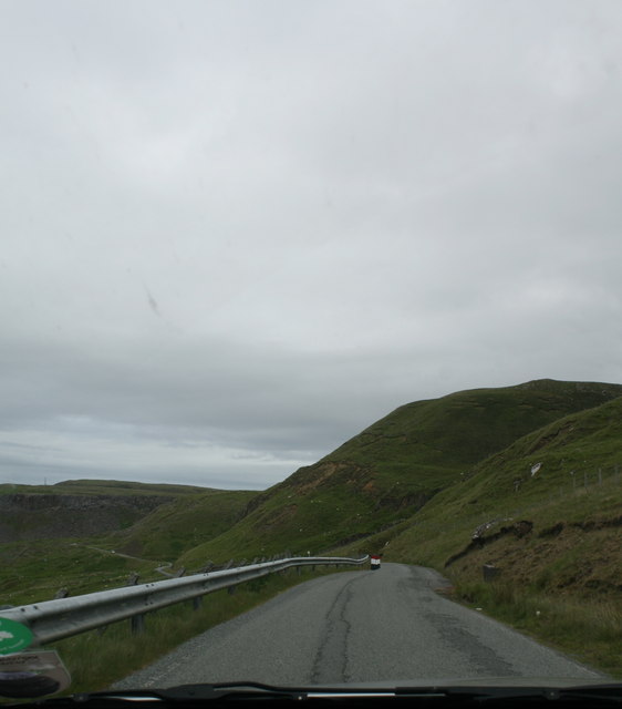
Cairidh Ghlumaig is a popular destination for nature enthusiasts, hikers, and photographers. Its unique geographical features and picturesque scenery draw visitors from both near and far. The headland offers several walking trails that allow visitors to explore its diverse flora and fauna, while also providing opportunities to witness breathtaking sunsets over the ocean.

Additionally, the headland's location near the coast makes it an ideal spot for various water-based activities such as fishing, sailing, and wildlife spotting. Its proximity to the Atlantic Ocean also means that visitors can enjoy the fresh sea breeze and take in the invigorating ambiance of this coastal region.

Cairidh Ghlumaig is a must-visit destination for anyone seeking natural beauty, tranquility, and a chance to immerse themselves in the stunning coastal landscapes of Inverness-shire. Its unique geological features, diverse wildlife, and picturesque views make it a memorable and awe-inspiring location for all who venture to its shores.

If you have any feedback on the listing, please let us know in the comments section below.

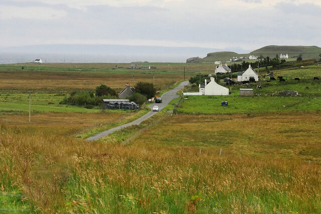
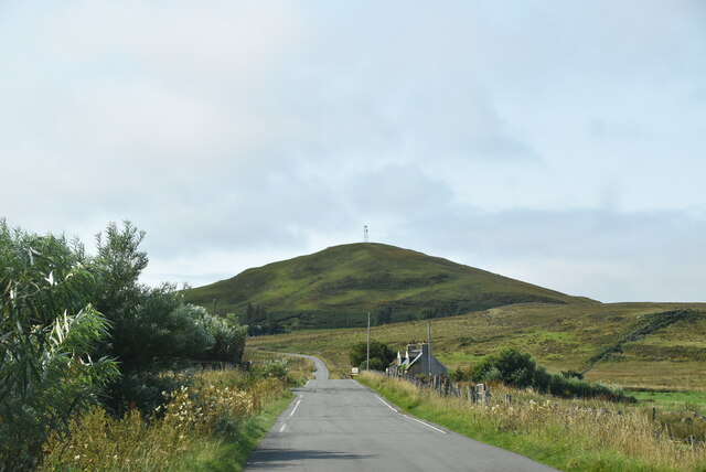
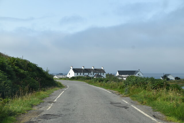
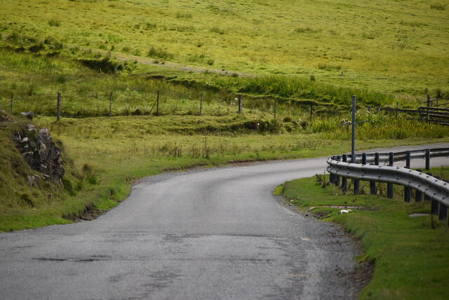
Cairidh Ghlumaig Images

Images are sourced within 2km of 57.68006/-6.3462715 or Grid Reference NG4173. Thanks to Geograph Open Source API. All images are credited.

Skye coastline near Osmigarry Looking towards Rubha Hunish
Skye coastline near Osmigarry
Looking towards Rubha Hunish
A855 near Osmigarry
A855 near Osmigarry
Ruins of Duntulm Castle
The rocky shoreline in Duntulm Bay The view out to sea is framed by Duntulm Castle and the southern tip of Tulm Island.
The rocky shoreline in Duntulm Bay
The view out to sea is framed by Duntulm Castle and the southern tip of Tulm Island.
Path from Rubha Hunish
Port Duntulm
Port Duntulm
Ruined Dwellings at Score The remains of several former croft houses can be seen from the A855.
Ruined Dwellings at Score
The remains of several former croft houses can be seen from the A855.
Coastline at Duntulm A large, flat rocky "island" left exposed at low tide.
Coastline at Duntulm
A large, flat rocky "island" left exposed at low tide.
Duntulm Castle The ruins of Duntulm Castle stand on the north coast of the Trotternish peninsula, near the hamlet of Duntulm. During the 17th century it was the seat of the chiefs of Clan MacDonald of Sleat. It is a scheduled monument (SM5307 <span class="nowrap"><a title="http://portal.historicenvironment.scot/designation/SM5307" rel="nofollow ugc noopener" href="http://portal.historicenvironment.scot/designation/SM5307">Link</a><img style="margin-left:2px;" alt="External link" title="External link - shift click to open in new window" src="https://s1.geograph.org.uk/img/external.png" width="10" height="10"/></span> Historic Environment Scotland).

The castle was built in the 14th and 15th centuries, when the area was subject to feuds between the rival MacLeod and Macdonald clans. The defences were improved in the 16th century, and by the early 17th century the MacDonalds had finally gained the upper hand in the area.

The castle was in use until ca1732. According to a local legend, the castle was abandoned after the infant son of the chieftain who dwelt there at the time fell from a window and was dashed on the rocks below. As a punishment, the nursemaid in the charge of the infant was set adrift on the North Atlantic in a small boat (Otta F Swire, Skye. The island and its legends. Third Edition Maclean Press 1999. ISBN 1-84158-479-7). The ghost of the nursemaid is said to still wander the ruins.
Duntulm Castle
The ruins of Duntulm Castle stand on the north coast of the Trotternish peninsula, near the hamlet of Duntulm. During the 17th century it was the seat of the chiefs of Clan MacDonald of Sleat. It is a scheduled monument (SM5307 LinkExternal link Historic Environment Scotland). The castle was built in the 14th and 15th centuries, when the area was subject to feuds between the rival MacLeod and Macdonald clans. The defences were improved in the 16th century, and by the early 17th century the MacDonalds had finally gained the upper hand in the area. The castle was in use until ca1732. According to a local legend, the castle was abandoned after the infant son of the chieftain who dwelt there at the time fell from a window and was dashed on the rocks below. As a punishment, the nursemaid in the charge of the infant was set adrift on the North Atlantic in a small boat (Otta F Swire, Skye. The island and its legends. Third Edition Maclean Press 1999. ISBN 1-84158-479-7). The ghost of the nursemaid is said to still wander the ruins.
Duntulm Castle Hotel and Tulm Island Originally a Highland shooting lodge dating back to the 1860s, the Hotel closed on 30th April 2014. Tulm Island lies just offshore in Tulm Bay, and the distant view is over the Fladda Chuain islands in the Minch with Harris on the horizon.
Duntulm Castle Hotel and Tulm Island
Originally a Highland shooting lodge dating back to the 1860s, the Hotel closed on 30th April 2014. Tulm Island lies just offshore in Tulm Bay, and the distant view is over the Fladda Chuain islands in the Minch with Harris on the horizon.
House and Barn near Duntulm
Loch Cleat, near Duntulm
A855, Shulista The A855 is approximately 33 miles long, encircling the Trotternish Peninsula at the north end of Skye. It is single-track for much of its length, undergoing fairly frequent repair as it is mostly built on top of a peat moor. Despite nominally being a coast road, the route is more often than not inland, with only glimpses of the sea available, particularly on the east coast of Trotternish. Despite this, however, it is a spectacular drive, and reveals some of Skye's finer features <span class="nowrap"><a title="https://www.sabre-roads.org.uk/wiki/index.php?title=A855" rel="nofollow ugc noopener" href="https://www.sabre-roads.org.uk/wiki/index.php?title=A855">Link</a><img style="margin-left:2px;" alt="External link" title="External link - shift click to open in new window" src="https://s1.geograph.org.uk/img/external.png" width="10" height="10"/></span> (SABRE).
A855, Shulista
The A855 is approximately 33 miles long, encircling the Trotternish Peninsula at the north end of Skye. It is single-track for much of its length, undergoing fairly frequent repair as it is mostly built on top of a peat moor. Despite nominally being a coast road, the route is more often than not inland, with only glimpses of the sea available, particularly on the east coast of Trotternish. Despite this, however, it is a spectacular drive, and reveals some of Skye's finer features LinkExternal link (SABRE).
A855 The A855 runs 33 miles around North Skye from Portree <a href="https://www.geograph.org.uk/photo/7431346">NG4743 : A87, A855 junction, Portree</a> to Uig <a href="https://www.geograph.org.uk/photo/7386522">NG3964 : A855 / A87 junction</a>, via Staffin.
<span class="nowrap"><a title="https://www.sabre-roads.org.uk/wiki/index.php?title=A855" rel="nofollow ugc noopener" href="https://www.sabre-roads.org.uk/wiki/index.php?title=A855">Link</a><img style="margin-left:2px;" alt="External link" title="External link - shift click to open in new window" src="https://s1.geograph.org.uk/img/external.png" width="10" height="10"/></span>
A855
The A855 runs 33 miles around North Skye from Portree NG4743 : A87, A855 junction, Portree to Uig NG3964 : A855 / A87 junction, via Staffin. LinkExternal link
A855 near Loch Cleat
A855 The A855 runs 33 miles around North Skye from Portree <a href="https://www.geograph.org.uk/photo/7431346">NG4743 : A87, A855 junction, Portree</a> to Uig <a href="https://www.geograph.org.uk/photo/7386522">NG3964 : A855 / A87 junction</a>, via Staffin.
<span class="nowrap"><a title="https://www.sabre-roads.org.uk/wiki/index.php?title=A855" rel="nofollow ugc noopener" href="https://www.sabre-roads.org.uk/wiki/index.php?title=A855">Link</a><img style="margin-left:2px;" alt="External link" title="External link - shift click to open in new window" src="https://s1.geograph.org.uk/img/external.png" width="10" height="10"/></span>
A855
The A855 runs 33 miles around North Skye from Portree NG4743 : A87, A855 junction, Portree to Uig NG3964 : A855 / A87 junction, via Staffin. LinkExternal link
Mast, Cnoc Roll
Mast, Cnoc Roll
A855, Duntulm The A855 runs 33 miles around North Skye from Portree <a href="https://www.geograph.org.uk/photo/7431346">NG4743 : A87, A855 junction, Portree</a> to Uig <a href="https://www.geograph.org.uk/photo/7386522">NG3964 : A855 / A87 junction</a>, via Staffin.
<span class="nowrap"><a title="https://www.sabre-roads.org.uk/wiki/index.php?title=A855" rel="nofollow ugc noopener" href="https://www.sabre-roads.org.uk/wiki/index.php?title=A855">Link</a><img style="margin-left:2px;" alt="External link" title="External link - shift click to open in new window" src="https://s1.geograph.org.uk/img/external.png" width="10" height="10"/></span>
A855, Duntulm
The A855 runs 33 miles around North Skye from Portree NG4743 : A87, A855 junction, Portree to Uig NG3964 : A855 / A87 junction, via Staffin. LinkExternal link
Show me another place!

Cairidh Ghlumaig is located at Grid Ref: NG4173 (Lat: 57.68006, Lng: -6.3462715)

Unitary Authority: Highland

Police Authority: Highlands and Islands

What 3 Words

///brands.defend.envoy. Near Uig, Highland

Related Wikis

Duntulm

Duntulm (Scottish Gaelic: Dùn Thuilm) is a township on the most northerly point of the Trotternish peninsula of the Isle of Skye made up of Shulista (north...

Kilmaluag

Kilmaluag (Scottish Gaelic: Cill Moluaig, meaning St. Moluag's Cell, Church or Chapel) is a township made up of several small settlements on the most northerly...

Skye Museum of Island Life

The Skye Museum of Island Life is a museum in Kilmuir, Skye, Scotland, which is dedicated to preserving a township of thatched cottages as they would have...
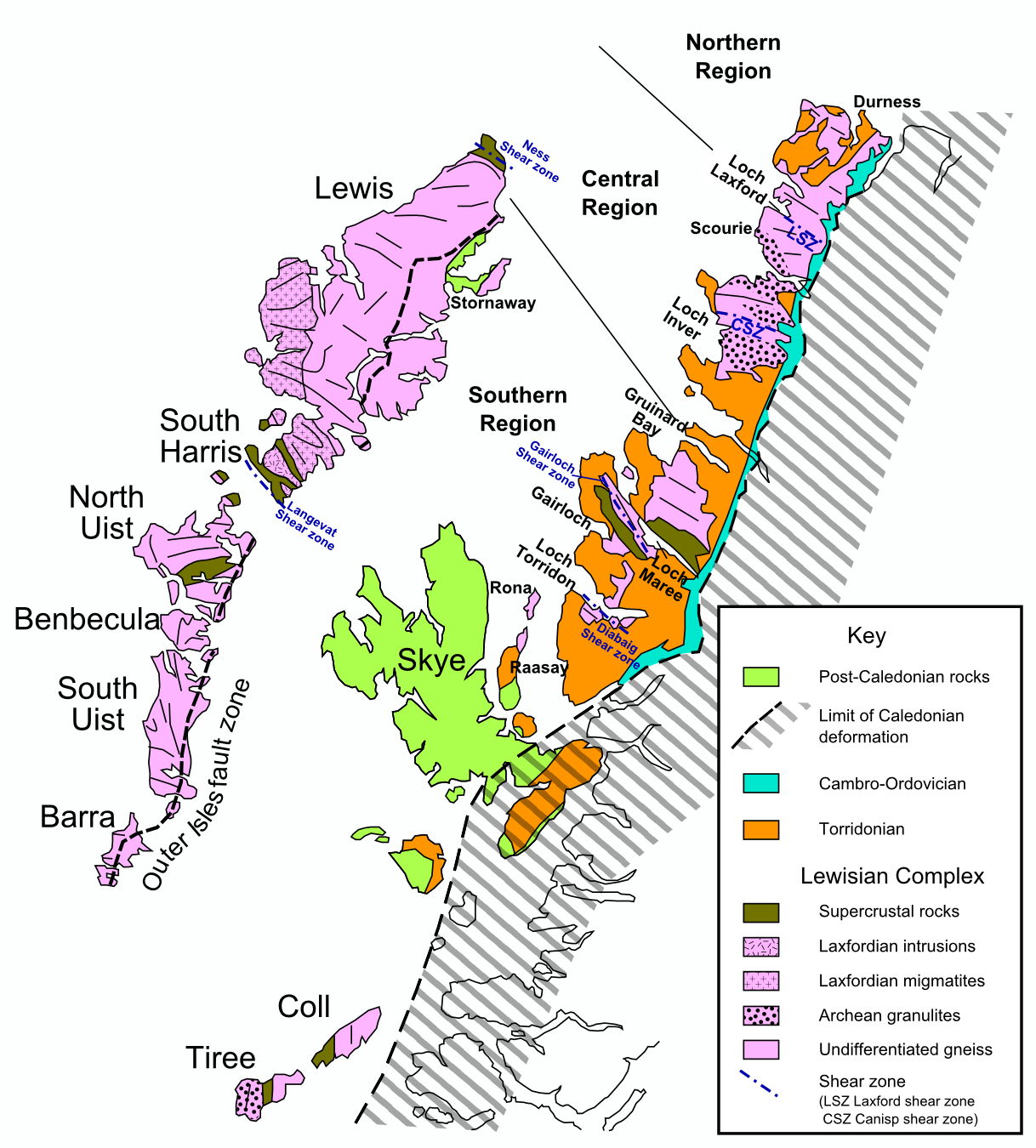
Hebridean Terrane

The Hebridean Terrane is one of the terranes that form part of the Caledonian orogenic belt in northwest Scotland. Its boundary with the neighbouring Northern...

Nearby Amenities

Located within 500m of 57.68006,-6.3462715
Source: PGS
Lat/Long: 57.6839534/-6.3442499
Source: PGS
Lat/Long: 57.6839071/-6.3443224
Source: PGS
Lat/Long: 57.6842656/-6.3460658
Source: PGS
Lat/Long: 57.6843548/-6.3465544
Source: PGS
Lat/Long: 57.6844674/-6.347137
Source: PGS
Lat/Long: 57.6843866/-6.3475272
Source: PGS
Lat/Long: 57.6843422/-6.3484972
Source: PGS
Lat/Long: 57.6839444/-6.3497316
Source: PGS
Lat/Long: 57.6837619/-6.3496085
Source: PGS
Lat/Long: 57.6836524/-6.3494767
Source: PGS
Lat/Long: 57.6831132/-6.348692
Source: PGS
Lat/Long: 57.6829132/-6.3482568
Source: PGS
Lat/Long: 57.6825843/-6.3474316
Source: PGS
Lat/Long: 57.6824866/-6.3471331
Source: PGS
Lat/Long: 57.6823833/-6.346855
Source: PGS
Lat/Long: 57.6823206/-6.3468746
Source: PGS
Lat/Long: 57.6817289/-6.3465716
Source: PGS
Lat/Long: 57.6815526/-6.3463416
Source: PGS
Lat/Long: 57.6812035/-6.3456231
Source: PGS
Lat/Long: 57.6808496/-6.3450901
Source: PGS
Lat/Long: 57.680345/-6.3448441
Source: PGS
Lat/Long: 57.6796913/-6.3451247
Source: PGS
Lat/Long: 57.6788334/-6.3459205
Source: PGS
Lat/Long: 57.6785252/-6.3462066
Created By: dmgroom_coastlines
Source: PGS
Lat/Long: 57.67772/-6.34685
Created By: dmgroom_coastlines
Source: PGS
Lat/Long: 57.67697/-6.34739
Created By: dmgroom_coastlines
Source: PGS
Lat/Long: 57.67672/-6.34789
Created By: dmgroom_coastlines
Source: PGS
Lat/Long: 57.67621/-6.3484
Created By: dmgroom_coastlines
Source: PGS
Lat/Long: 57.67597/-6.34866
Bus Stop
Duntulm Hotel
Bench: no
Bin: no
Bus: yes
Lit: no
Naptan AtcoCode: 6700712628
Naptan Bearing: SW
Naptan CommonName: Duntulm Hotel
Naptan Indicator: at Hotel Road End
Naptan Landmark: Hotel
Naptan NaptanCode: 45327967
Naptan Street: A855
Naptan Verified: no
Public Transport: platform
Shelter: no
Source: naptan_import
Tactile Paving: no
Lat/Long: 57.6823761/-6.3390635
Duntulm Castle Hotel
Addr City: South Duntulm
Addr Postcode: IV51 9UF
Disused Tourism: hotel
Website: http://www.duntulm.com/
Lat/Long: 57.6831893/-6.3403528
Passing Place
Lat/Long: 57.680253/-6.3443403
Passing Place
Lat/Long: 57.6775066/-6.3462814
Bench
Backrest: yes
Check Date: 2021-06-01
Lat/Long: 57.6814409/-6.3452898
Turning Circle
Lat/Long: 57.6810928/-6.3402238
Duntulm
Place: hamlet
Wikidata: Q2382330
Wikipedia: en:Duntulm
Lat/Long: 57.6820256/-6.3409695
Access: no
Barrier: kissing_gate
Foot: yes
Lat/Long: 57.6815763/-6.3453959
Tourism: viewpoint
Lat/Long: 57.6816516/-6.3453951
Material: wood
Power: pole
Lat/Long: 57.6822517/-6.3394251
Material: wood
Power: pole
Lat/Long: 57.6816595/-6.3396424
Material: wood
Power: pole
Lat/Long: 57.6809268/-6.3398704
Material: wood
Power: pole
Lat/Long: 57.6803689/-6.3400877
Material: wood
Power: pole
Lat/Long: 57.679758/-6.3396344
Power: pole
Lat/Long: 57.6791514/-6.3391891
Power: pole
Lat/Long: 57.6788302/-6.3389665
Power: pole
Lat/Long: 57.6782895/-6.3385776
Passing Place
Lat/Long: 57.6782616/-6.3456827
Cnoc a' Mhoid
Note: small hill, natural=peak not appropriate
Place: locality
Lat/Long: 57.6829945/-6.3452321
Post Box
Collection Times: Mo-Sa 08:30
Operator: Royal Mail
Operator Wikidata: Q638098
Post Box Mounting: pier
Post Box Type: lamp
Ref: IV51 73
Royal Cypher: scottish_crown
Source: survey
Lat/Long: 57.6813677/-6.3402047
The data included in this document is from www.openstreetmap.org. The data is made available under ODbL.

Have you been to Cairidh Ghlumaig?

Leave your review of Cairidh Ghlumaig below (or comments, questions and feedback).