Rubha Glas

Coastal Feature, Headland, Point in Ross-shire

Scotland

Rubha Glas

Shore at  Cuidhir Rocky shoreline backed by equally rocky hills at the Cuidhir road end.
Shore at Cuidhir Credit: Colin Smith

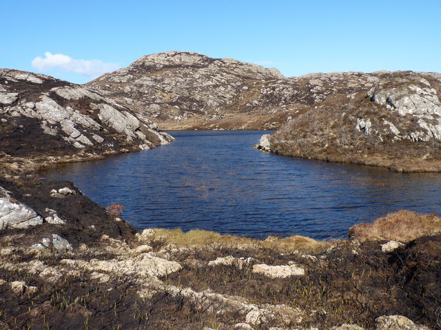
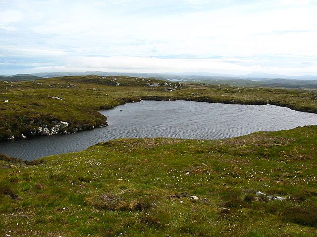
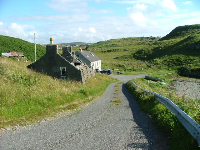
Rubha Glas, located in Ross-shire, Scotland, is a prominent coastal feature known for its stunning headland and picturesque point. Situated on the eastern coast of Scotland, it offers breathtaking panoramic views of the North Sea and the rugged coastline.

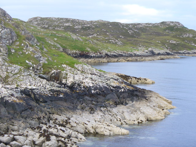
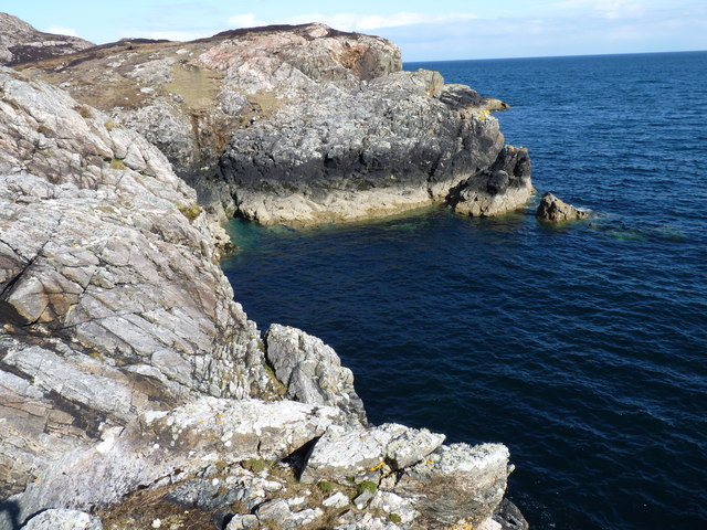
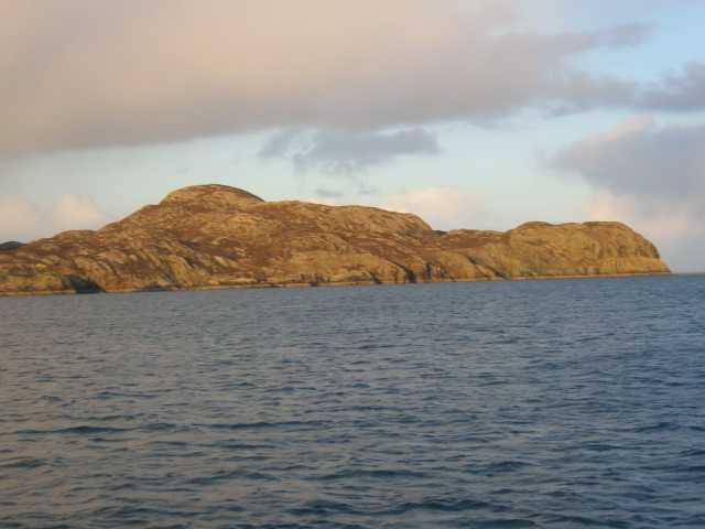
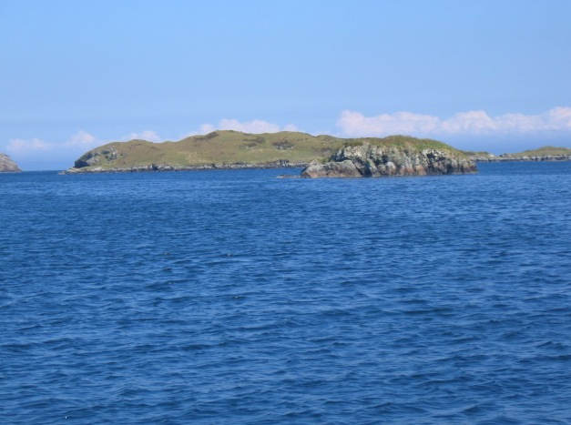
The headland of Rubha Glas extends into the sea, forming a distinctive shape that juts out from the mainland. It is characterized by towering cliffs and rocky outcrops, which have been shaped by centuries of erosion from powerful waves and coastal winds. These cliffs provide an important habitat for various seabird species, including guillemots and fulmars, making it a popular spot for birdwatchers.

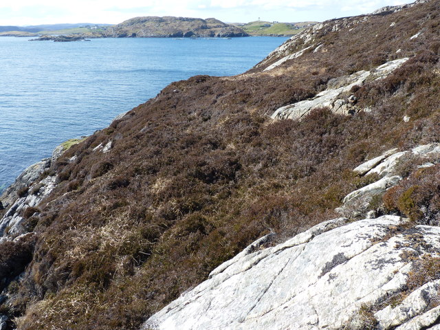
At the end of the headland, Rubha Glas forms a striking point that offers unobstructed views of the surrounding area. The point is a haven for marine wildlife, with seals often seen basking on the rocks and dolphins occasionally spotted swimming offshore. The area is also known for its diverse plant life, with heather, gorse, and wildflowers adding vibrant splashes of color to the landscape.

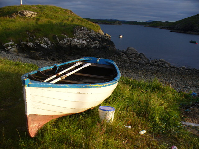
Rubha Glas is a popular destination for outdoor enthusiasts, offering opportunities for hiking, photography, and exploring the rugged coastline. It is an ideal spot for those seeking tranquility and natural beauty, with its dramatic cliffs, crashing waves, and breathtaking views creating a truly awe-inspiring experience.

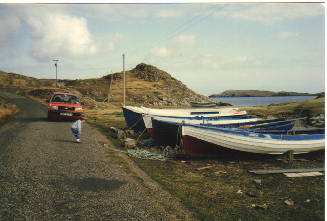
Accessible by foot or by car, Rubha Glas provides a unique and unforgettable coastal experience, showcasing the raw beauty and power of Scotland's eastern coastline.

If you have any feedback on the listing, please let us know in the comments section below.
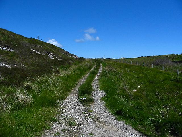
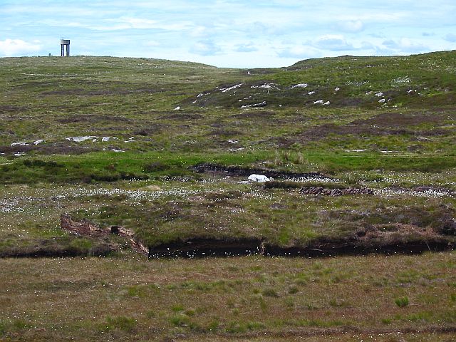
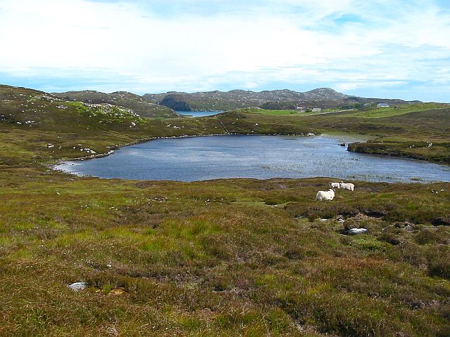
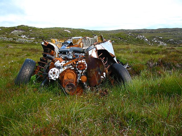
Rubha Glas Images

Images are sourced within 2km of 58.142871/-6.4027339 or Grid Reference NB4125. Thanks to Geograph Open Source API. All images are credited.

Shore at  Cuidhir Rocky shoreline backed by equally rocky hills at the Cuidhir road end.
Shore at Cuidhir
Rocky shoreline backed by equally rocky hills at the Cuidhir road end.
Evening at Cuidhir Rowing boat, in the evening sunshine, pulled up onto the grass above the small, rocky cove at Cuidhir.
Evening at Cuidhir
Rowing boat, in the evening sunshine, pulled up onto the grass above the small, rocky cove at Cuidhir.
Grimshader Salmon Farm Marine Harvest - Arachas Bhratan Griomshadair. Sea loch industry on the shores of Loch Griomsiadair.
Grimshader Salmon Farm
Marine Harvest - Arachas Bhratan Griomshadair. Sea loch industry on the shores of Loch Griomsiadair.
Loch Griomsiadair Yacht and lobster boat moored in the sheltered sea loch at Grimshader which is also used for salmon farming.
Loch Griomsiadair
Yacht and lobster boat moored in the sheltered sea loch at Grimshader which is also used for salmon farming.
Loch Lighigeag with Beinn-Mhòr in the background
Small inlet near Eilean Glas
Coastline
Coastline
Loch Grimshader Ordnance survey maps show two Loch Grimshaders! One is the sea loch as shown on  <a href="https://www.geograph.org.uk/gridref/NB3925">NB3925</a>; the second is this small freshwater loch in the village of Grimshader. It seems likely that the ordnance survey got it wrong many years ago when it first named the sea loch as Loch Grimshader. Its name was originally Loch Hurnavay.

This freshwater loch has a small island in it. Although I have found no archaeological reference to it, I suspect that the island is possibly a crannog, as it has a sunken overgrown interior within a ring of large stones and boulders. The loch is good for brown trout and eels.

The village, Grimshader, takes its name from the Norse, and means Grim's summer pasture.
Loch Grimshader
Ordnance survey maps show two Loch Grimshaders! One is the sea loch as shown on NB3925; the second is this small freshwater loch in the village of Grimshader. It seems likely that the ordnance survey got it wrong many years ago when it first named the sea loch as Loch Grimshader. Its name was originally Loch Hurnavay. This freshwater loch has a small island in it. Although I have found no archaeological reference to it, I suspect that the island is possibly a crannog, as it has a sunken overgrown interior within a ring of large stones and boulders. The loch is good for brown trout and eels. The village, Grimshader, takes its name from the Norse, and means Grim's summer pasture.
Grimshader's 'Peat Road' This track is used by local crofters to reach their flocks grazing on the open moorland, and by some villagers who cut peat for fuel.
Grimshader's 'Peat Road'
This track is used by local crofters to reach their flocks grazing on the open moorland, and by some villagers who cut peat for fuel.
Peat Cuttings, Bog Cotton and Water Tower The peat cuttings just right of centre in this photograph were, until recently, worked by Torcuil MacRath (Torquil MacRae), a Gaelic poet and author of some distinction who died late in 2006. A wonderful character and a good neighbour, it was our privilege and pleasure to count him as a friend during the few years my family and I have lived here. I now work these peat cuttings myself.

While much of the UK has suffered a wet spring and summer in 2007, the weather on the Isle of Lewis has been relatively dry. Perhaps this accounts for the fine crop of bog cotton seen on the moorland this year.

On the horizon is a water tower, no longer used.
Peat Cuttings, Bog Cotton and Water Tower
The peat cuttings just right of centre in this photograph were, until recently, worked by Torcuil MacRath (Torquil MacRae), a Gaelic poet and author of some distinction who died late in 2006. A wonderful character and a good neighbour, it was our privilege and pleasure to count him as a friend during the few years my family and I have lived here. I now work these peat cuttings myself. While much of the UK has suffered a wet spring and summer in 2007, the weather on the Isle of Lewis has been relatively dry. Perhaps this accounts for the fine crop of bog cotton seen on the moorland this year. On the horizon is a water tower, no longer used.
Loch nan Capull Loch nan Capull (the loch of the colt). A reasonably good trout loch.
Loch nan Capull
Loch nan Capull (the loch of the colt). A reasonably good trout loch.
Wrecked car at end of the peat road This car graces the far end of Grimshaders peat road. Although the tyres appear in good order, it is probable that the vehicle would fail its MoT on other counts.
Wrecked car at end of the peat road
This car graces the far end of Grimshaders peat road. Although the tyres appear in good order, it is probable that the vehicle would fail its MoT on other counts.
Loch Beinn Bhreac This loch is unusual in that no streams run into it, and no (surface) streams run out of it, as it is drained by an underground stream running through the peat. It is not believed to contain any fish.
Loch Beinn Bhreac
This loch is unusual in that no streams run into it, and no (surface) streams run out of it, as it is drained by an underground stream running through the peat. It is not believed to contain any fish.
Boats at Cuidhir Loch Leurbost The Islands of Tabhaidh Bheag and Tabhaidh are clearly seen in distance.
Boats at Cuidhir Loch Leurbost
The Islands of Tabhaidh Bheag and Tabhaidh are clearly seen in distance.
Entrance to Loch Grimshader Loch Grimshader is the first Sea Loch South of Stornoway.
Ben Casgro prominent on North Side of Loch.
Entrance to Loch Grimshader
Loch Grimshader is the first Sea Loch South of Stornoway. Ben Casgro prominent on North Side of Loch.
Rubha Raernis This headland forms the Southern Shore of Loch Grimshader and the Northern Shore of Loch Leurbost and leads to the entrance of Loch Erisort
Rubha Raernis
This headland forms the Southern Shore of Loch Grimshader and the Northern Shore of Loch Leurbost and leads to the entrance of Loch Erisort
Eilean Bhatarsaidh Unnamed Islet in foreground and Stac at Loch Erisort Entrance in distance (left of frame). Collectively these Islands are referred to as Na h-Eileanan Bairclin or Barkin Isles.
Eilean Bhatarsaidh
Unnamed Islet in foreground and Stac at Loch Erisort Entrance in distance (left of frame). Collectively these Islands are referred to as Na h-Eileanan Bairclin or Barkin Isles.
Road end at Crosbost
Show me another place!

Rubha Glas is located at Grid Ref: NB4125 (Lat: 58.142871, Lng: -6.4027339)

Unitary Authority: Na h-Eileanan an Iar

Police Authority: Highlands and Islands

What 3 Words

///reporter.skinning.chambers. Near Leurbost, Na h-Eileanan Siar

Related Wikis

Crossbost

Crossbost is a village on the Isle of Lewis in the parish of North Lochs, in the Outer Hebrides, Scotland. It is located approximately ten miles away...

North Lochs

North Lochs, (Scottish Gaelic: Ceann a Tuath nan Loch), an area in eastern Lewis, Outer Hebrides, Scotland, is named for the many lochans (small lochs...

Rainish Eilean Mòr

Rainish Eilean Mòr is an uninhabited island in Loch Orasaigh, north of the village of Leurbost in the area of South Lochs on the Isle of Lewis, Lewis and...

Leurbost

Leurbost (Scottish Gaelic: Liùrbost) is a village on the east coast of the Isle of Lewis in the Outer Hebrides of Scotland. It is approximately 6 miles...

Cromore

Cromore (Scottish Gaelic: Crò Mòr) is a crofting township on the Isle of Lewis in the district of Pairc, in the Outer Hebrides, Scotland. The settlement...

Eilean Chaluim Chille

Eilean Chaluim Chille (Gaelic: island of Saint Columba, Calum Cille) is an unpopulated island in the Outer Hebrides. It lies off the east coast of Lewis...

HMY Iolaire

HMY Iolaire was an Admiralty Yacht that sank at the entrance to Stornoway harbour on 1 January 1919, with the loss of at least 201 men out of the 283 on...

Stornoway power station

Stornoway power station, also known as Battery Point Power Station, is an electrical generation facility in Stornoway, Scotland. It was commissioned in...

Nearby Amenities

Located within 500m of 58.142871,-6.4027339
Created By: dmgroom_coastlines
Lat/Long: 58.14437/-6.39697
Created By: dmgroom_coastlines
Lat/Long: 58.144/-6.39772
Created By: dmgroom_coastlines
Lat/Long: 58.14282/-6.40265
Passing Place
Lat/Long: 58.142141/-6.395929
Turning Circle
Lat/Long: 58.1418834/-6.3946703
Passing Place
Lat/Long: 58.1391937/-6.4039666
Passing Place
Lat/Long: 58.1435838/-6.4102224
Passing Place
Lat/Long: 58.143686/-6.4093638
Passing Place
Lat/Long: 58.1438974/-6.4063776
Passing Place
Lat/Long: 58.1446007/-6.4034747
Passing Place
Lat/Long: 58.1450398/-6.4022267
Passing Place
Lat/Long: 58.1459921/-6.3978794
rbnb Lewis
Fixme: details? worth keeping?
Tourism: apartment
Lat/Long: 58.1440382/-6.4044666
Leisure: slipway
Lat/Long: 58.1431254/-6.4021562
Barrier: cattle_grid
Lat/Long: 58.1450745/-6.4023352
Power: pole
Lat/Long: 58.1416583/-6.3951263
Power: pole
Lat/Long: 58.1416259/-6.3961464
Power: pole
Lat/Long: 58.1415986/-6.3970633
Power: pole
Lat/Long: 58.1415662/-6.3979237
Power: pole
Lat/Long: 58.1413171/-6.3995879
Power: pole
Lat/Long: 58.140811/-6.4007481
Power: pole
Lat/Long: 58.1404516/-6.4015987
Power: pole
Lat/Long: 58.1402518/-6.4022255
Power: pole
Lat/Long: 58.1400753/-6.4028032
Power: pole
Lat/Long: 58.1398976/-6.403371
Power: pole
Lat/Long: 58.1413748/-6.3996768
Power: pole
Lat/Long: 58.1385818/-6.403902
Power: pole
Lat/Long: 58.1394305/-6.4028548
Power: pole
Lat/Long: 58.1461136/-6.3973556
Power: pole
Lat/Long: 58.1458684/-6.3980169
Power: pole
Lat/Long: 58.1444491/-6.4028497
Power: pole
Lat/Long: 58.143864/-6.4046392
Power: pole
Lat/Long: 58.1434359/-6.4059519
Power: pole
Lat/Long: 58.1434132/-6.4076173
Power: pole
Lat/Long: 58.1433814/-6.4091192
Power: pole
Lat/Long: 58.1433424/-6.4112075
Power: pole
Lat/Long: 58.1442312/-6.4101861
Power: pole
Lat/Long: 58.1441416/-6.4094388
Power: pole
Lat/Long: 58.1441001/-6.4089103
Power: pole
Lat/Long: 58.1440469/-6.4086817
Power: pole
Lat/Long: 58.1440301/-6.4081114
Power: pole
Lat/Long: 58.1439406/-6.4077709
Power: pole
Lat/Long: 58.1438445/-6.4069942
Power: pole
Lat/Long: 58.1439419/-6.406151
Power: pole
Lat/Long: 58.1440249/-6.4054234
Power: pole
Lat/Long: 58.1441027/-6.4046908
Power: pole
Lat/Long: 58.1443121/-6.4039616
Power: pole
Lat/Long: 58.1445322/-6.4032798
Power: pole
Lat/Long: 58.1447307/-6.4025903
The data included in this document is from www.openstreetmap.org. The data is made available under ODbL.

Have you been to Rubha Glas?

Leave your review of Rubha Glas below (or comments, questions and feedback).