Creag nan Con

Coastal Feature, Headland, Point in Argyllshire

Scotland

Creag nan Con

The Road to Knockan, Ross of Mull The unclassified road to the hamlet of Knockan just north of its junction with the A849.
The Road to Knockan, Ross of Mull Credit: JaneMcArtney

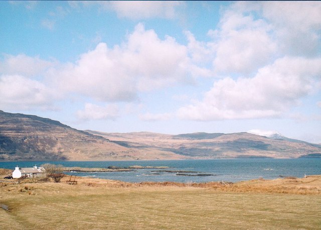
Creag nan Con is a prominent coastal feature located in Argyllshire, Scotland. It is characterized as a headland, also referred to as a point, due to its distinct shape and position jutting out into the surrounding waters. The name "Creag nan Con" translates to "Rock of the Dogs" in English, reflecting the rugged nature of this land formation.

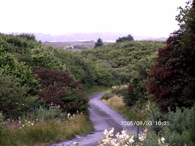
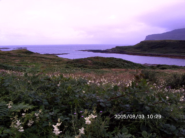
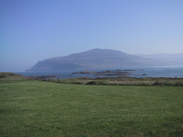
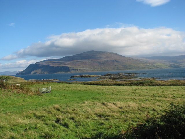
Situated along the western coastline of Argyllshire, Creag nan Con offers breathtaking views of the surrounding landscape. It is surrounded by the vast expanse of the Atlantic Ocean, providing visitors with a picturesque and serene setting. The headland itself is composed of rocky cliffs that rise steeply from the water, providing a dramatic backdrop to the coastal scenery.

The area surrounding Creag nan Con is rich in biodiversity, with various species of seabirds and marine life thriving in the waters. The headland serves as an important nesting site for many bird species, making it a popular destination for birdwatchers and nature enthusiasts.

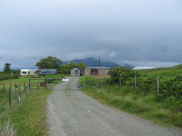
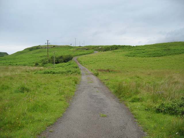
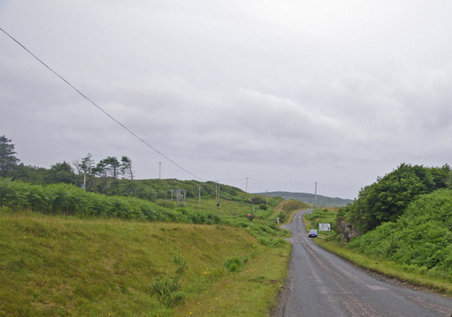
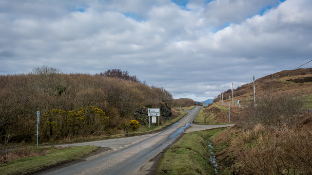
Access to Creag nan Con is relatively easy, with a well-maintained path leading to the headland from a nearby parking area. This allows visitors to explore the area and enjoy the stunning views it offers. Additionally, there are informational signs along the path, providing visitors with interesting facts about the geology and wildlife of the area.

Overall, Creag nan Con in Argyllshire is a captivating coastal feature that showcases the natural beauty and diversity of the region. Its rugged cliffs, panoramic views, and abundant wildlife make it a must-visit destination for both locals and tourists seeking an adventure in the Scottish coastal landscape.

If you have any feedback on the listing, please let us know in the comments section below.

Creag nan Con Images

Images are sourced within 2km of 56.331818/-6.1908288 or Grid Reference NM4123. Thanks to Geograph Open Source API. All images are credited.

The Road to Knockan, Ross of Mull The unclassified road to the hamlet of Knockan just north of its junction with the A849.
The Road to Knockan, Ross of Mull
The unclassified road to the hamlet of Knockan just north of its junction with the A849.
Loch na Corrobha, Ross of Mull A small sea loch Taken from the A849, the single track road, across the Ross of Mull.
Loch na Corrobha, Ross of Mull
A small sea loch Taken from the A849, the single track road, across the Ross of Mull.
Not the Rabbit Farm This is marked on the OS as a rabbit farm. It was once a combination of tourist attraction and angora production - but no longer.
Not the Rabbit Farm
This is marked on the OS as a rabbit farm. It was once a combination of tourist attraction and angora production - but no longer.
Track to Ardchrishnish
Coastal scene, Knockan, Mull Looking across croft land at Knockan towards Loch Scridain.
Coastal scene, Knockan, Mull
Looking across croft land at Knockan towards Loch Scridain.
Monument to Mary MacDonald Mary MacDonald wrote the Gaelic words to a hymn, which became an English favourite ("Child in a manger"). The tune was re-used for "Morning has broken" - probably the most famous Gaelic tune in the world now!  Beside the main road, near Ardtun where she died.
Monument to Mary MacDonald
Mary MacDonald wrote the Gaelic words to a hymn, which became an English favourite ("Child in a manger"). The tune was re-used for "Morning has broken" - probably the most famous Gaelic tune in the world now! Beside the main road, near Ardtun where she died.
Loch Scridain from Knockan
Rough Grazing, N of L.Assapol, Mull Competition between the bracken and the grass just becoming evident
Rough Grazing, N of L.Assapol, Mull
Competition between the bracken and the grass just becoming evident
Dense wild roadside shrubbery along the main road of the Ross of Mull
Countryside along the main road on the Ross of Mull
Bracken choked expanse with Loch na Corrobha beyond Photographer is on top of the main road along the Ross of Mull. These bracken invasions are the consequence of centuries of man's disturbance to the island, including the cycle of deforestation, livestock introduction and livestock reduction.
Bracken choked expanse with Loch na Corrobha beyond
Photographer is on top of the main road along the Ross of Mull. These bracken invasions are the consequence of centuries of man's disturbance to the island, including the cycle of deforestation, livestock introduction and livestock reduction.
Looking up the densely vegetated slopes and at outcrops of Capull Corrach
The Berg from Knockan
Loch an Arm, Isle of Mull Sometimes called Loch Arm or Loch nan Arm, this small loch lies in the hills a little north-east of Loch Assapol.  A small burn at its northern end runs down into Bun an Leoib (56°20'N., 6°11'W.), a bay 1.5 miles E of Ard Tun.
Loch an Arm, Isle of Mull
Sometimes called Loch Arm or Loch nan Arm, this small loch lies in the hills a little north-east of Loch Assapol. A small burn at its northern end runs down into Bun an Leoib (56°20'N., 6°11'W.), a bay 1.5 miles E of Ard Tun.
Phone box at Ardtun
Phone box at Ardtun
Moor at Faoileann
Moor at Faoileann
Left for Knockan, right for Lee
Unnamed hill loch on the moorland
Show me another place!

Creag nan Con is located at Grid Ref: NM4123 (Lat: 56.331818, Lng: -6.1908288)

Unitary Authority: Argyll and Bute

Police Authority: Argyll and West Dunbartonshire

What 3 Words

///wisdom.confusion.immunity. Near Fionnphort, Argyll & Bute

Related Wikis

Knockan

Knockan (Scottish Gaelic: An Cnocan) is a township of six crofts in the community of Ardtun, in the south of the Isle of Mull off the west coast of Scotland...

Ardtun

Ardtun (Scottish Gaelic: Àird Tunna) is a settlement on the Isle of Mull, in Argyll and Bute, Scotland. Ardtun is within the parish of Kilfinichen and...

Bunessan

Bunessan (Scottish Gaelic: Bun Easain) is a small village on the Ross of Mull in the south-west of the Isle of Mull, off the west coast of Scotland. The...

Suidhe

Suidhe (Scottish Gaelic: Suidhe) is a ruined township located on the southwestern peninsula of the Isle of Mull, Scotland. It lies just over 1 km to the...

Nearby Amenities

Located within 500m of 56.331818,-6.1908288
Leob Croft
Addr City: Isle of Mull
Addr Housename: Leob Croft
Addr Postcode: PA70 6HF
Smoking: outside
Tourism: guest_house
Website: https://www.leobcroft.co.uk/
Lat/Long: 56.3316073/-6.1938499
Dun na Muirgheigh
Historic: archaeological_site
Lat/Long: 56.3341032/-6.1874155
Power: pole
Lat/Long: 56.3312156/-6.1834302
Power: pole
Lat/Long: 56.3308325/-6.1861986
Power: pole
Lat/Long: 56.3306533/-6.186967
Power: pole
Lat/Long: 56.3302258/-6.1881821
Power: pole
Lat/Long: 56.3305678/-6.1911097
Power: pole
Lat/Long: 56.3304749/-6.1922912
Power: pole
Lat/Long: 56.329921/-6.1930396
Power: pole
Lat/Long: 56.3296533/-6.1937866
Power: pole
Lat/Long: 56.3291418/-6.1954978
Power: pole
Lat/Long: 56.3288681/-6.1964902
Leisure: garden
Lat/Long: 56.3323925/-6.1850827
Power: pole
Lat/Long: 56.331856/-6.1854872
Power: pole
Lat/Long: 56.3314904/-6.1850555
Power: pole
Lat/Long: 56.3310459/-6.184528
Power: pole
Lat/Long: 56.3313308/-6.1828446
The data included in this document is from www.openstreetmap.org. The data is made available under ODbL.

Have you been to Creag nan Con?

Leave your review of Creag nan Con below (or comments, questions and feedback).