Creag Orril

Cliff, Slope in Inverness-shire

Scotland

Creag Orril

A855 approaching the Museum of Island Life from Duntulm
A855 approaching the Museum of Island Life from Duntulm Credit: Elliott Simpson

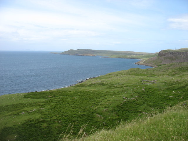
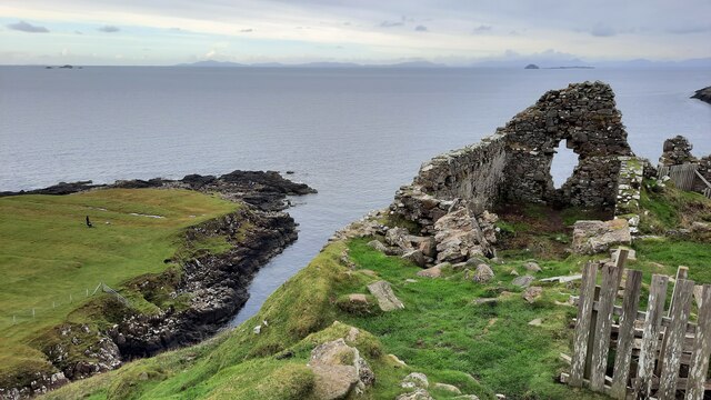
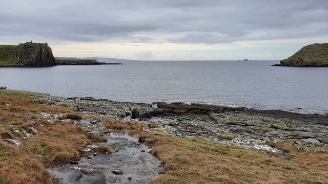
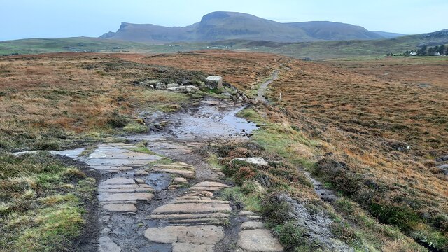
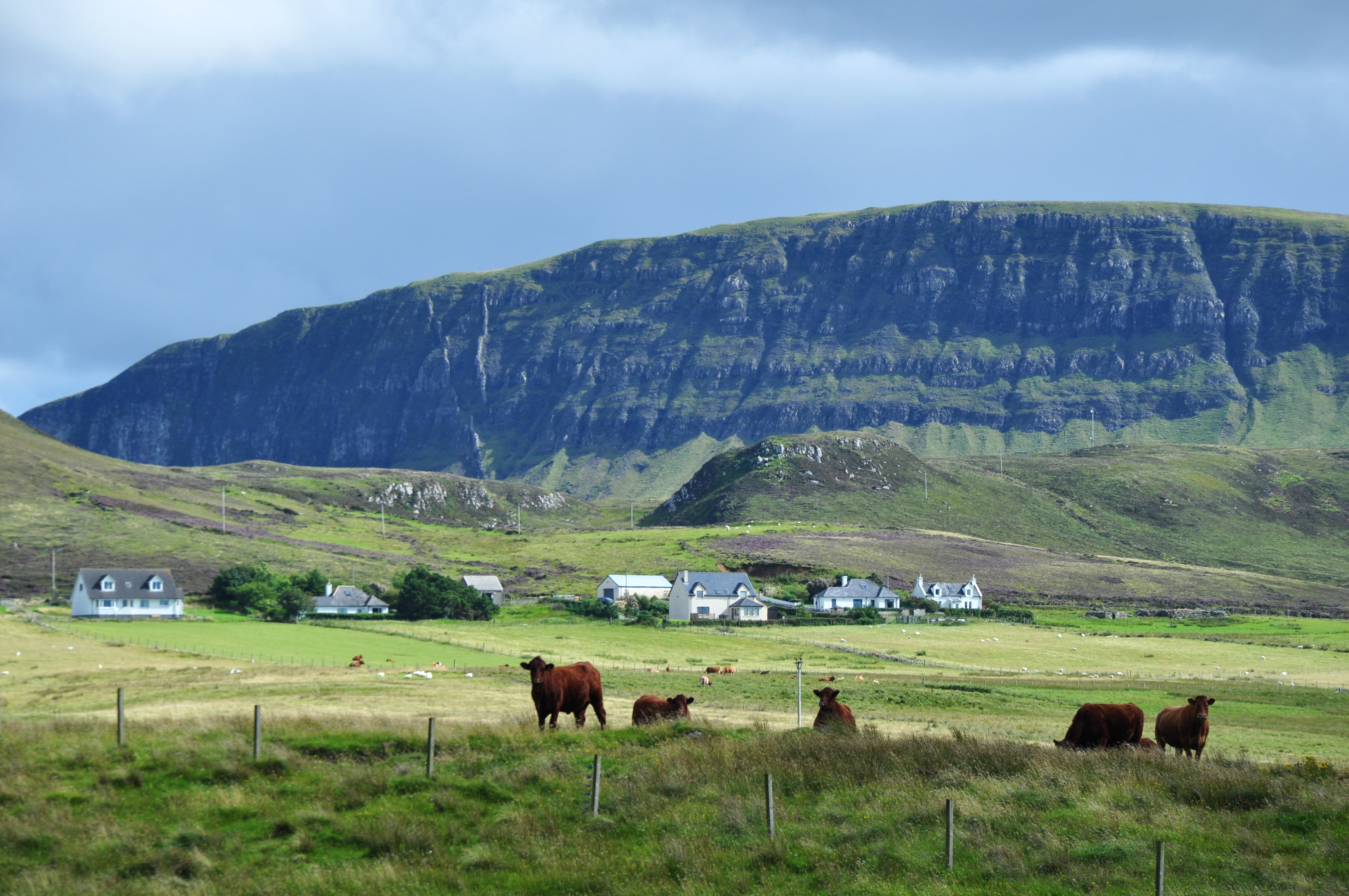
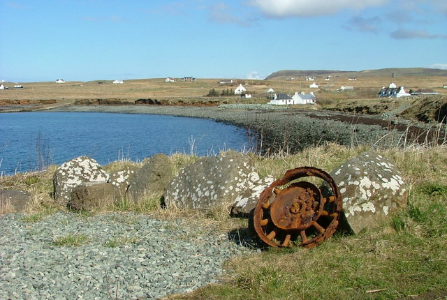
Creag Orril is a prominent cliff located in Inverness-shire, Scotland. Situated in the northern part of the county, it is nestled within the picturesque Scottish Highlands. The cliff is renowned for its impressive height and stunning views, attracting both locals and tourists alike.

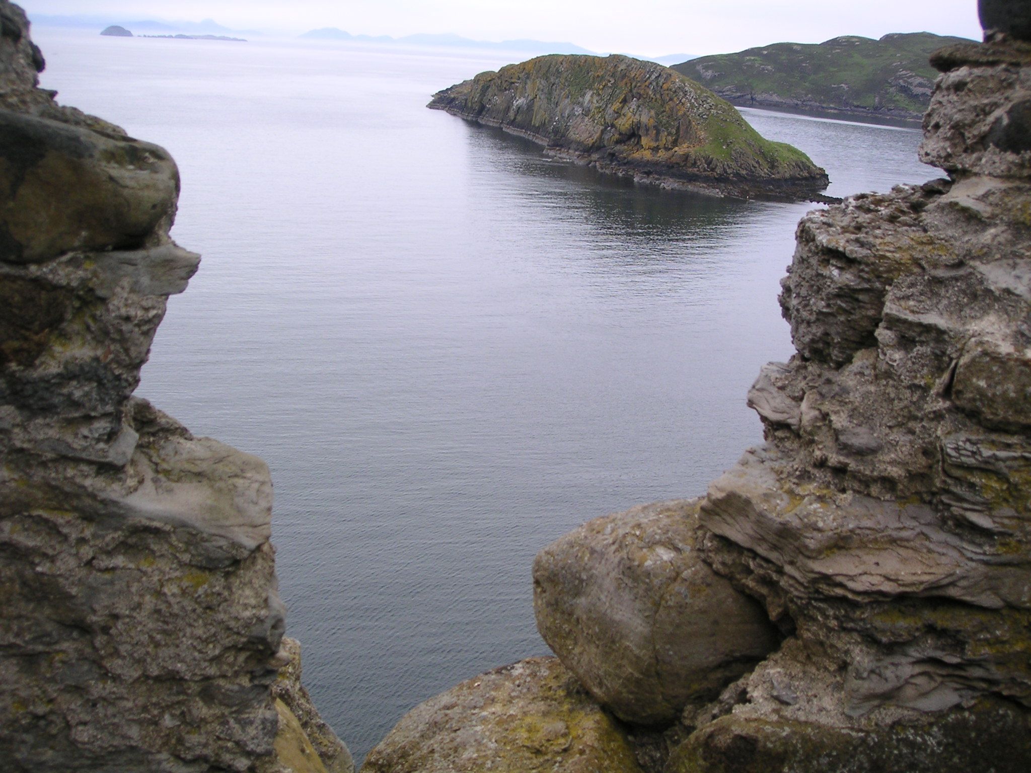
Rising to a height of approximately 300 meters (984 feet), Creag Orril offers a breathtaking panorama of the surrounding landscape. Its rocky face is characterized by rugged features and sheer drops, making it a popular destination for rock climbers and adventure enthusiasts. The cliff's challenging terrain provides an exhilarating experience for those seeking an adrenaline-fueled adventure.

Creag Orril is also home to a diverse range of flora and fauna. The surrounding slopes are covered in lush vegetation, including heather, ferns, and mosses, creating a vibrant and colorful landscape. The cliff provides a natural habitat for various bird species, such as peregrine falcons and golden eagles, making it a haven for birdwatchers and nature enthusiasts.

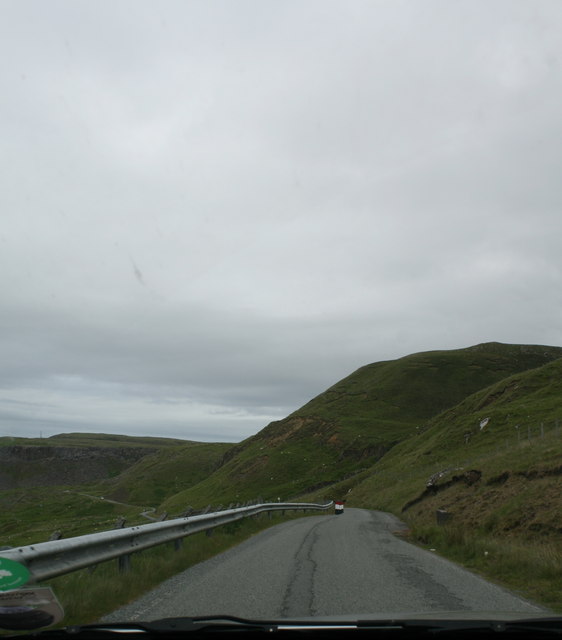
Access to Creag Orril is relatively easy, with several well-marked trails leading to the cliff's base. These paths cater to different levels of fitness and expertise, ensuring that visitors of all abilities can enjoy the beauty of this natural wonder. Additionally, the cliff is located in close proximity to other popular attractions in Inverness-shire, such as Loch Ness and the Cairngorms National Park, making it an ideal stop for those exploring the region.

In summary, Creag Orril is a magnificent cliff in Inverness-shire, Scotland, offering awe-inspiring views, challenging rock climbing opportunities, and a rich biodiversity. It is a must-visit destination for nature lovers and adventure seekers looking to immerse themselves in the stunning Scottish Highlands.

If you have any feedback on the listing, please let us know in the comments section below.

Creag Orril Images

Images are sourced within 2km of 57.67519/-6.3406684 or Grid Reference NG4173. Thanks to Geograph Open Source API. All images are credited.

A855 approaching the Museum of Island Life from Duntulm
A855 near Osmigarry
A855 near Osmigarry
Farmland at Osmigarry Near the Flora Macdonald monument.
Farmland at Osmigarry
Near the Flora Macdonald monument.
Skye coastline near Osmigarry Looking towards Rubha Hunish
Skye coastline near Osmigarry
Looking towards Rubha Hunish
Coast road southwest of Duntulm, Skye
Wrapped bales
Wrapped bales
Old Settlement at Osmigarry Remains of an old coastal crofting community.
Old Settlement at Osmigarry
Remains of an old coastal crofting community.
Metal Stile Near Kilmuir Cemetery. The small islands on the Minch, seen through the handrail, are Sgeir nan Ruideag, An t-lasgair and An Dubh Sgeir.
Metal Stile
Near Kilmuir Cemetery. The small islands on the Minch, seen through the handrail, are Sgeir nan Ruideag, An t-lasgair and An Dubh Sgeir.
Unfinished inscription Kilmuir graveyard is better known for the memorial to Flora MacDonald. But within the burial ground is this oddity - the inscription is unfinished.
The stone marks the burial place of Charles MacArthur, one of the pipers to Clan MacDonald. According to tradition, the piper's son, who had commissioned a sculptor to letter the stone, was drowned while crossing the Minch. As the sculptor considered he was unlikely therefore to be paid, he abandoned his work, never to return.
(From information board in Kilmuir cemetery).
Unfinished inscription
Kilmuir graveyard is better known for the memorial to Flora MacDonald. But within the burial ground is this oddity - the inscription is unfinished. The stone marks the burial place of Charles MacArthur, one of the pipers to Clan MacDonald. According to tradition, the piper's son, who had commissioned a sculptor to letter the stone, was drowned while crossing the Minch. As the sculptor considered he was unlikely therefore to be paid, he abandoned his work, never to return. (From information board in Kilmuir cemetery).
Grave of Angus Martin, Kilmuir Cemetery According to tradition, this slab, depicting a mailed figure, once marked the grave of an early Scottish king, but was stolen by Angus to be placed in due course over his own grave. He is reputed to have carried it up on his back from the shore. (From information board in Kilmuir cemetery).
Grave of Angus Martin, Kilmuir Cemetery
According to tradition, this slab, depicting a mailed figure, once marked the grave of an early Scottish king, but was stolen by Angus to be placed in due course over his own grave. He is reputed to have carried it up on his back from the shore. (From information board in Kilmuir cemetery).
Kilmuir Cemetery The large Celtic Cross marks the grave of Flora MacDonald.
The Outer Isles lie on the horizon.
Kilmuir Cemetery
The large Celtic Cross marks the grave of Flora MacDonald. The Outer Isles lie on the horizon.
Tablet in mausoleum See also <a href="https://www.geograph.org.uk/photo/1245915">NG3971 : Mausoleum in Kilmuir cemetery</a> .
The Mausoleum contains the burial place of Dr John Maclean.
The inscription on his tablet is in Latin. 
It reads: "Sacred to the memory of Johannis Maclean who being as distinguished in medicine as he was loved for his high principle, pleasant manner and sound judgement, died, lamented by all, on the 1st May 1793 at the age of 85".
(From information board in Kilmuir cemetery).
Tablet in mausoleum
See also NG3971 : Mausoleum in Kilmuir cemetery . The Mausoleum contains the burial place of Dr John Maclean. The inscription on his tablet is in Latin. It reads: "Sacred to the memory of Johannis Maclean who being as distinguished in medicine as he was loved for his high principle, pleasant manner and sound judgement, died, lamented by all, on the 1st May 1793 at the age of 85". (From information board in Kilmuir cemetery).
A855 near Osmigarry
A855 near Osmigarry
Flora Macdonald Monument The inscription around the base reads: "Flora Macdonald. Born at Milton, South Uist 1722. Died at Kingsburgh Skye 4th March 1790." She actually died at Peinduin <a href="https://www.geograph.org.uk/photo/1612132">NG3857 : The deathplace of Flora MacDonald</a>, a few miles from Kingsburgh.
In 1746 Flora had become famous for assisting Charles Edward Stuart, dressed as her maid Betty Burke, over the sea from Uist to Skye. She was subsequently arrested for her actions and imprisoned in the Tower of London. She married Alan Macdonald of Kingsburgh and spent time in North Carolina before returning to Skye. She died in 1790, and a memorial was built here at Kilmuir in 1871. This first one blew over in 1879, but a new cross was erected in 1880 and refurbished in 1882. 
The epitaph on this memorial is a comment from Dr Johnson. It reads:
"A name that will be mentioned in history and, if courage and fidelity be virtues, mentioned with honour."
Flora Macdonald Monument
The inscription around the base reads: "Flora Macdonald. Born at Milton, South Uist 1722. Died at Kingsburgh Skye 4th March 1790." She actually died at Peinduin NG3857 : The deathplace of Flora MacDonald, a few miles from Kingsburgh. In 1746 Flora had become famous for assisting Charles Edward Stuart, dressed as her maid Betty Burke, over the sea from Uist to Skye. She was subsequently arrested for her actions and imprisoned in the Tower of London. She married Alan Macdonald of Kingsburgh and spent time in North Carolina before returning to Skye. She died in 1790, and a memorial was built here at Kilmuir in 1871. This first one blew over in 1879, but a new cross was erected in 1880 and refurbished in 1882. The epitaph on this memorial is a comment from Dr Johnson. It reads: "A name that will be mentioned in history and, if courage and fidelity be virtues, mentioned with honour."
Footprints in Kilmuir Cemetery The frozen snow gives evidence that someone has walked the path around the graves.
The sun was very low in the sky, as it is all day at this time of year. The picture was taken at 2pm, an hour and a half before sunset.
Footprints in Kilmuir Cemetery
The frozen snow gives evidence that someone has walked the path around the graves. The sun was very low in the sky, as it is all day at this time of year. The picture was taken at 2pm, an hour and a half before sunset.
Ruins of Duntulm Castle
The rocky shoreline in Duntulm Bay The view out to sea is framed by Duntulm Castle and the southern tip of Tulm Island.
The rocky shoreline in Duntulm Bay
The view out to sea is framed by Duntulm Castle and the southern tip of Tulm Island.
Path from Rubha Hunish
Show me another place!

Creag Orril is located at Grid Ref: NG4173 (Lat: 57.67519, Lng: -6.3406684)

Unitary Authority: Highland

Police Authority: Highlands and Islands

What 3 Words

///runways.chromatic.circulate. Near Uig, Highland

Related Wikis

Duntulm

Duntulm (Scottish Gaelic: Dùn Thuilm) is a township on the most northerly point of the Trotternish peninsula of the Isle of Skye made up of Shulista (north...

Kilmaluag

Kilmaluag (Scottish Gaelic: Cill Moluaig, meaning St. Moluag's Cell, Church or Chapel) is a township made up of several small settlements on the most northerly...

Skye Museum of Island Life

The Skye Museum of Island Life is a museum in Kilmuir, Skye, Scotland, which is dedicated to preserving a township of thatched cottages as they would have...

Hebridean Terrane

The Hebridean Terrane is one of the terranes that form part of the Caledonian orogenic belt in northwest Scotland. Its boundary with the neighbouring Northern...

Heribusta

Heribusta (Scottish Gaelic: Hearabusta), (also Herbusta), is a small crofting township on the Trotternish peninsula of the Isle of Skye in the Highlands...

Hungladder

Hungladder is a small village on north west coast of the Trotternish peninsula in Kilmuir, Portree, Isle of Skye, Scottish Highlands and is in the Scottish...

Kilmuir, Skye

Kilmuir (Scottish Gaelic: Cille Mhoire) is a village on the west coast of the Trotternish peninsula in the north of the island of Skye. It is in the Scottish...

Beaton's Cottage

Beaton's Cottage (also known as Beaton's Croft) is a croft dwelling in Bornesketaig, Isle of Skye, Scotland, near the island's northern tip. A Category...

Nearby Amenities

Located within 500m of 57.67519,-6.3406684
Source: PGS
Lat/Long: 57.6785252/-6.3462066
Created By: dmgroom_coastlines
Source: PGS
Lat/Long: 57.67772/-6.34685
Created By: dmgroom_coastlines
Source: PGS
Lat/Long: 57.67697/-6.34739
Created By: dmgroom_coastlines
Source: PGS
Lat/Long: 57.67672/-6.34789
Created By: dmgroom_coastlines
Source: PGS
Lat/Long: 57.67621/-6.3484
Created By: dmgroom_coastlines
Source: PGS
Lat/Long: 57.67597/-6.34866
Passing Place
Lat/Long: 57.6775066/-6.3462814
Old township
Place: locality
Lat/Long: 57.6745602/-6.3349061
Power: pole
Lat/Long: 57.6791514/-6.3391891
Power: pole
Lat/Long: 57.6788302/-6.3389665
Power: pole
Lat/Long: 57.6782895/-6.3385776
Power: pole
Lat/Long: 57.6776485/-6.3380894
Power: pole
Lat/Long: 57.6770261/-6.3376978
Power: pole
Lat/Long: 57.676395/-6.3372338
Power: pole
Lat/Long: 57.6758443/-6.3368261
Power: pole
Lat/Long: 57.6751831/-6.3368771
Power: pole
Lat/Long: 57.6741892/-6.3370219
Power: pole
Lat/Long: 57.6734233/-6.3370809
Power: pole
Lat/Long: 57.6731952/-6.3383362
Power: pole
Lat/Long: 57.6729787/-6.3395351
Power: pole
Lat/Long: 57.6725096/-6.3403961
Power: pole
Lat/Long: 57.6720377/-6.3412061
Power: pole
Lat/Long: 57.6715472/-6.3420779
Power: pole
Lat/Long: 57.6710265/-6.3429925
Power: pole
Lat/Long: 57.677219/-6.3336448
Power: pole
Lat/Long: 57.677163/-6.3350579
Power: pole
Lat/Long: 57.6771189/-6.3363804
Passing Place
Lat/Long: 57.6782616/-6.3456827
The data included in this document is from www.openstreetmap.org. The data is made available under ODbL.

Have you been to Creag Orril?

Leave your review of Creag Orril below (or comments, questions and feedback).