Geodha nan Nathraichean
Coastal Feature, Headland, Point in Ross-shire
Scotland
Geodha nan Nathraichean
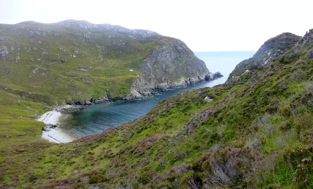
Geodha nan Nathraichean, located in Ross-shire, Scotland, is a stunning coastal feature known for its picturesque headland and point. This natural formation boasts breathtaking views of the surrounding landscape and is a popular destination for both locals and tourists.
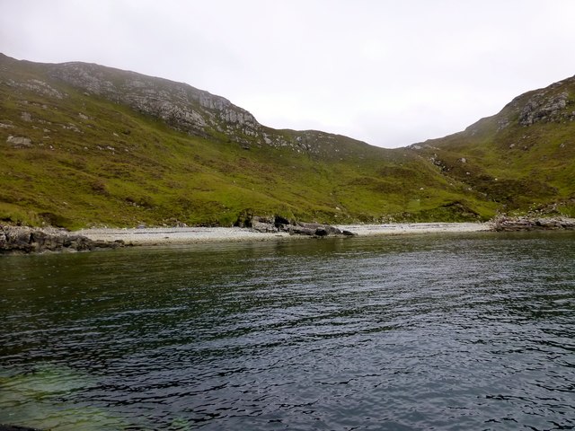
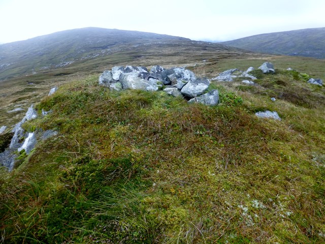
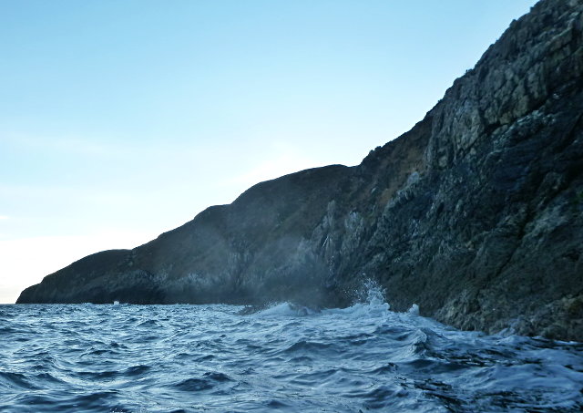
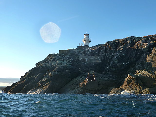
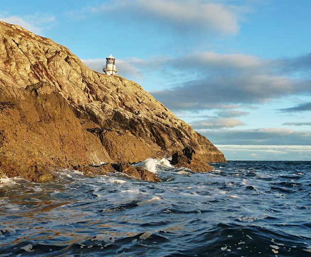
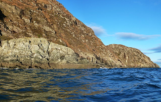
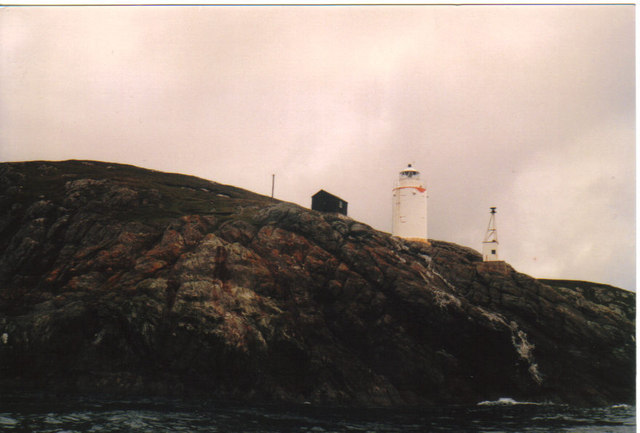
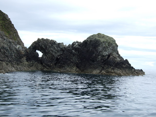
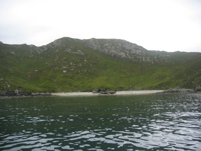
The headland of Geodha nan Nathraichean is characterized by its rugged cliffs, which tower above the sea. These cliffs are composed of ancient rock formations, providing a glimpse into the geological history of the area. The coastline is adorned with diverse flora and fauna, including various species of seabirds that nest on the cliffs.
The point of Geodha nan Nathraichean extends into the sea, creating a dramatic and striking panorama. From this vantage point, visitors can admire the vast expanse of the ocean and the distant horizon. The crashing waves against the cliffs create a mesmerizing symphony of sound that adds to the allure of this coastal feature.
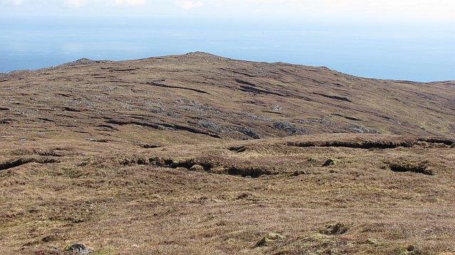
Geodha nan Nathraichean is not only a visual delight but also offers opportunities for outdoor activities. The headland provides an ideal spot for hiking enthusiasts to explore the rugged terrain and enjoy panoramic views. The point is also a popular spot for fishing, attracting anglers in search of a bountiful catch.
In summary, Geodha nan Nathraichean in Ross-shire is a captivating coastal feature that showcases the beauty of Scotland's natural landscape. With its stunning cliffs, breathtaking views, and recreational opportunities, it is a must-visit destination for nature lovers and adventure seekers alike.
If you have any feedback on the listing, please let us know in the comments section below.
Geodha nan Nathraichean Images
Images are sourced within 2km of 57.949285/-6.4679051 or Grid Reference NB3504. Thanks to Geograph Open Source API. All images are credited.
Geodha nan Nathraichean is located at Grid Ref: NB3504 (Lat: 57.949285, Lng: -6.4679051)
Unitary Authority: Na h-Eileanan an Iar
Police Authority: Highlands and Islands
What 3 Words
///sectors.upstarts.stardom. Near Tarbert, Na h-Eileanan Siar
Nearby Locations
Related Wikis

Eilean Liubhaird
Eilean Liubhaird or Eilean Iubhard is an island in the Outer Hebrides, to the east of Lewis. == Geography and geology == The rock is "gneiss bedrock with...

Orinsay
Orinsay (Scottish Gaelic: Orasaigh) is a crofting village on the Isle of Lewis in the district of Pairc, in the Outer Hebrides, Scotland. The settlement...

Stiomrabhaig
Stiomrabhaig is an abandoned crofter's village on the Isle of Lewis in the Outer Hebrides. == History == The United Kingdom Census 1851 shows that the...

Park, Lewis
Park (Scottish Gaelic: A' Phàirc), also known as South Lochs, is a huge area of land connected to the rest of Lewis only by a narrow neck between Loch...

Garbh Eilean, Shiant Islands
Garbh Eilean (Scottish Gaelic Rough Isle) is one of the Shiant Islands at the south end of the Minch on the west coast of Scotland. == Geology == In geological...

Shiant Islands
The Shiant Islands (; Scottish Gaelic: Na h-Eileanan Mòra [nə ˈhelanən ˈmoːɾə] or Na h-Eileanan Seunta [nə ˈhelanən ˈʃiant̪ə] ) or Shiant Isles are a privately...
Eilean an Taighe
"Eilean an Taighe", or "Eilean Taigh" is a fairly common island nameEilean an T(a)ighe, meaning "House Island" (lit. "Island of the House"), is one of...

Eilean Mhuire
Eilean Mhuire (meaning "Virgin Mary's island") is the most easterly of the Shiant Islands in the Outer Hebrides. Once populated, Eilean Mhuire is now used...
Have you been to Geodha nan Nathraichean?
Leave your review of Geodha nan Nathraichean below (or comments, questions and feedback).