Geodh' an Tobair
Coastal Feature, Headland, Point in Ross-shire
Scotland
Geodh' an Tobair
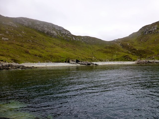
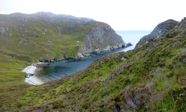
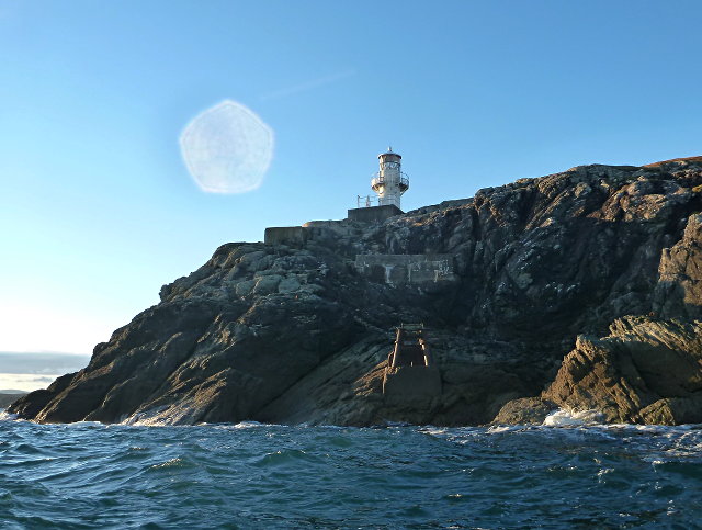
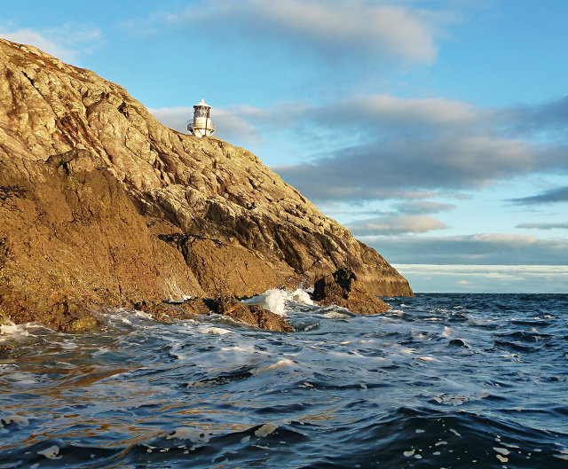
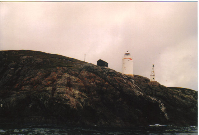
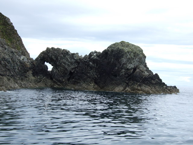
Geodh' an Tobair is a prominent coastal feature located in Ross-shire, Scotland. It is a stunning headland that juts out into the North Sea, offering breathtaking views and natural beauty. The name Geodh' an Tobair translates to "cove of the well" in English, referring to a small freshwater spring found within the area.
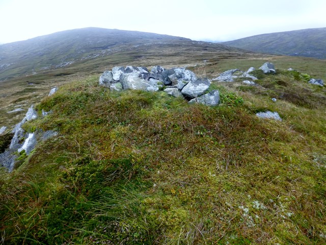
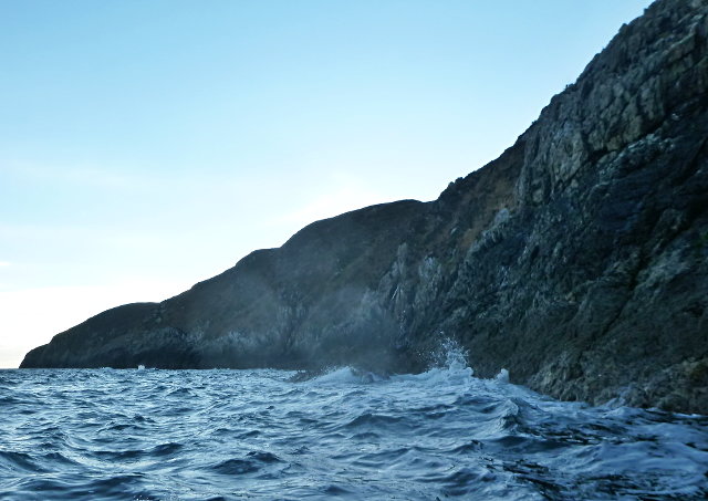
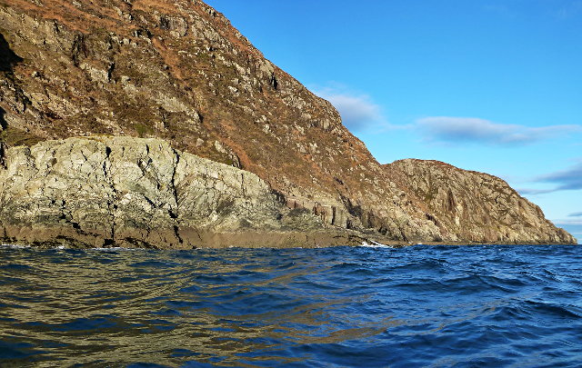
This headland is characterized by its rugged cliffs, which provide a dramatic backdrop against the crashing waves of the sea. The cliffs are formed from layers of sedimentary rock, showcasing the geological history of the region. They are also home to a variety of seabirds, including gannets, puffins, and guillemots, making it a popular spot for birdwatching enthusiasts.
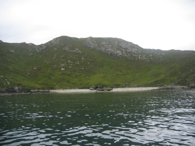
Geodh' an Tobair is also known for its sandy beaches, which stretch along the coastline. These beaches are perfect for leisurely walks, picnics, and even water activities such as swimming and surfing. The crystal-clear waters and stunning rock formations make it a paradise for photographers and nature lovers alike.
Access to Geodh' an Tobair is relatively easy, with a designated footpath leading to the headland. Visitors can enjoy cliff-top walks, exploring the rock pools, or simply soaking in the tranquility of the surroundings. The headland is also a great spot for whale and dolphin watching, as these majestic creatures often pass through the nearby waters.
Overall, Geodh' an Tobair is a must-visit destination for those seeking natural beauty, wildlife encounters, and a peaceful coastal experience.
If you have any feedback on the listing, please let us know in the comments section below.
Geodh' an Tobair Images
Images are sourced within 2km of 57.952108/-6.4671572 or Grid Reference NB3504. Thanks to Geograph Open Source API. All images are credited.
Geodh' an Tobair is located at Grid Ref: NB3504 (Lat: 57.952108, Lng: -6.4671572)
Unitary Authority: Na h-Eileanan an Iar
Police Authority: Highlands and Islands
What 3 Words
///query.full.skipped. Near Tarbert, Na h-Eileanan Siar
Nearby Locations
Related Wikis

Eilean Liubhaird
Eilean Liubhaird or Eilean Iubhard is an island in the Outer Hebrides, to the east of Lewis. == Geography and geology == The rock is "gneiss bedrock with...

Orinsay
Orinsay (Scottish Gaelic: Orasaigh) is a crofting village on the Isle of Lewis in the district of Pairc, in the Outer Hebrides, Scotland. The settlement...

Stiomrabhaig
Stiomrabhaig is an abandoned crofter's village on the Isle of Lewis in the Outer Hebrides. == History == The United Kingdom Census 1851 shows that the...

Park, Lewis
Park (Scottish Gaelic: A' Phàirc), also known as South Lochs, is a huge area of land connected to the rest of Lewis only by a narrow neck between Loch...

Garbh Eilean, Shiant Islands
Garbh Eilean (Scottish Gaelic Rough Isle) is one of the Shiant Islands at the south end of the Minch on the west coast of Scotland. == Geology == In geological...

Shiant Islands
The Shiant Islands (; Scottish Gaelic: Na h-Eileanan Mòra [nə ˈhelanən ˈmoːɾə] or Na h-Eileanan Seunta [nə ˈhelanən ˈʃiant̪ə] ) or Shiant Isles are a privately...
Eilean an Taighe
"Eilean an Taighe", or "Eilean Taigh" is a fairly common island nameEilean an T(a)ighe, meaning "House Island" (lit. "Island of the House"), is one of...

Eilean Mhuire
Eilean Mhuire (meaning "Virgin Mary's island") is the most easterly of the Shiant Islands in the Outer Hebrides. Once populated, Eilean Mhuire is now used...
Have you been to Geodh' an Tobair?
Leave your review of Geodh' an Tobair below (or comments, questions and feedback).