Clach Mhòr Geodha na Gaoith a Tuath
Coastal Feature, Headland, Point in Ross-shire
Scotland
Clach Mhòr Geodha na Gaoith a Tuath

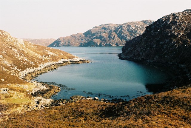
Clach Mhòr Geodha na Gaoith a Tuath, located in Ross-shire, Scotland, is a notable coastal feature that consists of a majestic headland and point. The name, which translates to "Big Rock of the North Wind Bay," perfectly encapsulates the character and significance of this geological wonder.
Standing proudly on the edge of the North Atlantic Ocean, Clach Mhòr Geodha na Gaoith a Tuath is characterized by its towering cliffs and rugged coastline. The headland is composed of ancient rocks, formed millions of years ago, that have been shaped and sculpted by the relentless power of the wind and waves. The result is a breathtaking landscape that showcases the raw beauty of nature.
Visitors to Clach Mhòr Geodha na Gaoith a Tuath can marvel at the dramatic cliffs that rise steeply from the sea, providing a dramatic backdrop to the crashing waves below. The headland offers panoramic views of the surrounding coastline and the vast expanse of the Atlantic Ocean. It is also a haven for wildlife, with seabirds nesting on the cliffs and seals often spotted basking on the nearby rocks.
The point of Clach Mhòr Geodha na Gaoith a Tuath provides a perfect vantage point for observing the marine life that thrives in these waters. The clear, turquoise sea teems with a variety of fish species, making it a popular spot for anglers. It is also a great place for coastal walks, with well-maintained paths that allow visitors to explore the area and discover its hidden gems.
Overall, Clach Mhòr Geodha na Gaoith a Tuath is a captivating coastal feature that offers a unique glimpse into the power and beauty of Scotland's natural landscape. It is a must-visit destination for nature lovers, photographers, and anyone seeking a truly awe-inspiring experience.
If you have any feedback on the listing, please let us know in the comments section below.
Clach Mhòr Geodha na Gaoith a Tuath Images
Images are sourced within 2km of 58.062462/-7.0692014 or Grid Reference NB0119. Thanks to Geograph Open Source API. All images are credited.


Clach Mhòr Geodha na Gaoith a Tuath is located at Grid Ref: NB0119 (Lat: 58.062462, Lng: -7.0692014)
Unitary Authority: Na h-Eileanan an Iar
Police Authority: Highlands and Islands
What 3 Words
///detained.these.thickens. Near Tarbert, Na h-Eileanan Siar
Nearby Locations
Related Wikis

Eilean Mhealasta
Eilean Mhealasta (Mealista Island) is an uninhabited island off the west coast of Lewis in the Outer Hebrides of Scotland. It takes its name from Mealista...

Game pieces of the Lewis chessmen hoard
Game pieces of the Lewis chessmen hoard include the ninety-three game pieces of the Lewis chessmen hoard found on the Isle of Lewis in the Outer Hebrides...

Mealista
Mealista (Scottish Gaelic: Mealasta) was a township in the west of the Isle of Lewis. It is currently largely uninhabited due to the Highland Clearances...

Scarp, Scotland
Scarp (Scottish Gaelic: An Sgarp) is an uninhabited island in the Outer Hebrides of Scotland, west of Hushinish on Harris. Once inhabited, the island was...
Nearby Amenities
Located within 500m of 58.062462,-7.0692014Have you been to Clach Mhòr Geodha na Gaoith a Tuath?
Leave your review of Clach Mhòr Geodha na Gaoith a Tuath below (or comments, questions and feedback).