Rubha Bhuic

Coastal Feature, Headland, Point in Inverness-shire

Scotland

Rubha Bhuic

Horsanais Point Quite a prominent headland in West Loch Tarbert. Ben Luskentyre centre and Isle Taransay to right of frame.
Horsanais Point Credit: JJM

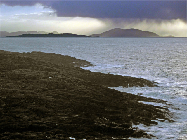
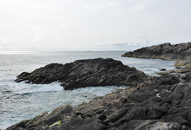
Rubha Bhuic is a prominent headland located in Inverness-shire, Scotland. It is situated on the northern coast of the country, overlooking the Moray Firth. The headland is characterized by rugged cliffs that drop dramatically into the sea, offering stunning views of the surrounding landscape.

The name "Rubha Bhuic" translates to "yellow point" in Gaelic, which may refer to the color of the rocks or vegetation found on the headland. The area is known for its diverse wildlife, with seabirds such as puffins and guillemots nesting on the cliffs, and seals often spotted basking on the rocks below.

Visitors to Rubha Bhuic can enjoy scenic coastal walks along the headland, taking in the breathtaking views of the sea and surrounding countryside. The area is popular with hikers, birdwatchers, and nature enthusiasts seeking a peaceful retreat away from the hustle and bustle of city life.

Overall, Rubha Bhuic is a picturesque coastal feature that showcases the natural beauty of the Scottish Highlands, making it a must-visit destination for those exploring the Inverness-shire region.

If you have any feedback on the listing, please let us know in the comments section below.

Rubha Bhuic Images

Images are sourced within 2km of 57.961885/-7.0553694 or Grid Reference NB0108. Thanks to Geograph Open Source API. All images are credited.
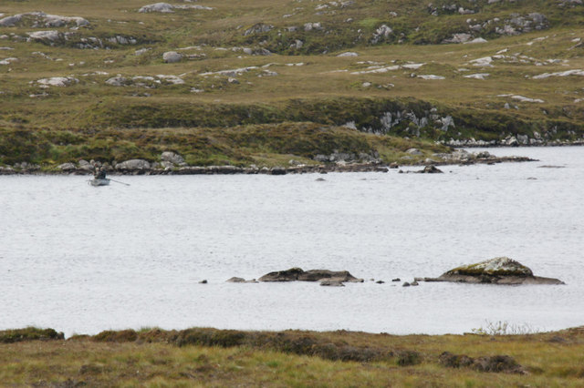
Horsanais Point Quite a prominent headland in West Loch Tarbert. Ben Luskentyre centre and Isle Taransay to right of frame.
Horsanais Point
Quite a prominent headland in West Loch Tarbert. Ben Luskentyre centre and Isle Taransay to right of frame.
Looking south across Baralob to Toe Head The dark rocks around Baralob are run through by trenches of redder rocks
Looking south across Baralob to Toe Head
The dark rocks around Baralob are run through by trenches of redder rocks
Horsanish coastline
Horsanish coastline
Communications mast near Gobhaig
Water pipe access covers by the outflow of an unnamed loch on Àirde Beaga
Fishing on Loch Haladail Or Thaladal on some maps.
Fishing on Loch Haladail
Or Thaladal on some maps.
Tidal pool at Conachro Look west across the tidal pool at Conachro
Tidal pool at Conachro
Look west across the tidal pool at Conachro
Loch Langabhat The view south east along the loch towards the big hills [Beinn Dhubh etc] on the south side of Loch a' Siar.
Loch Langabhat
The view south east along the loch towards the big hills [Beinn Dhubh etc] on the south side of Loch a' Siar.
Rubha Bhogha-sgeir Horsanish coastline.
Rubha Bhogha-sgeir
Horsanish coastline.
Whit you lookin it? Says the cow whose mate had blocked the road and only decided to let us past after I gave him a hard stare.  This one was really just scratching an itchy spot on his back and not trying to pick a fight at all.
Whit you lookin it?
Says the cow whose mate had blocked the road and only decided to let us past after I gave him a hard stare. This one was really just scratching an itchy spot on his back and not trying to pick a fight at all.
Is it real? What an amazing pastime is Geographing!  How else would you be able to spot and photograph a shot like this, unless you were heading to grab a Geograph in remote myriad NA?  This is of course a passing place - but the cow has completely misread the sign.
Is it real?
What an amazing pastime is Geographing! How else would you be able to spot and photograph a shot like this, unless you were heading to grab a Geograph in remote myriad NA? This is of course a passing place - but the cow has completely misread the sign.
A bad hair day by the loch side
On the B887 road to Huisinis
Loch Langabhat
Loch Langabhat
Road to Govig
Road to Govig
Loch Langavat
Loch Langavat
Loch Halladale
Loch Halladale
Bagh Gobhaig Govic Bay with village nestling at the head of the bay. 
The citizens of Gobhaig claim this village as the "capital" of North Harris.
Bagh Gobhaig
Govic Bay with village nestling at the head of the bay. The citizens of Gobhaig claim this village as the "capital" of North Harris.
Show me another place!

Rubha Bhuic is located at Grid Ref: NB0108 (Lat: 57.961885, Lng: -7.0553694)

Unitary Authority: Na h-Eileanan an Iar

Police Authority: Highlands and Islands

What 3 Words

///manly.herb.older. Near Tarbert, Na h-Eileanan Siar

Nearby Locations

Rubha Bhuic Cadha Crò

Related Wikis

Amhuinnsuidhe

Amhuinnsuidhe (Scottish Gaelic: Abhainn Suidhe) is a settlement on Harris, in the Outer Hebrides, Scotland. The settlement is also within the parish of...

Amhuinnsuidhe Castle

Amhuinnsuidhe Castle is a large 19th-century private country house on Harris, one of the Western Isles of Scotland. It was designated as a Category A listed...

Hushinish

Huisinish or Hushinish (Scottish Gaelic Hùisinis) is a remote place on the west coast of Harris in the Outer Hebrides of Scotland. It lies at the end of...

Chliostair Hydro-Electric Scheme

Chliostair Hydro-Electric Scheme is a small scheme promoted by the North of Scotland Hydro-Electric Board on Harris, Outer Hebrides. It consists of a single...

Nearby Amenities

Located within 500m of 57.961885,-7.0553694
Rubha Bhuic
Natural: cape
Lat/Long: 57.9616884/-7.056312
The data included in this document is from www.openstreetmap.org. The data is made available under ODbL.

Have you been to Rubha Bhuic?

Leave your review of Rubha Bhuic below (or comments, questions and feedback).