Loch na Shinas

Lake, Pool, Pond, Freshwater Marsh in Ross-shire

Scotland

Loch na Shinas

Wild camp at the head of Tamana Siar
Wild camp at the head of Tamana Siar Credit: Peter Edwards

Loch na Shinas is a picturesque freshwater loch located in Ross-shire, Scotland. Situated amidst stunning natural landscapes, this body of water offers a tranquil and serene environment for visitors to enjoy.

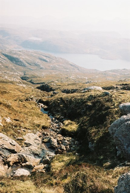
Spanning approximately 1.5 hectares, Loch na Shinas is a relatively small yet idyllic freshwater pool. The loch is surrounded by lush greenery and rolling hills, providing an enchanting backdrop for nature enthusiasts. It is nestled within a freshwater marsh, which adds to its ecological significance.

The loch is home to a diverse range of aquatic flora and fauna. Visitors can spot various species of water plants, such as water lilies and reeds, which thrive in the calm and nutrient-rich waters. These provide an important habitat for numerous aquatic insects, amphibians, and small fish that inhabit the loch.

The tranquil surroundings of Loch na Shinas make it an ideal spot for birdwatching. The loch attracts a variety of water birds throughout the year, including ducks, geese, and swans. Birdwatchers can observe these feathered creatures as they swim gracefully across the sparkling waters or take flight above the loch.

The loch itself is a popular spot for recreational activities such as fishing and boating. Anglers can cast their lines into the loch in search of trout, which are known to inhabit its depths. Boating enthusiasts can explore the calm waters and take in the breathtaking views of the surrounding countryside.

Overall, Loch na Shinas offers a peaceful retreat for nature lovers, providing a haven for both wildlife and visitors alike. Its scenic beauty and ecological diversity make it a must-visit destination in Ross-shire, Scotland.

If you have any feedback on the listing, please let us know in the comments section below.

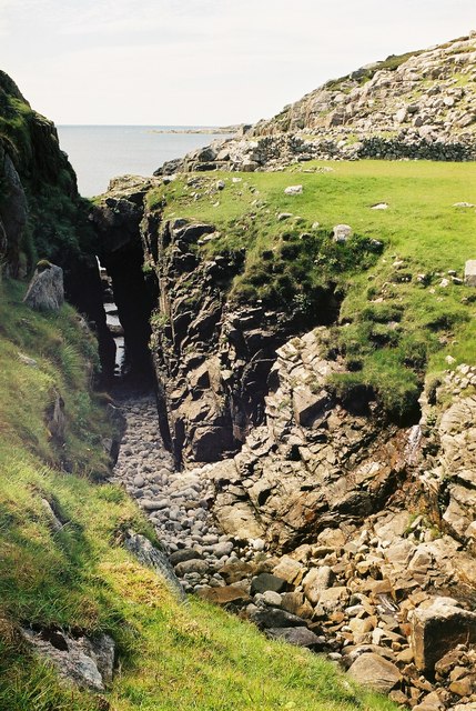
Loch na Shinas Images

Images are sourced within 2km of 58.066559/-7.0718378 or Grid Reference NB0119. Thanks to Geograph Open Source API. All images are credited.

Wild camp at the head of Tamana Siar
Moorland opposite Eilean Mhealasta
Mullach na h-Airde Bige Second HuMP around the northern edge of Loch Resort on an Alan Holmes RIB trip. What a brilliant day.
Name: Mullach na h-Airde Bige
Hill number: 4947
Height: 182m / 597ft
Area: 24A: Lewis and Nearby Islands
Class: Hu,1
Grid ref: NB026188 (est)
Drop: 128m
Col: 54m  NB044194
Mullach na h-Airde Bige
Second HuMP around the northern edge of Loch Resort on an Alan Holmes RIB trip. What a brilliant day. Name: Mullach na h-Airde Bige Hill number: 4947 Height: 182m / 597ft Area: 24A: Lewis and Nearby Islands Class: Hu,1 Grid ref: NB026188 (est) Drop: 128m Col: 54m NB044194
Rubha Loisgte An abruptly truncated spur of rock meets the sea.
Rubha Loisgte
An abruptly truncated spur of rock meets the sea.
Rubha Geodha nan Sgarbh The entrance to Loch Tealasvay is well concealed close to the right of the picture.
Rubha Geodha nan Sgarbh
The entrance to Loch Tealasvay is well concealed close to the right of the picture.
View to Scarp from the Island of Liongam
View of the Lewis mainland to Mealasta Island from the Island of Liongam
View from the Island of Liongam to the North Harris Hills
Looking South over the lochan to Scarp and beyond from the Island of Liongam
Looking East to the Lewis mainland from the Island of Liongam
The Rocky South East Shore of the Island of Liongam with a view of the North Harris Hills
A Craggy Cove on the East Coast of the Island of Liongam
A View looking South over the Island of Liongam to Scarp, the North Harris Hills and Taransay beyond
Loch Tamnabhaigh Aird Bheag to left of image and Tamana Sear to right
Loch Tamnabhaigh
Aird Bheag to left of image and Tamana Sear to right
Gully Between Aird Ghriamanais and Aird Dhrolai geodha.
Gully
Between Aird Ghriamanais and Aird Dhrolai geodha.
Burn flowing into Gleann Sgaladail
The head of Gleann Sgaladail The lower picture shows ruined shielings with a burn running through.
The head of Gleann Sgaladail
The lower picture shows ruined shielings with a burn running through.
Ruined shielings in Gleann Sgaladail
Show me another place!

Loch na Shinas is located at Grid Ref: NB0119 (Lat: 58.066559, Lng: -7.0718378)

Unitary Authority: Na h-Eileanan an Iar

Police Authority: Highlands and Islands

What 3 Words

///kidney.lifestyle.soup. Near Tarbert, Na h-Eileanan Siar

Related Wikis

Eilean Mhealasta

Eilean Mhealasta (Mealista Island) is an uninhabited island off the west coast of Lewis in the Outer Hebrides of Scotland. It takes its name from Mealista...

Game pieces of the Lewis chessmen hoard

Game pieces of the Lewis chessmen hoard include the ninety-three game pieces of the Lewis chessmen hoard found on the Isle of Lewis in the Outer Hebrides...

Mealista

Mealista (Scottish Gaelic: Mealasta) was a township in the west of the Isle of Lewis. It is currently largely uninhabited due to the Highland Clearances...

Scarp, Scotland

Scarp (Scottish Gaelic: An Sgarp) is an uninhabited island in the Outer Hebrides of Scotland, west of Hushinish on Harris. Once inhabited, the island was...

Nearby Amenities

Located within 500m of 58.066559,-7.0718378
Tamna Sear
Natural: bay
Lat/Long: 58.0662253/-7.0682989
Aonaig Ruadh Tamna Sear
Place: locality
Lat/Long: 58.0643427/-7.0657694
Aonaig Mhor Tamna Sear
Place: locality
Lat/Long: 58.0658636/-7.0801675
Gearraaidh Mill Tamna
Place: locality
Lat/Long: 58.0670229/-7.0741031
The data included in this document is from www.openstreetmap.org. The data is made available under ODbL.

Have you been to Loch na Shinas?

Leave your review of Loch na Shinas below (or comments, questions and feedback).