Round Rock

Coastal Feature, Headland, Point in Cornwall

England

Round Rock

Lower Town Quay The smaller of the two quays on St Martin’s. The larger quay at Higher Town is the one used for freight deliveries, but is inaccessible at a low tide.

The island behind is the uninhabited Tean (pronounced tea-an).
Lower Town Quay Credit: David Lally

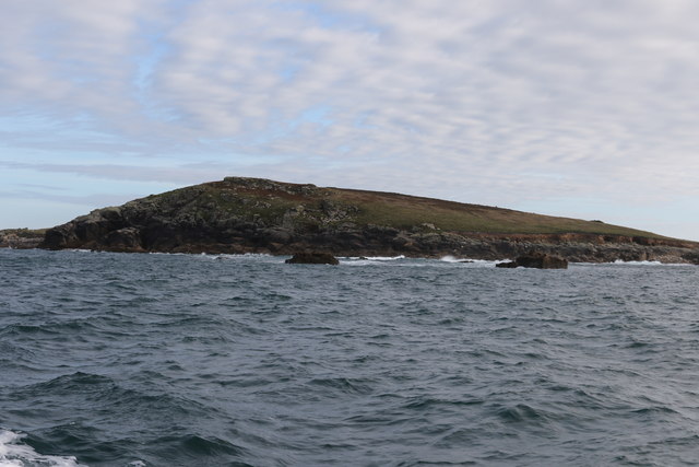
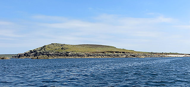
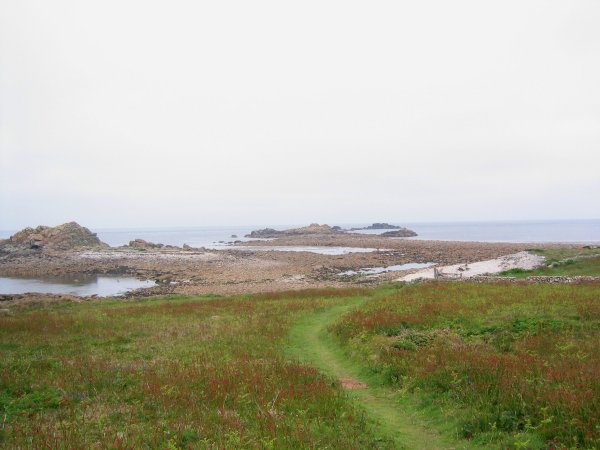
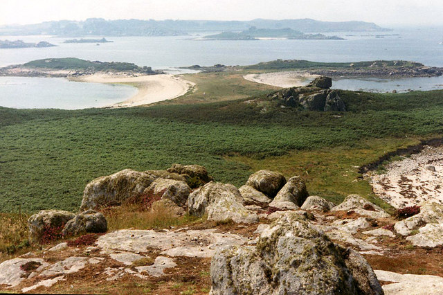
Round Rock is a prominent coastal feature located in Cornwall, England. Situated on the southern coast, it is specifically categorized as a headland or point due to its distinct geographical characteristics. Standing tall and commanding, Round Rock serves as a striking natural landmark that captivates both locals and tourists alike.

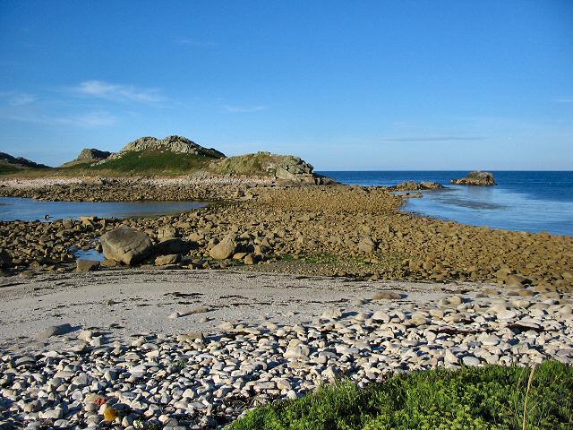
The headland is known for its rugged and rocky terrain, which stretches out into the Atlantic Ocean. The rock formation is named after its rounded shape, which has been formed by centuries of erosion from the relentless crashing waves. Its unique appearance makes it a popular spot for photography and sightseeing.

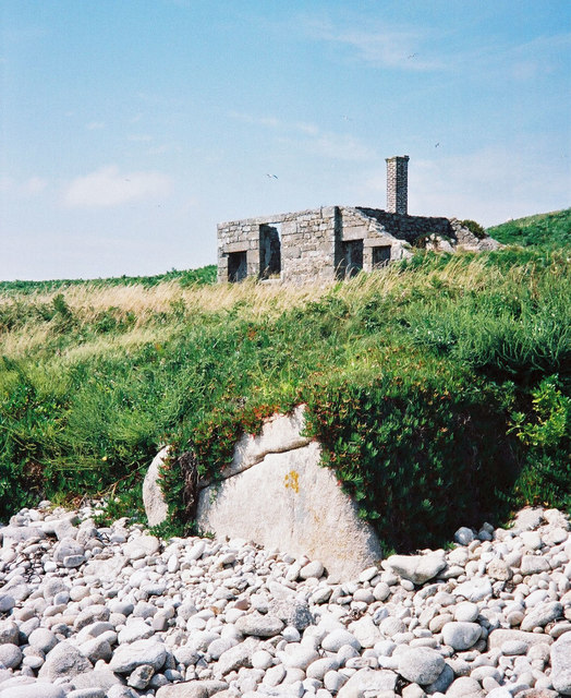
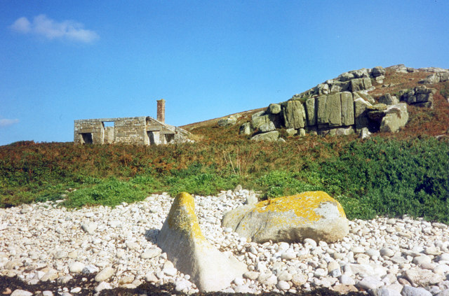
Round Rock also boasts a diverse ecosystem, with various plant and animal species calling it home. The rock pools that form during low tide provide a habitat for marine life, such as crabs, small fish, and mollusks. Seabirds can often be seen perched on the cliffs, including gulls and cormorants.

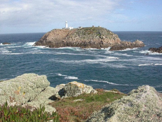
In addition to its natural beauty, Round Rock has historical significance. It has served as a navigational landmark for ships for centuries, helping sailors to safely navigate the treacherous waters of the Atlantic. The headland has also witnessed numerous shipwrecks throughout history, further adding to its allure and intrigue.

Overall, Round Rock in Cornwall is a picturesque and fascinating coastal feature. Its rugged beauty, diverse wildlife, and historical importance make it a must-visit destination for nature enthusiasts and history buffs alike.

If you have any feedback on the listing, please let us know in the comments section below.

Round Rock Images

Images are sourced within 2km of 49.977153/-6.2997011 or Grid Reference SV9117. Thanks to Geograph Open Source API. All images are credited.

Lower Town Quay The smaller of the two quays on St Martin’s. The larger quay at Higher Town is the one used for freight deliveries, but is inaccessible at a low tide.

The island behind is the uninhabited Tean (pronounced tea-an).
Lower Town Quay
The smaller of the two quays on St Martin’s. The larger quay at Higher Town is the one used for freight deliveries, but is inaccessible at a low tide. The island behind is the uninhabited Tean (pronounced tea-an).
Great Bay panorama On of the most beautiful spots on the islands.
Great Bay panorama
On of the most beautiful spots on the islands.
The north end of St Helen's From a boat trip around the north of the Isles of Scilly
The north end of St Helen's
From a boat trip around the north of the Isles of Scilly
The Pest House, St Helen's An 18th century quarantine station for plague victims from passing ships who were isolated on this small island to await their fate. <span class="nowrap"><a title="https://en.wikipedia.org/wiki/St_Helen%27s,_Isles_of_Scilly" rel="nofollow ugc noopener" href="https://en.wikipedia.org/wiki/St_Helen%27s,_Isles_of_Scilly">Link</a><img style="margin-left:2px;" alt="External link" title="External link - shift click to open in new window" src="https://s1.geograph.org.uk/img/external.png" width="10" height="10"/></span>
The Pest House, St Helen's
An 18th century quarantine station for plague victims from passing ships who were isolated on this small island to await their fate. LinkExternal link
St Helen's Pest House The small quarantine shelter where sailors infected with the plague were marooned. A small graveyard is nearby which kind of tells its own story.
St Helen's Pest House
The small quarantine shelter where sailors infected with the plague were marooned. A small graveyard is nearby which kind of tells its own story.
St Helen's from the North St Helen's is a low-lying island unlike some of the rocky islands further west and east. It is the home of several seabirds, but not in the numbers on the rockier islands
St Helen's from the North
St Helen's is a low-lying island unlike some of the rocky islands further west and east. It is the home of several seabirds, but not in the numbers on the rockier islands
St Martins The beautiful St Martin's Bay
St Martins
The beautiful St Martin's Bay
Lower Town, St. Martin's Looking SW, Tresco in distance
Lower Town, St. Martin's
Looking SW, Tresco in distance
St Martin's - Scillies The high street of Middle Town, St Martin's.
St Martin's - Scillies
The high street of Middle Town, St Martin's.
Looking out from gardens of Seven Stones pub View looking south from the pub
Looking out from gardens of Seven Stones pub
View looking south from the pub
St Martin's coastal path, looking towards Great Bay
St Martin's bay from Scilly point This is a beautiful beach of white sand.
St Martin's bay from Scilly point
This is a beautiful beach of white sand.
The tidal causeway to White Island, Scilly White Island is a part of St Martin's. This is the only land based way onto the island.
The tidal causeway to White Island, Scilly
White Island is a part of St Martin's. This is the only land based way onto the island.
Lower Town quay, St Martin's - Scilly A small quay - but very well used for loading and unloading all the things that are essential for island life.
Lower Town quay, St Martin's - Scilly
A small quay - but very well used for loading and unloading all the things that are essential for island life.
Round Island from St Helens, Isles of Scilly St Helen's is an uninhabited Island.  I had landed, with others, from a vessel taking visitors around uninhabited islands on the northern edge of the Scillies archipelago.  I had been on St Helen's in (was it) 1999 for the eclipse - which we actually did see despite a certain amount of cloud.
Round Island from St Helens, Isles of Scilly
St Helen's is an uninhabited Island. I had landed, with others, from a vessel taking visitors around uninhabited islands on the northern edge of the Scillies archipelago. I had been on St Helen's in (was it) 1999 for the eclipse - which we actually did see despite a certain amount of cloud.
Seven Stones, St Martins, Scilly For many years requests for real beer were met with "it doesn't travel across water". Now the seas have changed their character around Scilly, proper beer is now plentiful at the Seven Stones. Views are pretty good too.
Seven Stones, St Martins, Scilly
For many years requests for real beer were met with "it doesn't travel across water". Now the seas have changed their character around Scilly, proper beer is now plentiful at the Seven Stones. Views are pretty good too.
The northern tip of St Martin's at low water.
Tean, Isles of Scilly. View from the Great Hill
Show me another place!

Round Rock is located at Grid Ref: SV9117 (Lat: 49.977153, Lng: -6.2997011)

Division: Isles of Scilly

Unitary Authority: Isles of Scilly

Police Authority: Devon and Cornwall

What 3 Words

///flattery.vies.army. Near St Martin's, Isles of Scilly

Related Wikis

White Island, Isles of Scilly

White Island (Cornish: Ar Nor, "facing the mainland" or Enys Wynn "white island" ) is one of the larger unpopulated islands of the Isles of Scilly, part...

Middle Town, St Martin's

Middle Town (Cornish: Tregres) is a small settlement on the island of St Martin's in the Isles of Scilly, England. It is situated slightly inland, approximately...

Lower Town, Isles of Scilly

Lower Town (Cornish: Trewoles) is the westernmost settlement on the island of St Martin's in the Isles of Scilly, England. One of the island's two quays...

Teän

Teän ( TEE-ən, sometimes written Tean without the diaeresis; Cornish: Enys Tian) is an uninhabited island to the north of the Isles of Scilly archipelago...

St Martin's, Isles of Scilly

St Martin's (Cornish: Brechiek, lit. 'dappled island') is the northernmost populated island of the Isles of Scilly, England, United Kingdom. It has an...

Round Island Light, Isles of Scilly

Round Island Lighthouse (Cornish: Golowji an Voth "the hump lighthouse"), in the Isles of Scilly was designed by William Tregarthen Douglass for Trinity...

St Helen's, Isles of Scilly

St Helen's (Cornish: Enys Elyd or Enys Elidius) is one of the fifty or so uninhabited islands in the archipelago of the Isles of Scilly and has an approximate...

St Martin's Church, St Martin's

St Martin's Church, St Martin's is a Grade II listed parish church in the Church of England located in St Martin's, Isles of Scilly, UK. == History... ==

Nearby Amenities

Located within 500m of 49.977153,-6.2997011
Natural: peak
Lat/Long: 49.9793939/-6.2947263
The data included in this document is from www.openstreetmap.org. The data is made available under ODbL.

Have you been to Round Rock?

Leave your review of Round Rock below (or comments, questions and feedback).