Deason's Cap

Coastal Feature, Headland, Point in Cornwall

England

Deason's Cap

Bar Point at a low spring tide Looking across Crow Sound to the western end of St Martin’s, Tean, and St Helen’s.
Bar Point at a low spring tide Credit: David Lally

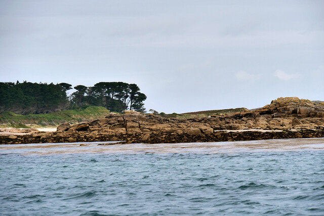
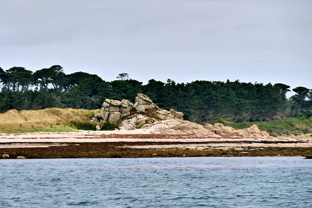
Deason's Cap is a prominent coastal feature located in Cornwall, England. It is a headland that juts out into the Atlantic Ocean, forming a distinct point along the coastline.

The headland is characterized by its rugged and dramatic cliffs, which rise steeply from the sea. These cliffs are composed primarily of granite, giving them a distinctive reddish hue. They are eroded by the relentless pounding of the waves, resulting in dramatic rock formations and sea caves along the shoreline.

Deason's Cap offers breathtaking views of the surrounding coastline and the vast expanse of the ocean. On clear days, visitors can see for miles, taking in the beauty of the rugged cliffs and the deep blue sea. The headland is also home to a variety of seabirds, including gulls, cormorants, and puffins, making it a popular spot for birdwatching.

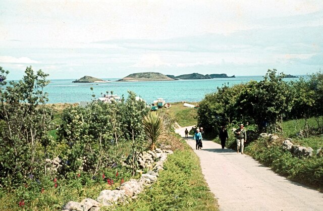
Access to Deason's Cap is relatively easy, with a footpath leading from the nearby coastal village. However, caution is advised when exploring the cliffs, as they can be unstable and dangerous. It is recommended to stay on designated paths and avoid getting too close to the cliff edge.

Deason's Cap is a popular destination for hikers and nature enthusiasts, offering a unique opportunity to experience the raw beauty of the Cornish coastline. Its rugged cliffs, stunning views, and diverse wildlife make it a must-visit location for anyone exploring the area.

If you have any feedback on the listing, please let us know in the comments section below.

Deason's Cap Images

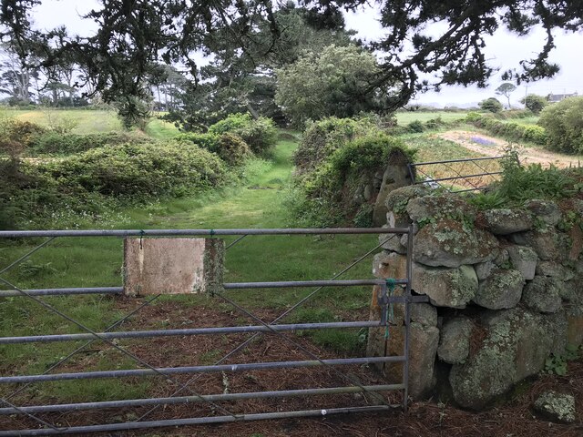
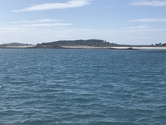
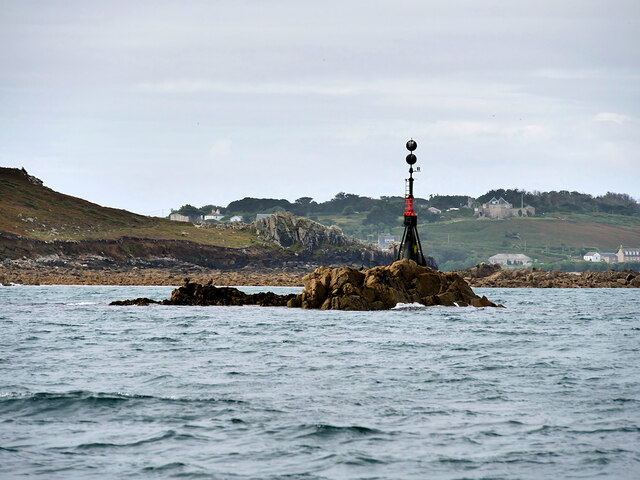
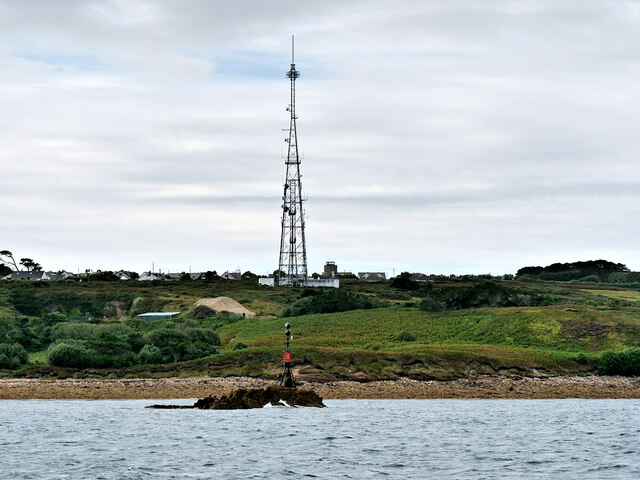
Images are sourced within 2km of 49.950497/-6.2971137 or Grid Reference SV9114. Thanks to Geograph Open Source API. All images are credited.

Bar Point at a low spring tide Looking across Crow Sound to the western end of St Martin’s, Tean, and St Helen’s.
Bar Point at a low spring tide
Looking across Crow Sound to the western end of St Martin’s, Tean, and St Helen’s.
Looking east from Bar Point At a low spring tide.
Looking east from Bar Point
At a low spring tide.
Entrance to the Innisidgen chambered cairn Scheduled Monument including both burial cairn and other features:

Two entrance graves, a prehistoric field system, and Civil War fieldworks and blockhouse on Innisidgen Hill and Helvear Down, St Mary's

List Entry Number:1013271 <span class="nowrap"><a title="https://historicengland.org.uk/listing/the-list/list-entry/1013271?section=official-list-entry" rel="nofollow ugc noopener" href="https://historicengland.org.uk/listing/the-list/list-entry/1013271?section=official-list-entry">Link</a><img style="margin-left:2px;" alt="External link" title="External link - shift click to open in new window" src="https://s1.geograph.org.uk/img/external.png" width="10" height="10"/></span>
Entrance to the Innisidgen chambered cairn
Scheduled Monument including both burial cairn and other features: Two entrance graves, a prehistoric field system, and Civil War fieldworks and blockhouse on Innisidgen Hill and Helvear Down, St Mary's List Entry Number:1013271 LinkExternal link
Rope swing near Innisidgen Hanging from a very high branch of a Monterey Pine.
Rope swing near Innisidgen
Hanging from a very high branch of a Monterey Pine.
Gate with faded sign Possibly an old PRIVATE sign? According to the OS  the track ahead is a right of way..
Gate with faded sign
Possibly an old PRIVATE sign? According to the OS the track ahead is a right of way..
Tobaccoman’s Point and Green Island With Tresco Abbey behind.

Taken on the way back from St Martin’s.
Tobaccoman’s Point and Green Island
With Tresco Abbey behind. Taken on the way back from St Martin’s.
Lower Town Quay The smaller of the two quays on St Martin’s. The larger quay at Higher Town is the one used for freight deliveries, but is inaccessible at a low tide.

The island behind is the uninhabited Tean (pronounced tea-an).
Lower Town Quay
The smaller of the two quays on St Martin’s. The larger quay at Higher Town is the one used for freight deliveries, but is inaccessible at a low tide. The island behind is the uninhabited Tean (pronounced tea-an).
Great Bay panorama On of the most beautiful spots on the islands.
Great Bay panorama
On of the most beautiful spots on the islands.
Isles of Scilly, Eastern Isles from Crow Sound The large island in the background is St Martin's.
Isles of Scilly, Eastern Isles from Crow Sound
The large island in the background is St Martin's.
Hats South Cardinal Marker, Crow Sound A cardinal mark is a sea mark (a buoy or other floating or fixed structure) used in maritime pilotage to indicate the position of a hazard and the direction of safe water. The direction of its two conical top marks indicates the safest side to pass. In this case, both cones are pointing down which indicates that shipping should pass on the south side of the buoy (to avoid the Hats shallows and an uncovering boiler structure from a wreck in the sound. <span class="nowrap"><a title="https://en.wikipedia.org/wiki/Cardinal_mark" rel="nofollow ugc noopener" href="https://en.wikipedia.org/wiki/Cardinal_mark">Link</a><img style="margin-left:2px;" alt="External link" title="External link - shift click to open in new window" src="https://s1.geograph.org.uk/img/external.png" width="10" height="10"/></span>  (Cardinal Mark, Wikipedia).
Hats South Cardinal Marker, Crow Sound
A cardinal mark is a sea mark (a buoy or other floating or fixed structure) used in maritime pilotage to indicate the position of a hazard and the direction of safe water. The direction of its two conical top marks indicates the safest side to pass. In this case, both cones are pointing down which indicates that shipping should pass on the south side of the buoy (to avoid the Hats shallows and an uncovering boiler structure from a wreck in the sound. LinkExternal link (Cardinal Mark, Wikipedia).
Crow Rock and Beacon Crow Rock is an islet in the Isles of Scilly, situated near to Halangy Point on St Mary's. At high tide. only the central tip of the rock is visible above the water, hence the need for the beacon.
Crow Rock and Beacon
Crow Rock is an islet in the Isles of Scilly, situated near to Halangy Point on St Mary's. At high tide. only the central tip of the rock is visible above the water, hence the need for the beacon.
Isles of Scilly, Crow Rock and Halangy Down Transmitter Mast Crow Rock is an islet in the Isles of Scilly, situated near Halangy Point on St Mary's. At high tide. only the central tip of the rock is visible above the water, hence the need for the beacon. The Halangy Down transmitter on St Mary's is a 500-watt FM radio and television transmitter with a 250 feet high steel lattice tower, surmounted by a main TV antenna. It was built by the BBC in 1969.
Isles of Scilly, Crow Rock and Halangy Down Transmitter Mast
Crow Rock is an islet in the Isles of Scilly, situated near Halangy Point on St Mary's. At high tide. only the central tip of the rock is visible above the water, hence the need for the beacon. The Halangy Down transmitter on St Mary's is a 500-watt FM radio and television transmitter with a 250 feet high steel lattice tower, surmounted by a main TV antenna. It was built by the BBC in 1969.
Green Island, Tresco
Tresco, Skirt Island
Isles of Scilly. Little Ganinick One of the Eastern Isles, a group of twelve small uninhabited islands within the Isles of Scilly Area of Outstanding Natural Beauty. Part of the larger island of Great Ganinick (with more vegetation) can be seen behind (and slightly to the right of) Little Ganinick.
Isles of Scilly. Little Ganinick
One of the Eastern Isles, a group of twelve small uninhabited islands within the Isles of Scilly Area of Outstanding Natural Beauty. Part of the larger island of Great Ganinick (with more vegetation) can be seen behind (and slightly to the right of) Little Ganinick.
Rocky Shore, Little Ganilly Little Ganilly (Cornish: Goonhyli Bian, little salt water down) lies just to the north of Little Arthur.
Rocky Shore, Little Ganilly
Little Ganilly (Cornish: Goonhyli Bian, little salt water down) lies just to the north of Little Arthur.
Higher Town Quay, St Martin's, Scilly Also known as New Quay - but it's new only in a relative sense! Out to sea is the unmistakable conical shape of Hanjague, one of the Eastern Isles.
Higher Town Quay, St Martin's, Scilly
Also known as New Quay - but it's new only in a relative sense! Out to sea is the unmistakable conical shape of Hanjague, one of the Eastern Isles.
The road to Higher Town, St Martin's, Scilly Day trippers are faced with a bit of a climb up from the Quay but the view will be worth it. Across Higher Town Bay are the Eastern Isles of Nornour & Great Ganilly.
The road to Higher Town, St Martin's, Scilly
Day trippers are faced with a bit of a climb up from the Quay but the view will be worth it. Across Higher Town Bay are the Eastern Isles of Nornour & Great Ganilly.
Show me another place!

Deason's Cap is located at Grid Ref: SV9114 (Lat: 49.950497, Lng: -6.2971137)

Division: Isles of Scilly

Unitary Authority: Isles of Scilly

Police Authority: Devon and Cornwall

What 3 Words

///beauty.annual.plotting. Near St Martin's, Isles of Scilly

Related Wikis

St Martin's Methodist Church, Isles of Scilly

The Methodist Church, St Martin's, Isles of Scilly is a Grade II listed chapel in St Martin's, Isles of Scilly. == History == Bible Christians arrived...

Higher Town, Isles of Scilly

Higher Town (Cornish: Trewartha) is the easternmost and largest settlement on the island of St Martin's in the Isles of Scilly, England. It is situated...

St Martin's Church, St Martin's

St Martin's Church, St Martin's is a Grade II listed parish church in the Church of England located in St Martin's, Isles of Scilly, UK. == History... ==

St Martin's, Isles of Scilly

St Martin's (Cornish: Brechiek, lit. 'dappled island') is the northernmost populated island of the Isles of Scilly, England, United Kingdom. It has an...

Have you been to Deason's Cap?

Leave your review of Deason's Cap below (or comments, questions and feedback).